Upgrade to Pro — share decks privately, control downloads, hide ads and more …

Impacting Local Government - Updating Functional Classification Using GIS by Greg Nation

Impacting Local Government - Updating Functional Classification Using GIS by Greg Nation

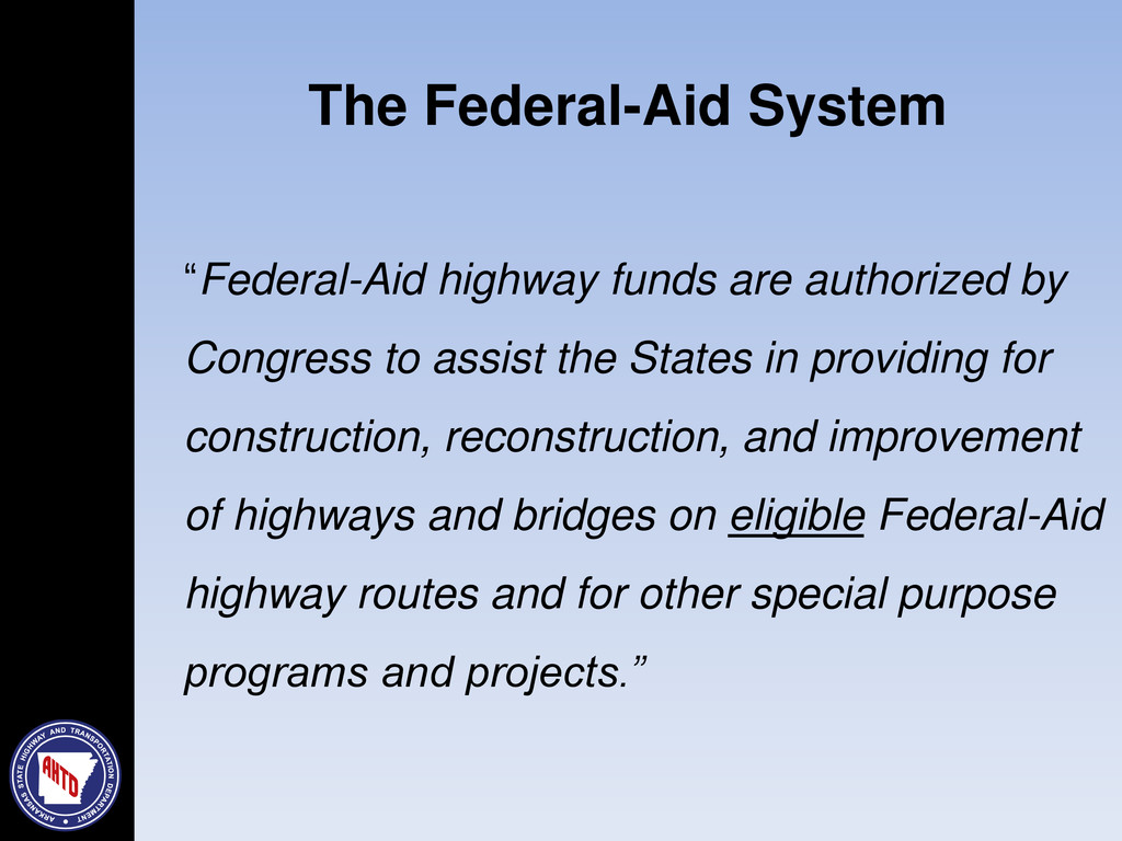
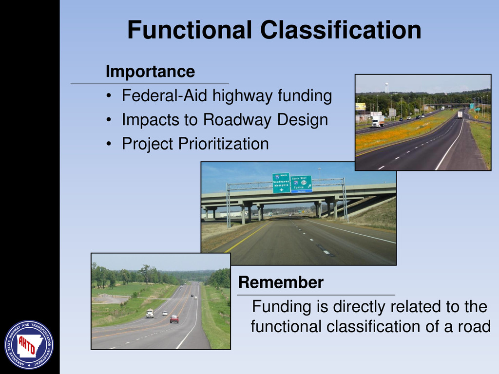
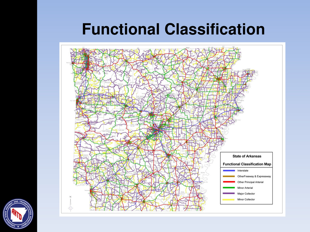
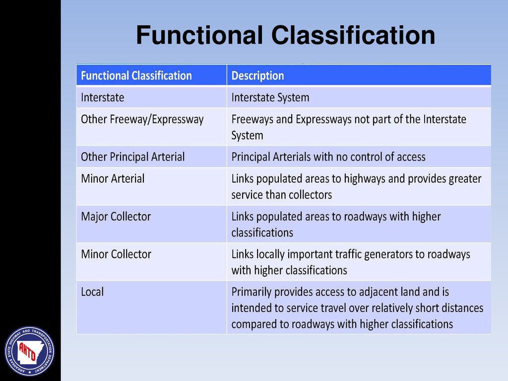
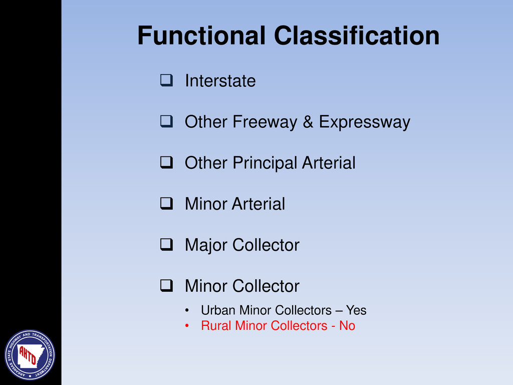
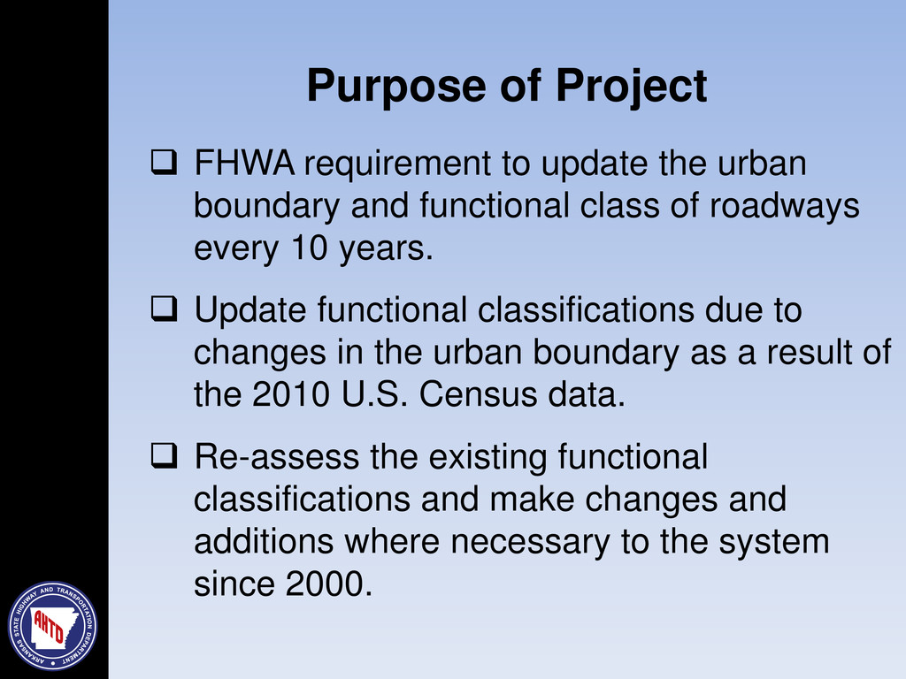
After every decennial census, the Federal Highway Administration (FHWA) requires the State to update the functional classification of their roadways. Functional class determines a roadway’s federal aid eligibility (aka funding). This will be the first time that functional class will be updated and reported geospatially. Most cities, metropolitan planning organizations (MPOs) and counties are unaware or only vaguely familiar with the importance of functional class, let alone the update process utilizing GIS. This presentation will summarize the importance of functional class and outline the update process. Also, it will give AHTD a chance to directly interact with city and county GIS personnel that will be responsible for updating functional class. As a note, the submitted datasets from the counties and cities will become part of a national geospatial network that spans the entire United States.

More Decks by Arkansas GIS Users Forum Conference

Other Decks in Technology

Transcript

  1. Presentation Overview  Introduction  Federal-Aid System  Functional Class

     Adjusted Urban Area Boundary  Purpose of Project  Methodology – GIS  Proposed Process  Good Practice Steps & Schedule  Questions and Answers
  2. “Federal-Aid highway funds are authorized by Congress to assist the

    States in providing for construction, reconstruction, and improvement of highways and bridges on eligible Federal-Aid highway routes and for other special purpose programs and projects.” The Federal-Aid System
  3. The Federal-Aid System Arkansas 22,360 miles  State Highways 16,220

    miles  County Roads 3,780 miles  City Streets 2,360 miles
  4. Functional Classification Importance • Federal-Aid highway funding • Impacts to

    Roadway Design • Project Prioritization Remember Funding is directly related to the functional classification of a road
  5. Functional Classification  Interstate  Other Freeway & Expressway 

    Other Principal Arterial  Minor Arterial  Major Collector  Minor Collector • Urban Minor Collectors – Yes • Rural Minor Collectors - No
  6. Functional Classification Mileage Extent (Rural) Mileage Extent (Urban) Interstate 0%

    - 3% 1% -3% Other Freeway & Expressway 1% - 14% 6% - 19% Other Principal Arterial 19% - 38% 14% - 27% Minor Arterial 3% - 5% 8% - 13% Major Collector 11% - 18% All Collectors Combined Minor Collectors 4% - 15% 8% - 15% Functional Classification
  7. Classification Population Rural < 5,000 Small Urban 5,000 to 49,999

    Urbanized >= 50,000 Adjusted Urban Area Boundary
  8.  FHWA requirement to update the urban boundary and functional

    class of roadways every 10 years.  Update functional classifications due to changes in the urban boundary as a result of the 2010 U.S. Census data.  Re-assess the existing functional classifications and make changes and additions where necessary to the system since 2000. Purpose of Project
  9. Methodology  Updating using GIS is a new process 

    Utilize  ESRI Shapefiles  Geo-Database Files  Learn as we go  Utilize stakeholder Input  Inter-Agency Cooperation
  10. ESRI Shapefiles sent to requesting Agency Agency utilizes Shapefiles and

    makes updates Return to AHTD for evaluation Evaluated files returned to Agency Agency reviews and officially approves Return to ATHD for FHWA approval Methodology Proposed Process
  11.  Assess Need for Additional Functional Classification Changes  Make

    updates  Meet FHWA mileage % ranges  Prepare Maps or GIS Files for AHTD Evaluation  Work with AHTD during evaluation process  Evaluation process will take some time  Seek FHWA Approval  FHWA is a concerned stakeholder Methodology Proposed Process
  12.  Functional Classification - Triggers  Changes in roadway characteristics

    or use  New significant roadways  Significant growth (population/traffic)  Extension of existing roadways  Changes in traffic patterns  New schools, industry, or other economic assets Methodology Proposed Process
  13.  Minimize functional class changes along the roadway  A

    roadway of higher classification should not terminate at a single roadway of a lower classification  There will be exceptions  Maintain Topological Connectivity  Be consistent  Use common sense Methodology Proposed Process
  14. Good Practice Steps & Schedule Arterial Collector ors Local Areas

    of Uncertainty Determining level of functional classification of a roadway can be difficult at times and create uncertainty.  FHWA Functional Classification Manual  FHWA Functional Classification Website (under construction)  AHTD as a resource  Share understanding of the game plan  Encourage & work towards timely delivery of functional classification revisions
  15. Event Schedule of Dates AHTD launches functional class update process

    September 2013 AHTD works with partners to review and purpose changes to the functional classification of it’s roadways September 2014  Approved by Local Agency  Approved by AHTD AHTD processes all proposed functional classification changes and submits for FHWA review and approval December 2014  Approved by FHWA AHTD submits FHWA approved functional class changes through HPMS June 2015 Good Practice Steps & Schedule
  16. What If: If we do not complete the functional class

    update, what happens? Answer: AHTD will update the State Highways in your area and leave the existing functional classification at the 2000 level with only minor adjustments. What If: Can functional classification be updated at a later date? Answer: Yes, but only on a case-by-case basis. System-wide update is a one shot deal. What If: Future or proposed un-built roads are included? Answer: There is a 4-year must be built clause and it should already be in the STIP before being added to the functional class file. (see above) What If