Upgrade to Pro — share decks privately, control downloads, hide ads and more …

Creative Procurement Nightmares Can Lead to Sweet Dreams with Big Rewards Case Study on the Arkansas Parcel Mapping Project by Shelby Johnson

Creative Procurement Nightmares Can Lead to Sweet Dreams with Big Rewards Case Study on the Arkansas Parcel Mapping Project by Shelby Johnson

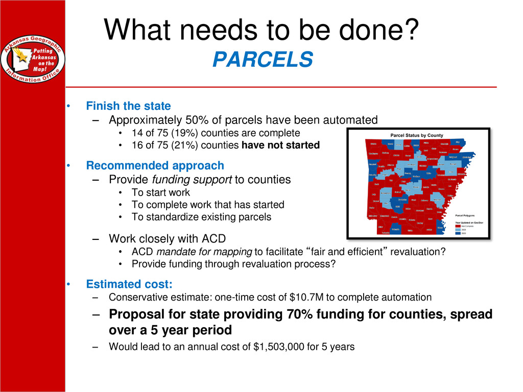
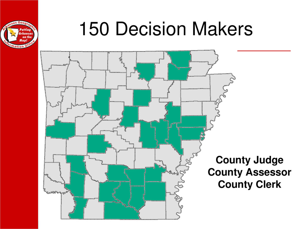
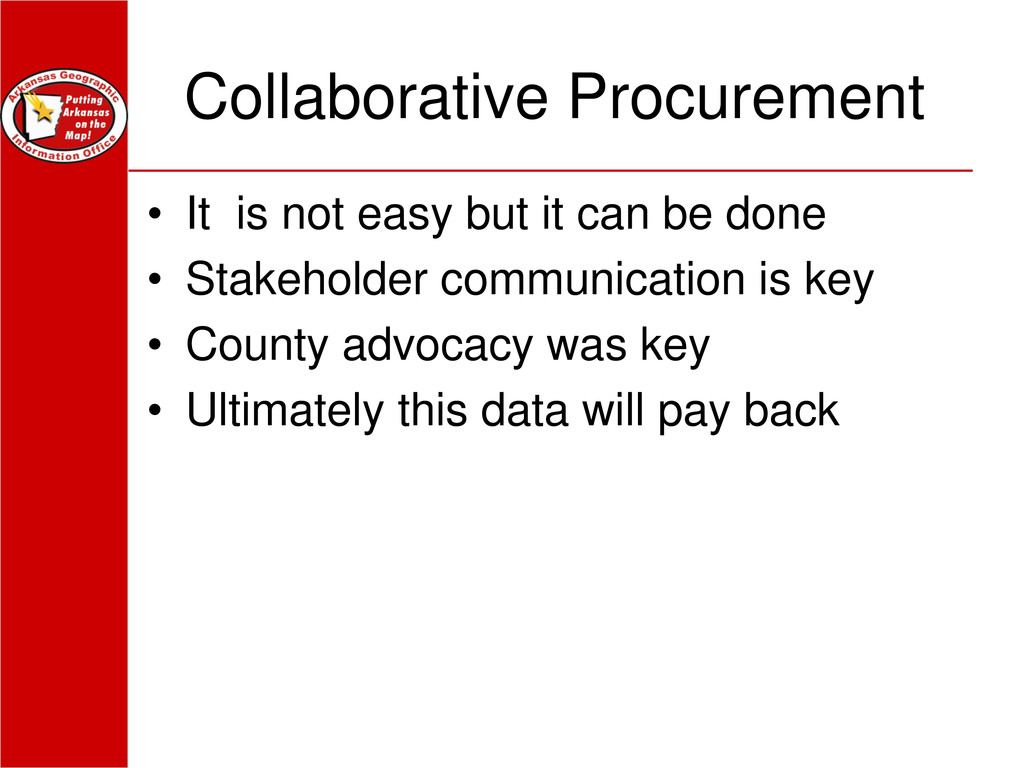
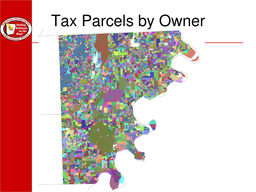
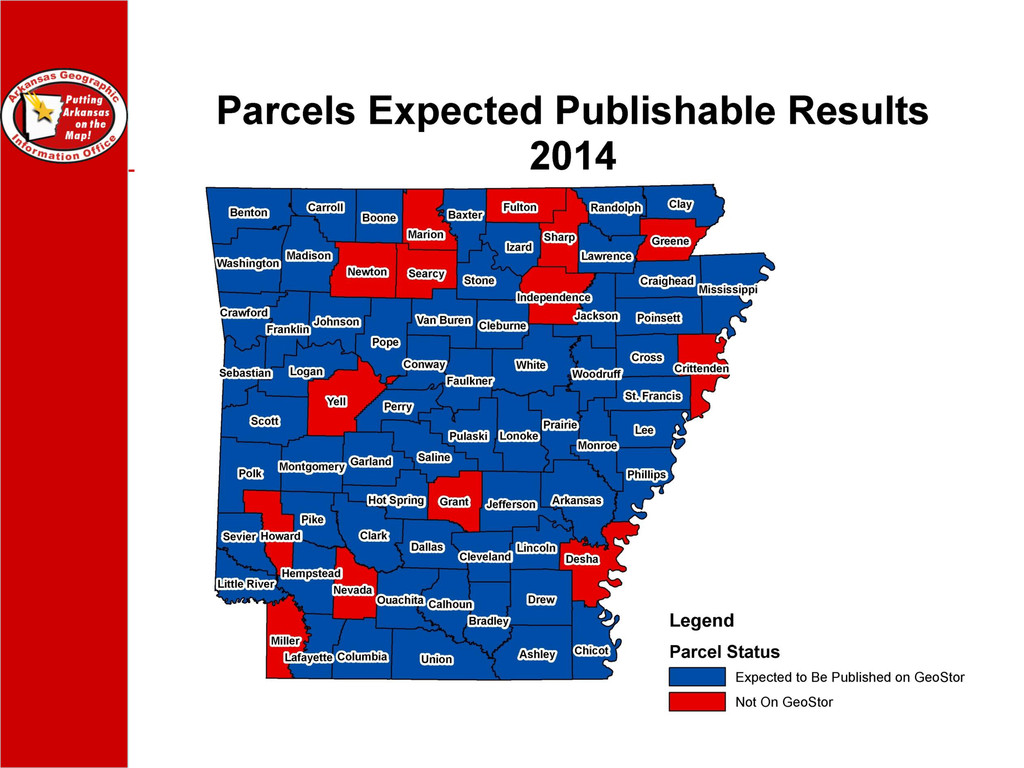
In 2009 the Arkansas Geographic Information Office was awarded a small grant from the Federal Geographic Data Committee to complete a state business plan. A major recommendation of the plan was to complete a statewide tax parcel database using a matching concept. Under this scheme, state and local funding would be pooled to purchase outside services to do the tax parcel conversion process. Four years later the AGIO and participating counties are midway through the process outlined in the plan. This talk will cover the multi-year effort; it will feature back ground on the procurement process, the steps to achieve state and local funding, the contract mechanism, financial accounting, and other moving parts. Intergovernmental purchasing is a challenge but the results of this project will lead to big rewards in the future.

More Decks by Arkansas GIS Users Forum Conference

Other Decks in Technology

Transcript

  1. Creative Procurement Nightmares Can Lead to Sweet Dreams with Big

    Rewards Case Study on the Arkansas Parcel Mapping Project 2013 Arkansas GIS Symposium Shelby D Johnson, Geographic Information Officer Arkansas Geographic Information Office
  2. What needs to be done? PARCELS • Finish the state

    – Approximately 50% of parcels have been automated • 14 of 75 (19%) counties are complete • 16 of 75 (21%) counties have not started • Recommended approach – Provide funding support to counties • To start work • To complete work that has started • To standardize existing parcels – Work closely with ACD • ACD mandate for mapping to facilitate “fair and efficient” revaluation? • Provide funding through revaluation process? • Estimated cost: – Conservative estimate: one-time cost of $10.7M to complete automation – Proposal for state providing 70% funding for counties, spread over a 5 year period – Would lead to an annual cost of $1,503,000 for 5 years
  3. Parcel Mapping Grant The goal of this program is to

    map the largest possible number of property parcel boundaries in digital form with the available grant money in as many counties as possible. Applications set to each county
  4. 40/60 Split The AGIO cost will be 60% of the

    lowest responsible bid for each county. The County cost will be 40% of the lowest responsible bid for their County.
  5. 3 Phased Approach Idea: Big to Small, Easier to Harder

    Phase 1: Short Legals; Any parcel polygon that can be placed using the short legals which is defined as a legal description as found in the CAMA extract that are aliquot parts of the PLSS system that can be quickly and easily discerned down to 20 acres. Phase 2: All parcel polygons that can be placed and attributed, using the parcel ID, using a georeferenced scan. Phase 3: All parcel polygons left to be placed by whatever means is necessary. This usually will involve pulling a deed.
  6. Bid Results • County Total Price County Share State Share

    • Faulkner $42,311.00 $16,924.40 $25,386.60 • Lawrence $20,438.50 $8,175.40 $12,263.10 • Bradley $33,871.50 $13,548.60 $20,322.90 • Lincoln $18,880.00 $7,552.00 $11,328.00 • Monroe $28,510.50 $11,404.20 $17,106.30 • Hempstead $53,409.00 $21,363.60 $32,045.40 • Scott $35,882.00 $14,352.80 $21,529.20 • Dallas $23,314.00 $9,325.60 $13,988.40 • Lee $30,474.00 $12,189.60 $18,284.40 • Lafayette $19,127.00 $7,650.80 $11,476.20 • Drew $22,545.50 $9,018.20 $13,527.30 • Union $147,140.00 $58,856.00 $88,284.00 • Pike $26,060.00 $10,424.00 $15,636.00
  7. Collaborative Procurement • It is not easy but it can

    be done • Stakeholder communication is key • County advocacy was key • Ultimately this data will pay back
  8. GIS is not just a tool, it’s a weapon And

    you are helping Arkansas gain a competitive advantage.
  9. Contact Information • Arkansas Geographic Information Office • 1 Capitol

    Mall Ste 2B900 Little Rock, AR 72203 • PH (501) 682-2767 • http://www.gis.arkansas.gov