Upgrade to Pro — share decks privately, control downloads, hide ads and more …

The Arkansas Master Addressing Program by Jonathan Duran

The Arkansas Master Addressing Program by Jonathan Duran

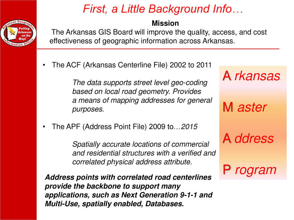
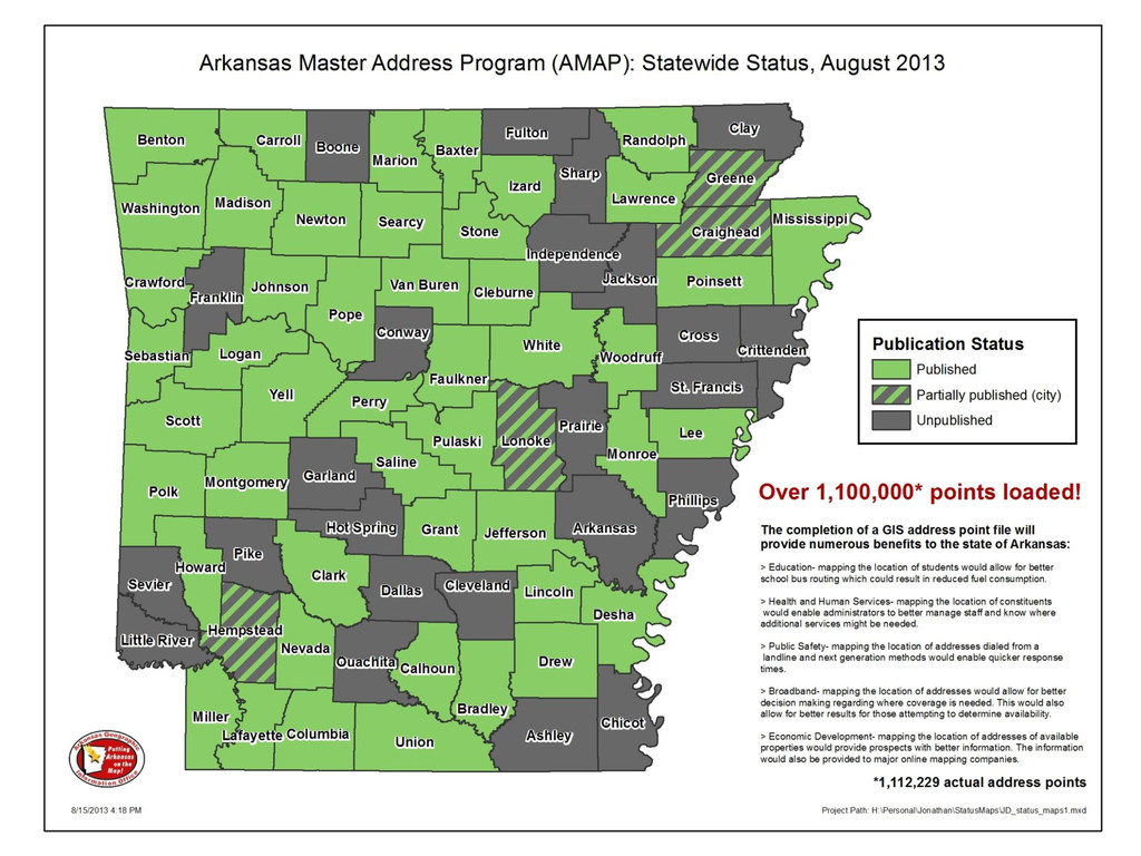
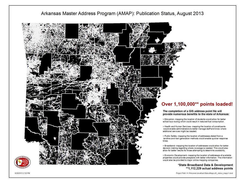
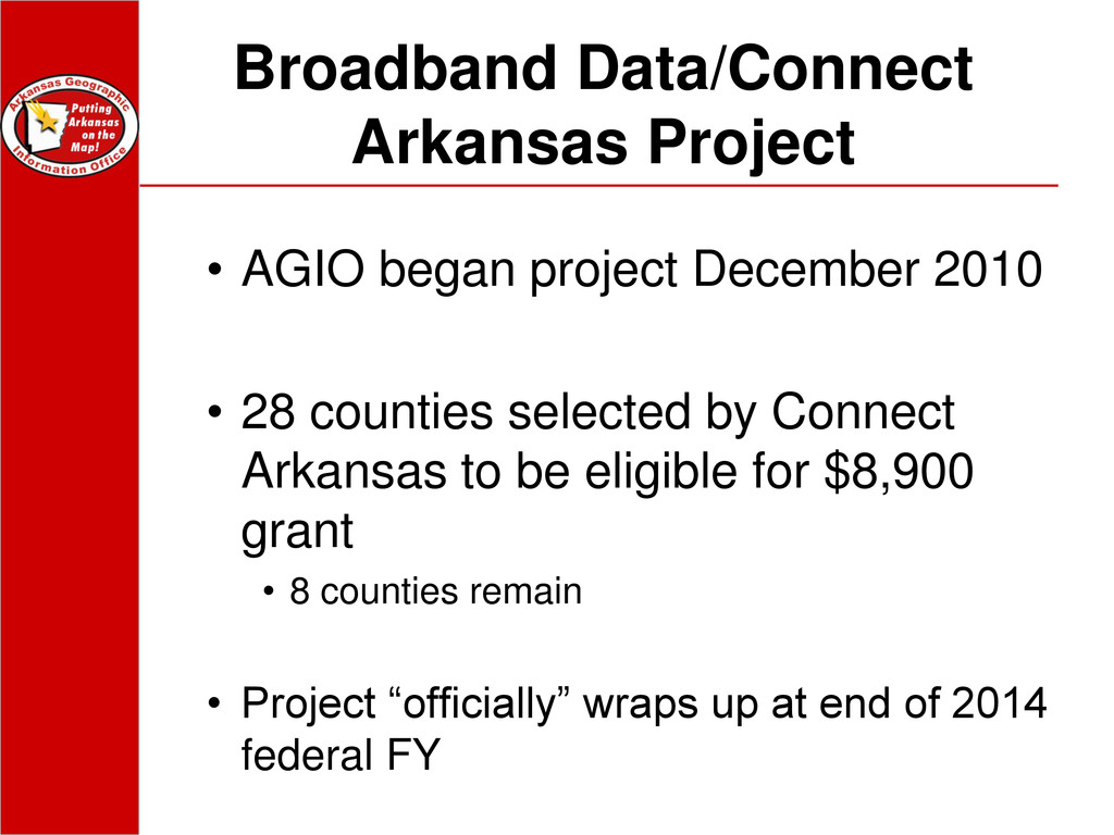
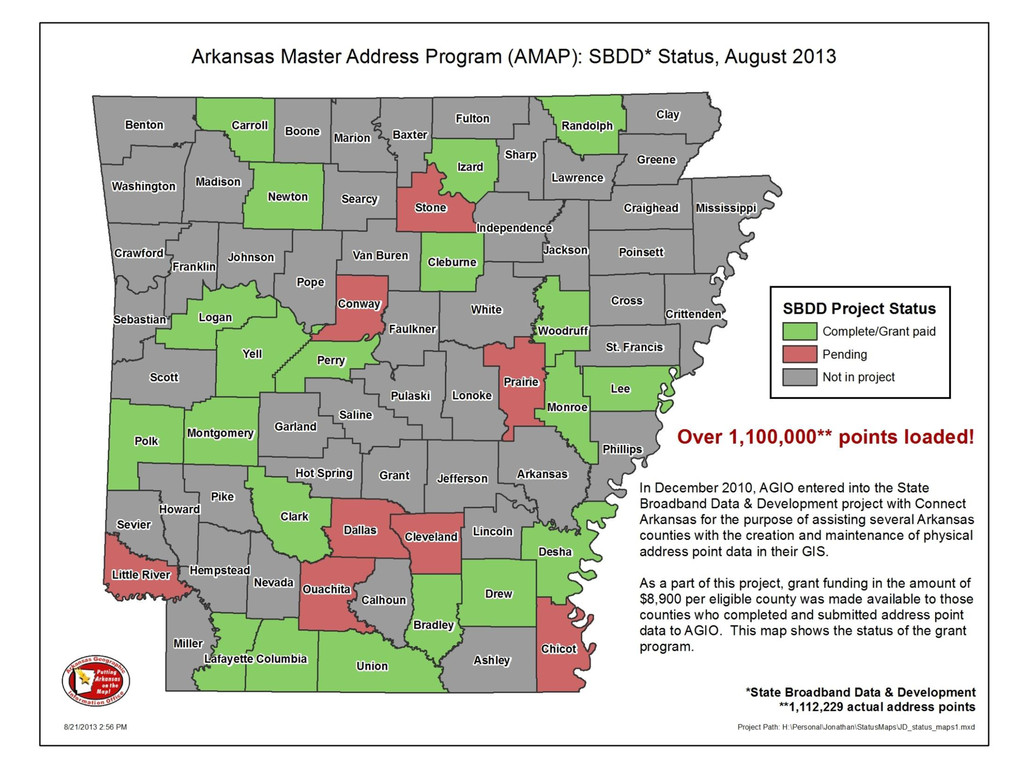
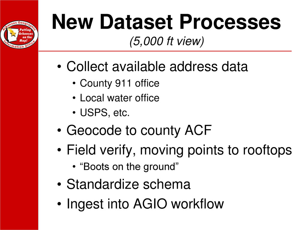
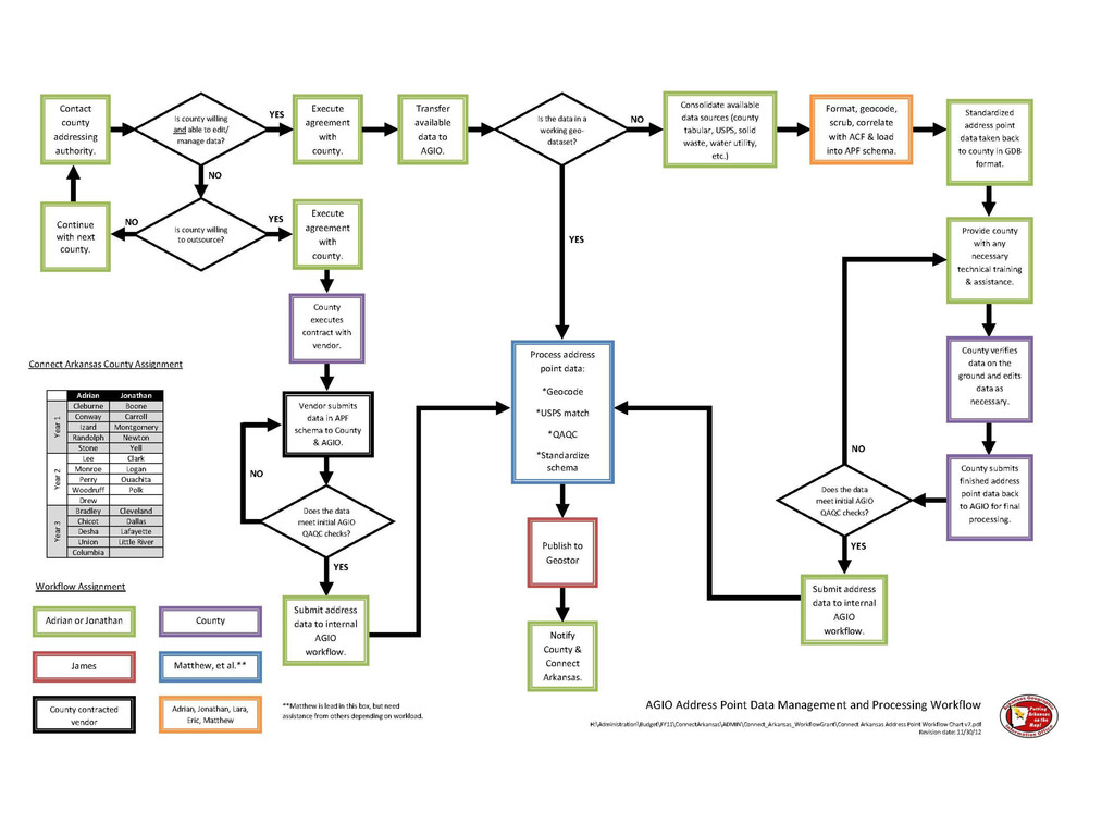
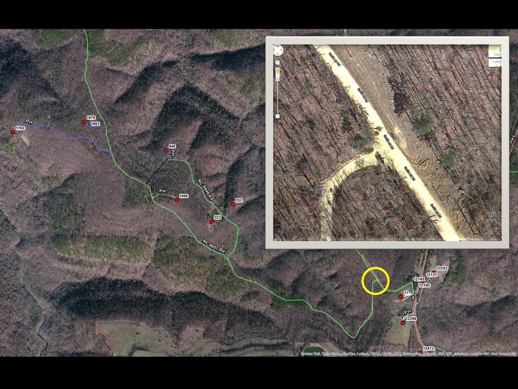
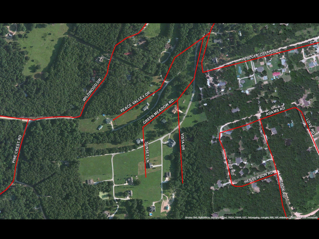
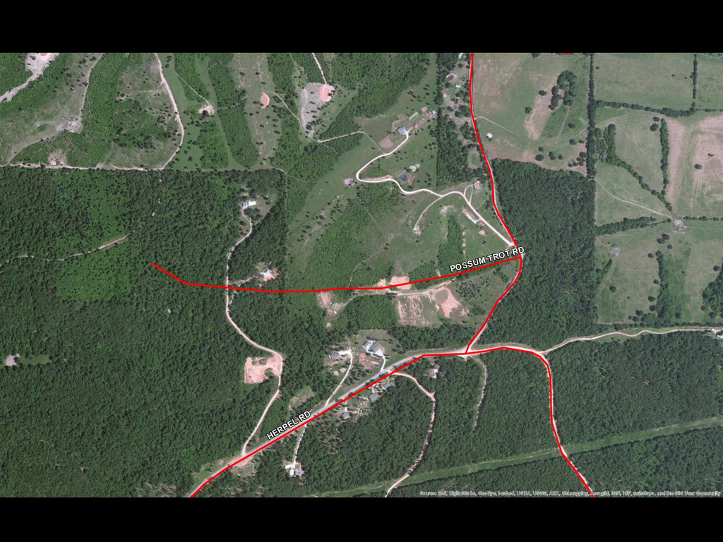
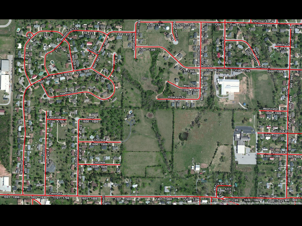
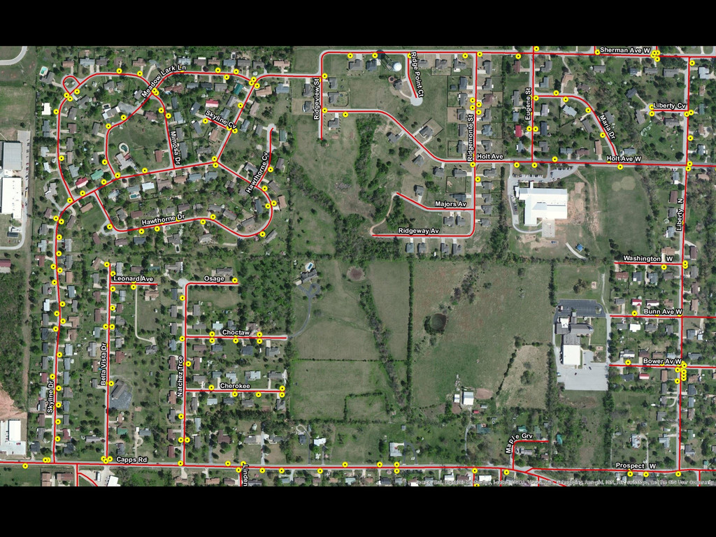
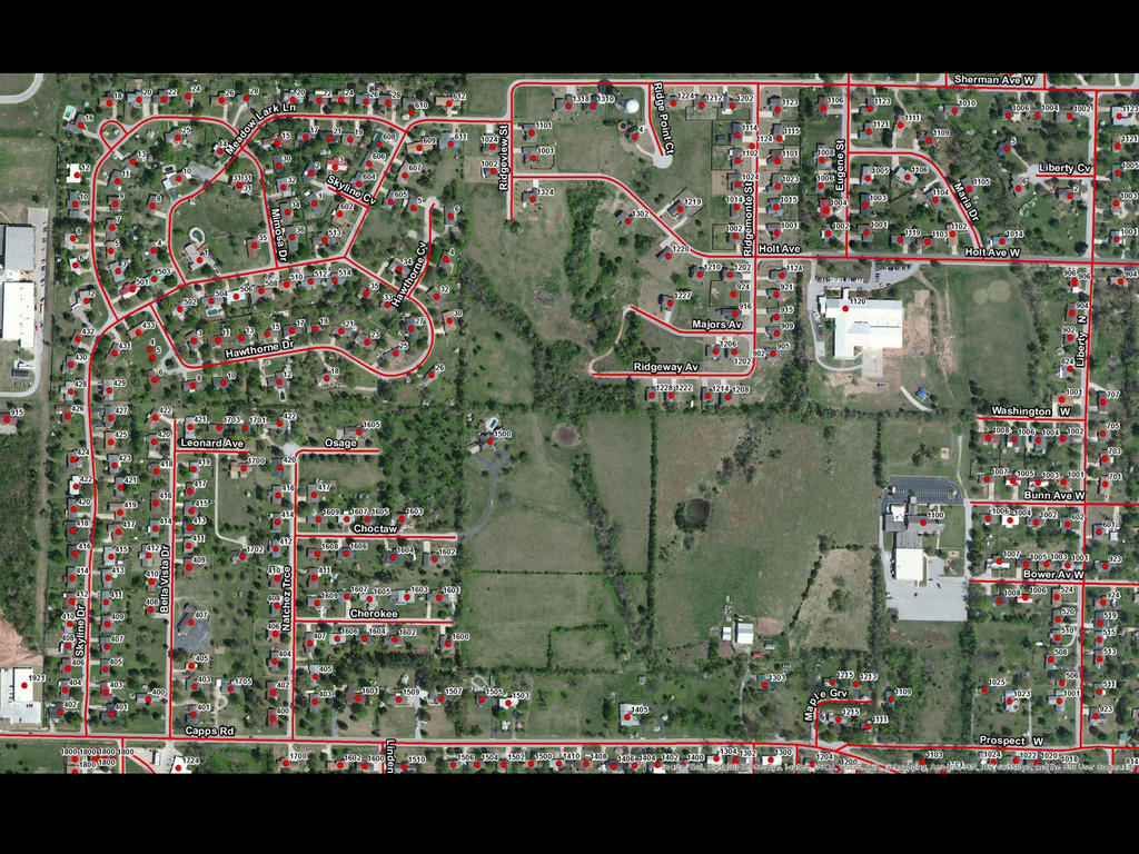
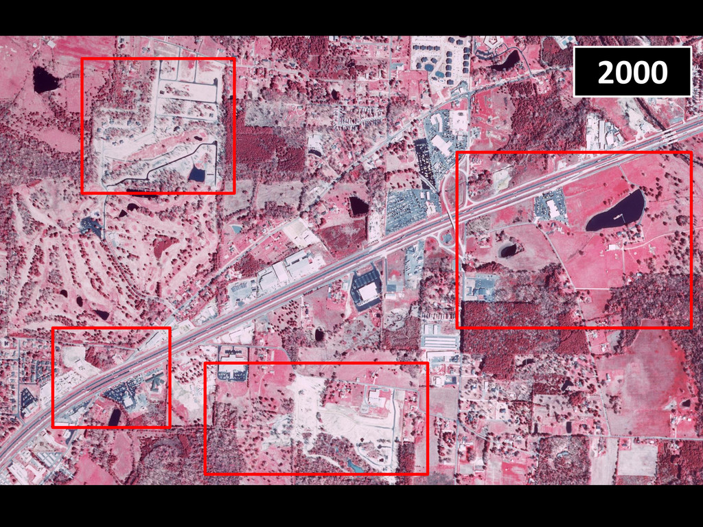
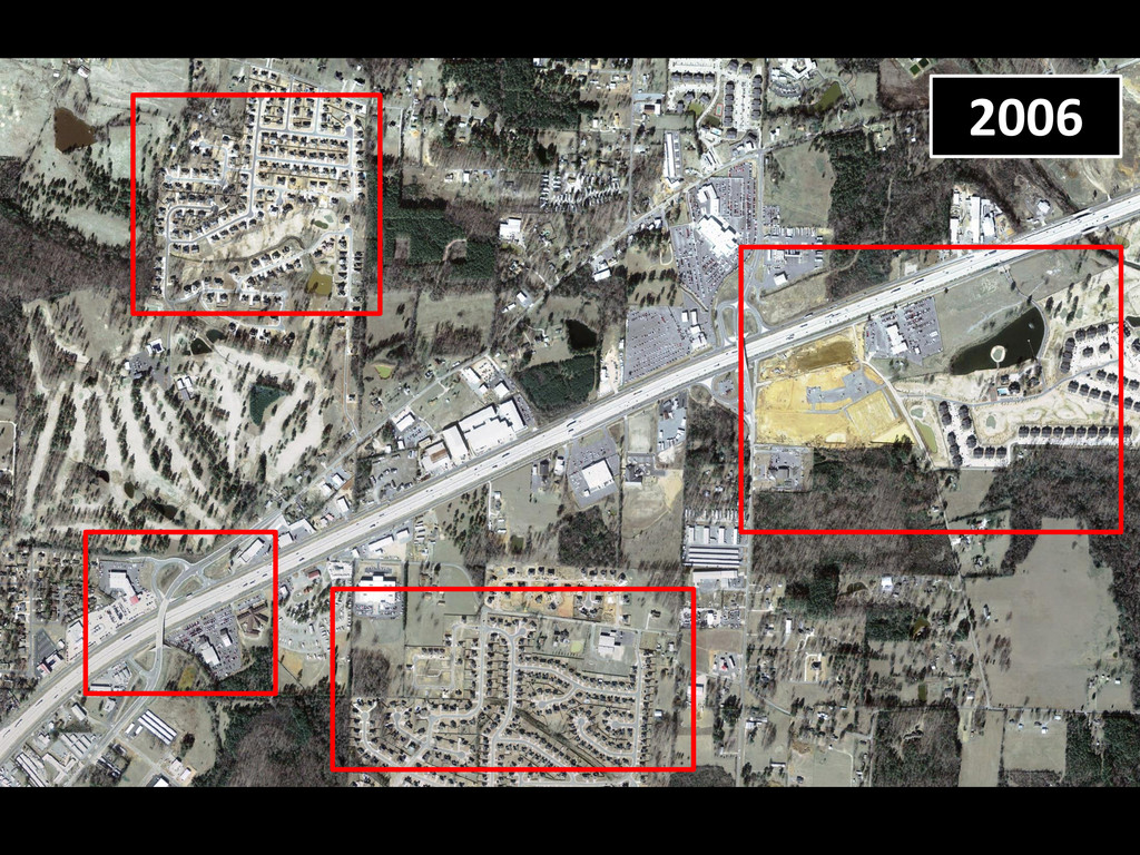
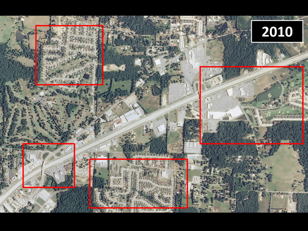
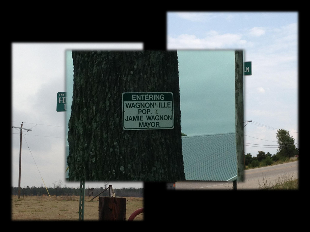
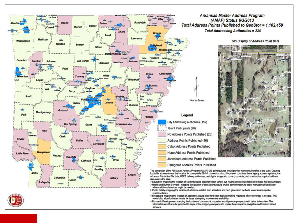
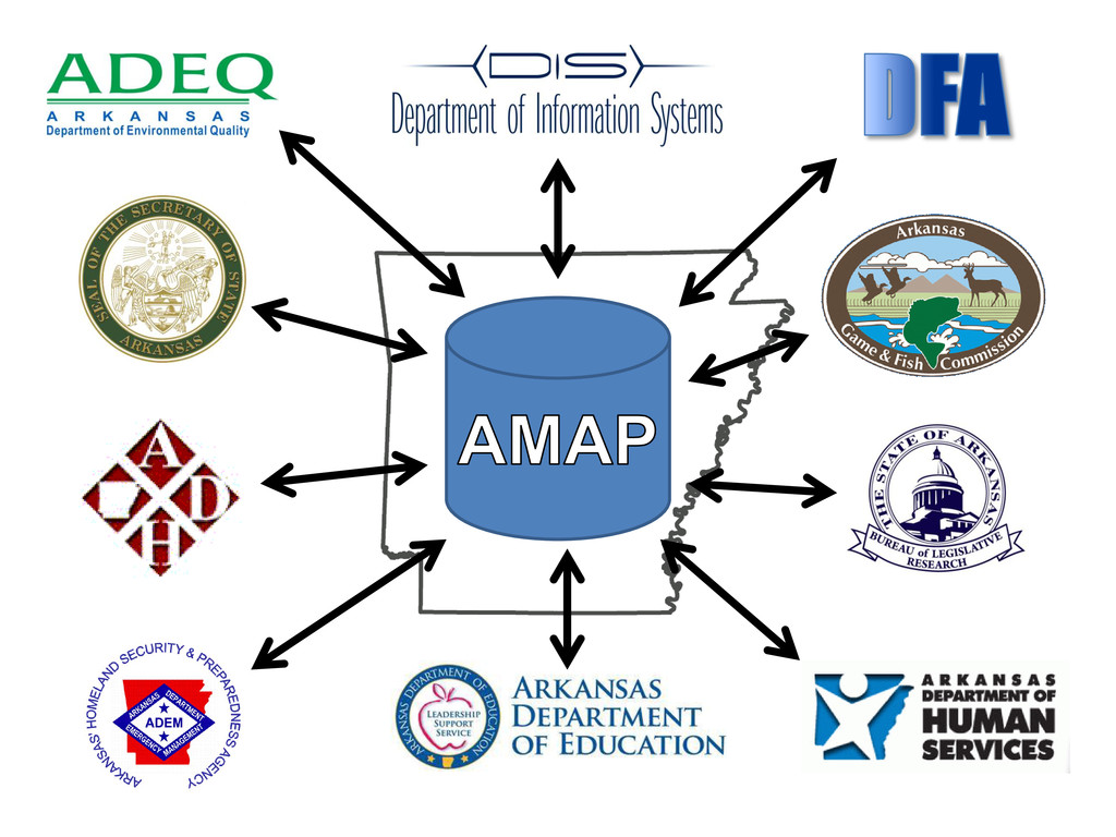
A physical address is one of the most basic pieces of location data collected and utilized by citizens, businesses, and government entities. They are part of the “backbone” data for E9-1-1 dispatch. Beginning in 2011, AGIO, in conjunction with Connect Arkansas, has worked on an address mapping grant program with several counties for the purpose of broadband data development. Upon completion, this effort will have added 28 address datasets into GeoStor. Started just 3 short years ago with only a few hundred-thousand physical address features, the current published count stands at about 1.2 million digitized points (of an expected 1.4 million). We have collectively created a maintenance problem of magnificent proportion; especially when the users and uses of the data are growing exponentially. This presentation will describe how we got where we are, explain the existing production and maintenance environment and then show how this issue has-is-and-will affect every citizen.

More Decks by Arkansas GIS Users Forum Conference

Other Decks in Technology

Transcript

  1. The Arkansas Master Address Program (AMAP) Jonathan Duran, Matthew DeLong,

    & Adrian Clark Arkansas Geographic Information Office A look at the statewide physical address point database: creation, processing, application, & maintenance.
  2. Mission The Arkansas GIS Board will improve the quality, access,

    and cost effectiveness of geographic information across Arkansas. • The ACF (Arkansas Centerline File) 2002 to 2011 The data supports street level geo-coding based on local road geometry. Provides a means of mapping addresses for general purposes. • The APF (Address Point File) 2009 to…2015 Spatially accurate locations of commercial and residential structures with a verified and correlated physical address attribute. First, a Little Background Info… A rkansas M aster A ddress P rogram Address points with correlated road centerlines provide the backbone to support many applications, such as Next Generation 9-1-1 and Multi-Use, spatially enabled, Databases.
  3. • Technical assistance to local authority • Receive data from

    local authority • QAQC tasks • Spatial accuracy • Topology • Attribution • Streamline incorporation • Update GeoStor data • Situs address points • ZIP9 (ZIP+4) points Key Workflows (10,000 ft view)
  4. Broadband Data/Connect Arkansas Project • ARRA Broadband Initiatives • “…accelerate

    broadband deployment in unserved, underserved, and rural areas and to strategic institutions that are likely to create jobs or provide significant public benefits.” • State Broadband Initiatives (SBI) • “…a comprehensive program, led by state entities or non-profit organizations working at their direction, to facilitate the integration of broadband and information technology into state and local economies. Economic development, energy efficiency, and advances in education and health care rely not only on broadband infrastructure, but also on the knowledge and tools to leverage that infrastructure.” • State Broadband Data & Development (SBDD) • “In collaboration with the Arkansas Geographic Information Office (AGIO) and using the state E-911 file and U.S. Postal Service address database, Connect Arkansas will further develop a statewide address file, focusing first on unserved and underserved communities.” • Follow the $$$ • ARRA >> NTIA >> Connect Arkansas >> AGIO >> County
  5. • AGIO began project December 2010 • 28 counties selected

    by Connect Arkansas to be eligible for $8,900 grant • 8 counties remain • Project “officially” wraps up at end of 2014 federal FY Broadband Data/Connect Arkansas Project
  6. • Collect available address data • County 911 office •

    Local water office • USPS, etc. • Geocode to county ACF • Field verify, moving points to rooftops • “Boots on the ground” • Standardize schema • Ingest into AGIO workflow New Dataset Processes (5,000 ft view)
  7. Streamlined Sales Tax Project (SSTP) Purpose: “to simplify and modernize

    sales and use tax collection and administration.”
  8. • Spatial data are key elements • Zip+4 ranges (USPS)

    • Foundational data Geocoded to the ACF • Administrative boundaries (AHTD) • City and County • Physical address points (Addressing Authority) • Structure oriented* • Zip Code Tabulation Areas (Census) • generalized area representatives for tabulation • Tax rate & boundary database tables • Produced quarterly 5 weeks prior to applicable quarter • Lookup tools • http://www.arkansas.gov/dfa/excise_tax_v2/st_zip.html SSTP Source Data
  9. Multi-Use Point Features “Where the People Are” • Roof-Top location

    pushes point-derived polygons and complex geospatial analysis. • Mix and match of tabular data from disparate sources using standardized physical address attributes. • USPS CASS (coding accuracy support systems) certified mailing lists that are also spatially referenced. • Changes the way we create, modify, and use differing types of information.
  10. • Accurate and up-to-date data is critical! • Address points

    (APF) • Road centerlines (ACF) • Political boundaries (outside or inside city, may share zip code) • The best data is local data!! Primary AMAP Features
  11. If the best data is local data, then how do

    we insure a consistent flow of authoritative information from the creators to the users? • AGIO current training and support includes: 1. 2 full time staff to coordinate with 234 local organizations. (see next slide) 2. Phone/online/on-site technical support, plus web seminars and regional on-site training courses. 3. Adopting new technology to make the process simple and reliable.  Should the AGIO manage the process under the authority of the Arkansas GIS Board? What about the Future
  12. Leadership, it’s What We Are Known For! • Most state

    governments, the USPS and US Census Bureau are working on this issue. Arkansas is far ahead because we understand the importance of, and have good working relationships with, local and state partners. • The information is simply too valuable and it will become more valuable, as more and more business processes come to depend on it. • It may be local data, but we need to treat it as the precious state resource it is and manage it accordingly.