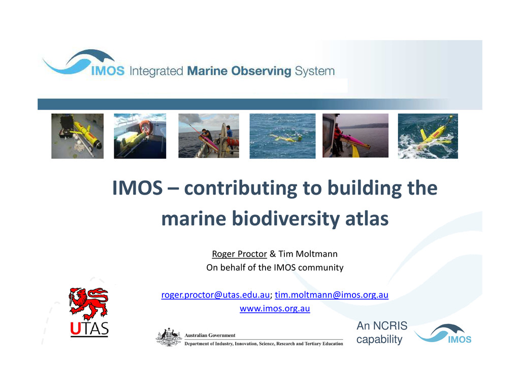
building the marine biodiversity atlas Roger Proctor & Tim Moltmann On behalf of the IMOS community [email protected]; [email protected] www.imos.org.au An NCRIS capability
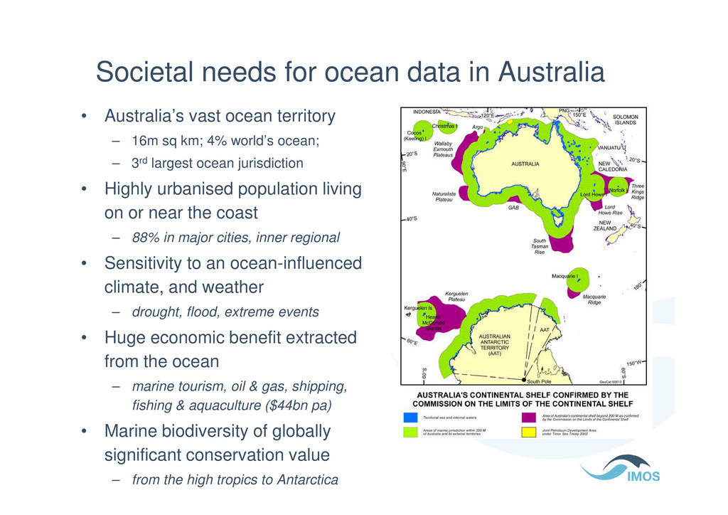
ocean territory – 16m sq km; 4% world’s ocean; – 3rd largest ocean jurisdiction • Highly urbanised population living on or near the coast – 88% in major cities, inner regional • Sensitivity to an ocean-influenced • Sensitivity to an ocean-influenced climate, and weather – drought, flood, extreme events • Huge economic benefit extracted from the ocean – marine tourism, oil & gas, shipping, fishing & aquaculture ($44bn pa) • Marine biodiversity of globally significant conservation value – from the high tropics to Antarctica
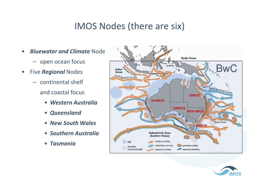
– open ocean focus • Five Regional Nodes – continental shelf and coastal focus QIMOS BwC and coastal focus • Western Australia • Queensland • New South Wales • Southern Australia • Tasmania WAIMOS QIMOS NSW-IMOS SAIMOS TasIMOS
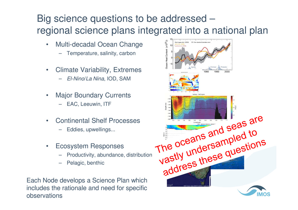
integrated into a national plan • Multi-decadal Ocean Change – Temperature, salinity, carbon • Climate Variability, Extremes – El-Nino/La Nina, IOD, SAM • Major Boundary Currents – EAC, Leeuwin, ITF – EAC, Leeuwin, ITF • Continental Shelf Processes – Eddies, upwellings... • Ecosystem Responses – Productivity, abundance, distribution – Pelagic, benthic Each Node develops a Science Plan which includes the rationale and need for specific observations
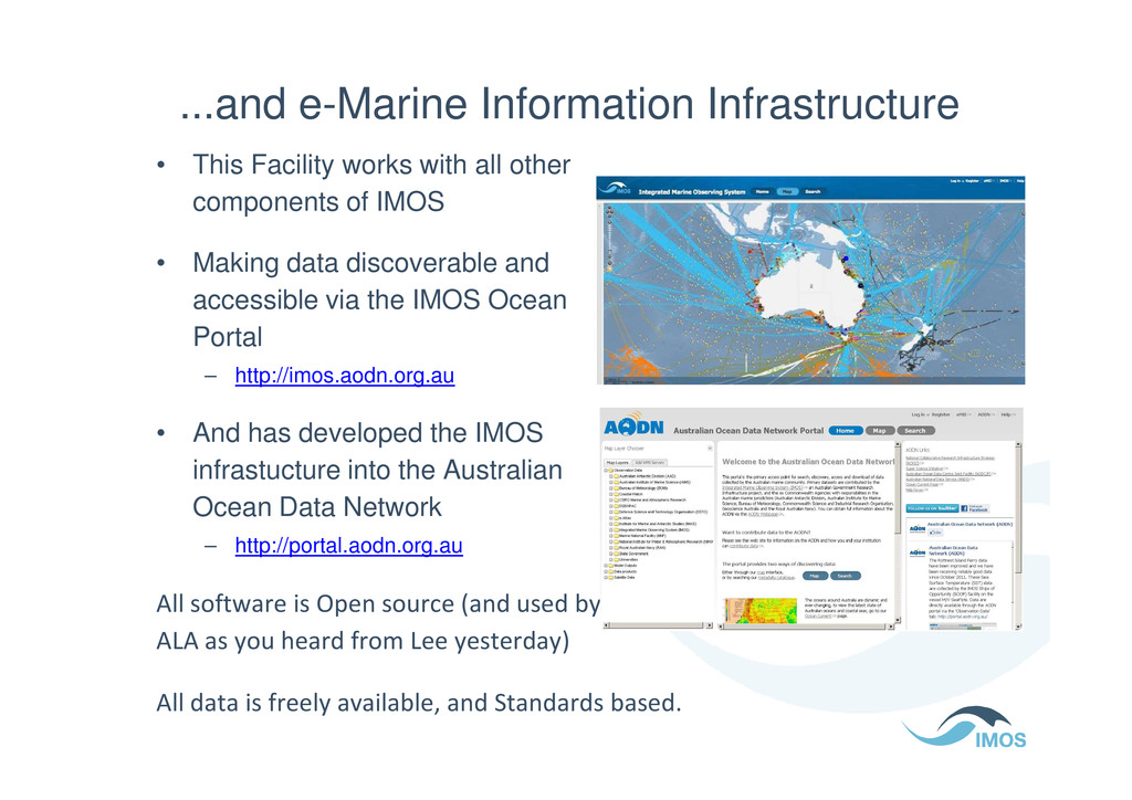
other components of IMOS • Making data discoverable and accessible via the IMOS Ocean Portal – http://imos.aodn.org.au • And has developed the IMOS infrastucture into the Australian Ocean Data Network – http://portal.aodn.org.au All software is Open source (and used by ALA as you heard from Lee yesterday) All data is freely available, and Standards based.
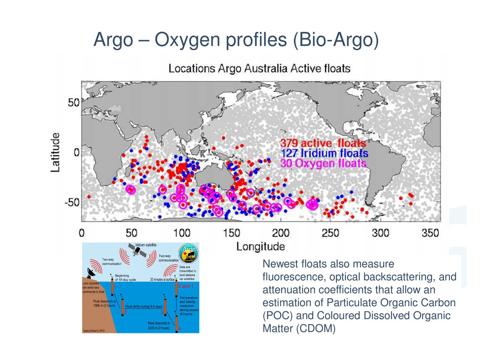
optical backscattering, and attenuation coefficients that allow an estimation of Particulate Organic Carbon (POC) and Coloured Dissolved Organic Matter (CDOM)
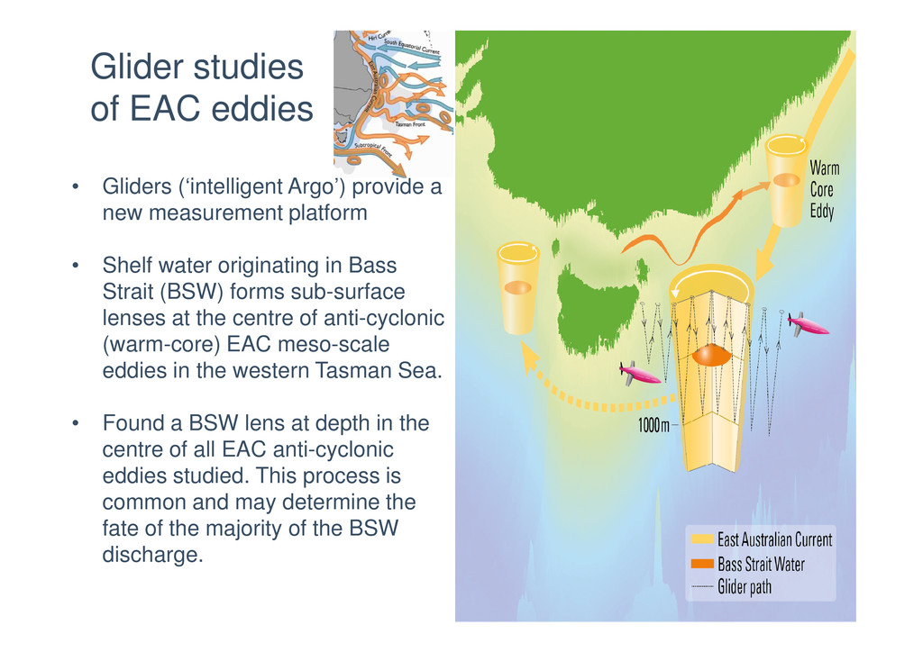
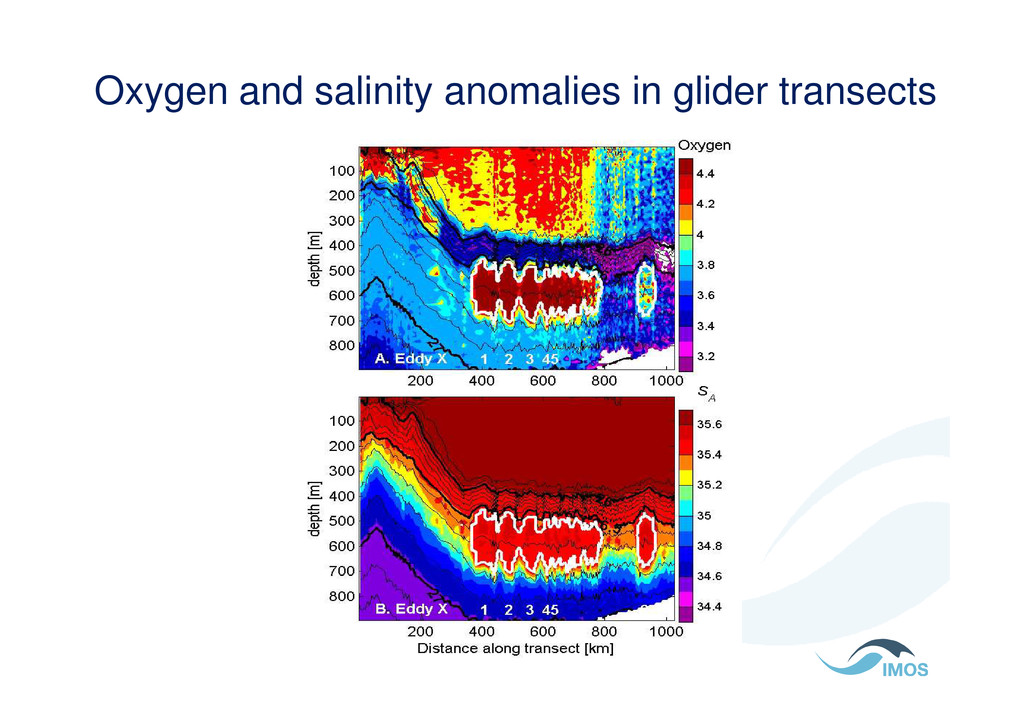
Shelf water originating in Bass Strait (BSW) forms sub-surface lenses at the centre of anti-cyclonic Glider studies of EAC eddies lenses at the centre of anti-cyclonic (warm-core) EAC meso-scale eddies in the western Tasman Sea. • Found a BSW lens at depth in the centre of all EAC anti-cyclonic eddies studied. This process is common and may determine the fate of the majority of the BSW discharge.
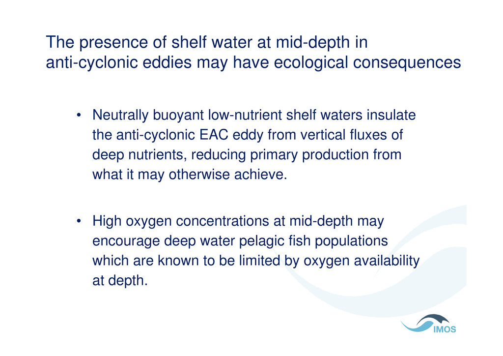
may have ecological consequences • Neutrally buoyant low-nutrient shelf waters insulate the anti-cyclonic EAC eddy from vertical fluxes of deep nutrients, reducing primary production from what it may otherwise achieve. what it may otherwise achieve. • High oxygen concentrations at mid-depth may encourage deep water pelagic fish populations which are known to be limited by oxygen availability at depth.
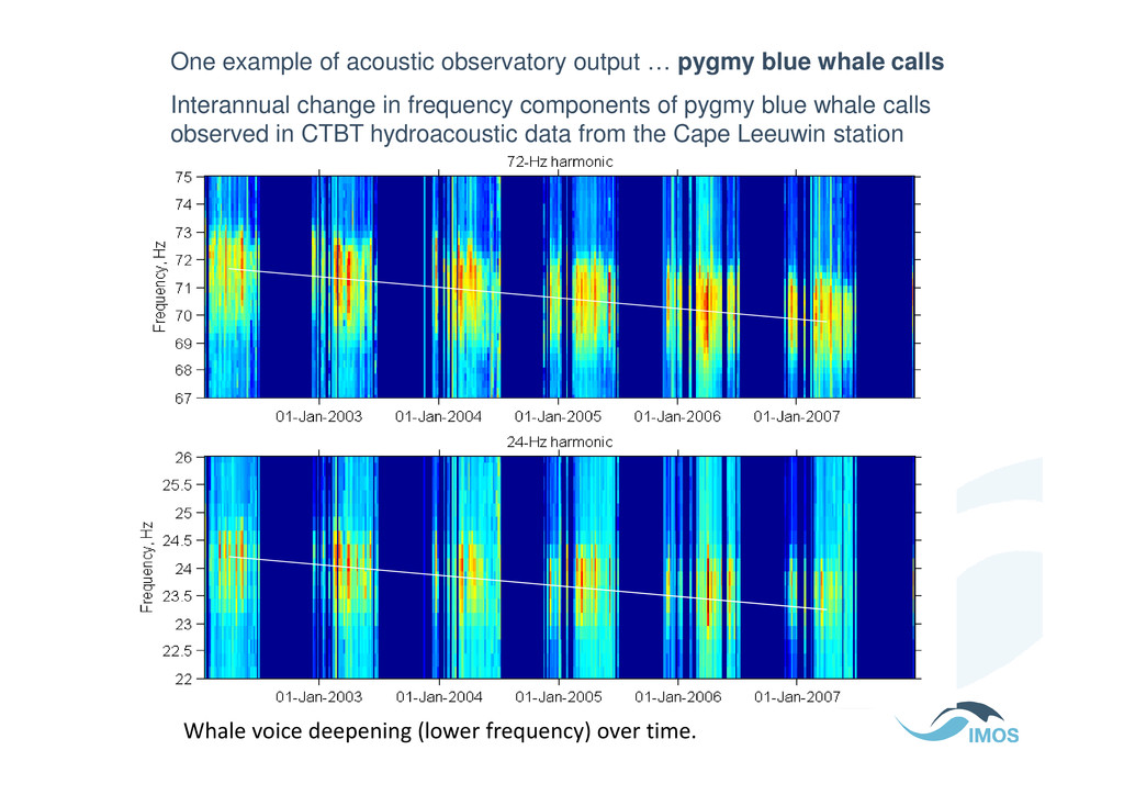
calls Interannual change in frequency components of pygmy blue whale calls observed in CTBT hydroacoustic data from the Cape Leeuwin station Whale voice deepening (lower frequency) over time.
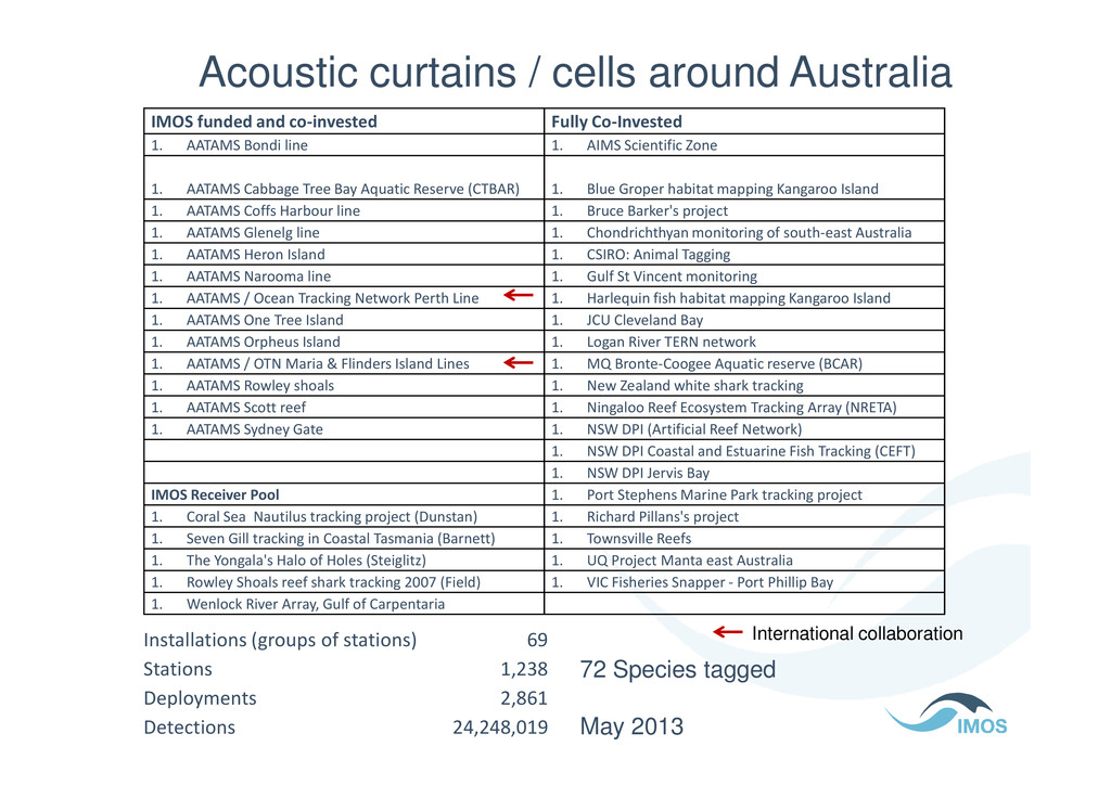
1. AIMS Scientific Zone 1. AATAMS Cabbage Tree Bay Aquatic Reserve (CTBAR) 1. Blue Groper habitat mapping Kangaroo Island 1. AATAMS Coffs Harbour line 1. Bruce Barker's project 1. AATAMS Glenelg line 1. Chondrichthyan monitoring of south-east Australia 1. AATAMS Heron Island 1. CSIRO: Animal Tagging 1. AATAMS Narooma line 1. Gulf St Vincent monitoring 1. AATAMS / Ocean Tracking Network Perth Line 1. Harlequin fish habitat mapping Kangaroo Island 1. AATAMS One Tree Island 1. JCU Cleveland Bay 1. AATAMS Orpheus Island 1. Logan River TERN network 1. AATAMS / OTN Maria & Flinders Island Lines 1. MQ Bronte-Coogee Aquatic reserve (BCAR) 1. AATAMS Rowley shoals 1. New Zealand white shark tracking Acoustic curtains / cells around Australia 1. AATAMS Rowley shoals 1. New Zealand white shark tracking 1. AATAMS Scott reef 1. Ningaloo Reef Ecosystem Tracking Array (NRETA) 1. AATAMS Sydney Gate 1. NSW DPI (Artificial Reef Network) 1. NSW DPI Coastal and Estuarine Fish Tracking (CEFT) 1. NSW DPI Jervis Bay IMOS Receiver Pool 1. Port Stephens Marine Park tracking project 1. Coral Sea Nautilus tracking project (Dunstan) 1. Richard Pillans's project 1. Seven Gill tracking in Coastal Tasmania (Barnett) 1. Townsville Reefs 1. The Yongala's Halo of Holes (Steiglitz) 1. UQ Project Manta east Australia 1. Rowley Shoals reef shark tracking 2007 (Field) 1. VIC Fisheries Snapper - Port Phillip Bay 1. Wenlock River Array, Gulf of Carpentaria Installations (groups of stations) 69 Stations 1,238 Deployments 2,861 Detections 24,248,019 72 Species tagged May 2013 International collaboration
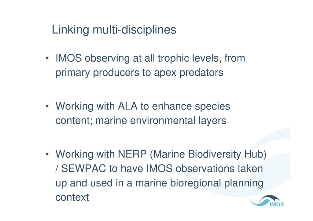
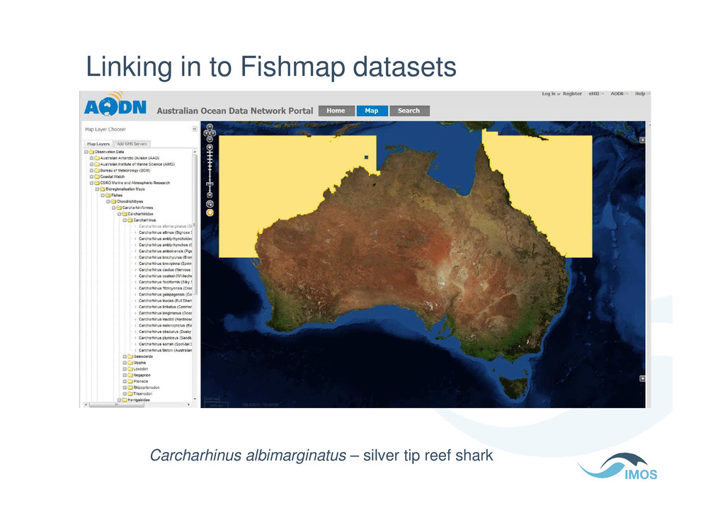
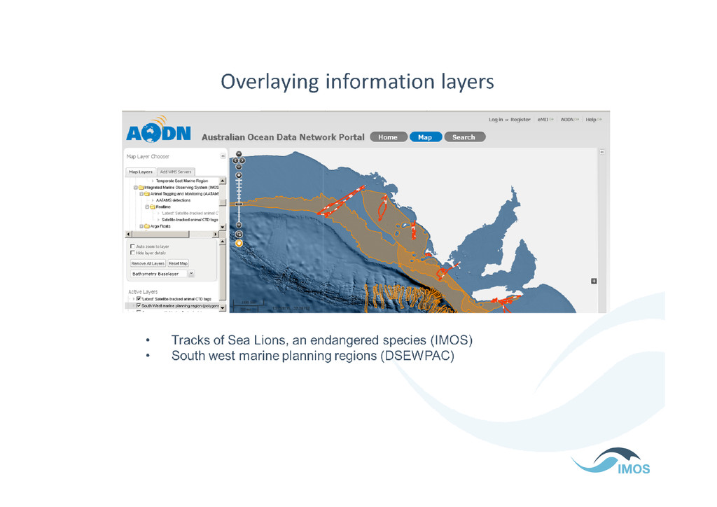
primary producers to apex predators • Working with ALA to enhance species • Working with ALA to enhance species content; marine environmental layers • Working with NERP (Marine Biodiversity Hub) / SEWPAC to have IMOS observations taken up and used in a marine bioregional planning context
![Thanks for listening [email protected] http://portal.aodn.org.au](https://files.speakerdeck.com/presentations/1838fcc0dfa7013085473afd53d53d4f/slide_45.jpg)