Upgrade to Pro — share decks privately, control downloads, hide ads and more …

ASARECA Projects | Examples of Selected TIMPs

CGIAR-CSI
September 23, 2014
78

ASARECA Projects | Examples of Selected TIMPs

CGIAR-CSI

September 23, 2014
Tweet

Transcript

  1. Agricultural Technologies Agricultural Technology refers to: ① Products ② Services

    ③ Techniques, and ④ Activities whose use results in increased plant & livestock productivity and higher yield improvements. ! These technologies can be used individually or in combination.
  2. Goal: Competitiveness of appropriate agricultural systems improved Purpose: Equitable Access

    & Utilization of Agricultural Research & Development Innovations enhanced Intermediate PDO: Gender-responsive Governance & Management strengthened Output 1 ! Appropriate Technologies, Innovations & Management Practices adapted or generated Output 2 ! Appropriate TIMPs disseminated & Up-scaled Output 3 ! Appropriate Policy Analysis & Advocacy enhanced Output 4 ! Stakeholder capacity for Innovation strengthened Output 5 ! Communication, Information & Knowledge Management improved
  3. ASARECA STRATEGIC PLAN &
 CAADP PILLAR IV ◦ The ASARECA

    Strategic Plan has laid out the Scope and scale of ASARECA’s mandate in research, and possible roles in analysis & advocacy as laid out in FAAP, e.g.: ✓ Extension and service provision ! ✓ Agricultural education and training ! ✓ Empowerment of farmers’ organizations and other appropriate bodies“
  4. Plant genetics and breeding (varieties, cultivars, etc) ! Conservation, Characterization

    & Evaluation of genetic resources (varieties, cultivars, lines, accessions) ! Seed/Germplasm Multiplication ! Livestock Production Innovations (e.g. hay choppers) ! Selected Management Practices (e.g. Intercropping). CATEGORIES OF ASARECA TIMPS
  5. Post-Harvest Handling + Processing ! Soil and water management (ISFM

    & IWM) ! NRM + Forestry + Forestry Products ! Plant and animal health (kits, vaccines, methods) ! Range and pasture management methods. CATEGORIES OF TIMPS CONCL.
  6. EXAMPLES OF TIMPS ① Drought tolerant & striga resistant sorghum

    varieties (ASARECA T1; ASARECA W2, ASARECA AG3 and ASARECA AG4) ! ② Improved sorghum varieties combined with H20 harvesting techs (WAHI; MTAMA 1, GADAM & MARCIA) ! ③ High yielding bush beans varieties (RWK 10; RWR 1180) ! ④ Small scale irrigation & manure application for vegetable & fodder production ! ⑤ Soil & water management technologies for drought tolerant maize varieties (DT Maize) ! ⑥ Feed & water conservation TIMPs for semi-arid areas.
  7. DESCRIPTION OF DROUGHT-TOLERANT AND STRIGA- RESISTANT SORGHUM VARIETIES ◦ Thrive

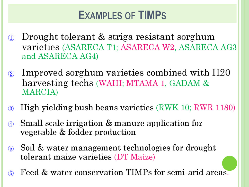
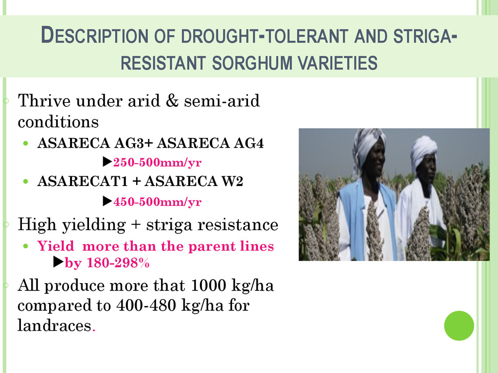
    under arid & semi-arid conditions • ASARECA AG3+ ASARECA AG4 ▶250-500mm/yr • ASARECAT1 + ASARECA W2 ▶450-500mm/yr ◦ High yielding + striga resistance • Yield more than the parent lines ▶by 180-298% ◦ All produce more that 1000 kg/ha compared to 400-480 kg/ha for landraces.
  8. CRITERIA FOR SELECTION OF TIMPS Potential for adoption in >1

    ECA country. ! Replicable and up-scalable. ! Tackle common cross-border issues. ! Ranked highly during stakeholder priority setting sessions. ! Financially feasible in implementation.
  9. Staples Bur Ken Rwa Tan Uga 6.8 5.9 6.7 5.8

    5.5 2.4 2.1 3.9 2.9 3.6 BAU BU-U
  10. 0 100 200 300 400 500 600 Sugar Poultry Beans_Peas

    Wheat_Barley Rice Potatoes_Sweetpotatoes Coffee_Tea Bananas Maize Beef Vegetable_Fruits Sorghum_Millet Cassava Oilseeds Milk Regional GDP Gains to 2015 from Growth in Selected Commodity Sub-Sectors (US$ million)
  11. Staples Livestock Fruits & Veg Oilseeds Hot Bevs Pulses 0

    400 800 1200 1600 Regional GDP Gains to 2015 from growth in Selected Commodity Groups (US$ million)
  12. PLANNED ACTIVITIES Mapping of TIMPs + Process Monitoring ! Tracking

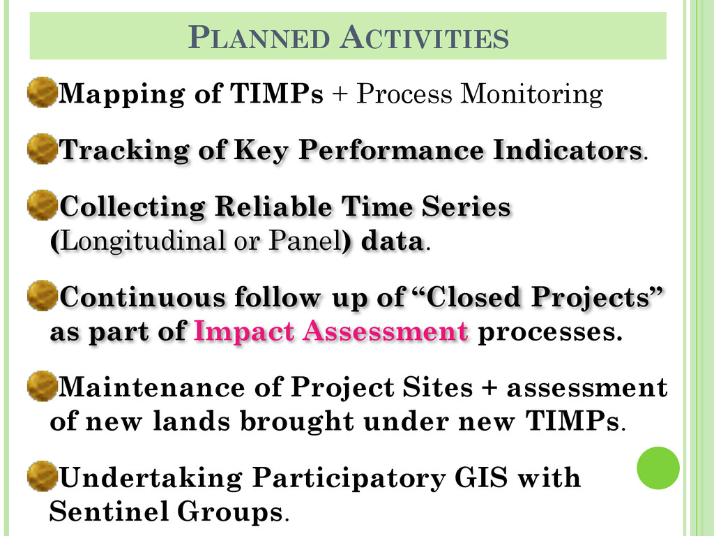
    of Key Performance Indicators. ! Collecting Reliable Time Series (Longitudinal or Panel) data. ! Continuous follow up of “Closed Projects” as part of Impact Assessment processes. ! Maintenance of Project Sites + assessment of new lands brought under new TIMPs. ! Undertaking Participatory GIS with Sentinel Groups.