Upgrade to Pro
— share decks privately, control downloads, hide ads and more …
Speaker Deck
Features
Speaker Deck
PRO
Sign in
Sign up for free
Search
Search
GIS: It’s getting really good.
Search
Sponsored
·
Your Podcast. Everywhere. Effortlessly.
Share. Educate. Inspire. Entertain. You do you. We'll handle the rest.
→
CGIAR-CSI
September 23, 2014
89
0
Share
GIS: It’s getting really good.
CGIAR-CSI
September 23, 2014
More Decks by CGIAR-CSI
See All by CGIAR-CSI
A Remote Sensing Application to Drought and Flood Monitoring
cgiarcsi
1
87
eAtlas Initiative
cgiarcsi
0
70
Monitoring Agriculture Areas using Remote sensing techniques
cgiarcsi
0
97
Hyperspectral information for adoption and technology tracking
cgiarcsi
0
88
Geospatial, Open-Source Hosting of Agriculture, Resources and Environmental Data Pilot Project Overview & Lessons Learned
cgiarcsi
0
39
CGIAR-CSI_ESRI_2.pdf
cgiarcsi
0
110
Esri Resources for CSI 2014
cgiarcsi
0
48
What we've been up to.. SpatialDev
cgiarcsi
0
38
Mapping Agricultural Investments and Technologies
cgiarcsi
0
51
Featured
See All Featured
The Cult of Friendly URLs
andyhume
79
6.9k
How to Create Impact in a Changing Tech Landscape [PerfNow 2023]
tammyeverts
55
3.4k
Pawsitive SEO: Lessons from My Dog (and Many Mistakes) on Thriving as a Consultant in the Age of AI
davidcarrasco
0
150
Agile that works and the tools we love
rasmusluckow
331
21k
Digital Projects Gone Horribly Wrong (And the UX Pros Who Still Save the Day) - Dean Schuster
uxyall
0
1.5k
How to Get Subject Matter Experts Bought In and Actively Contributing to SEO & PR Initiatives.
livdayseo
0
130
Color Theory Basics | Prateek | Gurzu
gurzu
0
320
State of Search Keynote: SEO is Dead Long Live SEO
ryanjones
0
200
Leveraging Curiosity to Care for An Aging Population
cassininazir
1
250
The Anti-SEO Checklist Checklist. Pubcon Cyber Week
ryanjones
0
140
We Have a Design System, Now What?
morganepeng
55
8.2k
Dealing with People You Can't Stand - Big Design 2015
cassininazir
367
27k
Transcript
GIS: It’s getting really good. Susana Crespo
[email protected]
Tony Mason
[email protected]
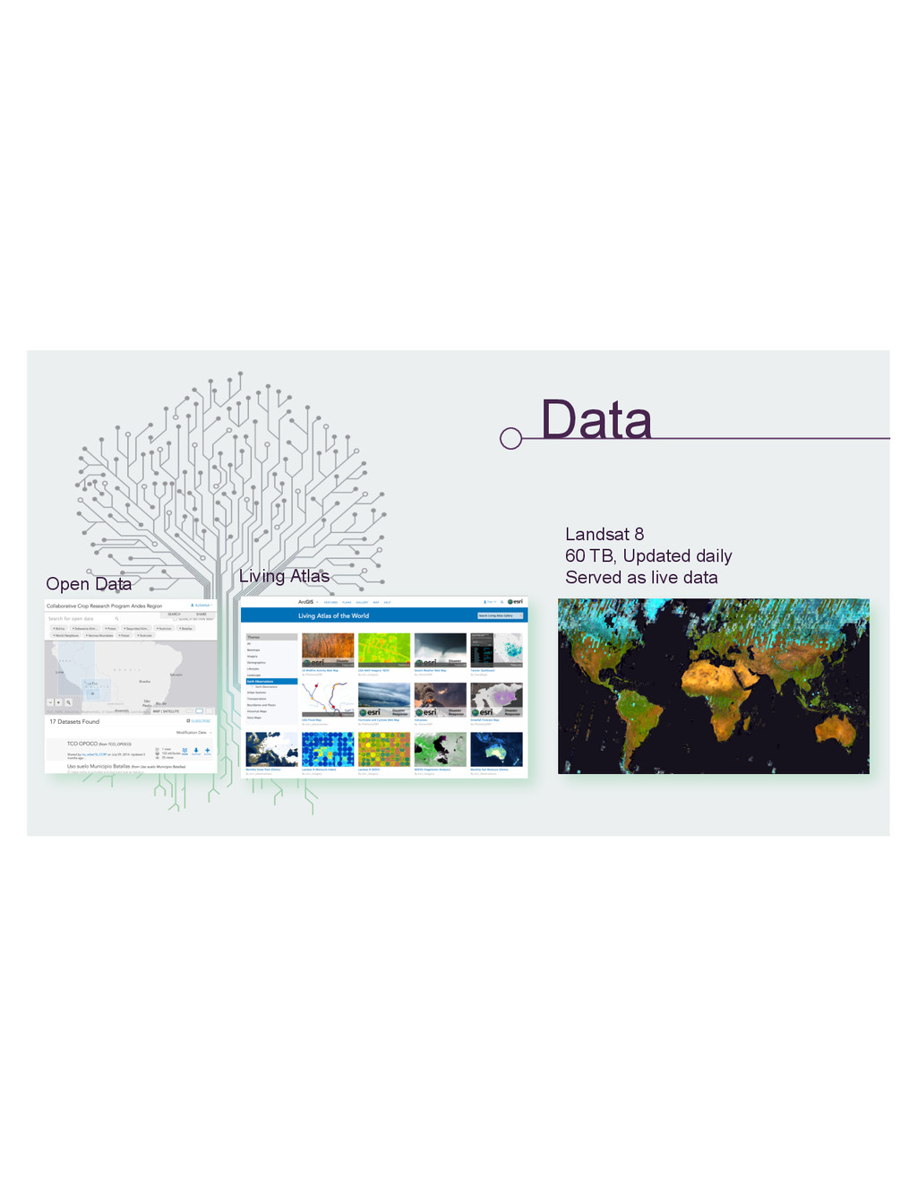
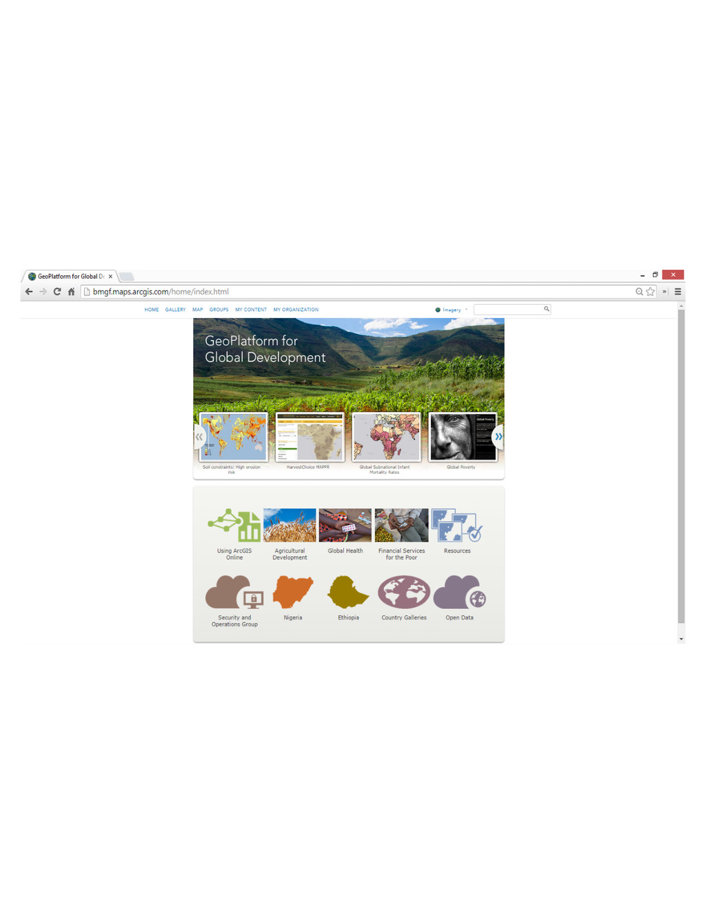
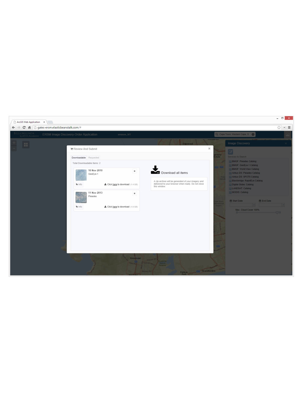
Data Open Data Living Atlas Landsat 8 60 TB, Updated
daily Served as live data
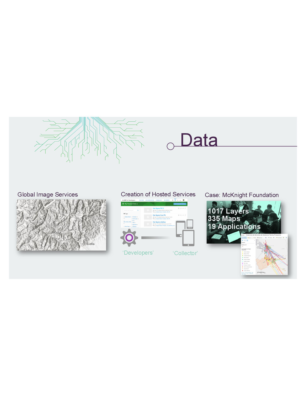
Data Global Image Services Creation of Hosted Services ‘Developers’ ‘Collector’
1017 Layers 335 Maps 19 Applications Case: McKnight Foundation
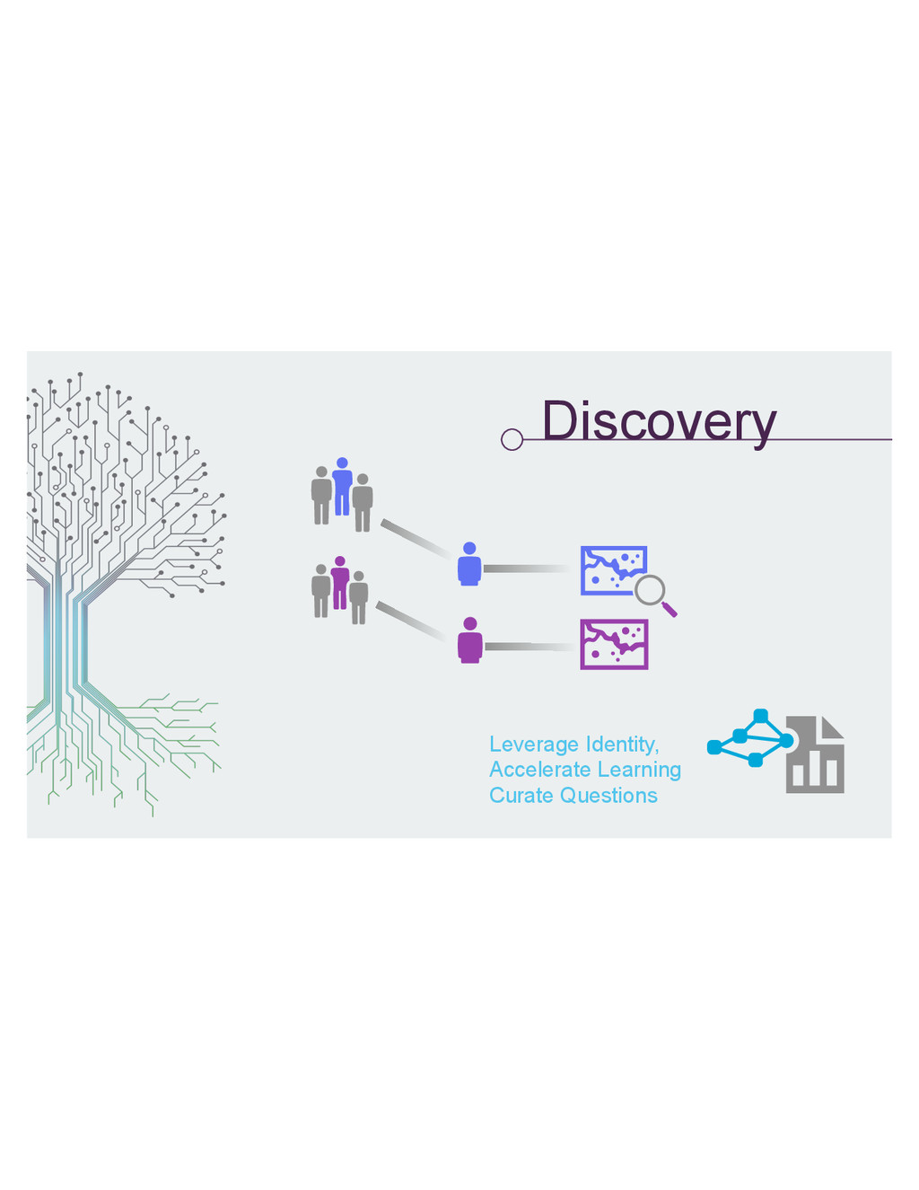
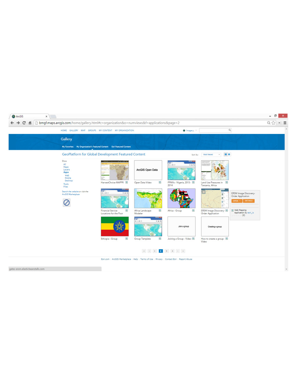
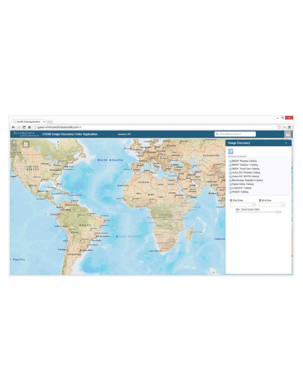
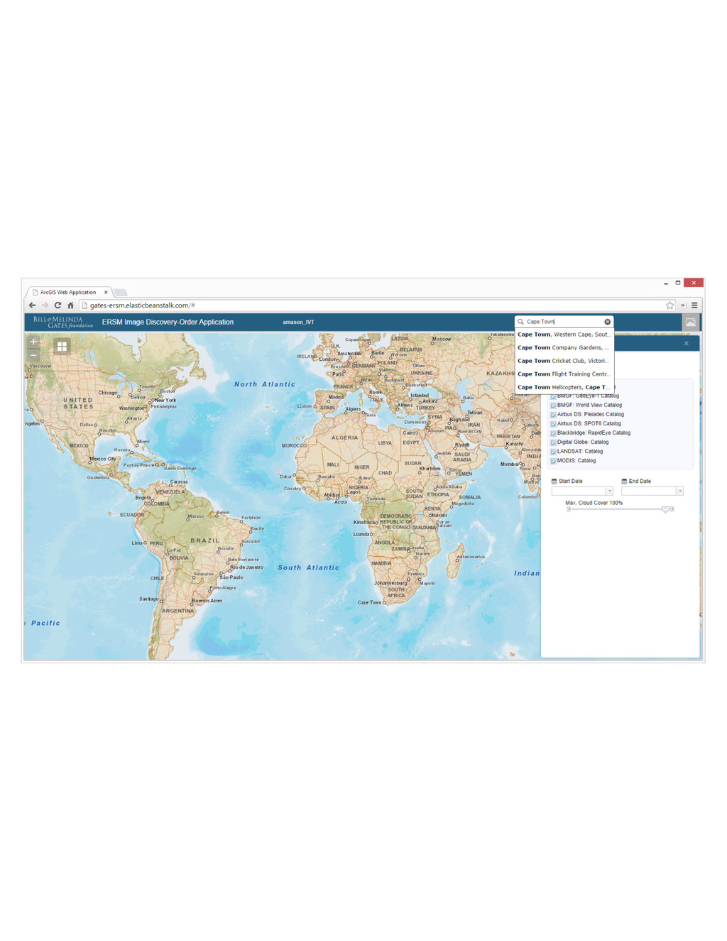
Discovery Leverage Identity, Accelerate Learning Curate Questions
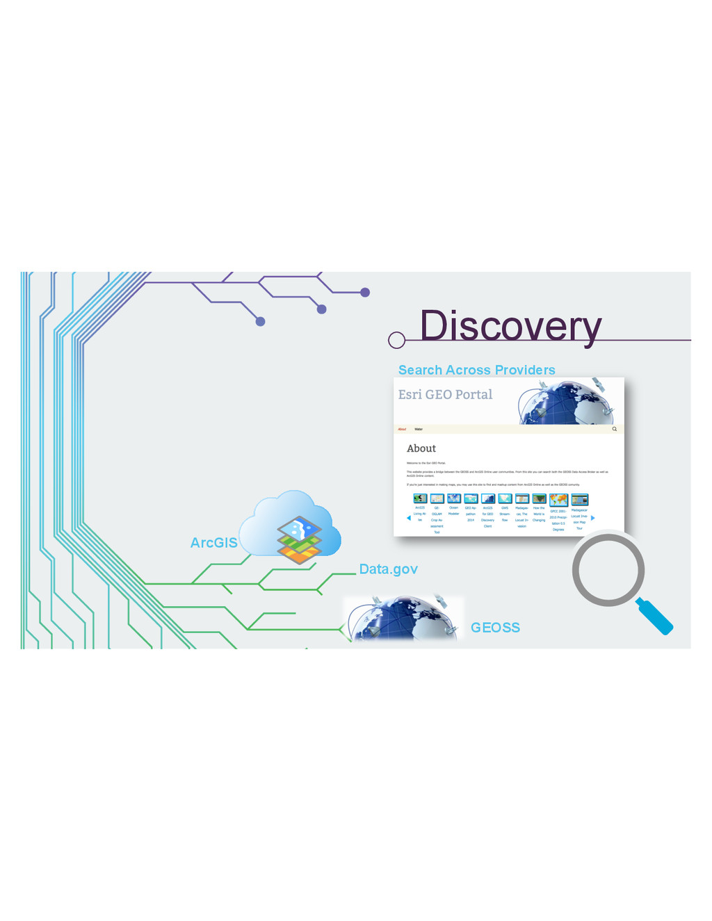
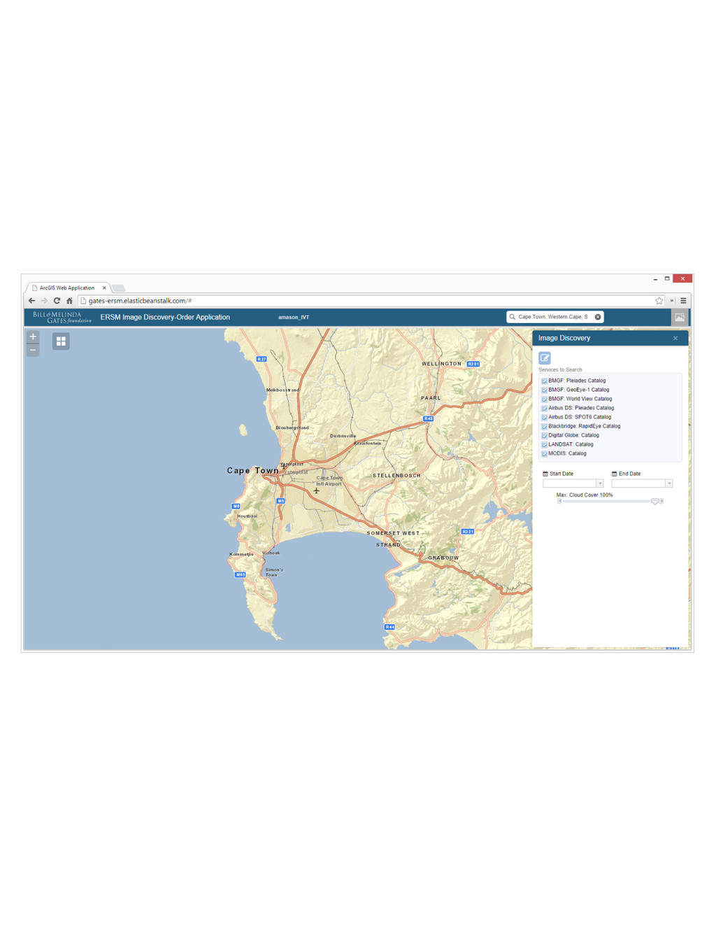
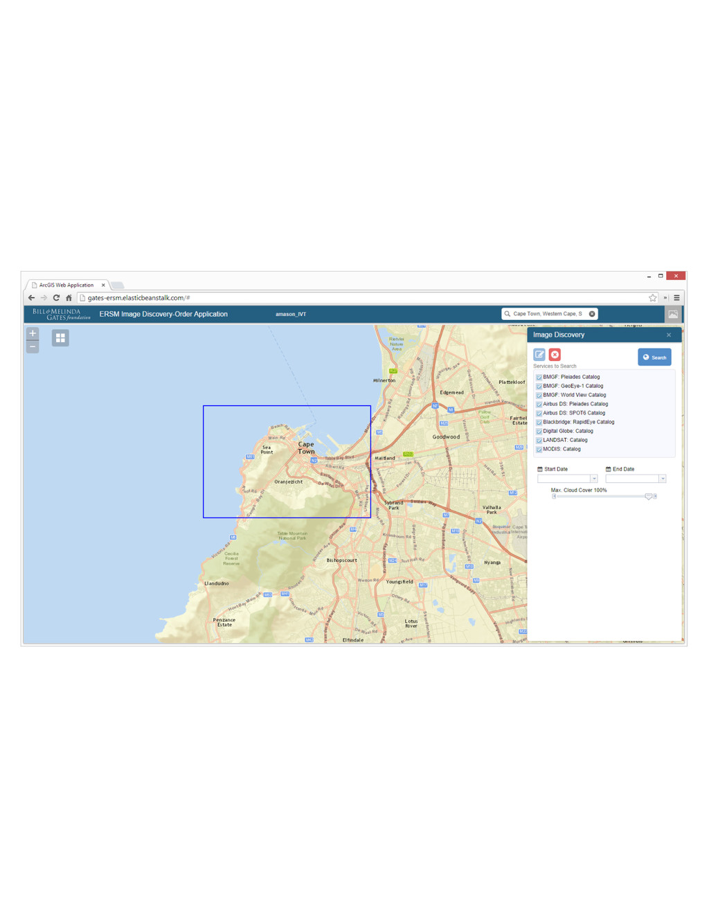
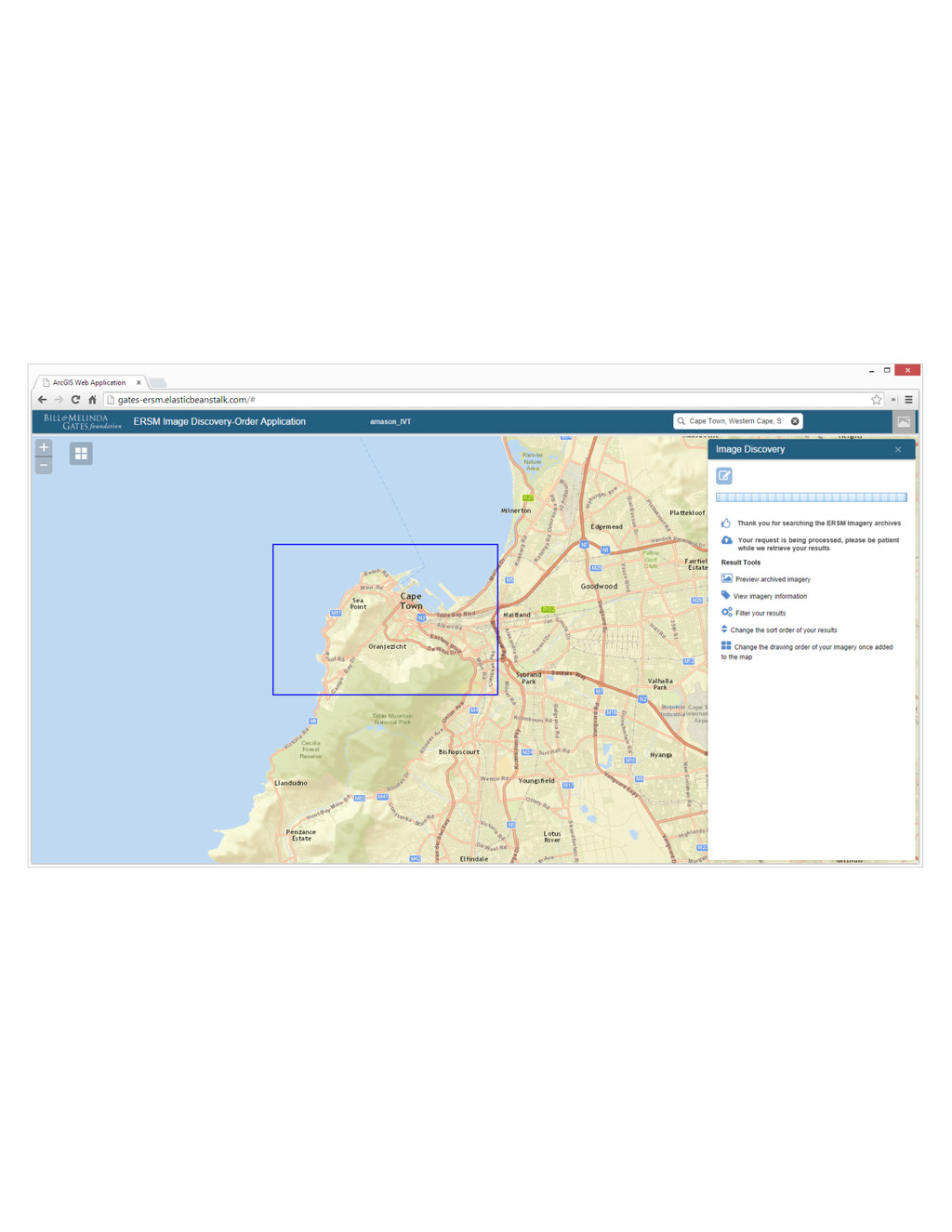
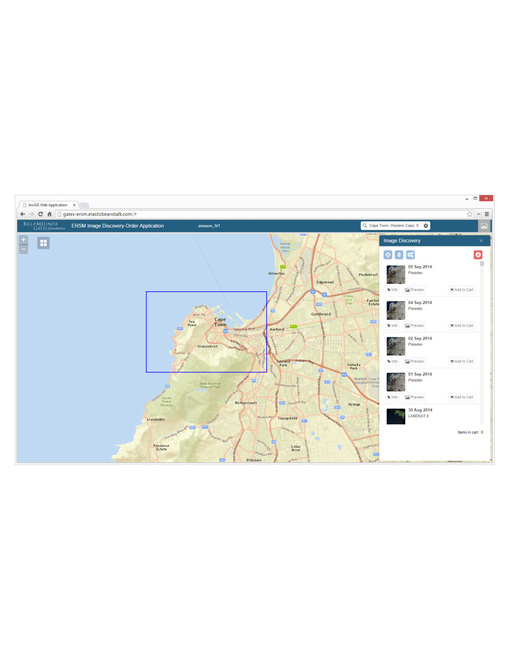
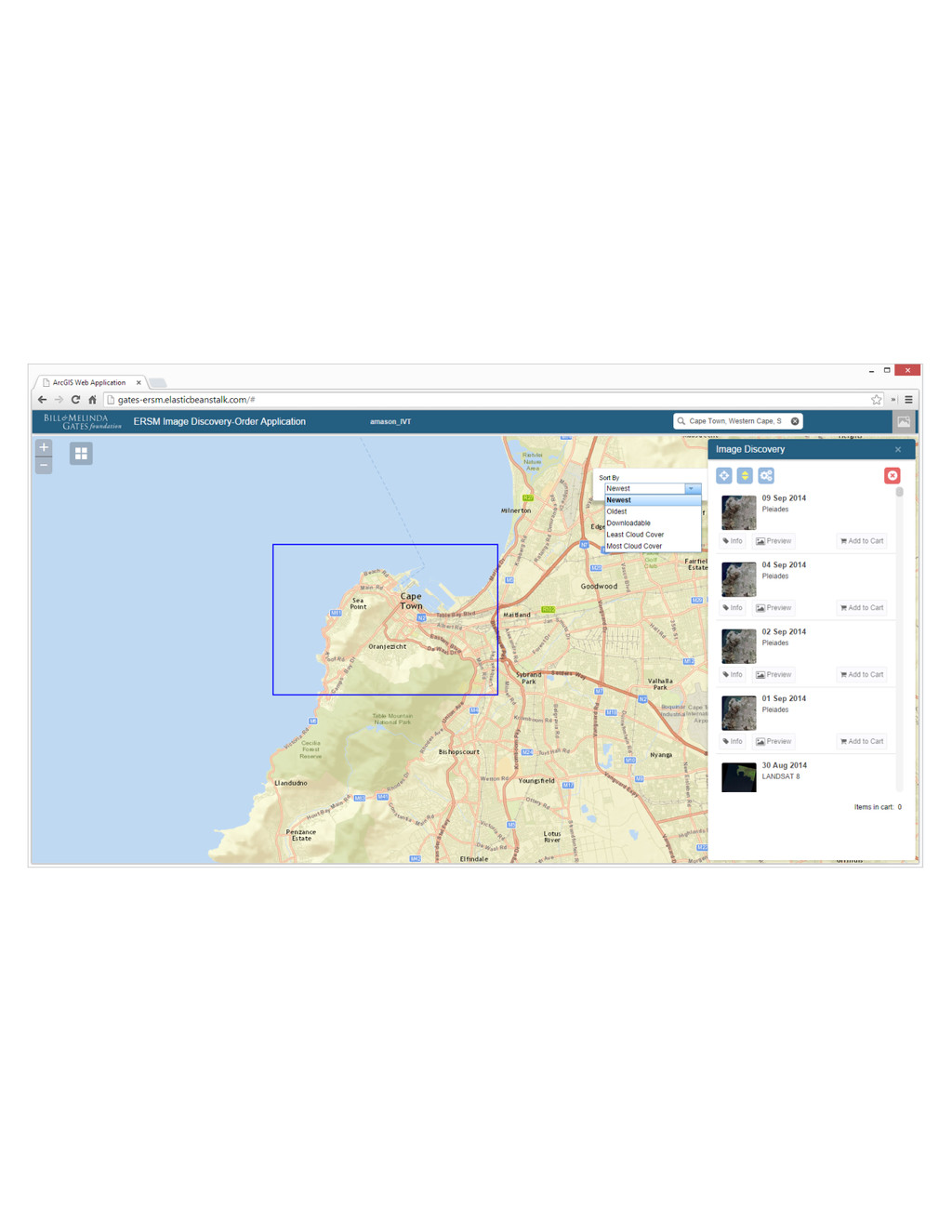
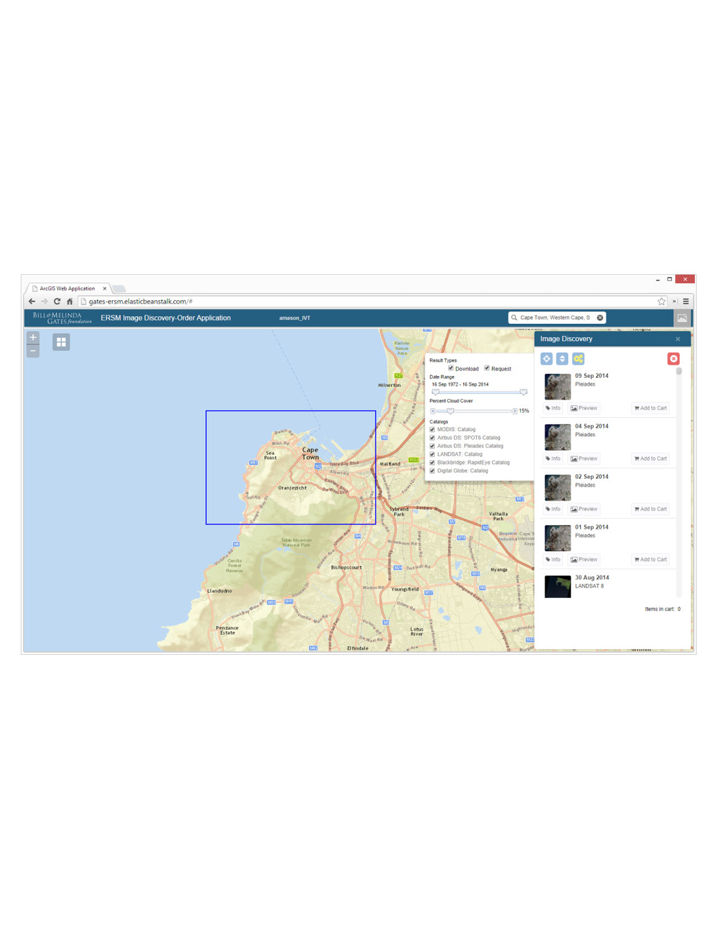
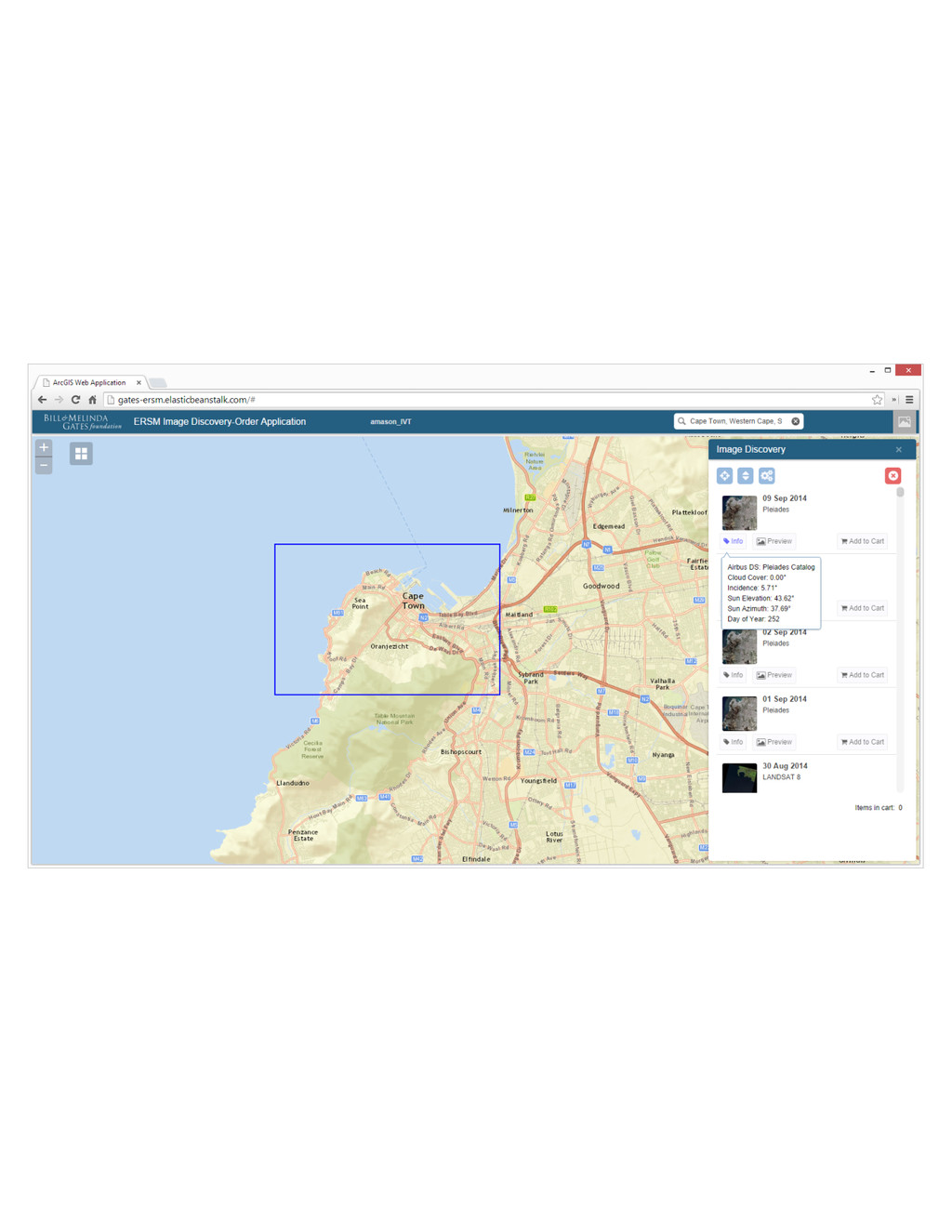
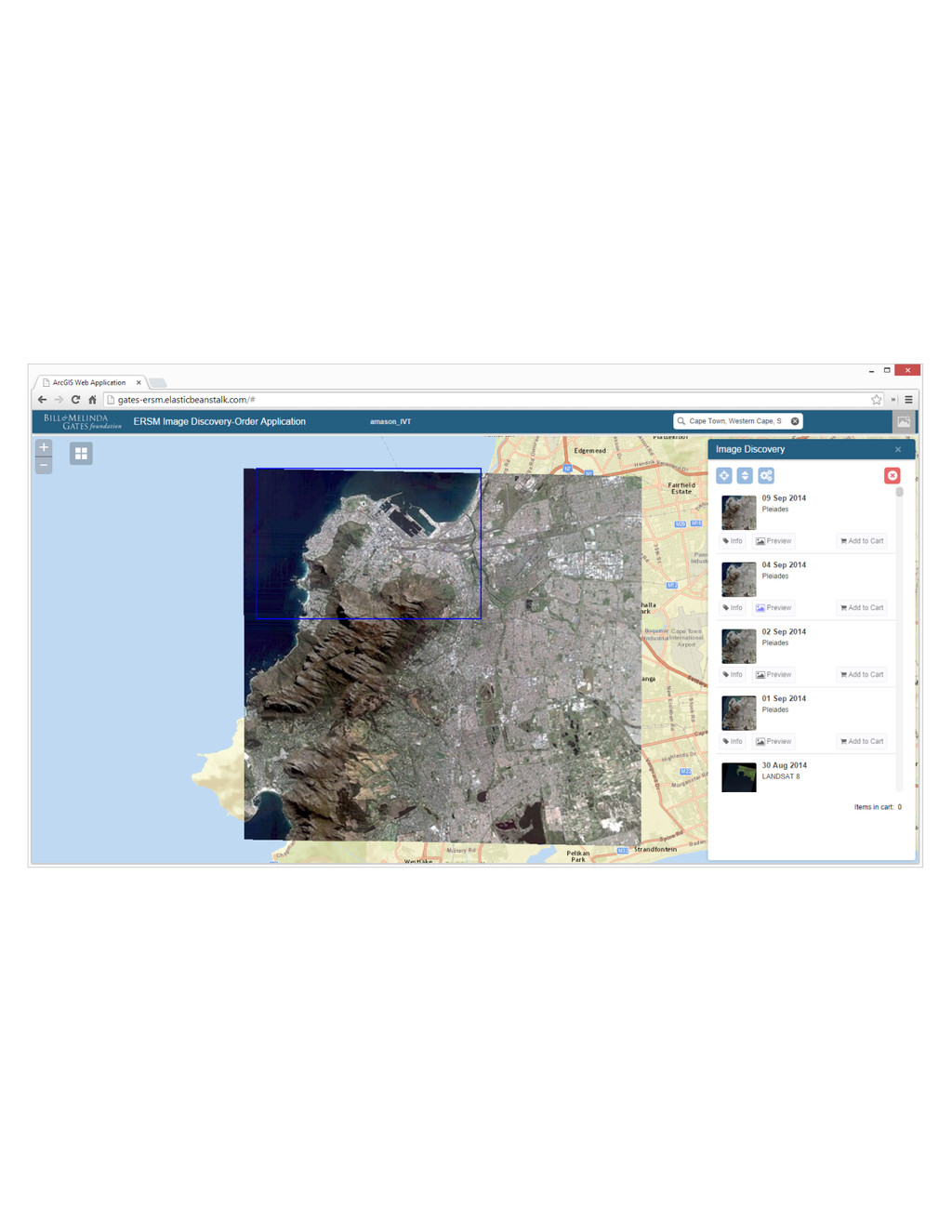
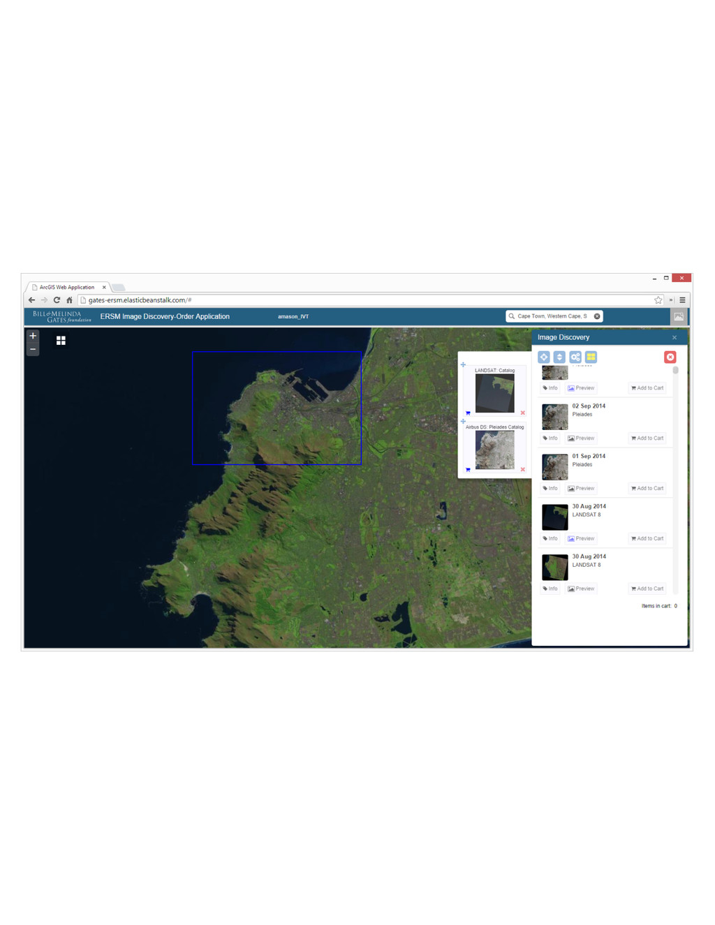
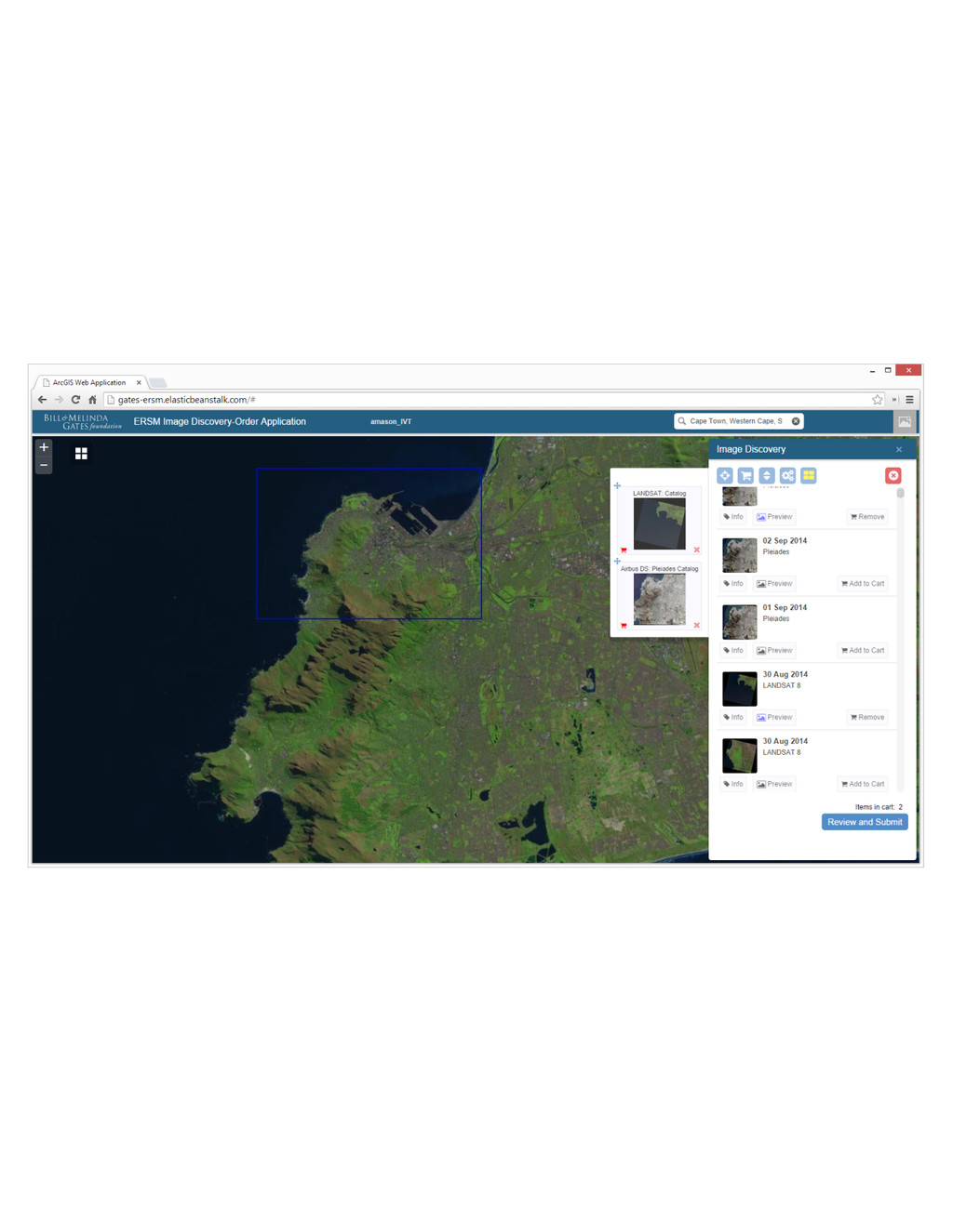
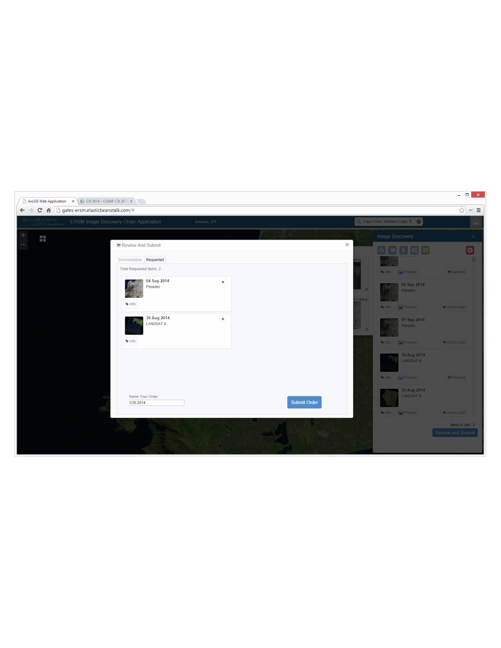
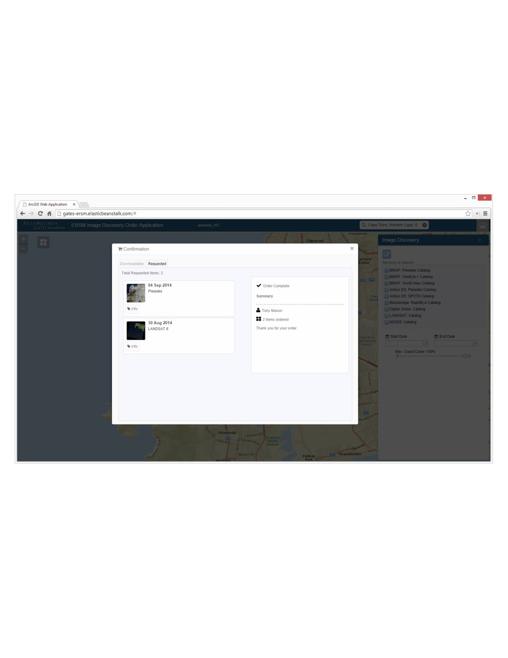
Discovery ArcGIS Data.gov GEOSS Search Across Providers
None
None
None
None
None
None
None
None
None
None
None
None
None
None
None
None
None
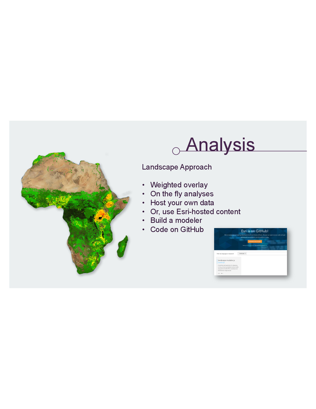
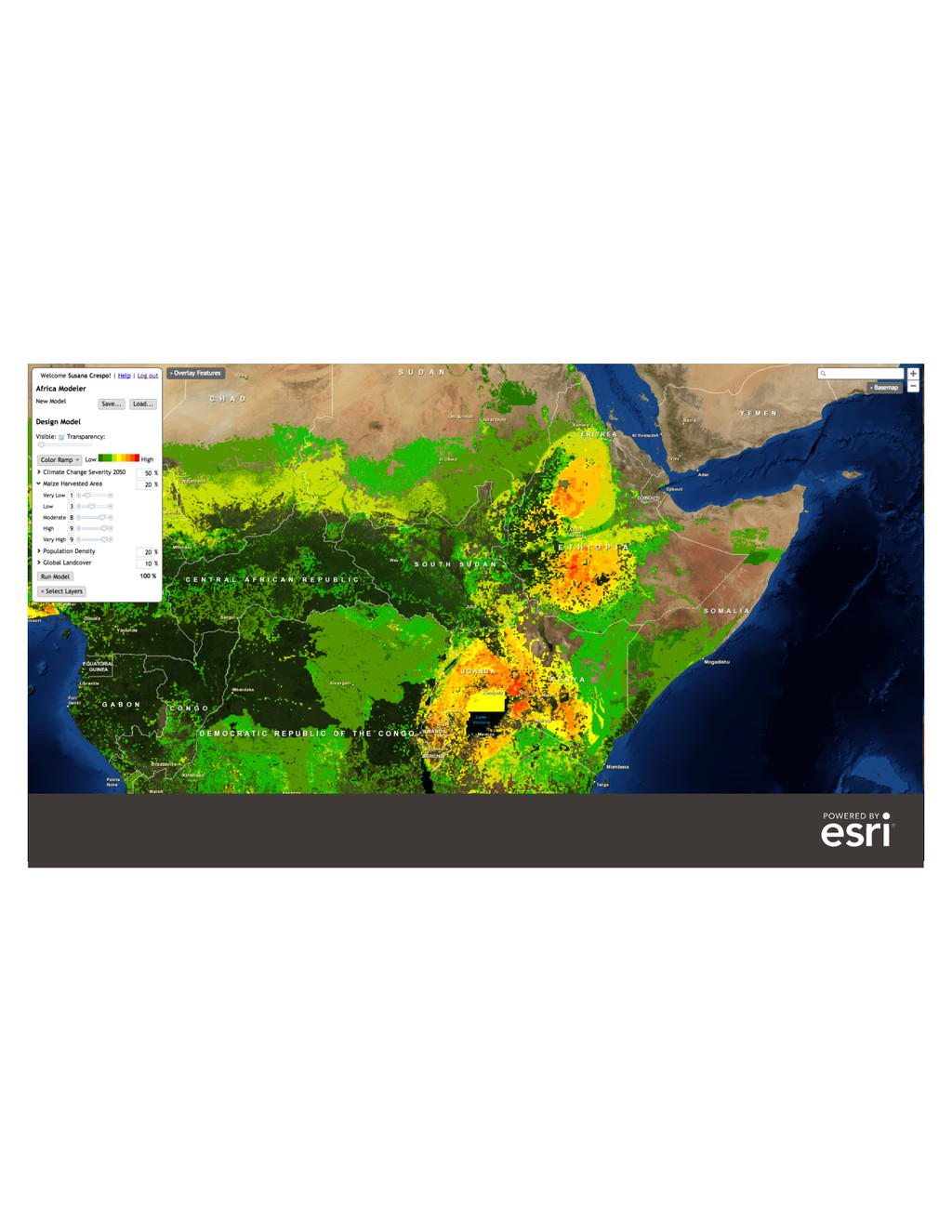
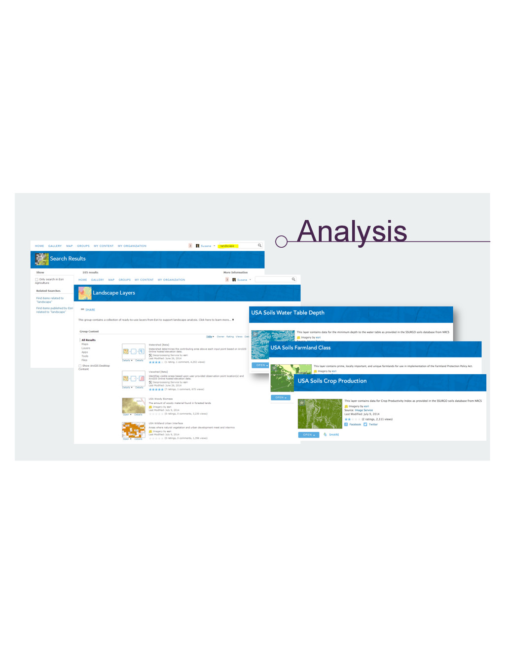
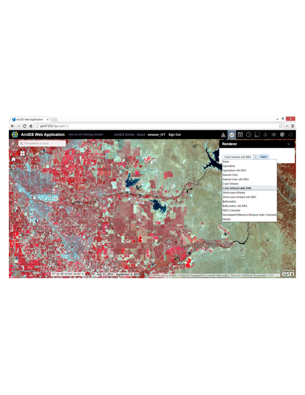
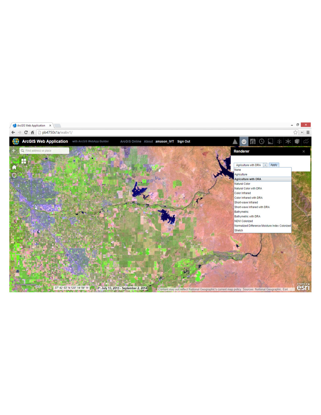
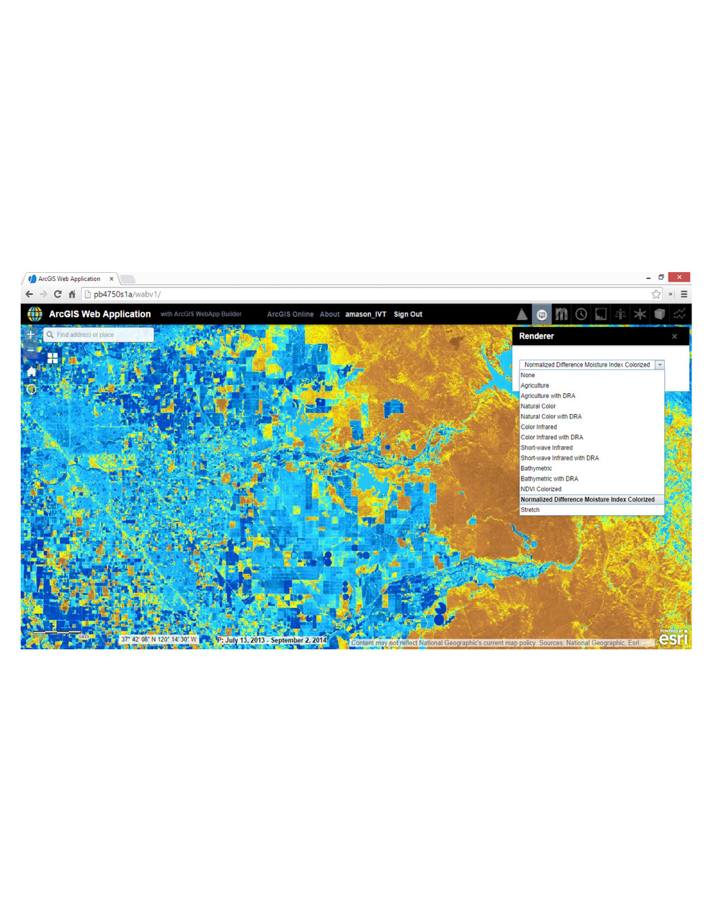
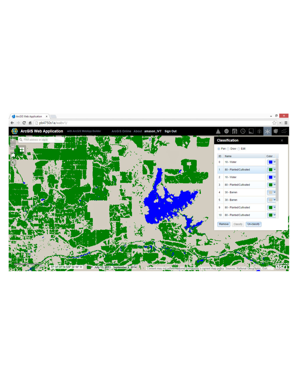
Analysis
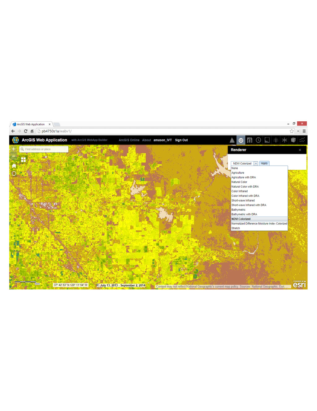
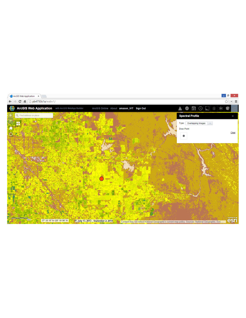
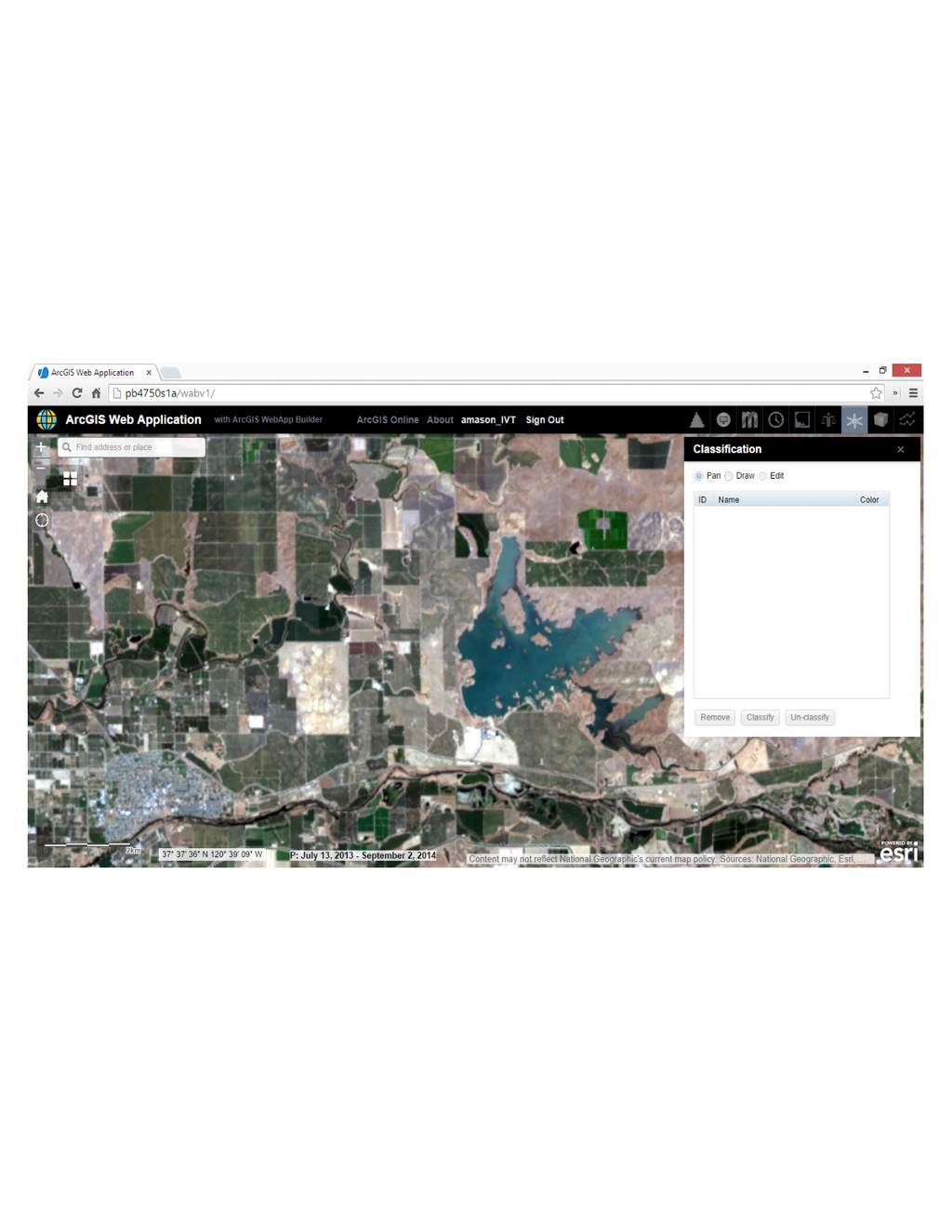
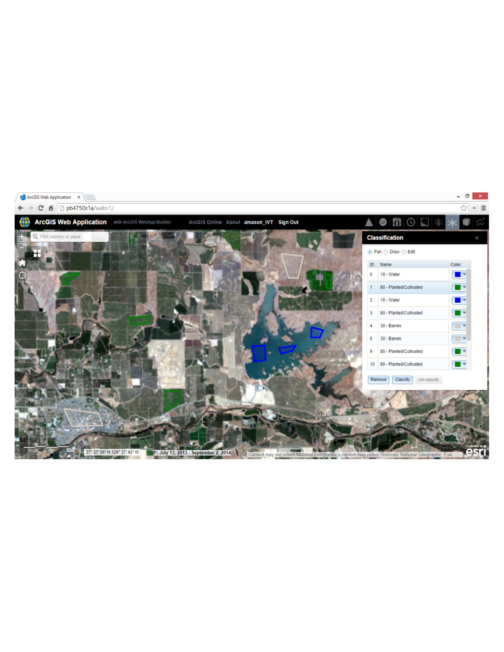
Analysis (On – the - fly)
Analysis
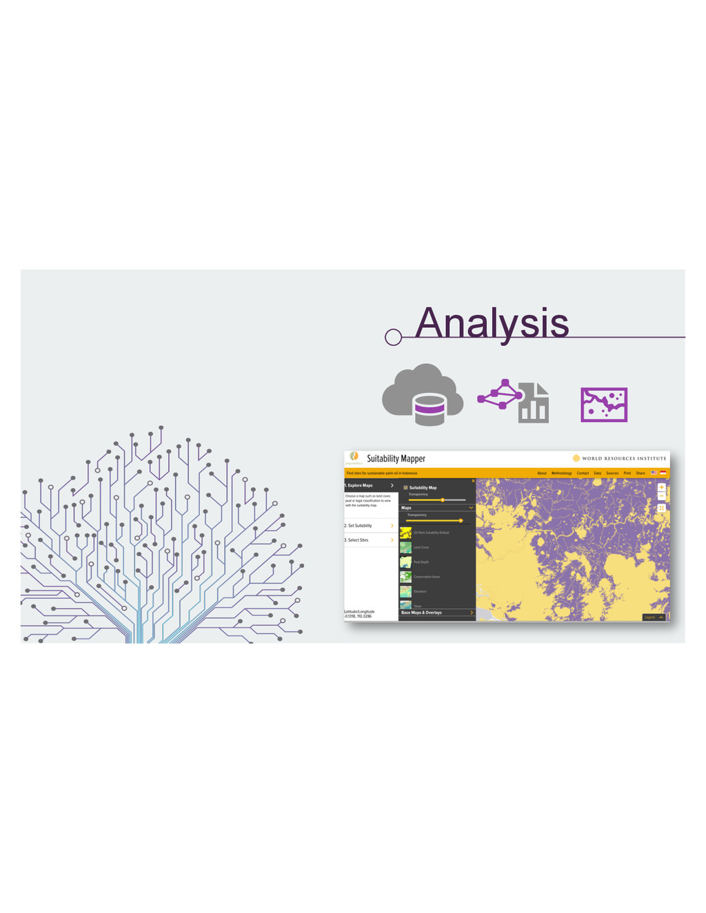
Analysis Landscape Approach • Weighted overlay • On the fly
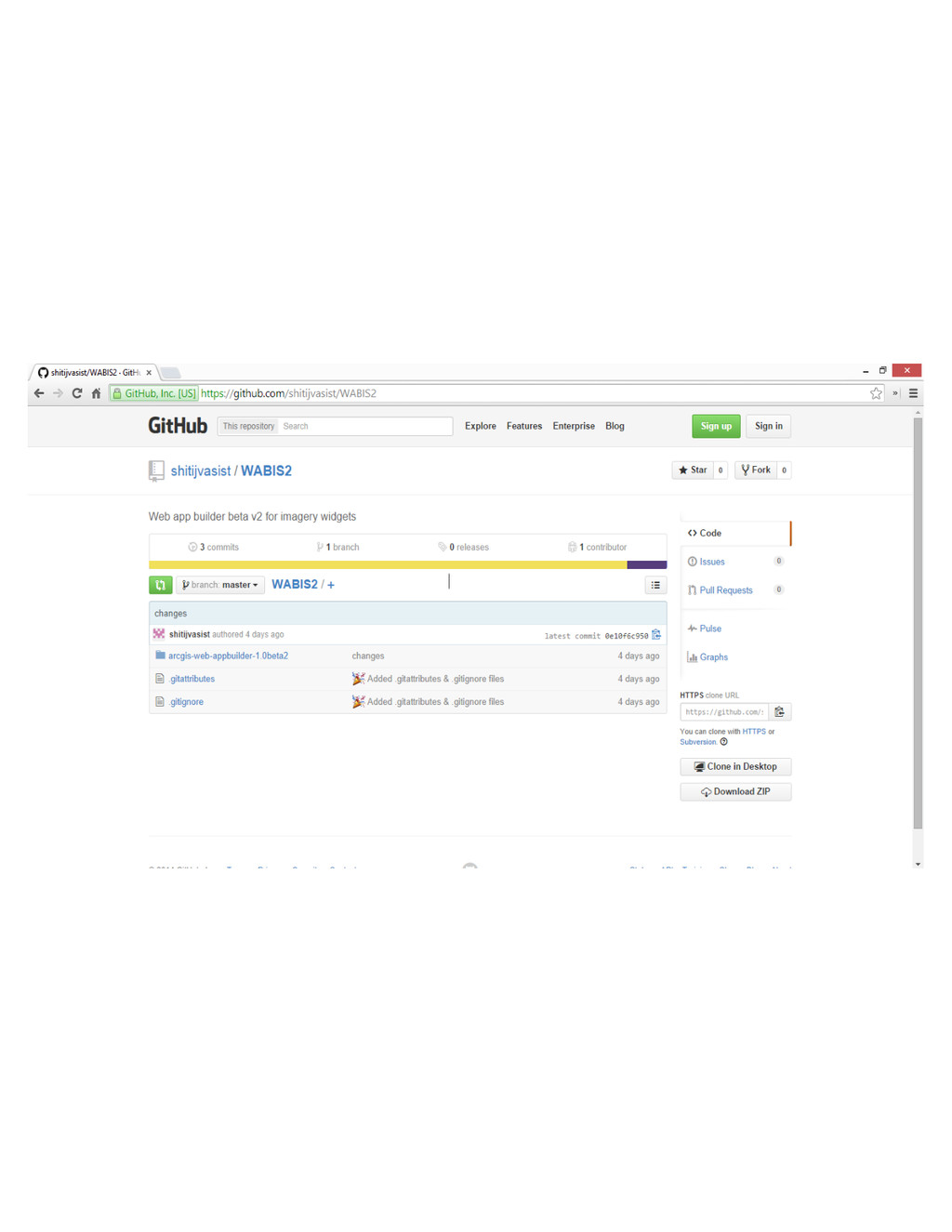
analyses • Host your own data • Or, use Esri-hosted content • Build a modeler • Code on GitHub
None
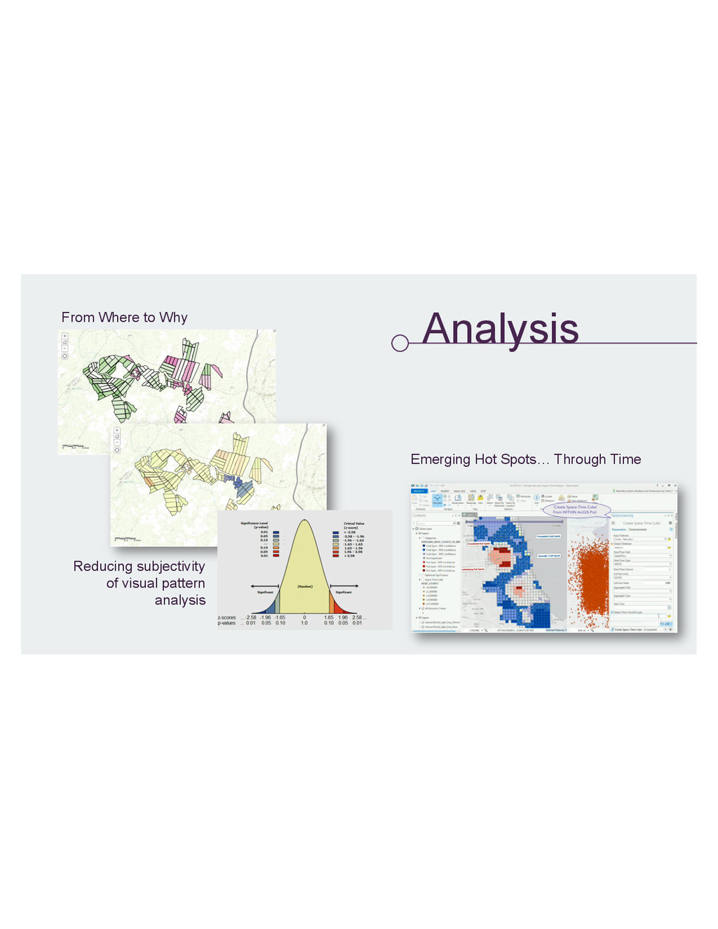
Analysis
Analysis From Where to Why Emerging Hot Spots… Through Time
Reducing subjectivity of visual pattern analysis
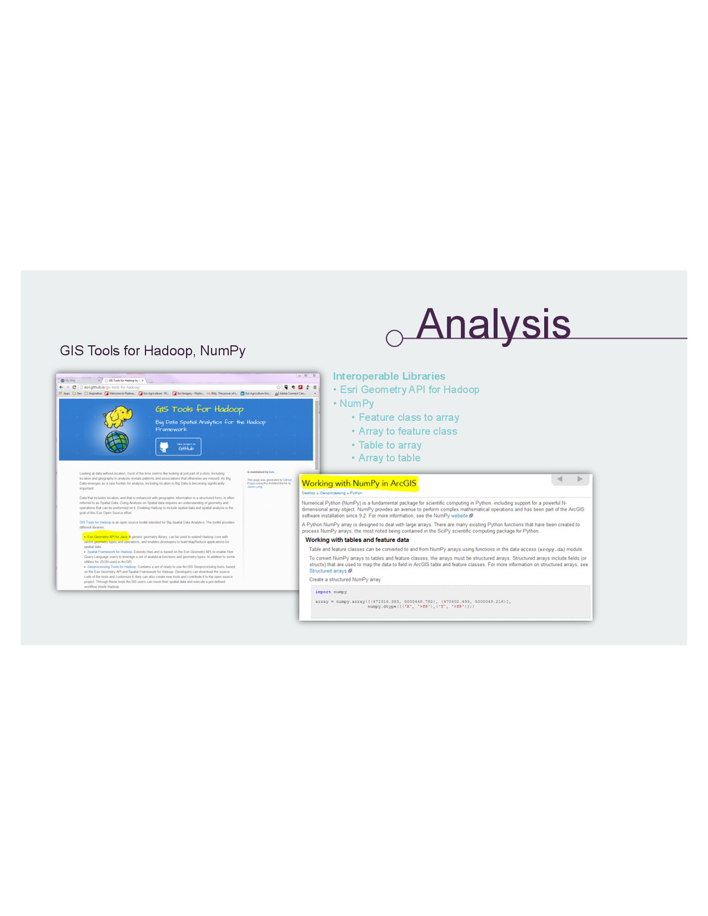
Analysis GIS Tools for Hadoop, NumPy Interoperable Libraries • Esri
Geometry API for Hadoop • NumPy • Feature class to array • Array to feature class • Table to array • Array to table
None
None
None
None
None
None
None
None
None
None
None
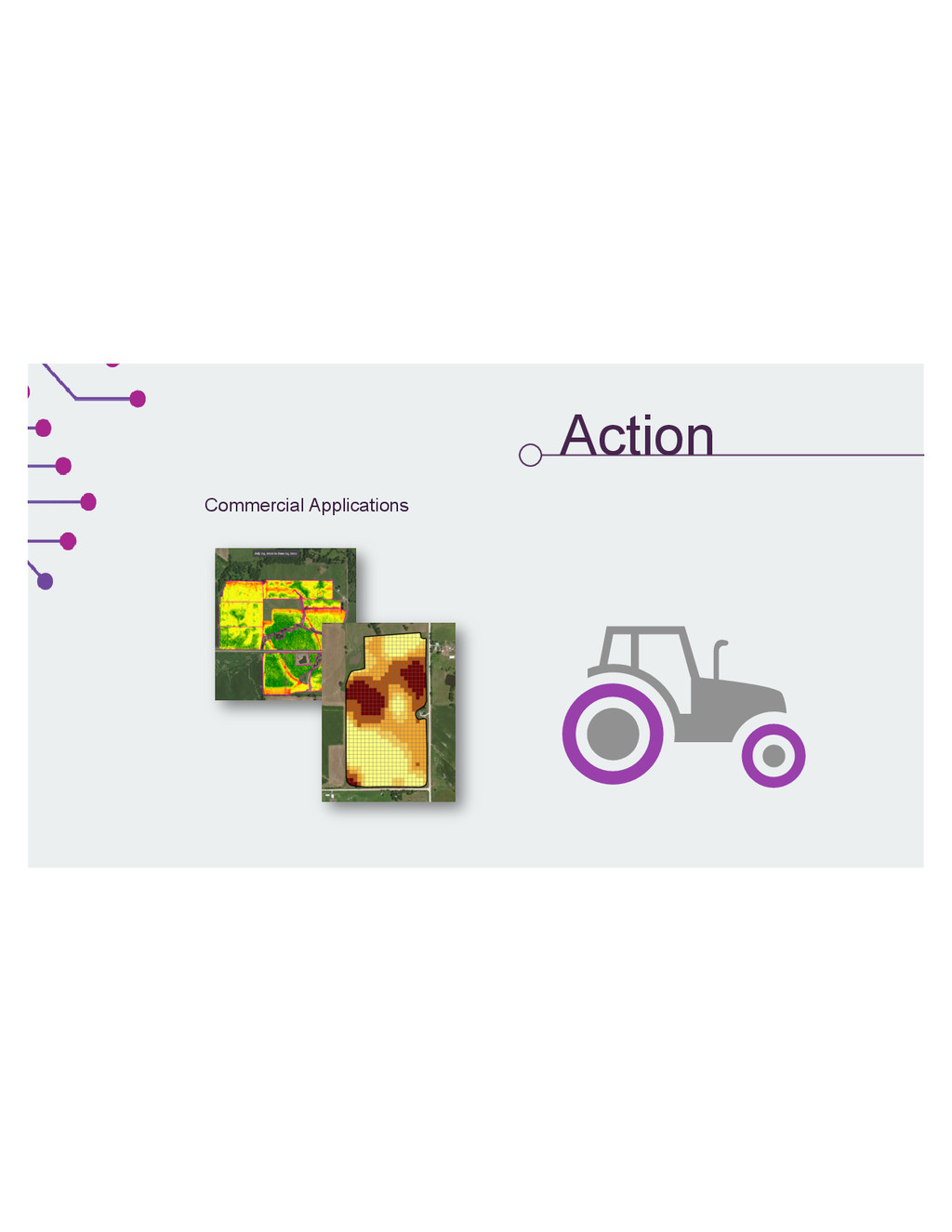
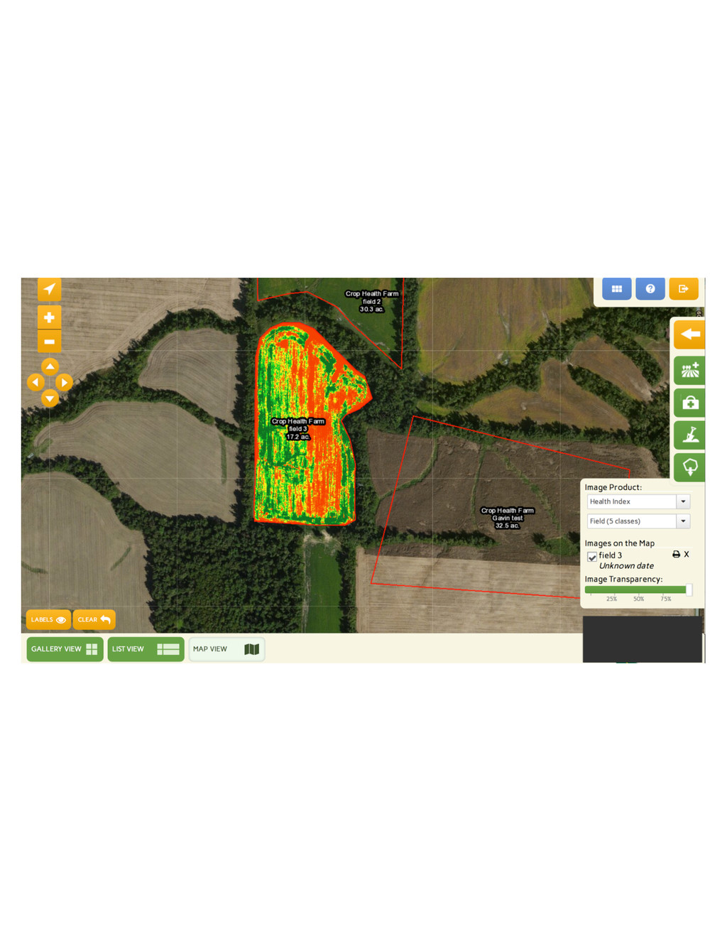
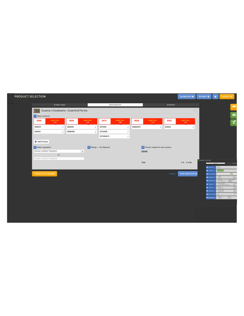
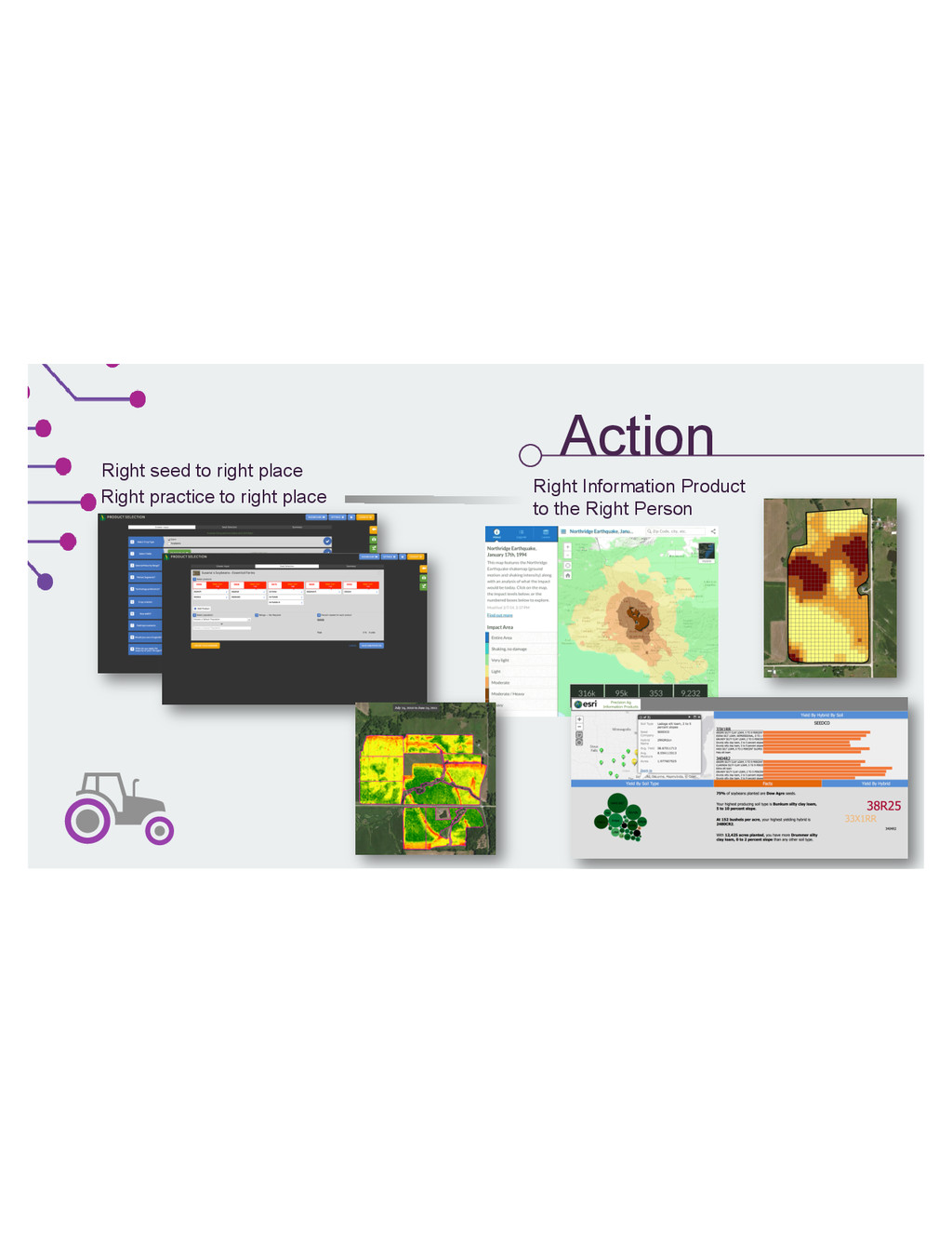
Action Commercial Applications
None
None
Action Right seed to right place Right practice to right
place Right Information Product to the Right Person
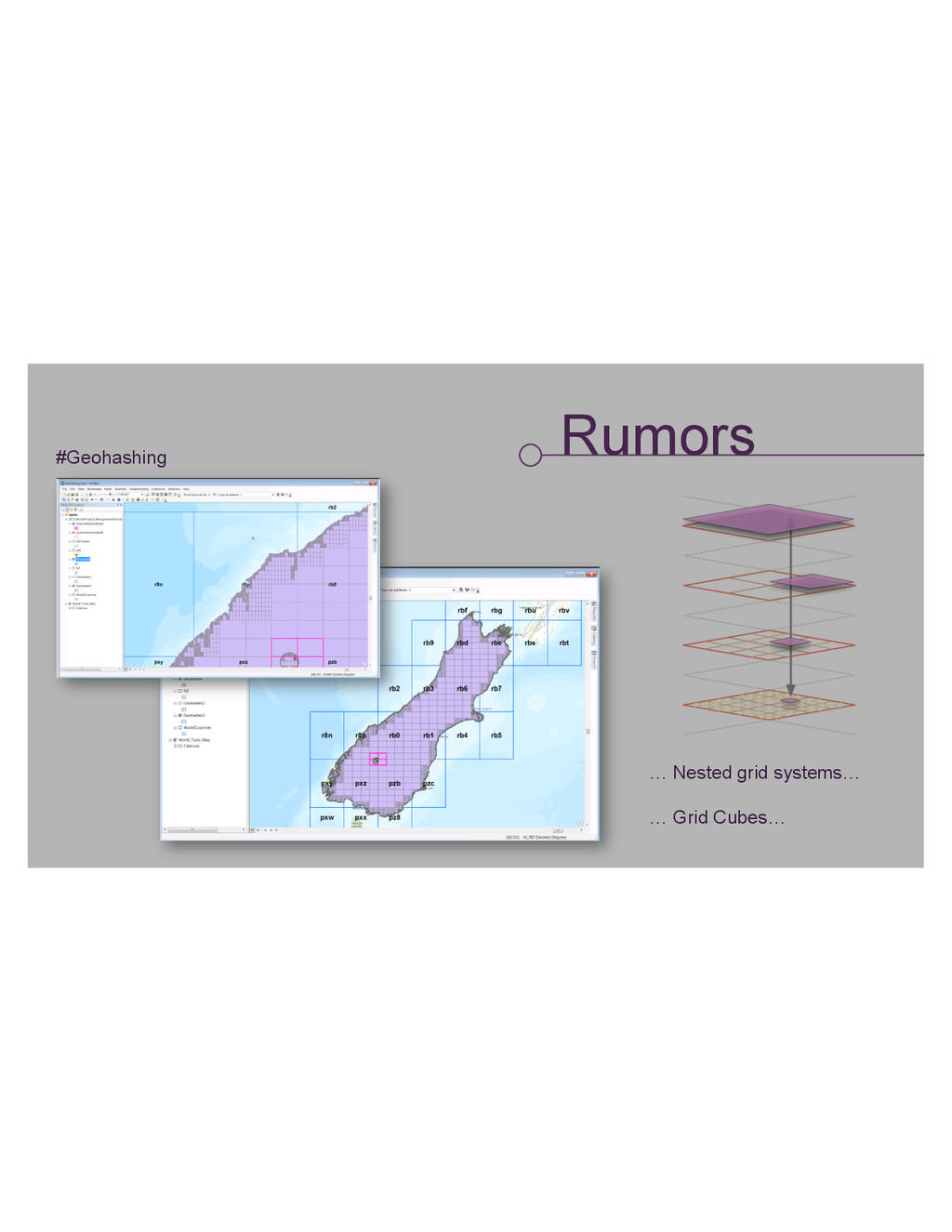
Rumors #Geohashing … Nested grid systems… … Grid Cubes…
None
![GIS: It’s getting really good. Susana Crespo [email protected] Tony Mason](https://files.speakerdeck.com/presentations/17157e00252b01326e4a064769dcc1c7/slide_0.jpg)