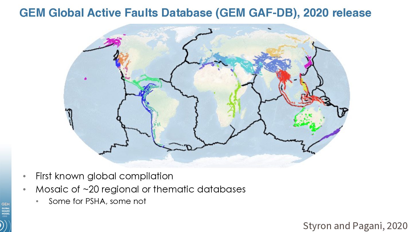
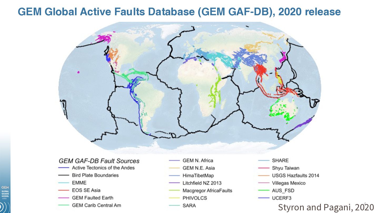
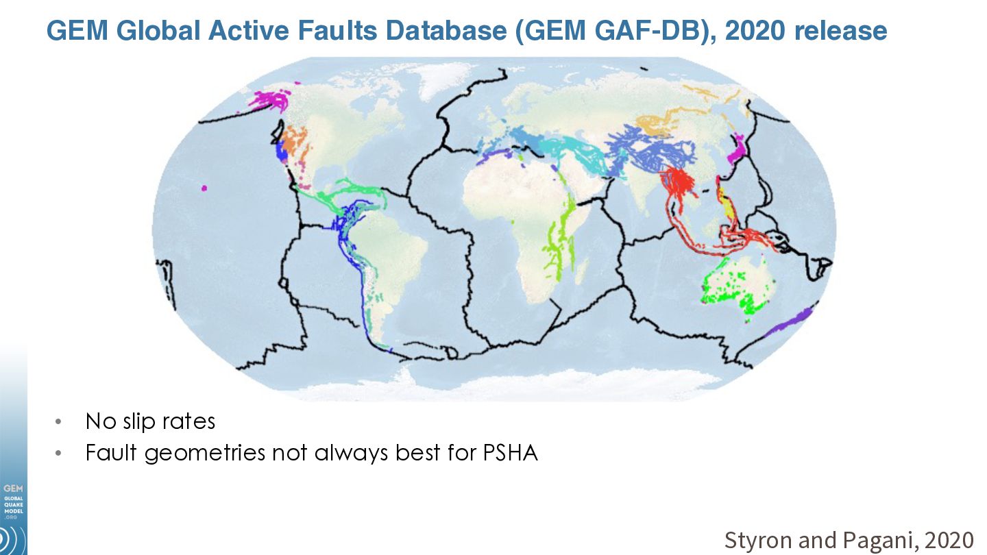
on mapped (or mappable) faults • Fault sources in PSHA provide much more accurate rupture location, geometry, and kinematics compared to distributed seismic sources • Fault slip rates provide budget for earthquake occurrence • Fault catalogs have different limitations than earthquake catalogs
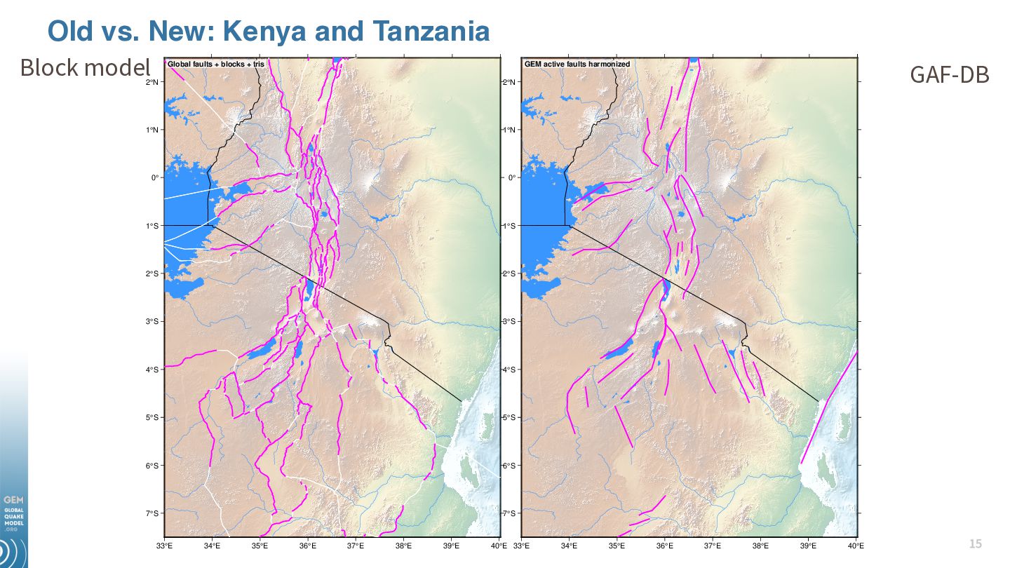
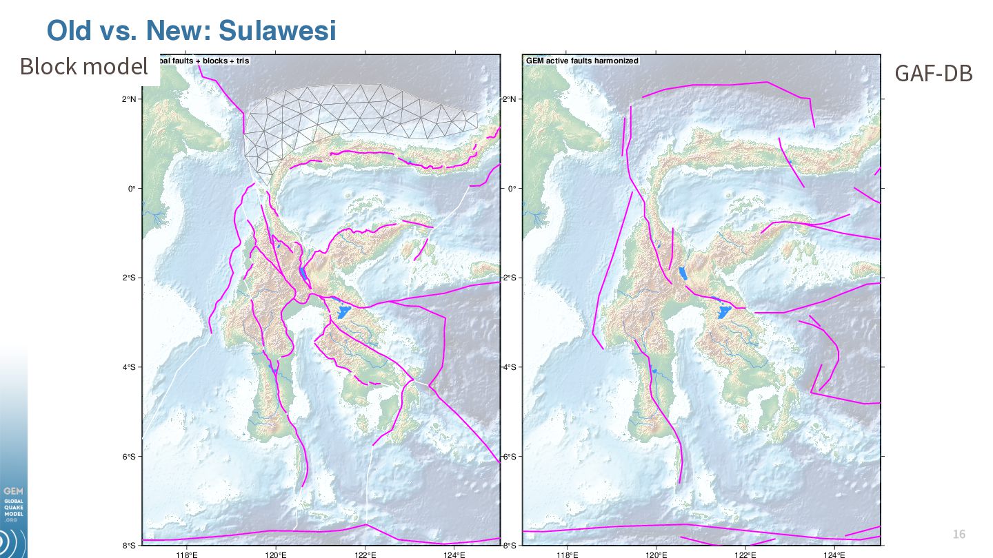
resolution of traces • Traces represent seismic sources, not surface deformation • More accurate slip rate estimates (no more guesstimates) Precision • Lower slip rate uncertainties • Correlated slip rate uncertainties • Fewer branches/samples to explore parameter space Clarity • Clearer links between model parameters and data • Simpler models with fewer logic tree branches How? Remap everything and link all available data and theory (systematize it)!
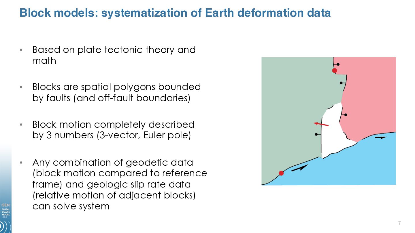
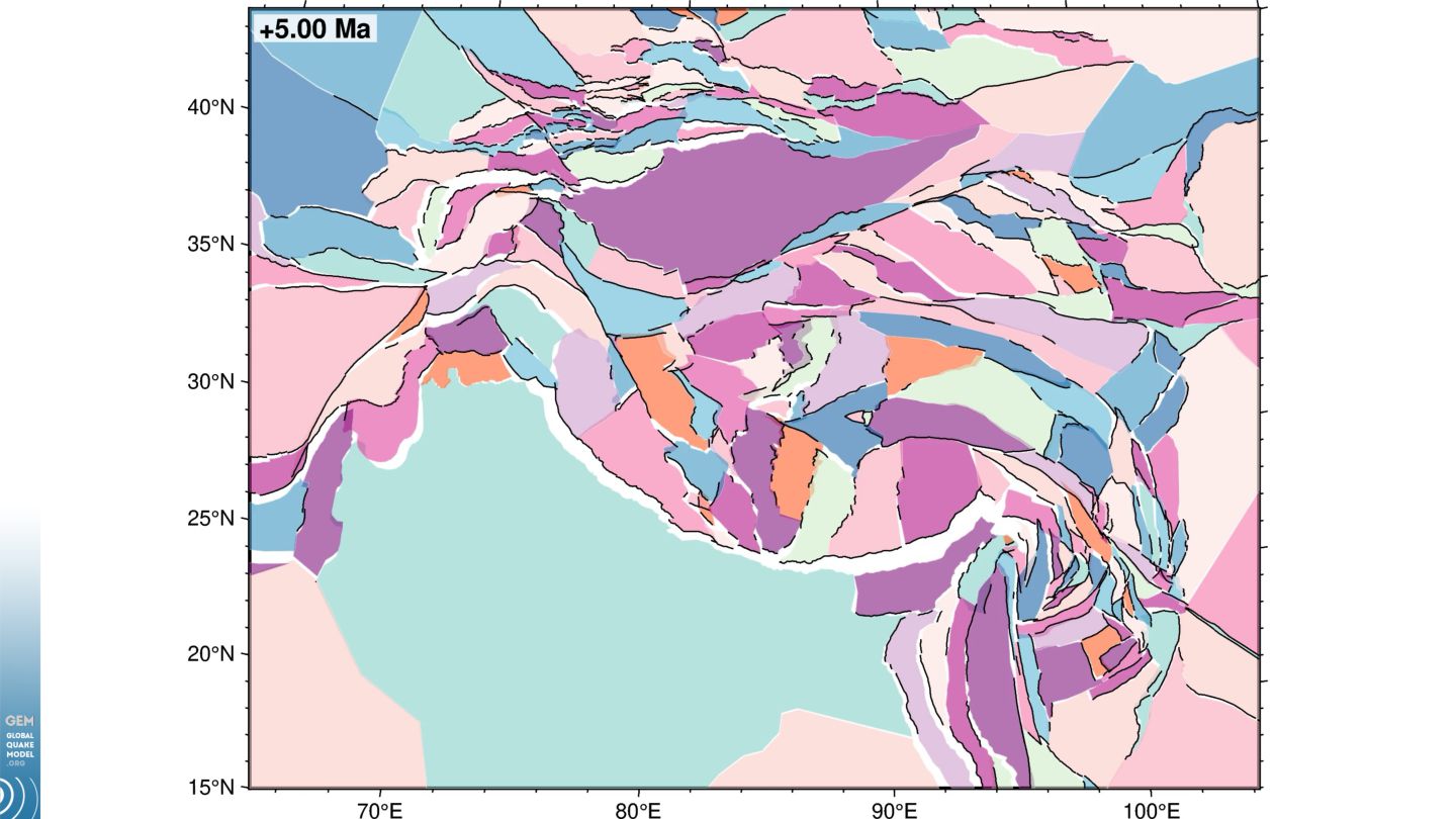
plate tectonic theory and math • Blocks are spatial polygons bounded by faults (and off-fault boundaries) • Block motion completely described by 3 numbers (3-vector, Euler pole) • Any combination of geodetic data (block motion compared to reference frame) and geologic slip rate data (relative motion of adjacent blocks) can solve system
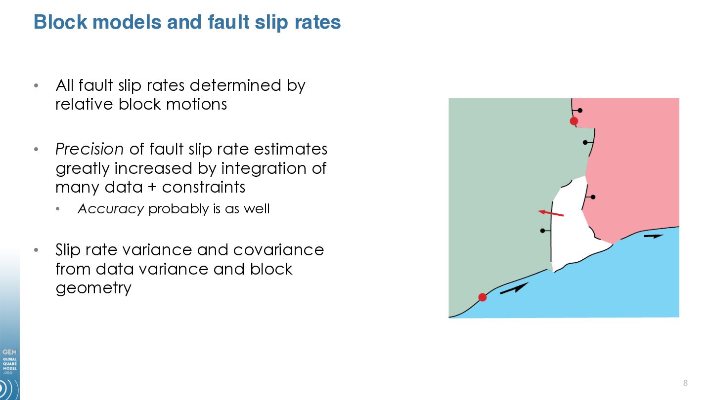
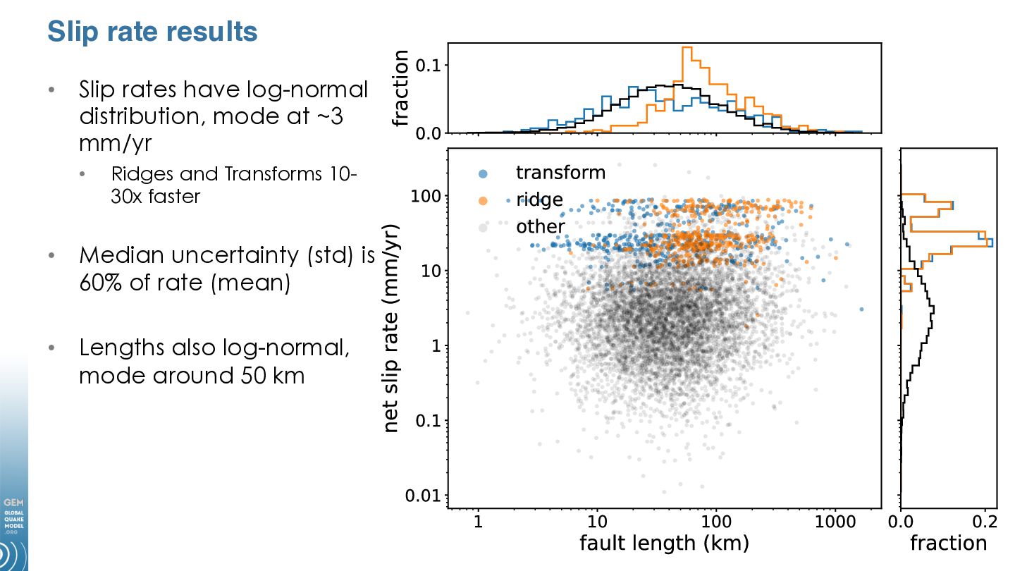
rates determined by relative block motions • Precision of fault slip rate estimates greatly increased by integration of many data + constraints • • Accuracy probably is as well Slip rate variance and covariance from data variance and block geometry
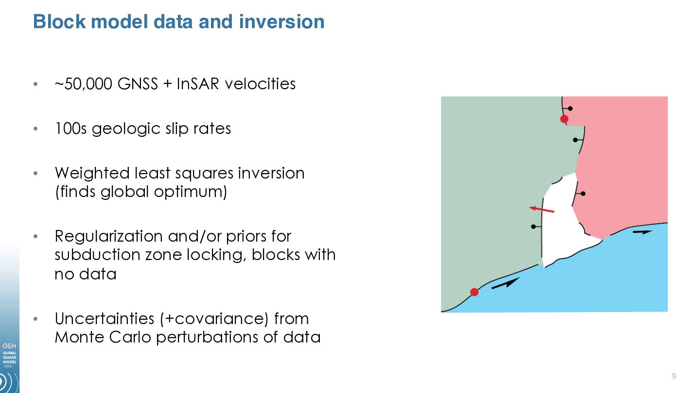
velocities • 100s geologic slip rates • Weighted least squares inversion (finds global optimum) • Regularization and/or priors for subduction zone locking, blocks with no data • Uncertainties (+covariance) from Monte Carlo perturbations of data
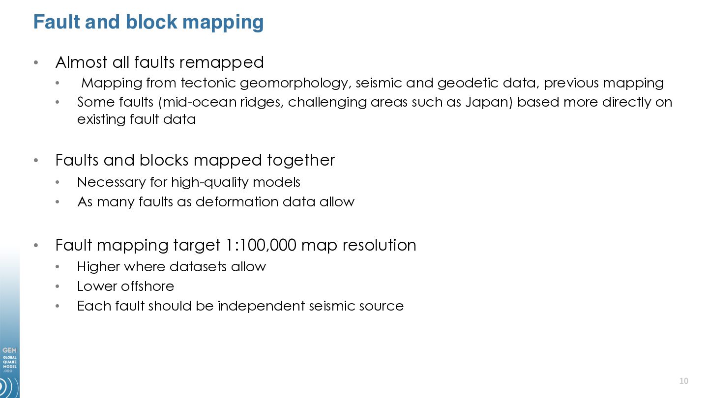
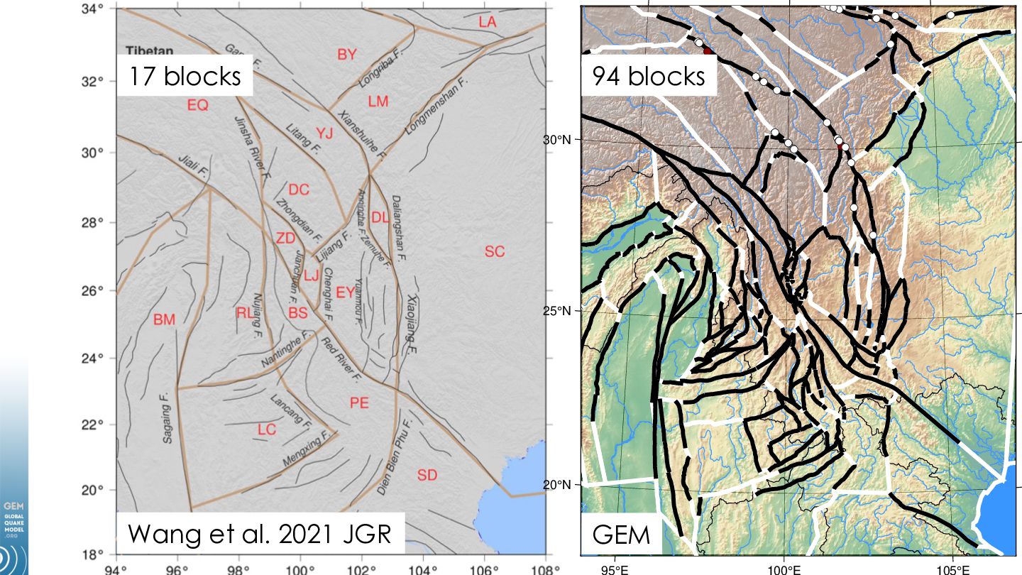
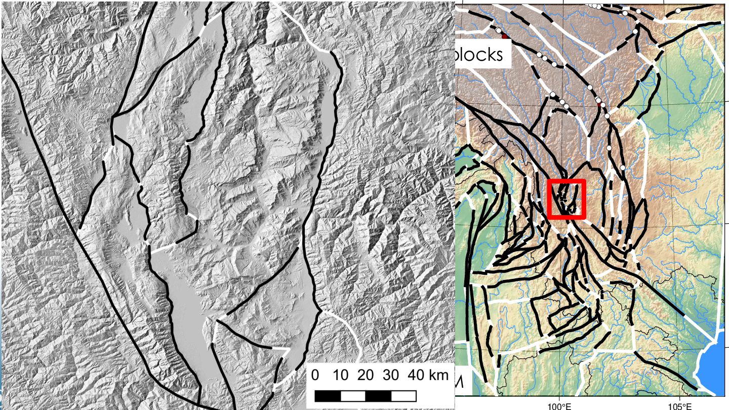
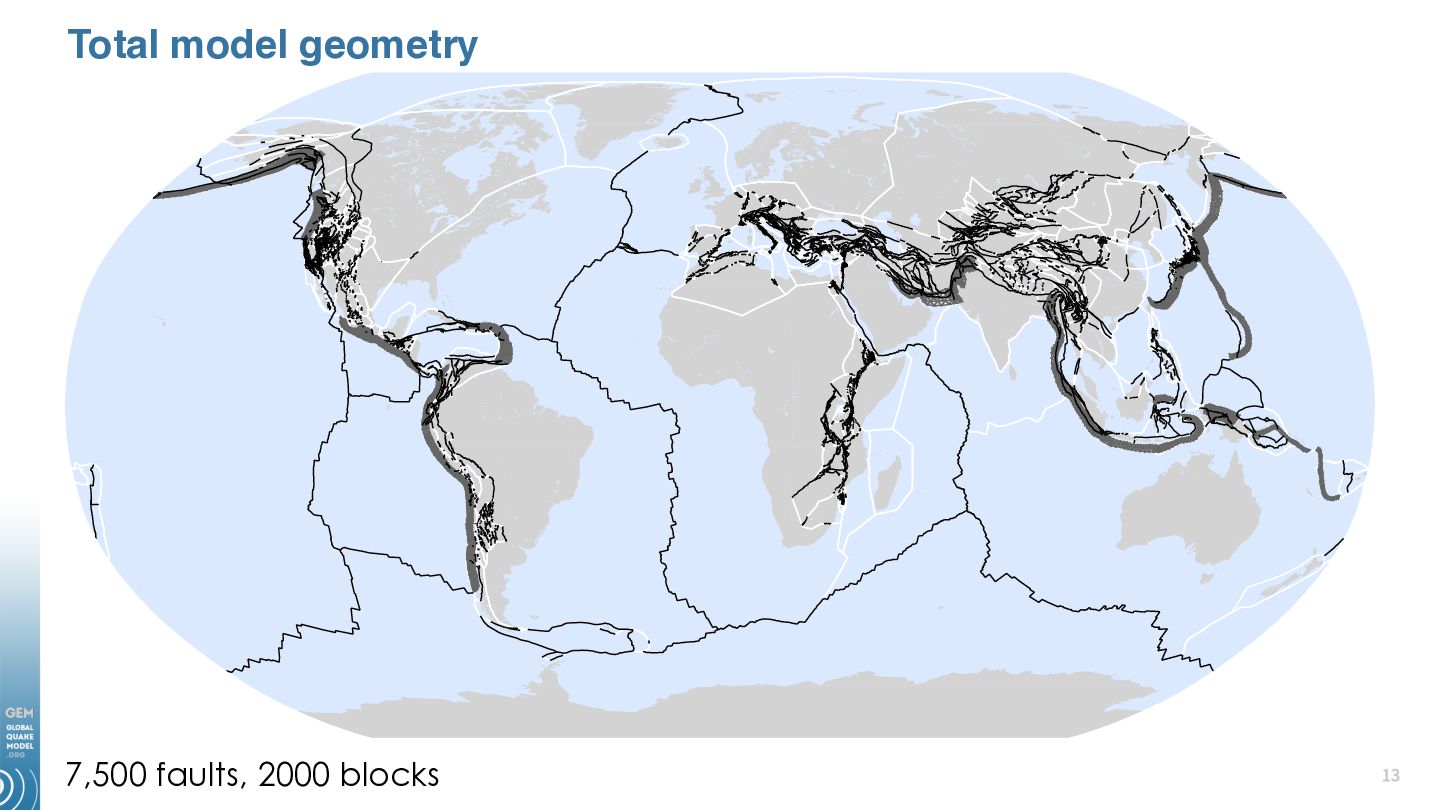
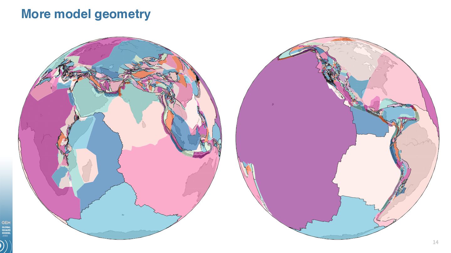
• • Faults and blocks mapped together • • • Mapping from tectonic geomorphology, seismic and geodetic data, previous mapping Some faults (mid-ocean ridges, challenging areas such as Japan) based more directly on existing fault data Necessary for high-quality models As many faults as deformation data allow Fault mapping target 1:100,000 map resolution • • • Higher where datasets allow Lower offshore Each fault should be independent seismic source
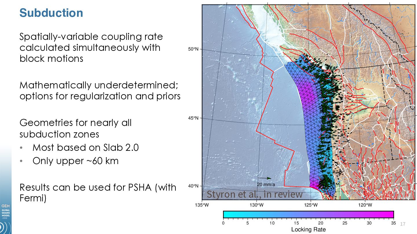
Mathematically underdetermined; options for regularization and priors Geometries for nearly all subduction zones • Most based on Slab 2.0 • Only upper ~60 km Results can be used for PSHA (with Fermi) 45°N 40°N 20 mm/a Styron et al., in review 135°W 130°W 0 5 125°W 10 15 120°W 20 Locking Rate 25 30 35
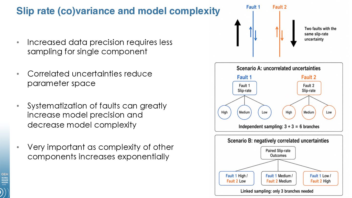
requires less sampling for single component • Correlated uncertainties reduce parameter space • Systematization of faults can greatly increase model precision and decrease model complexity • Very important as complexity of other components increases exponentially
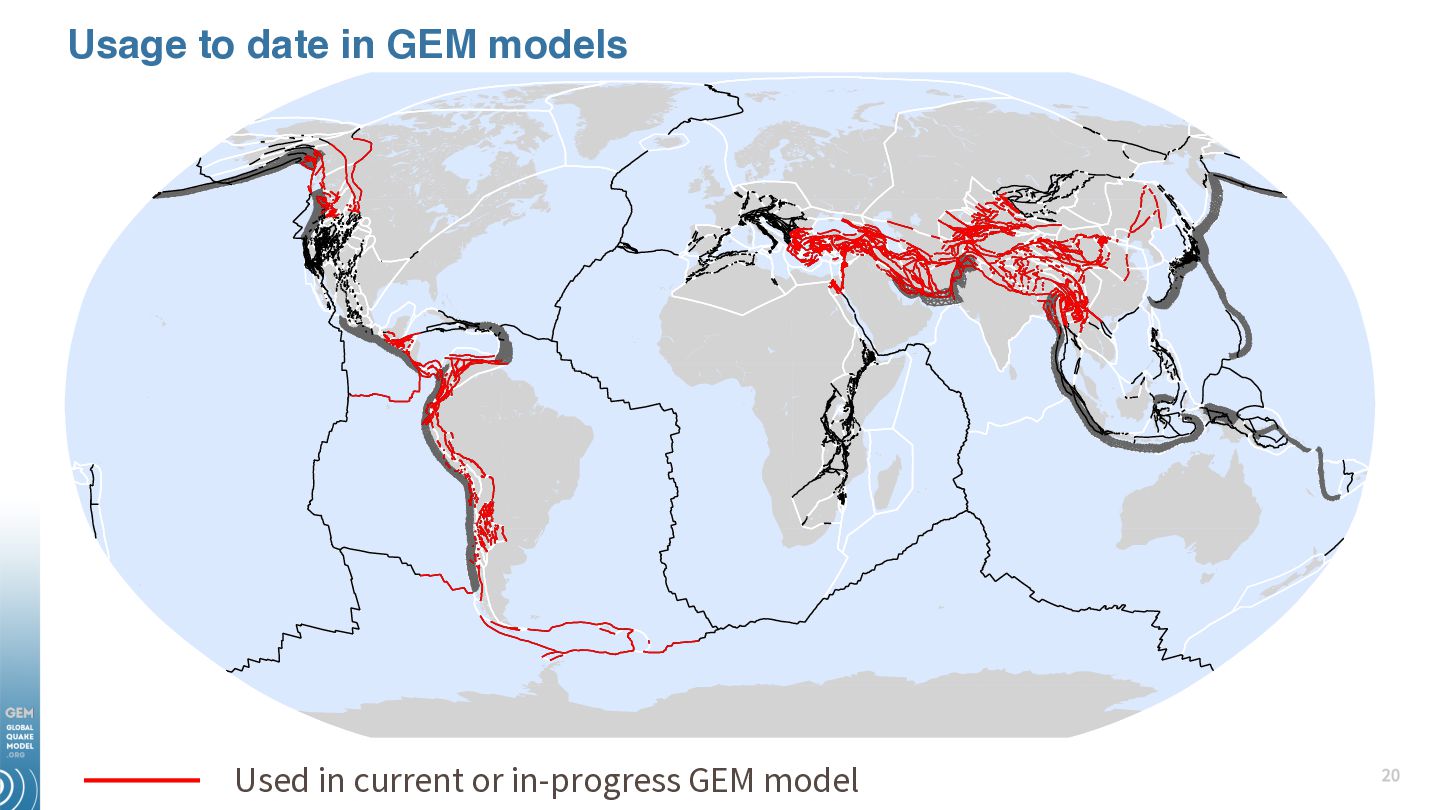
most mapping original linework • Contributions from other scientists primarily geodetic data (thank you all!) • Mapping will be complete July 2026, block model modifications through Dec 2026 (initial version!) • Data and models will be available on Github, GEM products page
link to: https://www.globalquakemodel.org Except where otherwise noted, this work is licensed under a Creative Commons Attribution-NonCommercial-NoDerivatives 4.0 International License (CC BY-NC-ND 4.0) https://creativecommons.org/licenses/by-nc-nd/4.0/


 cossatot
 ryanjones
 mclloyd
 panda_program
 lara
lara
 takai
takai
 akashhashmi
 mfonobong
 twada
twada
 holman
 eileencodes
 helmedeiros
 aleyda