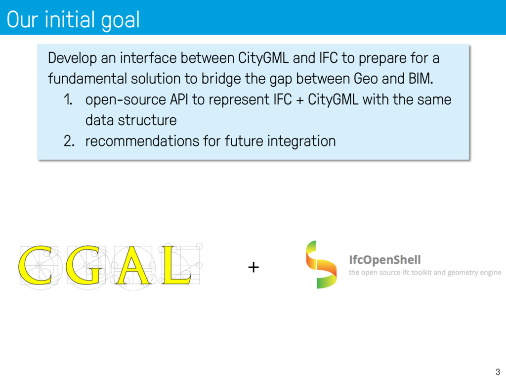
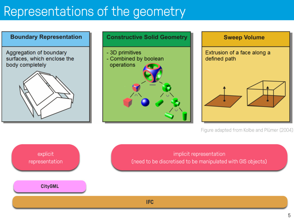
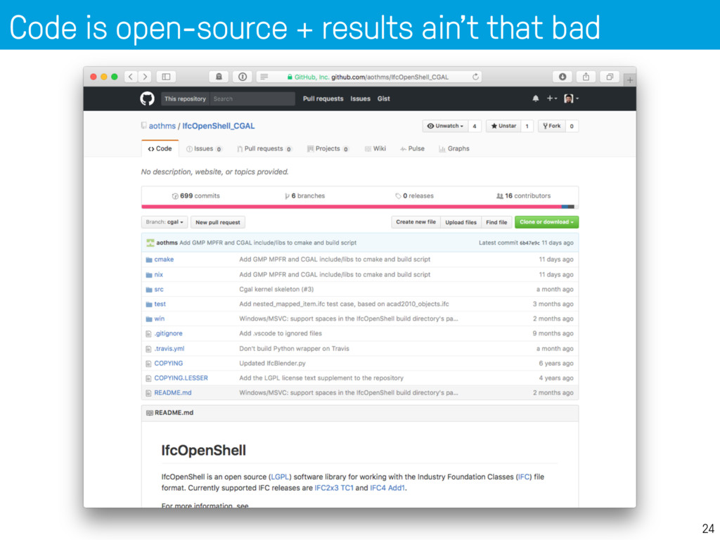
IFC to prepare for a fundamental solution to bridge the gap between Geo and BIM. 1. open-source API to represent IFC + CityGML with the same data structure 2. recommendations for future integration +
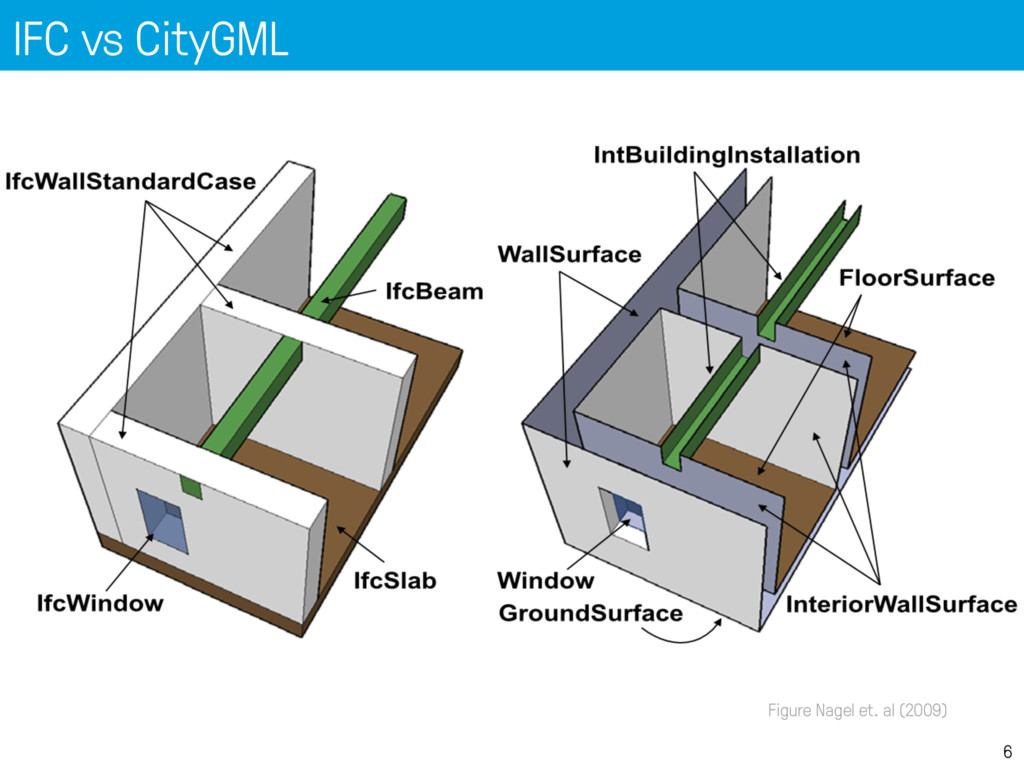
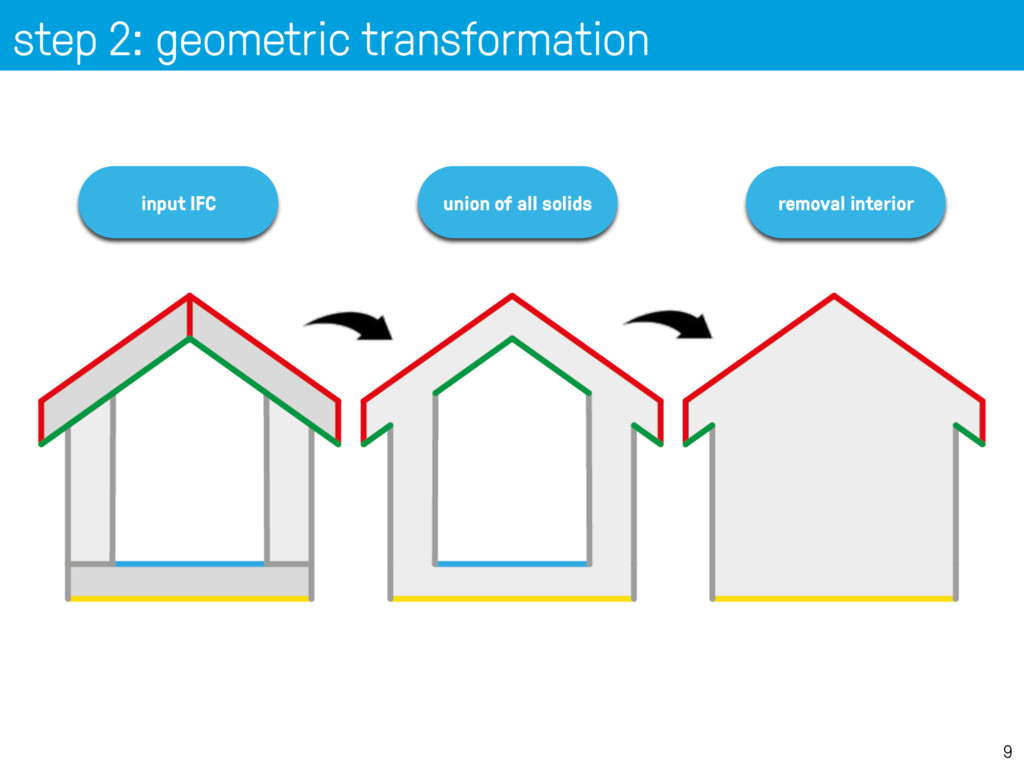
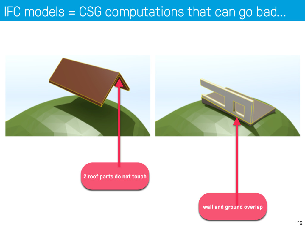
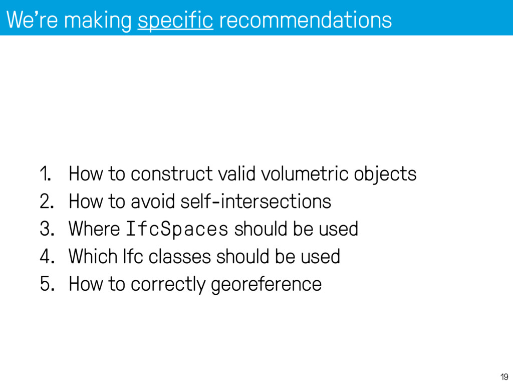
volumetric objects 2. How to avoid self-intersections 3. Where IfcSpaces should be used 4. Which Ifc classes should be used 5. How to correctly georeference
European spatial data research EuroSDR 3DSIG: 12 NMCAS collaborate on issues of common interest (since 2013) Crowd funded EuroSDR project GeoBIM • Aim: • To develop common view on how individual, highly detailed BIM- models can be best integrated in geo-databases with topographic data at lower levels of detail • Driven by use cases and experiences in the respective countries (like the presented work in NL)
to maintain one digital view on the built-environment and identification of technical developments needed to achieve this • Requirements for BIM-data to be used in geo-domain and vice versa to support the uses cases • Understanding on how to derive such data from BIM-data respectively geo-data • Modelling guidelines for BIM-data designers so that the BIM data can be better understood/imported in geo applications and vice versa
Swisstopo, Ordnance Survey Ireland, Kadaster, ICGC Catalonia, GUGiK Poland, IGN Fr, IGN B, Lantmateriet Sweden, NLS Finland Time path: • November 2017: workshop to identify the stat-of-the-art in the 10 respective countries; define the uses cases and project plan • 2 years project Collaboration: • With national and international standardisation bodies More information: [email protected] Organisation
![thank you. Hugo Ledoux 3d.bk.tudelft.nl/hledoux [email protected]](https://files.speakerdeck.com/presentations/56a7123be705426abbd03b8a389c5b5e/slide_27.jpg)