Upgrade to Pro — share decks privately, control downloads, hide ads and more …

高性能計算機クラスタを用いた大規模点群処理による森林の単木抽出と構造解析

Sponsored · Your Podcast. Everywhere. Effortlessly. Share. Educate. Inspire. Entertain. You do you. We'll handle the rest.

 高性能計算機クラスタを用いた大規模点群処理による森林の単木抽出と構造解析

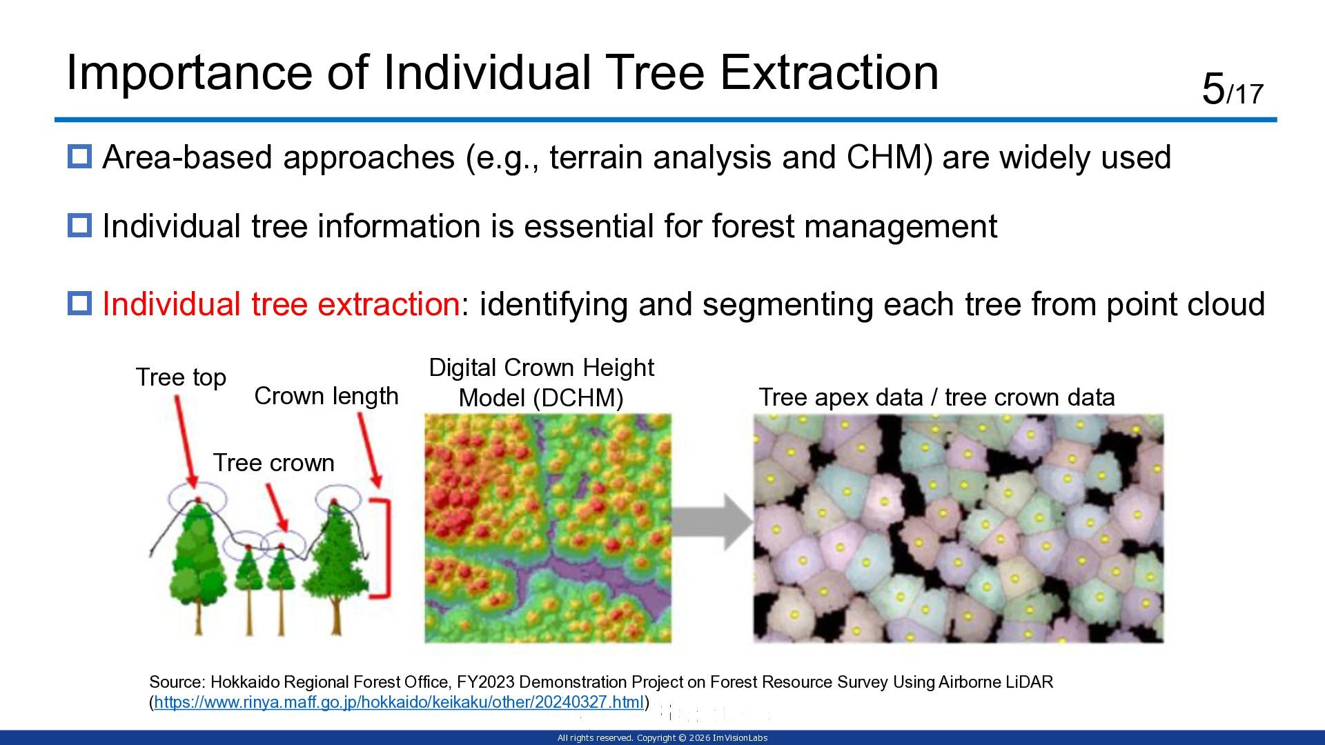
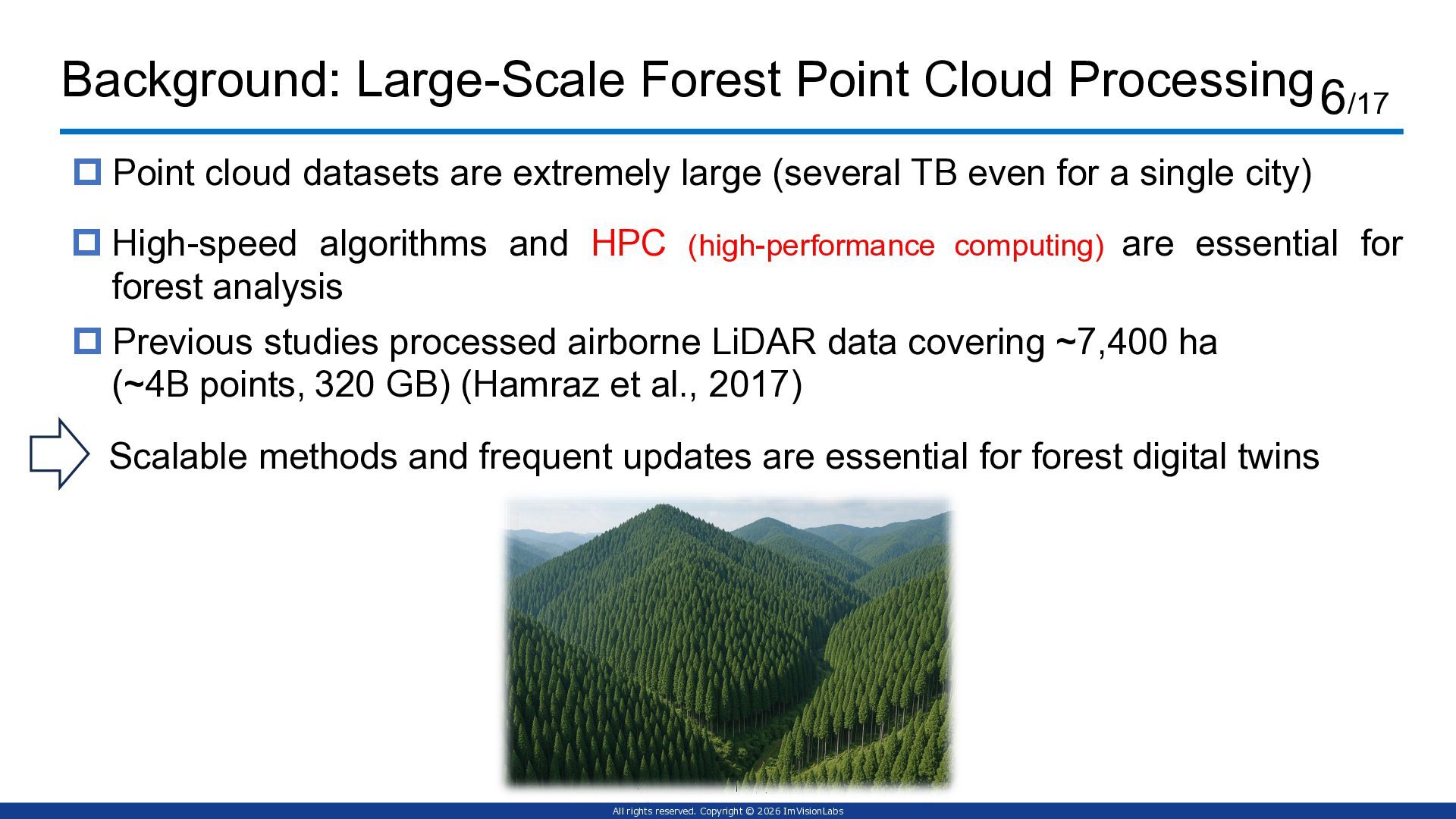
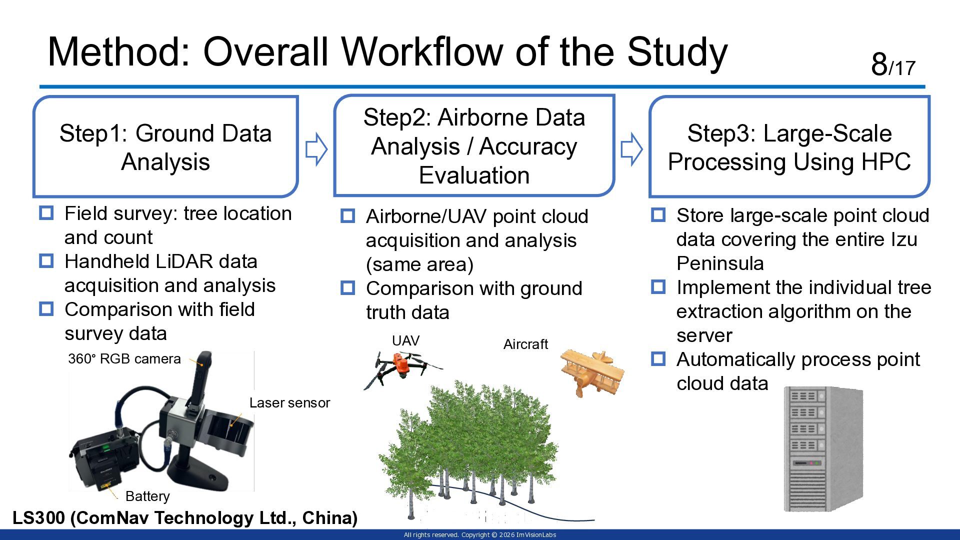
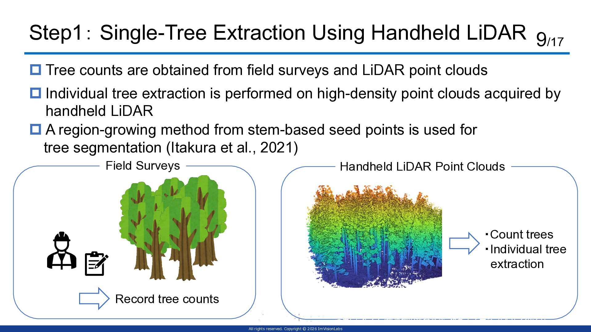
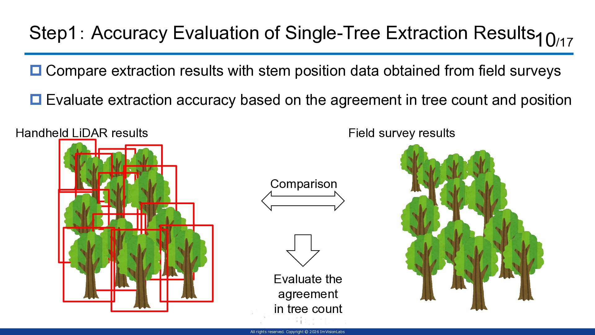
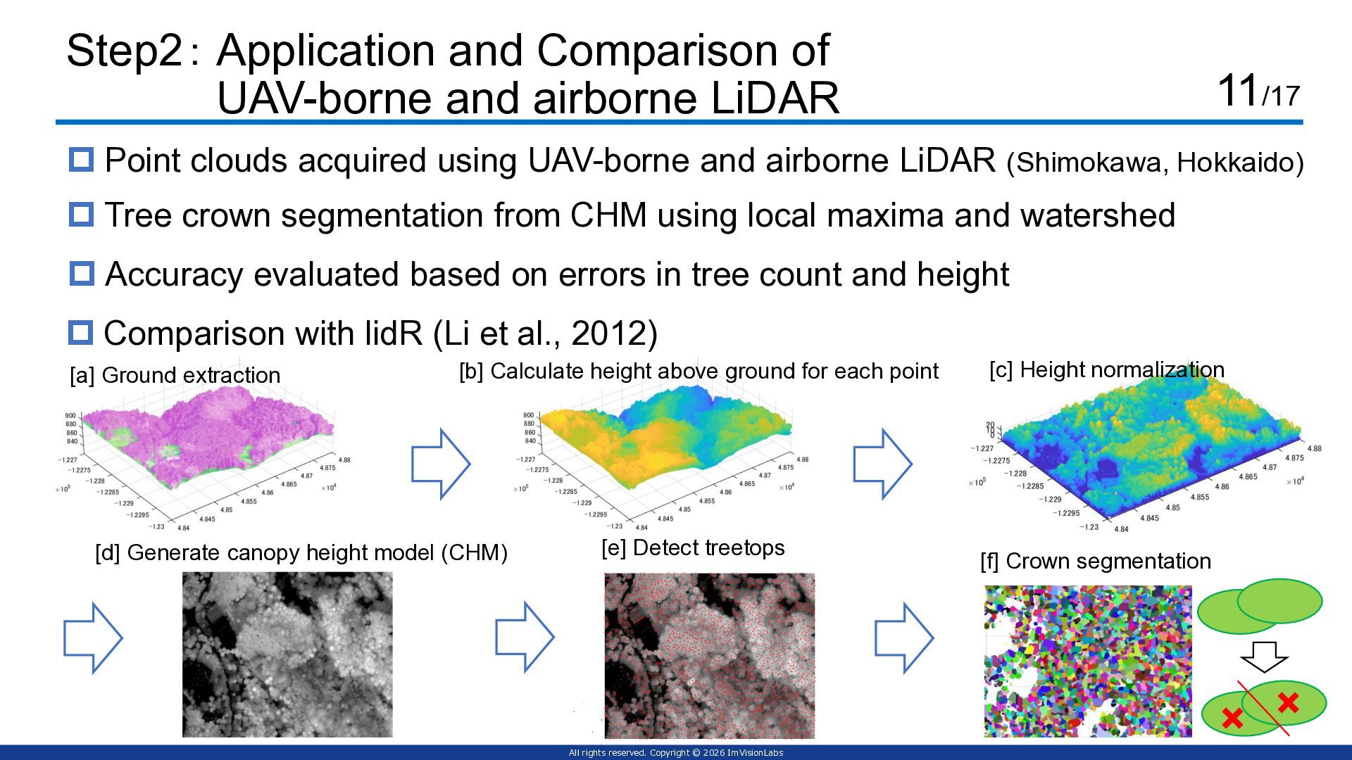
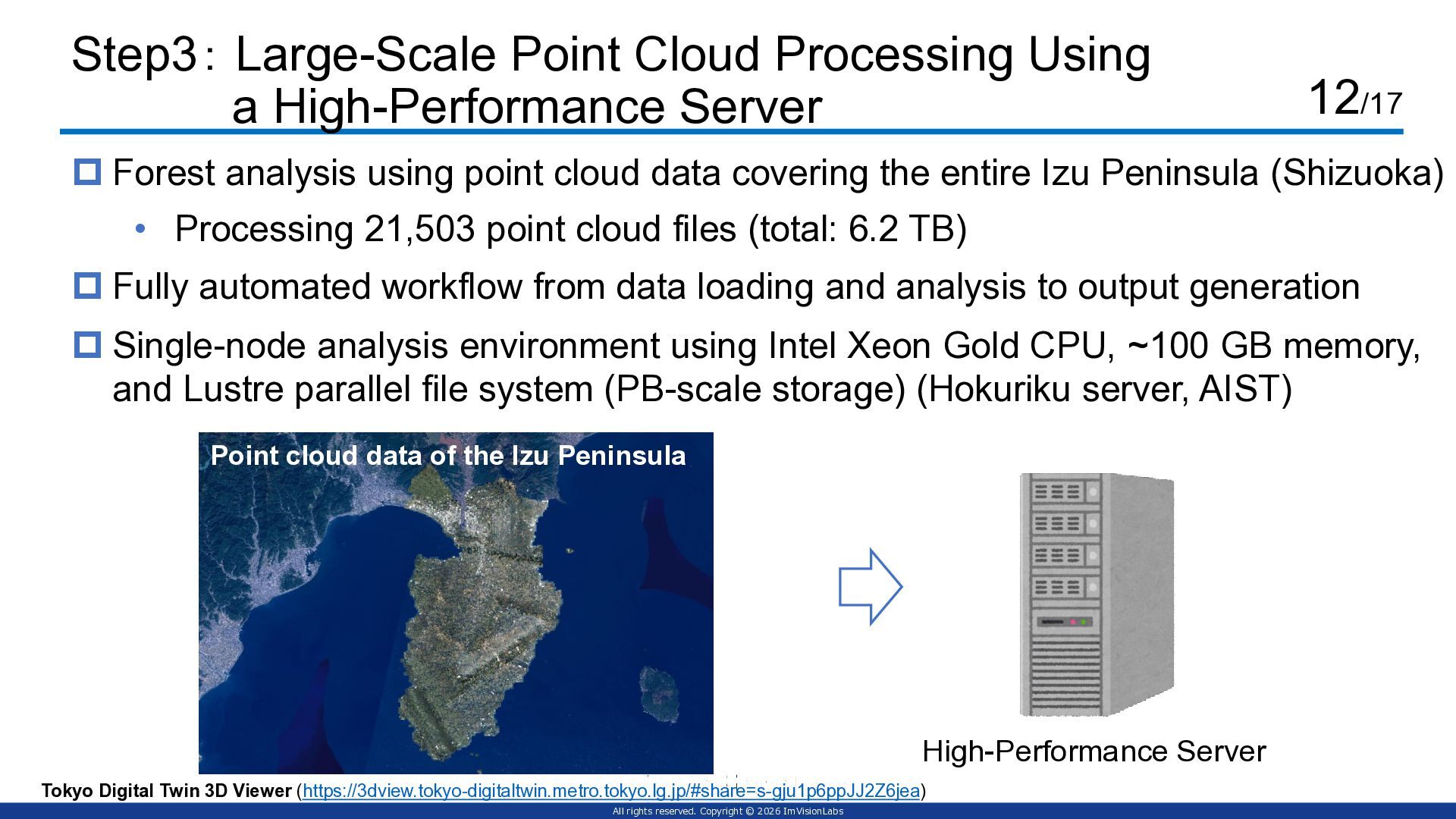
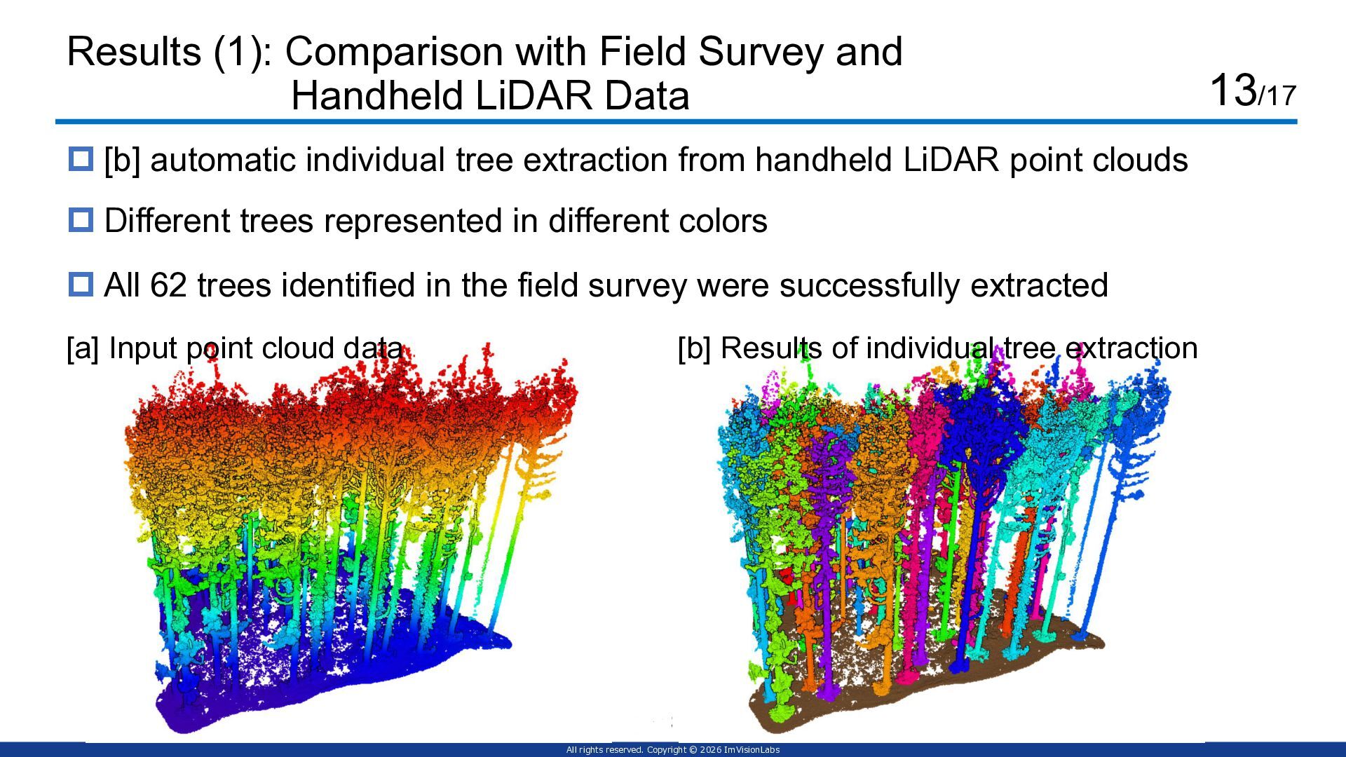
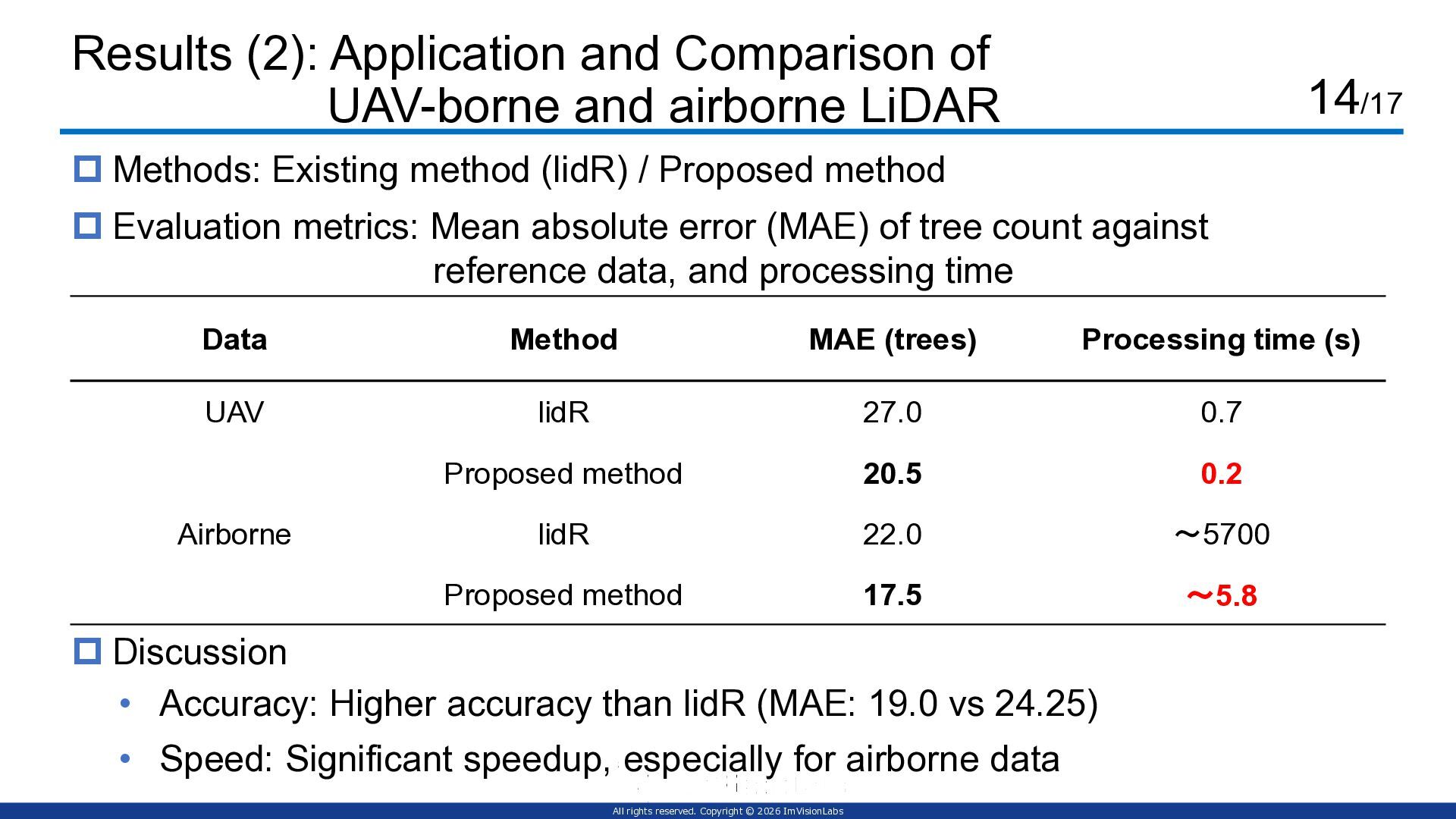
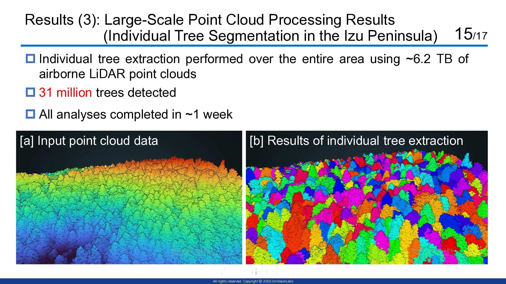
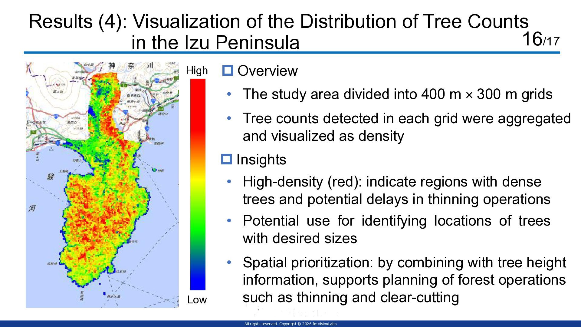
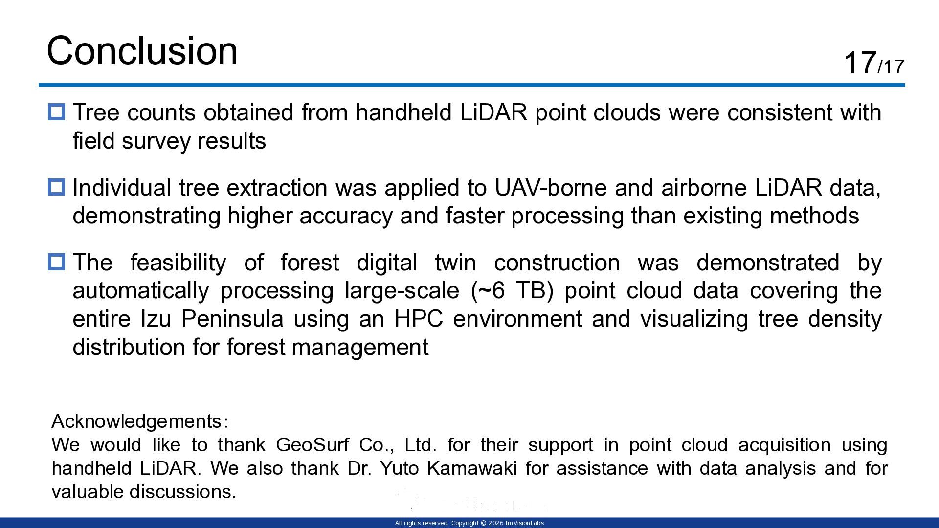
土木学会デジタルシンポジウムにて大規模点群処理の発表をしました。伊豆半島全体を含む6.2TBの 点群 データから樹木の解析を行った事例について発表しました。産業技術総合研究所様、森林総研様、GEOSURF様との取り組みです。

論文
https://jstage.jst.go.jp/article/jsceiiai/7/1/7_134/_article/-char/en
大会ページ
https://committees.jsce.or.jp/struct1002/node/88

Avatar for Kenta Itakura

Kenta Itakura

June 16, 2026

More Decks by Kenta Itakura

Other Decks in Technology

Transcript

  1. Large-scale point cloud processing for tree segmentation and structural analysis

    using high-performance computing cluster 〇 Kenta Itakura 1, Seishiro Taki 2, Hiroyuki Matsushita 3, Yosuke Ikeda 3, Chiaki Tsutsumi 3, Zhao Chen 4, Yu Obata 1, Keishu Aruga 1 and Ryosuke Nakamura 5 ¹ImVisionLabs Inc., ² Forestry and Forest Products Research Institute, ³ Intelligent Platforms Research Institute, National Institute of Advanced Industrial Science and Technology,4 GEOSURF CORPORATION, 5 Artificial Intelligence Research Center, National Institute of Advanced Industrial Science and Technology
  2. All rights reserved. Copyright © 2026 ImVisionLabs Toward Realization of

    Forest Digital Twins  In Japan, 3D city models for 56 cities are available as open data via the PLATEAU Project.  Digital twin technology, which replicates the real world in cyberspace and feeds insights back, is rapidly expanding. 2/17 Source: Ministry of Internal Affairs and Communications (MIC), “What is Digital Twin?”(https://www.soumu.go.jp/hakusho-kids/use/economy/economy_11.html) Extending digital twin technology to large-scale and complex environments such as forests remains an important challenge. Feedback Analysis / Simulation Real-Time Data Acquisition Physical Space (Real World) Cyberspace (Virtual Space)
  3. All rights reserved. Copyright © 2026 ImVisionLabs 3D Digitization of

    Forests Using LiDAR Various platforms are available, including ground-based and UAV-mounted systems. Forest environments can be digitized in 3D by LiDAR and photogrammetry 3/17 UAV-mounted LiDAR (DJI) 3D point cloud
  4. All rights reserved. Copyright © 2026 ImVisionLabs Example Concept of

    Forest Digital Twin 4/17 ScanX2.0 Cyberspace (virtual space) ①Sensing Optimization / optimal solution (e.g., automation of forestry machinery) ③Advanced data analysis (e.g., logging operations, timber extraction, tree growth) Seamless digital information sharing Continuous digital information updating ②Integration and accumulation ④Real-world applications Digital twin construction (e.g., UAVs, LiDAR) Physical space (real world) Supports forest management and automation through integration with machinery
  5. All rights reserved. Copyright © 2026 ImVisionLabs Importance of Individual

    Tree Extraction  Individual tree information is essential for forest management  Area-based approaches (e.g., terrain analysis and CHM) are widely used 5/17  Individual tree extraction: identifying and segmenting each tree from point cloud Source: Hokkaido Regional Forest Office, FY2023 Demonstration Project on Forest Resource Survey Using Airborne LiDAR (https://www.rinya.maff.go.jp/hokkaido/keikaku/other/20240327.html) Tree top Tree crown Crown length Digital Crown Height Model (DCHM) Tree apex data / tree crown data
  6. All rights reserved. Copyright © 2026 ImVisionLabs Background: Large-Scale Forest

    Point Cloud Processing  High-speed algorithms and HPC (high-performance computing) are essential for forest analysis  Point cloud datasets are extremely large (several TB even for a single city) 6/17  Previous studies processed airborne LiDAR data covering ~7,400 ha (~4B points, 320 GB) (Hamraz et al., 2017) Scalable methods and frequent updates are essential for forest digital twins
  7. All rights reserved. Copyright © 2026 ImVisionLabs Objective of This

    Study  Develop an HPC-based analysis method for TB-scale point clouds  Targeting large-scale forest point clouds, forest resource information (e.g., tree count, height) is estimated based on individual tree extraction 7/17  Establishment of an analytical framework to support forest digital twins with large-scale processing and frequent updates Large-scale data High-speed processing High accuracy
  8. All rights reserved. Copyright © 2026 ImVisionLabs Method: Overall Workflow

    of the Study 8/17 Step1: Ground Data Analysis Step2: Airborne Data Analysis / Accuracy Evaluation Step3: Large-Scale Processing Using HPC  Field survey: tree location and count  Handheld LiDAR data acquisition and analysis  Comparison with field survey data  Airborne/UAV point cloud acquisition and analysis (same area)  Comparison with ground truth data  Store large-scale point cloud data covering the entire Izu Peninsula  Implement the individual tree extraction algorithm on the server  Automatically process point cloud data Aircraft UAV 360° RGB camera Laser sensor Battery LS300 (ComNav Technology Ltd., China)
  9. All rights reserved. Copyright © 2026 ImVisionLabs Step1: Single-Tree Extraction

    Using Handheld LiDAR  Individual tree extraction is performed on high-density point clouds acquired by handheld LiDAR  Tree counts are obtained from field surveys and LiDAR point clouds 9/17  A region-growing method from stem-based seed points is used for tree segmentation (Itakura et al., 2021) 画像出典: 山下淳子, 木村沙智, & 川村日成. (2019). 3 次元点群データを 活用したインフラ構造物の維持管理. 精密工学会誌, 85(3), 228-231. 毎木調査 Handheld LiDAR Point Clouds Record tree counts ・Count trees ・Individual tree extraction Field Surveys
  10. All rights reserved. Copyright © 2026 ImVisionLabs Step1: Accuracy Evaluation

    of Single-Tree Extraction Results  Evaluate extraction accuracy based on the agreement in tree count and position  Compare extraction results with stem position data obtained from field surveys 10/17 画像出典: 山下淳子, 木村沙智, & 川村日成. (2019). 3 次元点群データを 活用したインフラ構造物の維持管理. 精密工学会誌, 85(3), 228-231. Comparison Evaluate the agreement in tree count Handheld LiDAR results Field survey results
  11. All rights reserved. Copyright © 2026 ImVisionLabs Step2: Application and

    Comparison of UAV-borne and airborne LiDAR  Tree crown segmentation from CHM using local maxima and watershed  Point clouds acquired using UAV-borne and airborne LiDAR (Shimokawa, Hokkaido) 11/17  Accuracy evaluated based on errors in tree count and height 画像出典: 山下淳子, 木村沙智, & 川村日成. (2019). 3 次元点群データを 活用したインフラ構造物の維持管理. 精密工学会誌, 85(3), 228-231.  Comparison with lidR (Li et al., 2012) [d] Generate canopy height model (CHM) [e] Detect treetops [f] Crown segmentation [a] Ground extraction [b] Calculate height above ground for each point [c] Height normalization
  12. All rights reserved. Copyright © 2026 ImVisionLabs Step3: Large-Scale Point

    Cloud Processing Using a High-Performance Server • Processing 21,503 point cloud files (total: 6.2 TB)  Forest analysis using point cloud data covering the entire Izu Peninsula (Shizuoka) 12/17  Fully automated workflow from data loading and analysis to output generation  Single-node analysis environment using Intel Xeon Gold CPU, ~100 GB memory, and Lustre parallel file system (PB-scale storage) (Hokuriku server, AIST) Tokyo Digital Twin 3D Viewer (https://3dview.tokyo-digitaltwin.metro.tokyo.lg.jp/#share=s-gju1p6ppJJ2Z6jea) Point cloud data of the Izu Peninsula High-Performance Server
  13. All rights reserved. Copyright © 2026 ImVisionLabs Results (1): Comparison

    with Field Survey and Handheld LiDAR Data  [b] automatic individual tree extraction from handheld LiDAR point clouds 13/17  All 62 trees identified in the field survey were successfully extracted  Different trees represented in different colors [a] Input point cloud data [b] Results of individual tree extraction
  14. All rights reserved. Copyright © 2026 ImVisionLabs Results (2): Application

    and Comparison of UAV-borne and airborne LiDAR  Evaluation metrics: Mean absolute error (MAE) of tree count against reference data, and processing time 14/17 Data Method MAE (trees) Processing time (s) UAV lidR 27.0 0.7 Proposed method 20.5 0.2 Airborne lidR 22.0 ~5700 Proposed method 17.5 ~5.8  Methods: Existing method (lidR) / Proposed method  Discussion • Accuracy: Higher accuracy than lidR (MAE: 19.0 vs 24.25) • Speed: Significant speedup, especially for airborne data
  15. All rights reserved. Copyright © 2026 ImVisionLabs Results (3): Large-Scale

    Point Cloud Processing Results (Individual Tree Segmentation in the Izu Peninsula)  31 million trees detected 15/17  Individual tree extraction performed over the entire area using ~6.2 TB of airborne LiDAR point clouds  All analyses completed in ~1 week [a] Input point cloud data [b] Results of individual tree extraction
  16. All rights reserved. Copyright © 2026 ImVisionLabs Results (4): Visualization

    of the Distribution of Tree Counts in the Izu Peninsula • Tree counts detected in each grid were aggregated and visualized as density 16/17 • The study area divided into 400 m × 300 m grids  Overview  Insights • High-density (red): indicate regions with dense trees and potential delays in thinning operations • Spatial prioritization: by combining with tree height information, supports planning of forest operations such as thinning and clear-cutting • Potential use for identifying locations of trees with desired sizes High Low
  17. All rights reserved. Copyright © 2026 ImVisionLabs Conclusion 17/17 

    Tree counts obtained from handheld LiDAR point clouds were consistent with field survey results  The feasibility of forest digital twin construction was demonstrated by automatically processing large-scale (~6 TB) point cloud data covering the entire Izu Peninsula using an HPC environment and visualizing tree density distribution for forest management  Individual tree extraction was applied to UAV-borne and airborne LiDAR data, demonstrating higher accuracy and faster processing than existing methods Acknowledgements: We would like to thank GeoSurf Co., Ltd. for their support in point cloud acquisition using handheld LiDAR. We also thank Dr. Yuto Kamawaki for assistance with data analysis and for valuable discussions.
  18. All rights reserved. Copyright © 2026 ImVisionLabs References 16/16 •

    Hamraz, H., Contreras, M. A. and Zhang, J.: A scalable approach for tree segmentation within small-footprint airborne LiDAR data, Computers & Geosciences, Vol. 102, pp. 139-147, 2017. • Itakura, K., Miyatani, S. and Hosoi, F.: Estimating tree structural parameters via automatic tree segmentation from LiDAR point cloud data, IEEE Journal of Selected Topics in Applied Earth Observations and Remote Sensing, Vol. 15, pp. 555-564, 2021. • Li, W., Guo, Q., Jakubowski, M. K., & Kelly, M. (2012). A new method for segmenting individual trees from the lidar point cloud. Photogrammetric Engineering & Remote Sensing, 78(1), 75-84.