Safy Nurhussein
USAID
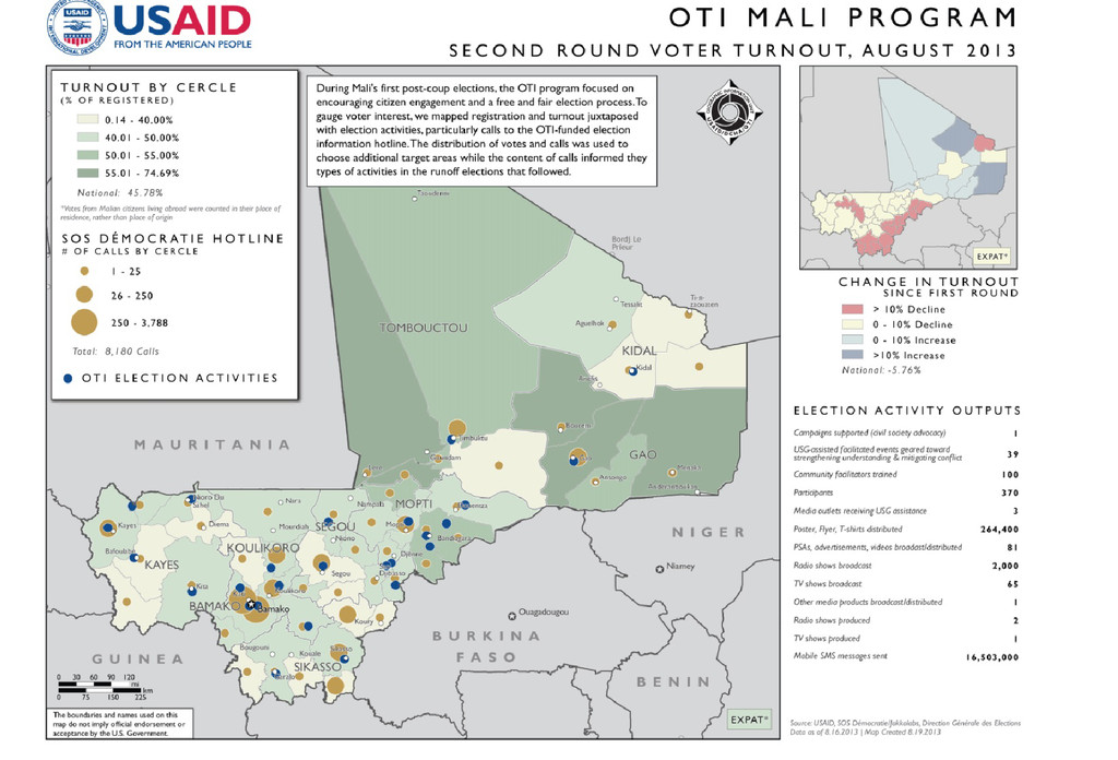
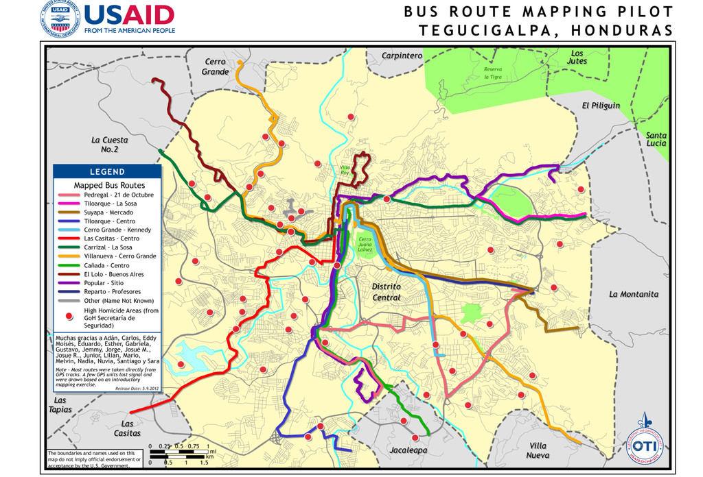
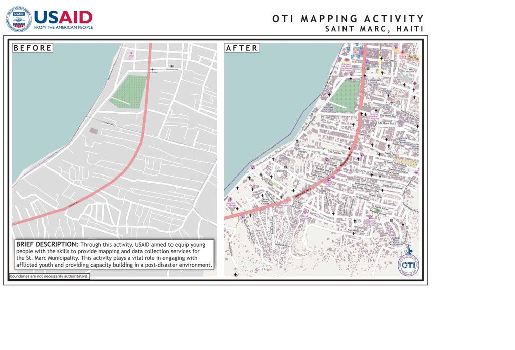
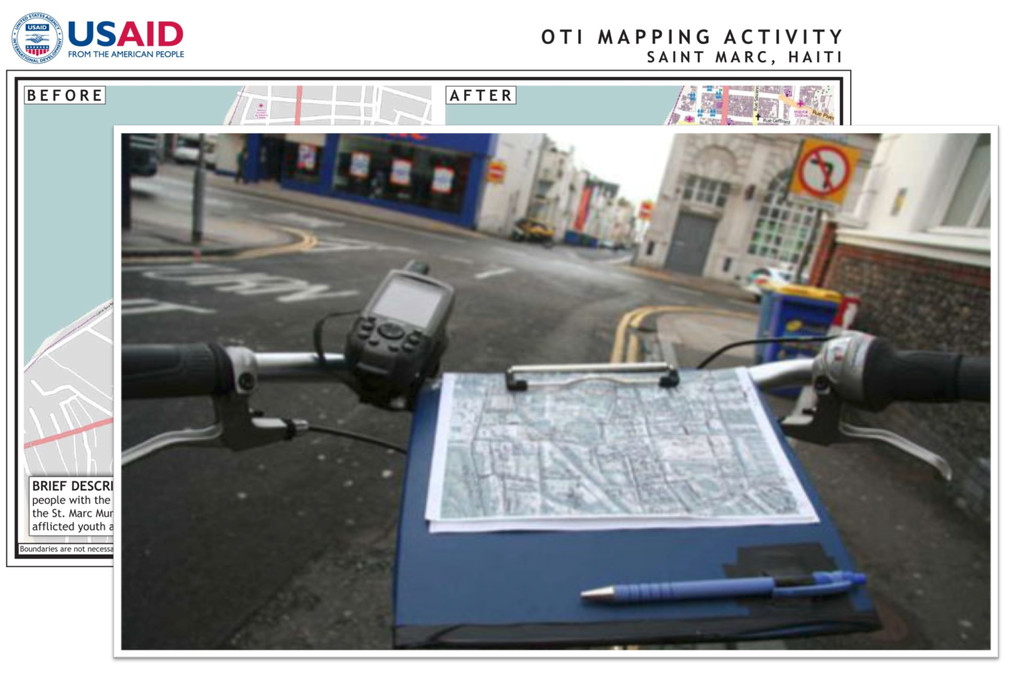
The mission of USAID's Office of Transition Initiatives is to support U.S. foreign policy objectives by helping local partners advance peace and democracy in priority countries in crisis. The office's Geographic Information Unit supports that mission with cartographic products, web maps and data visualizations - base maps, maps for briefings in Washington and overseas, maps for situational analysis, and more. Staff will discuss how they acquire and convert data from various sources, including OpenStreetMap.org and Ushahidi as well as data sources collected in the field in countries like Libya, Afghanistan, Mali and Honduras. These include GIS data sets from local organizations and the UN, data from community mapping sessions, and surveys of local people and aid worker staff. In addition, they will discuss their cartographic process and standards, mostly using ArcGIS, QGIS and Adobe Illustrator, plus other scripts and tools.
NACIS 2014