David Retchless, Penn State University
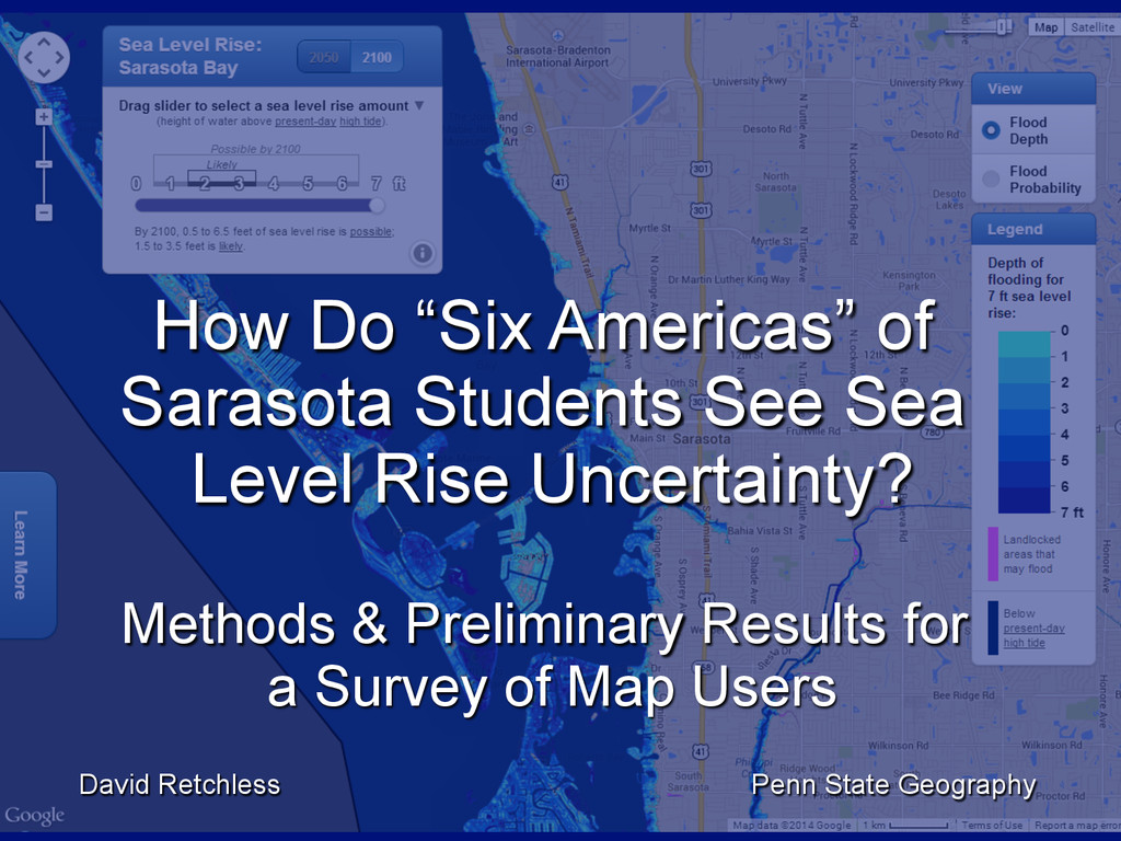
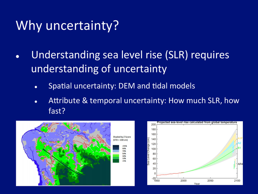
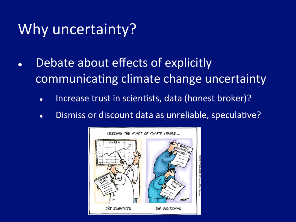
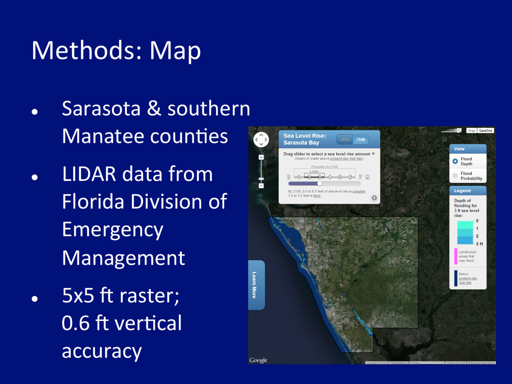
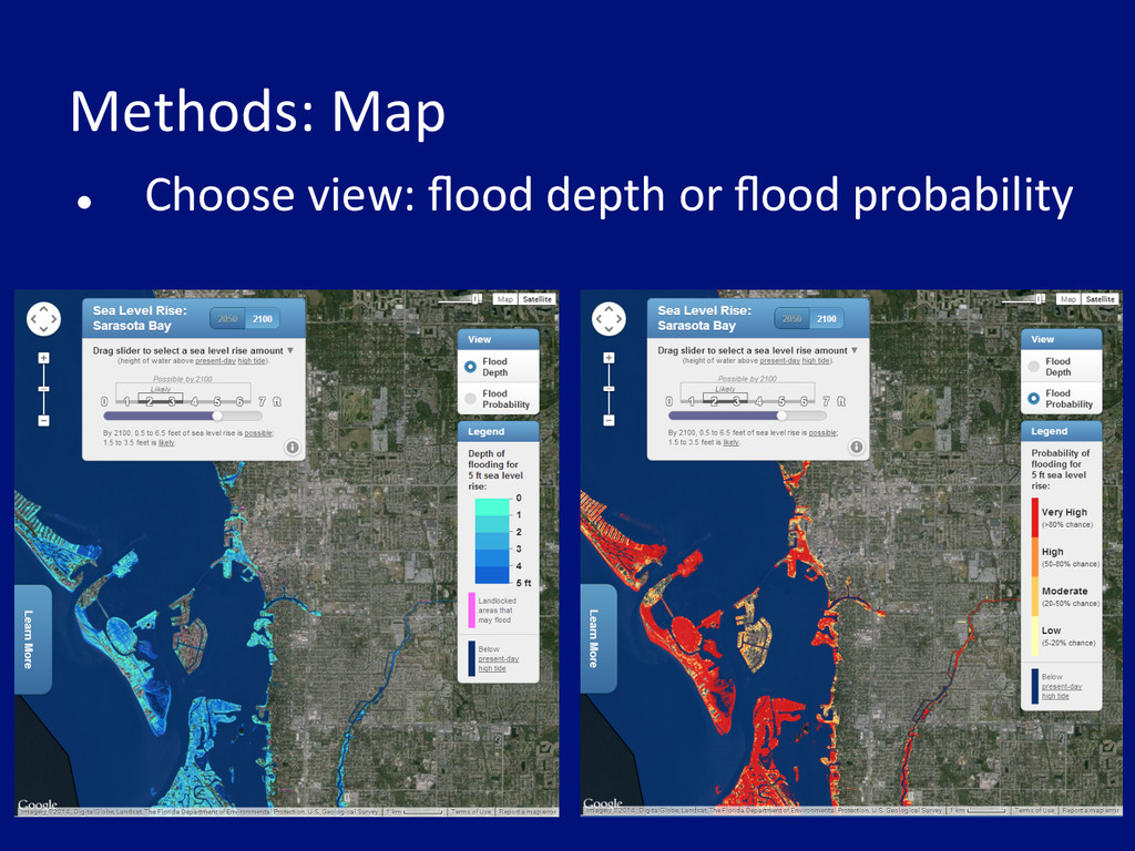
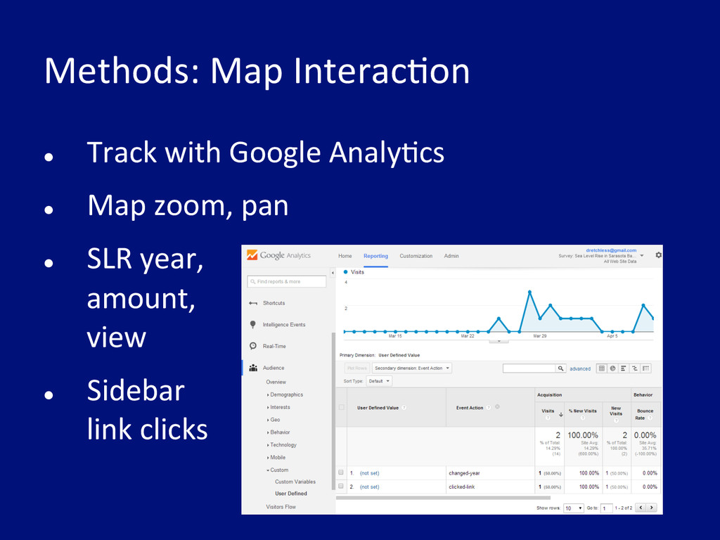
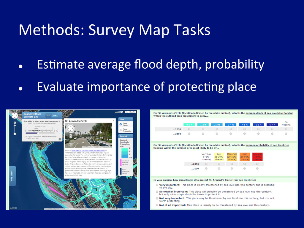
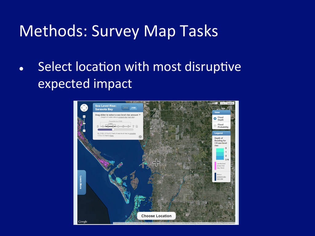
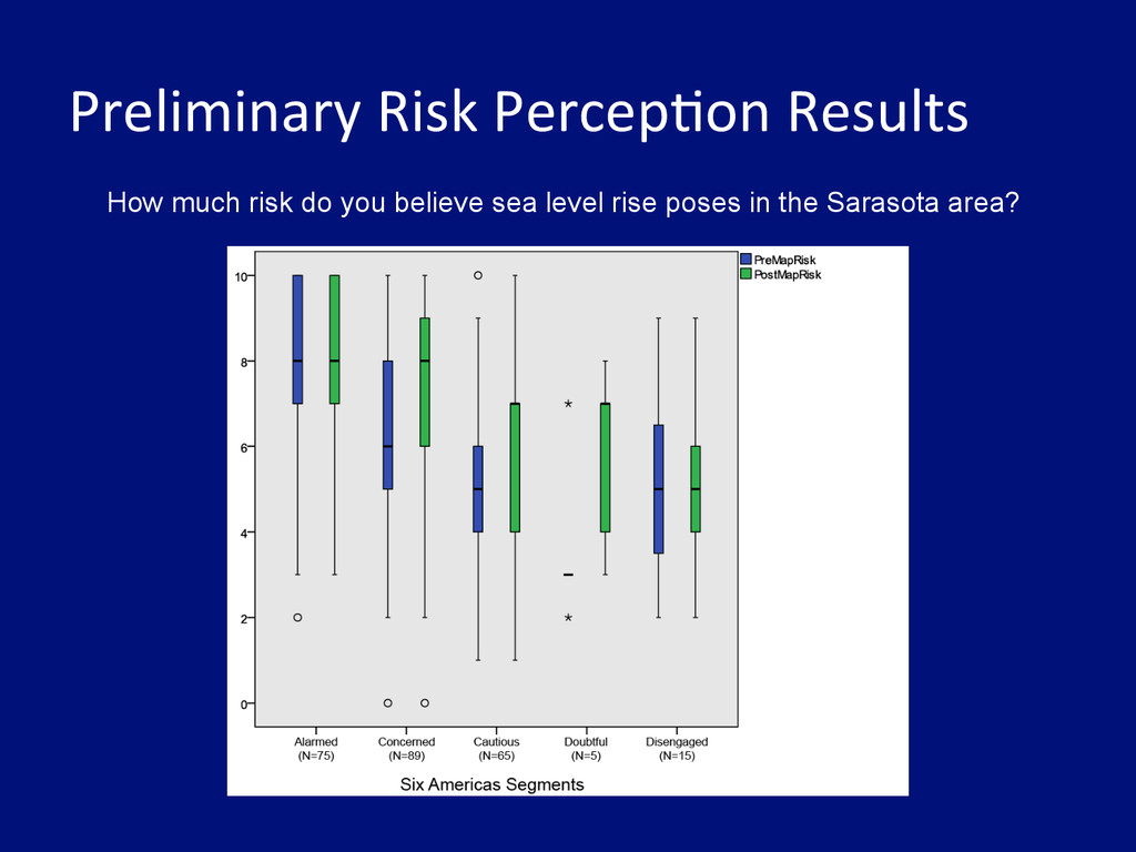
When mapping highly uncertain hazards such as sea level rise (SLR), cartographers often consider both whether and how to show uncertainty. While several studies have suggested that including uncertainty can improve decision outcomes, few have considered how uncertainty interacts with audience characteristics to affect the decision process. To address this gap, I use surveys of college students to assess how the depiction of uncertainty on an online SLR mapping tool for the Sarasota, Florida area interacts with map users' individual differences to affect their perceptions of the hazard, interaction with the map, and subsequent decision making. Individual differences considered include an audience segmentation analysis performed using the "Global Warming's Six Americas" framework. It is hoped that the preliminary results presented here will help cartographers create hazard maps that are better tailored to their audience, more engaging, and more likely to encourage thoughtful decision making.