Upgrade to Pro — share decks privately, control downloads, hide ads and more …

Past Practices, Contemporary Applications

Past Practices, Contemporary Applications

Jake Coolidge
Jake Coolidge Cartography

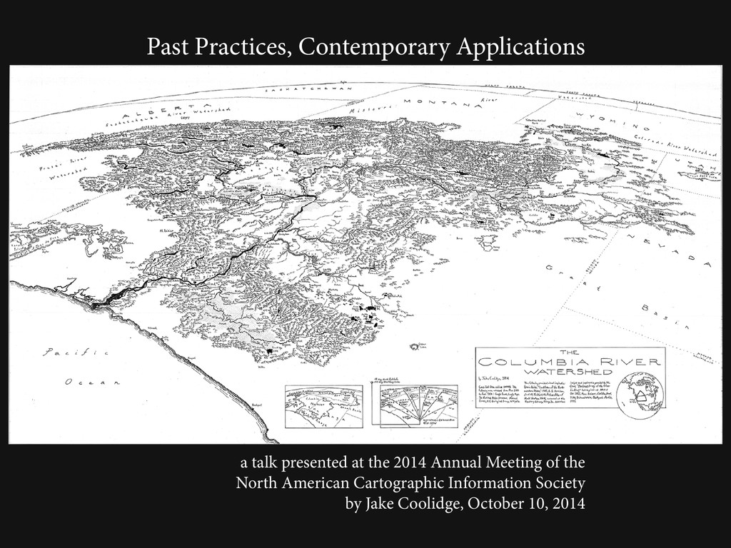
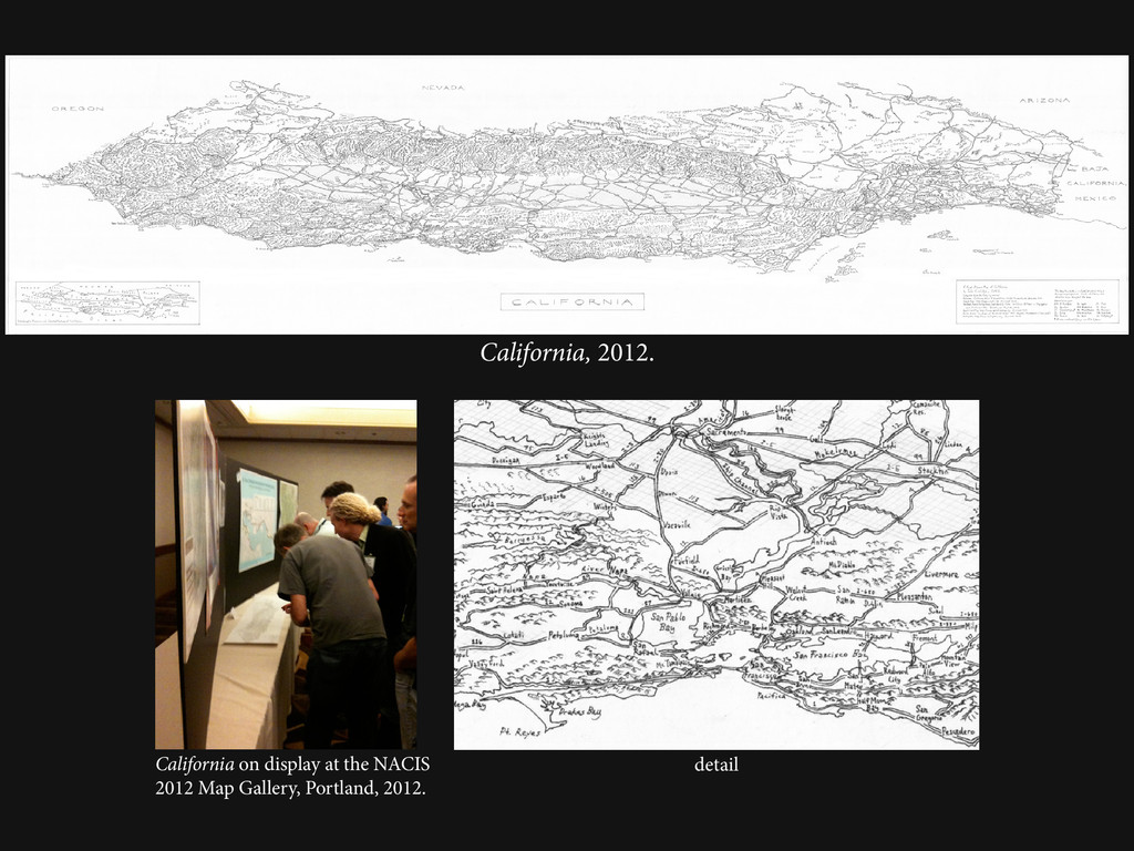
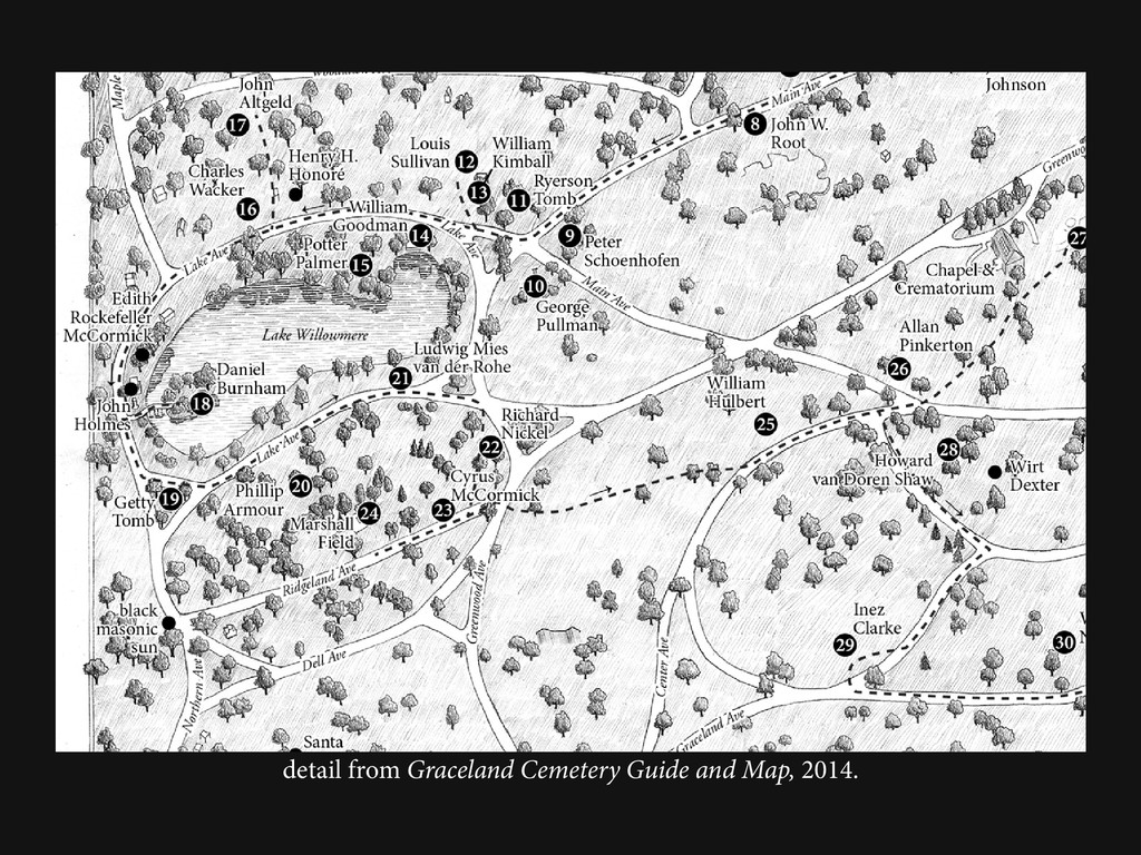
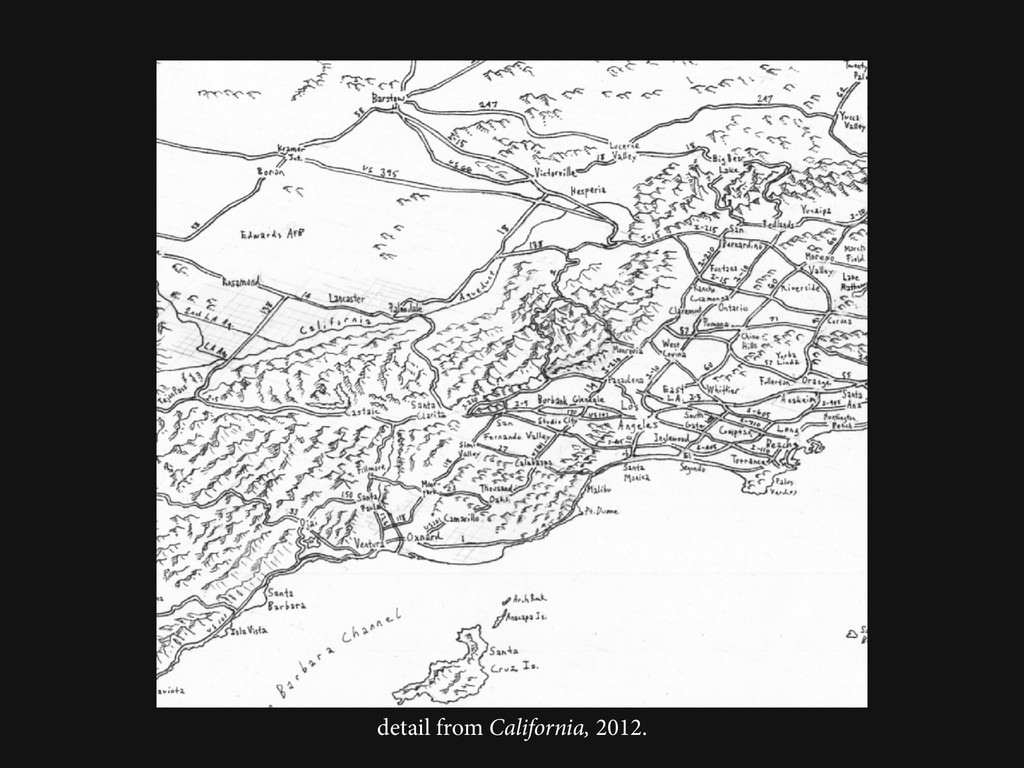
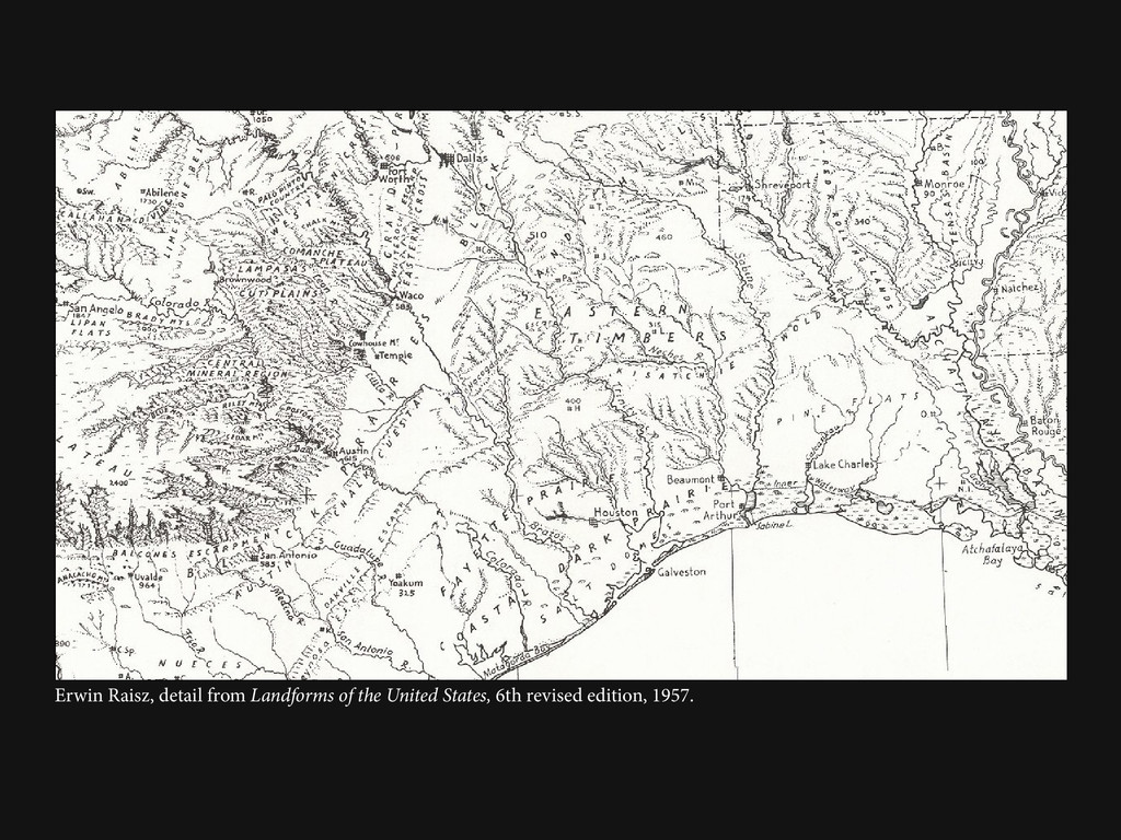
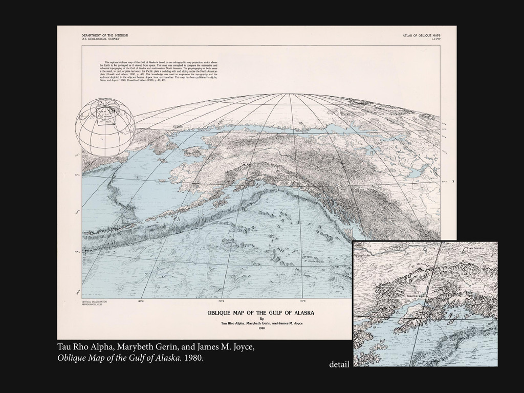
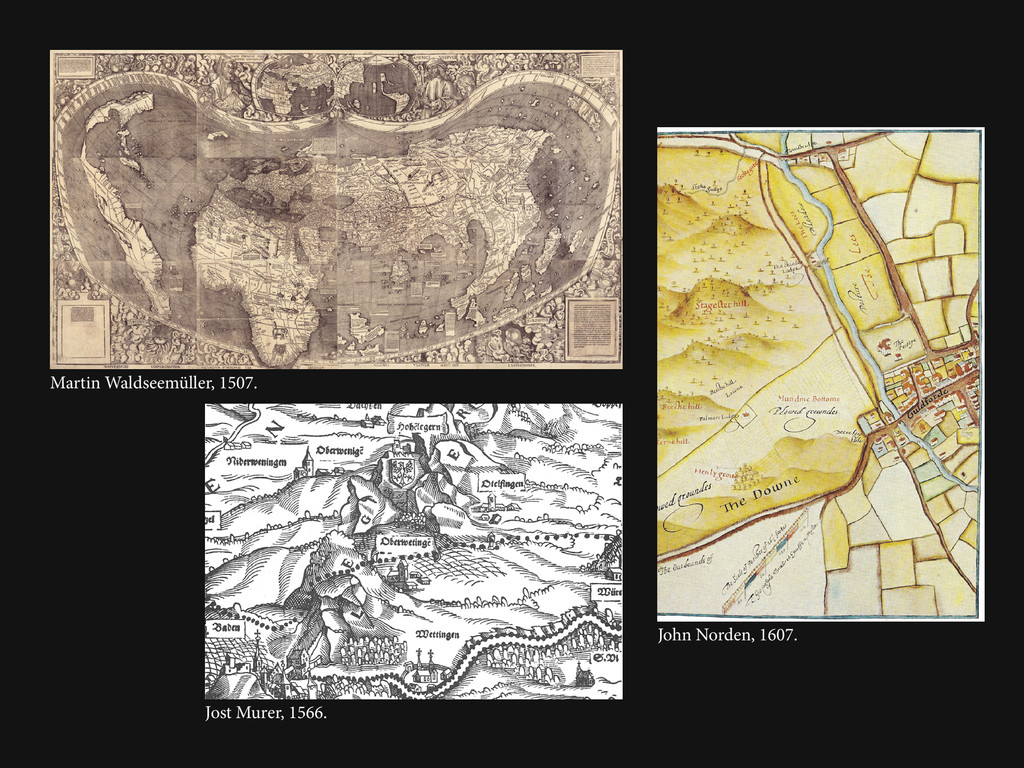
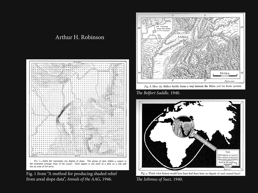
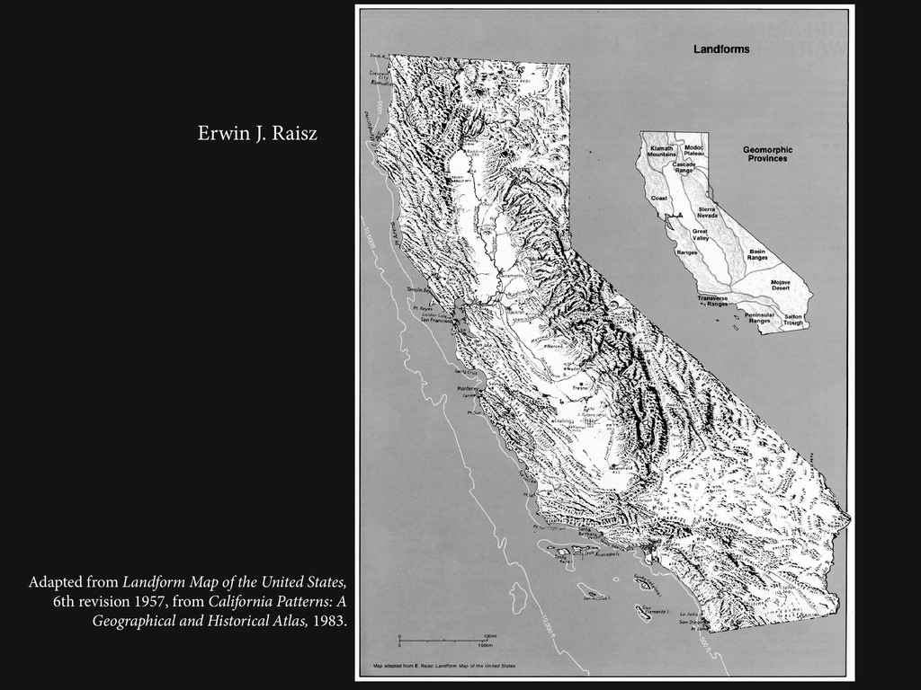
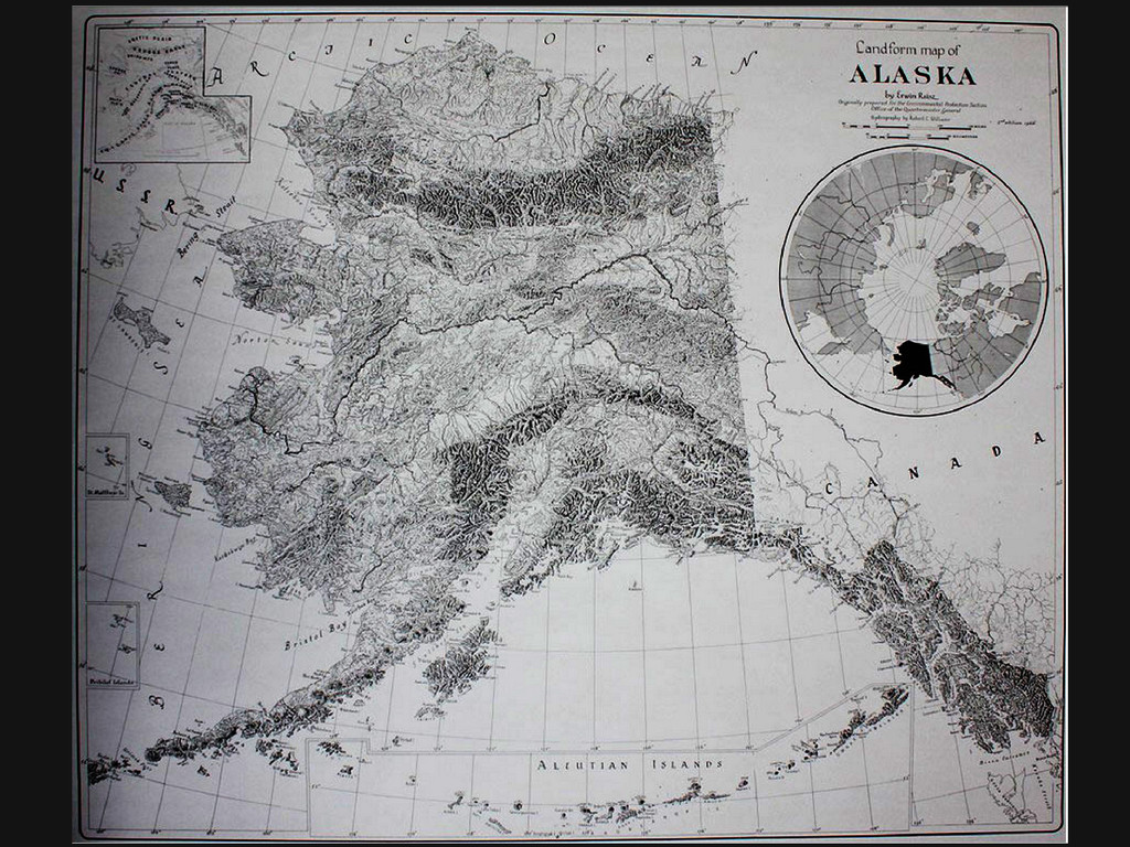
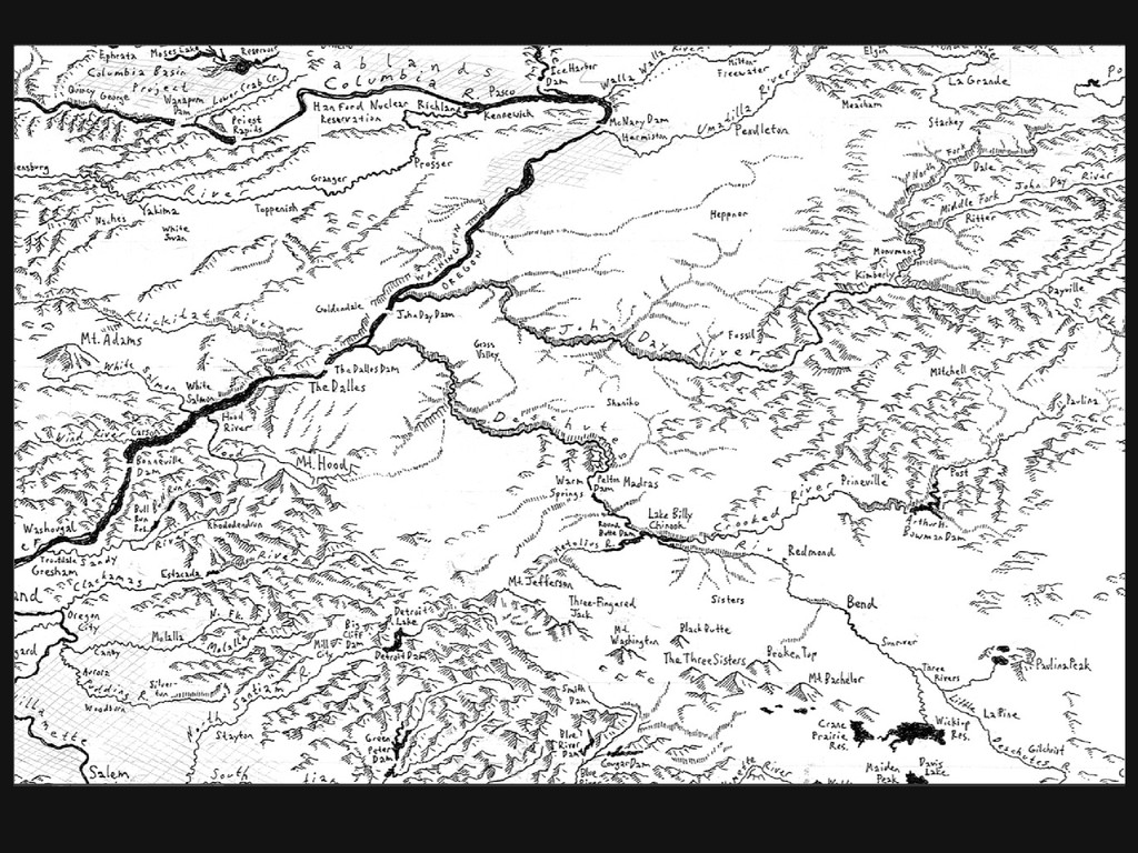
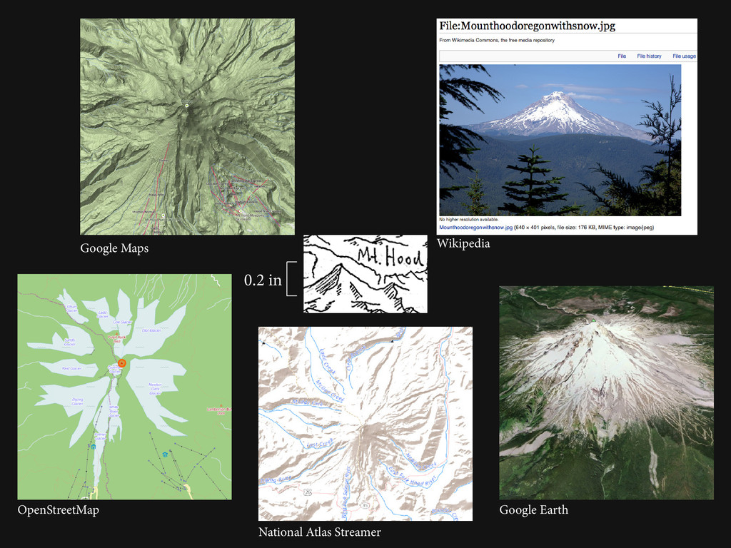
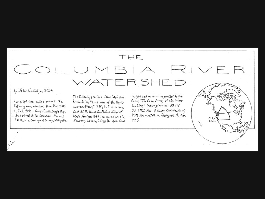
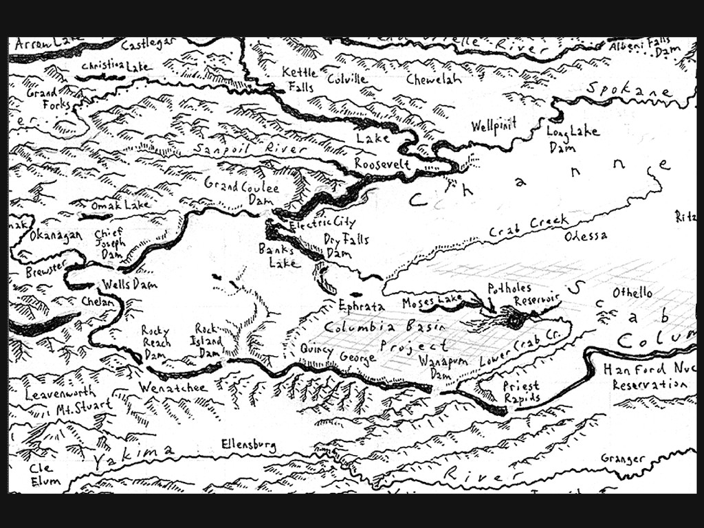
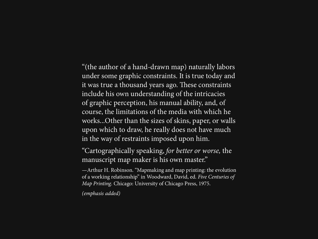
This talk will reflect upon recent experiences drawing large, geographically complex regions by hand, a practice that brings into sharp relief the many decisions at the core of the cartographer's craft--generalization and abstraction, label placement, the symbolization of features, among others--in an era where geographic information systems can automate many of these tasks and obscure the process from the map designer. I use hand-drawn map-making to reconnect with these processes in a tangible way, while invoking pre-digital maps made in the mid-20th century. I argue that reclaiming these practices in a contemporary context allows us to augment how we imagine places and to rediscover a broader set of tools for graphically expressing geographic phenomena.

NACIS 2014

Nathaniel V. KELSO

October 10, 2014
Tweet

More Decks by Nathaniel V. KELSO

Other Decks in Design

Transcript

  1. Past Practices, Contemporary Applications a talk presented at the 2014

    Annual Meeting of the North American Cartographic Information Society by Jake Coolidge, October 10, 2014
  2. Christopher Dunn, Northeast Portland. 2009. Phil Thompson, Lakefront Currents. 2013.

    Jenni Sparks, Berlin. 2013. Stephen Walter, The Island: London. 2006-08. www.handmaps.org
  3. Tau Rho Alpha, Marybeth Gerin, and James M. Joyce, Oblique

    Map of the Gulf of Alaska. 1980. detail
  4. Christopher J.R. Tolkien, Map of Middle Earth. 1954. Erwin Raisz,

    Landform Map of China. 1949. Arthur H. Robinson, The Belfort Saddle. 1940. Richard Edes Harrison, The Not So Soft Underside. 1943.
  5. The Belfort Saddle. 1940. The Isthmus of Suez. 1940. Fig.

    1 from “A method for producing shaded relief from areal slope data”, Annals of the AAG, 1946. Arthur H. Robinson
  6. Richard Edes Harrison Published in Fortune, 1940. Published in Fortune,

    1944. From Great Adventures and Explorations, by Vilhjalmur Stefansson, 1947.
  7. Erwin J. Raisz Adapted from Landform Map of the United

    States, 6th revision 1957, from California Patterns: A Geographical and Historical Atlas, 1983.
  8. “Make a map not a tracing!” —Gilles Deleuze and Félix

    Guattari. A Thousand Plateaus: Capitalism and Schizophrenia. Minneapolis: University of Minnesota Press, 1987.
  9. Map Sources: Google Earth, Google Maps National Atlas Streamer Natural

    Earth OpenStreetMap USGS Topographic Quad Series Wikipedia
  10. “Unlike tracings, which propagate redundancies, mappings discover new worlds within

    past and present ones; they inaugurate new grounds upon the hidden traces of a living context.” —James Corner, “The Agency of Mapping: Speculation, Critique and Invention” in Cosgrove, Denis, Mappings London: Reaktion Books, 1999.
  11. “(the author of a hand-drawn map) naturally labors under some

    graphic constraints. It is true today and it was true a thousand years ago. These constraints include his own understanding of the intricacies of graphic perception, his manual ability, and, of course, the limitations of the media with which he works...Other than the sizes of skins, paper, or walls upon which to draw, he really does not have much in the way of restraints imposed upon him. “Cartographically speaking, for better or worse, the manuscript map maker is his own master.” —Arthur H. Robinson. “Mapmaking and map printing: the evolution of a working relationship” in Woodward, David, ed. Five Centuries of Map Printing. Chicago: University of Chicago Press, 1975. (emphasis added)
  12. Dunn, Christopher. Northeast Portland. 2009. http://www.handmaps.org/maps/ hand_drawn_map_portland_ne.jpg Accessed 3 Oct.

    2014. Walter, Stephen. The Island: London Series. 2006-2008. http://www.stephenwalter. co.uk/wp/maps/the-island-london-series Accessed 3 Oct. 2014. Thompson, Phil. Lakefront Currents. 2013. http://capehorn-illustration.com/ lakefront_currents.html Accessed 3 Oct. 2014. Sparks, Jenni. Berlin. 2013. http://jennisparks.com/Hand-Drawn-Map-of-Berlin Accessed 3 Oct. 2014. Hand Drawn Mapping Association. http://www.handmaps.org Accessed 3 Oct. 2014. Raisz, Erwin J. Landforms of the United States, 6th revised edition, 1957. Cambridge: Institute of Geographical Exploration, Harvard University. David Rumsey Map Collection. http://www.davidrumsey.com/luna/servlet/ s/0v89k0 Accessed 3 Oct. 2014. Alpha, Tau Rho, Marybeth Gerin, and James M. Joyce. Oblique Map of the Gulf of Alaska. Reston, Va.: United States Geological Survey. David Rumsey Map Collection. http://www.davidrumsey.com/luna/servlet/s/kbonkt Accessed 3 Oct. 2014. Waldseemüller, Martin. Universalis cosmographia secundum Ptholomaei traditionem et Americi Vespucii alioru[m]que lustrationes. 1507. Library of Congress. http://www.loc.gov/item/2003626426/ Accessed 3 Oct. 2014. Murer, Jost. Map of the Zürich Canton. 1566. In: Eduard Imhof, Cartographic Relief Presentation. Redlands, Ca.: ESRI Press, 2007. Norden, John. Description of the Honor of Windsor. 1607. In: Leo Bagrow and R.A. Skelton, History of Cartography. 2nd Ed. Chicago: Precedent Publishing, 1985. Tolkien, Christopher J.R. Map of Middle Earth. 1954. In: J.R.R. Tolkien, The Lord of the Rings. 2nd Ed. Boston: Houghton Mifflin. 1993. Robinson, Arthur H. The Belfort Saddle. In: Roderick Peattie, Geography and Human Destiny. 1940. New York: George W. Stewart. Harrison, Richard E. The Not-So-Soft Underside. In: Fortune. 1943. Library of Congress online exhibition, “Churchill and the Great Republic.” http://www. loc.gov/exhibits/churchill Accessed 8 Apr. 2013. Raisz, Erwin J. Landform Map of China. In: David Greenhood. Mapping. 1964. Chicago: Univ. of Chicago Press. www.jakecoolidgecartography.com [email protected] Sources for images used, in order of appearance
  13. Robinson, Arthur H. The Isthmus of Suez. In: Roderick Peattie,

    Geography and Human Destiny, 1940. New York: George W. Stewart. Robinson, Arthur H. Fig. 1 from “A method for producing shaded relief from areal slope data”, Annals of the AAG, 36 (4): 248-252. 1946. Harrison, Richard E. The World According to Standard. In: Fortune. 1940. Norman B. Leventhal Map Center, Boston Public Library. http://maps.bpl. org/id/m8742 Accessed 8 Apr. 2013. Harrison, Richard E. Eight Views of the World. In: Look at the World: the Fortune Atlas of World Strategy, New York: Knopf. 1944. Norman B. Leventhal Map Center, Boston Public Library. http://maps.bpl.org/id/m8667 Accessed 8 Apr. 2013. Harrison, Richard E. In: Great Adventures and Explorations, by Vilhjalmur Stefansson, 1947. New York: Dial Press. Raisz, Erwin J. Adapted from Landform Map of the United States, 6th revision, 1957, In: David Hornbeck, David L. Fuller, and Phillip S. Kane. California Patterns: A Geographical and Historical Atlas, Palo Alto, Ca.: Mayfield. 1983. Raisz, Erwin J., Robert L. Williams, and U.S. Office of the Quartermaster General, Environmental Protection Section. Landform Map of Alaska. 1966. Raisz Maps. http://www.raiszmaps.com/images/Alaska-8.jpg Accessed 3 Oct. 2014. Google Maps. http://maps.google.com Accessed 3 Oct. 2014. Smith, F.L. “Mount Hood Oregon With Snow.” Wikipedia http://en.wikipedia. org/wiki/Mount_Hood#mediaviewer/File:Mounthoodoregonwithsnow.jpg OpenStreetMap. http://openstreetmap.org Accessed 3 Oct. 2014. National Atlas Streamer. http://nationalmap.gov/streamer/webApp/streamer. html Accessed 3 Oct. 2014. Google Earth. Accessed 3 Oct. 2014. All other images 2012–2014 by the author. Sources for images used, in order of appearance, continued