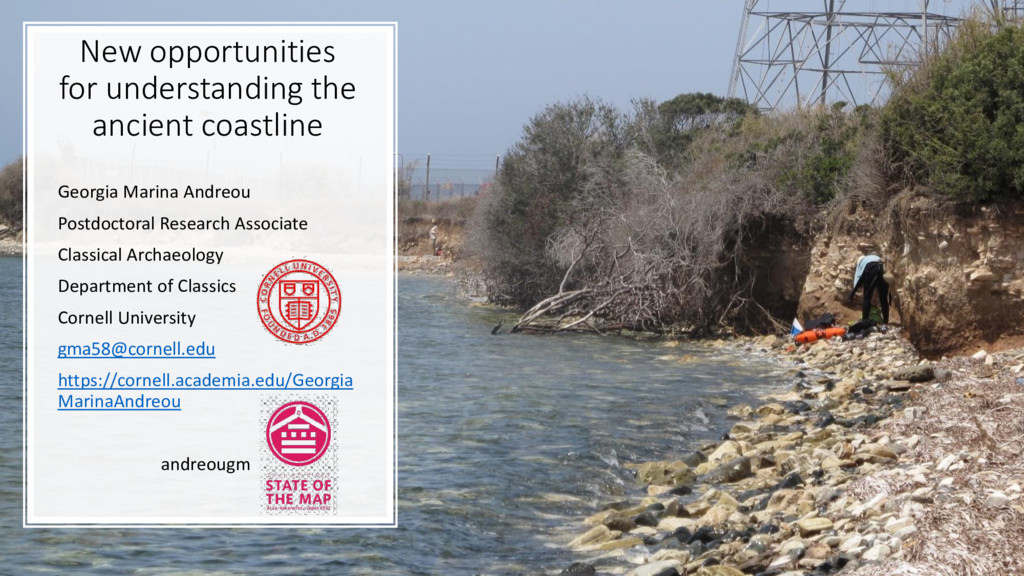
Postdoctoral Research Associate Classical Archaeology Department of Classics Cornell University [email protected] https://cornell.academia.edu/Georgia MarinaAndreou andreougm
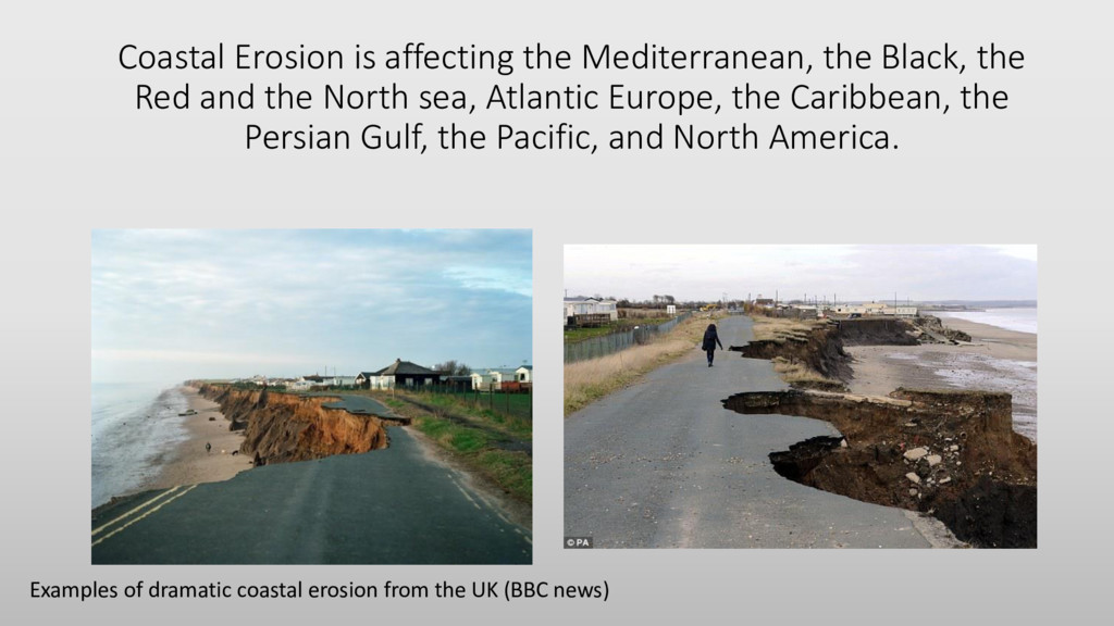
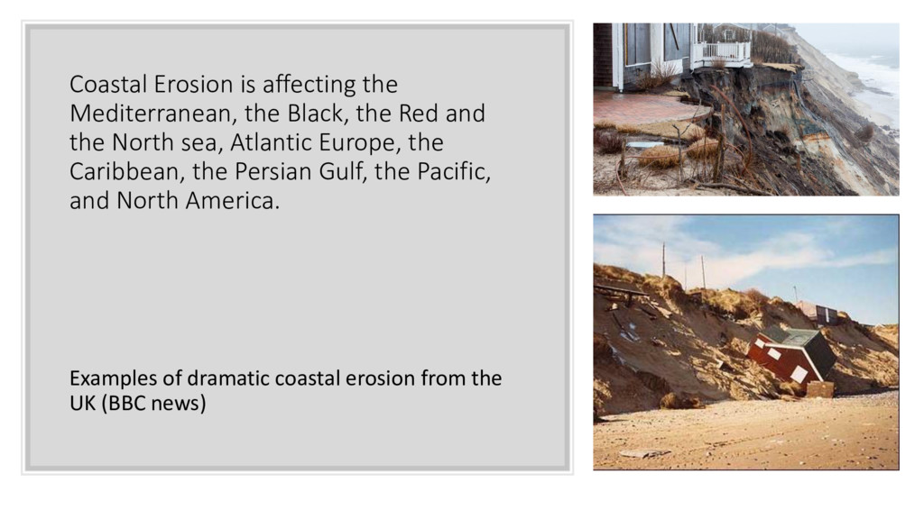
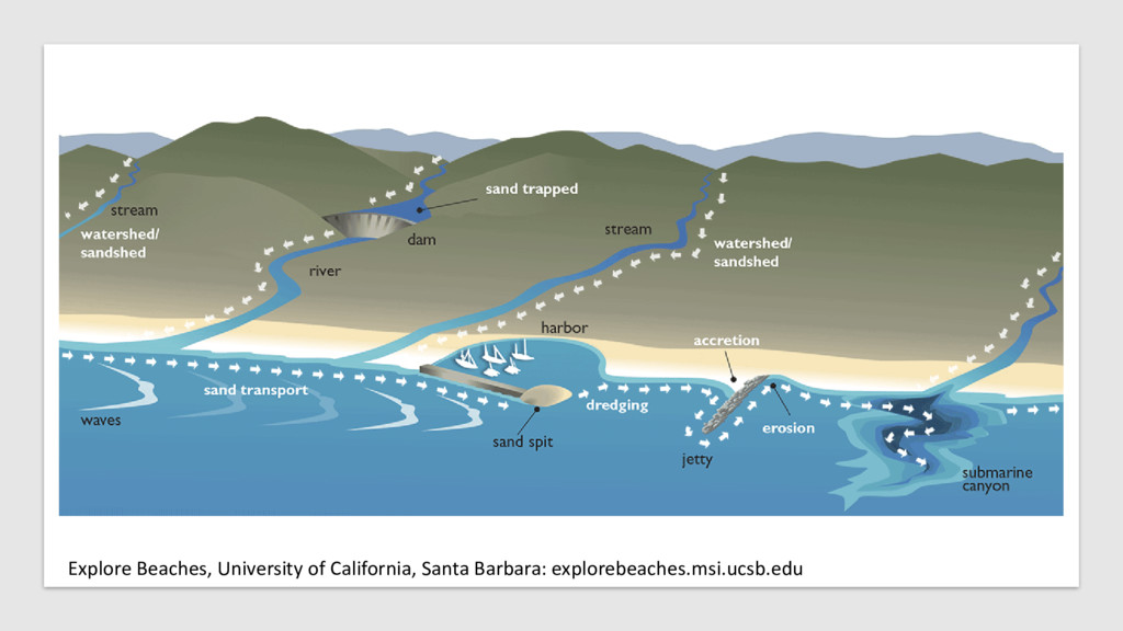
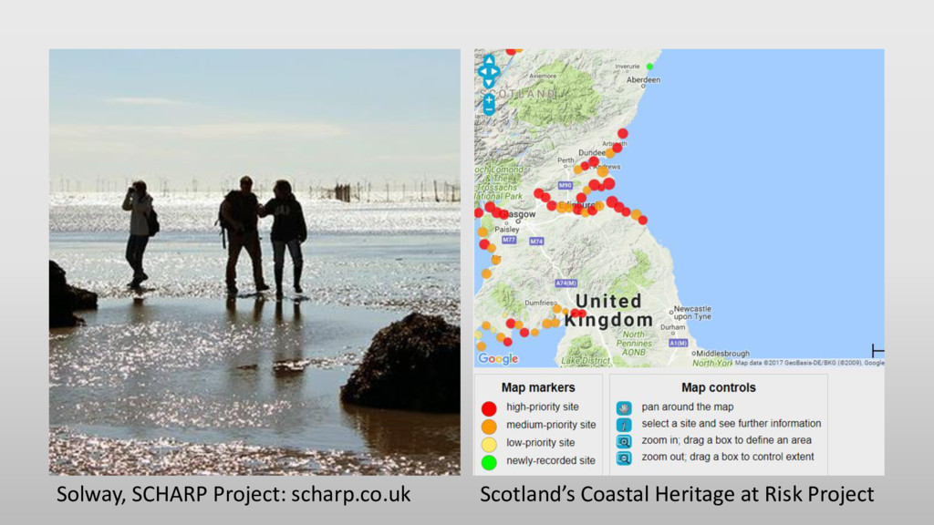
and the North sea, Atlantic Europe, the Caribbean, the Persian Gulf, the Pacific, and North America. Examples of dramatic coastal erosion from the UK (BBC news)
and the North sea, Atlantic Europe, the Caribbean, the Persian Gulf, the Pacific, and North America. Examples of dramatic coastal erosion from the UK (BBC news)
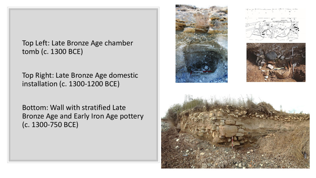
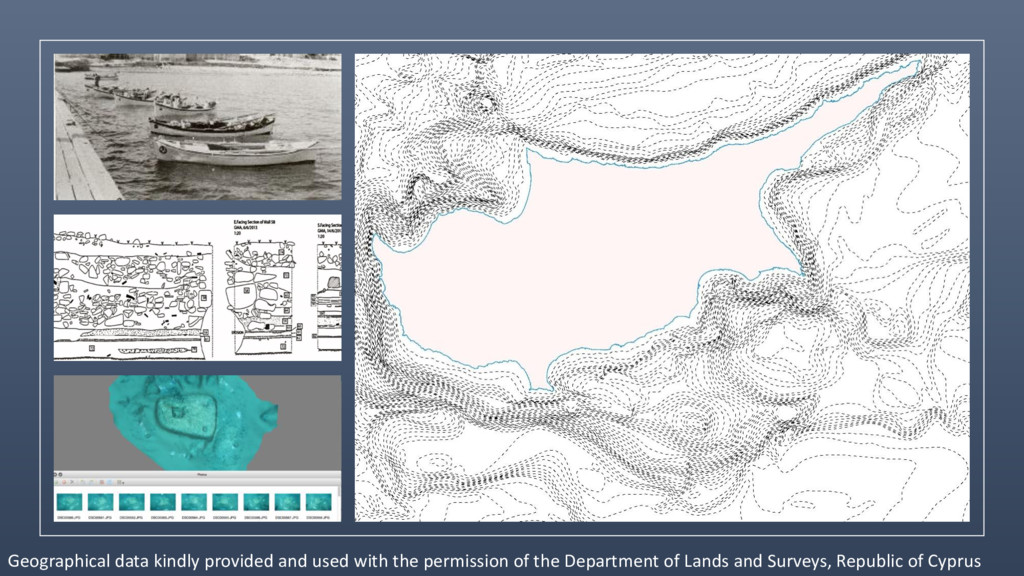
Top Right: Late Bronze Age domestic installation (c. 1300-1200 BCE) Bottom: Wall with stratified Late Bronze Age and Early Iron Age pottery (c. 1300-750 BCE)
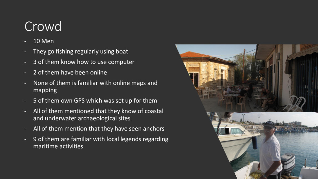
boat - 3 of them know how to use computer - 2 of them have been online - None of them is familiar with online maps and mapping - 5 of them own GPS which was set up for them - All of them mentioned that they know of coastal and underwater archaeological sites - All of them mention that they have seen anchors - 9 of them are familiar with local legends regarding maritime activities
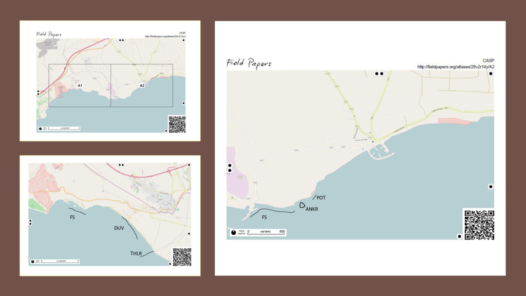
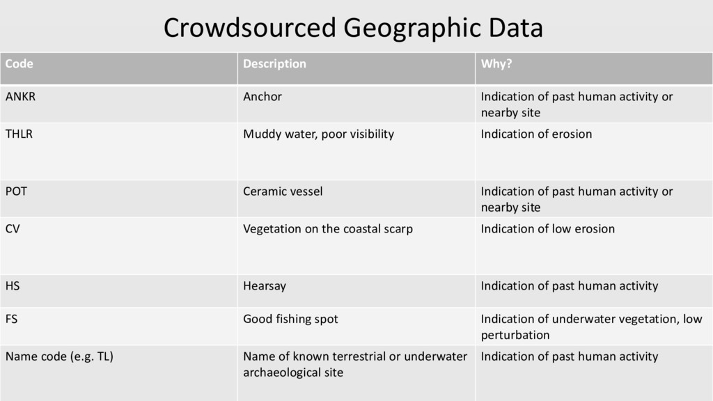
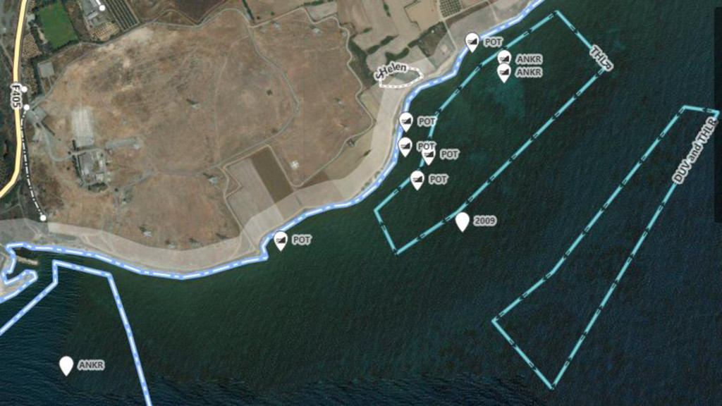
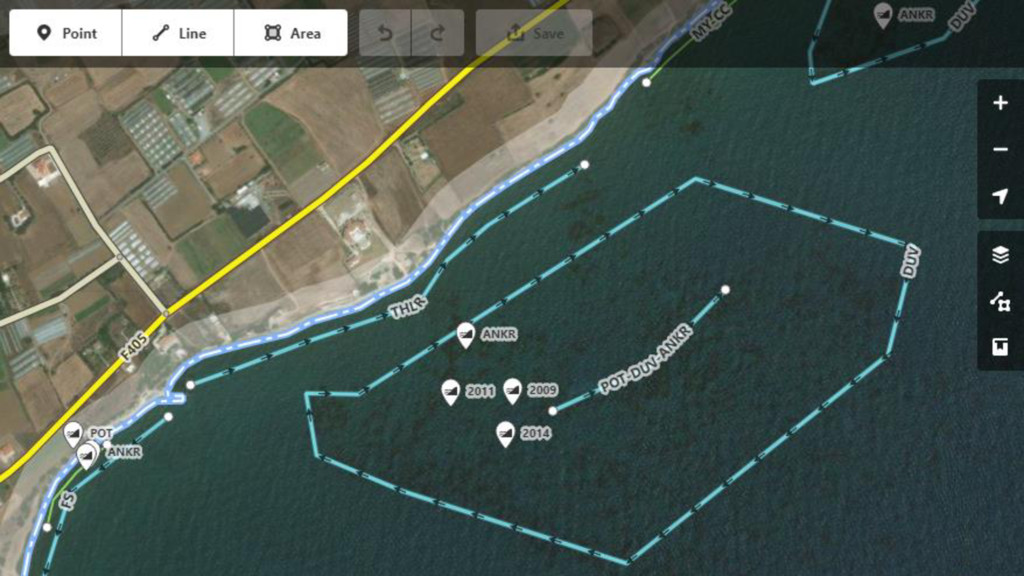
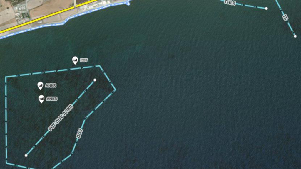
Anchor Indication of past human activity or nearby site THLR Muddy water, poor visibility Indication of erosion POT Ceramic vessel Indication of past human activity or nearby site CV Vegetation on the coastal scarp Indication of low erosion HS Hearsay Indication of past human activity FS Good fishing spot Indication of underwater vegetation, low perturbation Name code (e.g. TL) Name of known terrestrial or underwater archaeological site Indication of past human activity
Postdoctoral Research Associate Classical Archaeology Department of Classics Cornell University [email protected] https://cornell.academia.edu/Georgia MarinaAndreou andreougm ありがとう Thank you Ευχαριστώ