Upgrade to Pro
— share decks privately, control downloads, hide ads and more …
Speaker Deck
Features
Speaker Deck
PRO
Sign in
Sign up for free
Search
Search
Day1-1030-OSM in Aizuwakamatsu city: Constructi...
Search
Sponsored
·
Your Podcast. Everywhere. Effortlessly.
Share. Educate. Inspire. Entertain. You do you. We'll handle the rest.
→
sotm2017
September 01, 2017
Research
190
1
Share
Embed
Copy iframe code
Copy JS code
Copy link
Start on current slide
Day1-1030-OSM in Aizuwakamatsu city: Construction of a hazard map
sotm2017
September 01, 2017
More Decks by sotm2017
See All by sotm2017
Day1-1100-How to build up an OSM Community
sotm2017
0
450
Day1-1440-High precision mapping with streetlevel imagery
sotm2017
0
290
Day1-1030-Mobile app development with routing and voice navigation
sotm2017
0
170
Day1-1200-Mapping with a time dimension
sotm2017
0
140
Day1-1230-New opportunities for understanding the ancient coastline
sotm2017
0
170
Day1-1410-Challenges in geonames and address extraction
sotm2017
0
260
Day1-1440-One road goes a long way: measuring the impact of maps on fighting FGM in Tanzania
sotm2017
0
240
Day2-0930-Taking on responsibility for OSM data
sotm2017
0
130
Day2-1000-MapRoulette: One million corrections and beyond
sotm2017
0
140
Other Decks in Research
See All in Research
ScoreMatchingRiesz for Automatic Debiased Machine Learning and Policy Path Estimation with an Application to Japanese Monetary Policy Evaluation
masakat0
0
310
論文紹介 "ReSim: Reliable World Simulation for Autonomous Driving"
kogo
0
710
GLIM とMegaParticles:正規分布近似の限界とタイトカップリング&パーティクルフィルタの進展 / GLIM and MegaParticles : Progress of the distribution representation in SLAM
koide3
0
630
nlp2026 In-Context Learningに基づく経路案内のための地理的知識の活用方法に関する検討
takashiinui
0
110
Cross-Media Information Spaces and Architectures
signer
PRO
0
320
[BlackHatAsia2026] Hidden Telemetry: Uncovering TraceLogging ETW Providers You're Not Using (Yet)
asuna_jp
1
610
通時的な類似度行列に基づく単語の意味変化の分析
rudorudo11
0
340
COMETAを用いたデータ民主化運動の歴史
sazimai
0
130
研究室単位での自律的 IPv6接続性確立に向けたAS共同運用モデルの提案と実証
reokashiwa
PRO
0
170
技術は予測を代補する:スティグレールの三次的記憶論と予測処理パラダイムの交差
ktanishima
0
100
typst の使い方:言語学を研究する学生のために
gitomochang
0
530
EIRによる不正端末のブロッキング 5G時代におけるデバイス識別と不正対策の進化
stellarcraft
0
100
Featured
See All Featured
[RailsConf 2023] Rails as a piece of cake
palkan
59
6.8k
What’s in a name? Adding method to the madness
productmarketing
PRO
24
4.1k
Visualization
eitanlees
152
17k
Designing Experiences People Love
moore
143
24k
Un-Boring Meetings
codingconduct
0
350
XXLCSS - How to scale CSS and keep your sanity
sugarenia
249
1.3M
We Have a Design System, Now What?
morganepeng
55
8.2k
How to Create Impact in a Changing Tech Landscape [PerfNow 2023]
tammyeverts
55
3.4k
HTML-Aware ERB: The Path to Reactive Rendering @ RubyCon 2026, Rimini, Italy
marcoroth
3
370
Gemini Prompt Engineering: Practical Techniques for Tangible AI Outcomes
mfonobong
2
470
How People are Using Generative and Agentic AI to Supercharge Their Products, Projects, Services and Value Streams Today
helenjbeal
1
250
Are puppies a ranking factor?
jonoalderson
1
3.7k
Transcript
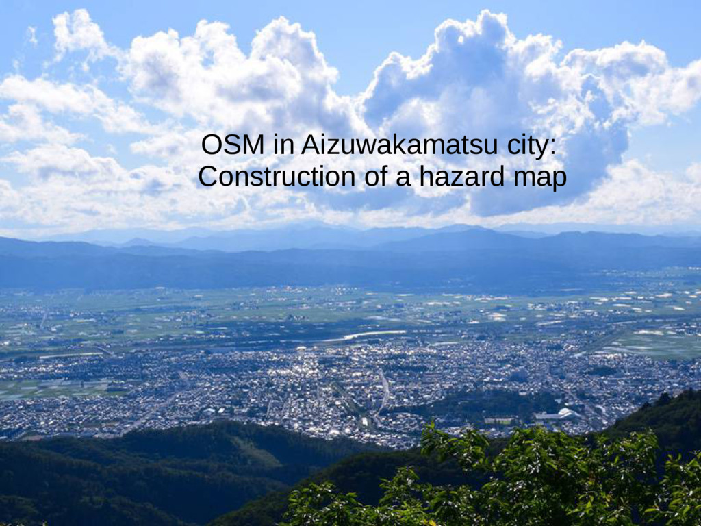
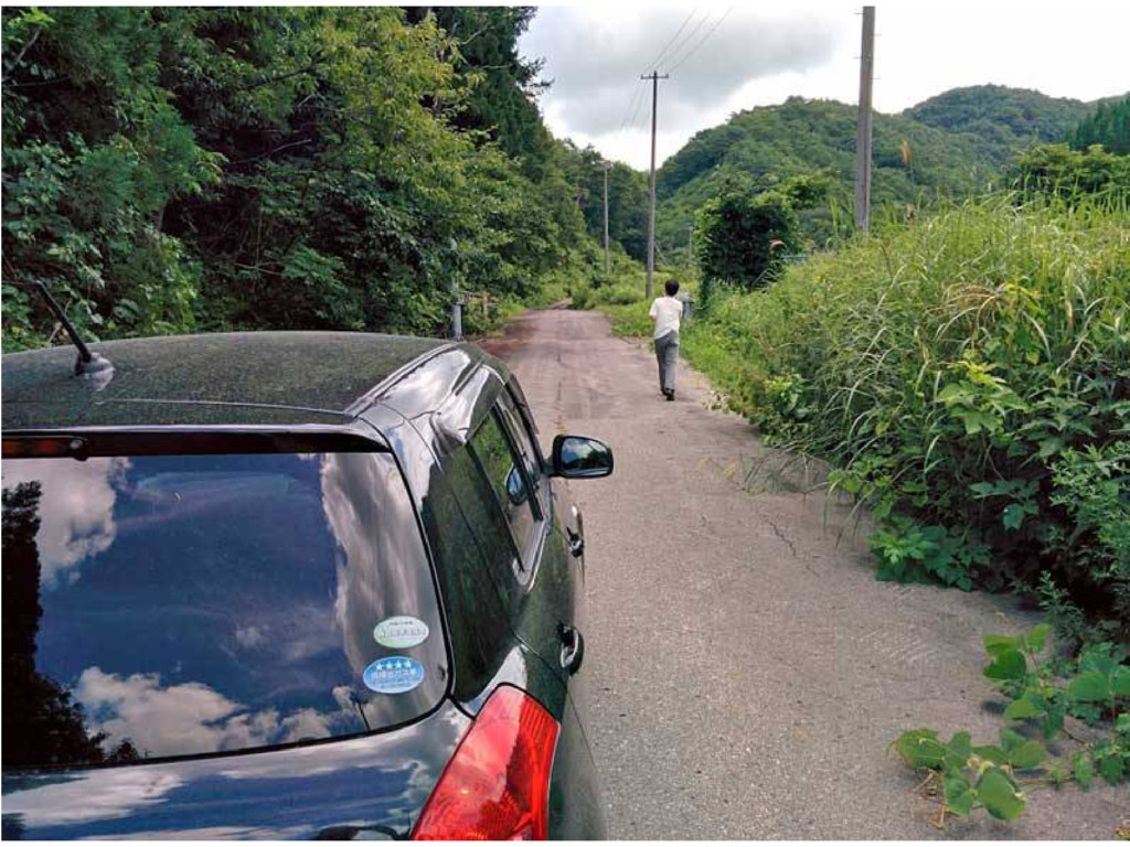
OSM in Aizuwakamatsu city: Construction of a hazard map
None
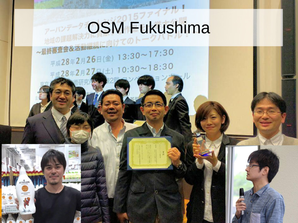
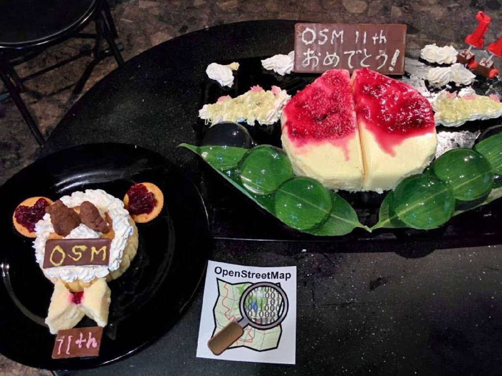
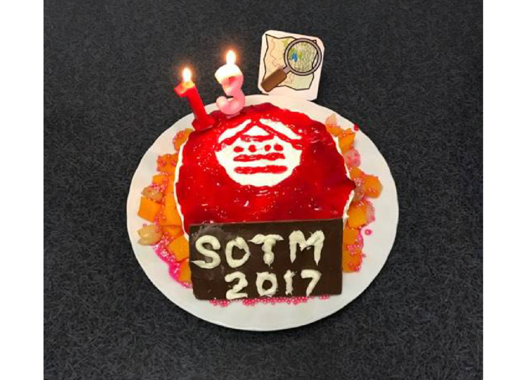
OSM Fukushima
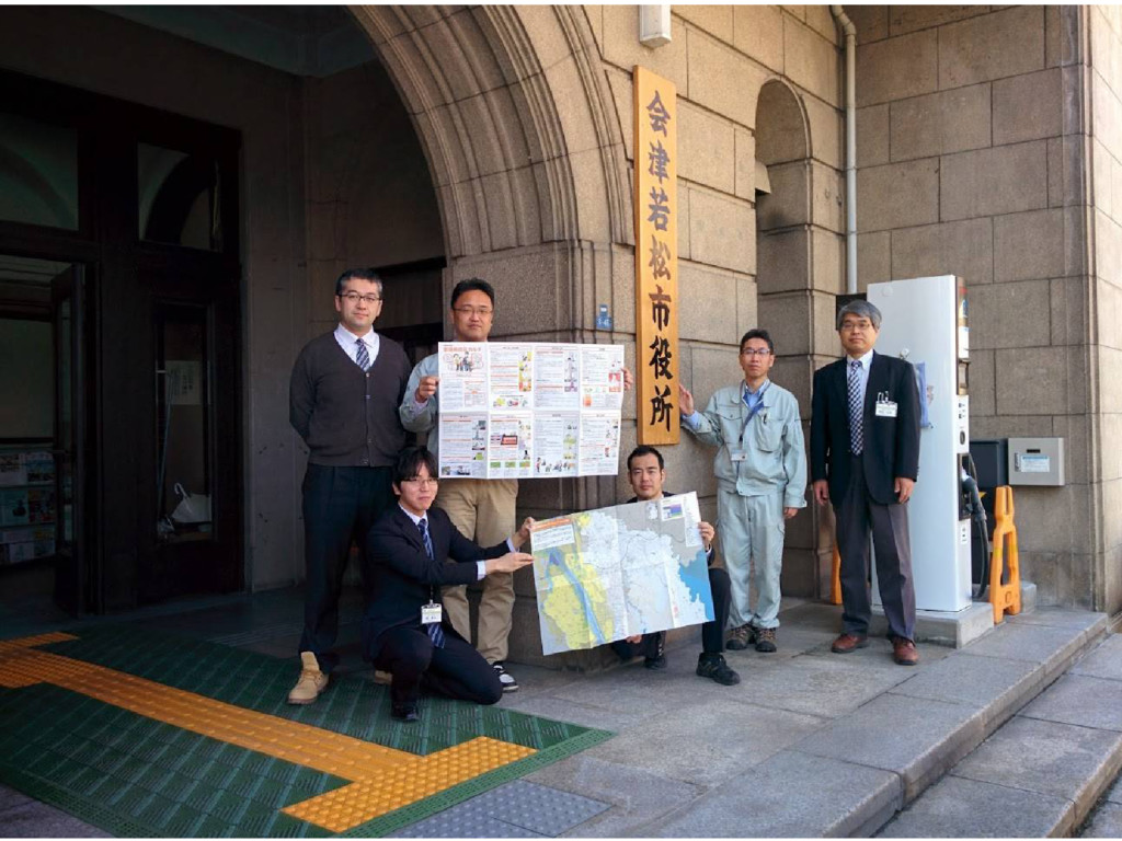
Aizuwakamatsu City Hall
None
None
None
None
None
None
None
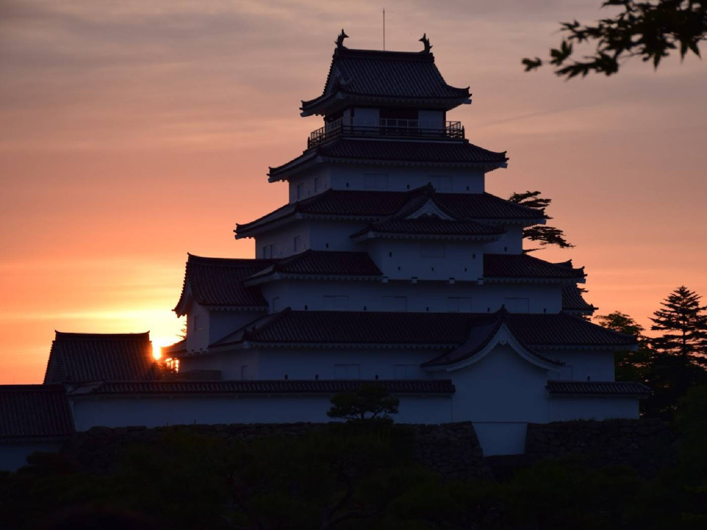
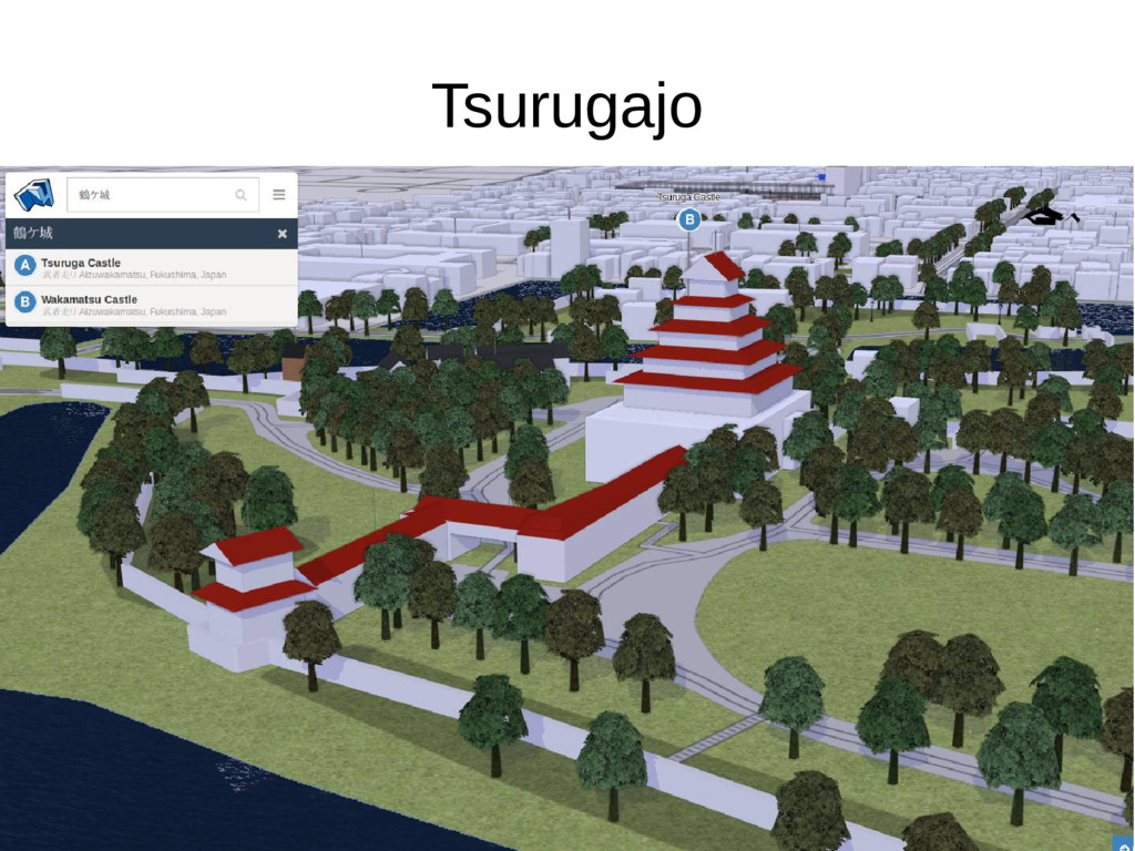
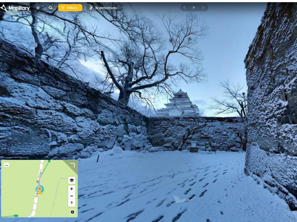
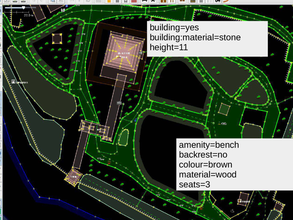
Tsurugajo
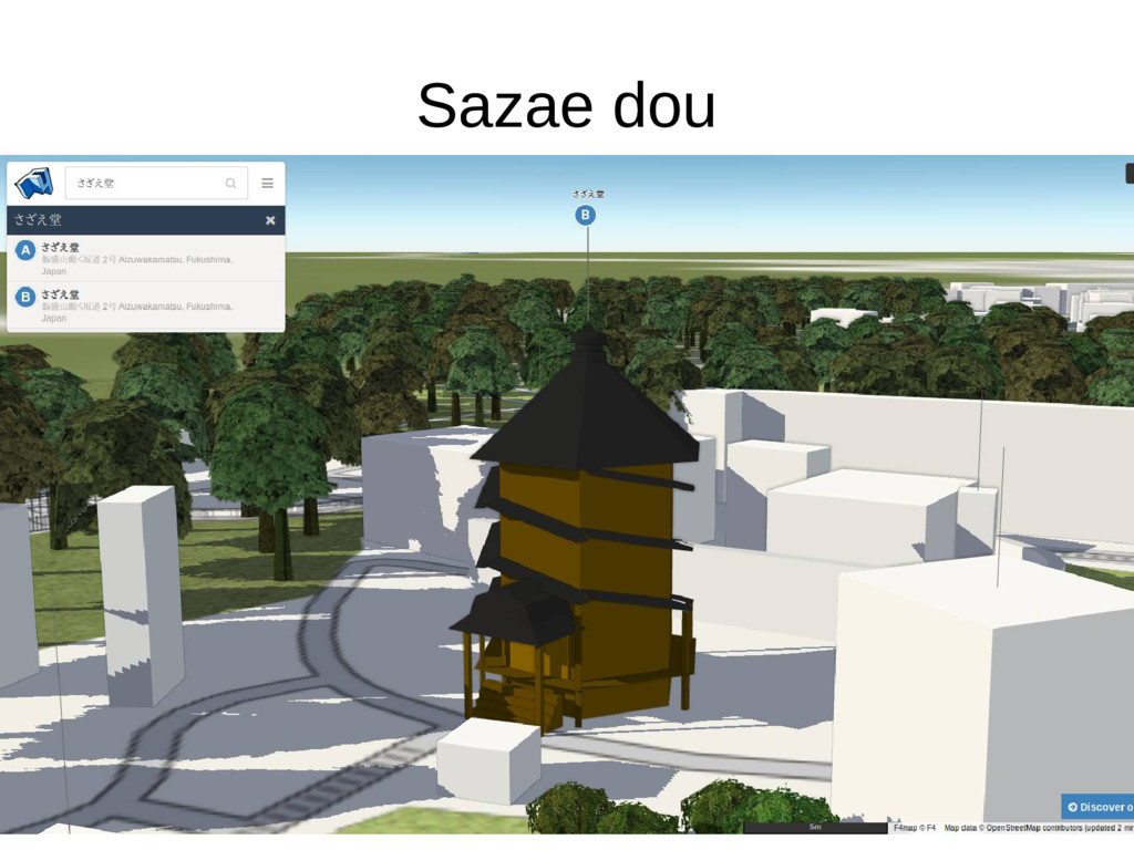
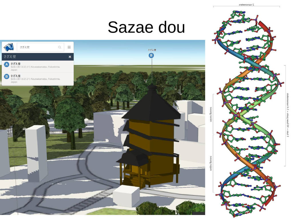
Sazae dou
Sazae dou
None
None
None
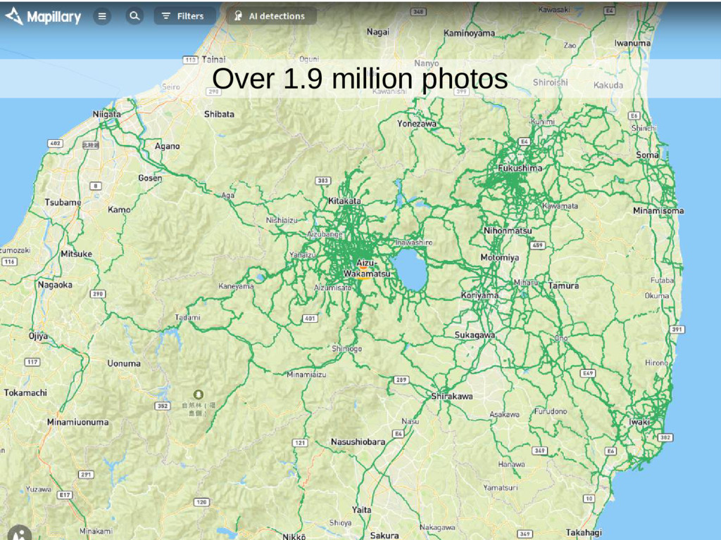
Over 1.9 million photos
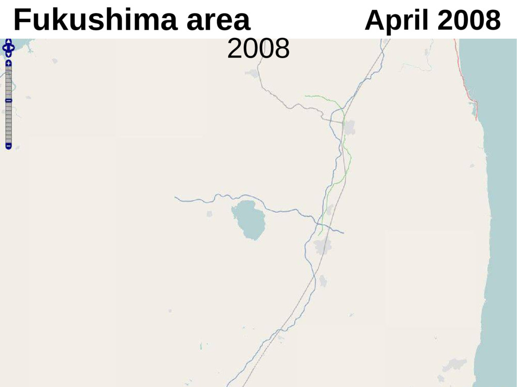
April 2008 Fukushima area 2008
Fukushima area June 2009 2009
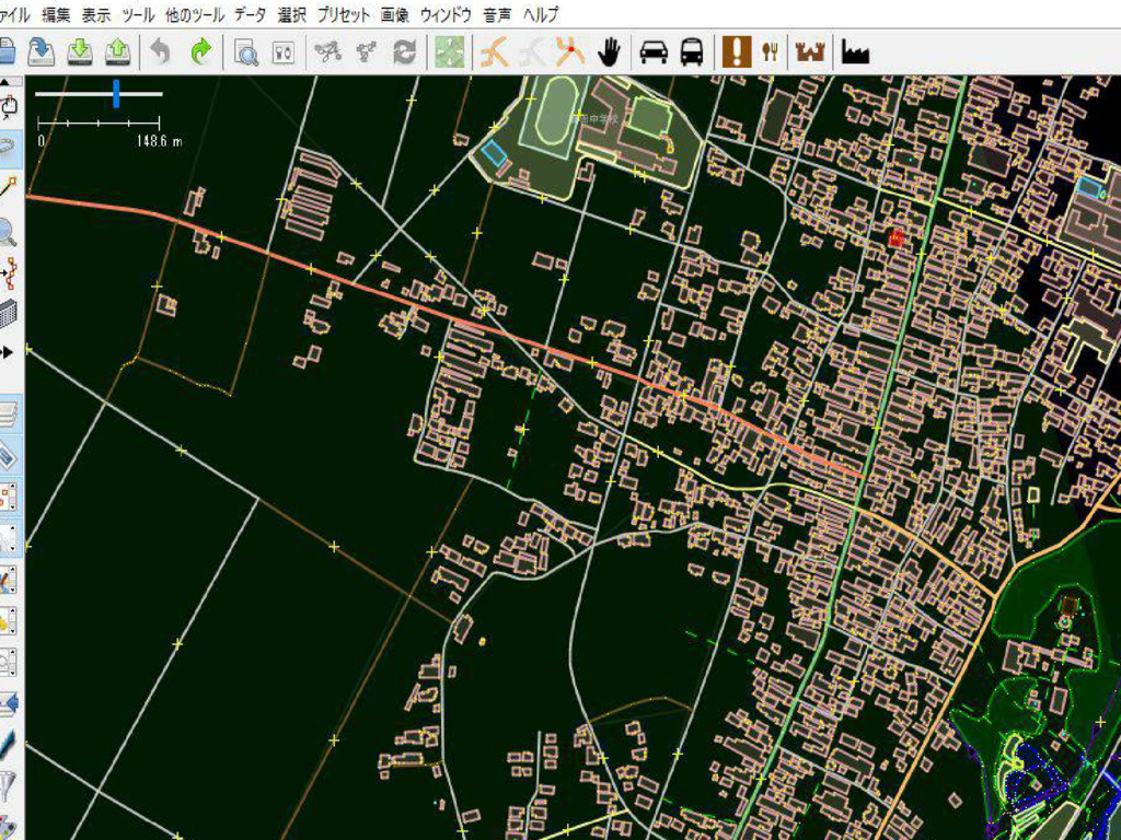
2017 • コミュニティによって市内す べての建物が作成された
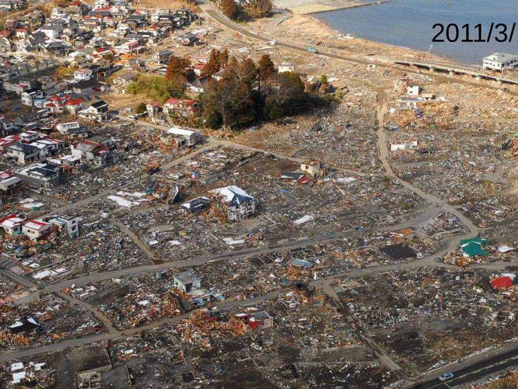
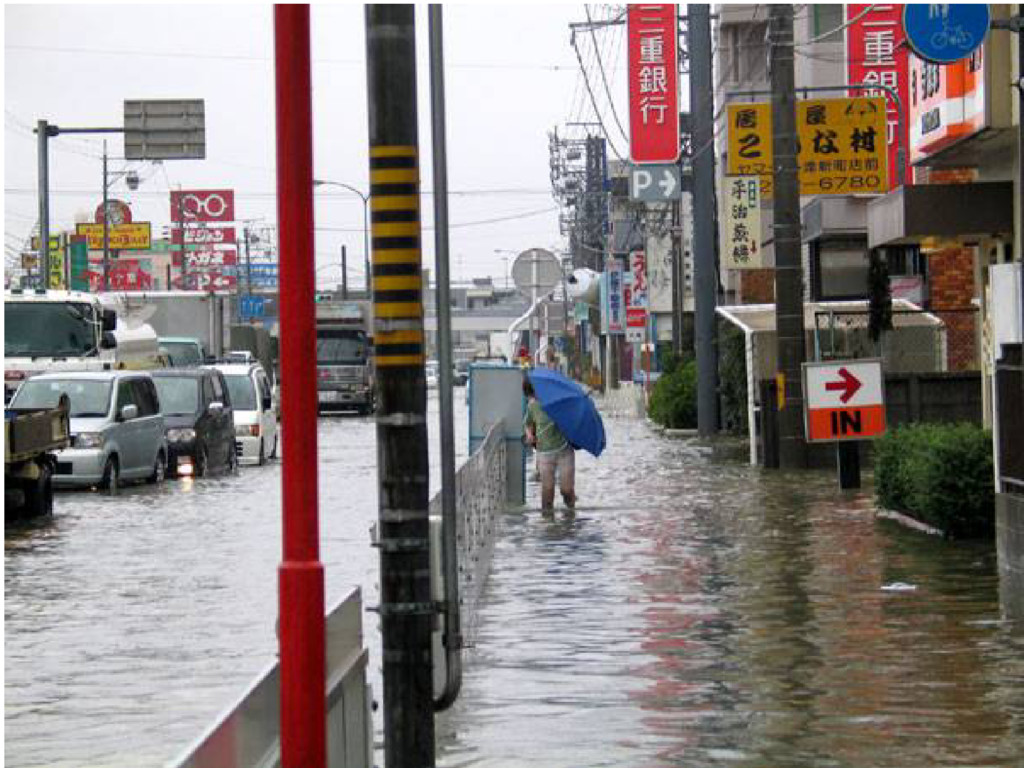
2011/3/1
None
None
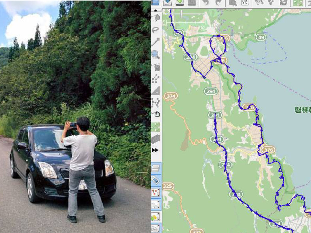
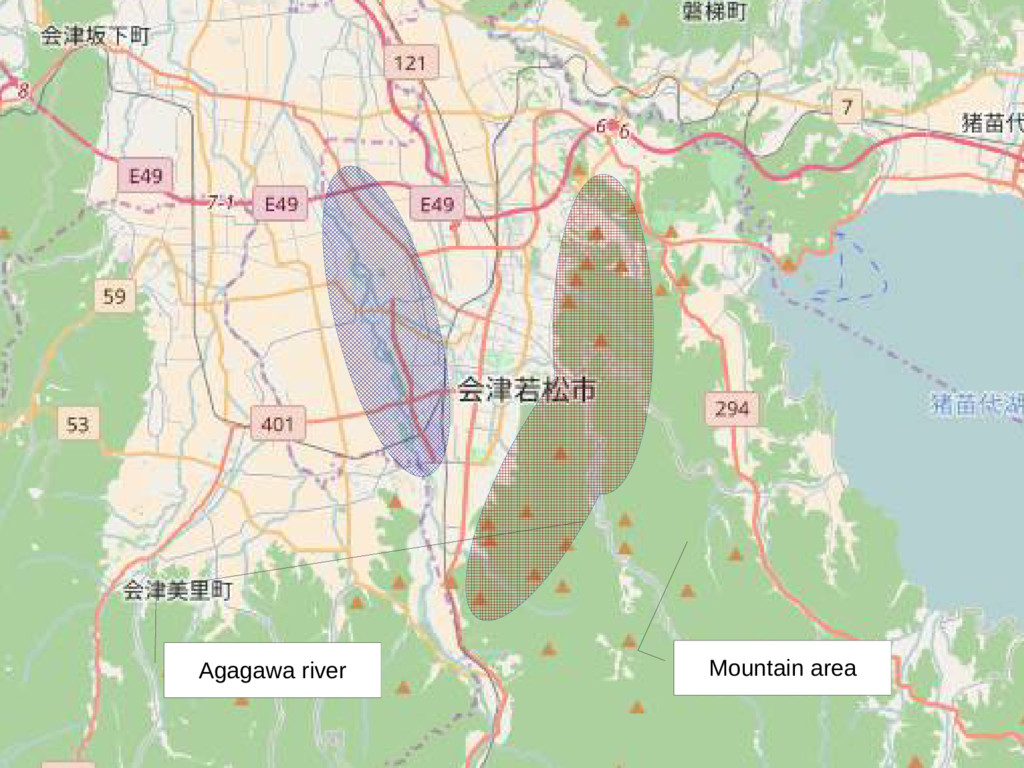
Mountain area Agagawa river
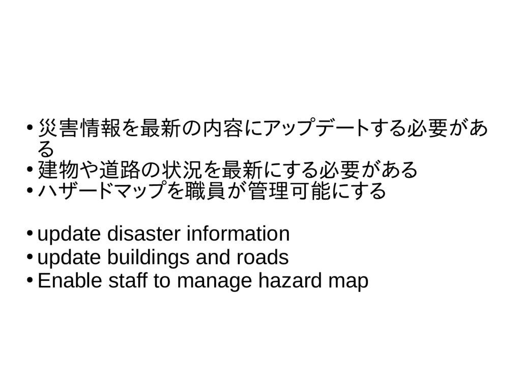
• 災害情報を最新の内容にアップデートする必要があ る • 建物や道路の状況を最新にする必要がある • ハザードマップを職員が管理可能にする • update disaster
information • update buildings and roads • Enable staff to manage hazard map
• 災害情報を最新の内容にアップデートする必要があ る • 建物や道路の状況を最新にする必要がある • ハザードマップを職員が管理可能にする • update disaster
information • update buildings and roads • Enable staff to manage hazard map
None
Aizu terrain
Disaster of Aizu building=yes building:material=stone height=11 amenity=bench backrest=no colour=brown material=wood
seats=3
None
行 1 行 2 行 3 行 4 0 2
4 6 8 10 12 列 1 列 2 列 3 Explaining...
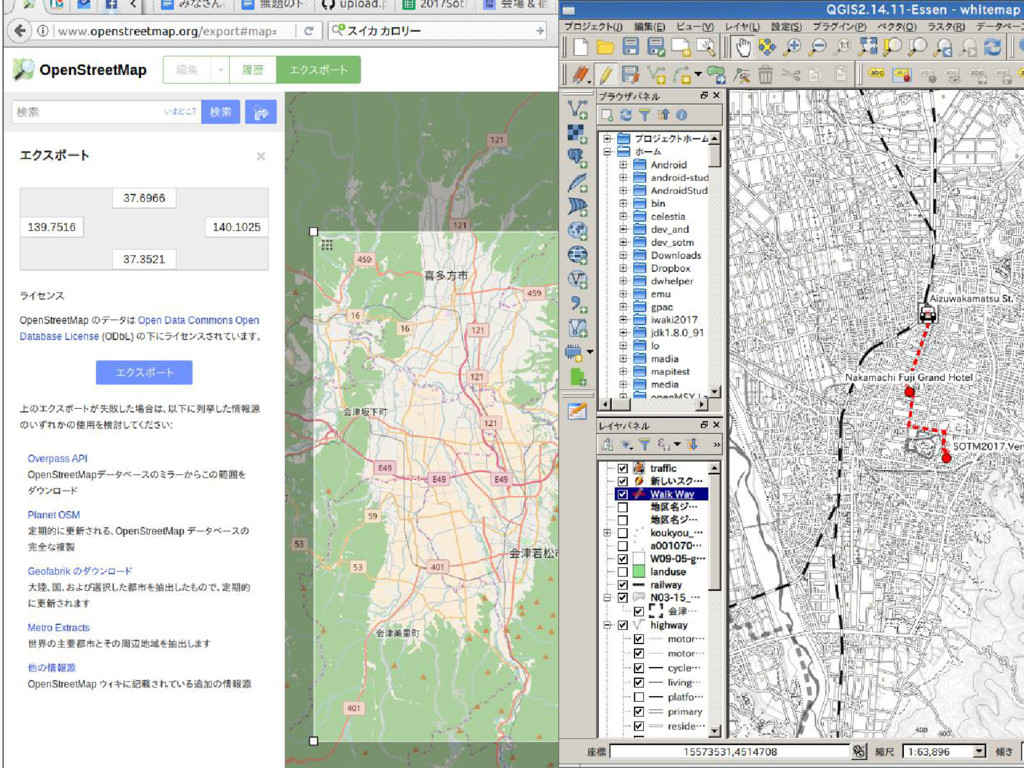
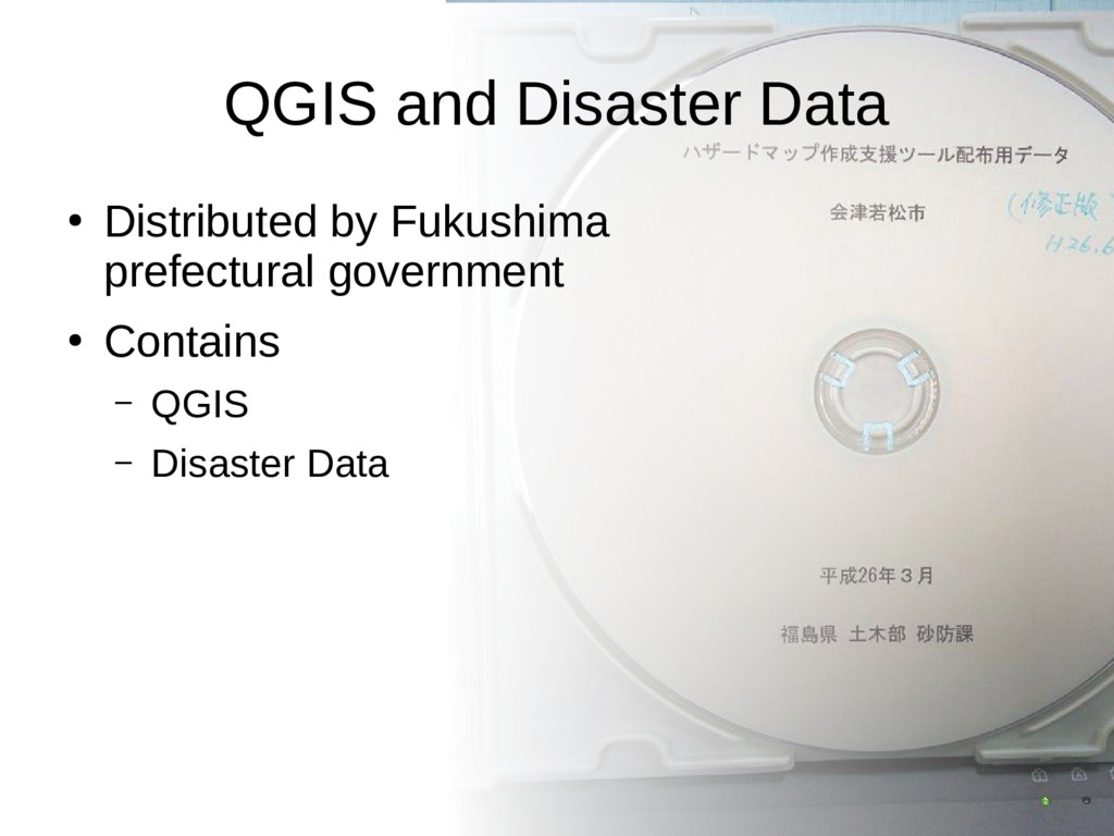
QGIS and Disaster Data • Distributed by Fukushima prefectural government
• Contains – QGIS – Disaster Data
None
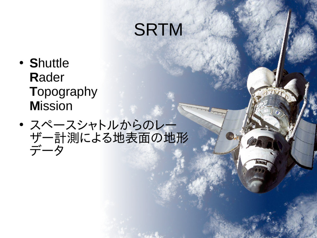
SRTM • Shuttle Rader Topography Mission • スペースシャトルからのレー ザー計測による地表面の地形 データ
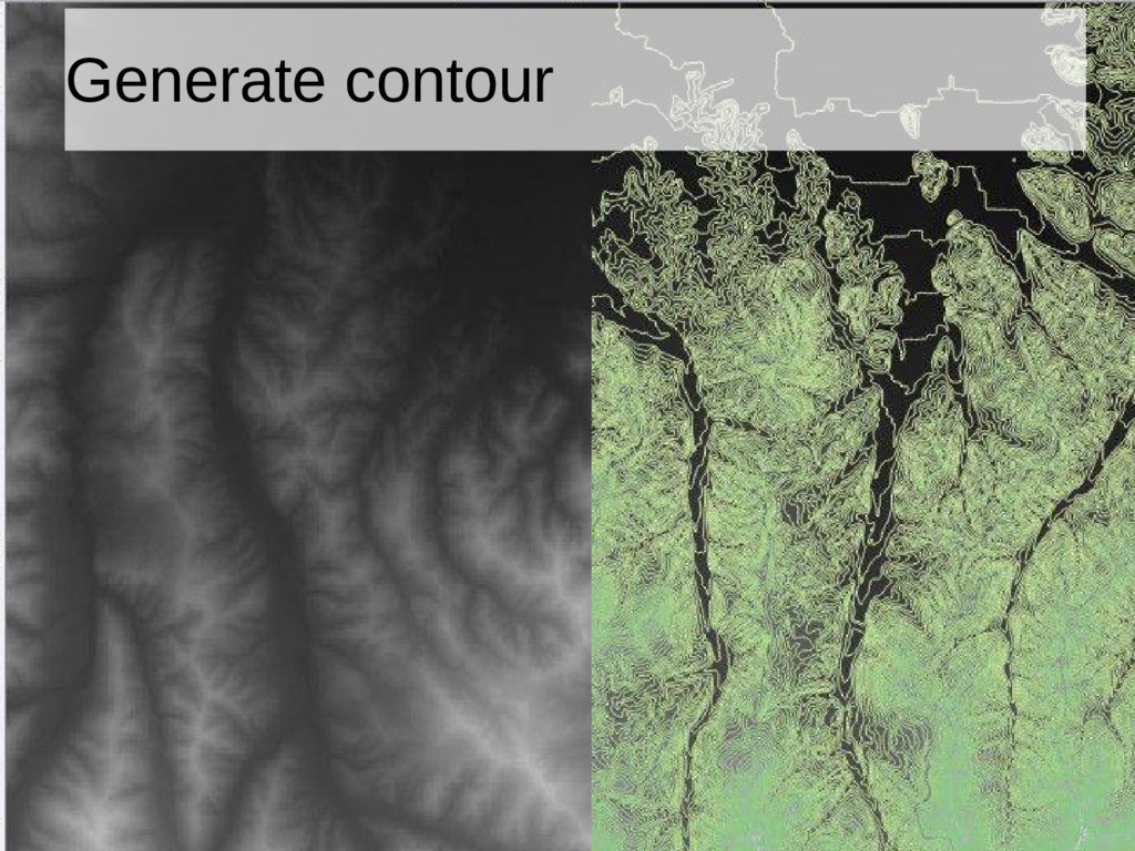
Generate contour
Import buildings and roads
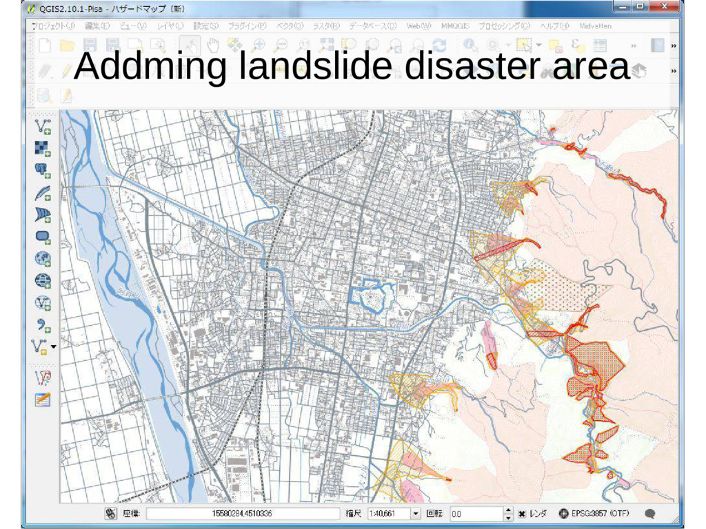
Addming landslide disaster area
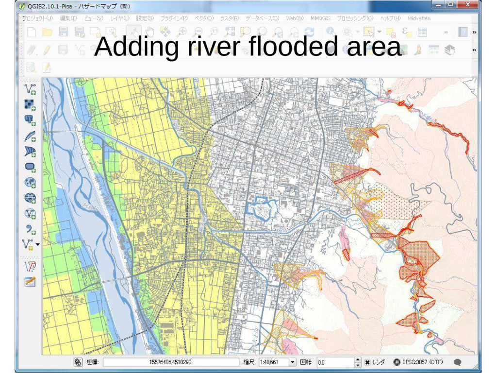
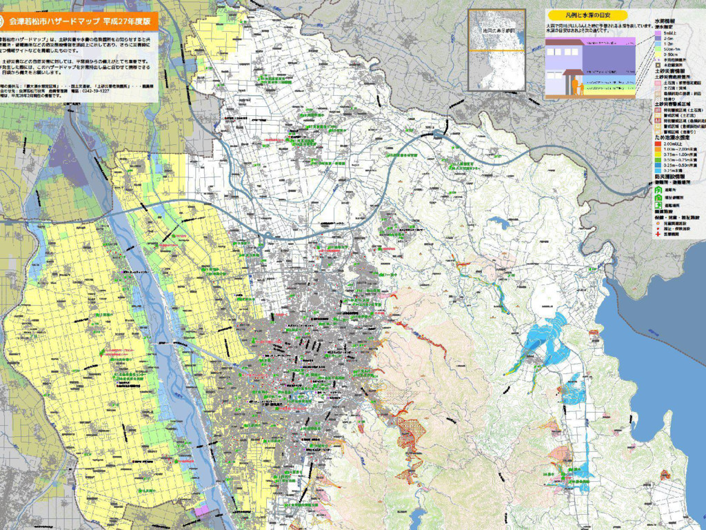
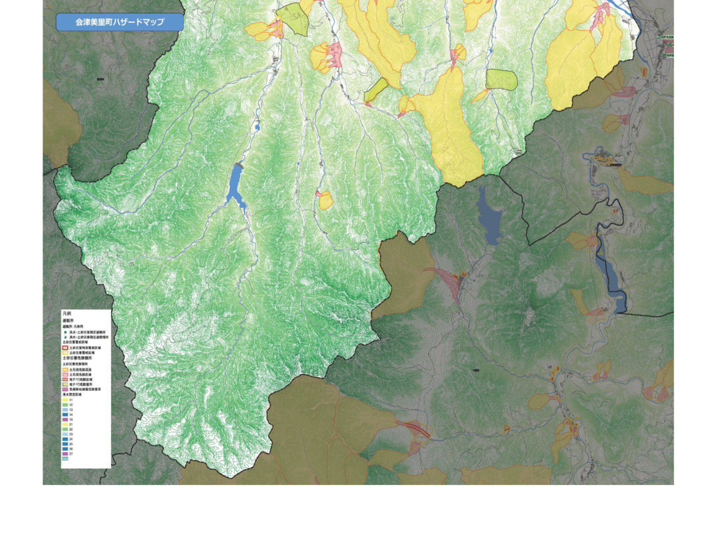
Adding river flooded area
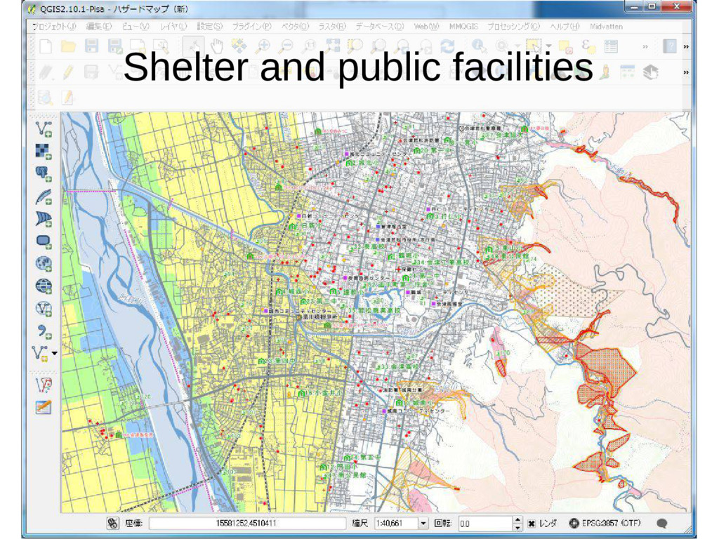
Shelter and public facilities
None
None
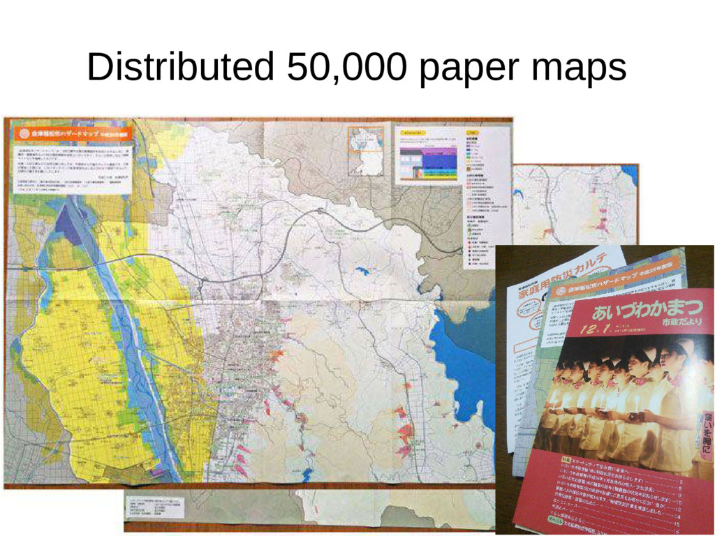
Distributed 50,000 paper maps
None
None
None
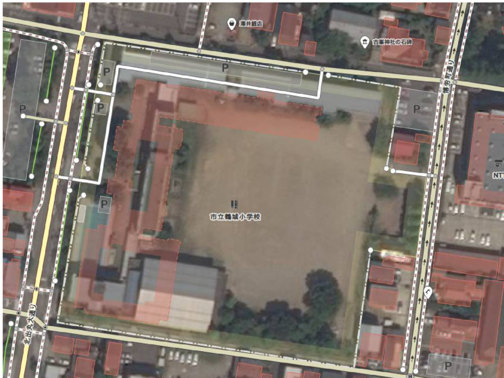
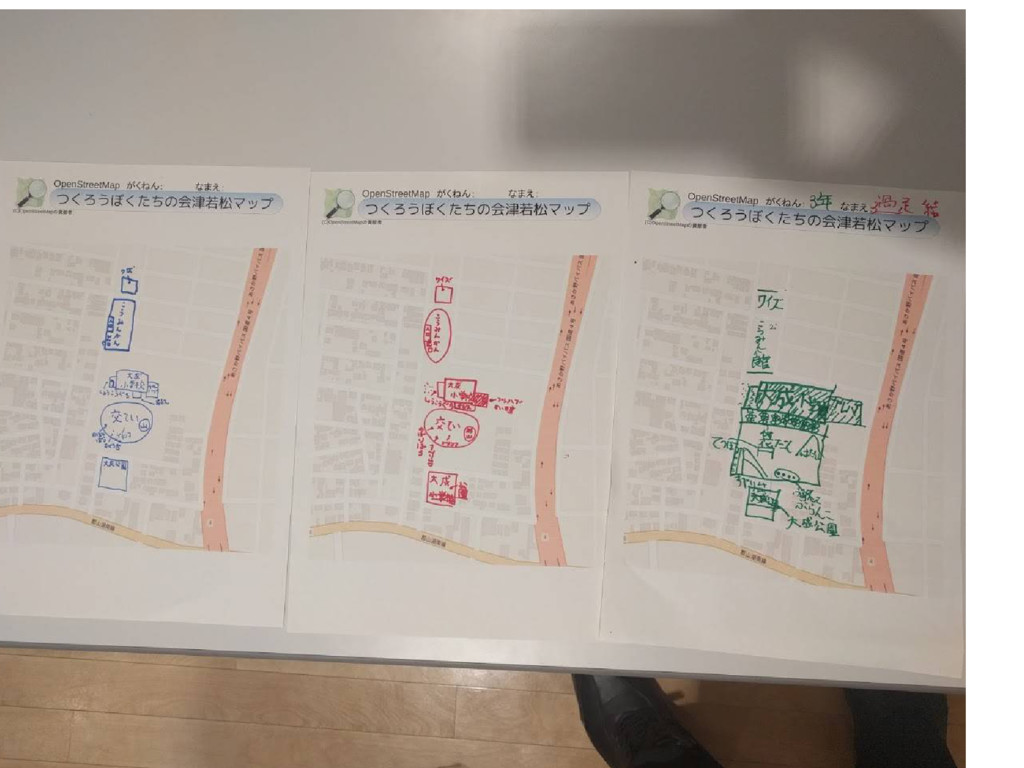
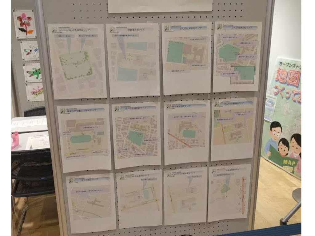
Aizu Misato Hazardmap Aizu Misato Hazardmap
None
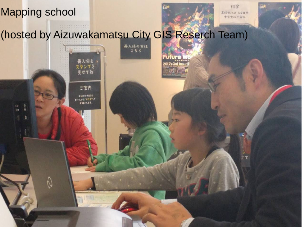
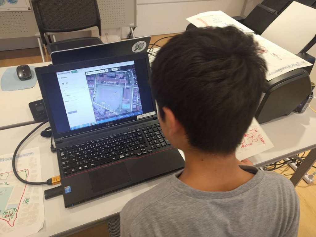
Mapping school (hosted by Aizuwakamatsu City GIS Reserch Team)
None
None
None
OSM Fukushima