$30 off During Our Annual Pro Sale. View Details »

An ArcGIS Server-based framework for oil and gas E&P decision support

An ArcGIS Server-based framework for oil and gas E&P decision support

Presented at the 2012 ESRI PUG in Houston and the 2012 OK SCAUG meeting

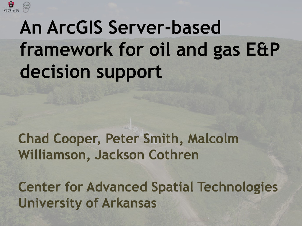
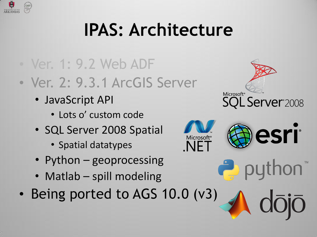
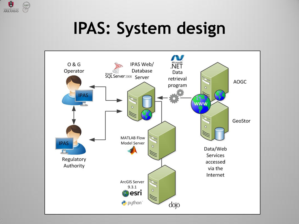
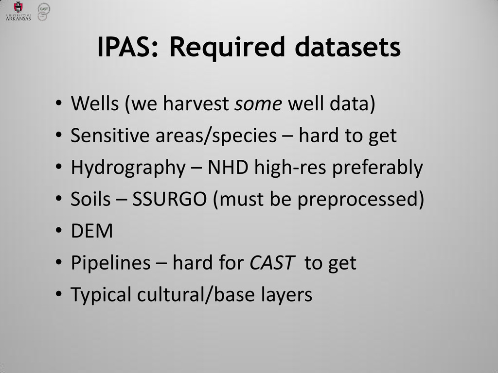
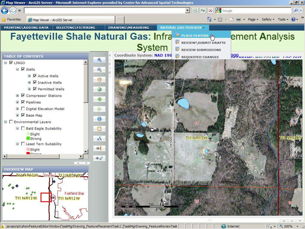
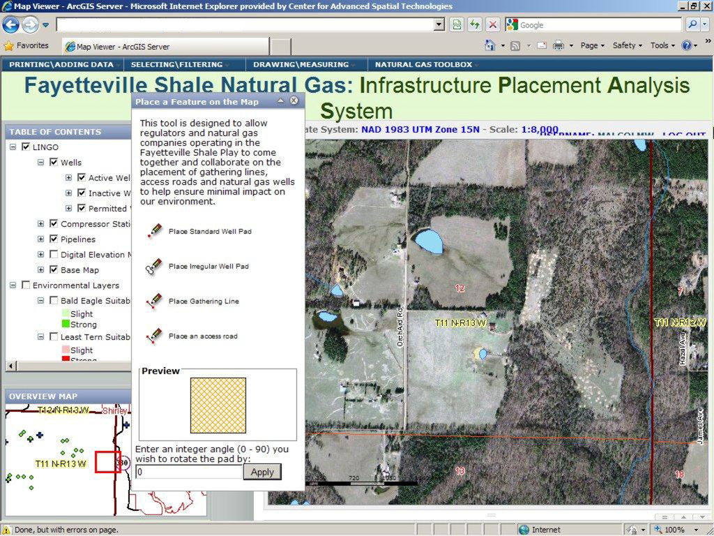
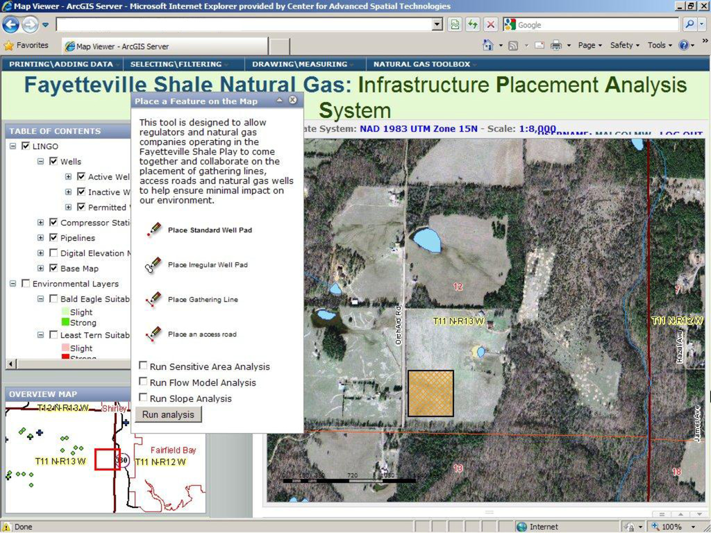
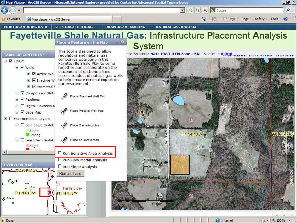
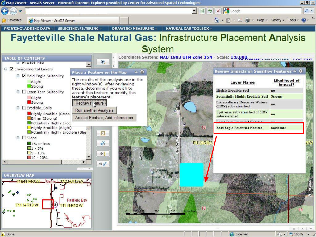
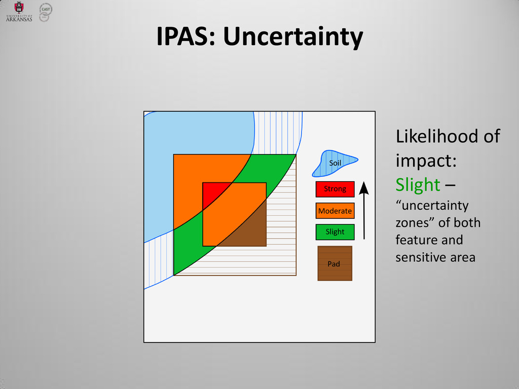
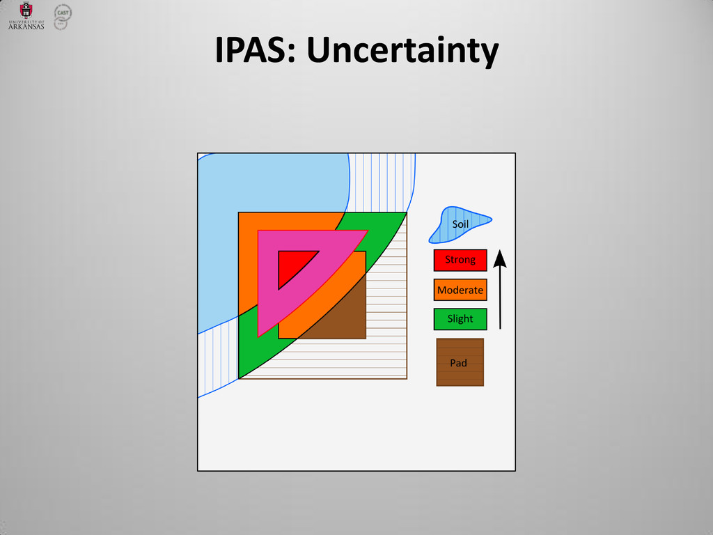
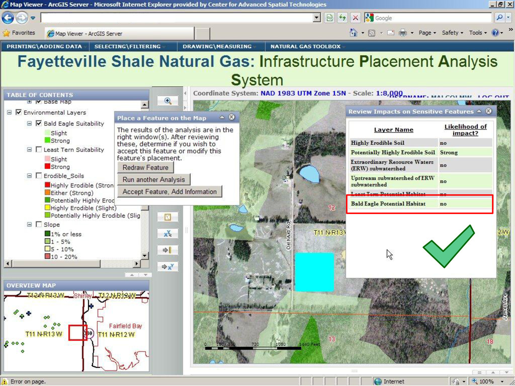
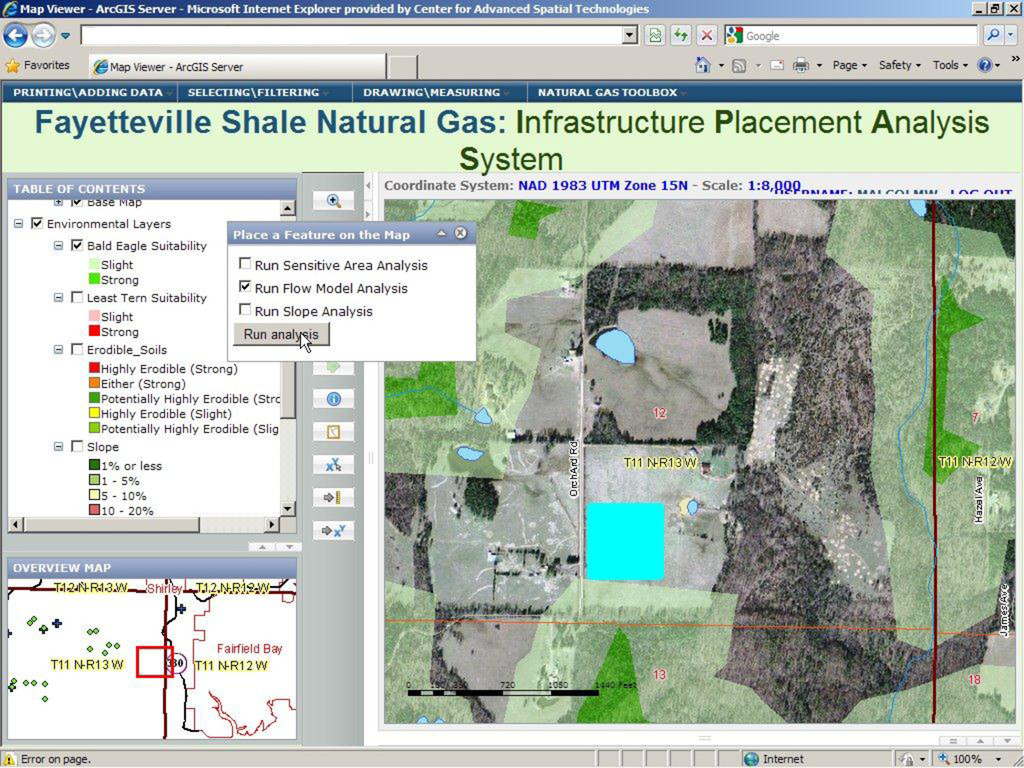
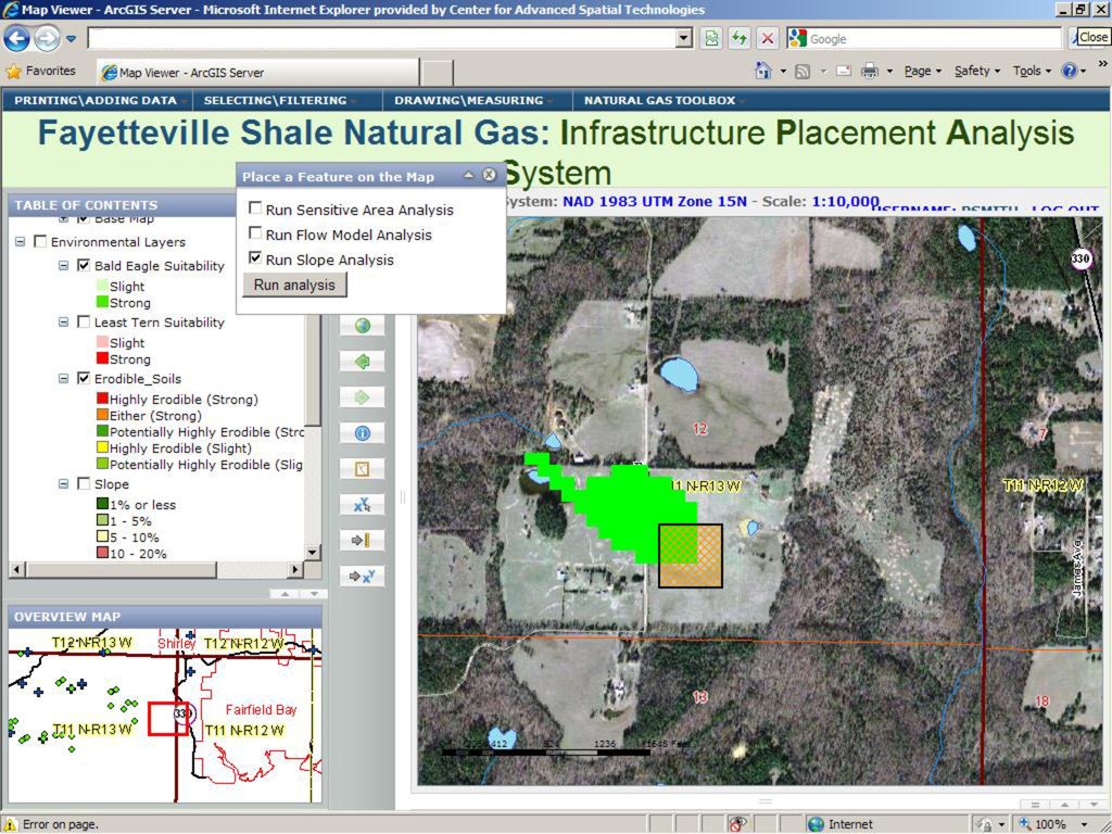
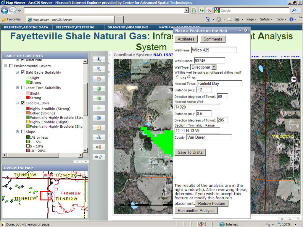
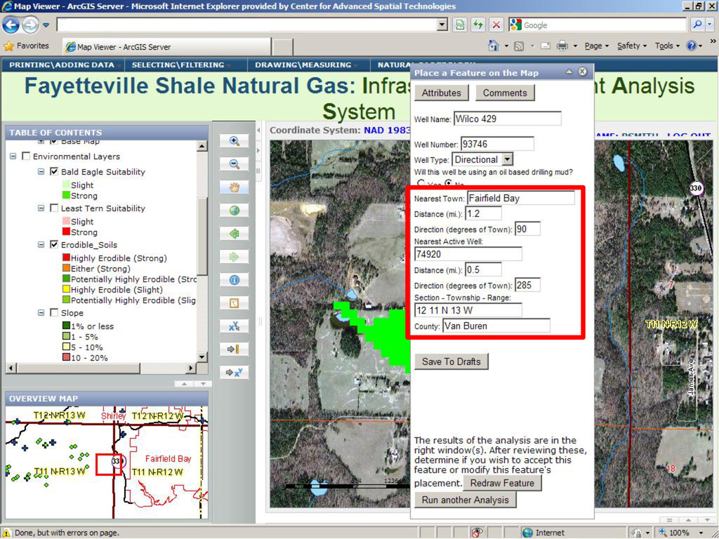
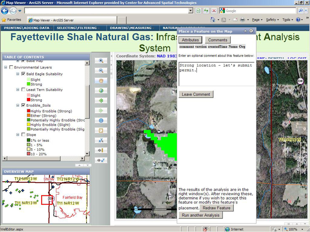
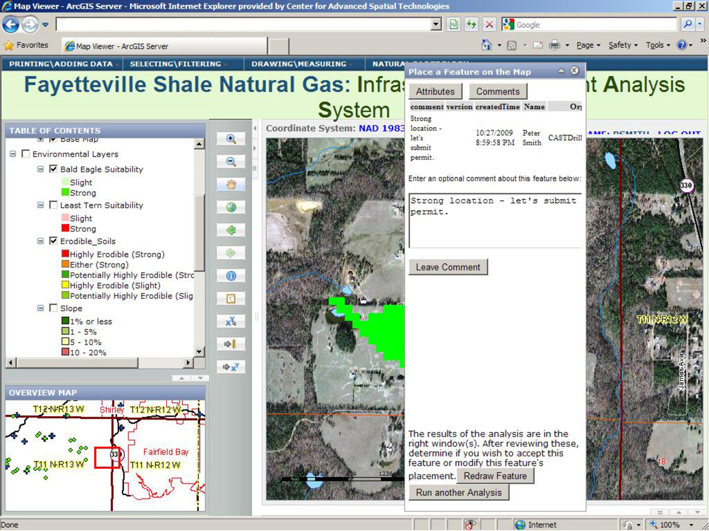
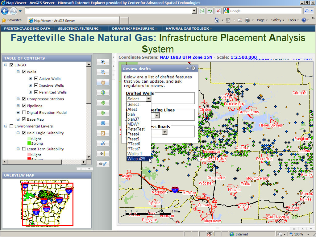
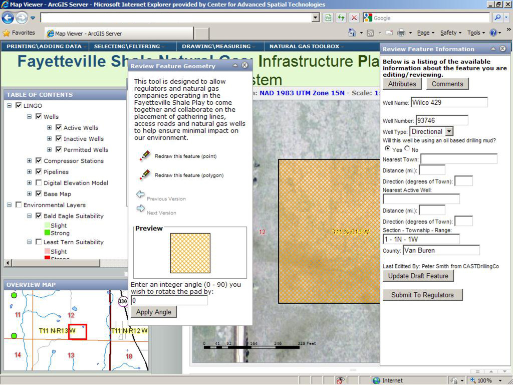
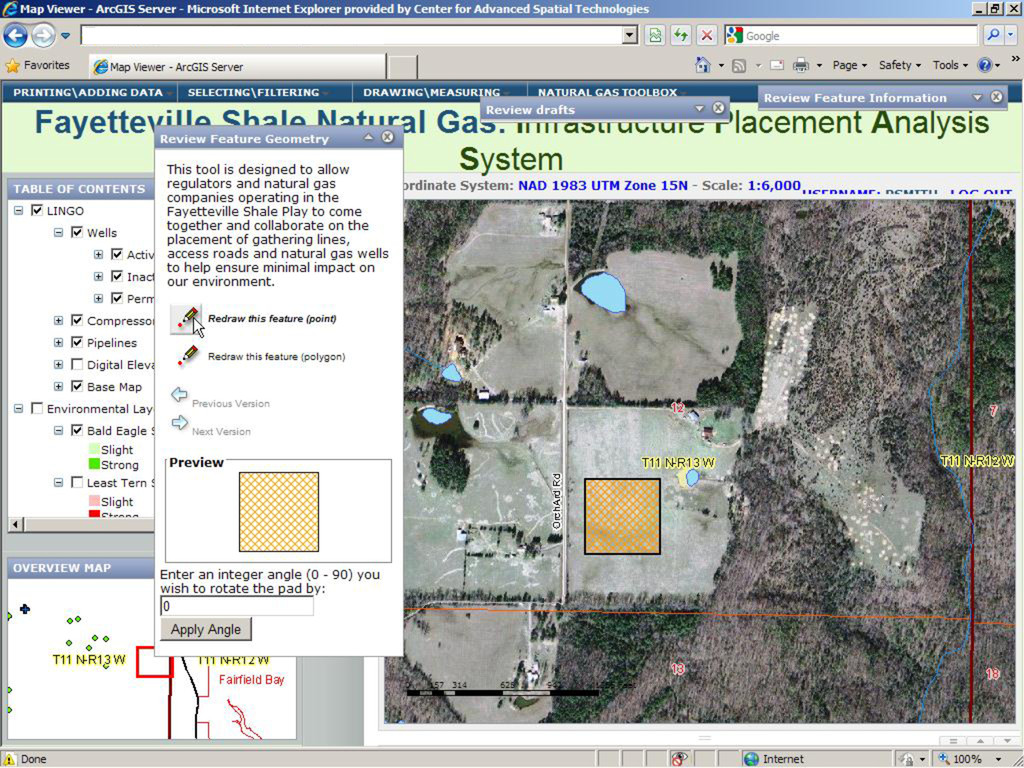
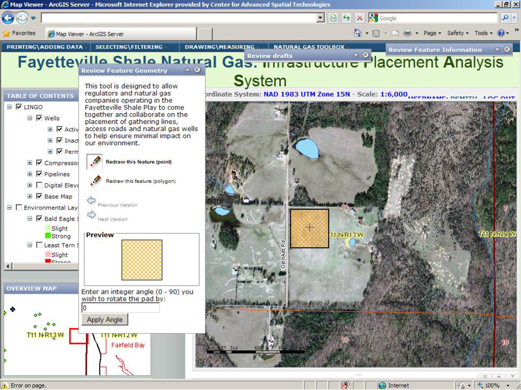
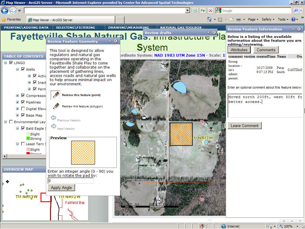
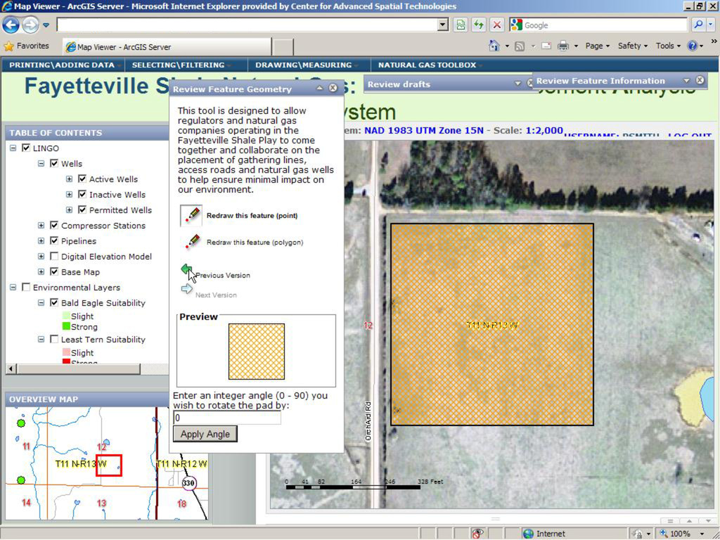
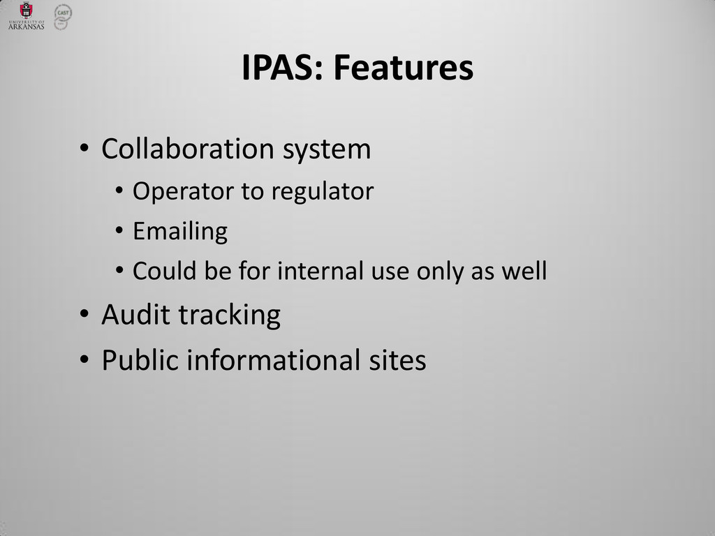
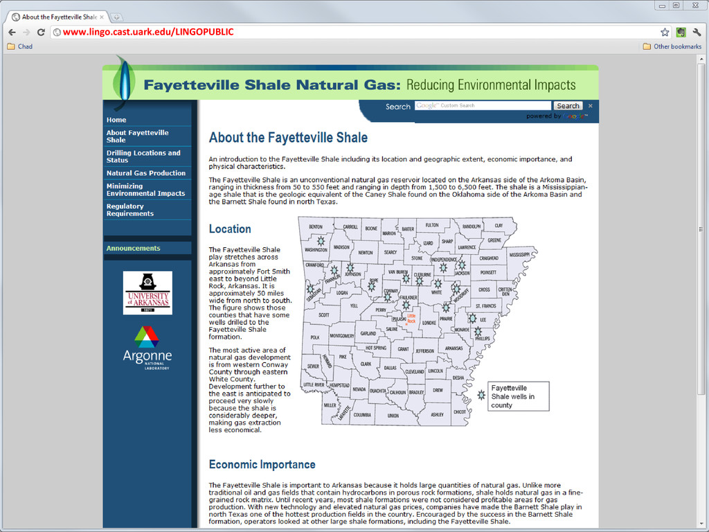
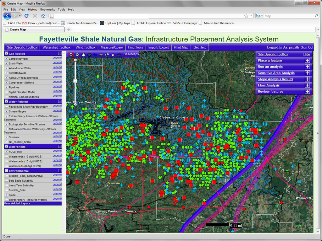
Exploration and production activities can reap significant benefits from the use of GIS-based decision support tools, yet it is rarely practical to distribute desktop GIS tools to every potential user in an organization. The Center for Advanced Spatial Technologies (CAST), in collaboration with the University of Arkansas Department of Chemical Engineering and Argonne National Lab, has created a robust framework centered on ArcGIS Server which allows the integration of geoprocessing models both from within ArcGIS and from external platforms, while providing secure, distributed access across organizations. Funded by the Department of Energy National Energy Technology Laboratory (DOE-NETL) and from The Research Partnership to Secure Energy for America (RPSEA), pilot implementations have been developed for both the Fayetteville and Haynesville shale gas plays.

Chad Cooper

May 19, 2013
Tweet

More Decks by Chad Cooper

Other Decks in Technology

Transcript

  1. An ArcGIS Server-based
    framework for oil and gas E&P
    decision support
    Chad Cooper, Peter Smith, Malcolm
    Williamson, Jackson Cothren
    Center for Advanced Spatial Technologies
    University of Arkansas

    View Slide

  2. IPAS: Infrastructure Placement
    Analysis System
    Purpose:
    Integrate current technologies and
    practices to minimize adverse
    environmental impacts

    View Slide

  3. “Closed” web-based decision support
    system (DSS)
    • Operators and regulators share:
    • Geographic view of proposed
    infrastructure
    • Environmental and sensitive area data
    • Models of potential impacts
    • Secure environment – only see your data
    IPAS: What is it?

    View Slide

  4. • GIS-based infrastructure planning
    • well pads, gathering lines, lease roads
    • use sensitive and environmental data
    • Increased communication efficiency
    • Speeds up permitting = $$$ saved
    • Increased transparency between
    regulators and producers
    • User-friendly interface
    IPAS: What does it provide?

    View Slide

  5. • Ver. 1: 9.2 Web ADF
    • Ver. 2: 9.3.1 ArcGIS Server
    • JavaScript API
    • Lots o’ custom code
    • SQL Server 2008 Spatial
    • Spatial datatypes
    • Python – geoprocessing
    • Matlab – spill modeling
    • Being ported to AGS 10.0 (v3)
    IPAS: Architecture

    View Slide

  6. IPAS: System design

    View Slide

  7. • Wells (we harvest some well data)
    • Sensitive areas/species – hard to get
    • Hydrography – NHD high-res preferably
    • Soils – SSURGO (must be preprocessed)
    • DEM
    • Pipelines – hard for CAST to get
    • Typical cultural/base layers
    IPAS: Required datasets

    View Slide

  8. View Slide

  9. View Slide

  10. View Slide

  11. View Slide

  12. View Slide

  13. View Slide

  14. View Slide

  15. View Slide

  16. IPAS: Uncertainty
    • An attempt to deal with inaccuracies in
    spatial data
    • Used in sensitive area analyses and feature
    digitization (further zoomed out, greater
    the uncertainty)
    • 90% confidence interval as defined by
    National Map Accuracy Standards

    View Slide

  17. “For maps on publication scales > 1:20,000,
    not more than 10% of the points shall be in
    error by more than 1/30 inch, measured on
    the publication scale; for maps on publication
    scales of <= 1:20,000, 1/50 inch”
    IPAS: Uncertainty and National
    Map Accuracy Standards

    View Slide

  18. http://www.flickr.com/photos/b-tal/163450213/

    View Slide

  19. IPAS: Uncertainty
    ℎ ×
    12 ℎ/ =

    View Slide

  20. Soils: digitized at 24K  40 foot inner and
    outer buffer
    IPAS: Uncertainty
    1
    50 × 24,000
    12 = 40
    ℎ ×
    12 ℎ/ =

    View Slide

  21. IPAS: Uncertainty

    View Slide

  22. IPAS: Uncertainty

    View Slide

  23. IPAS: Uncertainty

    View Slide

  24. IPAS: Uncertainty

    View Slide

  25. IPAS: Uncertainty

    View Slide

  26. IPAS: Uncertainty

    View Slide

  27. IPAS: Uncertainty
    Likelihood of
    impact

    View Slide

  28. IPAS: Uncertainty
    Likelihood of
    impact:
    Strong –
    “certain” area of
    feature and
    “certain”
    sensitive area
    feature = pad
    sensitive area = soil

    View Slide

  29. IPAS: Uncertainty
    Likelihood of
    impact:
    Moderate –
    “certain” area of
    feature and
    “uncertain”
    sensitive area (1),
    or “uncertain”
    area of feature
    and “certain”
    sensitive area (2)
    1
    2

    View Slide

  30. IPAS: Uncertainty
    Likelihood of
    impact:
    Slight –
    “uncertainty
    zones” of both
    feature and
    sensitive area

    View Slide

  31. IPAS: Uncertainty

    View Slide

  32. View Slide

  33. View Slide

  34. View Slide

  35. View Slide

  36. View Slide

  37. View Slide

  38. View Slide

  39. View Slide

  40. View Slide

  41. View Slide

  42. View Slide

  43. View Slide

  44. View Slide

  45. View Slide

  46. View Slide

  47. View Slide

  48. • Collaboration system
    • Operator to regulator
    • Emailing
    • Could be for internal use only as well
    • Audit tracking
    • Public informational sites
    IPAS: Features

    View Slide

  49. www.lingo.cast.uark.edu/LINGOPUBLIC

    View Slide

  50. IPAS: New Directions
    Haynesville Shale play
    • Funded through Houston Advanced
    Research Center/Environmentally Friendly
    Drilling program
    • Port the app across plays
    • Challenges of multi-state regulations and
    data

    View Slide

  51. IPAS: New Directions
    Water modeling in the Fayetteville play
    • Blacklands Research & Extension Center,
    Texas A&M – (modified) SWAT model
    • DOE funding through NETL
    • Focus on surface water
    • AR Natural Resources Commission
    • Improved understanding of available water
    • Faster permitting with peace of mind

    View Slide

  52. IPAS: New Directions
    NHD high-resolution water layer
    (yellow).
    Water (blue) extracted from the color-
    infrared imagery. Object-based
    classification using Trimble eCognition.

    View Slide

  53. View Slide

  54. Wanna beta test?
    [email protected]
    cast.uark.edu

    View Slide