Upgrade to Pro — share decks privately, control downloads, hide ads and more …

Automated Impervious Surface Classification and Mapping

Automated Impervious Surface Classification and Mapping

Presented by:
Ajay Jadhav - CDM Smith

More Decks by Texas Natural Resources Information System

Other Decks in Technology

Transcript

  1. Automated  Impervious  Surface   Classifica6on  and  Mapping   Stormwater  Management

     and  Beyond   October  22,  2014   Ajay  Jadhav   CDM  Smith   Aus6n  ,  TX           Texas  GIS  Forum  
  2. Agenda   •  Impervious  Surface  Areas  (ISA)   •  ApplicaCons

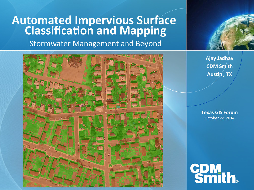
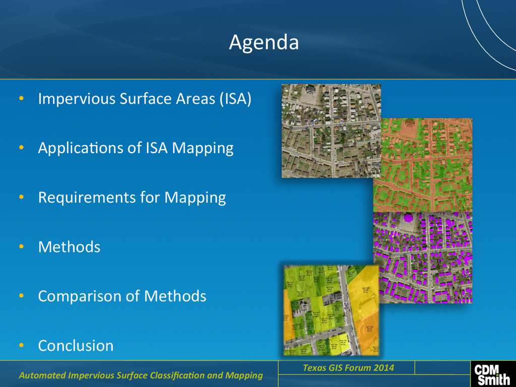
     of  ISA  Mapping   •  Requirements  for  Mapping   •  Methods   •  Comparison  of  Methods   •  Conclusion     Automated  Impervious  Surface  Classifica6on  and  Mapping     Texas  GIS  Forum  2014    
  3. What  are  Impervious  Surfaces  and  why  do  we  care?  

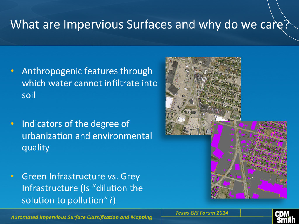
    •  Anthropogenic  features  through   which  water  cannot  infiltrate  into   soil   •  Indicators  of  the  degree  of   urbanizaCon  and  environmental   quality   •  Green  Infrastructure  vs.  Grey   Infrastructure  (Is  “diluCon  the   soluCon  to  polluCon”?)     Automated  Impervious  Surface  Classifica6on  and  Mapping     Texas  GIS  Forum  2014    
  4. Need  for  an  Impervious  Layer   •  Hydrologic  Modeling  

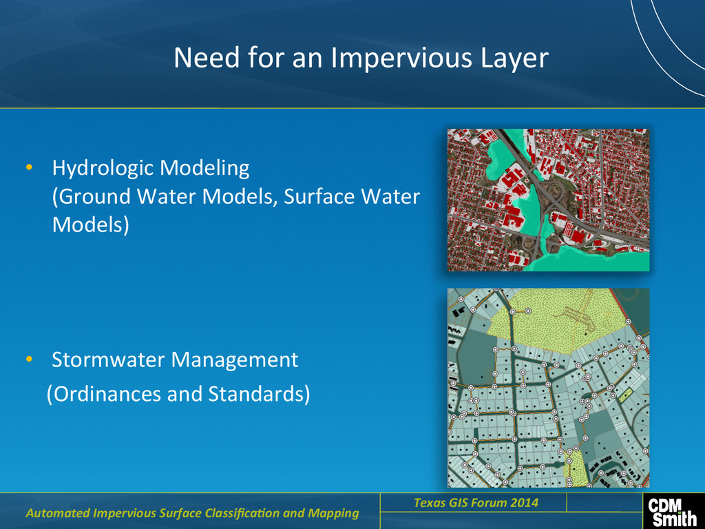
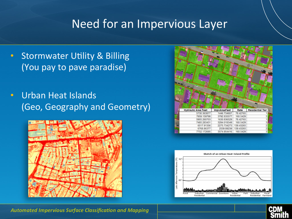
                                              (Ground  Water  Models,  Surface  Water   Models)   •  Stormwater  Management          (Ordinances  and  Standards)       Automated  Impervious  Surface  Classifica6on  and  Mapping     Texas  GIS  Forum  2014    
  5. Need  for  an  Impervious  Layer   •  Stormwater  UClity  &

     Billing             (You  pay  to  pave  paradise)   •  Urban  Heat  Islands                                         (Geo,  Geography  and  Geometry)   Automated  Impervious  Surface  Classifica6on  and  Mapping  
  6. Need  for  an  Impervious  Layer   Answering  the  Whys  and

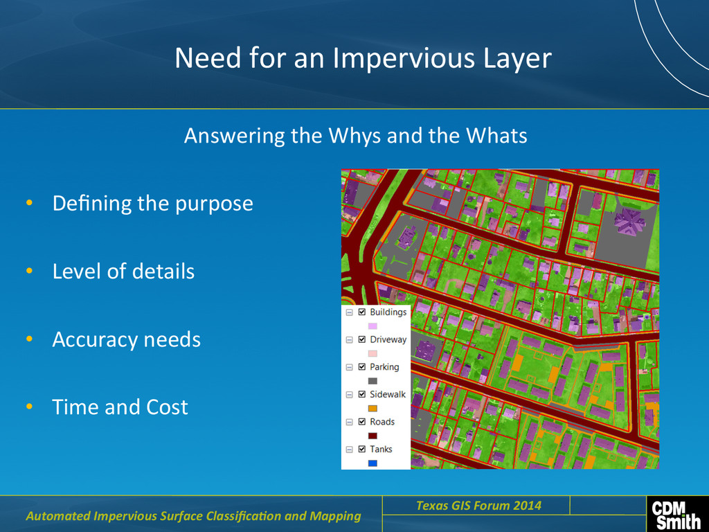
     the  Whats   •  Defining  the  purpose   •  Level  of  details   •  Accuracy  needs   •  Time  and  Cost     Automated  Impervious  Surface  Classifica6on  and  Mapping     Texas  GIS  Forum  2014    
  7. Approaches  to  ISA  Layer  Development   •  Field  based  survey

     with  GPS     •  Manual  digiCzaCon   •  Automated  Approaches   •  Hybrid  Approaches     Automated  Impervious  Surface  Classifica6on  and  Mapping     Texas  GIS  Forum  2014    
  8. ConsideraCons  for  Field  Survey   •  Planimetric  Mapping   • 

    Time  &  Budget   •  What  other  data  is  needed?   •  LisCng  features  to  be  captured     Automated  Impervious  Surface  Classifica6on  and  Mapping     Texas  GIS  Forum  2014    
  9.   ConsideraCons  for  Manual  DigiCzing     •  Accuracy  

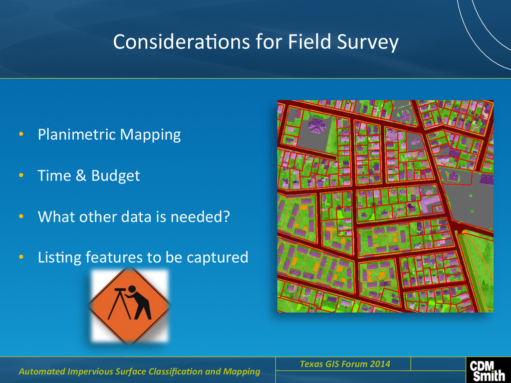
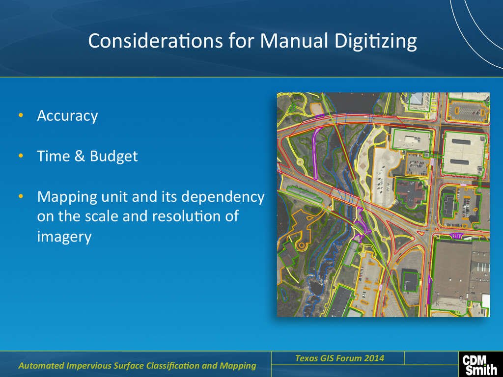
    •  Time  &  Budget   •  Mapping  unit  and  its  dependency   on  the  scale  and  resoluCon  of   imagery     Automated  Impervious  Surface  Classifica6on  and  Mapping     Texas  GIS  Forum  2014    
  10. ConsideraCons  for  Automated  Approach   •  Data  -­‐  Imagery  (Satellite

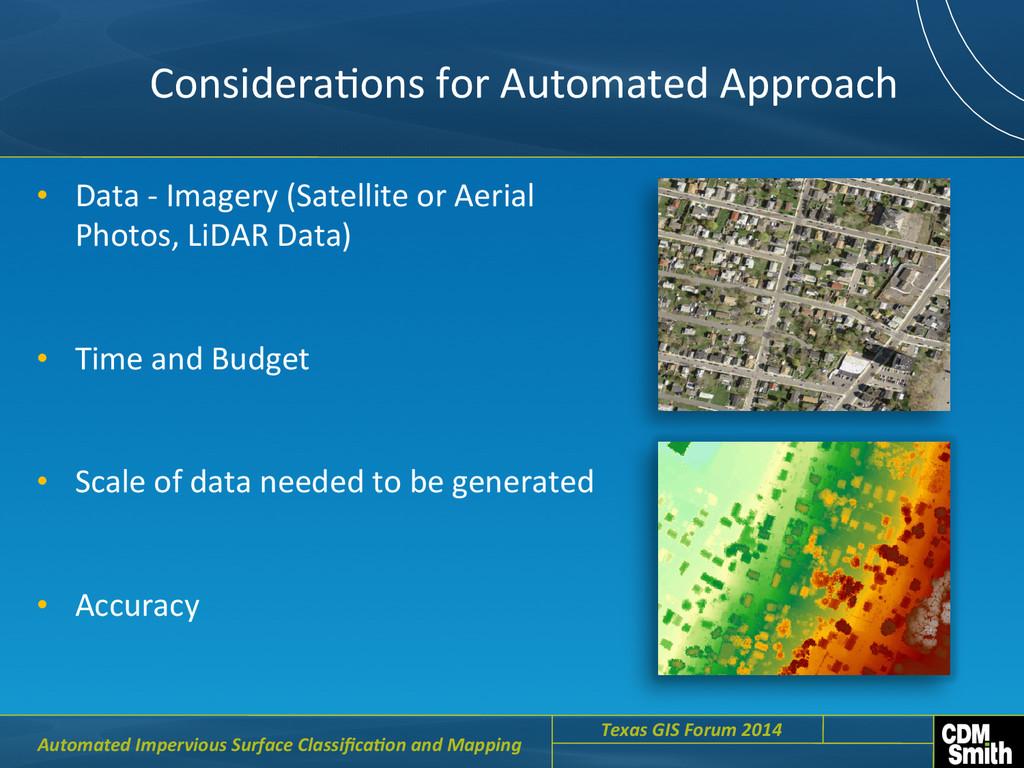
     or  Aerial   Photos,  LiDAR  Data)   •  Time  and  Budget   •  Scale  of  data  needed  to  be  generated   •  Accuracy     Automated  Impervious  Surface  Classifica6on  and  Mapping     Texas  GIS  Forum  2014    
  11. Automated  Approach   •  Available  Data   •  Technology  

                 -­‐  So[ware  tools              -­‐  ClassificaCon  methods    (Pixel  based  vs  Object  Based)     Automated  Impervious  Surface  Classifica6on  and  Mapping     Texas  GIS  Forum  2014    
  12. Automated  Approach   Pixel  Based  ClassificaCon   (ArcGIS)   Pixel

     Based  ClassificaCon     (Feature  Analyst)                                                 Automated  Impervious  Surface  Classifica6on  and  Mapping     Texas  GIS  Forum  2014    
  13. ClassificaCon  Accuracy  of  Automated  Approach     Overall  Accuracy  

    90.67%   Kappa  Coefficient   0.82   Classified  Pervious   0.88   Classified  Impervious   0.92   Producers  Accuracy   Accuracy  %   Overall  Accuracy   83.20%   Kappa  Coefficient   0.70   Classified  Pervious   0.68   Classified  Impervious   0.93   Producers  Accuracy   Accuracy  %   (ArcGIS–  Pixel  Based)     (Feature  Analyst–  Pixel  Based)       Automated  Impervious  Surface  Classifica6on  and  Mapping     Texas  GIS  Forum  2014    
  14. Automated  Approach                

                 Object  Based  ClassificaCon  (ERDAS  Imagine  ObjecCve)     Automated  Impervious  Surface  Classifica6on  and  Mapping     Texas  GIS  Forum  2014    
  15. ClassificaCon  Accuracy  of  Automated  Approach     Overall  Accuracy  

    92.3  %   Kappa  Coefficient   0.88   Automated  Impervious  Surface  Classifica6on  and  Mapping   Classified  Pervious   0.86   Classified  Impervious   0.95   Producers  Accuracy   Accuracy  %     (ERDAS  –  Pixel  Based  and  Object  Based)     Overall  Accuracy   89  %   Kappa  Coefficient   0.78   Classified  Pervious   0.79   Classified  Impervious   0.94   Producers  Accuracy   Accuracy  %  
  16. Automated  Approach   Automated  Feature  ExtracCon     Automated  Impervious

     Surface  Classifica6on  and  Mapping     Texas  GIS  Forum  2014    
  17. ClassificaCon  Accuracy  of  Automated  Approach     Overall  Accuracy  

    87%   Kappa  Coefficient   0.76   Classified  Pervious   0.92   Classified  Impervious   0.84   Producers  Accuracy   Accuracy  %   Overall  Accuracy   97%   Kappa  Coefficient   0.95   Classified  Pervious   NA   Classified  Impervious   NA   Producers  Accuracy   Accuracy  %   (Planimetric)     (Manual  DigiCze)       Automated  Impervious  Surface  Classifica6on  and  Mapping     Texas  GIS  Forum  2014    
  18. What's  Best  For  Me?   •  Accuracy     • 

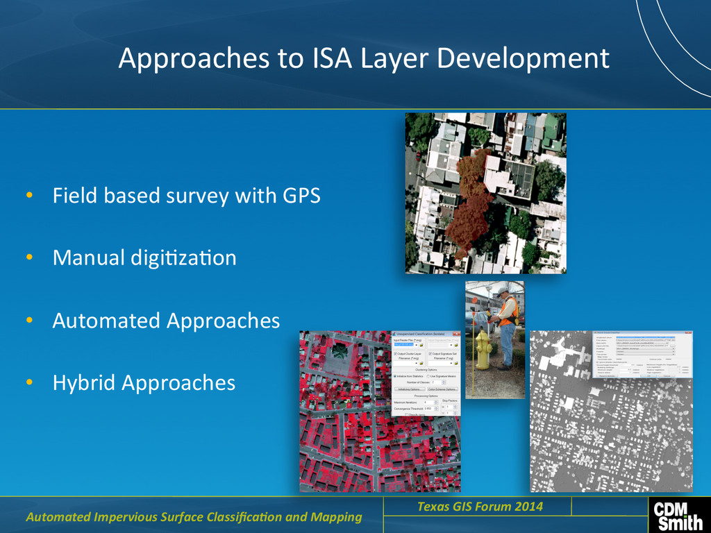
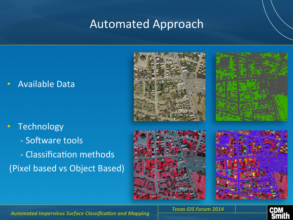
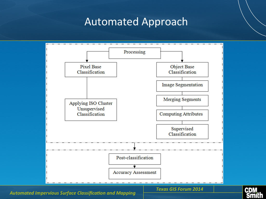
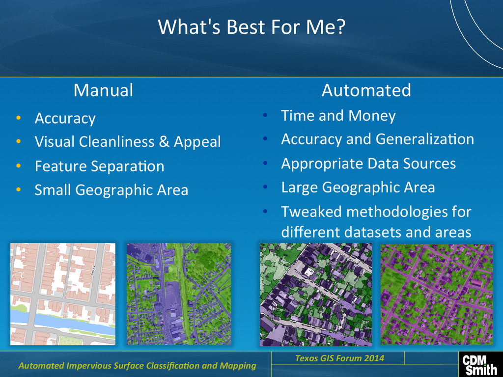
    Visual  Cleanliness  &  Appeal   •  Feature  SeparaCon   •  Small  Geographic  Area   •  Time  and  Money   •  Accuracy  and  GeneralizaCon   •  Appropriate  Data  Sources   •  Large  Geographic  Area   •  Tweaked  methodologies  for   different  datasets  and  areas   Automated   Manual     Automated  Impervious  Surface  Classifica6on  and  Mapping     Texas  GIS  Forum  2014    
  19. QuesCons   Ajay Jadhav CDM Smith Austin, TX [email protected]  

    Automated  Impervious  Surface  Classifica6on  and  Mapping     Texas  GIS  Forum  2014