week, we’ll talk about what we don’t know…and how to deal with it. Today, we’ll talk about UNCERTAINTY and ERRORS in raster data. Next time, we’ll talk about ERROR MODELING and CHANGE DETECTION.
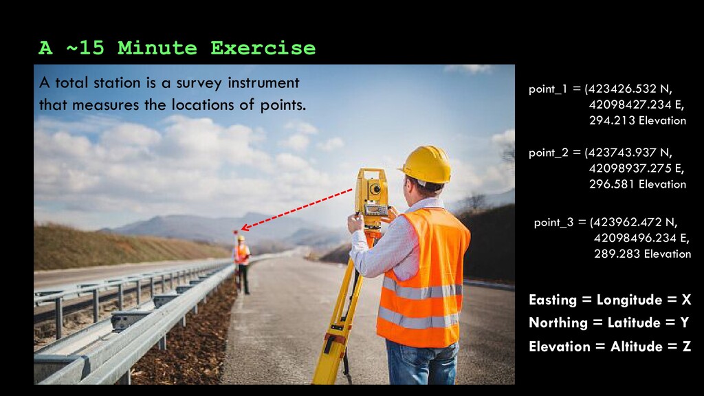
instrument that measures the locations of points. point_1 = (423426.532 N, 42098427.234 E, 294.213 Elevation point_2 = (423743.937 N, 42098937.275 E, 296.581 Elevation point_3 = (423962.472 N, 42098496.234 E, 289.283 Elevation Northing = Latitude = Y Easting = Longitude = X Elevation = Altitude = Z
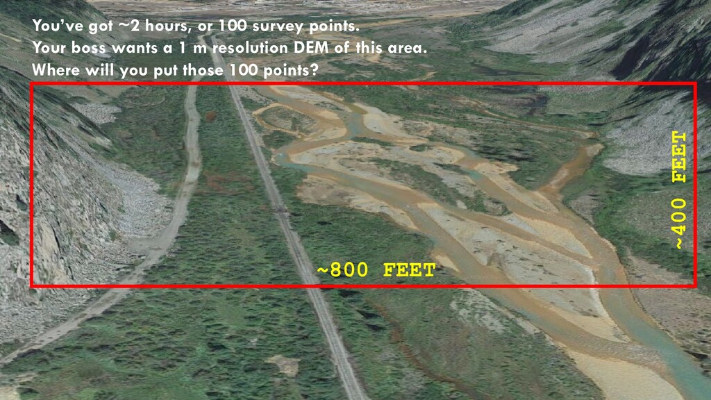
time to survey 100 total station points. A total station is a survey instrument that measures the locations of points. point_1 = (423426.532 N, 42098427.234 E, 294.213 Elevation point_2 = (423743.937 N, 42098937.275 E, 296.581 Elevation point_3 = (423962.472 N, 42098496.234 E, 289.283 Elevation Northing = Latitude = Y Easting = Longitude = X Elevation = Altitude = Z
wants a 1 m resolution DEM of this area. Where will you put those 100 points? ~800 FEET ~400 FEET tinyurl.com/yyyq5y42 (in class) tinyurl.com/y6t435fa (at home)
in accuracy Remotely Sensed/Aerial Surveys: Ground-Based/In Situ Surveys: Boat-Based/Bathymetric Surveys: Airborne light detection and ranging (e.g., lidar): +/- 12-25 cm Aerial photogrammetry: +/- 10-15 cm Total Station: +/- 2-10 cm Real-Time Kinematic Global Positioning System (RTK-GPS): +/- 3-12 cm Terrestrial Lidar: +/- 0.5-4 cm Multibeam and Singlebeam sonar: on par with terrestrial lidar
in accuracy Remotely Sensed/Aerial Surveys: Ground-Based/In Situ Surveys: Boat-Based/Bathymetric Surveys: Airborne light detection and ranging (e.g., lidar): +/- 12-25 cm Aerial photogrammetry: +/- 10-15 cm Total Station: +/- 2-10 cm Real-Time Kinematic Global Positioning System (RTK-GPS): +/- 3-12 cm Terrestrial Lidar: +/- 0.5-4 cm Multibeam and Singlebeam sonar: on par with terrestrial lidar
Random sampling randomly pick spots and survey at those locations Feature-based sampling: more effort devoted to particular features (slopes, trees, river banks, cliffs) Uniform grid sampling: cover the area in a regular grid of survey points LEVEL OF THOUGHT REQUIRED
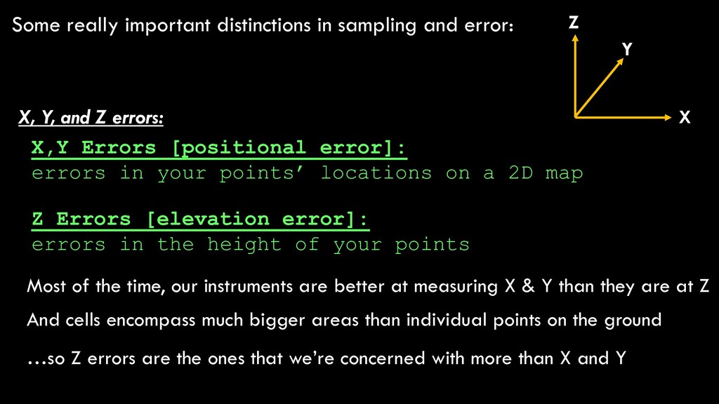
and Z errors: X,Y Errors [positional error]: errors in your points’ locations on a 2D map Z Errors [elevation error]: errors in the height of your points
and Z errors: X,Y Errors [positional error]: errors in your points’ locations on a 2D map Z Errors [elevation error]: errors in the height of your points Most of the time, our instruments are better at measuring X & Y than they are at Z And cells encompass much bigger areas than individual points on the ground …so Z errors are the ones that we’re concerned with more than X and Y X Y Z
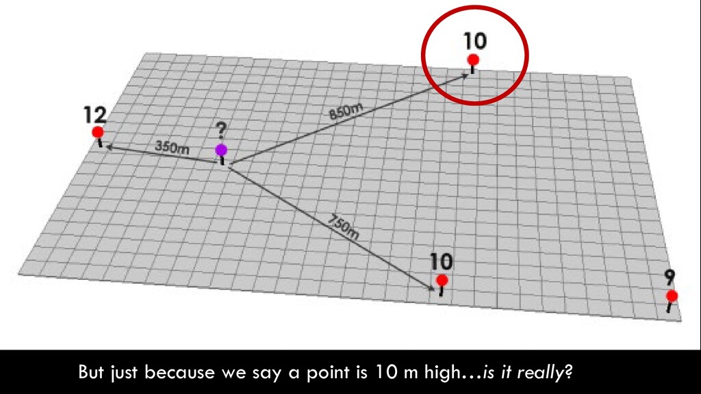
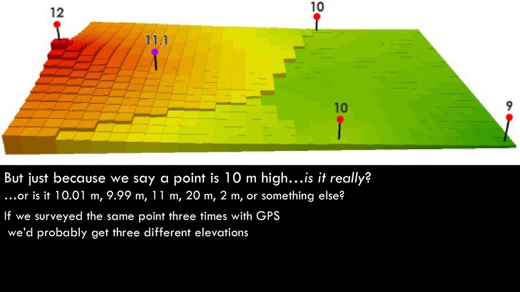
high…is it really? …or is it 10.01 m, 9.99 m, 11 m, 20 m, 2 m, or something else? If we surveyed the same point three times with GPS we’d probably get three different elevations
high…is it really? …or is it 10.01 m, 9.99 m, 11 m, 20 m, 2 m, or something else? Because our rasters are built from point measurements every raster cell inherits those points’ errors! If we surveyed the same point three times with GPS we’d probably get three different elevations
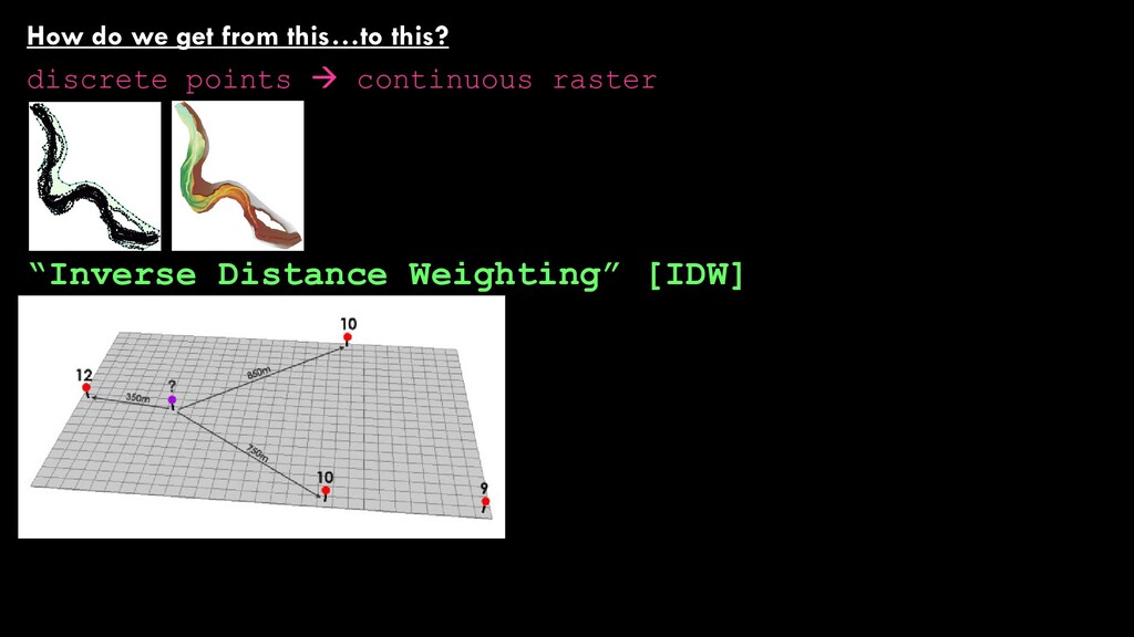
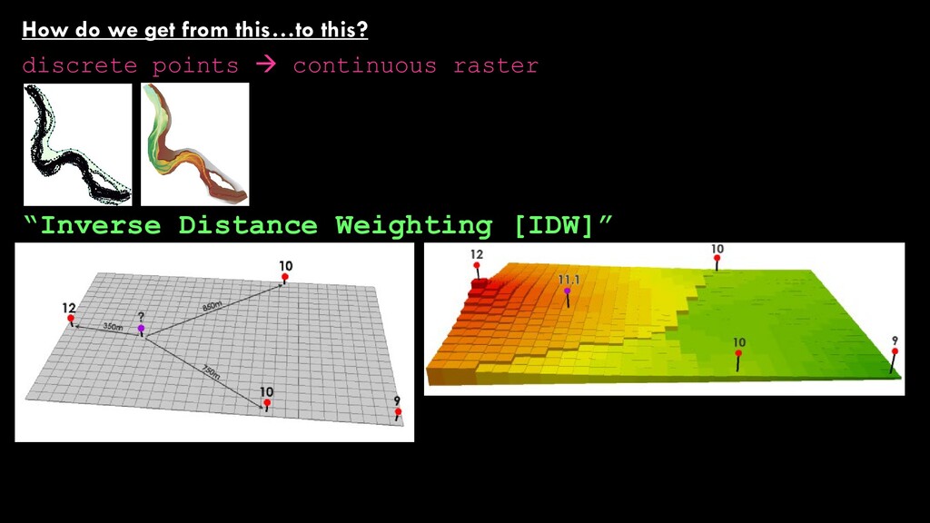
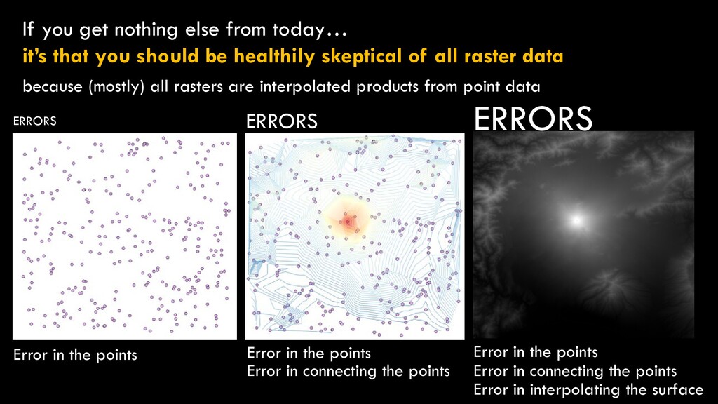
should be healthily skeptical of all raster data because (mostly) all rasters are interpolated products from point data Error in the points Error in the points Error in connecting the points Error in interpolating the surface Error in the points Error in connecting the points ERRORS ERRORS ERRORS
should be healthily skeptical of all raster data because (mostly) all rasters are interpolated products from point data Error in the points Error in the points Error in connecting the points Error in interpolating the surface Error in the points Error in connecting the points ERRORS ERRORS ERRORS