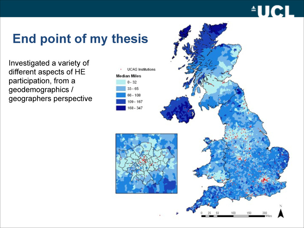
• A Spatio-Temporal Analysis of Access to Higher Education (aprox. 1 year ago) – Three Themes • Momentum • Unfinished Business • Future Directions – Unconventional • PhD – Spent 2 years in Cheltenham at UCAS – KTP • Post-Doc – It isn’t really one
writing lots – Use this to write papers, grant / book proposals • Disillusion with PhD topic – Good to put it down for a while and do something else • 2 Papers on E-Society – Online validation – Digital deprivation V material deprivation • 2 Papers on Neo-Geography
which you wanted to cover but didn’t have time / room – Methodological • Alternate algorithms to k-means in creation geodemographics • Geographic representations of cluster instability – related to initial seed locations • Alternate optimisation procedures –measures of spatial rather than social similarity – Domain Specific • Course Clusters – Overarching Themes • Future of area classification – Real Time Geodemographics
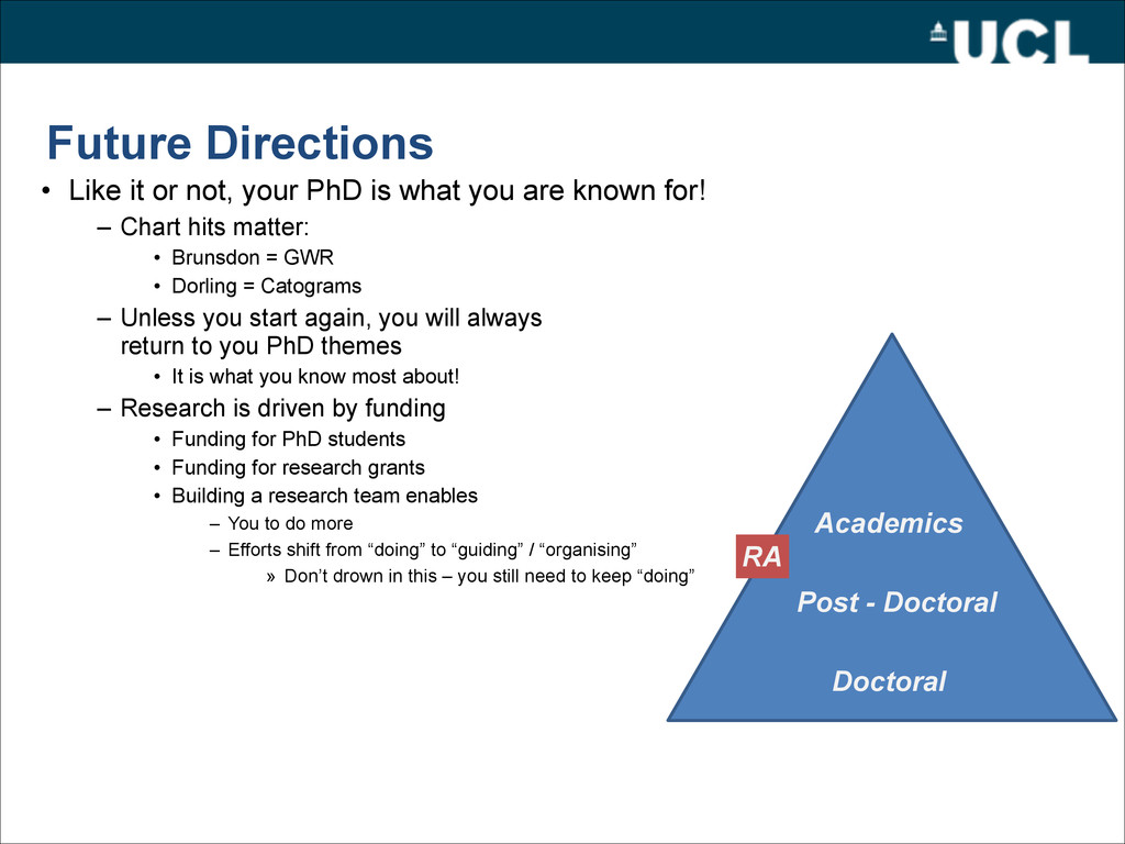
what you are known for! – Chart hits matter: • Brunsdon = GWR • Dorling = Catograms – Unless you start again, you will always return to you PhD themes • It is what you know most about! – Research is driven by funding • Funding for PhD students • Funding for research grants • Building a research team enables – You to do more – Efforts shift from “doing” to “guiding” / “organising” » Don’t drown in this – you still need to keep “doing” Doctoral Post - Doctoral Academics RA
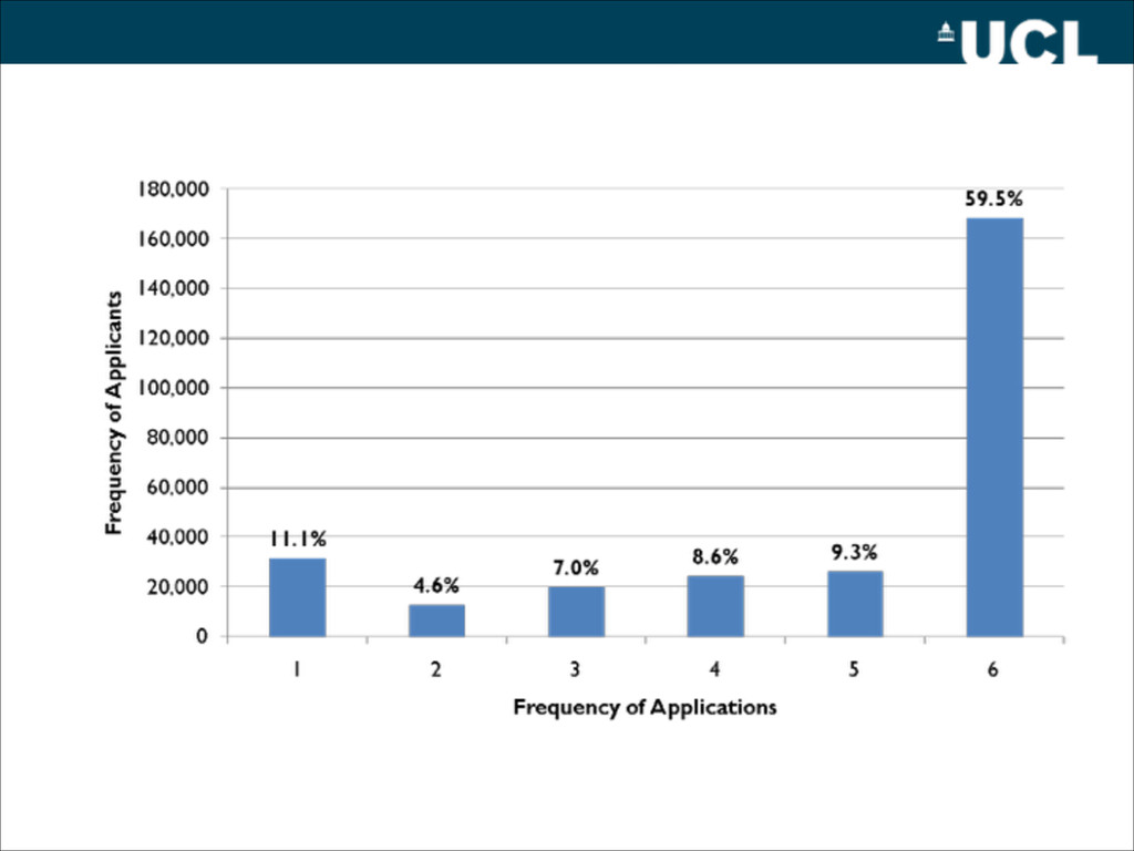
apply for a small grant – essentially 1 researcher @ FEC funding + expenses • Very competitive – Over 200 applications last year – ~13% success • Spatial interaction modelling, geodemographics and widening participation in the Higher Education sector?
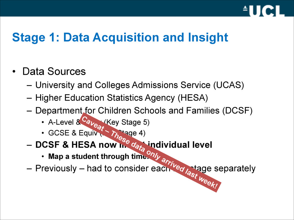
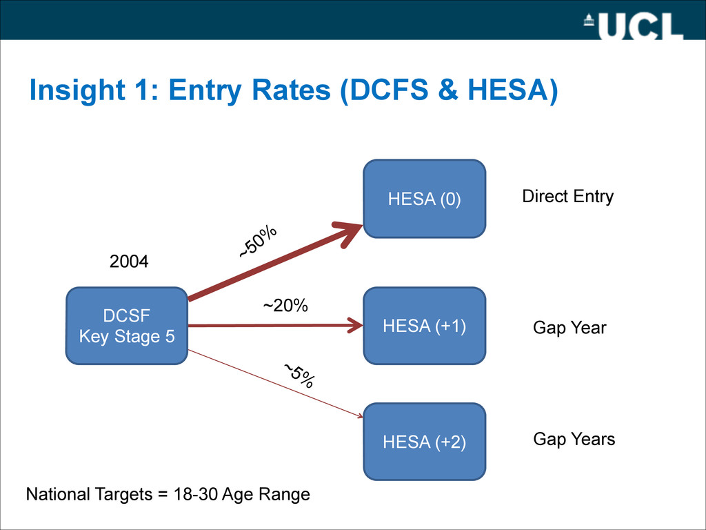
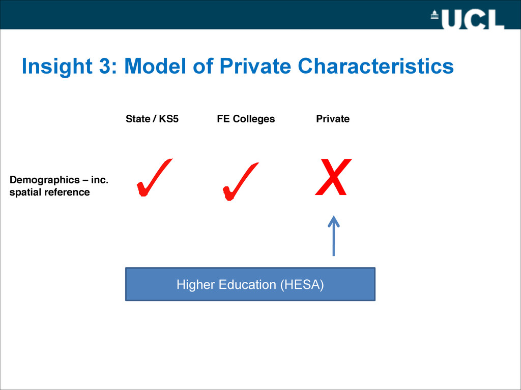
University and Colleges Admissions Service (UCAS) – Higher Education Statistics Agency (HESA) – Department for Children Schools and Families (DCSF) • A-Level & Equiv (Key Stage 5) • GCSE & Equiv (Key Stage 4) – DCSF & HESA now link at individual level • Map a student through time! – Previously – had to consider each key stage separately Caveat – These data only arrived last week!
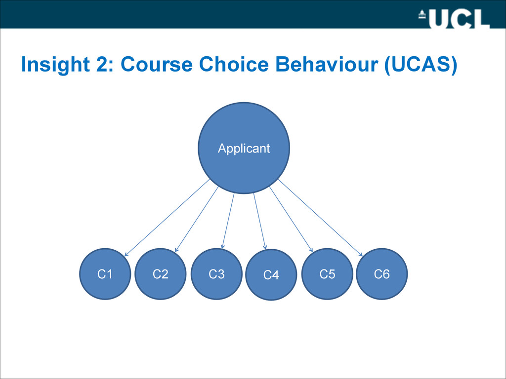
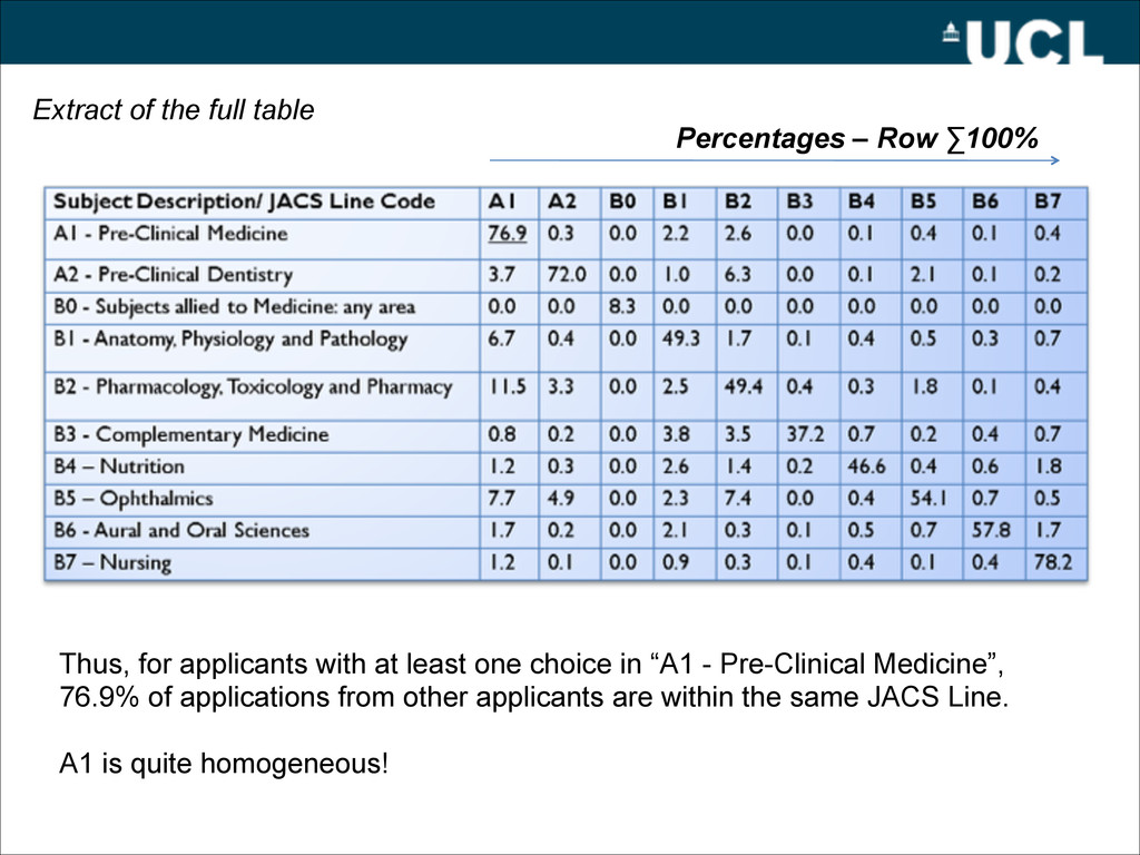
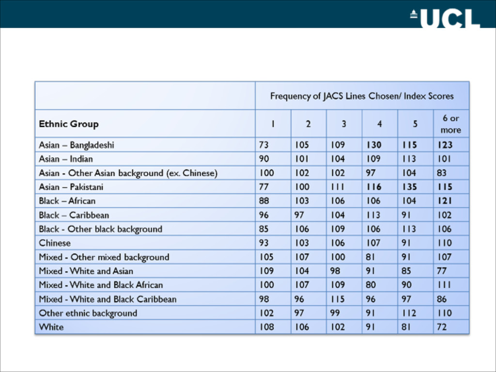
one choice in “A1 - Pre-Clinical Medicine”, 76.9% of applications from other applicants are within the same JACS Line. ! A1 is quite homogeneous! Extract of the full table
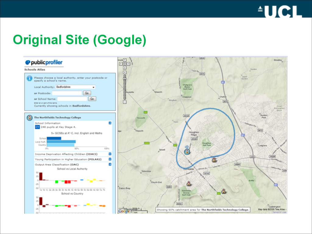
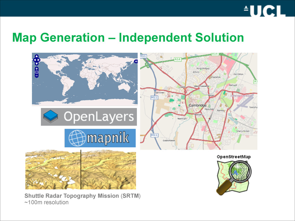
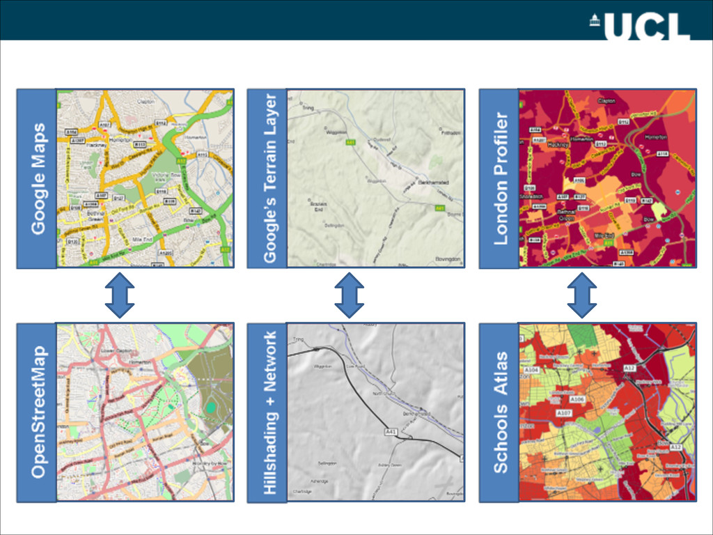
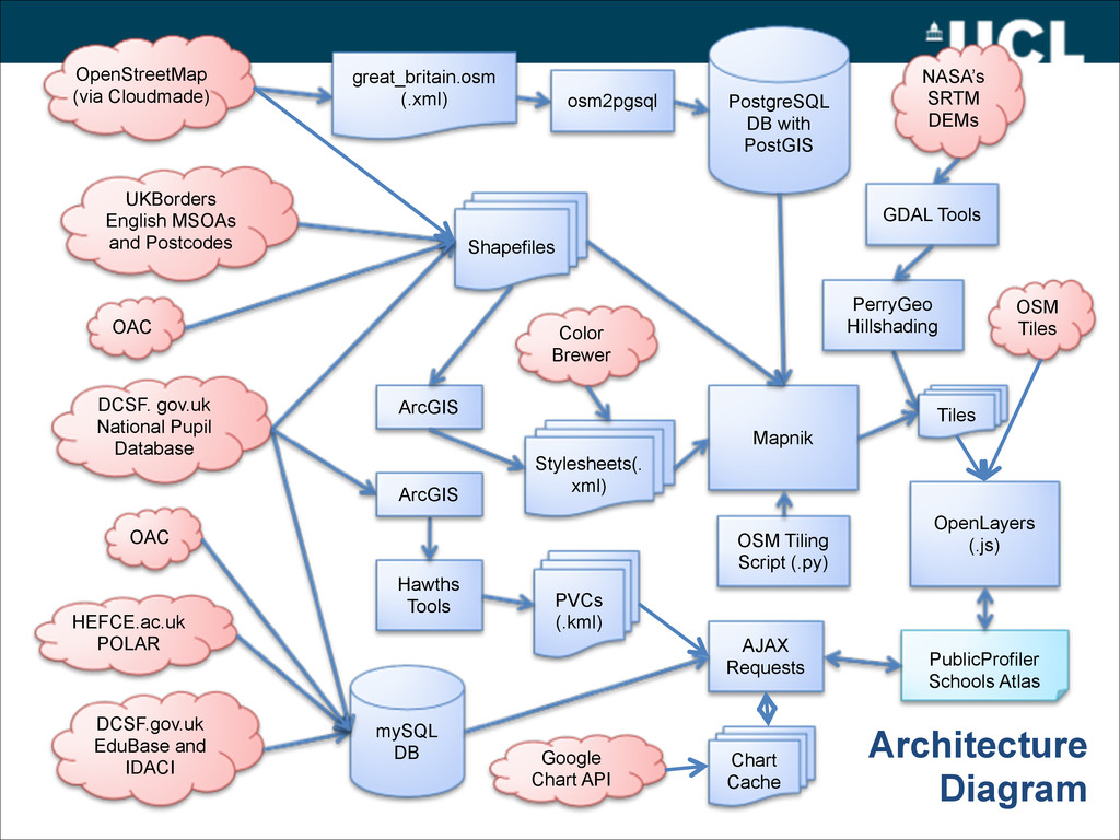
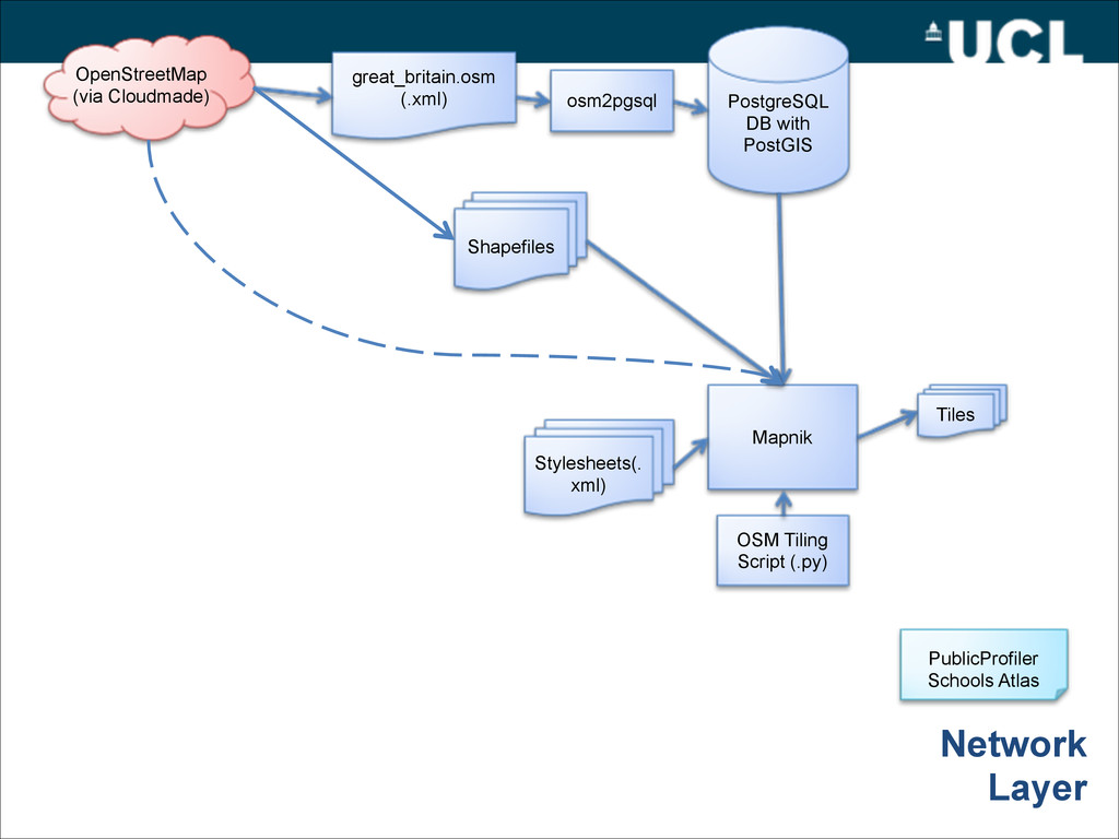
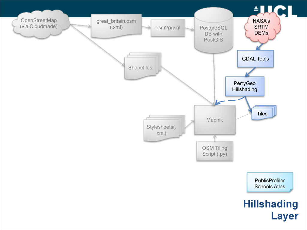
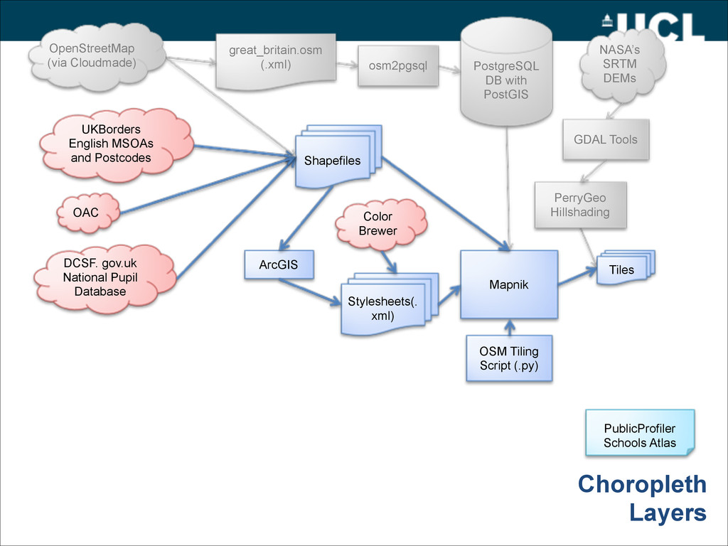
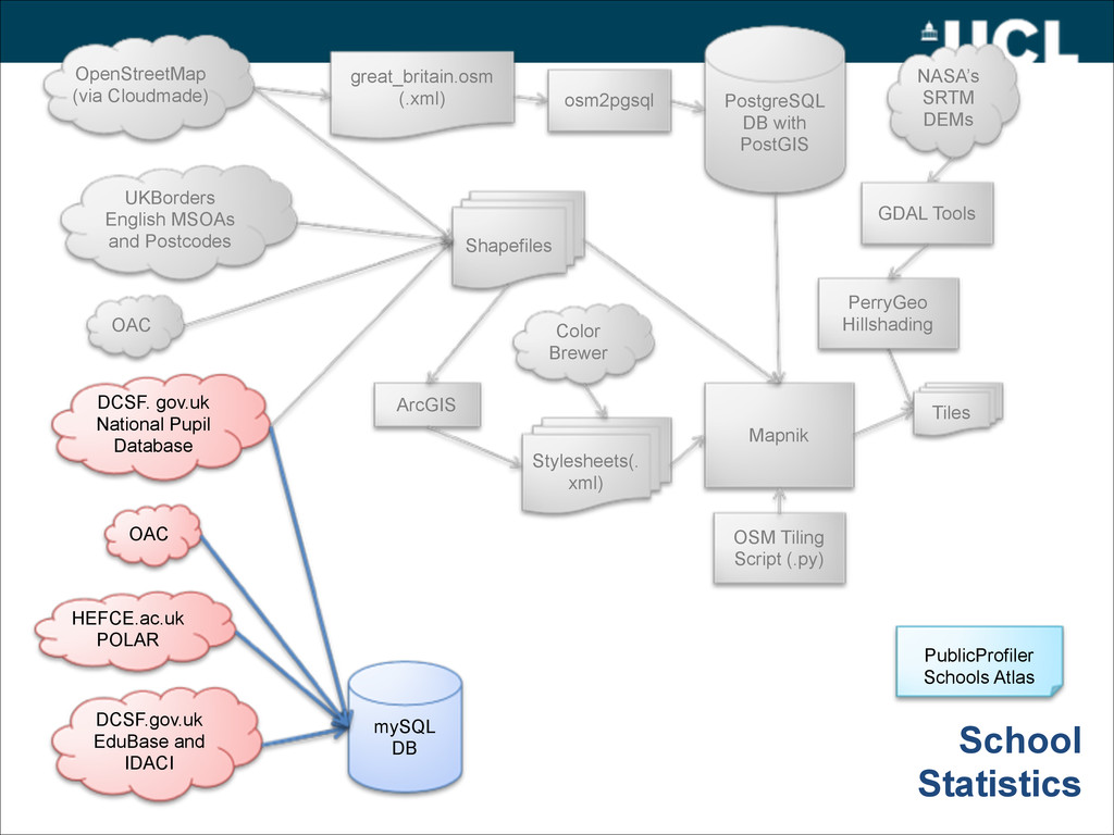
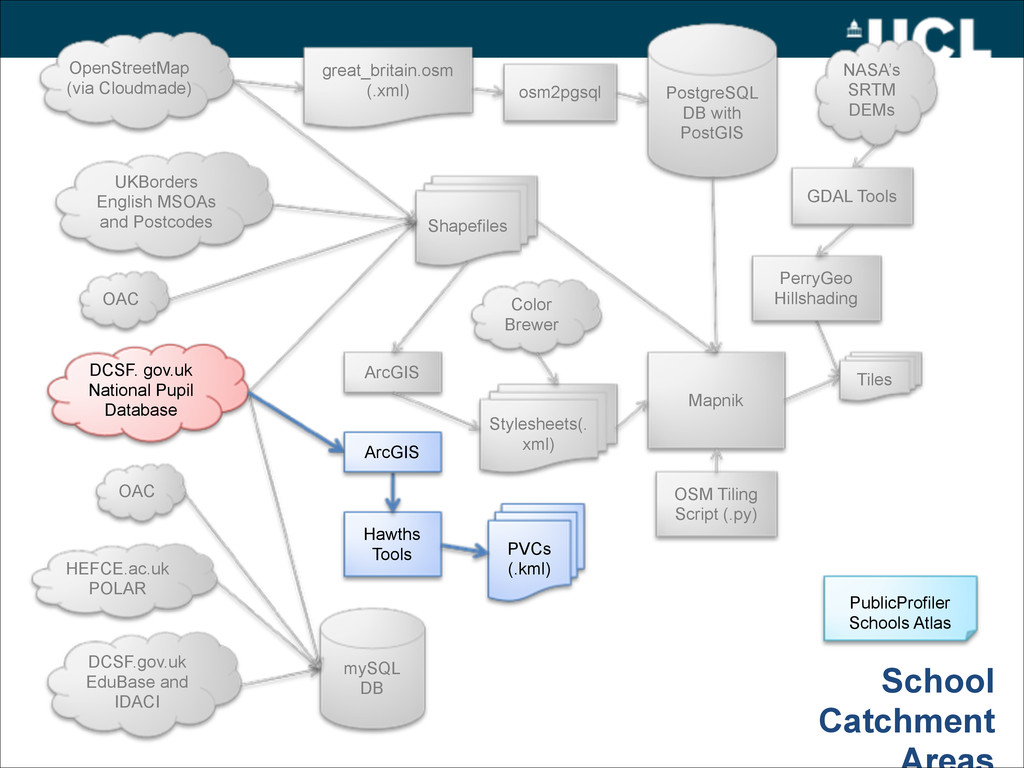
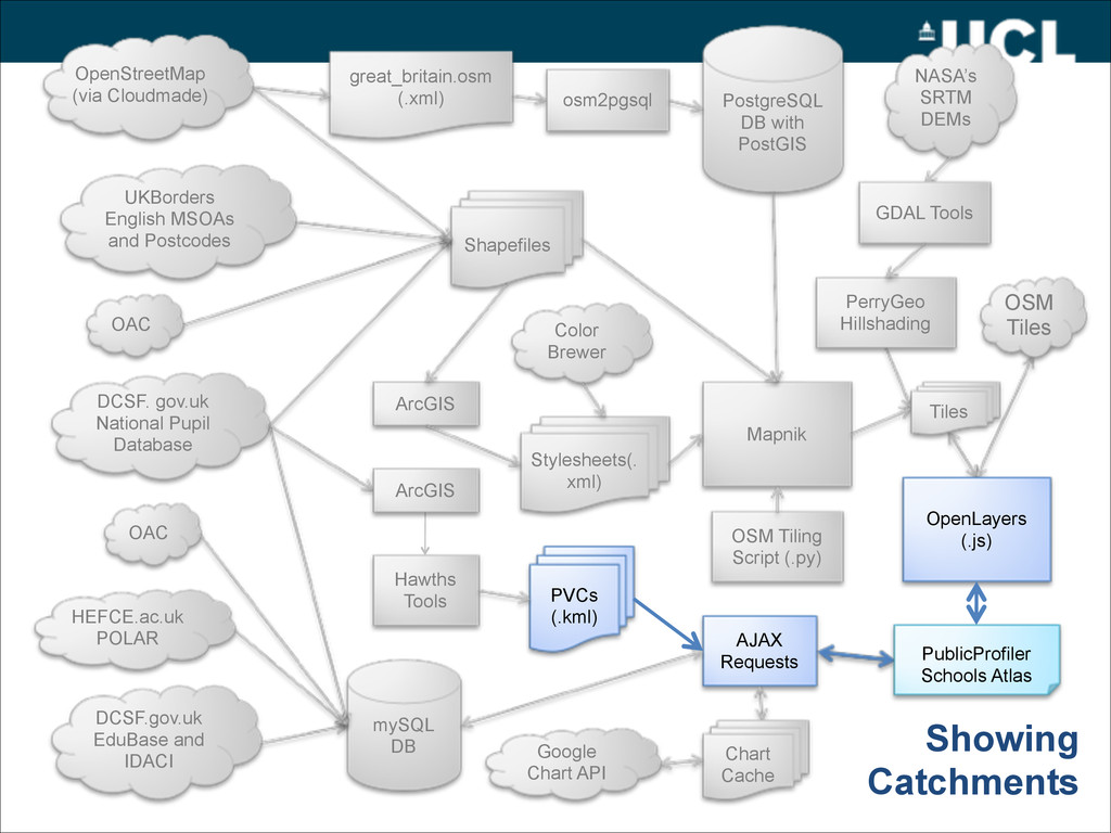
GDAL Tools UKBorders English MSOAs and Postcodes DCSF. gov.uk National Pupil Database mySQL DB DCSF.gov.uk EduBase and IDACI HEFCE.ac.uk POLAR OAC Mapnik Shapefiles OSM Tiling Script (.py) Stylesheets(. xml) ArcGIS Color Brewer PerryGeo Hillshading OAC School Statistics ! PublicProfiler Schools Atlas Tiles OpenStreetMap (via Cloudmade)
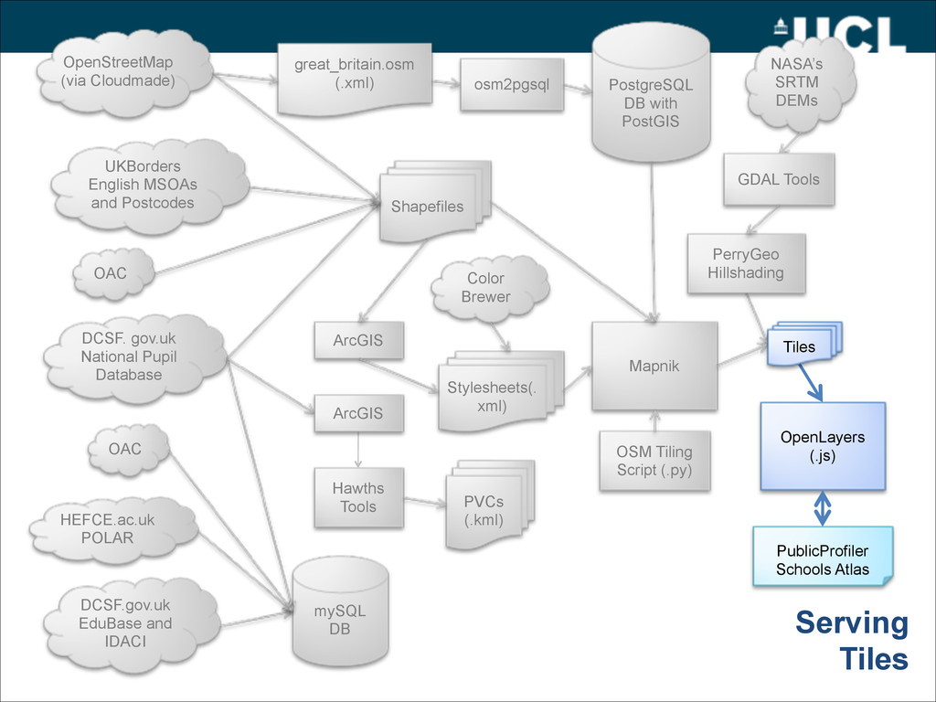
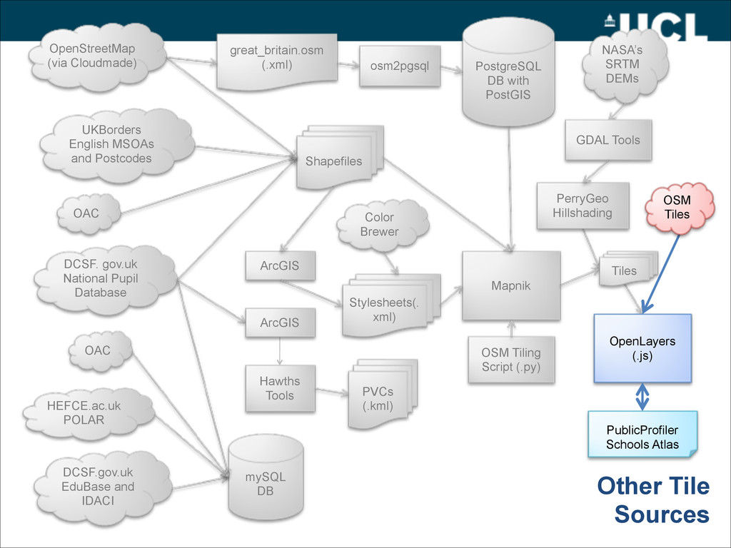
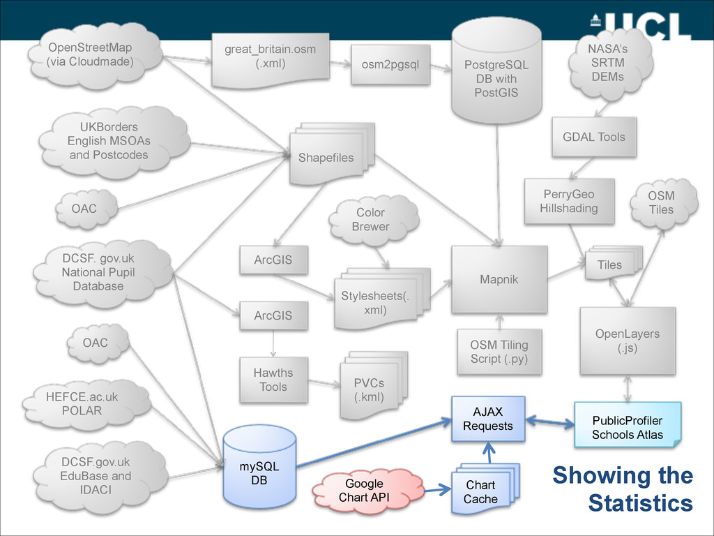
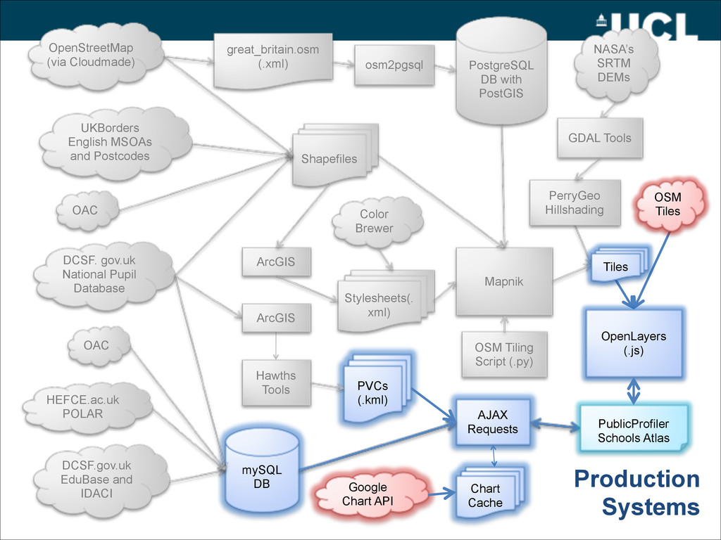
GDAL Tools UKBorders English MSOAs and Postcodes DCSF. gov.uk National Pupil Database mySQL DB DCSF.gov.uk EduBase and IDACI HEFCE.ac.uk POLAR OAC Mapnik Shapefiles OSM Tiling Script (.py) Stylesheets(. xml) ArcGIS Color Brewer PerryGeo Hillshading AJAX Requests PVCs (.kml) OAC Hawths Tools ArcGIS Google Chart API Chart Cache ! PublicProfiler Schools Atlas OSM Tiles OpenLayers (.js) Tiles Production Systems OpenStreetMap (via Cloudmade)
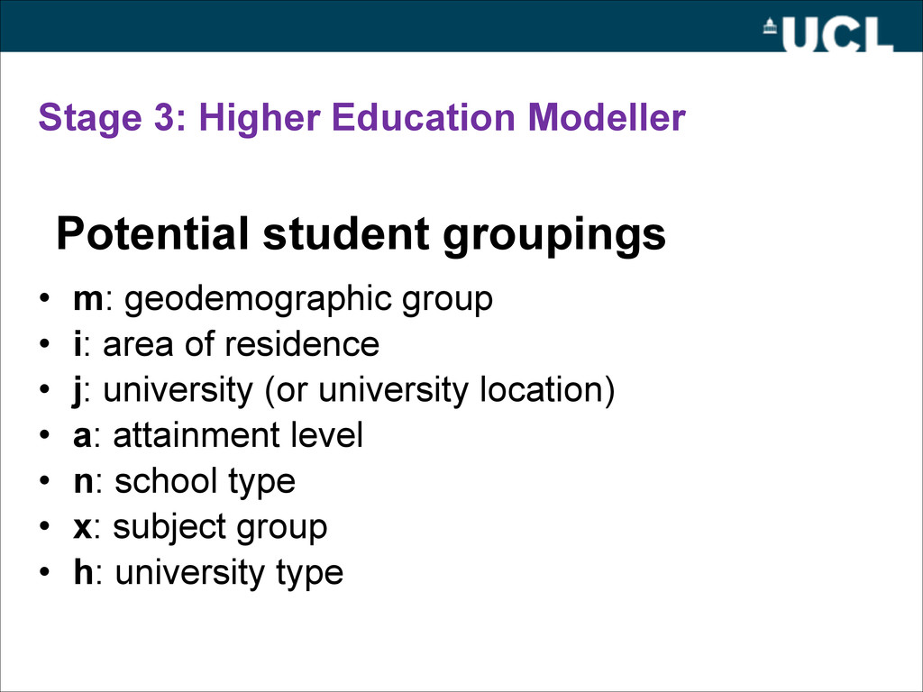
i: area of residence • j: university (or university location) • a: attainment level • n: school type • x: subject group • h: university type Potential student groupings
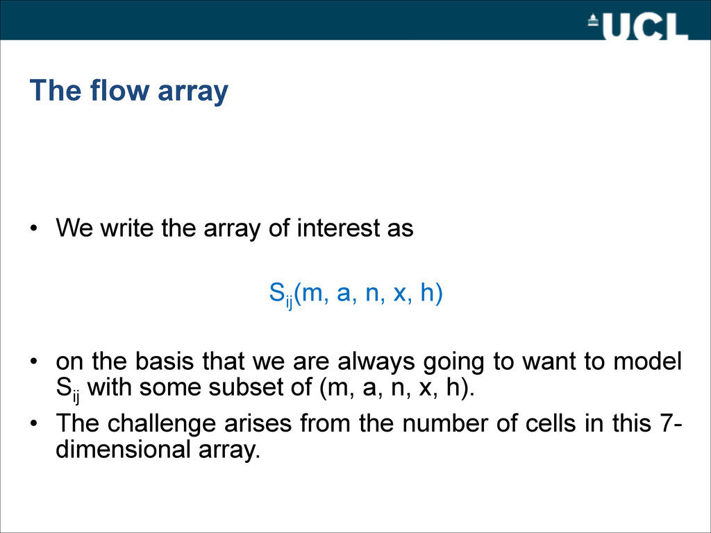
as ! S ij (m, a, n, x, h) ! • on the basis that we are always going to want to model S ij with some subset of (m, a, n, x, h). • The challenge arises from the number of cells in this 7- dimensional array.
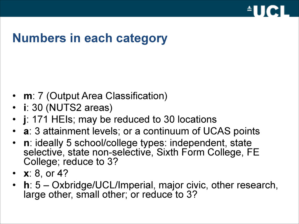
• i: 30 (NUTS2 areas) • j: 171 HEIs; may be reduced to 30 locations • a: 3 attainment levels; or a continuum of UCAS points • n: ideally 5 school/college types: independent, state selective, state non-selective, Sixth Form College, FE College; reduce to 3? • x: 8, or 4? • h: 5 – Oxbridge/UCL/Imperial, major civic, other research, large other, small other; or reduce to 3?
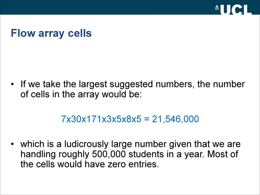
numbers, the number of cells in the array would be: ! 7x30x171x3x5x8x5 = 21,546,000 ! • which is a ludicrously large number given that we are handling roughly 500,000 students in a year. Most of the cells would have zero entries.
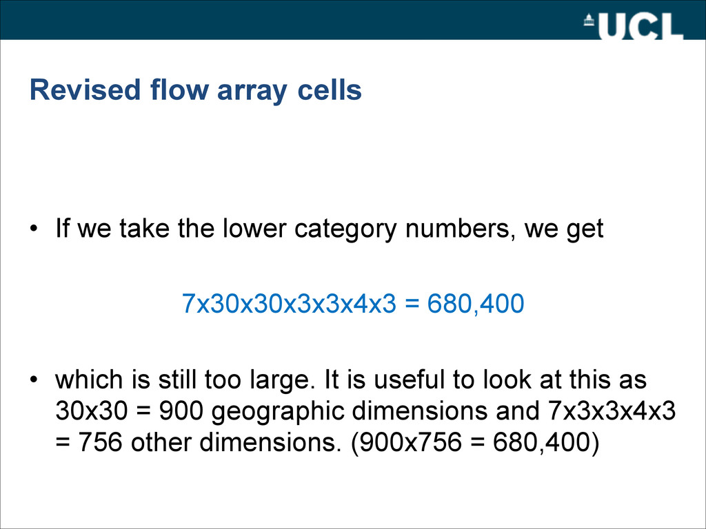
category numbers, we get ! 7x30x30x3x3x4x3 = 680,400 ! • which is still too large. It is useful to look at this as 30x30 = 900 geographic dimensions and 7x3x3x4x3 = 756 other dimensions. (900x756 = 680,400)
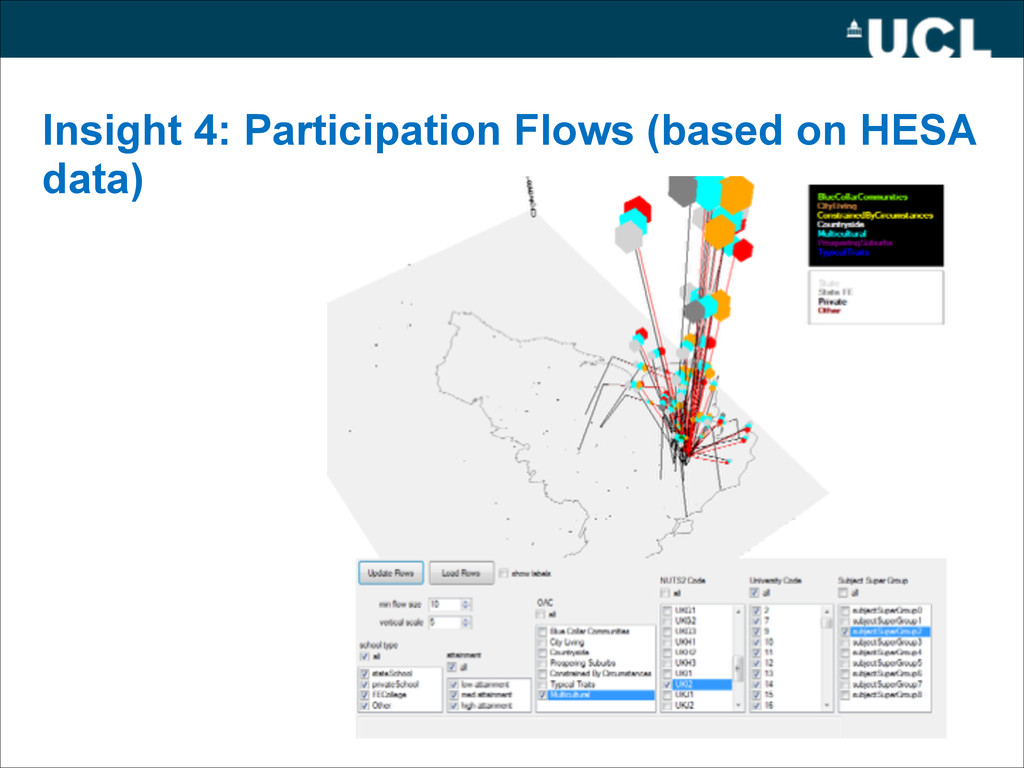
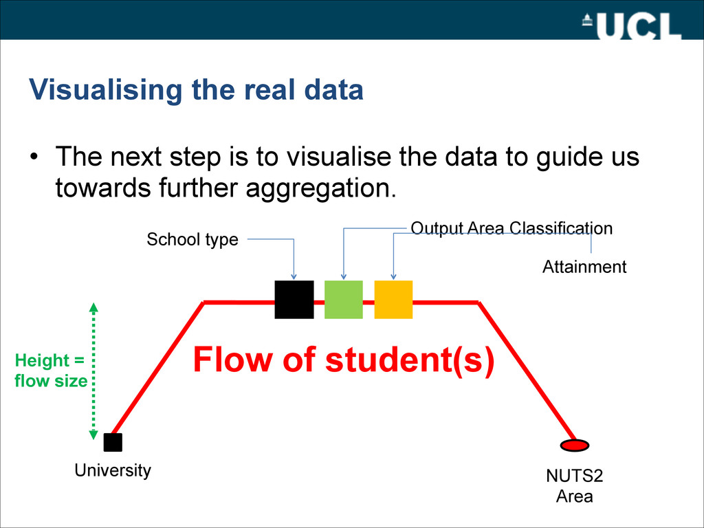
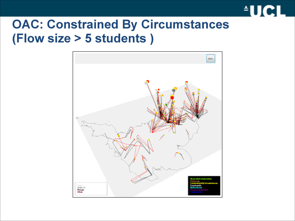
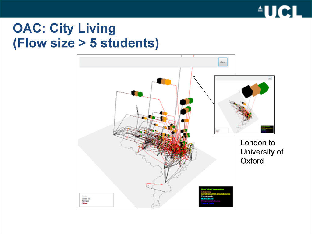
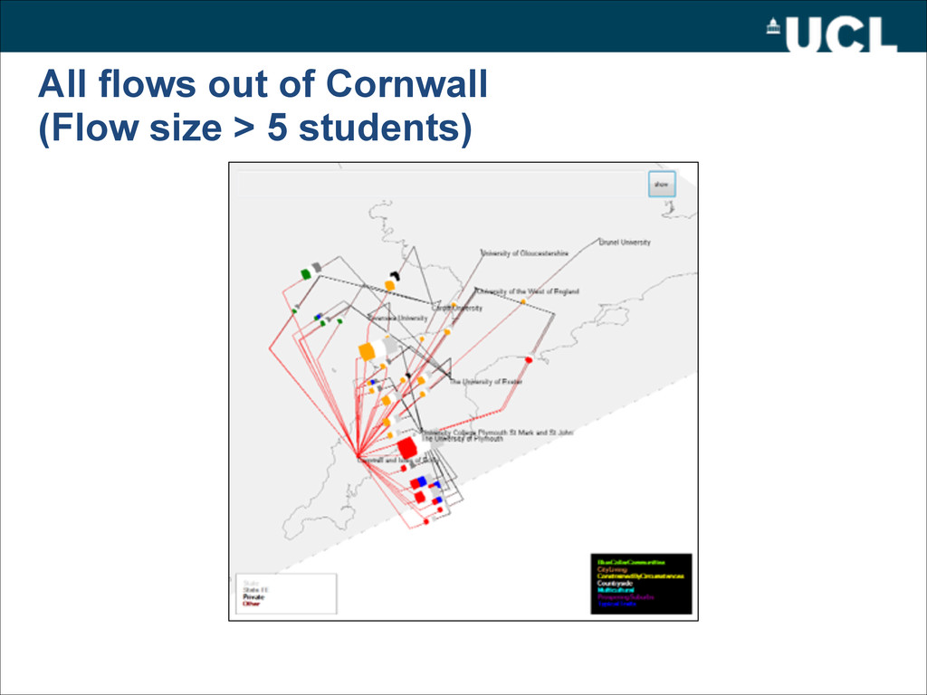
visualise the data to guide us towards further aggregation. School type Output Area Classification Attainment University NUTS2 Area Flow of student(s) Height = flow size
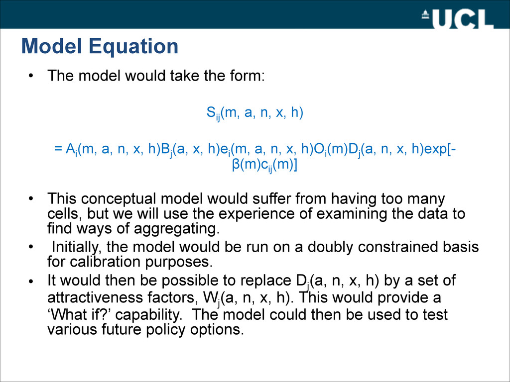
Sij (m, a, n, x, h) ! = Ai (m, a, n, x, h)Bj (a, x, h)ei (m, a, n, x, h)Oi (m)Dj (a, n, x, h)exp[- β(m)cij (m)] ! • This conceptual model would suffer from having too many cells, but we will use the experience of examining the data to find ways of aggregating. • Initially, the model would be run on a doubly constrained basis for calibration purposes. • It would then be possible to replace Dj (a, n, x, h) by a set of attractiveness factors, Wj (a, n, x, h). This would provide a ‘What if?’ capability. The model could then be used to test various future policy options.