Technologist, Stamen Design PhD Candidate, University of British Columbia [email protected] @mappingmashups Wikimedia Research & Data Showcase February 18, 2015
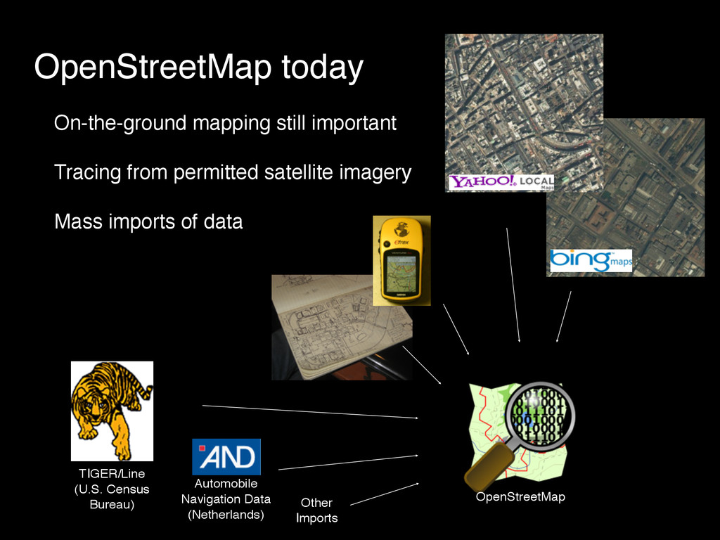
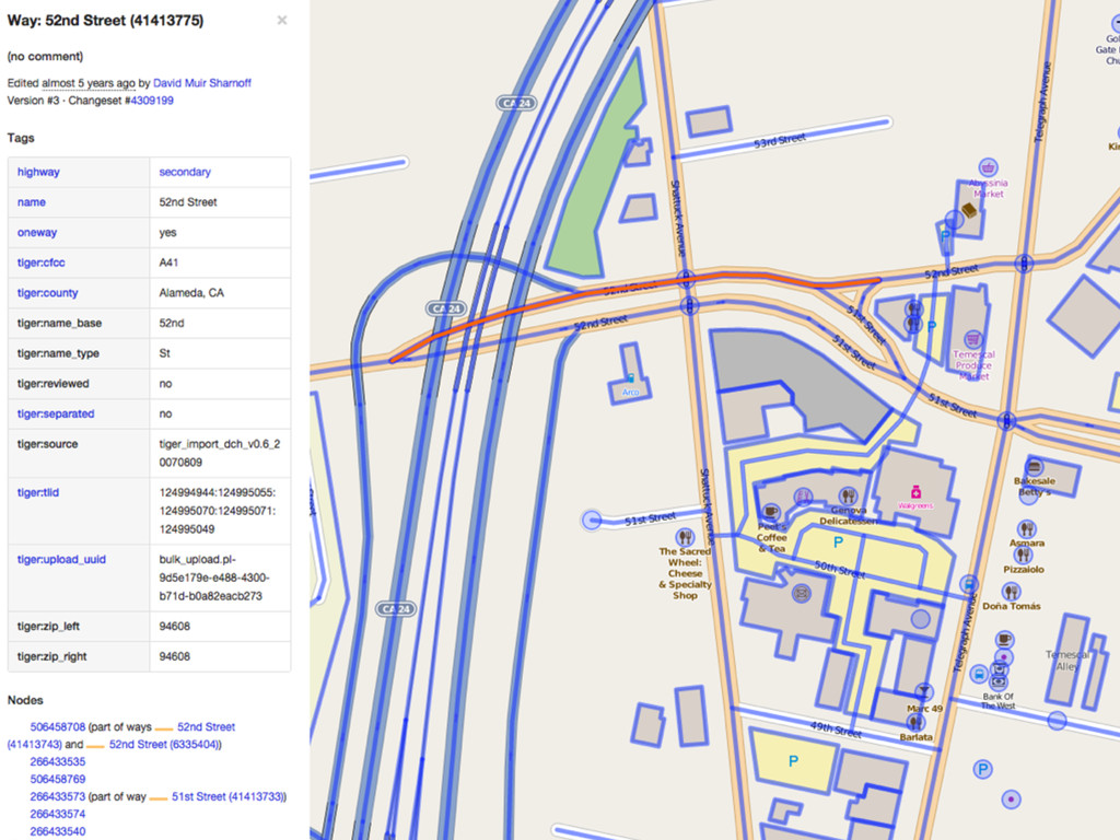
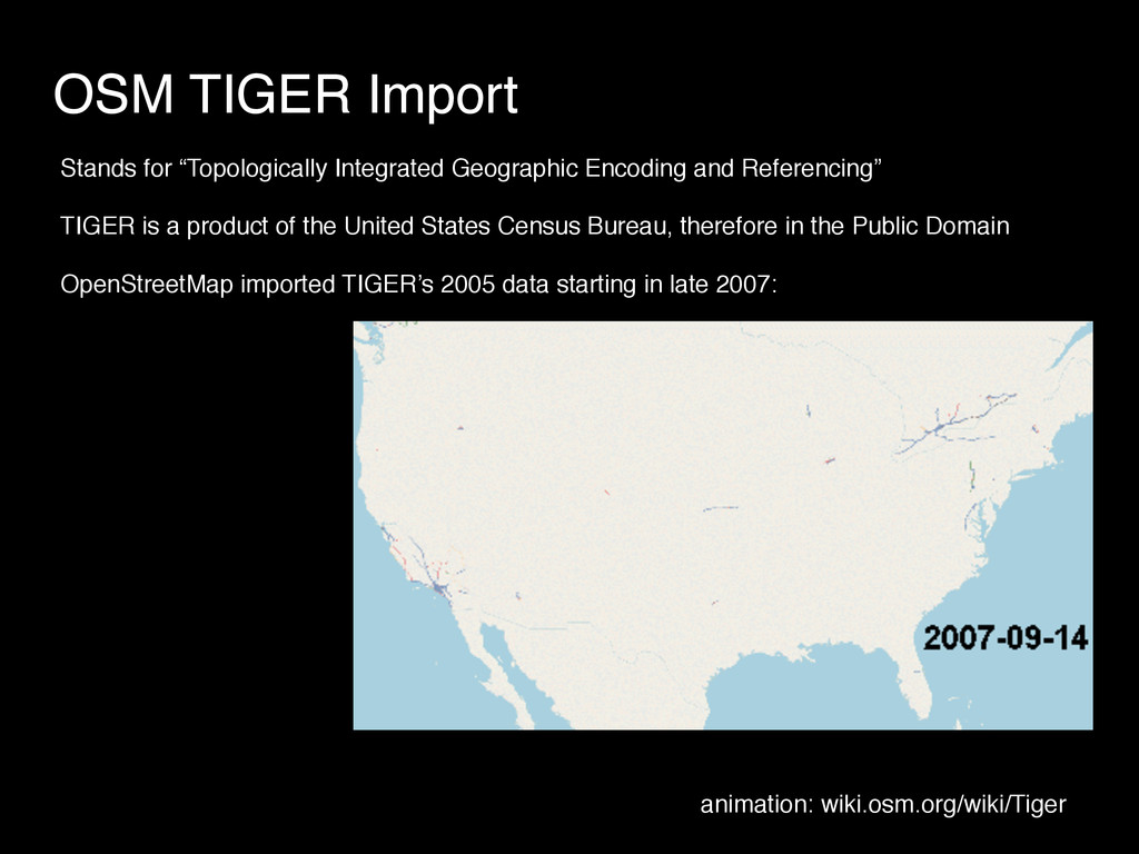
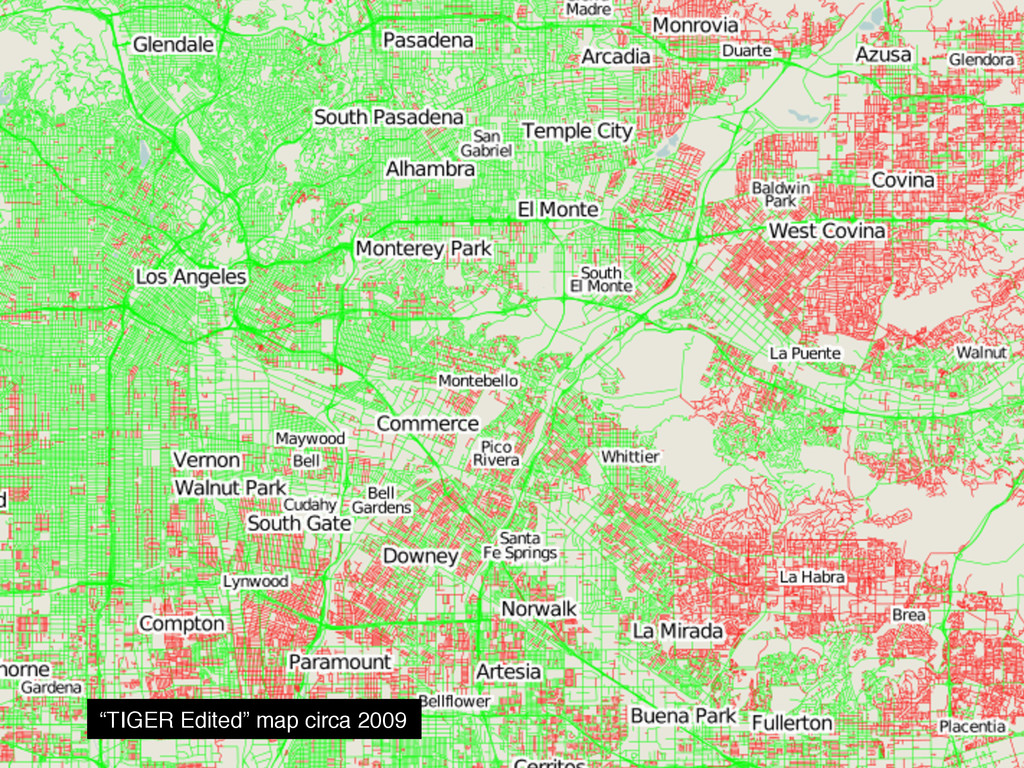
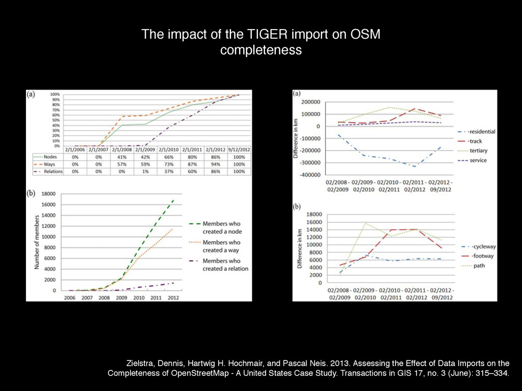
Referencing” TIGER is a product of the United States Census Bureau, therefore in the Public Domain OpenStreetMap imported TIGER’s 2005 data starting in late 2007: animation: wiki.osm.org/wiki/Tiger
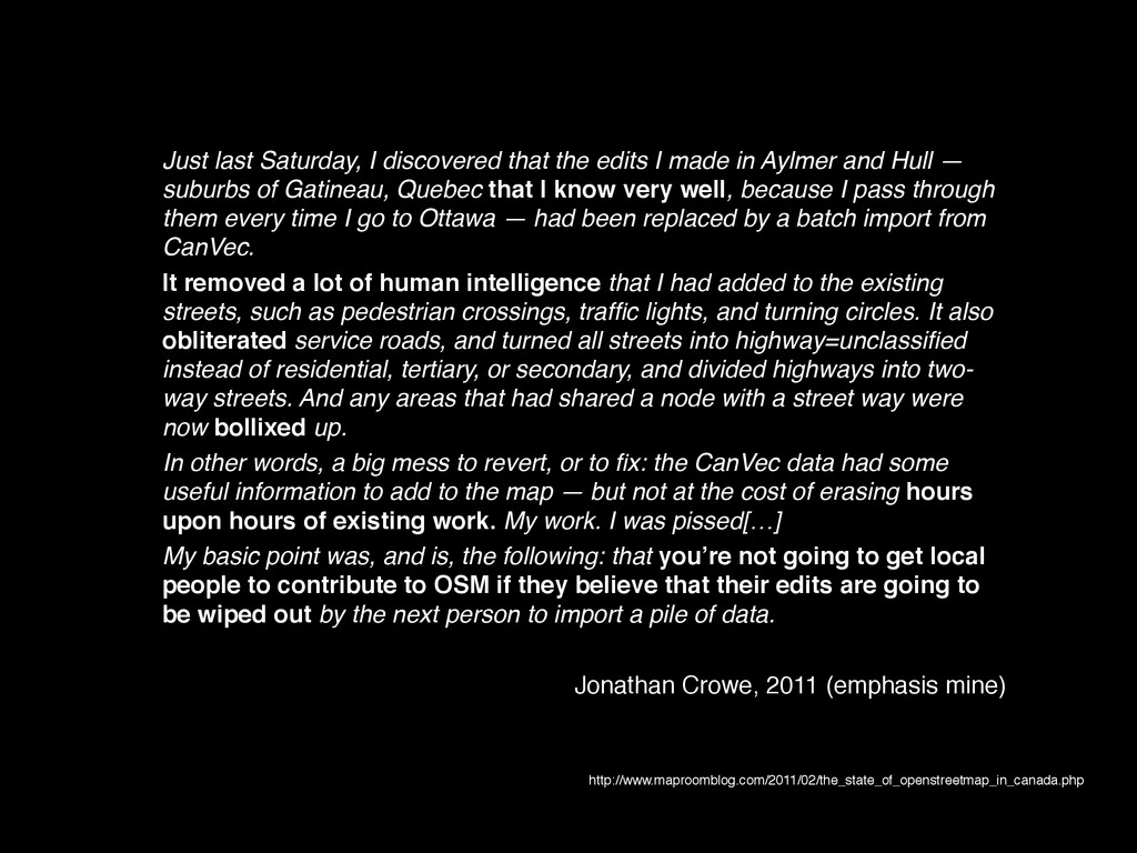
in Aylmer and Hull — suburbs of Gatineau, Quebec that I know very well, because I pass through them every time I go to Ottawa — had been replaced by a batch import from CanVec. It removed a lot of human intelligence that I had added to the existing streets, such as pedestrian crossings, traffic lights, and turning circles. It also obliterated service roads, and turned all streets into highway=unclassified instead of residential, tertiary, or secondary, and divided highways into two- way streets. And any areas that had shared a node with a street way were now bollixed up. In other words, a big mess to revert, or to fix: the CanVec data had some useful information to add to the map — but not at the cost of erasing hours upon hours of existing work. My work. I was pissed[…] My basic point was, and is, the following: that you’re not going to get local people to contribute to OSM if they believe that their edits are going to be wiped out by the next person to import a pile of data. Jonathan Crowe, 2011 (emphasis mine) http://www.maproomblog.com/2011/02/the_state_of_openstreetmap_in_canada.php
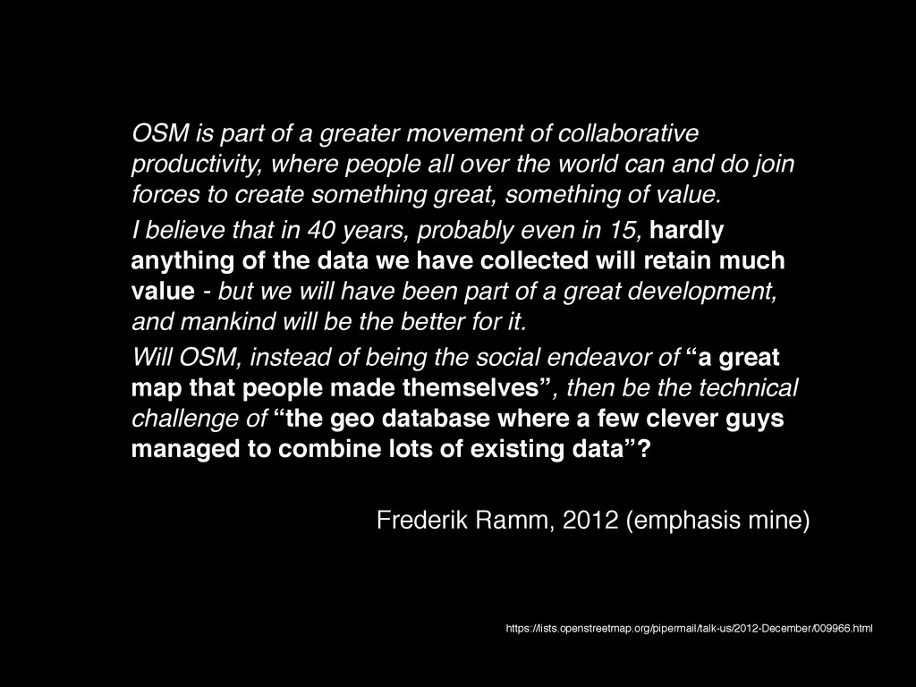
where people all over the world can and do join forces to create something great, something of value. I believe that in 40 years, probably even in 15, hardly anything of the data we have collected will retain much value - but we will have been part of a great development, and mankind will be the better for it. Will OSM, instead of being the social endeavor of “a great map that people made themselves”, then be the technical challenge of “the geo database where a few clever guys managed to combine lots of existing data”? Frederik Ramm, 2012 (emphasis mine) https://lists.openstreetmap.org/pipermail/talk-us/2012-December/009966.html
imports are to blame for slowing down the development of the US community. …instead of the fun task of going out, finding new streets, and filling in a blank map, new contributors in the US were now faced with the relative tedium of correcting repetitive errors in an existing dataset. Meanwhile, in countries like Germany, almost all data has been collected by volunteer mappers, with only a few small-scale imports conducted in places where there already was an active community. This was not by design - there simply wasn't a comparable dataset that could have been imported - but it was ultimately beneficial. At least if you accept the theory, of course. Tobias Knerr, literally yesterday (emphasis mine) http://forum.openstreetmap.org/viewtopic.php?id=30121
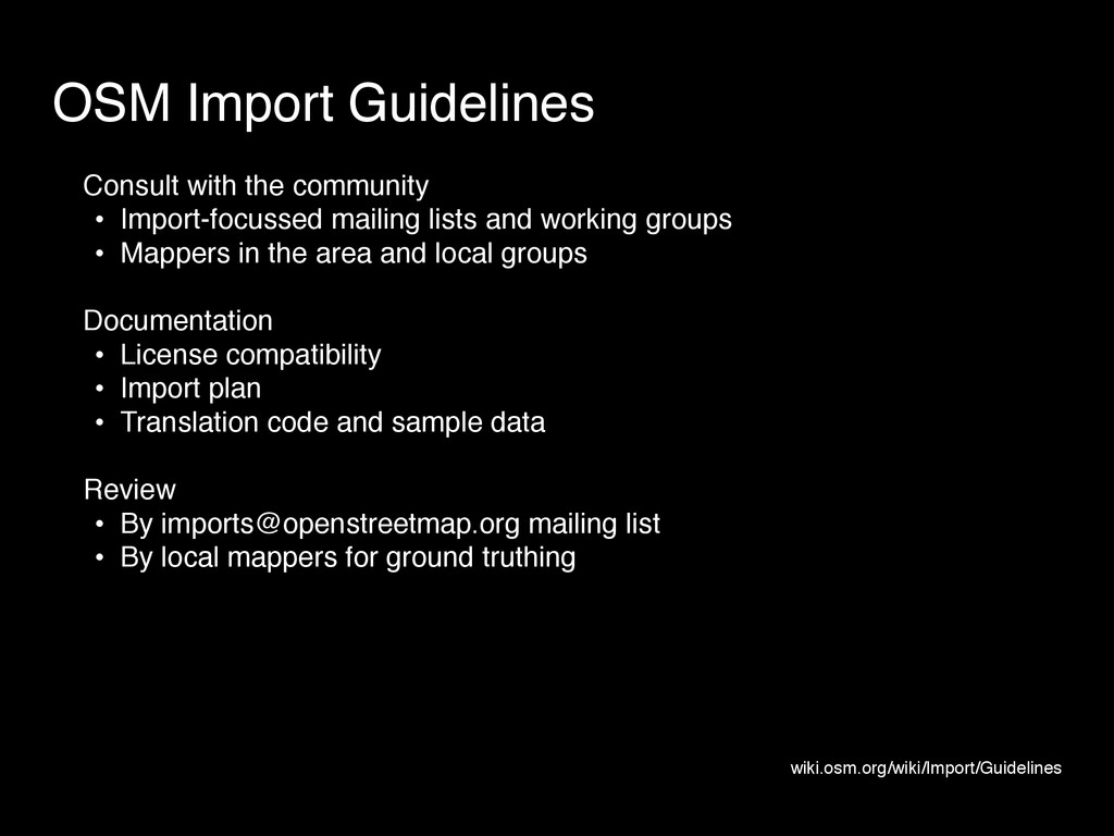
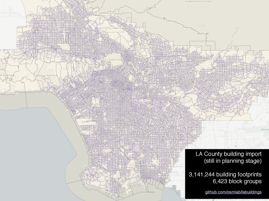
groups • Mappers in the area and local groups Documentation • License compatibility • Import plan • Translation code and sample data Review • By [email protected] mailing list • By local mappers for ground truthing OSM Import Guidelines wiki.osm.org/wiki/Import/Guidelines
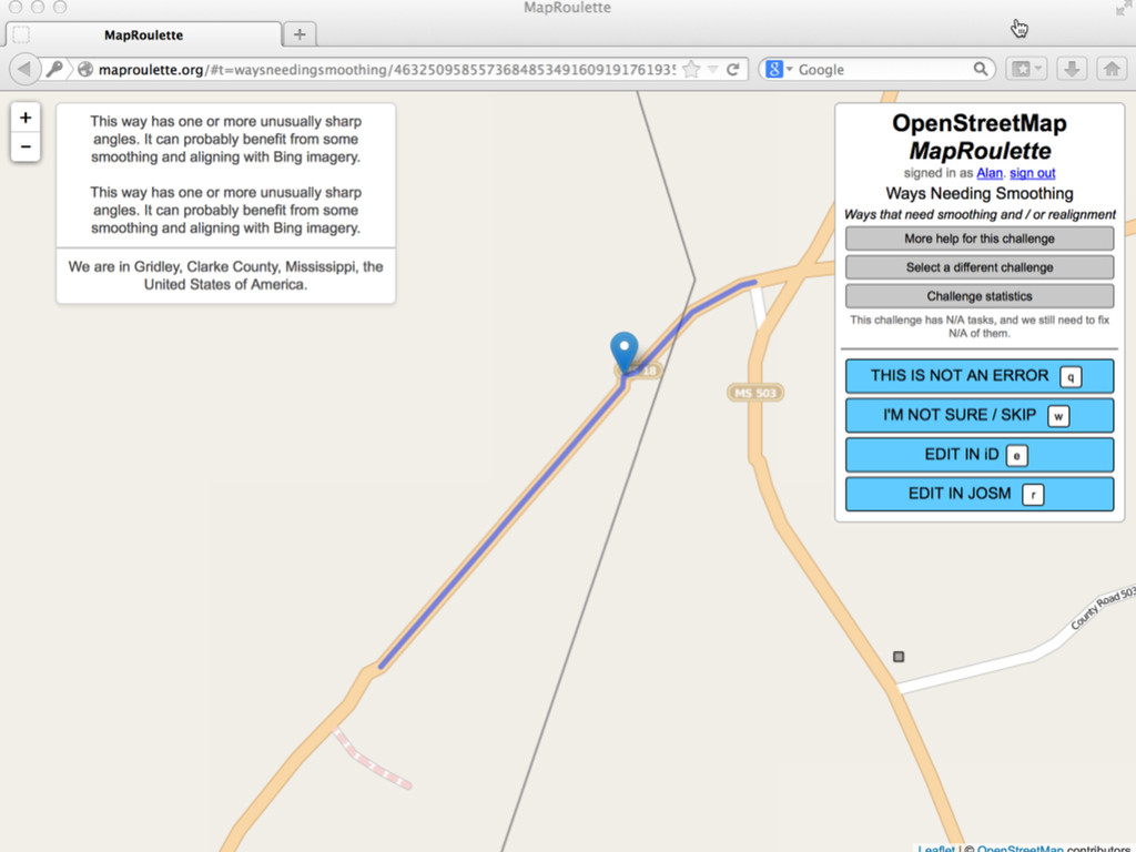
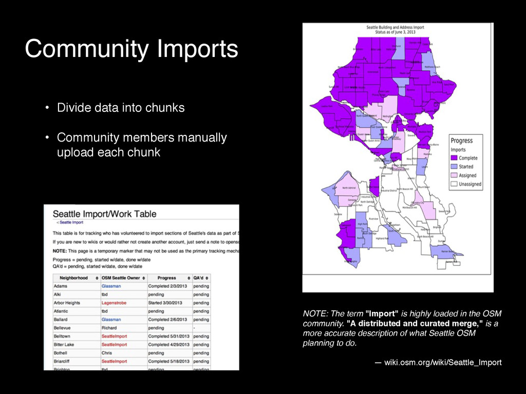
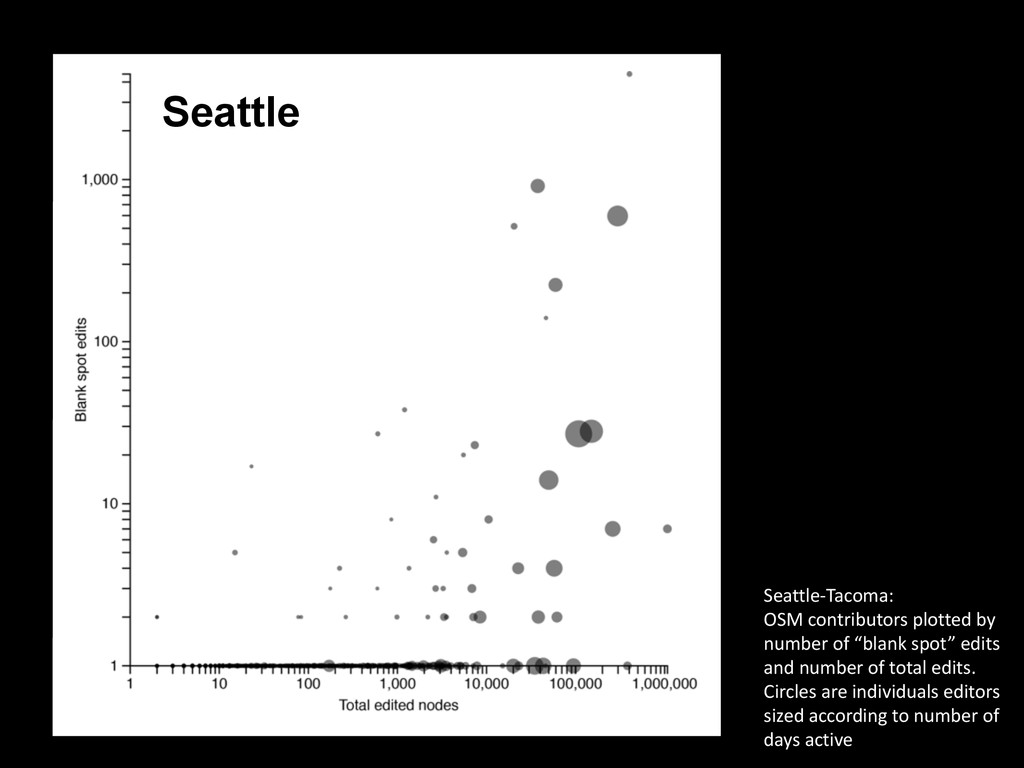
manually upload each chunk NOTE: The term "Import" is highly loaded in the OSM community. "A distributed and curated merge," is a more accurate description of what Seattle OSM planning to do. — wiki.osm.org/wiki/Seattle_Import
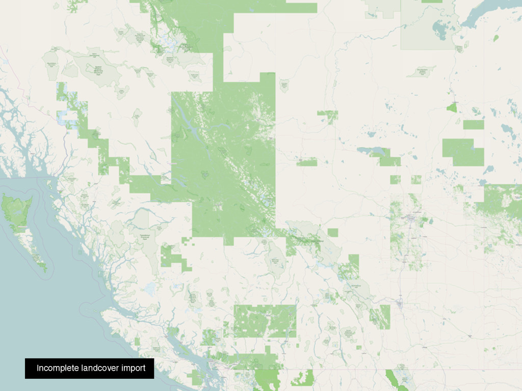
Assessing the Effect of Data Imports on the Completeness of OpenStreetMap - A United States Case Study. Transactions in GIS 17, no. 3 (June): 315–334. The impact of the TIGER import on OSM completeness
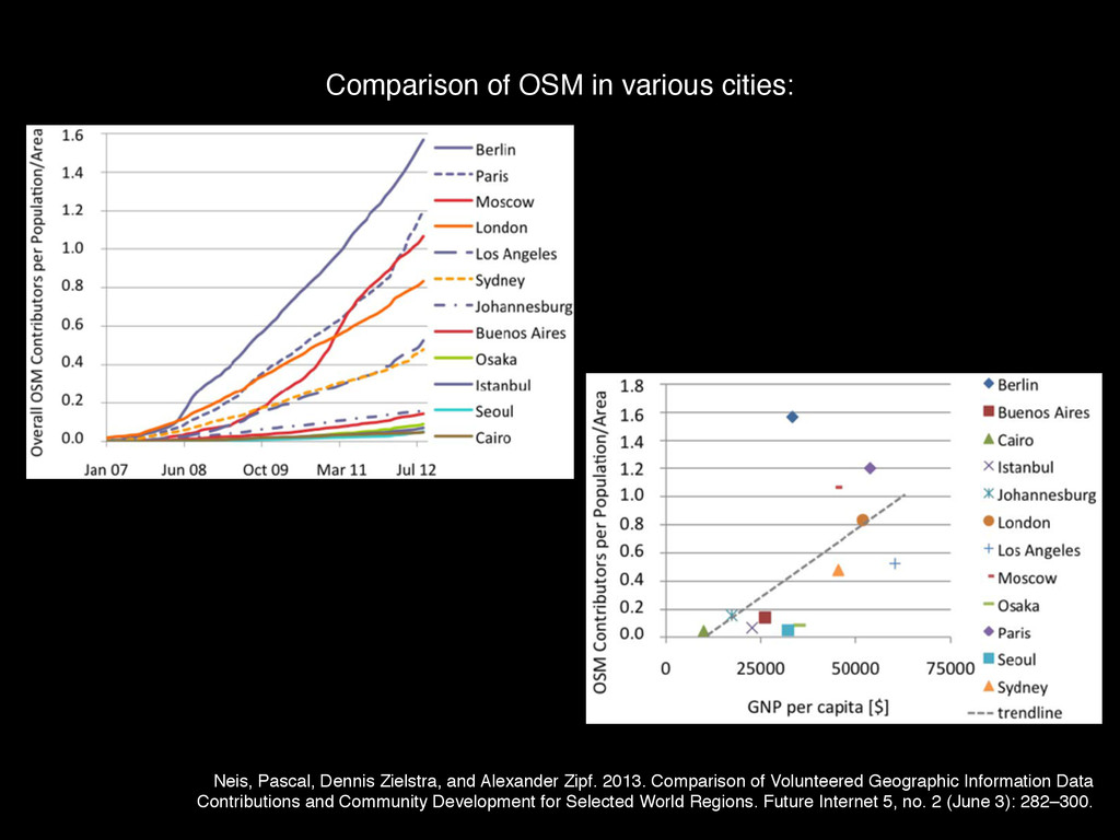
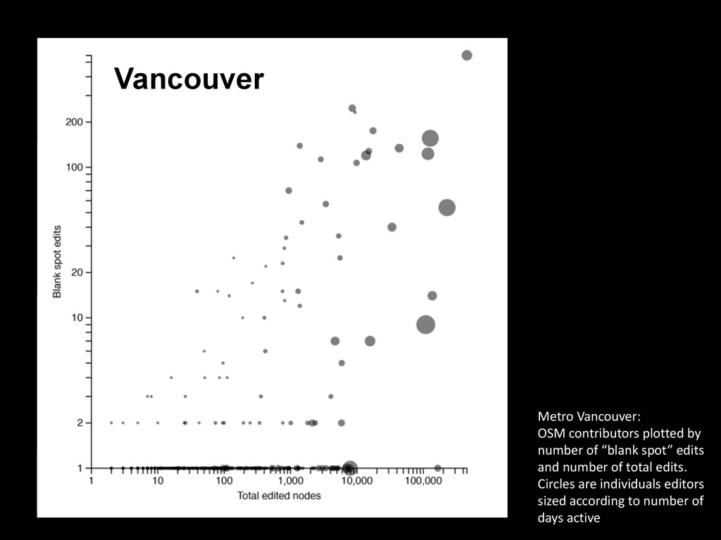
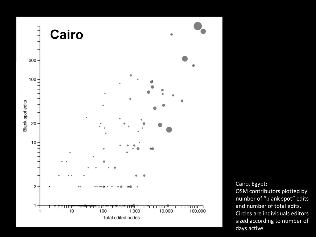
of Volunteered Geographic Information Data Contributions and Community Development for Selected World Regions. Future Internet 5, no. 2 (June 3): 282–300. Comparison of OSM in various cities:
![@mappingmashups [email protected] Thanks!](https://files.speakerdeck.com/presentations/d435c82c012141a684c8c33a59175442/slide_50.jpg)