Upgrade to Pro — share decks privately, control downloads, hide ads and more …

LiDAR - The 3rd Dimension by Nancy Graham

LiDAR - The 3rd Dimension by Nancy Graham

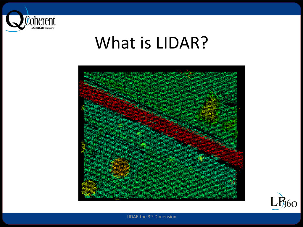
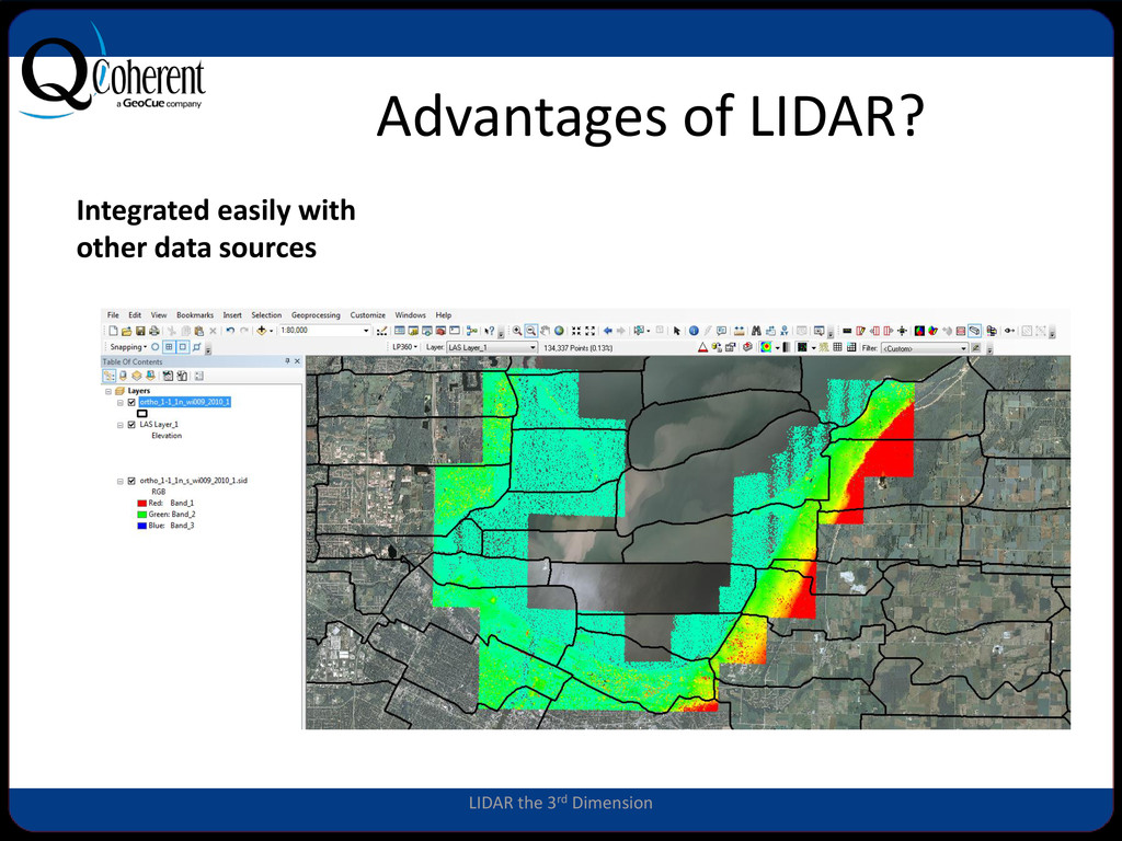
We often think of LiDAR data as a base dataset for creating an elevation model and, indeed, it serves this purpose in a spectacular manner. But did you know that LiDAR data can be used in a wide variety of other ways? In this presentation we will discuss the 3-dimensional aspects of LiDAR data relative to how this is beneficial to GIS analysis, explore some common ways to derive significant value from LiDAR data sets, and show how to use LiDAR to enhance images and vector files within the ArcGIS environment. Examples of practical use include dynamic contour layers superimposed on orthophoto backdrops, breakline modification to terrain information and profile visualization. The overall aim of this talk is to provide GIS users who have access to LiDAR with ideas that can allow them to unlock hidden value in these often underused data sets.

More Decks by Arkansas GIS Users Forum Conference

Other Decks in Technology

Transcript

  1. LIDAR The 3rd Dimension GeoCue Corporation GeoCue Corporation QCoherent Software

    LLC 9668 Madison Blvd., Suite 202 Madison, AL 35758 256.461.8289 www.qcoherent.com Nancy Graham, LP360 Product Manager [email protected]
  2. GeoCue • GeoCue is North America’s largest supplier of LIDAR

    tools for production and exploitation • For our Demo we will be using the GeoCue tools – LP360 for ArcGIS – LP360 for Windows • You can download a demo version from – www.LP360.com LIDAR the 3rd Dimension
  3. Advantages of LIDAR? True Ortho perspective Data can be collected

    quickly Collected day or night LIDAR the 3rd Dimension
  4. How Accurate are the Data? Various ground-truth comparisons and evaluations

    of fixed- wing airborne laser-derived data by groups such as the USGS, US Army Corps of Engineers, FEMA and similar European groups confirm that the following are achievable: • The absolute RMSE(z) is 6 - 10 cm. This corresponds to a 1 σ measure. • Accuracy(z) (2σ) of 10 - 20 cm for normally distributed error. • Absolute RMSE in XY (planimetric) is dependent on the particular operating parameters of the instrument but is on the order of 10 – 20 cm TNGIC
  5. LIDAR Uses • 3-D Visualization • Creating Elevation Grids, Hillshades,

    Contours… • Hydro enforcement • 3D Measurement • Change Detection • Feature Extraction • Vegetation Encroachment • Archaeology… TINGIC