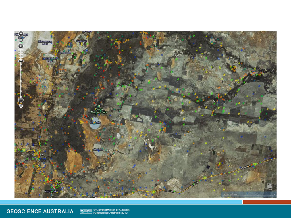
Lymburner - Combining the Atlas of Living Australia with the Dynamic_Land_Cover_Dataset_v2 to characterise the impact of vegetation distburbance events
0.30 0.35 0.40 2000 2002 2004 2006 2008 2010 a) Low EVI Aerial view and ground photo b) High EVI Aerial view and ground photo Enhanced Vegetation Index: ‘Scattered tree scene’ Northern Territory, Australia Scattered tree scene: Trees on a background of grasses. The Enhanced Vegetation Index changes with season. Low EVI = brown High EVI = green Enhanced Vegetation Index
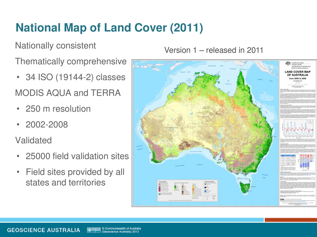
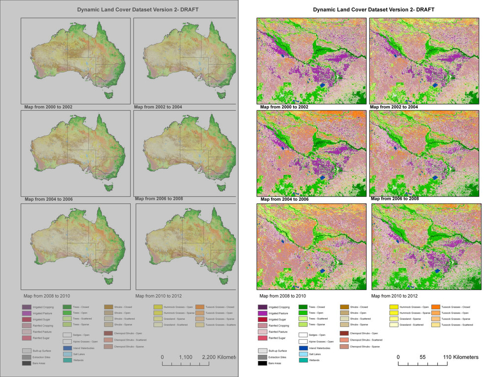
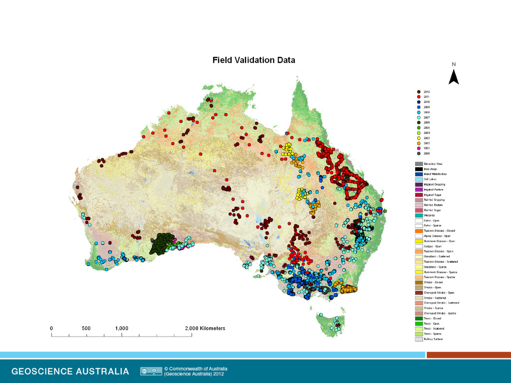
• 34 ISO (19144-2) classes MODIS AQUA and TERRA • 250 m resolution • 2002-2008 Validated • 25000 field validation sites • Field sites provided by all states and territories Version 1 – released in 2011
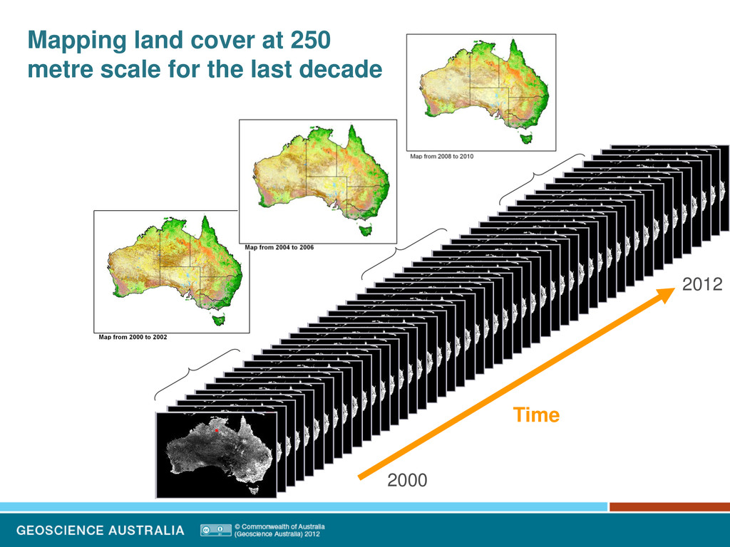
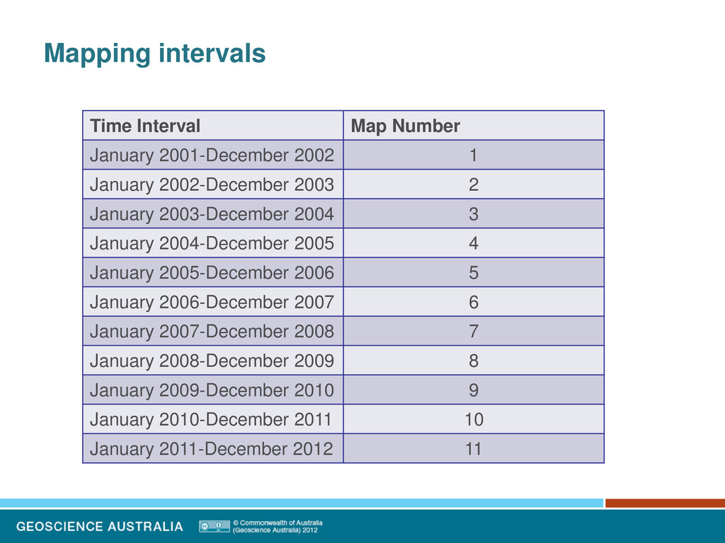
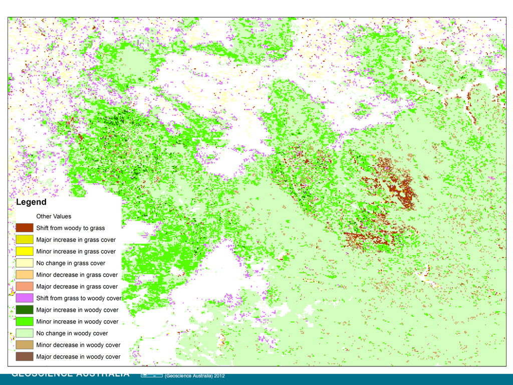
January 2002-December 2003 2 January 2003-December 2004 3 January 2004-December 2005 4 January 2005-December 2006 5 January 2006-December 2007 6 January 2007-December 2008 7 January 2008-December 2009 8 January 2009-December 2010 9 January 2010-December 2011 10 January 2011-December 2012 11