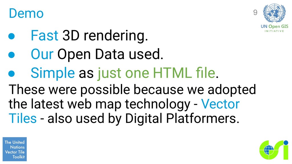
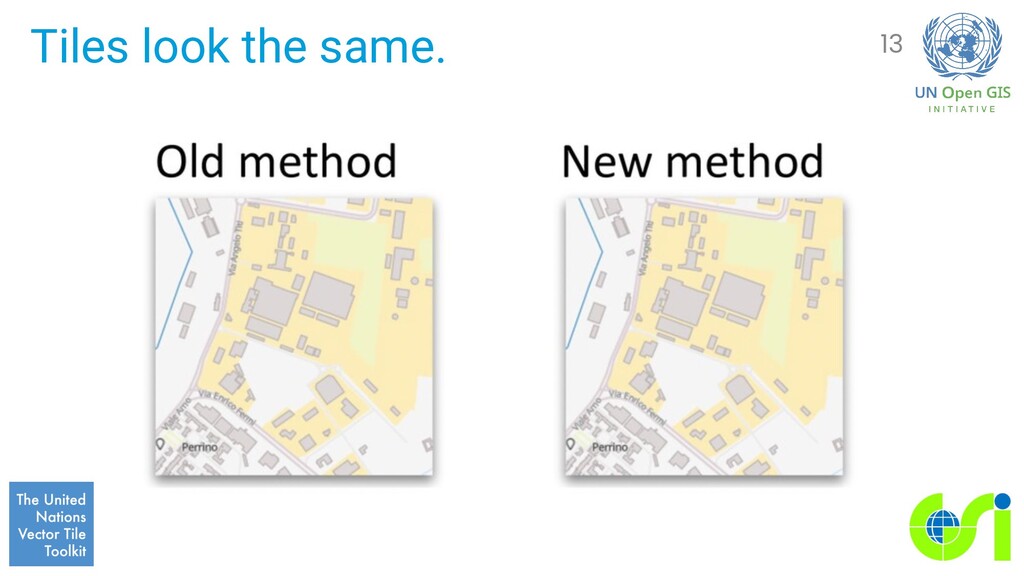
• Simple as just one HTML file. These were possible because we adopted the latest web map technology - Vector Tiles - also used by Digital Platformers. 9
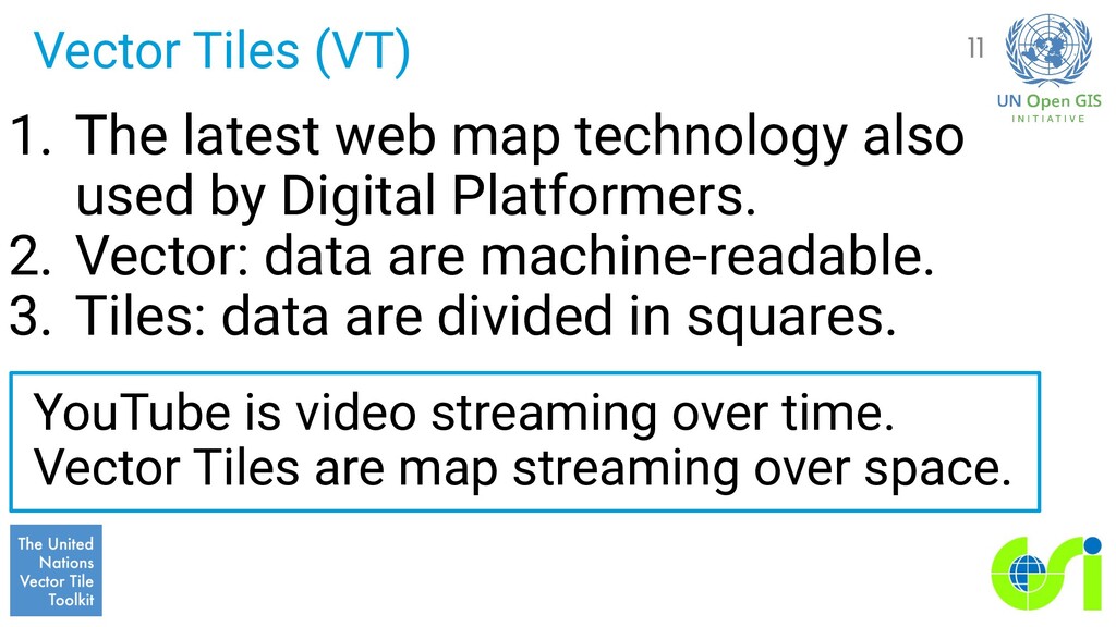
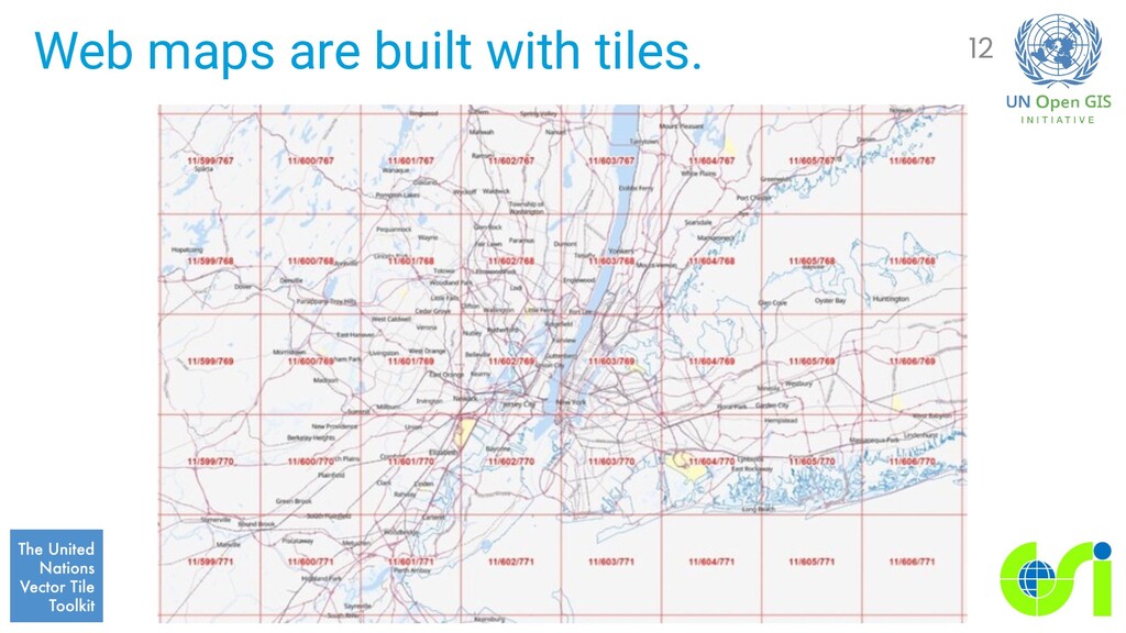
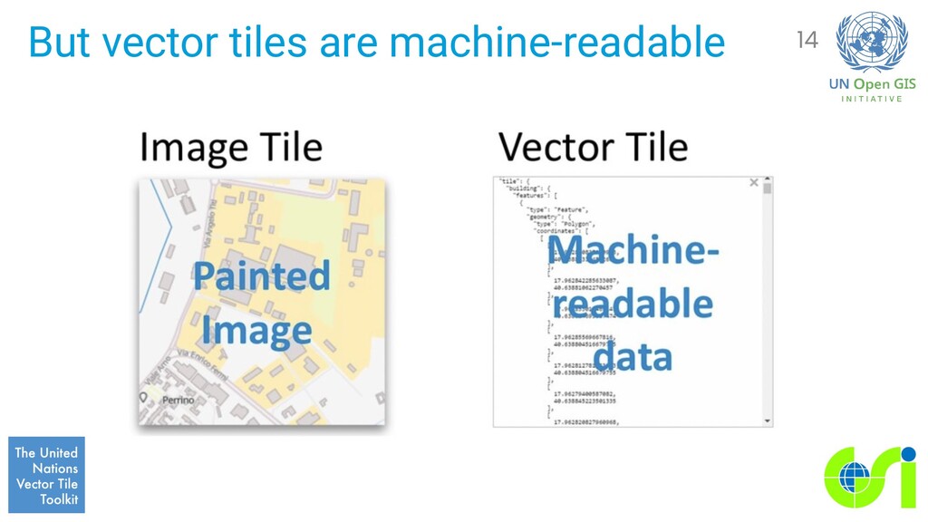
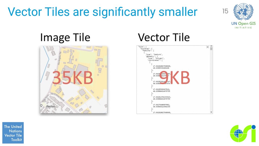
used by Digital Platformers. 2. Vector: data are machine-readable. 3. Tiles: data are divided in squares. YouTube is video streaming over time. Vector Tiles are map streaming over space. 11
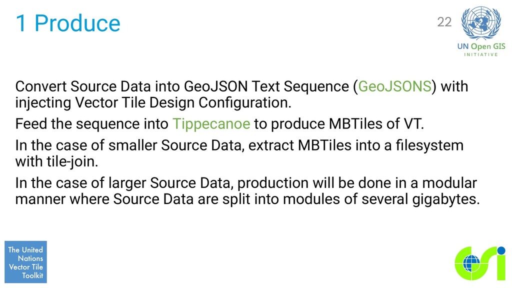
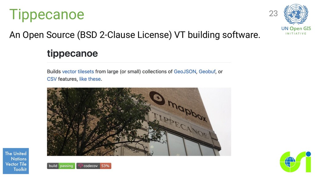
with injecting Vector Tile Design Configuration. Feed the sequence into Tippecanoe to produce MBTiles of VT. In the case of smaller Source Data, extract MBTiles into a filesystem with tile-join. In the case of larger Source Data, production will be done in a modular manner where Source Data are split into modules of several gigabytes. 22
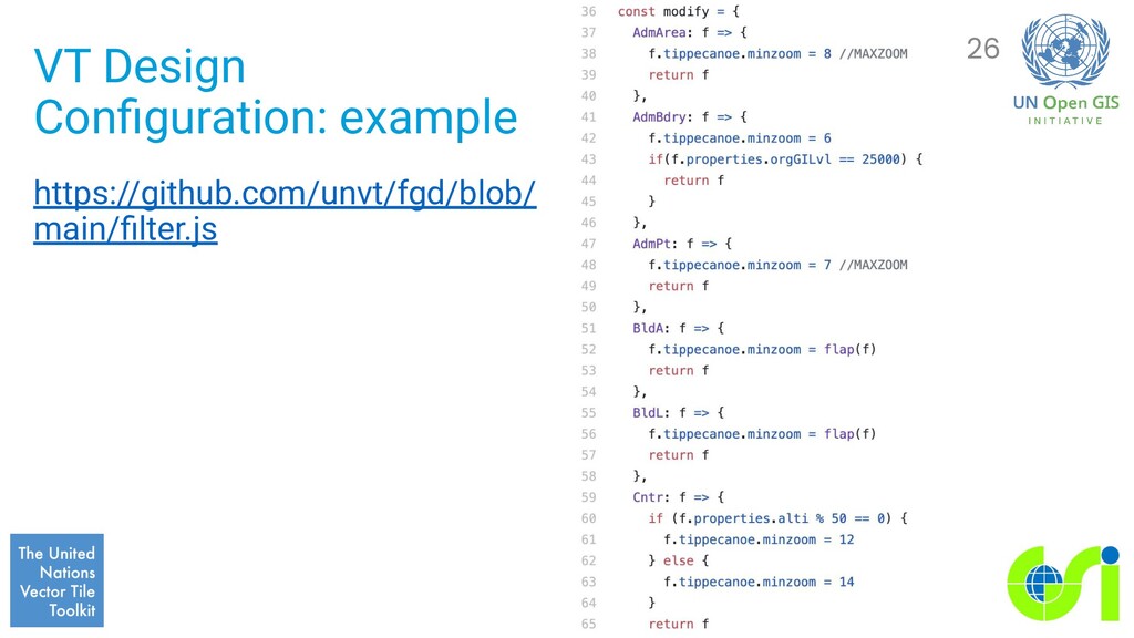
a JavaScript or Ruby script which takes a GeoJSONS from standard input, filters features with adding GeoJSON extention for Tippecanoe, and stream them to standard output as GeoJSONS. 25
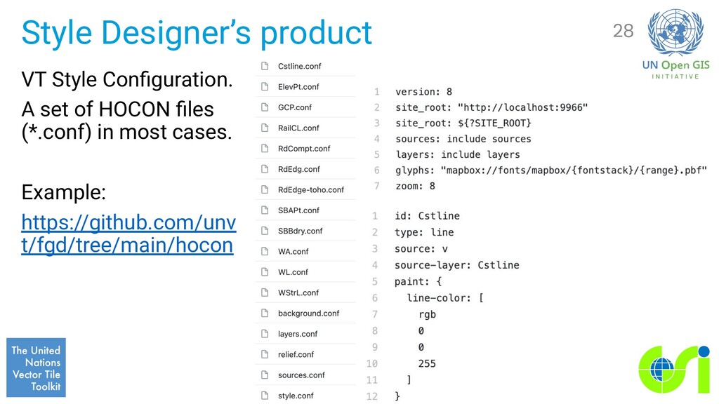
and in harmony with a VT Design Configuration. Human-Optimized Config Object Notation (HOCON) was introduced to organize the style configuration layer-wise because in most cases a style.json is large and complex. 27
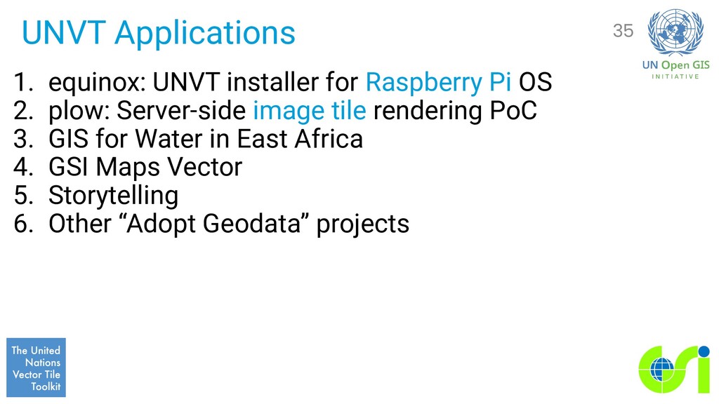
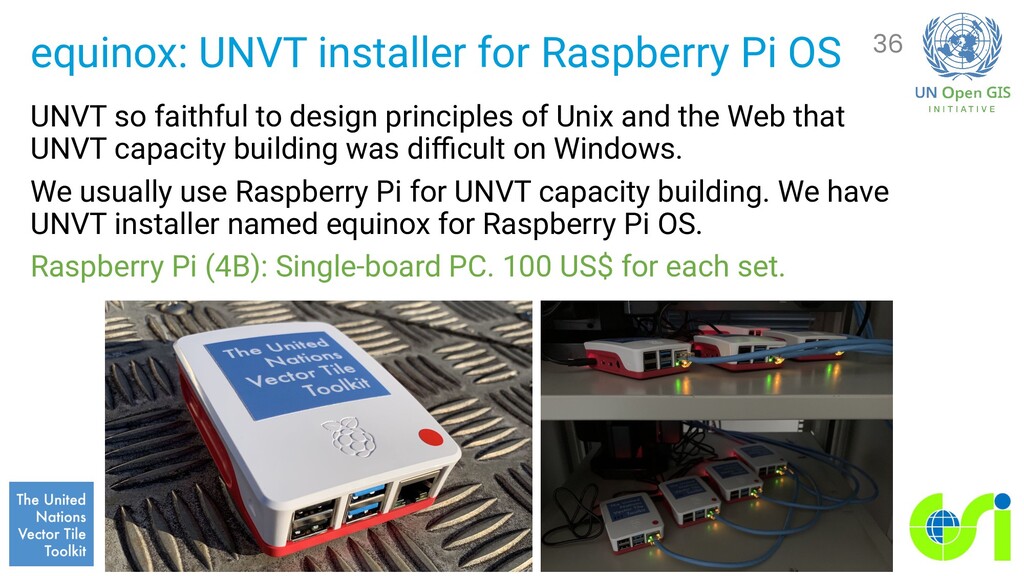
to design principles of Unix and the Web that UNVT capacity building was difficult on Windows. We usually use Raspberry Pi for UNVT capacity building. We have UNVT installer named equinox for Raspberry Pi OS. Raspberry Pi (4B): Single-board PC. 100 US$ for each set. 36
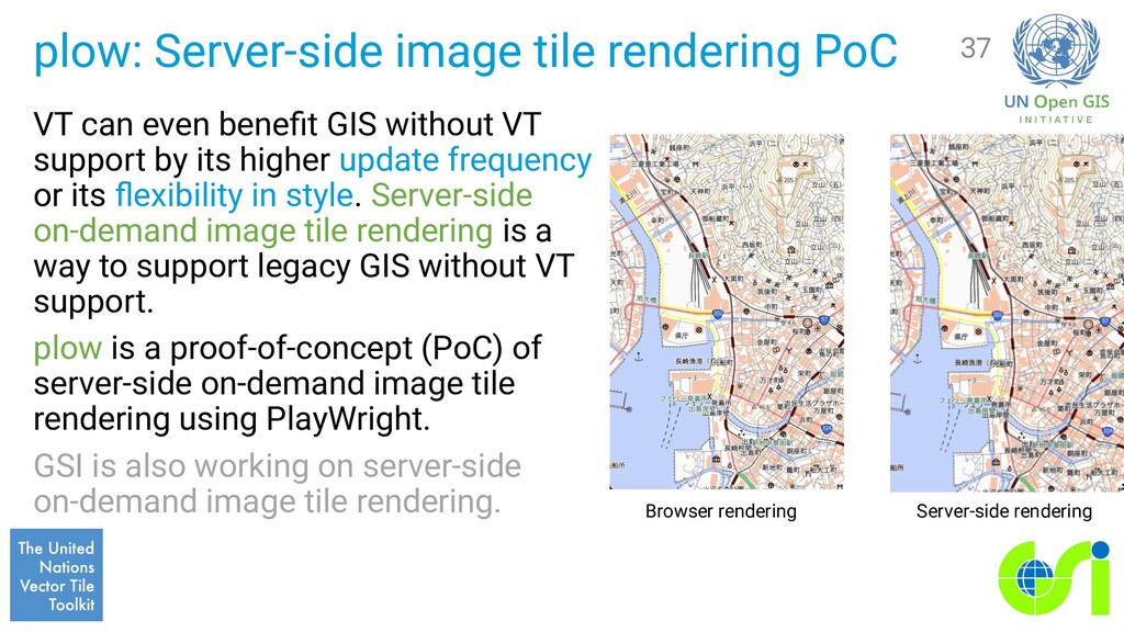
GIS without VT support by its higher update frequency or its flexibility in style. Server-side on-demand image tile rendering is a way to support legacy GIS without VT support. plow is a proof-of-concept (PoC) of server-side on-demand image tile rendering using PlayWright. GSI is also working on server-side on-demand image tile rendering. 37 Browser rendering Server-side rendering
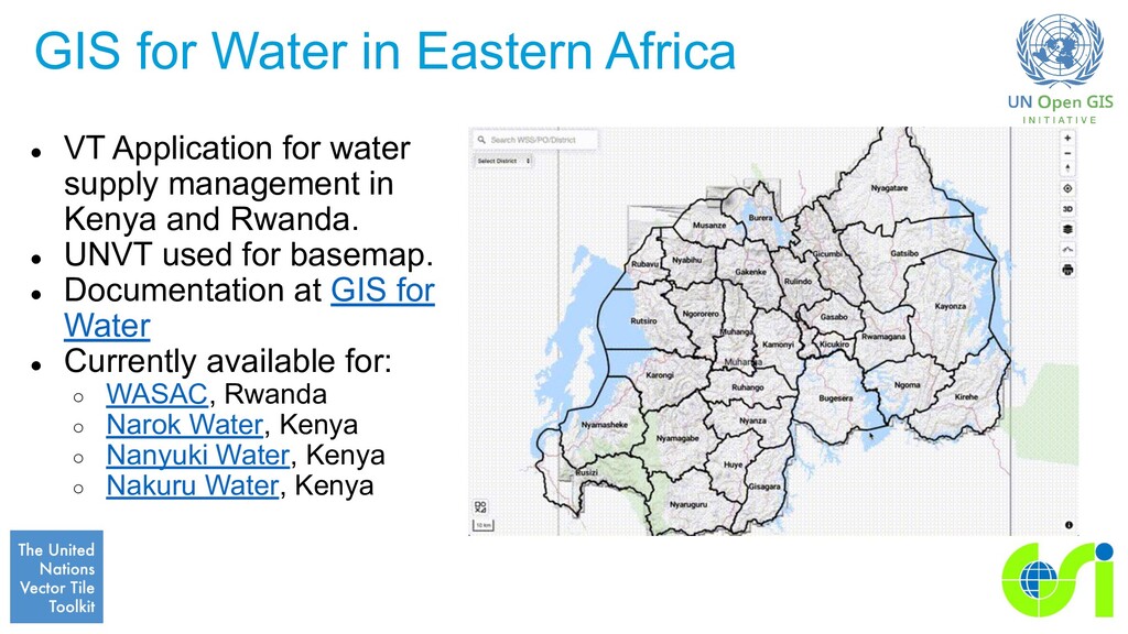
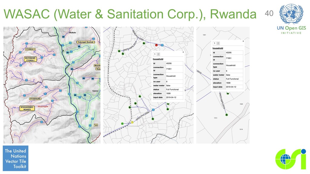
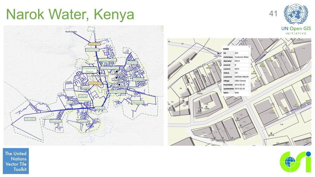
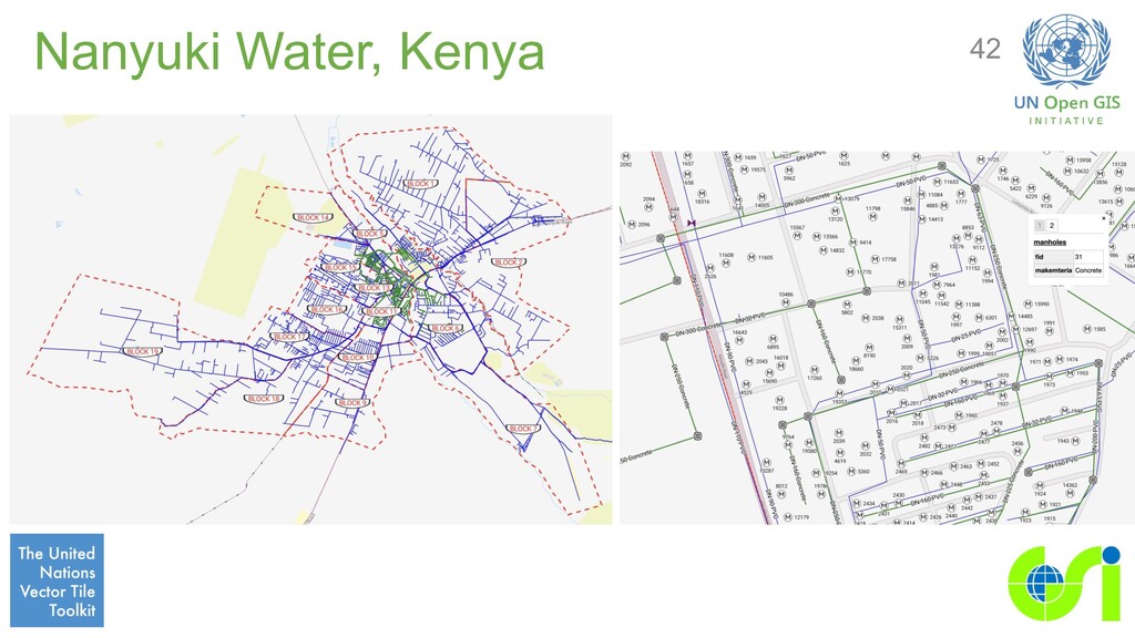
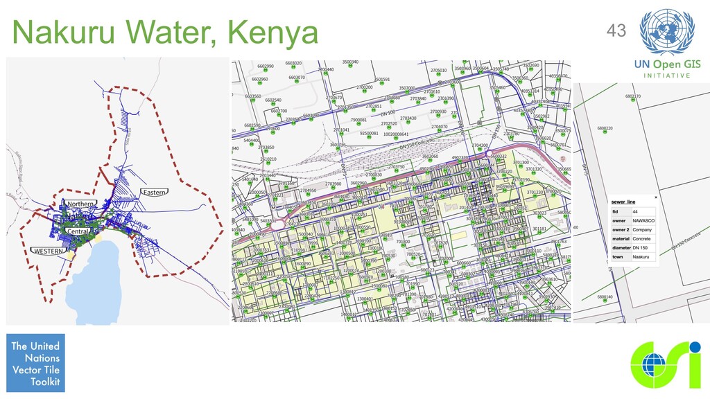
water supply management in Kenya and Rwanda. • UNVT used for basemap. • Documentation at GIS for Water • Currently available for: ◦ WASAC, Rwanda ◦ Narok Water, Kenya ◦ Nanyuki Water, Kenya ◦ Nakuru Water, Kenya
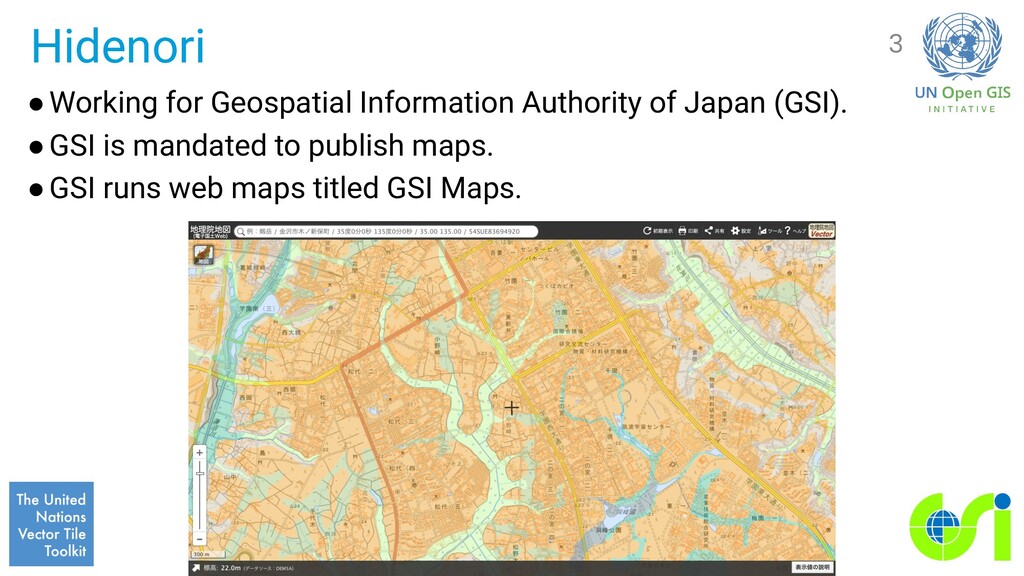
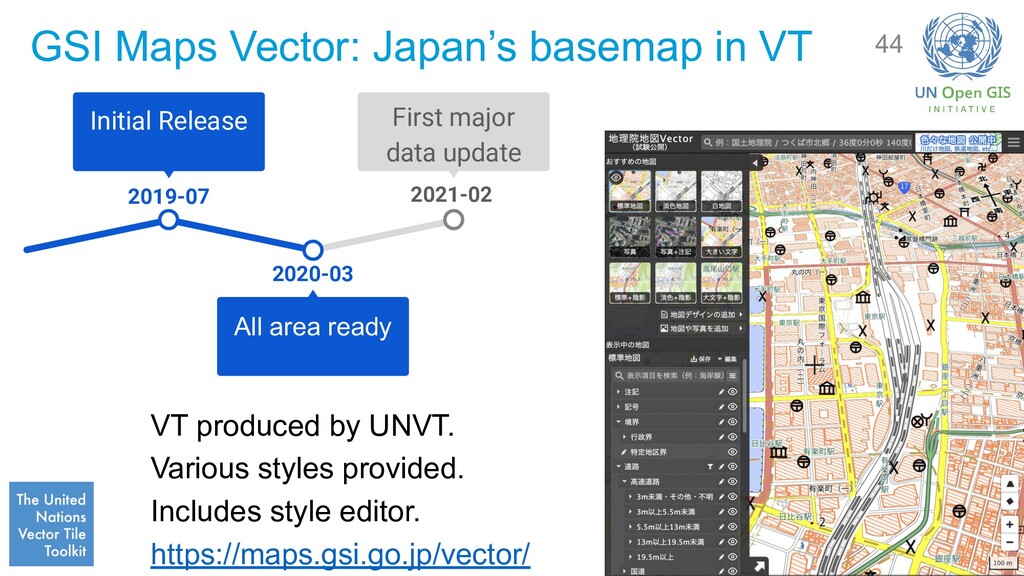
UNVT. Various styles provided. Includes style editor. https://maps.gsi.go.jp/vector/ 44 2021-02 First major data update 2020-03 All area ready 2019-07 Initial Release
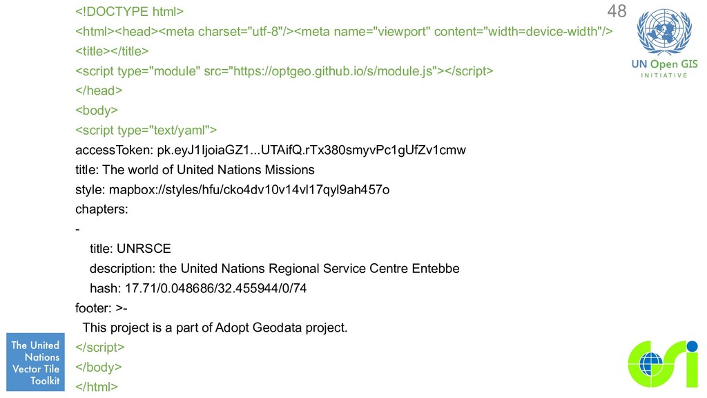
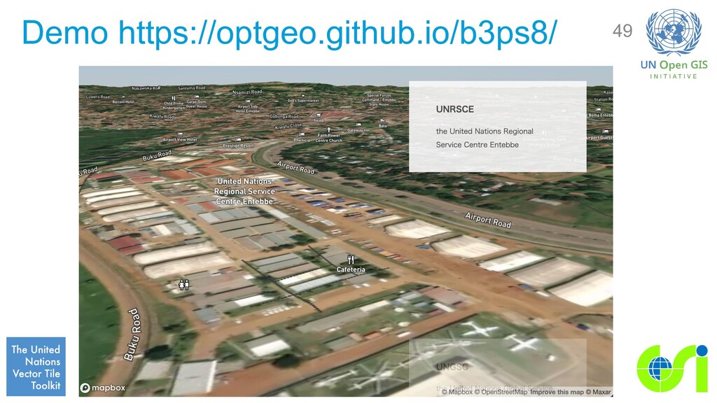
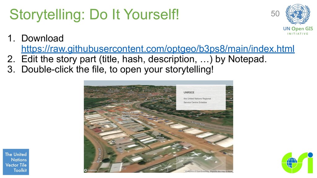
for easy storytelling, e.g.: - title: UNRSCE description: the United Nations Regional Service Centre Entebbe hash: 17.71/0.048686/32.455944/0/74 hash: {zoom}/{lat}/{lng}/{bearing}/{pitch} 45
JS/Leaflet/MapLibre GL uses hash in the URL. For example: https://maps.gsi.go.jp/#15/36.069134/140.113586/ https://optgeo.github.io/b3p/#13.79/35.35156/138.73489/0/60 46
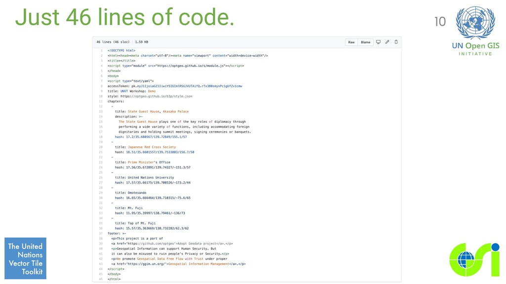
style: mapbox://styles/hfu/cko4dv10v14vl17qyl9ah457o chapters: - title: UNRSCE description: the United Nations Regional Service Centre Entebbe hash: 17.71/0.048686/32.455944/0/74 footer: >- <p>This project is a part of <a href='https://github.com/optgeo'>Adopt Geodata project</a>.</p> 47 This format is called YAML (YAML Ain't Markup Language).
</head> <body> <script type="text/yaml"> accessToken: pk.eyJ1IjoiaGZ1...UTAifQ.rTx380smyvPc1gUfZv1cmw title: The world of United Nations Missions style: mapbox://styles/hfu/cko4dv10v14vl17qyl9ah457o chapters: - title: UNRSCE description: the United Nations Regional Service Centre Entebbe hash: 17.71/0.048686/32.455944/0/74 footer: >- This project is a part of Adopt Geodata project. </script> </body> </html> 48
(optgeo) project is a project in tandem with UNVT. The purpose of the project is to demonstrate the value of VT, and to continuously improve UNVT, by creating VT from open geospatial data which are not yet in VT. Storytelling is a part of the Adopt Geodata project. 51
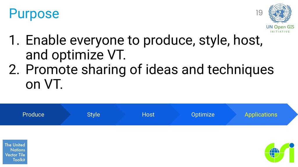
![GeoJSONS Example (for Tippecanoe) … {"type":"Feature","properties":{"orgGILvl":25000,"type":"市区町村 界"},"geometry":{"type":"LineString","coordinates":[[135.2475033,34.87827 78],[135.247415,34.8782711],[135.2472097,34.8782114]]},"tippecanoe":{"l ayer":"AdmBdry","minzoom":6,"maxzoom":16}} {"type":"Feature","properties":{"orgGILvl":25000,"type":"市区町村](https://files.speakerdeck.com/presentations/70446ac67ddf4cc98f1bcb590719b33c/slide_23.jpg)