technology is a "means" and not an “objective" • The "objective" is to solve a historical problem, and if necessary, to utilize non-IT means • The first priority is always to solve the problem • We have partnerships with several academic organizations and companies to solve the problems that exist • We also have a community of about 300 people on Facebook who come to ! for information • However, for now, Code for History is practically one person activity 5
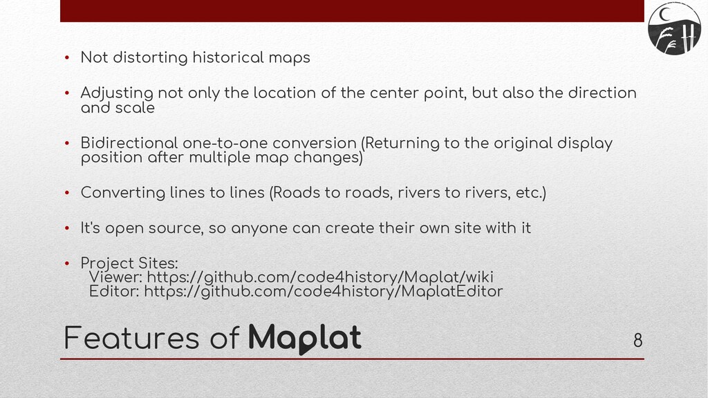
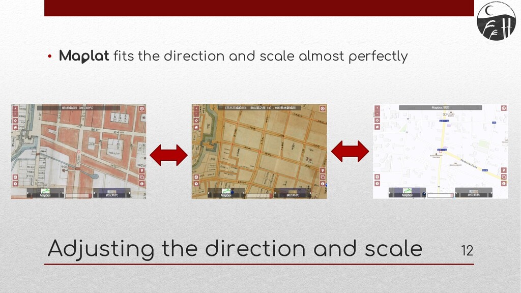
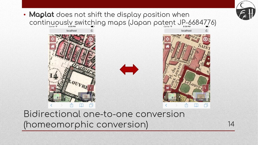
not only the location of the center point, but also the direction and scale • Bidirectional one-to-one conversion (Returning to the original display position after multiple map changes) • Converting lines to lines (Roads to roads, rivers to rivers, etc.) • It's open source, so anyone can create their own site with it • Project Sites: Viewer: https://github.com/code4history/Maplat/wiki Editor: https://github.com/code4history/MaplatEditor 8
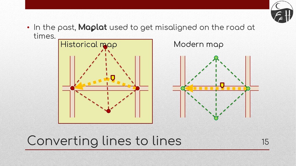
road to a point on the road Converting lines to lines Modern map Corresponding lines (HTGCL) Historical map 16 ※ HTGCL: Historical Topographic Ground Control Line
assets: • Preservation of original materials is the top priority, but it is also important to think about what to do if they are lost, in order to ensure the permanence of cultural assets • Digitization: Cloning cultural assets in a virtual world • Making them open data: Decentralizing the location of data by allowing anyone to use them
prevent the complete loss of cultural assets due to disasters • The data will be used, not just stored, to make them familiar and useful to citizens • It could also create an economic effect that attracts new business • In case the cultural assets are data related to maps or location information, ! can help this! Effects of digitization and open data 21
Prefecture (Gumma Shiryo-net)” • Cooperation in two locations, Tatebayashi city and Tamamura town • Two types of cultural asset data were made to open data and utilized • Historical map images • Location of the stone structures Case study: Tatebayashi city and Tamamura town in Gumma pref. 22
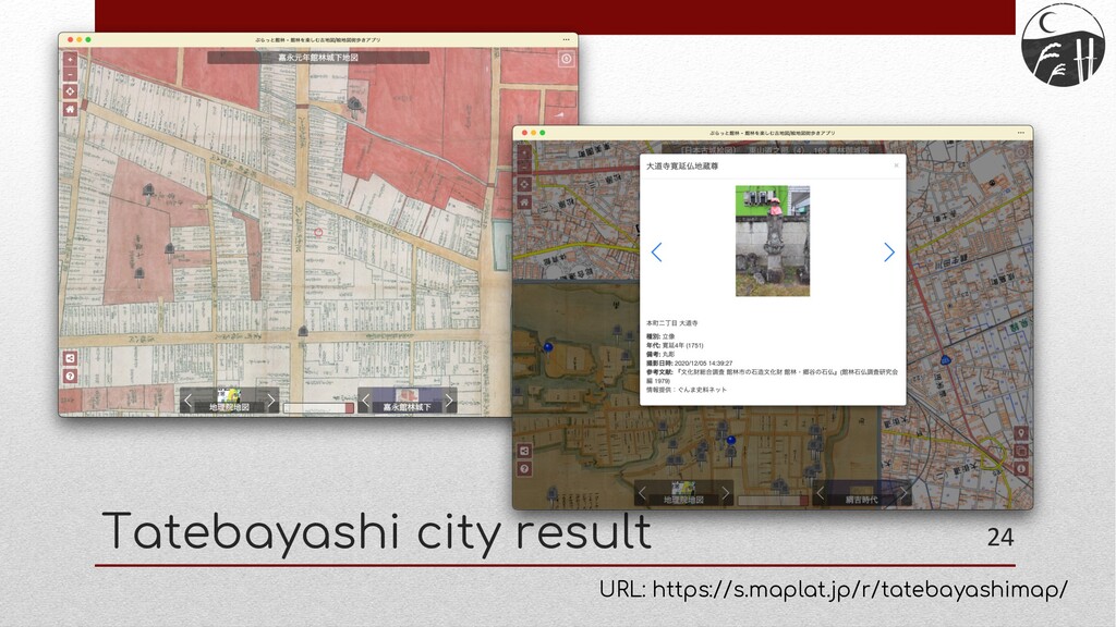
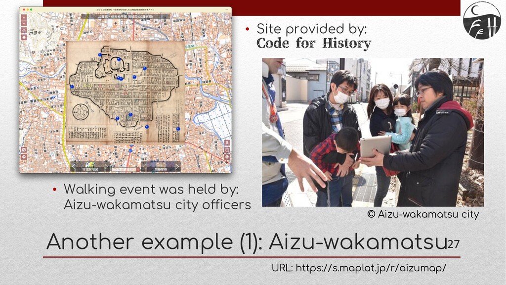
plenty of historical maps available • Focused on activities to resurvey the location of stone structures and make them open data • Previous survey of stone structures was conducted 50 years ago, but the current statuses were unknown because they were not surveyed in conjunction with images or precise locations • Therefore, we are trying to make citizens aware that there are important cultural assets close at hand by re-surveying them, linking images and locations, and making them open data • Current coverage: • City center area: about 80%, rural area: about 10% Tatebayashi city 23
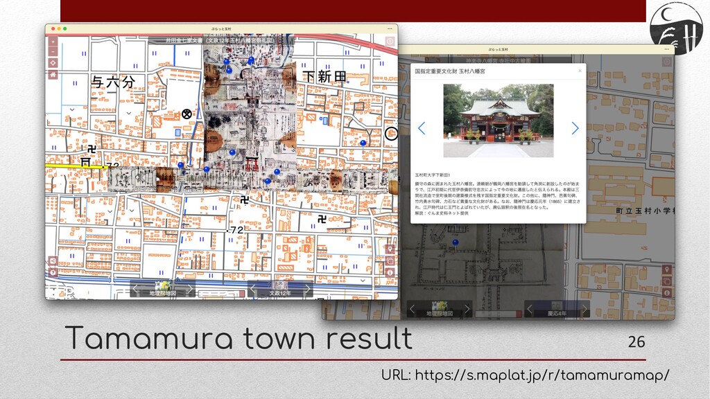
it still has its own proud history and good historical maps • The purpose of this activity was to make them available to the public so that the citizens could become familiar with the history • Surveys of stone structures will be conducted in this town in the future as well • There is also a possibility that we will take measures to make cultural assets more familiar to citizens in both Tatebayashi and Tamamura, such as using the ! site for citizens' street walking events Tamamura town 25
you to walk around town using historical maps • As one of the measures to protect cultural assets from disasters, it is important to decentralize the existence of data through digitization and making them open data • ! can help these activities for map related data Conslusions 30
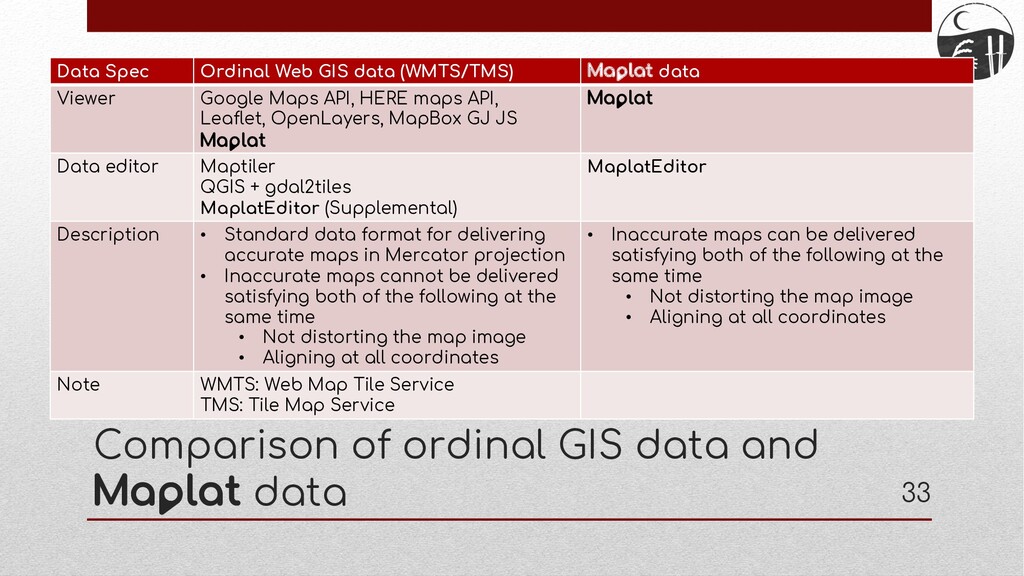
Spec Ordinal Web GIS data (WMTS/TMS) ! data Viewer Google Maps API, HERE maps API, Leaflet, OpenLayers, MapBox GJ JS ! ! Data editor Maptiler QGIS + gdal2tiles MaplatEditor (Supplemental) MaplatEditor Description • Standard data format for delivering accurate maps in Mercator projection • Inaccurate maps cannot be delivered satisfying both of the following at the same time • Not distorting the map image • Aligning at all coordinates • Inaccurate maps can be delivered satisfying both of the following at the same time • Not distorting the map image • Aligning at all coordinates Note WMTS: Web Map Tile Service TMS: Tile Map Service
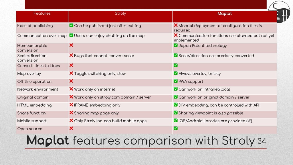
of publishing ✅ Can be published just after editing ❌ Manual deployment of configuration files is required Communication over map ✅ Users can enjoy chatting on the map ❌ Communication functions are planned but not yet implemented Homeomorphic conversion ❌ ✅ Japan Patent technology Scale/direction conversion ❌ Bugs that cannot convert scale ✅ Scale/direction are precisely converted Convert Lines to Lines ❌ ✅ Map overlay ❌ Toggle switching only, slow ✅ Always overlay, briskly Off-line operation ❌ ✅ PWA support Network environment ❌ Work only on internet ✅ Can work on intranet/local Original domain ❌ Work only on stroly.com domain / server ✅ Can work on original domain / server HTML embedding ❌ IFRAME embedding only ✅ DIV embedding, can be controlled with API Share function ❌ Sharing map page only ✅ Sharing viewpoint is also possible Mobile support ❌ Only Stroly Inc. can build mobile apps ✅ iOS/Android libraries are provided (※) Open source ❌ ✅
![End User: kochizufan Github pages: https://code4history.dev/ E-mail: [email protected] Slide: https://speakerdeck.com/kochizufan/code4lib-2021](https://files.speakerdeck.com/presentations/2a8d1adee1fa4aadb5621011765ba8ae/slide_30.jpg)