Introduction to • Introduction of HTGCL (Historical Topographic Ground Control Line) and its application to GIS • Other small topic (Not related with HTGCL) • Conclusions 2
technology is a "means" and not an “objective". • The "objective" is to solve a historical problem, and if necessary, to utilize non-IT means. • The first priority is always to solve the problem. 5
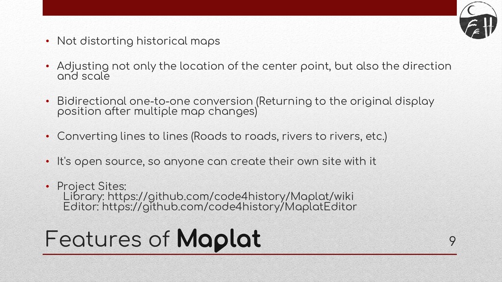
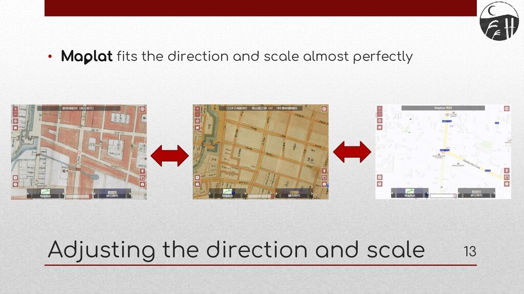
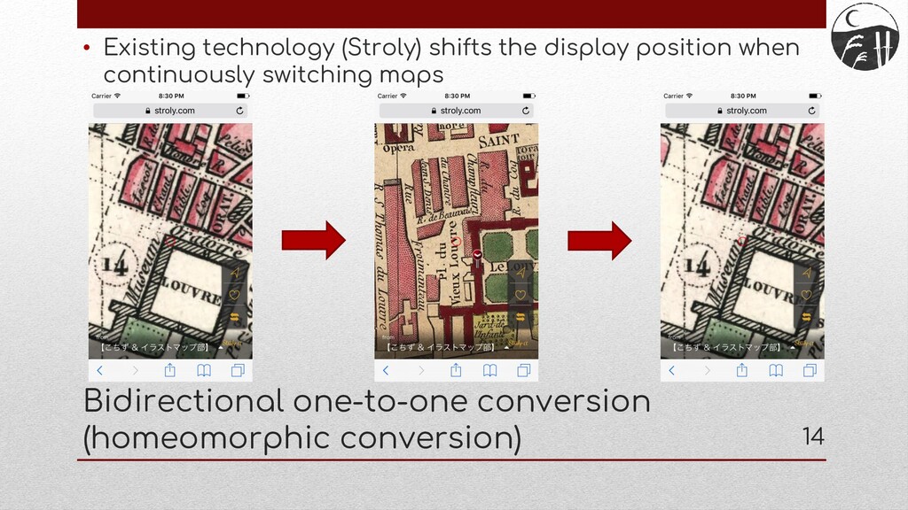
only the location of the center point, but also the direction and scale • Bidirectional one-to-one conversion (Returning to the original display position after multiple map changes) • Converting lines to lines (Roads to roads, rivers to rivers, etc.) • It's open source, so anyone can create their own site with it • Project Sites: Library: https://github.com/code4history/Maplat/wiki Editor: https://github.com/code4history/MaplatEditor 9
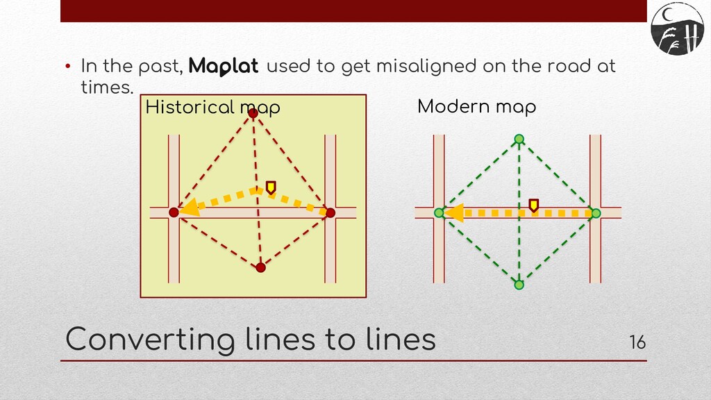
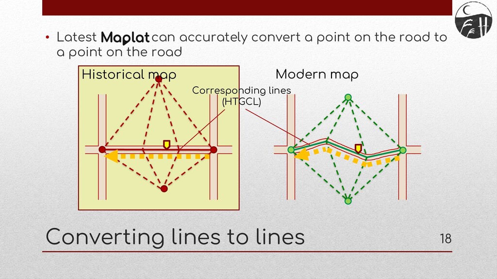
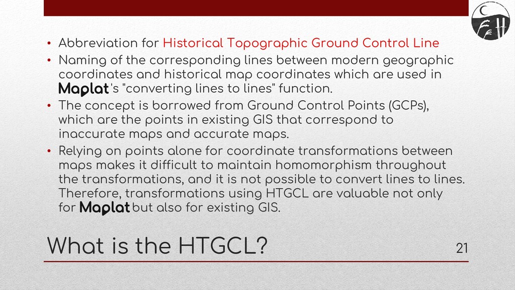
Control Line • Naming of the corresponding lines between modern geographic coordinates and historical map coordinates which are used in 's "converting lines to lines" function. • The concept is borrowed from Ground Control Points (GCPs), which are the points in existing GIS that correspond to inaccurate maps and accurate maps. • Relying on points alone for coordinate transformations between maps makes it difficult to maintain homomorphism throughout the transformations, and it is not possible to convert lines to lines. Therefore, transformations using HTGCL are valuable not only for but also for existing GIS. 21
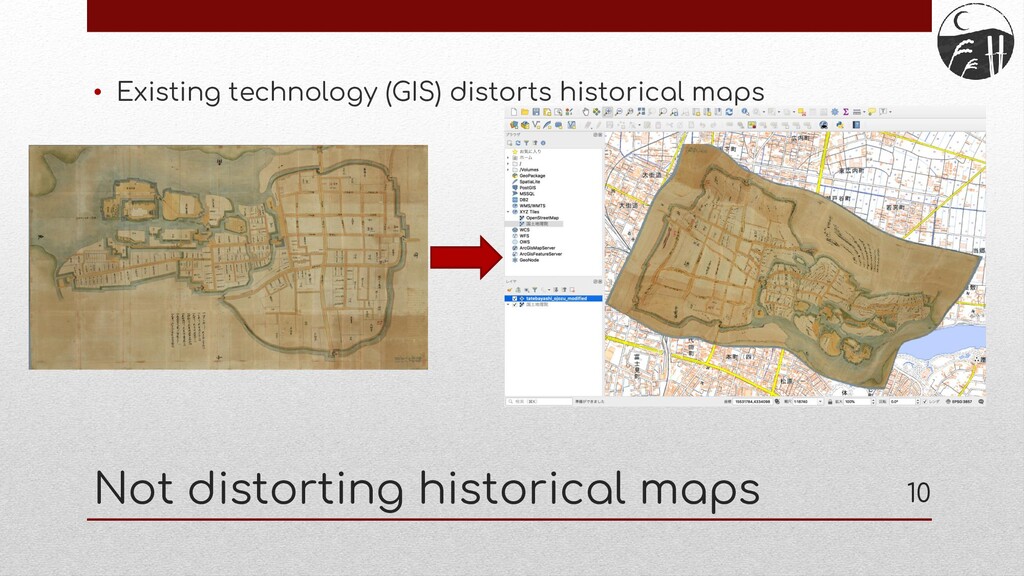
into two main processes • Converting coordinates between exact geographic coordinates and historical map coordinates, with features such as maintaining homomorphism and converting lines to lines => A • Overlapping historical map and modern map according to the result of the coordinate transformation, with adjusting the position, direction and scale. => B • Handling historical map with existing GIS also can be divided into two main processes • Converting coordinates between exact geographic coordinates and historical map coordinates => C • According to the results of the coordinate transformation, the historical map is distorted, reorganized into precise geographic coordinates and superimposed on the modern map. => D • If 's coordinate transformation A is better than existing GIS's coordinate transformation C, can't 's coordinate transformation A can be exported as pre-process of D in GIS? 22
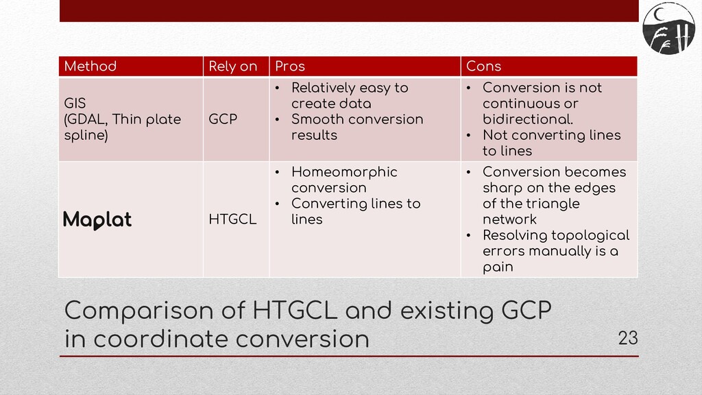
Rely on Pros Cons GIS (GDAL, Thin plate spline) GCP • Relatively easy to create data • Smooth conversion results • Conversion is not continuous or bidirectional. • Not converting lines to lines HTGCL • Homeomorphic conversion • Converting lines to lines • Conversion becomes sharp on the edges of the triangle network • Resolving topological errors manually is a pain 23
used HTGCL • The continuity and bi- directionality of the map coordinates is lost, as evidenced by the occurrence of spatial loops in some places. • Although intensely distorted, the continuity and bi- directionality of space, or in other words, homeomorphi sm, is strongly maintained.
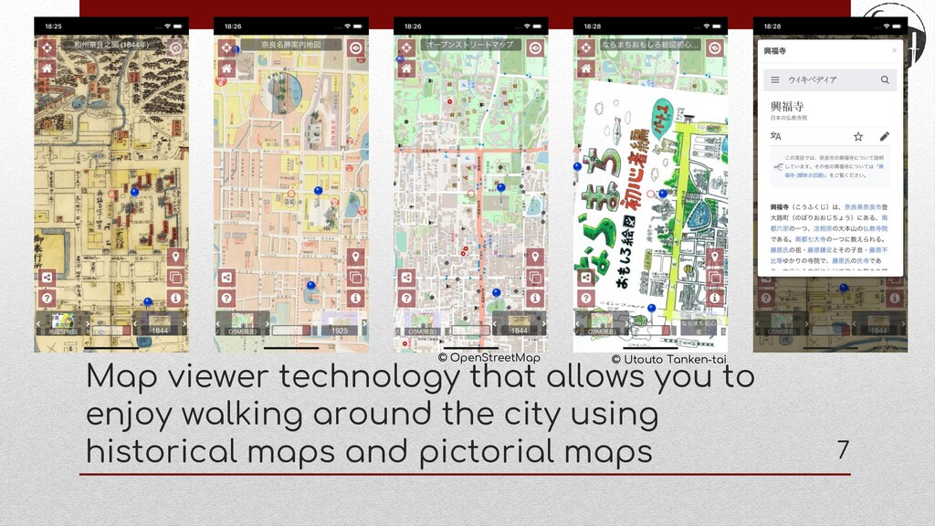
The result used HTGCL • The green line shows the modern roads, but the roads on the historical map side have been violently distorted into a curve and are off the green lines. • The roads on the historical map side have been transformed to follow the green lines definitely, although somewhat distorted.
result used GCP Original data used in conversion • Transformations using HTGCL are computed by vector transformations within triangles generated by the triangulation. • As a result, the transformations across the edges can result in sharp shape. • We are investigating whether there are any measures to mitigate this change. Sharp conversion The edge of triangulation which is used for this sharp transformation
errors case Fixed by adding dummy GCP Errors Dummy GCP • To perform a homeomorphic transformation with HTGCL, there must not be any topological errors in the triangulation. • If topological errors exist, it can be resolved by adding dummy GCPs in the appropriate places, but for now we have to do it manually. • We are collecting enough examples of what error cases and where GCPs need to be added, and hope to automate topological errors resolution in the future.
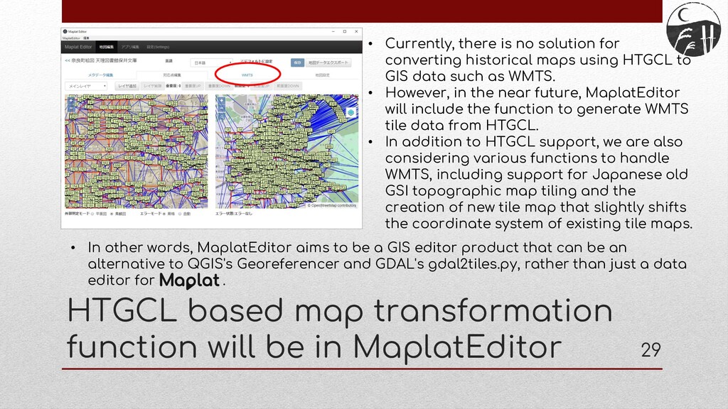
• Currently, there is no solution for converting historical maps using HTGCL to GIS data such as WMTS. • However, in the near future, MaplatEditor will include the function to generate WMTS tile data from HTGCL. • In addition to HTGCL support, we are also considering various functions to handle WMTS, including support for Japanese old GSI topographic map tiling and the creation of new tile map that slightly shifts the coordinate system of existing tile maps. • In other words, MaplatEditor aims to be a GIS editor product that can be an alternative to QGIS's Georeferencer and GDAL's gdal2tiles.py, rather than just a data editor for .
Now we are developing a Service Worker framework that works with PWA (Progressive Web App) that can cache tile data for tile maps offline. This framework makes it easy to create PWA map applications that can work offline. • It supports caching of map tiles, bulk download of caches, and clearing of caches. The Service Worker is already almost complete and we are developing a wrap class to make it easy to use on the front end. At the moment it only supports raster tiles, but if it is technically possible to support vector tiles, we will support it. • https://github.com/code4history/TileCacheServiceWorker
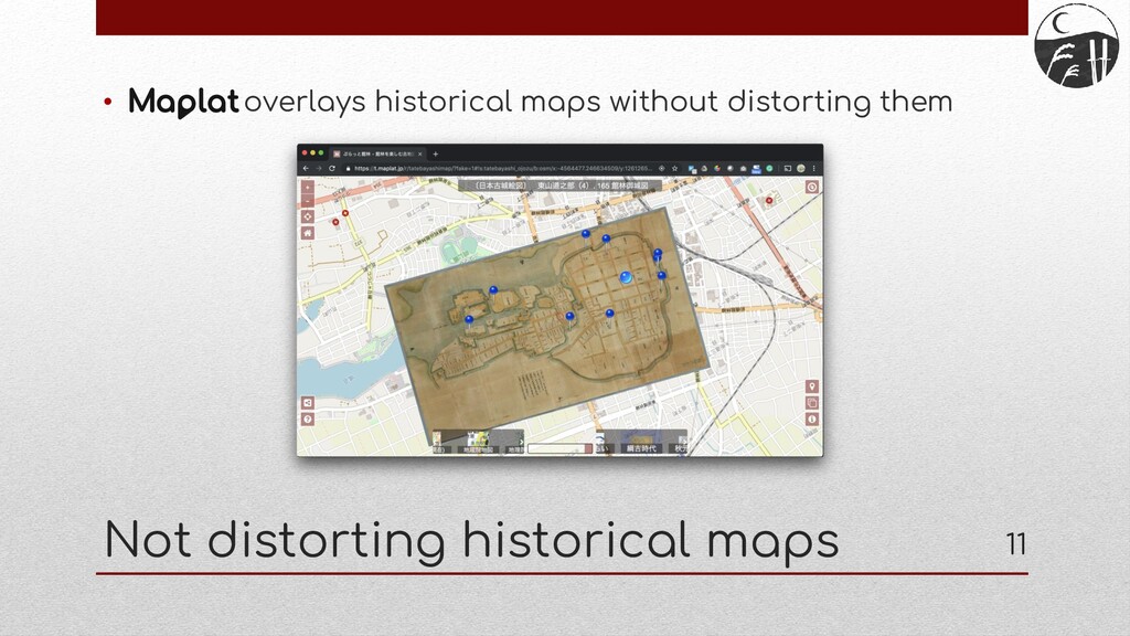
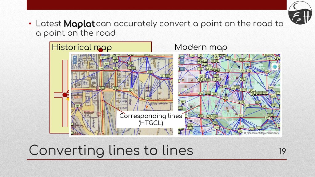
to walk around town using historical maps. • One of the features of is the ability to convert lines to lines in the coordinate conversion between historical maps and modern maps. • The corresponding lines networks those are set up when converting lines to lines is named HTGCL. • Since coordinate conversion using HTGCL has advantages over coordinate conversion using GCP in existing GIS, there is also value in creating tile map data by GIS-like historical map image transformation. • MaplatEditor will not only serve as a data creation editor for , but will also enhance the ability to create GIS tile map data in the future. Conslusions 33
engineer, and as the antithesis to historical map processing in GIS. As a result of pursuing that approach, I am very happy about the possibility of providing a new paradigm on the GIS side as a result. • I think this is also the result of developing , a solution with a different concept than GIS, but with the base technology system of GIS in place. I was also previously the developer of another solution called Stroly, but Stroly was a technology that was not based on a GIS technology system, and if I had continued to develop Stroly, I don't think we would be making this presentation today. • However, at any rate, is being developed by just one person, so I have no timetable yet for when this feature will be implemented. I have a lot of other features that I need to prioritize and develop, so it's likely to be years in the future. • is an open source activity, so if any GIS expert developers are interested in this presentation, please help me. Last comments 34
![End User: kochizufan Github pages: https://code4history.dev/ E-mail: [email protected] Slide: https://speakerdeck.com/kochizufan/foss4g-japan-2020](https://files.speakerdeck.com/presentations/0ee4febad83b4a81abfc50e9e2878e0e/slide_34.jpg)