source product of Code for History, and a conceptual presentation on potential areas of future collaboration between and OSM. There is nothing specific about collaboration at this time in terms of actual implementations or future timelines, so we hope you understand that. 2
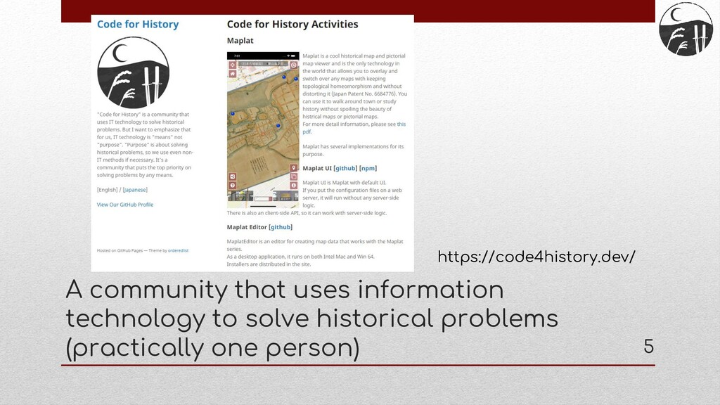
technology is a "means" and not an “objective". • The "objective" is to solve a historical problem, and if necessary, to utilize non-IT means. • The first priority is always to solve the problem. 6
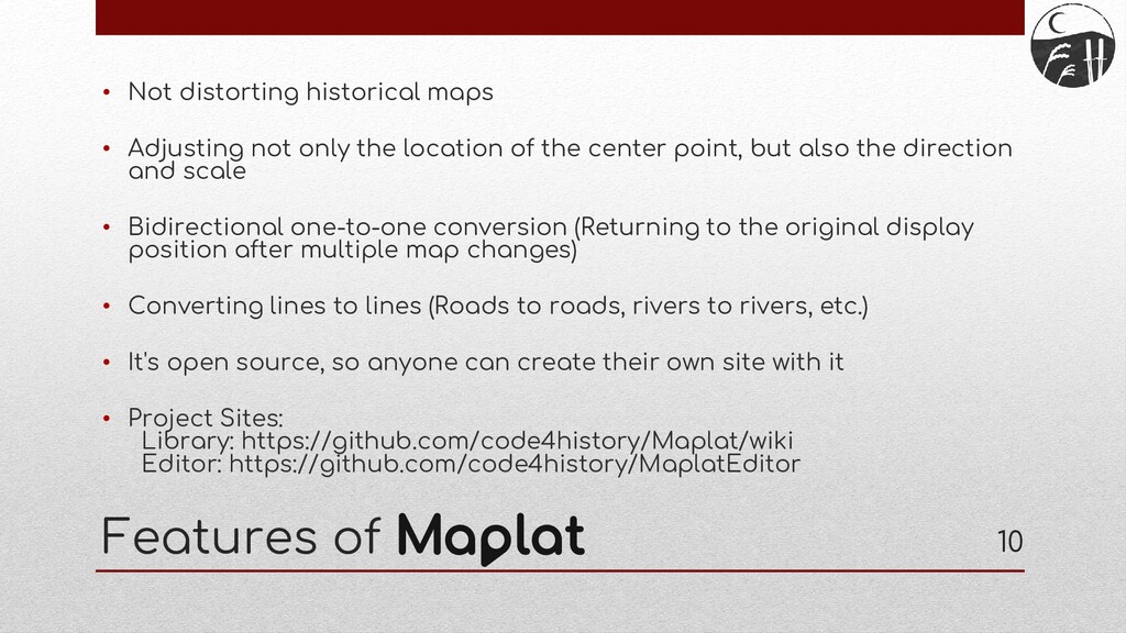
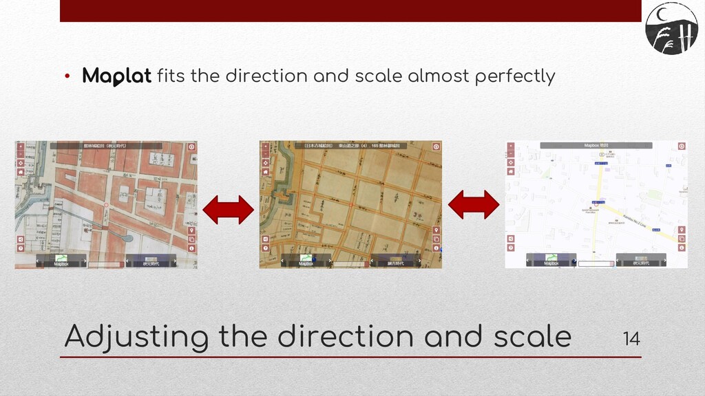
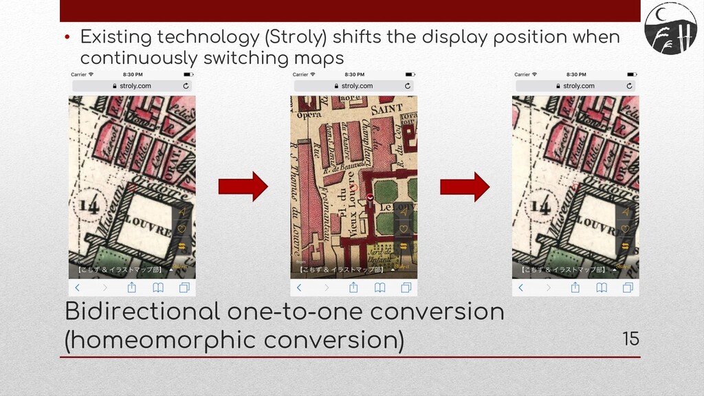
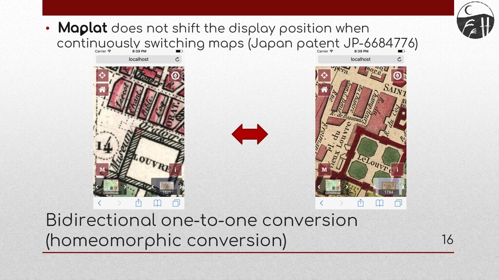
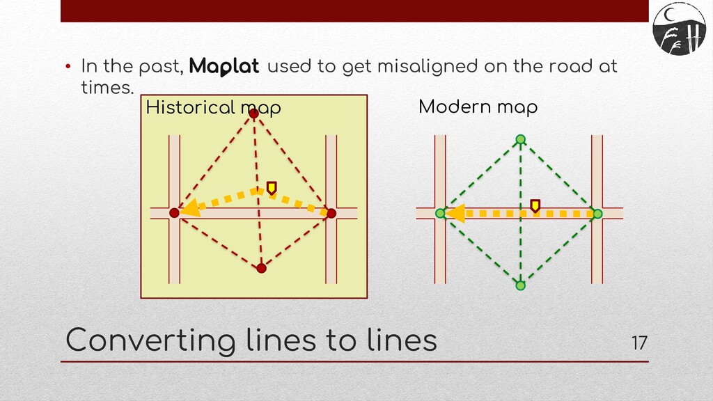
only the location of the center point, but also the direction and scale • Bidirectional one-to-one conversion (Returning to the original display position after multiple map changes) • Converting lines to lines (Roads to roads, rivers to rivers, etc.) • It's open source, so anyone can create their own site with it • Project Sites: Library: https://github.com/code4history/Maplat/wiki Editor: https://github.com/code4history/MaplatEditor 10
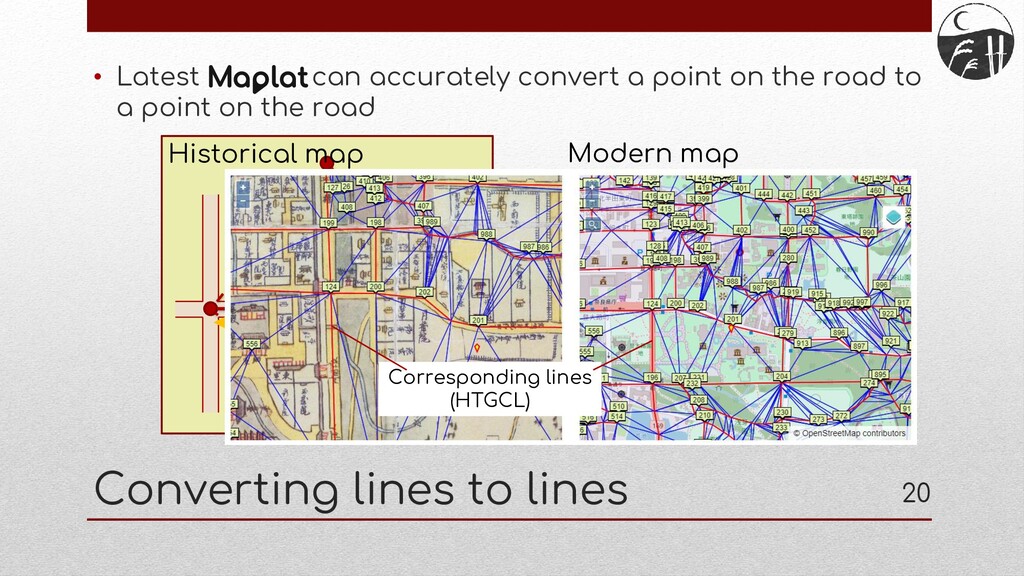
Control Line • Naming of the corresponding lines between modern geographic coordinates and historical map coordinates which are used in 's "converting lines to lines" function. • The concept is borrowed from Ground Control Points (GCPs), which are the points in existing GIS that correspond to inaccurate maps and accurate maps. • Relying on points alone for coordinate transformations between maps makes it difficult to maintain homeomorphism throughout the transformations, and it is not possible to convert lines to lines. Therefore, transformations using HTGCL are valuable not only for but also for existing GIS. • More on that in tomorrow's FOSS4G 2020 announcement. 22
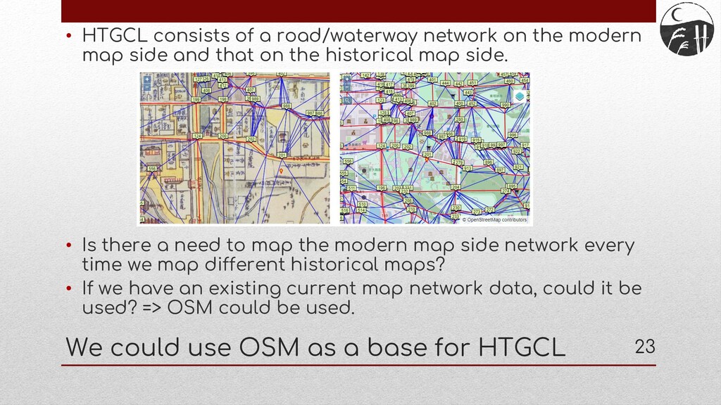
map side and that on the historical map side. • Is there a need to map the modern map side network every time we map different historical maps? • If we have an existing current map network data, could it be used? => OSM could be used. We could use OSM as a base for HTGCL 23
in the map UI on the modern map side of the editor • Read OSM data of the area as a network of modern map side • Then, specify the corresponding points and lines on the historical map Ideas on how to read OSM data 24 Download OSM network
modern map, could become a backbone axis of data connecting regional changes over history. • The use of clear, common modern map-side network data could also provide valuable data for mechanical analysis of changes in history, such as a river becoming a culvert and turning into a road or a new road being built. 25 OSM data as the backbone of regional history
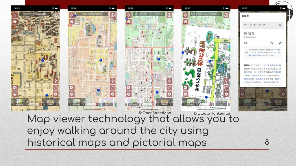
to walk around town using historical maps. • One of the features of is the ability to convert lines to lines in the coordinate conversion between historical maps and modern maps. • The corresponding lines networks those are set up when converting lines to lines is named HTGCL. • There is a plan to use OSM data for the network of the modern map side of HTGCL. • The OSM may become a backbone axis that connects maps over history, making it easier to analyze historical changes mechanically. Conslusions 27
since starting Maplat, I haven't done much OSM activity because I've been too busy with 's activities. Since deals with history, while OSM deals with the present, I was wondering if I would have less opportunity to get involved with OSM in the future. But now, I am happy to have the possibility to get involved with OSM with an unexpected idea. • However, at any rate, is being developed by just one person, so I have no timetable yet for when this feature will be implemented. I have a lot of other features that I need to prioritize and develop, so it's likely to be years in the future. • is an open source activity, so if any OSM expert developers are interested in this presentation, please help me. Last comments 28
![End User: kochizufan Github pages: https://code4history.dev/ E-mail: [email protected] Slide: https://speakerdeck.com/kochizufan/sotm-japan-2020](https://files.speakerdeck.com/presentations/67b33f8a83a64688b9dc40952854cd64/slide_28.jpg)