the Gulf of Mexico Kristen Thyng Rob Hetland IMUM 2013 Texas A&M University September 17, 2013 Kristen Thyng (Texas A&M) IMUM 2013 September 17, 2013 1 / 13
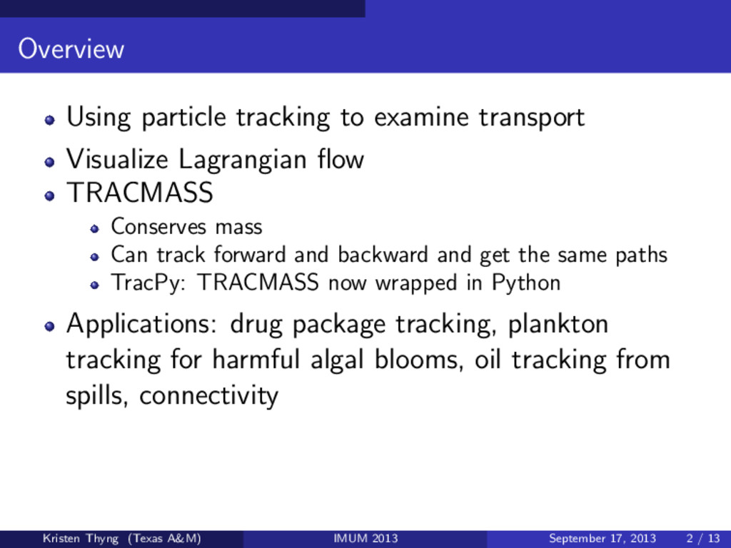
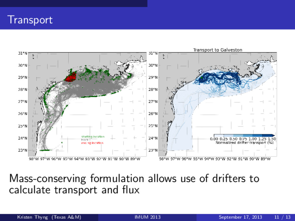
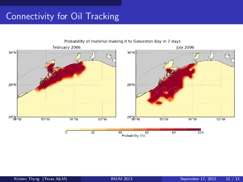
TRACMASS Conserves mass Can track forward and backward and get the same paths TracPy: TRACMASS now wrapped in Python Applications: drug package tracking, plankton tracking for harmful algal blooms, oil tracking from spills, connectivity Kristen Thyng (Texas A&M) IMUM 2013 September 17, 2013 2 / 13
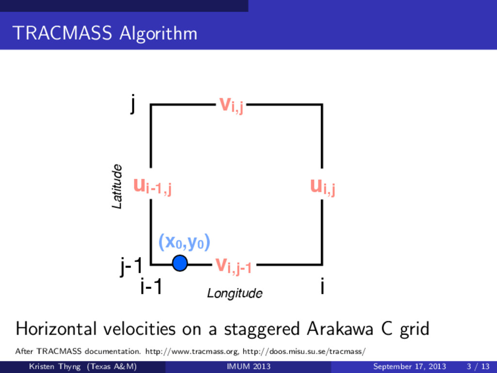
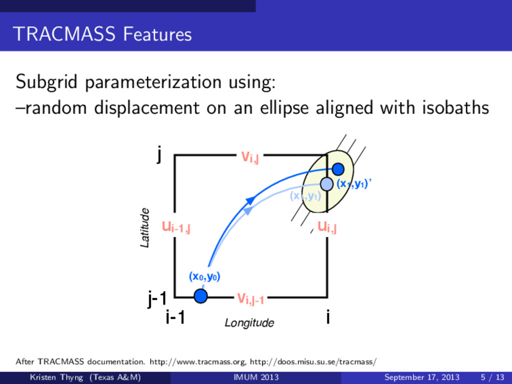
(x0,y0 ) Longitude Latitude Horizontal velocities on a staggered Arakawa C grid After TRACMASS documentation. http://www.tracmass.org, http://doos.misu.su.se/tracmass/ Kristen Thyng (Texas A&M) IMUM 2013 September 17, 2013 3 / 13
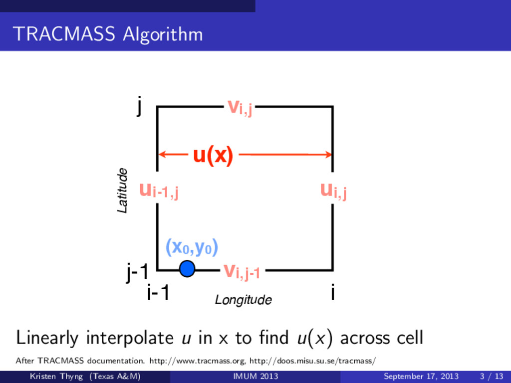
(x0,y0 ) Longitude Latitude u(x) Linearly interpolate u in x to find u(x) across cell After TRACMASS documentation. http://www.tracmass.org, http://doos.misu.su.se/tracmass/ Kristen Thyng (Texas A&M) IMUM 2013 September 17, 2013 3 / 13
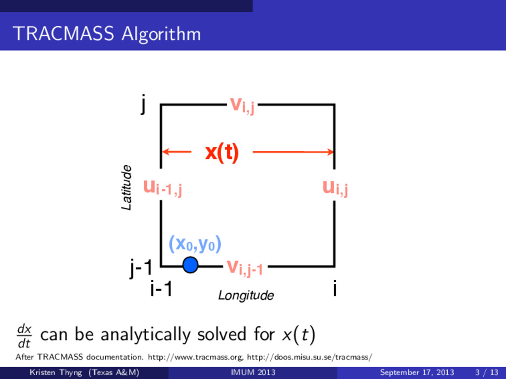
(x0,y0 ) Longitude Latitude x(t) dx dt can be analytically solved for x(t) After TRACMASS documentation. http://www.tracmass.org, http://doos.misu.su.se/tracmass/ Kristen Thyng (Texas A&M) IMUM 2013 September 17, 2013 3 / 13
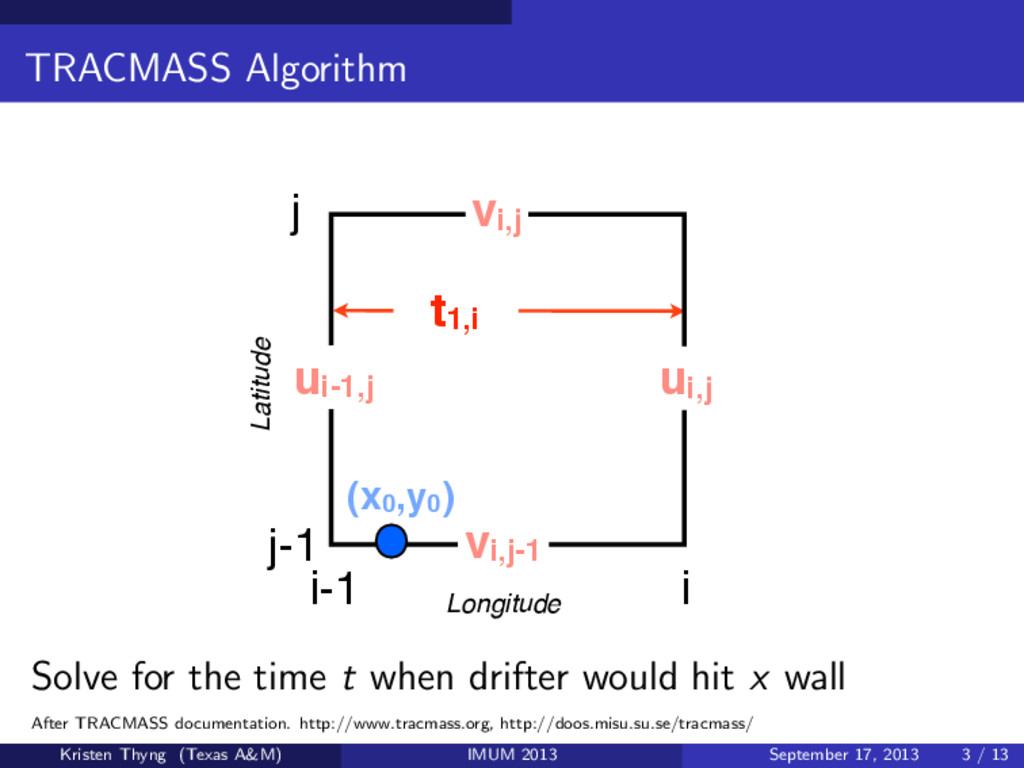
(x0,y0 ) Longitude Latitude t1,i Solve for the time t when drifter would hit x wall After TRACMASS documentation. http://www.tracmass.org, http://doos.misu.su.se/tracmass/ Kristen Thyng (Texas A&M) IMUM 2013 September 17, 2013 3 / 13
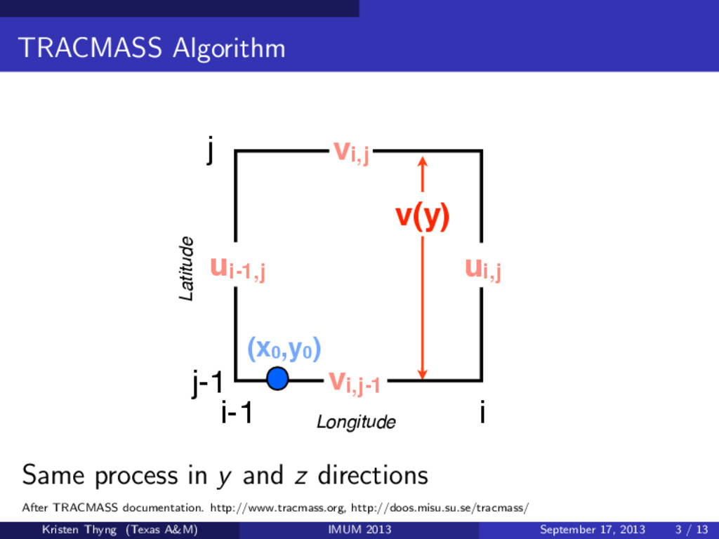
(x0,y0 ) Longitude Latitude v(y) Same process in y and z directions After TRACMASS documentation. http://www.tracmass.org, http://doos.misu.su.se/tracmass/ Kristen Thyng (Texas A&M) IMUM 2013 September 17, 2013 3 / 13
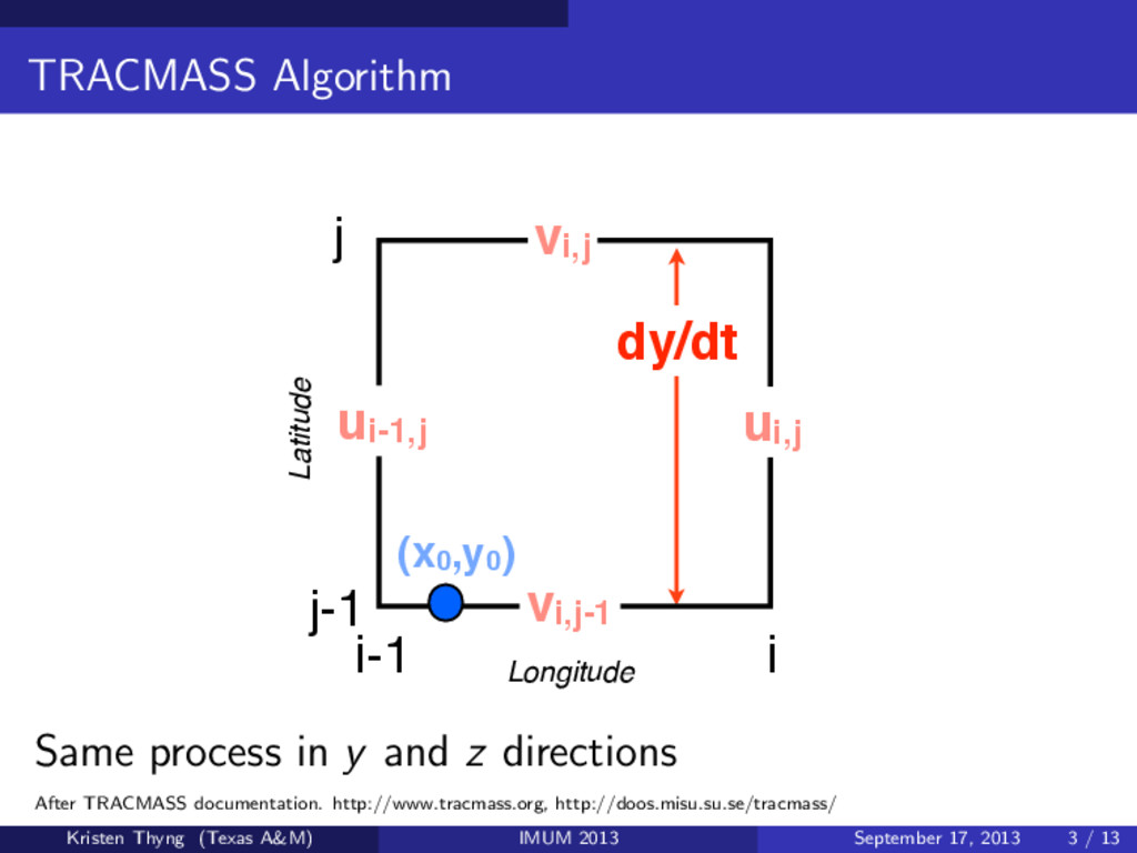
(x0,y0 ) Longitude Latitude dy/dt Same process in y and z directions After TRACMASS documentation. http://www.tracmass.org, http://doos.misu.su.se/tracmass/ Kristen Thyng (Texas A&M) IMUM 2013 September 17, 2013 3 / 13
(x0,y0 ) Longitude Latitude y(t) Same process in y and z directions After TRACMASS documentation. http://www.tracmass.org, http://doos.misu.su.se/tracmass/ Kristen Thyng (Texas A&M) IMUM 2013 September 17, 2013 3 / 13
(x0,y0 ) Longitude Latitude t1,j Same process in y and z directions After TRACMASS documentation. http://www.tracmass.org, http://doos.misu.su.se/tracmass/ Kristen Thyng (Texas A&M) IMUM 2013 September 17, 2013 3 / 13
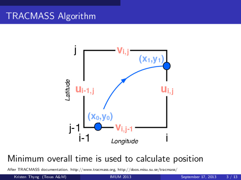
(x0,y0 ) Longitude Latitude (x1,y1 ) Minimum overall time is used to calculate position After TRACMASS documentation. http://www.tracmass.org, http://doos.misu.su.se/tracmass/ Kristen Thyng (Texas A&M) IMUM 2013 September 17, 2013 3 / 13
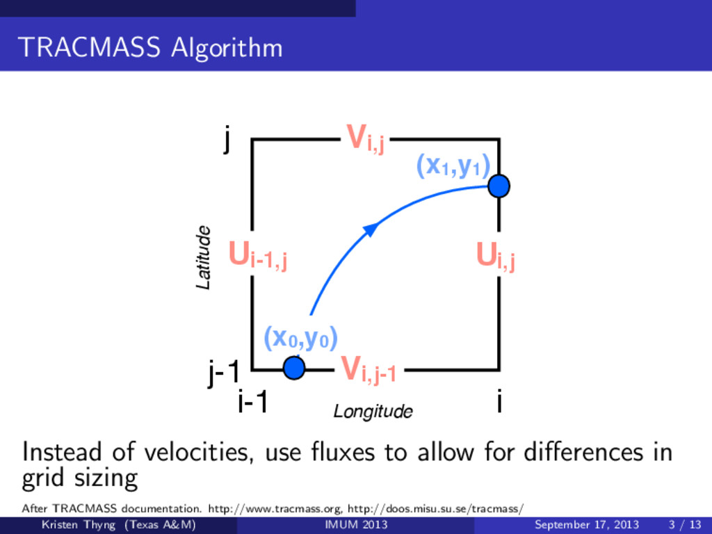
(x0,y0 ) Longitude Latitude (x1,y1 ) Instead of velocities, use fluxes to allow for differences in grid sizing After TRACMASS documentation. http://www.tracmass.org, http://doos.misu.su.se/tracmass/ Kristen Thyng (Texas A&M) IMUM 2013 September 17, 2013 3 / 13
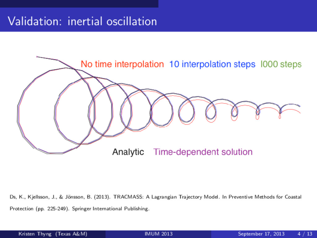
Schematic illustration of how the velocity fields u(t) can be updated in time, with new GCM data at regular intervals tG in green and linearly interpolated velocity points in red with the time step ti . The number of intermediate time steps between two GCM velocities is in this example IS = tG/ ti = 4 updated successively as new fields are available. If this is made ‘on-line’, i.e., in the same time as the GCM is integrated, then this time interval will simply be the same as the time step the GCM is integrated with, which is typically of the order of minutes in a global GCM. If instead the trajectories are calculated ‘off-line’ it will be at least as often as the fields have been stored by the GCM. A linear time interpolation of the velocity fields between two GCM velocity fields Interpolate between model outputs for time stepping (or use time dependent algorithm) Ds, K., Kjellsson, J., & J¨ onsson, B. (2013). TRACMASS: A Lagrangian Trajectory Model. In Preventive Methods for Coastal Protection (pp. 225-249). Springer International Publishing. Kristen Thyng (Texas A&M) IMUM 2013 September 17, 2013 3 / 13
B. (2013). TRACMASS: A Lagrangian Trajectory Model. In Preventive Methods for Coastal Protection (pp. 225-249). Springer International Publishing. Kristen Thyng (Texas A&M) IMUM 2013 September 17, 2013 4 / 13
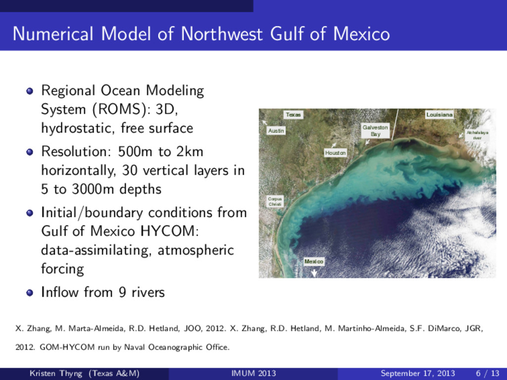
System (ROMS): 3D, hydrostatic, free surface Resolution: 500m to 2km horizontally, 30 vertical layers in 5 to 3000m depths Initial/boundary conditions from Gulf of Mexico HYCOM: data-assimilating, atmospheric forcing Inflow from 9 rivers Mexico Galveston Bay Atchafalaya river Corpus Christi Houston Louisiana Texas Austin X. Zhang, M. Marta-Almeida, R.D. Hetland, JOO, 2012. X. Zhang, R.D. Hetland, M. Martinho-Almeida, S.F. DiMarco, JGR, 2012. GOM-HYCOM run by Naval Oceanographic Office. Kristen Thyng (Texas A&M) IMUM 2013 September 17, 2013 6 / 13