Upgrade to Pro — share decks privately, control downloads, hide ads and more …

Untangling Pittsburgh (by Deconstructing the Road Map)

Untangling Pittsburgh (by Deconstructing the Road Map)

Robert Firth
Informing Design

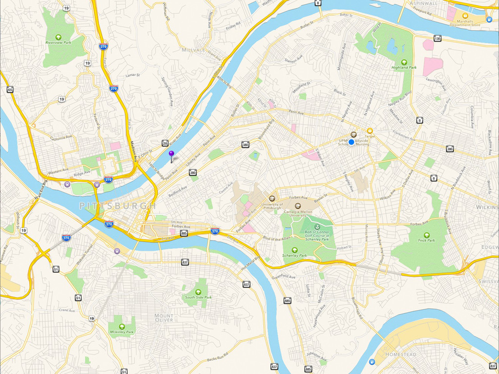
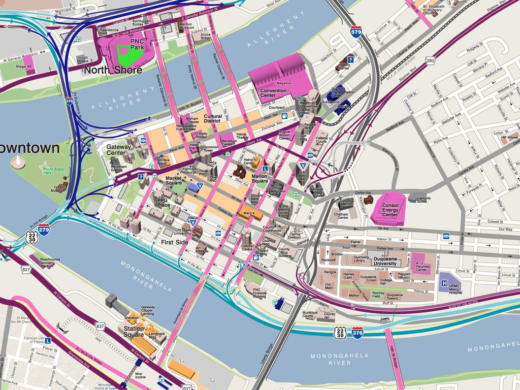
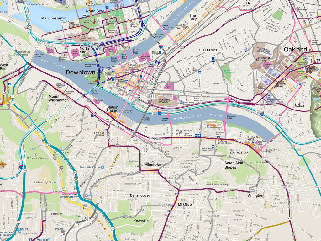
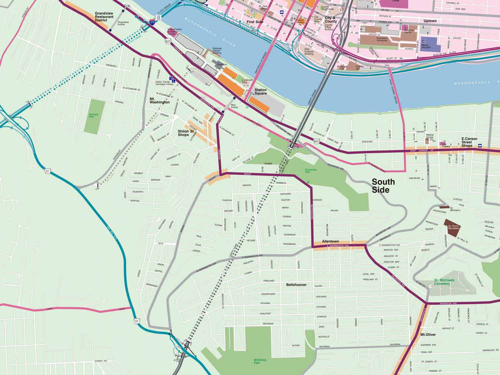
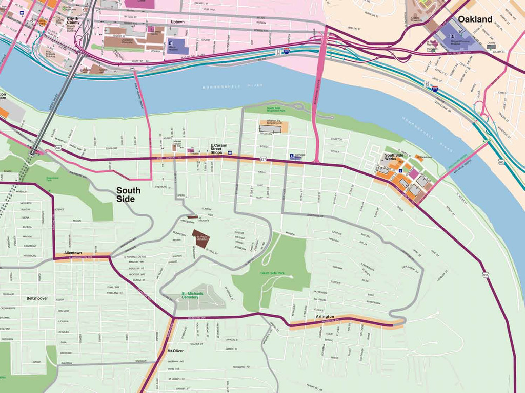
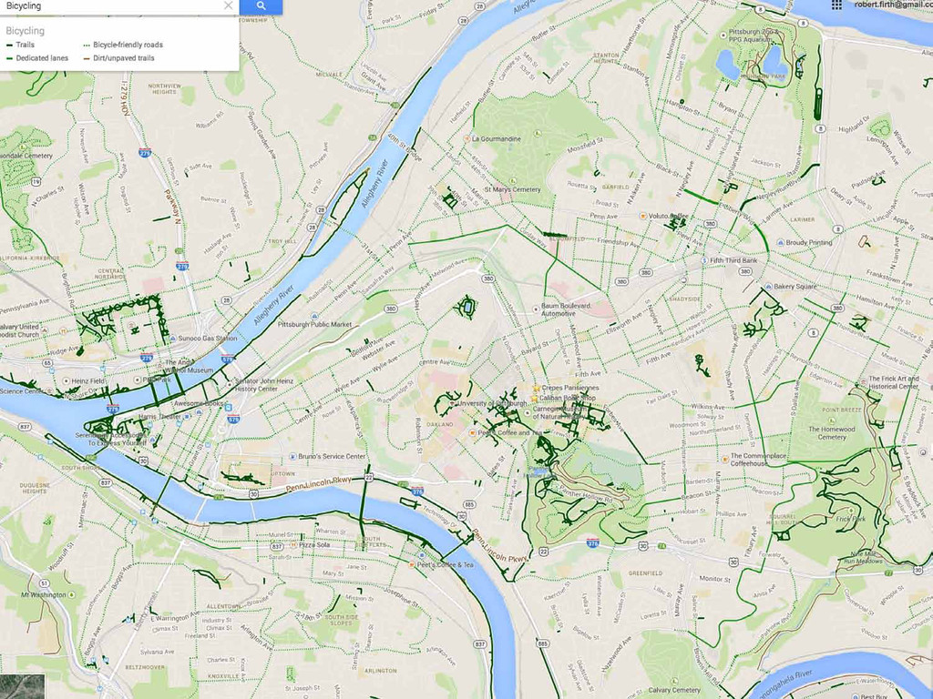
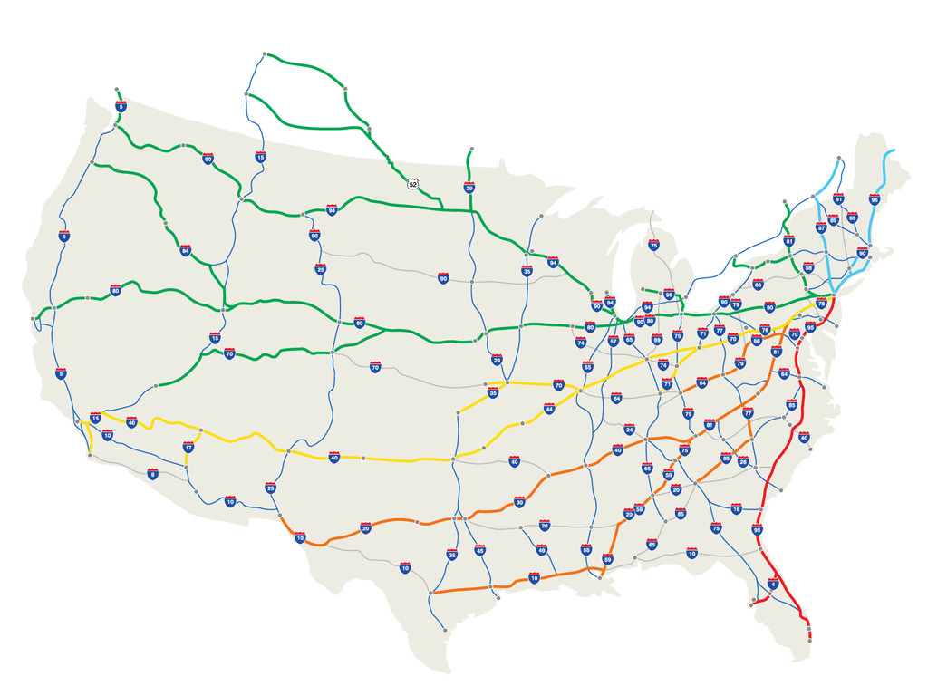
Twenty-five years ago, Pittsburgh finished a new highway into the City, completing a pentagon of expressways around its Downtown. Chaos ensued. Even nuclear engineers at Westinghouse were getting lost along eight lane highways. How was this possible?

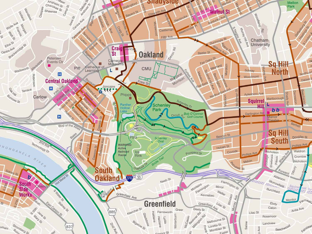
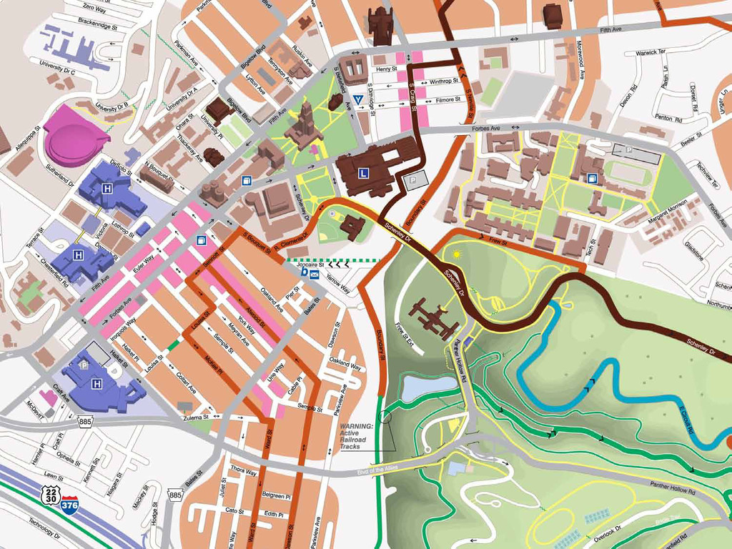
Pittsburgh is notoriously complicated. Ramps connect in one direction but not in the other, or take you right to go left. Bridges cross a river and then do not let you off on the other side. Local streets often don't go where they look like they are heading.

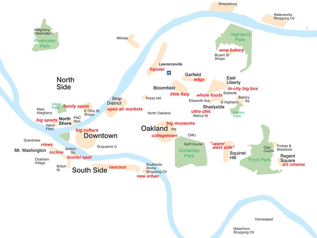
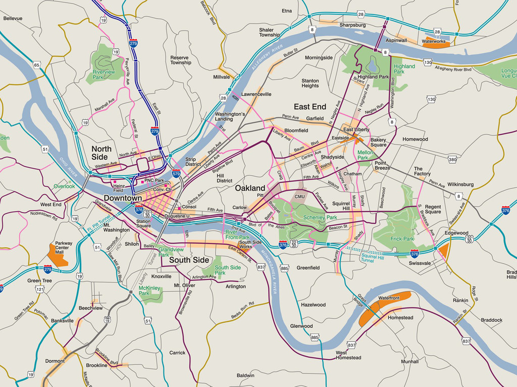
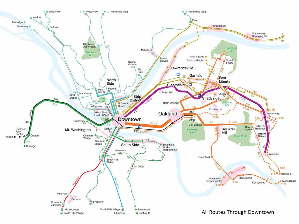
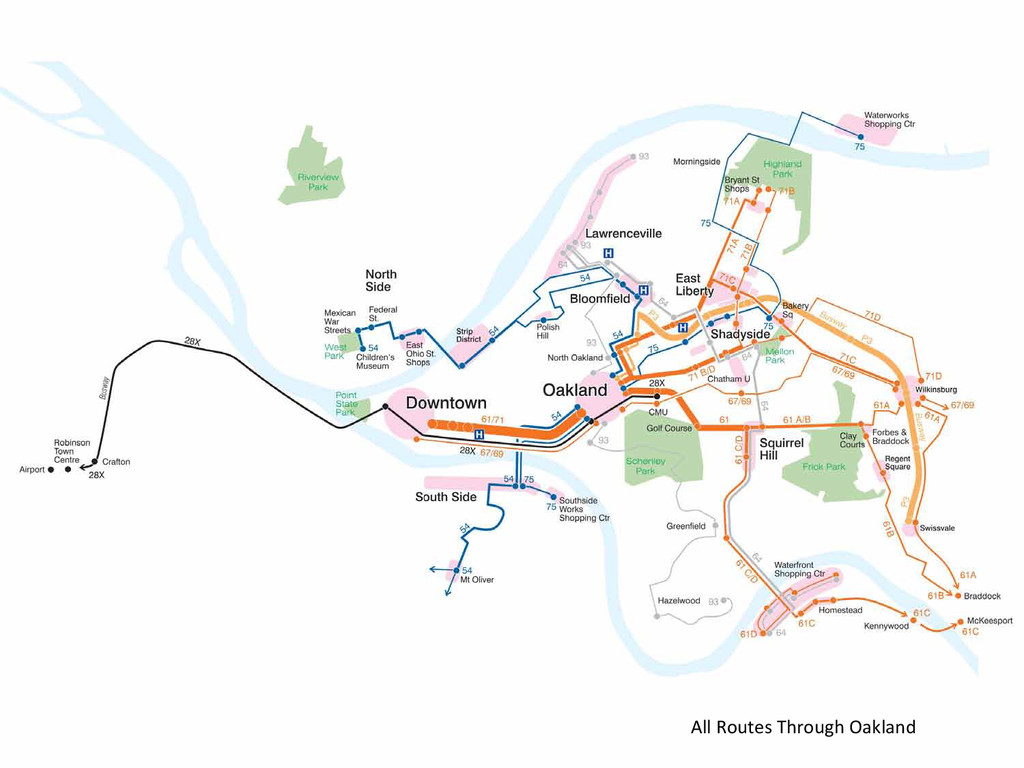
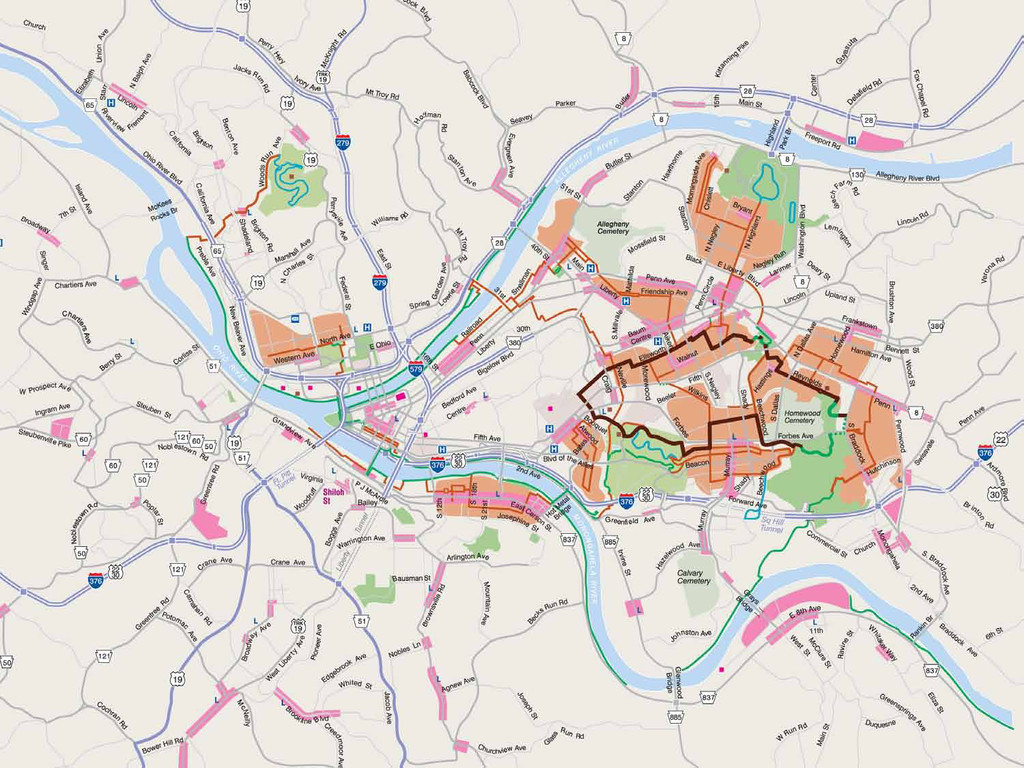
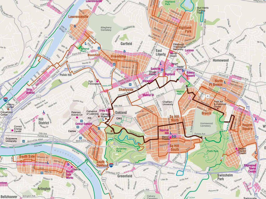
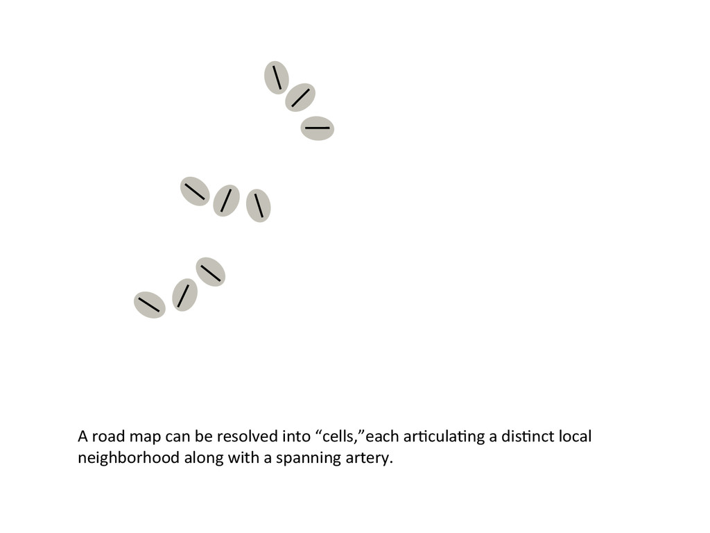
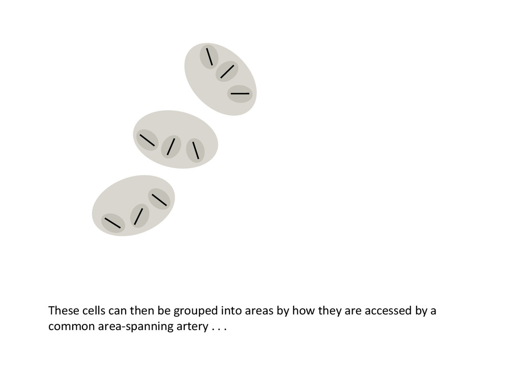
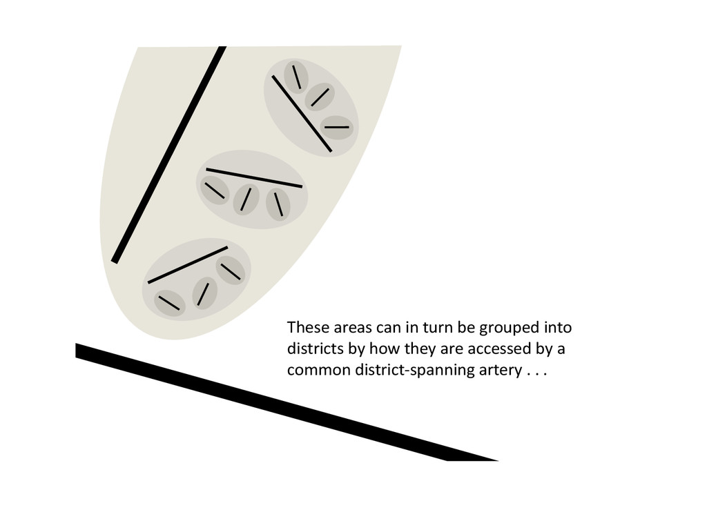
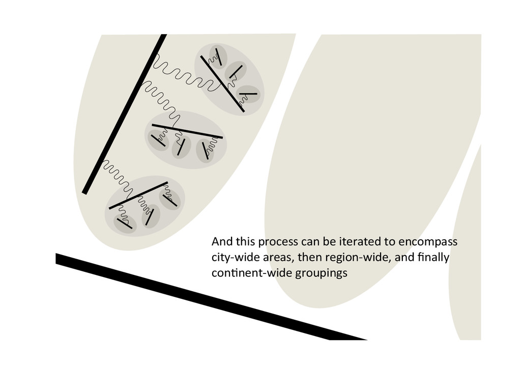
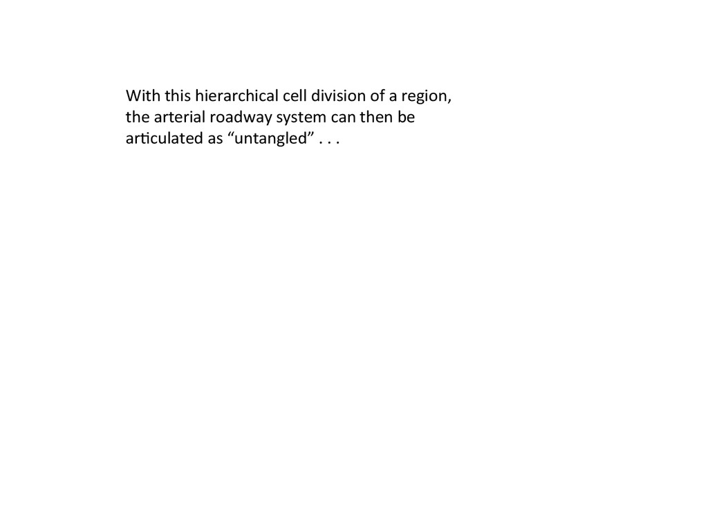
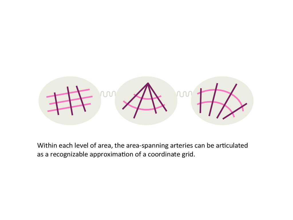
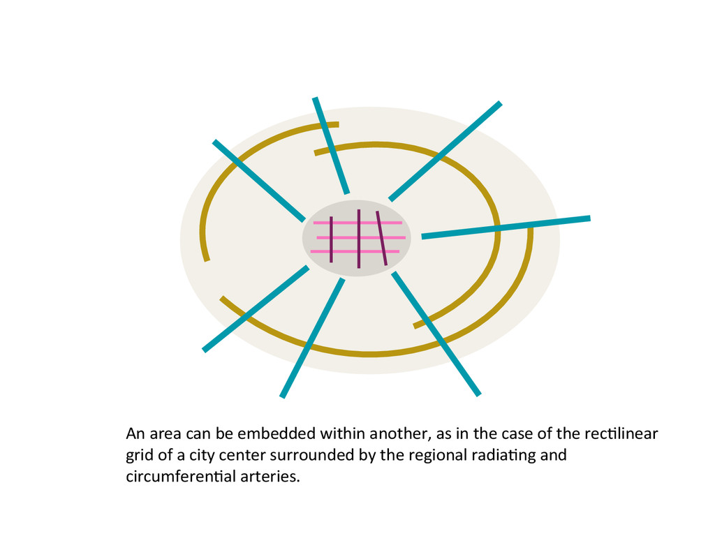
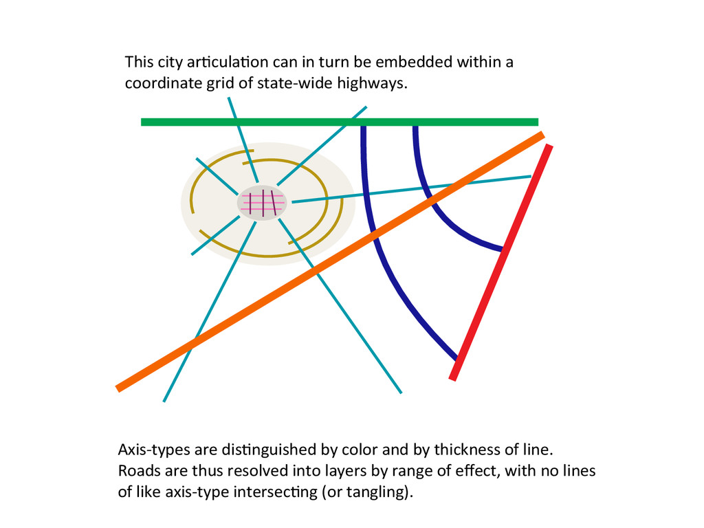
Treating this complexity like a geometry puzzle, it turns out that it is possible to remap the roadway network as “untangled”, while keeping true to geography without distortion or loss of detail (except for the usual scale-dependent generalizing). The network is broken down into layers consisting of “atoms” of simple travel patterns, which when superimposed result in a seamless “natural-looking” road map, except it’s one that can make a place as tough as Pittsburgh comprehensible.

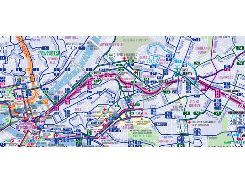
Drawing on print, web and app projects, this talk will demonstrate what such untangling visualizations can do for driving, walking, biking and bus-transit maps. (Free Pittsburgh maps will be distributed.)

NACIS 2014

Nathaniel V. KELSO

October 09, 2014
Tweet

More Decks by Nathaniel V. KELSO

Other Decks in Design

Transcript

  1. Pittsburgh is notoriously complicated. With its hills, hollows, and rivers,

    it has more bridges than Venice (446 vs 443). And its expressway system was built in fits and starts, with one section not fitting neatly into another (to say the least).
  2. With Pittsburgh as my laboratory, here’s the question I’ve been

    posing to myself since the 90s: What is it to “know” a city, and to what extent can that be captured and conveyed in a quick sequence of maps?
  3. In the following slides, I’m going to show you examples

    of: 1. The Pittsburgh road system untangled; 2. The local bus routes untangled; 3. Local bicycle routes untangled; 4. The U.S. interstate system untangled; 5. A bit of the method behind the madness of our “untangling.” And finally, I’ll have a few words on where I think this can take us on the
  4. Now a look at the center section of Pittsburgh’s very

    complicated bus routing system (the transit system’s version)
  5. A road map can be resolved into “cells,”each articulating a

    distinct local neighborhood along with a spanning artery.
  6. These cells can then be grouped into areas by how

    they are accessed by a common area-spanning artery . . .
  7. These areas can in turn be grouped into districts by

    how they are accessed by a common district-spanning artery . . .
  8. And this process can be iterated to encompass city-wide areas,

    then region-wide, and finally continent-wide groupings
  9. With this hierarchical cell division of a region, the arterial

    roadway system can then be articulated as “untangled” . . .
  10. Within each level of area, the area-spanning arteries can be

    articulated as a recognizable approximation of a coordinate grid.
  11. An area can be embedded within another, as in the

    case of the rectilinear grid of a city center surrounded by the regional radiating and circumferential arteries.
  12. This city articulation can in turn be embedded within a

    coordinate grid of state-wide highways. Axis-types are distinguished by color and by thickness of line. Roads are thus resolved into layers by range of efect, with no lines of like axis-type intersecting (or tangling).