Upgrade to Pro — share decks privately, control downloads, hide ads and more …

Evaluating Alternative Wolf Monitoring Techniques in Wisconsin

Evaluating Alternative Wolf Monitoring Techniques in Wisconsin

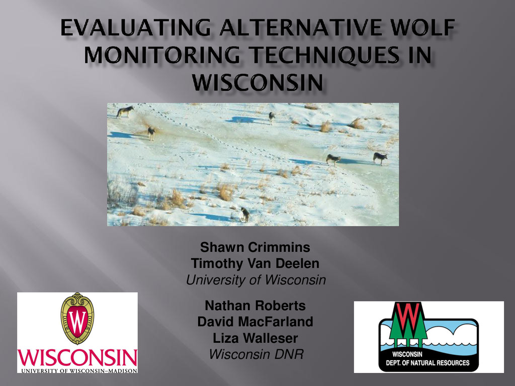
Authors: Shawn Crimmins, Timothy Van Deelen of the University of Wisconsin-Madison, Nathan Roberts, David MacFarland, Liza Walleser of the Wisconsin Department of Natural Resources. Presented at the 2015 Midwest Wolf Stewards Conference at Northland College. April 2015

More Decks by Sigurd Olson Environmental Institute

Other Decks in Research

Transcript

  1. Shawn Crimmins
    Timothy Van Deelen
    University of Wisconsin
    Nathan Roberts
    David MacFarland
    Liza Walleser
    Wisconsin DNR

    View Slide

  2. • De-listing removes ESA funds for monitoring
    • Financial need for evaluation (i.e. can WI afford it?)
    • Lack of statistical rigor
    • Largely based on expert opinion
    • No measure of uncertainty
    • Transparency
    • Difficult to replicate/explain expert decisions
    • Statistical models can lend credibility
    State management authority = State monitoring authority

    View Slide

  3. • Territory mapping variant
    • Telemetry + Track surveys + Howl surveys
    • Evolved from early survey efforts at low population size
    • Similar to other programs
    • Deemed most effective method
    • Did not evaluate many current
    techniques
    • Authors now exploring NGS in Idaho and
    POM in MT

    View Slide

  4. • Draw-backs
    • Flight costs
    • Progressively more
    difficult
    • Labor intensive
    • Benefits
    • Demographics
    • Habitat use

    View Slide

  5. • Draw-backs
    • Condition dependent
    • Hidden bias?
    • Dwindling participation?
    • Labor intensive
    • Varying effort
    • Benefits
    • Public participation
    • Spatial coverage

    View Slide

  6. • Draw-backs
    • Accuracy?
    • Minimal coverage
    • Utility
    • Benefits
    • Demographics
    • Identify un-collared packs

    View Slide

  7. • Variation of existing protocol
    • Can we get by with a little less?
    • Hunter surveys
    • Currently used in MT
    • Occupancy models
    • Snow-track surveys alone?
    • Non-invasive genetics
    • Idaho and Alberta
    • Remote cameras
    • Snapshot Wisconsin + SIPM

    View Slide

  8. • Progressively eliminate historical data
    • without howling surveys
    • with 50% reduction in snow-tracking
    • Cost-saving projections with GPS collars
    • Does greater collar cost offset reduced flights?
    • How many are needed?
    Proceeding

    View Slide

  9. • Currently used in MT to estimate total area
    occupied
    • Assumes constant territory size
    • Still requires estimates of pack size
    • Large effort to coordinate surveys
    • Spatial accuracy of surveys
    • Feasible in WI?
    • Lower visibility relative to MT
    • Species misidentification
    Not proceeding

    View Slide

  10. • Snow track surveys
    • Survey block specific population size
    • Autoregressive models
    • Varying sampling effort
    • Development of new modeling approach?
    • Feasible in WI?
    • Long-term dataset likely to continue
    • without telemetry
    • Effects of static sampling blocks?
    Proceeding

    View Slide

  11. • Den/rendezvous site visits
    • Small scale estimates in Idaho
    • Accurate at small scale (e.g. GMU)
    • Feasible in WI?
    • Massive field effort required for
    statewide approach
    • Knowledge of den/rendezvous site
    locations
    • Useful for targeted area?
    Proceeding

    View Slide

  12. • Statewide scat sampling
    • Collected during snow track surveys
    • Limited additional effort
    • Spring collection?
    • Feasible in WI?
    • Sample size requirements
    • Costs and time to process
    Proceeding – pilot study
    Proceeding – Pilot Scale

    View Slide

  13. • Occupancy vs abundance
    • Abundance estimated with mark-resight models
    • Insufficient number of collared individuals
    • Feasible in WI?
    • Large remote camera program initiated (Snapshot)
    • Individual detection rates needed
    • Spatially-explicit integrated population model
    • Basic IPM already developed

    View Slide

  14. • Deer Trustee Report
    • Increase citizen science
    • Assess distribution of carnivores
    • Develop new methods for monitoring deer
    • Move DNR into cutting edge research

    View Slide

  15. • Approach
    • Citizens sign up for survey block
    • DNR issues encrypted camera
    • Citizens deploy cameras and monitor
    • Images are uploaded to crowd-sourcing
    site
    • Public classifies images
    • Classified images returned to DNR
    • Animal occurrence linked to habitat
    features and vegetation structure
    • POM to estimate distribution, relative
    abundance, ecological relationships, etc.

    View Slide

  16. View Slide

  17. • Goal of one camera per 9 mi2
    • 500 cameras currently ordered
    • Hope to fully implement in this FY
    • 3,000 cameras this year
    • ~ 5,000 total
    • Pilot work in 2014
    Proceeding

    View Slide

  18. • Individual detection rates
    • Elk translocation – 200 remote camera grid
    • Wolf collars with proximity sensors
    Proceeding
    • Affix ID tags to
    cameras
    • Model whether or not
    wolf was photographed

    View Slide

  19. • GPS collar deployment at BRSF
    • Remote camera deployment at BRSF
    • Scat collection at den/rendezvous sites
    • Update of Kunkel et al. (2005)
    • Camera and collar deployment at Clam Lake?

    View Slide

  20. • Evaluations of alternative approaches needed
    • Not all approaches are equally feasible
    • Coordination with MN and MI beneficial
    • Approach should be transparent and robust
    • Feedback welcomed!!!

    View Slide

  21. View Slide