Upgrade to Pro — share decks privately, control downloads, hide ads and more …

Demystifing OGC APIs with GeoServer: introduction and status of implementation (FOSS4G 2022 Edition)

Demystifing OGC APIs with GeoServer: introduction and status of implementation (FOSS4G 2022 Edition)

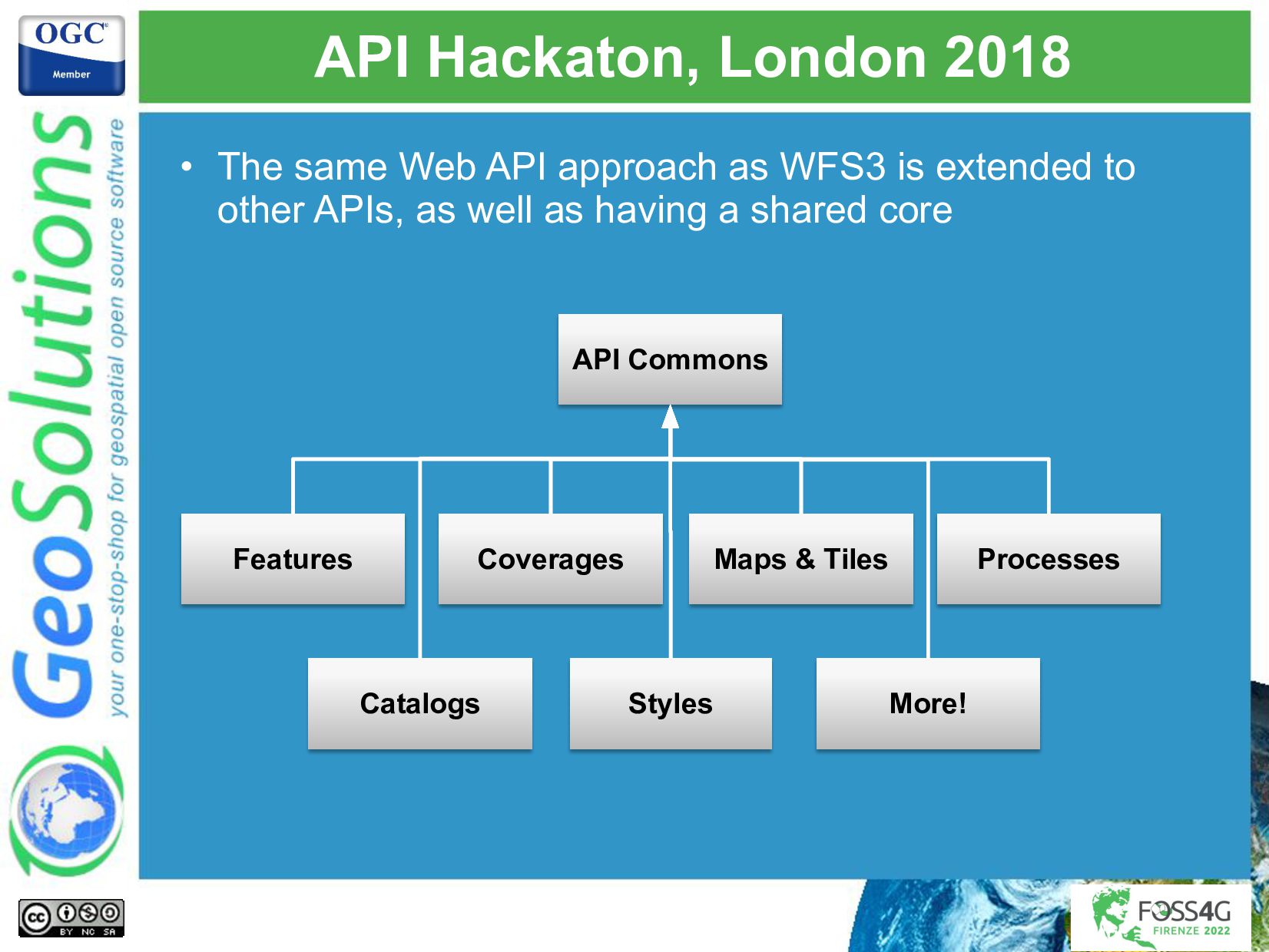
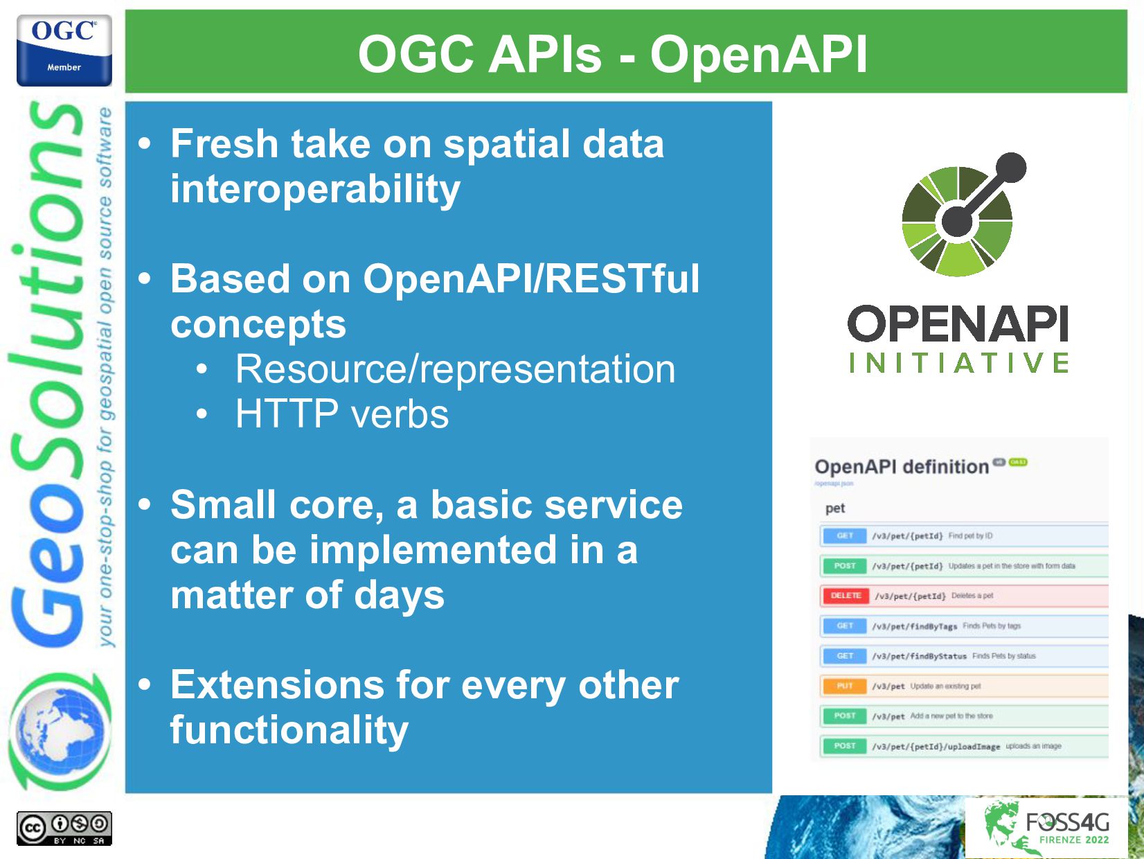
The OGC APIs are a fresh take at doing geo-spatial APIs, based on WEB API concepts and modern formats, including:

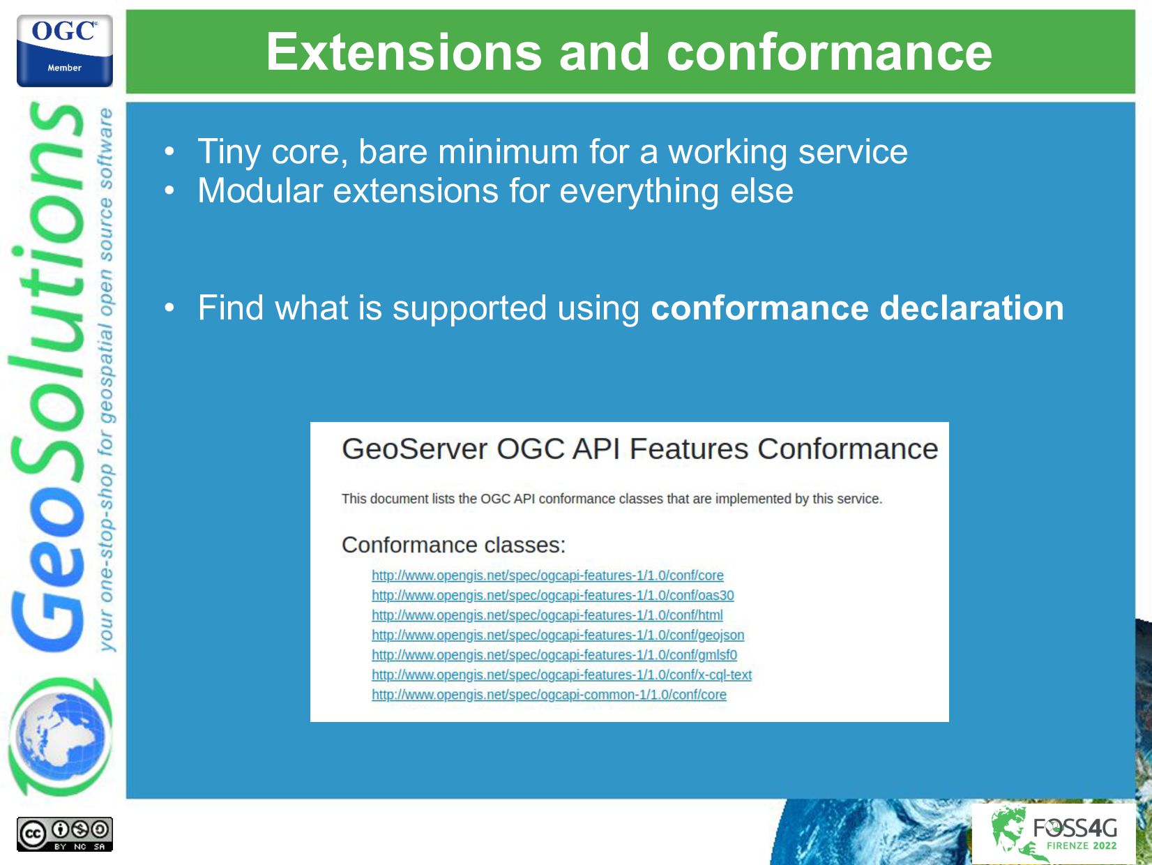
Small core with basic functionality, extra functionality provided by extensions
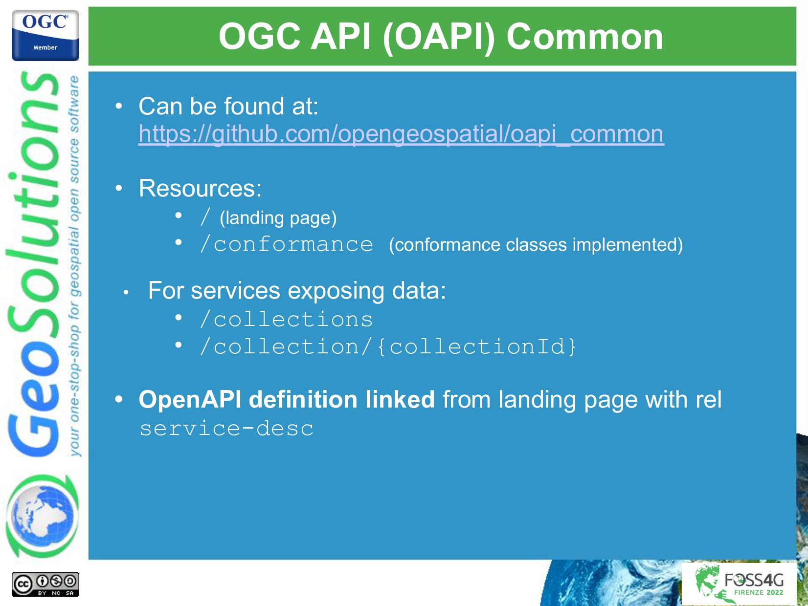
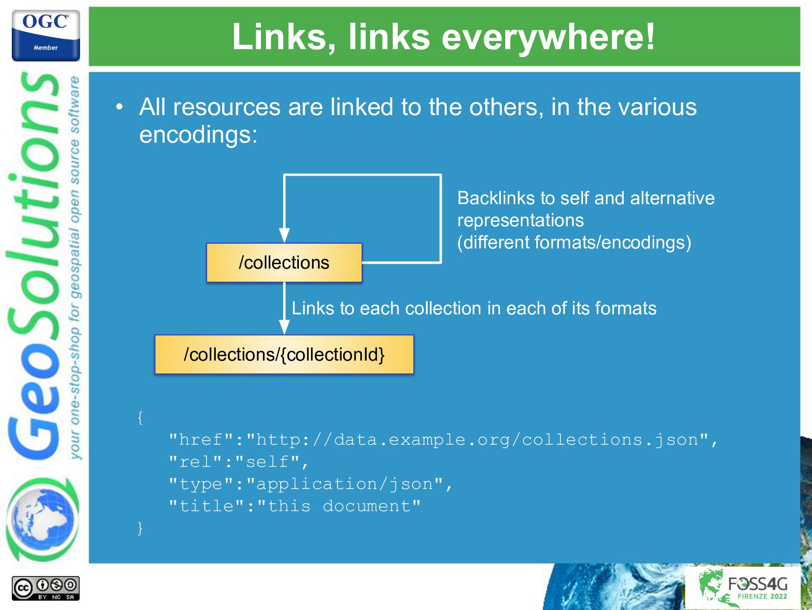
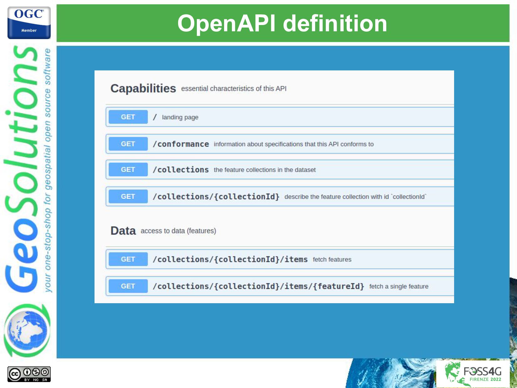
OpenAPI/RESTful based
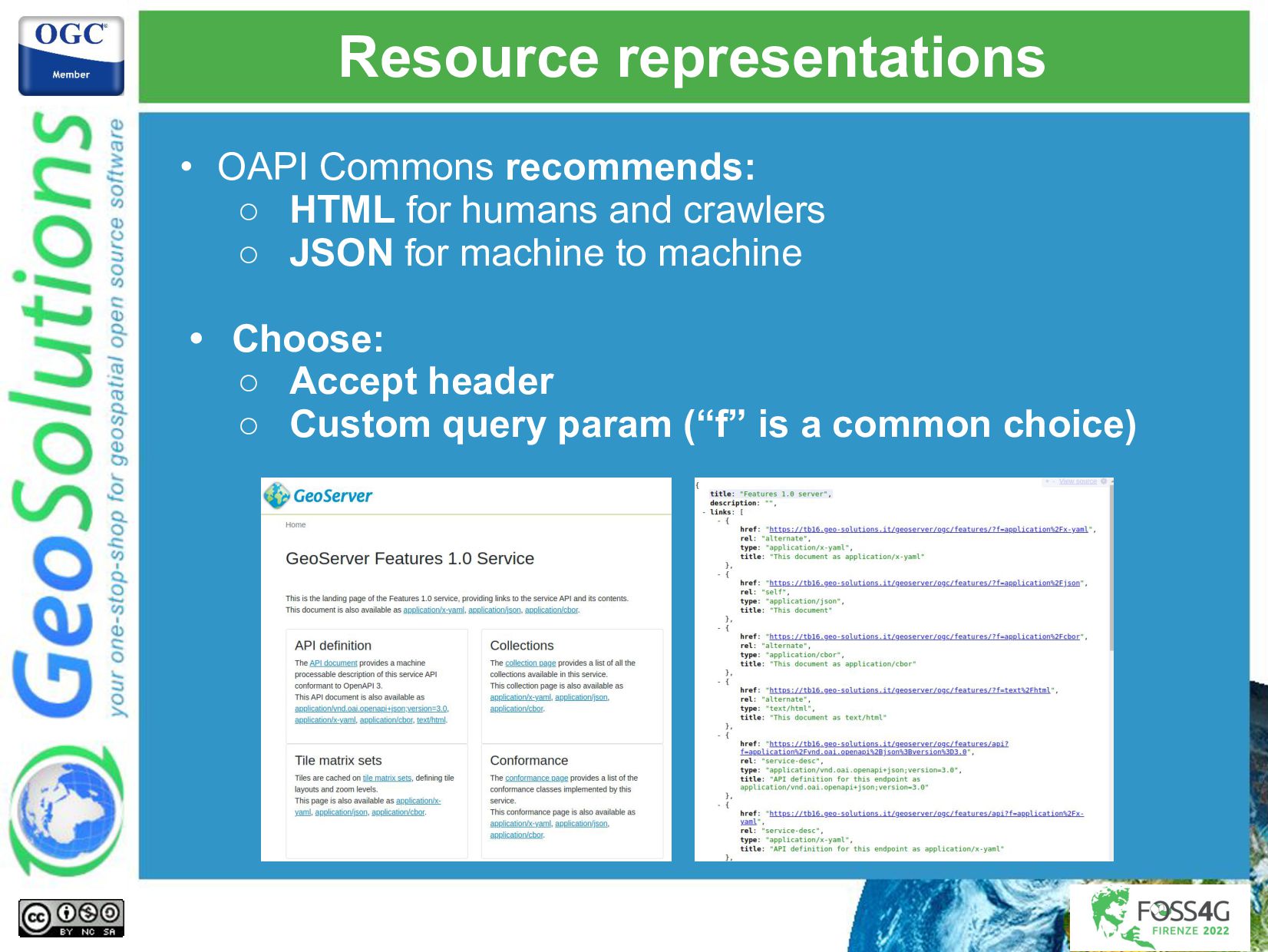
JSON first, while still allowing to provide data in other formats
No mandate to publish schemas for data
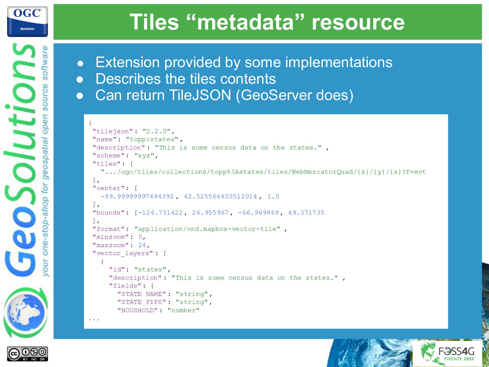
Improved support for data tiles (e.g., vector tiles)
Specialized APIs in addition to general ones (e.g., DAPA vs OGC API - Processes)
Full blown services, building blocks, and ease of extensibility

This presentation will provide an introduction to various OGC APIs and extensions, such as Features, Styles, Maps and Tiles, DAPA, STAC and CQL2 filtering. 
While some have reached a final release, most are in draft: we will discuss their trajectory towards official status, as well as how good the GeoServer implementation is tracking them, and show examples based on the GeoServer HTML representation of the various resources.

Simone Giannecchini
PRO

August 31, 2022
Tweet

More Decks by Simone Giannecchini

Other Decks in Technology

Transcript

  1. Demystifying OGC APIs
    with GeoServer:
    introduction and
    status of implementation
    Ing. Andrea Aime
    GeoSolutions

    View Slide

  2. GeoSolutions
    Enterprise Support
    Services
    Deployment
    Subscription
    Professional
    Training
    Customized
    Solutions
    GeoNode
    • Offices in Italy & US, Global Clients/Team
    • 40+ collaborators, 30+ Engineers
    • Our products
    • Our Offer

    View Slide

  3. Affiliations
    We strongly support Open
    Source, it Is in our core
    We actively participate in
    OGC working groups and
    get funded to advance new
    open standards
    We support standards
    critical to GEOINT

    View Slide

  4. A bit of history

    View Slide

  5. At the beginning, there was WFS3
    • First commit July 31st 2017
    • Developed in the repo for a bunch of months, then
    various public events shaped it into OGC API - Features
    WFS3 Hackaton
    Testbed 14
    Vector Tiles Pilot
    Testbed 15
    API Hackaton
    London

    View Slide

  6. API Hackaton, London 2018
    • The same Web API approach as WFS3 is extended to
    other APIs, as well as having a shared core
    API Commons
    Features Coverages Maps & Tiles Processes
    Catalogs Styles More!

    View Slide

  7. Periodic OGC API Sprints
    • Since then OGC organized
    periodic code sprints
    • Each sprint focuses on 2-3
    specs and:
    ○ Push forward
    specification drafts
    ○ Implement and gather
    feedback
    ○ Test interoperability
    • GeoSolutions participates
    to push GeoServer API
    implementations forwards

    View Slide

  8. Up to 2022: releases and drafts
    • Released:
    ○ OGC API - Features
    ■ Core (Sept 2019)
    ■ CRS by Reference (Oct 2020)
    ○ OGC API - Environmental Data Retrieval (March 2021)
    ○ OGC API - Processes (August 2021)
    • Most APIs and extensions are still in draft stage and
    changing

    View Slide

  9. OGC API - Common elements

    View Slide

  10. OGC APIs - OpenAPI
    • Fresh take on spatial data
    interoperability
    • Based on OpenAPI/RESTful
    concepts
    • Resource/representation
    • HTTP verbs
    • Small core, a basic service
    can be implemented in a
    matter of days
    • Extensions for every other
    functionality

    View Slide

  11. OGC API (OAPI) Common
    • Can be found at:
    https://github.com/opengeospatial/oapi_common
    • Resources:
    • / (landing page)
    • /conformance (conformance classes implemented)
    • For services exposing data:
    • /collections
    • /collection/{collectionId}
    • OpenAPI definition linked from landing page with rel
    service-desc

    View Slide

  12. Links, links everywhere!
    • All resources are linked to the others, in the various
    encodings:
    /collections
    /collections/{collectionId}
    Backlinks to self and alternative
    representations
    (different formats/encodings)
    Links to each collection in each of its formats
    {
    "href":"http://data.example.org/collections.json",
    "rel":"self",
    "type":"application/json",
    "title":"this document"
    }

    View Slide

  13. Resource representations
    • OAPI Commons recommends:
    ○ HTML for humans and crawlers
    ○ JSON for machine to machine
    • Choose:
    ○ Accept header
    ○ Custom query param (“f” is a common choice)

    View Slide

  14. Extensions and conformance
    • Tiny core, bare minimum for a working service
    • Modular extensions for everything else
    • Find what is supported using conformance declaration

    View Slide

  15. Features API Core

    View Slide

  16. Features API Core
    • In addition to OAPI core:
    • /collection/{collectionId}/items (features)
    • /collection/{collectionId}/items/{itemId}
    • Only supported CRS are
    • CRS84 (WGS84 lon/lat)
    • CRS84h (WGS84 lon/lat/height)
    • Schema not required, features can be anything:
    • Simple
    • Complex
    • Heterogeneous
    • “describeBy” can link to schema (optional)

    View Slide

  17. OpenAPI definition

    View Slide

  18. /collection/{collectionId}/items
    • Lists the contents of a collection
    • Can be a GeoJSON document, GML, anything
    • Filtering
    • bbox in CRS84 or CRS84h
    • datetime (instant or range of times)
    • extra parameters declared in the API document
    (only by equality, not supported by GS)
    …/collections/buildings/items?
    bbox=41,54,42,55
    &datetime=2018-02-12T23%3A20%3A52Z
    &buildingState=good

    View Slide

  19. Paging
    • limit query parameter
    • A limit is always present (like in WFS 1.x and 2.x) but can
    be high
    • Paging works through links, "prev" and "next" rel values
    • Links can be implemented the way you want
    • GeoServer uses offset as an extra paging parameter
    [
    {
    "href":"http://example.org/collections/buildings/items.json?limit:50",
    "rel":"prev",
    "type":"application/geo+json"
    },
    {
    "href":"http://example.org/collections/buildings/items.json?limit:50&offset:50",
    "rel":"self",
    "type":"application/geo+json"
    },
    {
    "href":"http://example.org/collections/buildings/items.json?limit:50&offset:100",
    "rel":"next",
    "type":"application/geo+json"
    }
    ]

    View Slide

  20. CORE: that’s all folks!
    • Yes ladies and gentlemen, this is everything
    OGC API - Features - CORE covers

    View Slide

  21. Wait wait wait….
    • Look that's nice, but what about….

    View Slide

  22. Part 2 - CRS by Reference
    • Support CRS other than CRS84
    • Discover:
    ○ Storage (native) CRS
    ○ Supported target CRS
    • Parameters:
    ○ bbox-crs (query)
    ○ crs (reproject)
    ● Finalized!
    ● GeoServer currently implements older draft

    View Slide

  23. Part 3 - Filtering (draft)
    ● Queryables: properties that can be
    used for filtering
    ○ May be a sub-set of the actual
    attributes
    ○ May not even match the attributes
    (e..g, like “anyText” in CSW)
    ● filter: the filter specification
    ● filter-lang: the language used
    ● filter-crs: the CRS for the geometries
    used in the filter
    ● cql2-text, cql2-json
    ● GeoServer supports also ecql-text
    (classic GeoServer extended CQL)

    View Slide

  24. CQL2 encodings (draft)
    eo:cloud_cover BETWEEN 0.1 AND 0.2
    AND landsat:wrs_row=28
    AND landsat:wrs_path=203
    {
    "and": [
    { "between": [ {"property": "eo:cloud_cover"}, 0.1, 0.2 ]
    },
    { "=": [{"property": "landsat:wrs_row"},28] },
    { "=": [{"property": "landsat:wrs_path"},203] }
    ]
    }
    &filter-lang=cql2-text
    &filter-lang=cql2-json

    View Slide

  25. CQL2 encodings support in GeoServer
    ● Initially it was slightly modified CQL, quite similar
    to ECQL. Supported!
    ● First round of CQL-JSON in Sept 2020
    ● In Sept 2021, CQL2, with significant changes
    ○ cql2-text support landed Feb 2021
    ○ cql2-json parsing March 2022
    ○ cql2-json encoding June 2022
    ● CQL2 is still changing (last change, Aug 2nd 2022)

    View Slide

  26. Sorting
    ● Not part (yet) of OGC API - Features
    ● Part of “proposals” not yet turned into draft
    extensions
    ● Borrowed from OGC API - Records
    ● Available in GS 2.22 and 2.21
    /items?sortby=name,-dateOfBirth

    View Slide

  27. Property selection
    ● Not part (yet) of OGC API - Features
    ● Not implemented in GeoServer
    ● Part of “proposals” not yet turned into draft
    extensions
    ● returnables, parallel to queryables, list properties
    that can be selected
    ● properties to enumerate wanted properties
    ● skip-geometry to avoid geometry field
    ● STAC API has a different take: fields
    ● Use “-” to remove a property, e.g.
    fields=geometry,-links,-assets&f=json

    View Slide

  28. Part 4 - CRUD transactions in draft
    ● Create/Replace/Update/Delete for single feature
    ● Currently in draft
    ● Not currently supported by GeoServer
    .../collections/topp:states/items/states.1
    POST
    PUT DELETE
    PATCH

    View Slide

  29. OGC Features API
    GeoServer HTML representations

    View Slide

  30. Features API landing page
    DEFAULT TEMPLATES
    FULLY CUSTOMIZABLE

    View Slide

  31. Features API /api

    View Slide

  32. Collections /collections

    View Slide

  33. Collection /collections/{collectionId}

    View Slide

  34. Items /collections/{collectionId}/items

    View Slide

  35. Coverages

    View Slide

  36. OGC APIs - Coverages
    • The simplest WCS ever?
    • Collection as a single coverage
    • GeoServer implementation is currently
    incomplete

    View Slide

  37. Coverage and its components
    • DomainSet: spatial and temporal domain
    description
    • RangeType: data structure (bands and types)
    • RangeSet: the actual pixels
    • Metadata: any other info about the coverage
    DomainSet +
    RangeType +
    RangeSet +
    Metadata =
    -----------
    Coverage
    Coverage
    Implementation
    Schema
    (JSON encoding)

    View Slide

  38. Coverage extraction
    • Core allows to extract data from a coverage by:
    • bbox
    • datetime
    ...collections/nurc:Img_Sample/coverage?
    f=image%2Fpng&
    bbox=-130,20,-100,40

    View Slide

  39. Missing bits
    • The GeoServer implementation lacks the
    following:
    • RangeSet resource
    → describes bands
    • Range subsetting
    → band selection
    • Scaling
    scale-size/scale-factor/scale-axes
    • Coverage tiles

    View Slide

  40. Maps

    View Slide

  41. Maps API
    • Draft available at
    https://github.com/opengeospatial/ogcapi-maps
    • Building block to produce maps, can be attached to
    collections, but in general, to any resource that can be
    mapped
    • Adds a notion of a “style”, listed in collection metadata
    • Adds a “maps” resource
    • GetFeatureInfo not in core!

    View Slide

  42. “map” resource
    • Fetches a map in the requested format
    • Params: width, height, bbox, crs, ….
    • Unlike WMS GetMap, all params are optional
    → similar to the GeoServer WMS reflector
    .../ogc/maps/collections/topp:states/styles/population/map?f=image/png

    View Slide

  43. “info” resource (GS specific)
    • Not part of the standard (used to be in a previous draft)
    • Still useful (considers scale deps, filters, symbology)
    • Feature info at given location
    • Params: “i/j” mandatory, others same as “map”
    .../ogc/maps/collections/topp:states/styles/population/map/info?
    f=text/plain&i=50&j=10
    Results for FeatureType 'http://www.openplans.org/topp:states':
    --------------------------------------------
    the_geom = [GEOMETRY (MultiPolygon) with 276 points]
    STATE_NAME = Washington
    STATE_FIPS = 53
    SUB_REGION = Pacific
    STATE_ABBR = WA
    LAND_KM = 172447.205
    WATER_KM = 12226.63
    PERSONS = 4866692.0
    FAMILIES = 1264934.0
    HOUSHOLD = 1872431.0
    MALE = 2413747.0
    FEMALE = 2452945.0
    WORKERS = 1830031.0
    DRVALONE = 1700872.0
    CARPOOL = 282240.0
    PUBTRANS = 104403.0
    EMPLOYED = 2293961.0
    UNEMPLOY = 139216.0
    --------------------------------------------

    View Slide

  44. Tiles

    View Slide

  45. Tiles API
    • Available at https://github.com/opengeospatial/ogcapi-tiles
    • Still evolving, GeoServer not up to date
    • Adds resources for tiles, tile matrix sets, eventually styles
    • Tiles can be styled or not (e.g. tiling maps or tiling data)

    View Slide

  46. Building block, can tile “anything”
    ● /collections/{collectionId} 🡪 data tiles from single
    collection
    ● /collections/{collectionId}/maps 🡪 rendered tiles
    from single map
    ● /collections 🡪 raw tiles from multiple collections (list
    of collections as query param)
    ● /map 🡪 tiles from multi-layer map (list of collections as
    query param)
    ● /add/your/own/here 🡪 if it can be sliced, we'll tile it

    View Slide

  47. Tiles resource, URL templates
    ogc/tiles/collections/topp%3Astates/styles/population/map/tiles/
    WebMercatorQuad/{tileMatrix}/{tileRow}/{tileCol}?f=image%2Fpng

    View Slide

  48. Tiles “metadata” resource
    ● Extension provided by some implementations
    ● Describes the tiles contents
    ● Can return TileJSON (GeoServer does)
    {
    "tilejson": "2.2.0",
    "name": "topp:states" ,
    "description" : "This is some census data on the states." ,
    "scheme": "xyz",
    "tiles": [
    ".../ogc/tiles/collections/topp%3Astates/tiles/WebMercatorQuad/{z}/{y}/{x}?f=mvt
    ],
    "center": [
    -89.99999997494392 , 42.525564403512014 , 1.0
    ],
    "bounds": [-124.731422 , 24.955967, -66.969849, 49.371735
    ],
    "format": "application/vnd.mapbox-vector-tile" ,
    "minzoom": 0,
    "maxzoom": 24,
    "vector_layers" : [
    {
    "id": "states",
    "description" : "This is some census data on the states." ,
    "fields": {
    "STATE_NAME" : "string",
    "STATE_FIPS" : "string",
    "HOUSHOLD": "number"
    ...

    View Slide

  49. Styles

    View Slide

  50. Styles API
    • Building block to describe styles for a resource
    • In GeoServer a stand-alone API

    View Slide

  51. Style transformation
    • If the server supports it, fetch a style in various encodings
    (GeoServer can do CSS 🡪 SLD, MBStyle 🡪 SLD, YSLD
    🡪🡪 SLD)
    A stylesheet can be marked as “native”
    SLD 1.0
    core
    SLD 1.1
    core
    YSLD
    extension
    MBStyles
    community
    GeoCSS
    extension
    SLD 1.0
    inspired
    object
    model,
    with
    extensions

    View Slide

  52. Style metadata
    Basic metadata info
    (yeah, I did not fill it yet, no love lost for metadata!)
    Access to style source, native (CSS)
    and converted (SLD) when possible
    List of layers involved in the style (could have many)
    and attributes used in each (style editor can use them
    to check compatibility with available data)
    The style identifier

    View Slide

  53. Styles API client
    • "Visual style editor" as developed by GeoSolutions in
    Testbed 15

    View Slide

  54. And more

    View Slide

  55. More of APIS!
    • More APIS supported by GeoServer:
    • STAC API
    • DGGS/DAPA (Data Access and Processing API)
    • Images (mosaic management)
    • More APIs NOT supported by GeoServer yet:
    • Records (CSW)
    • Processes (WPS)
    • Routes (WPS specific for routing)
    • Environmental Data Retrieval

    View Slide

  56. That’s all folks!
    Questions?
    [email protected]

    View Slide

  57. That’s all folks!
    Questions?
    [email protected]

    View Slide