Upgrade to Pro — share decks privately, control downloads, hide ads and more …

State of GeoServer Q1 2021, 2.18 and beyond

State of GeoServer Q1 2021, 2.18 and beyond

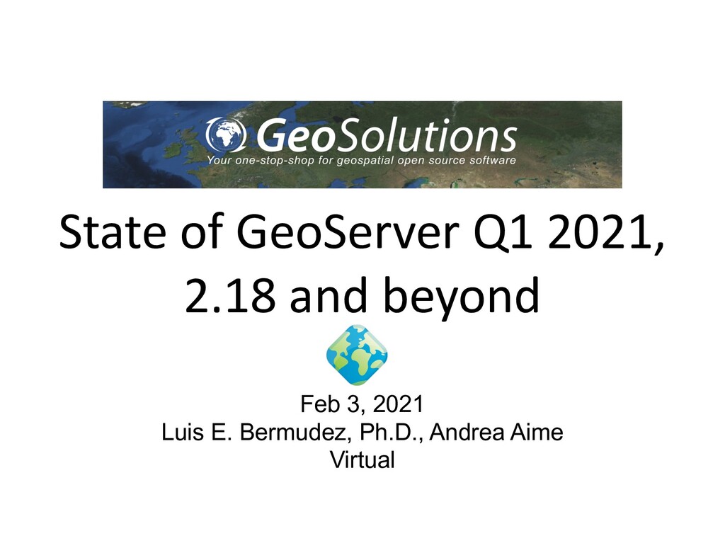
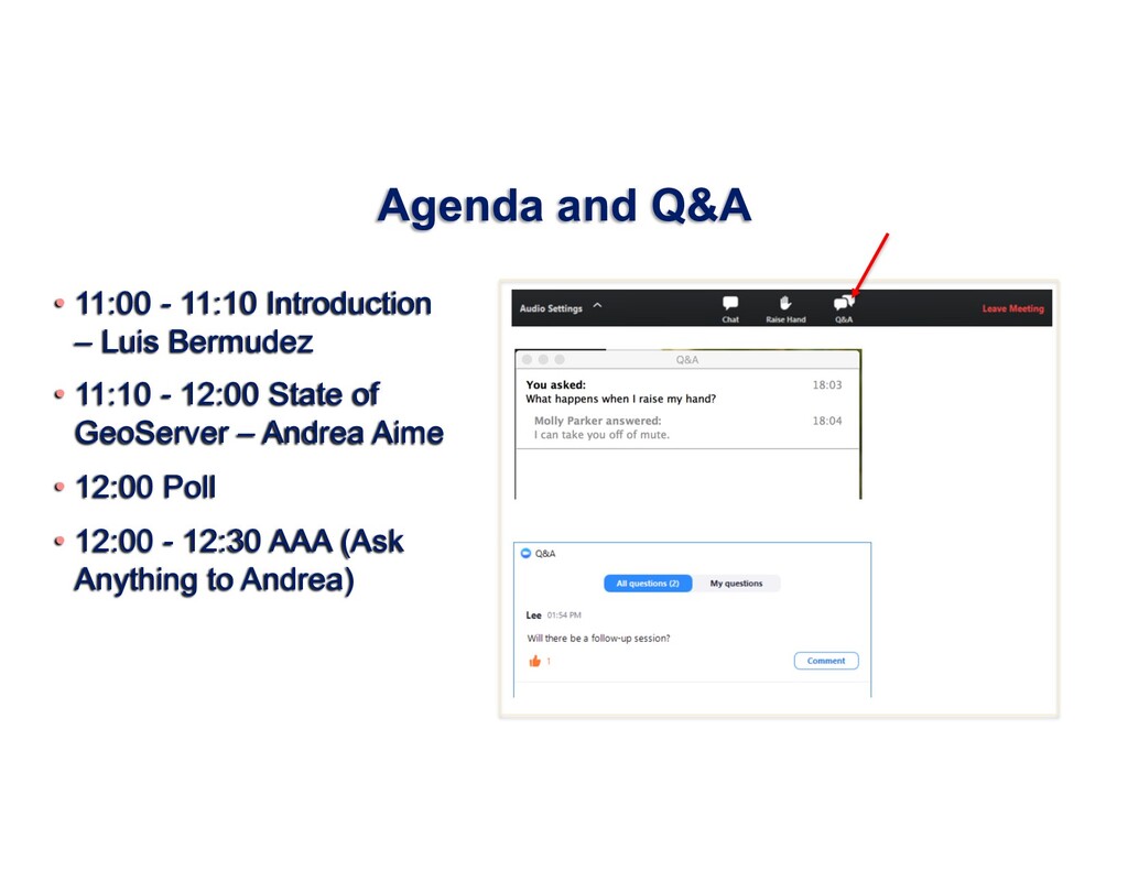
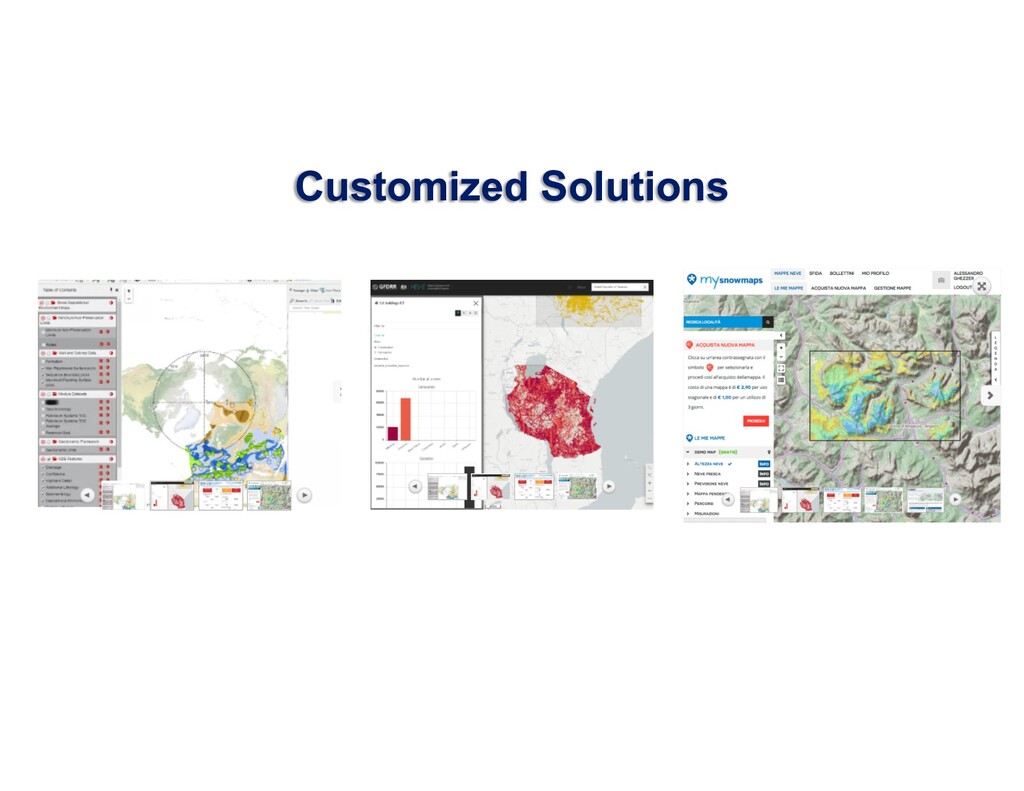
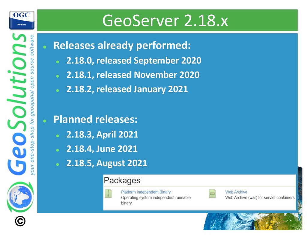
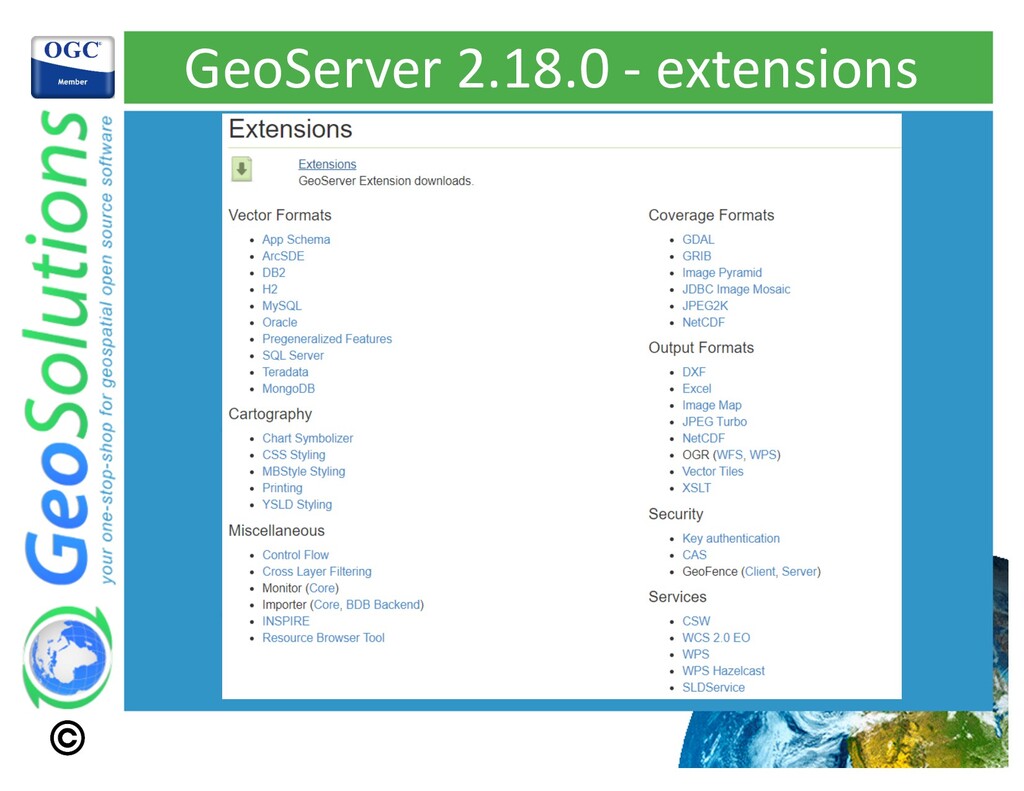
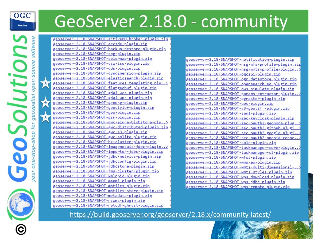
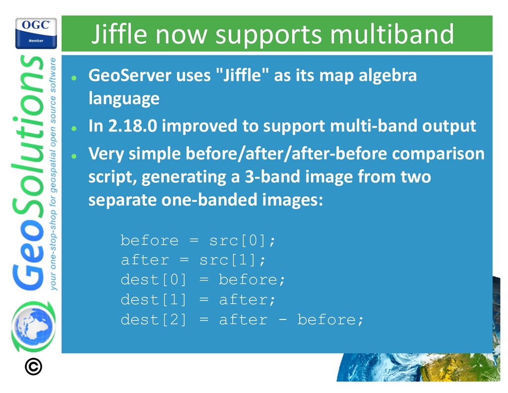
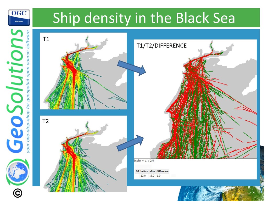
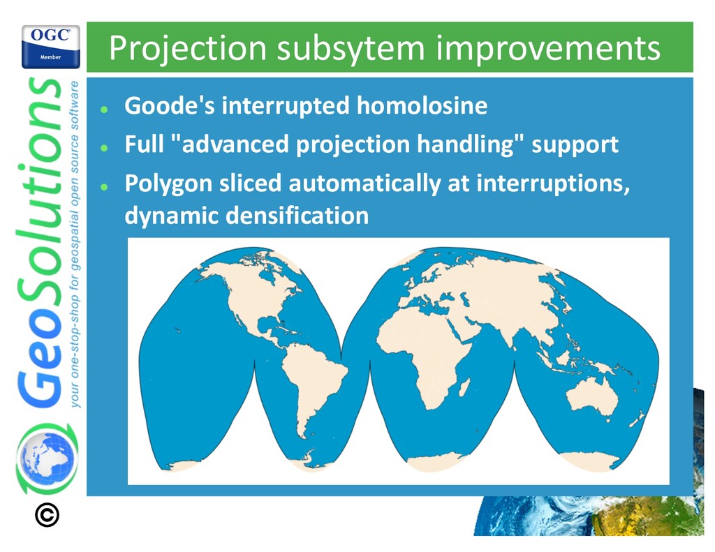
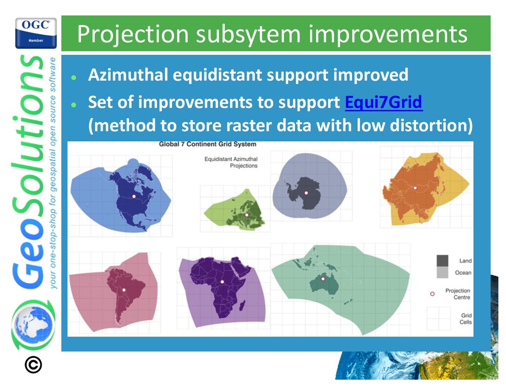
Webinar from GeoSolutions on GeoServer 2.18 and the coming 2.19: Improvements on raster analysis, GeoPackage metadata and styles, S3 COG support and more. We will have a 30 minutes presentation and 30 minutes of Q&A with our lead GeoServer developer, Andrea Aime.

Simone Giannecchini
PRO

February 03, 2021
Tweet

More Decks by Simone Giannecchini

Other Decks in Technology

Transcript

  1. State of GeoServer Q1 2021,
    2.18 and beyond
    Feb 3, 2021
    Luis E. Bermudez, Ph.D., Andrea Aime
    Virtual

    View Slide

  2. Agenda and Q&A
    • 11:00 - 11:10 Introduction
    – Luis Bermudez
    • 11:10 - 12:00 State of
    GeoServer – Andrea Aime
    • 12:00 Poll
    • 12:00 - 12:30 AAA (Ask
    Anything to Andrea)

    View Slide

  3. Robust Geospatial
    Server
    • GeoServer is the lead open source server to publish
    geospatial data at scale.
    • GeoServer is a robust solution for management and
    disseminating geospatial data according to the OGC,
    ISO and INSPIRE standards.
    • Organizations use GeoServer to serve petabytes of
    data, from point data (e.g. real-time world-wide ship
    positions) to massive earth observation data.

    View Slide

  4. GeoServer
    WFS
    1.0, 1.1,
    2.0
    WMS
    1.1.1
    1.3.0
    PostGIS
    Oracle
    H2
    DB2
    SQL
    Server
    MySql
    Spatialite
    GeoCouch
    Shapefile
    GeoPackage
    ----------
    ----------
    ---------
    ----------
    ----------
    ----------
    ---------
    ----------
    ----------
    ----------
    ---------
    ----------
    ArcSDE
    WFS
    PNG, GIF
    JPEG
    TIFF, GeoTIFF
    SVG, PDF
    KML/KMZ
    Shapefile
    GML2
    GML3
    GeoRSS
    GeoJSON
    CSV/XLS
    Raw vector
    data
    Servers
    Styled
    maps
    DBMS
    Vector files
    WCS
    1.0,1.1.1
    2.0.1
    GeoTIFF
    WMS
    ArcGrid
    GTopo30
    Img+world
    Mosaic
    MrSID
    JPEG 2000
    ECW,Pyramid
    Oracle
    GeoRaster,
    PostGis Raster
    NetCDF
    GeoPackage
    Raster files
    Raw raster
    data GeoTIFF
    ArcGrid
    GTopo30
    Img+World
    Google
    WPS
    1.0.0
    Vector
    Tiles
    Vector tiles
    format
    MapBox Vector
    (MVT)
    GeoJSON
    TopoJSON
    OGC
    Open
    APIs
    Mostly from
    directory Others
    GeoWebCache
    Authentication ( OKTA, LDAP,
    CAS, WSO2, OAUTH..)
    GeoFence
    Active Clustering (Hazelcast)

    View Slide

  5. World leader in the development and maintenance of
    open source enterprise software for geospatial
    information management

    View Slide

  6. UN FAO (CIOK, FIGIS,
    NRL, FORESTRY,
    ESTG), UN WFP,
    World Bank, DLR,
    EUMETSAT, JRC,
    ARPAT, NATO CMRE,
    UNESCO, IGAD,
    UNEP, ...
    BAYER, BASF,
    DigitalGlobe, MDA,
    TOPCON, SwissRE, e-
    GEOS, Halliburton,
    ..
    More than 200 clients since 2006

    View Slide

  7. GeoSolutions Support
    • Advice regarding a geospatial challenge
    • Architect, help configure and deploy clusters of GeoServers
    in the cloud
    • Automate deployments from different environments
    • Performance monitoring
    • Develop custom application (server or client slide)
    • Optimize ingesting and publishing geospatial data
    • Training
    • Other technical support

    View Slide

  8. Enterprise Support Services

    View Slide

  9. Subscription Services
    Example Premium Plan
    4 hours – response time
    16 # of incidents per year
    20 Additional Support hours
    24/7 support
    Oracle, SQL Server and PostGIS
    Support

    View Slide

  10. Training

    View Slide

  11. Customized Solutions

    View Slide

  12. A Solution for Data
    Management
    Identify how and where
    products, services, and
    data are utilized
    The monitor extension tracks
    requests made against a
    GeoServer instance. With the
    extension request data can be
    persisted to a database, used
    to generate simple reports ,
    and routed to a customized
    request audit log.
    10 Most Accessed Layers 10 Most Active Users
    10 Most Active IPs Request types

    View Slide

  13. GeoSolutions Contact Information
    Luis E. Bermudez, Ph.D.
    CEO
    GeoSolutions USA
    https://www.geosolutionsgroup.com/contacts/
    +1 (301) 337-7055
    [email protected]
    https://www.linkedin.com/in/bermudez
    https://www.geosolutionsgroup.com
    https://twitter.com/geosolutions_it

    View Slide

  14. Andrea Aime
    GeoSolutions
    State of GeoServer
    Q1 2021

    View Slide

  15. GeoServer 2.18.x

    View Slide

  16. GeoServer 2.18.x
    l
    Releases already performed:
    l
    2.18.0, released September 2020
    l
    2.18.1, released November 2020
    l
    2.18.2, released January 2021
    l
    Planned releases:
    l
    2.18.3, April 2021
    l
    2.18.4, June 2021
    l
    2.18.5, August 2021

    View Slide

  17. GeoServer 2.18.0 - extensions

    View Slide

  18. GeoServer 2.18.0 - community
    https://build.geoserver.org/geoserver/2.18.x/community-latest/

    View Slide

  19. Small GUI improvements
    l
    "Apply" button on most pages
    l
    Better visual separation for "cancel"
    l
    Save/Apply/Cancel bar always visible

    View Slide

  20. Jiffle now supports multiband
    l
    GeoServer uses "Jiffle" as its map algebra
    language
    l
    In 2.18.0 improved to support multi-band output
    l
    Very simple before/after/after-before comparison
    script, generating a 3-band image from two
    separate one-banded images:
    before = src[0];
    after = src[1];
    dest[0] = before;
    dest[1] = after;
    dest[2] = after - before;

    View Slide

  21. Ship density in the Black Sea
    T1
    T2
    T1/T2/DIFFERENCE

    View Slide

  22. Projection subsytem improvements
    l
    Goode's interrupted homolosine
    l
    Full "advanced projection handling" support
    l
    Polygon sliced automatically at interruptions,
    dynamic densification

    View Slide

  23. Projection subsytem improvements
    l
    Azimuthal equidistant support improved
    l
    Set of improvements to support Equi7Grid
    (method to store raster data with low distortion)

    View Slide

  24. Projection subsytem improvements
    l
    Azimuthal equidistant polar area improvements
    l
    Example source
    is vector, 3857
    (hence hole)

    View Slide

  25. Features template community module
    l
    Old "JSON-LD" community module
    l
    Can now generate GeoJSON too
    Simple features
    Complex features JSON-LD
    GeoJSON
    JSON template

    View Slide

  26. GeoPackage improvements
    l
    GeoServer "gs-geopkg" community module
    contains a WPS process that can produce
    GeoPackages
    l
    During OGC Testbed 16 it has been improved
    significantly:
    l
    Embeddig metadata
    l
    Embedding styles
    l
    Increased writing speed (2x or more)
    l
    Enumeration support
    l
    Generalized tables
    l
    GeoHash sorting

    View Slide

  27. GeoPackage metadata embedding
    l
    Metadata links target embedded in generated
    GeoPackage

    View Slide

  28. GeoPackage, storing styles
    l
    OS Mastermap Topography
    l
    Comes with 6 layers, and 4 different ways to
    present them ("layer groups")
    Backdrop Light
    Outdoor Standard

    View Slide

  29. GeoPackage, storing styles
    l
    GeoPackage "portrayal" extension stores:
    l
    Style bodies (eventually in multiple languages, e.g.,
    MBStyles and SLD)
    l
    Style icons (fully self contained!)
    l
    Semantic annotation extension
    l
    Links styles to tables (tags both with the same
    annotation)
    l
    Metadata extension
    l
    Stores "operational pictures", stacks of layers and the
    associated styles
    l
    Stored as OWS context documents in the metadata
    table

    View Slide

  30. GeoPackage writing speed
    l
    Writing OS Master Topography, full UK
    l
    Six tables, 500 million records!
    l
    300GB as stored in PostgreSQL (roughly the size of a
    world wide OSM database!)
    Before TB16 After TB16
    Cut it off at 24H, did not finish Terminates in 9 hours

    View Slide

  31. GeoPackage enumerations
    l
    Added support for the GeoPackage "schema
    extension" (one of the core extensions)
    l
    Ability to map integer numbers to value
    (enumeration)
    l
    Lots of enumerated fields in Mastermap

    View Slide

  32. GeoPackage enumerations
    l
    Part of the standard
    l
    Yet generally not well
    supported in clients

    View Slide

  33. GeoPackage, arrays
    l
    Storing them as JSON arrays
    l
    Using the JSON1 SQLite extension for querying
    l
    Eventually enumerated
    l
    TB16 specific extension, not part of the std

    View Slide

  34. GeoPackage, GeoHash sorting
    l
    Ability to write records sorted by Geohash
    l
    Up to 100x speed on Mastermap topography
    (topographicline table, 330 million records)
    https://postgis.net/workshops/postgis-intro/clusterindex.html
    Not an extension, just
    improved physical layout!

    View Slide

  35. GeoPackage, generalized tables
    l
    Speed up multi-scale representation
    l
    OS ZoomStack, free 10GB GeoPackage download

    View Slide

  36. GeoPackage, generalized tables
    l
    Speed up multi-scale representation
    l
    OSM style, secondary tables with simpler
    geometries and less records
    Table name Record count
    waterlines 2.431.848,00
    waterlines_g1 164.208,00
    waterlines_g2 12.752,00
    waterlines_g3 2.481,00
    Up to 100x speedup
    (depending on dataset)

    View Slide

  37. GeoPackage, more info
    l
    Get more information about this work!
    l
    10 minutes video presentation
    l
    Testbed 16 GeoPackage Engineering Report

    View Slide

  38. GeoServer 2.19.x

    View Slide

  39. Modules: going up, going down
    Extension
    Community
    GWC S3
    WPS
    download
    WPS
    JDBC
    Params
    extractor
    WMTS
    multidim
    COG
    ArcSDE Script
    DGGS
    S3
    GeoTiff
    Imagemosaic
    JDBC

    View Slide

  40. GWC – S3
    l
    GWC blobstore
    l
    Stores GWC tiles on S3.
    l
    Cheaper alternative to local file system for cloud
    deploys.
    GWC
    GWC
    GWC
    WMTS
    OGC API - Tiles

    View Slide

  41. WPS – Download
    l
    Set of WPS processes to replace WFS/WCS/WMS for large download
    workloads
    l
    Asynch request support
    l
    gs:Download à Vector and raster large download
    l
    gs:DownloadMap à Large map download (with eventual external layers)
    l
    gs:DownloadAnimation à MP4 generator based on maps and time series
    Execute wps:Download (asynch)
    GetStatus
    Download sesult

    View Slide

  42. WPS - JDBC
    l
    WPS status storage
    l
    Stores status of async requests in a database of choice
    l
    Allows clustered usage of WPS async requests
    LOAD BALANCER

    View Slide

  43. Params-extractor
    l
    Tool to smuggle vendor params into capabilities URLs
    l
    Makes un-aware shrink wrapped GIS software use
    vendor parameters (e.g., CQL_FILTER, VIEW_PARAMS,
    ENV, …)
    /geoserver/tiger/wms/H11
    ?SERVICE=WMS
    &VERSION=1.1.1
    &REQUEST=GetMap
    &…
    /geoserver/tiger/wms
    ?SERVICE=WMS
    &VERSION=1.1.1
    &REQUEST=GetMap
    &CQL_FILTER=CFCC%3D%27H11%27
    &…

    View Slide

  44. WMTS multidim
    l
    Extensions to the WMTS protocol developed in
    Testbed12
    l
    Extra requests allowing to explore dimensions
    (time, elevation and others)
    l
    DescribeDomains: list of dimensions and their
    description
    l
    GetDomainValues: list values in a dimension,
    eventually filtering on other dimension ranges (e.g.,
    "what are the times available in this bbox"?)
    l
    GetFeature: get tuples of all actual dimension value
    combinations
    l
    GetHistogram: produce histogram of values along a
    given dimension, with filtering

    View Slide

  45. WMTS multidim
    l
    MapStore Timeline plugin, powered by WMTS
    multidim
    Animation
    controls
    Histogram
    Filtering by
    current view

    View Slide

  46. COG replaces S3-GeoTiff
    l
    The COG module provides improved support for
    Cloud Optimized GeoTiffs
    l
    Works both on HTTP servers and S3
    l
    Leverages the COG structure to minimize the
    download
    l
    Integration with REST mosaic harvest operations in
    GeoServer
    l
    S3-GeoTIFF instead saved chunks of the remote
    TIFF on disk, without really leveraging its structure

    View Slide

  47. DGGS support
    l
    Set of community modules, under the GeoServer
    OGC API umbrella, to support Discrete Global Grid
    Systems (hierarchical, equal-ish area tassellations
    of the word)

    View Slide

  48. DGGS geometry store
    l
    No data per se, but allows to explore the DGGS and
    learn its structure
    rHealPix H3

    View Slide

  49. DGGS ClickHouse
    l
    Allows for actual data
    storage
    l
    Uses ClickHouse OLAP
    database
    l
    DGGS zones (aka cells) are
    stored by cell identifier
    l
    Fast lookup and
    aggregation using
    multiple cores/nodes

    View Slide

  50. DGGS API
    l
    Grab data, explore
    relationships between
    cells
    l
    E.g., children/parents,
    neighbors
    Neighbors
    Grand-children of a cell

    View Slide

  51. DGGS API
    l
    Map polygons to set of DGGS cells at a given
    resolution

    View Slide

  52. DGGS for analysis
    l
    Multi-resolution database
    l
    Perform aggregations at
    the desired zoom level
    l
    Choose between speed
    and accuracy

    View Slide

  53. DGGS DAPA API
    l
    Data Access and Processing API
    l
    Multi-aggregations on a given layer, based on
    space-time filter
    l
    Aggregate on time only or space only: series of value
    l
    Aggregate on both time and space: single values
    l
    DGGS implementation allows to choose desired
    resolution
    l
    Fast
    ClickHouse
    aggregation
    l
    Space/time aggregation
    l
    16 attributes
    l
    8.9 million records aggregated in
    less than a second
    l
    On spinning disks (RAID)

    View Slide

  54. DGGS: learn more
    l
    Dedicated 10 minutes presentation
    l
    OGC Testbed 16 - DGGS AND DGGS API
    engineering report
    l
    OGC Testbed-16: Data Access and Processing
    Engineering Report

    View Slide

  55. Modules demoted and removed
    l
    The script modules allowed to script certain
    GeoServer plugins in Python, Javascript, Groovy
    l
    The module fell un-maintained for years, we
    eventually had to drop it
    l
    ArcSDE is no longer supported by ESRI, and the
    module was also un-maintained
    l
    Imagemosaic-JDBC allows to read rasters from
    databases. No longer maintained, dropped to
    "community" status for the time being.

    View Slide

  56. That’s all!
    https://www.geosolutionsgroup.com/contacts/

    View Slide