GeoServer 2.17 was released in April 21st 2020. In this webinar you will learn about MBStyles support, vector tiles, improved security, map rendering advancement, GeoWebCache performance improvement, and more.
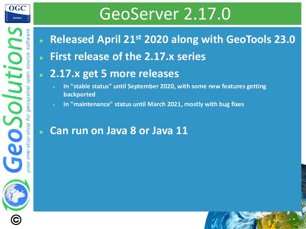
23.0 ⚫ First release of the 2.17.x series ⚫ 2.17.x get 5 more releases ⚫ In "stable status" until September 2020, with some new features getting backported ⚫ In "maintenance" status until March 2021, mostly with bug fixes ⚫ Can run on Java 8 or Java 11
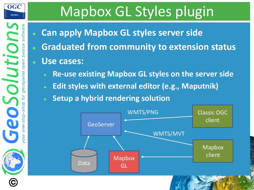
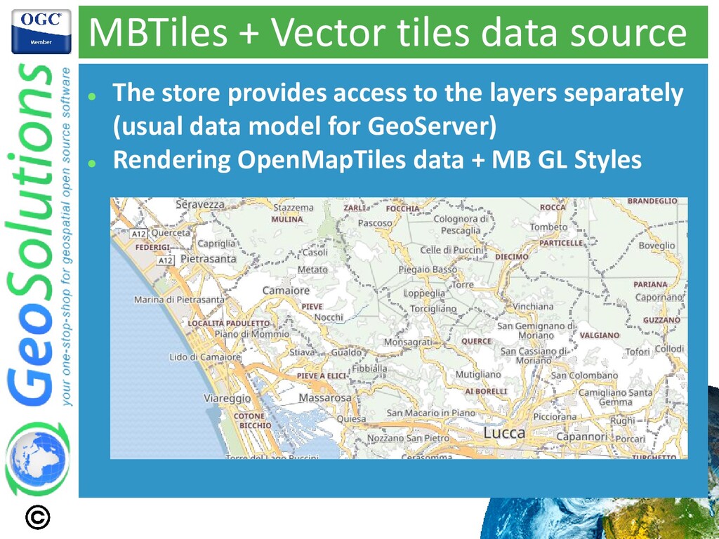
server side ⚫ Graduated from community to extension status ⚫ Use cases: ⚫ Re-use existing Mapbox GL styles on the server side ⚫ Edit styles with external editor (e.g., Maputnik) ⚫ Setup a hybrid rendering solution GeoServer Data Mapbox GL Classic OGC client Mapbox client WMTS/PNG WMTS/MVT
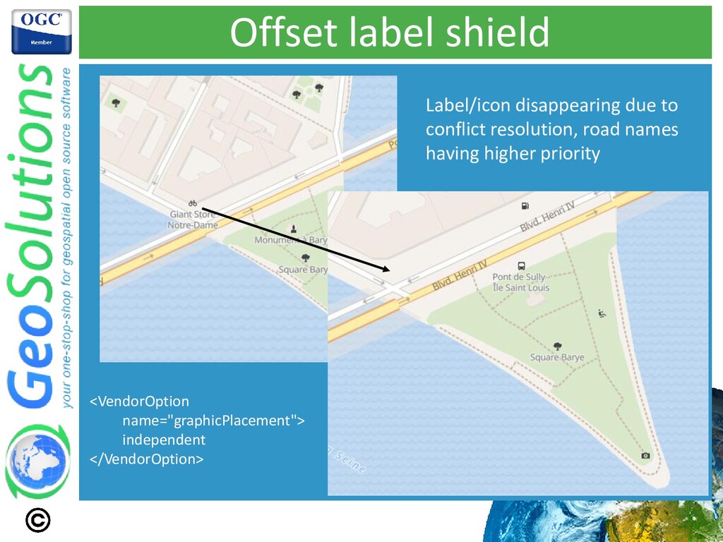
tickets resolved ⚫ Increased rendering fidelity (e.g. better match of zoom related functions, improved font matching) ⚫ Increased behavior match (e.g. icons and labels showing up together, or disappearing together)
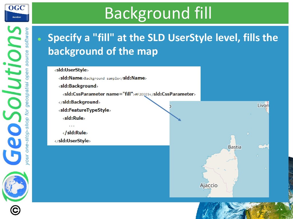
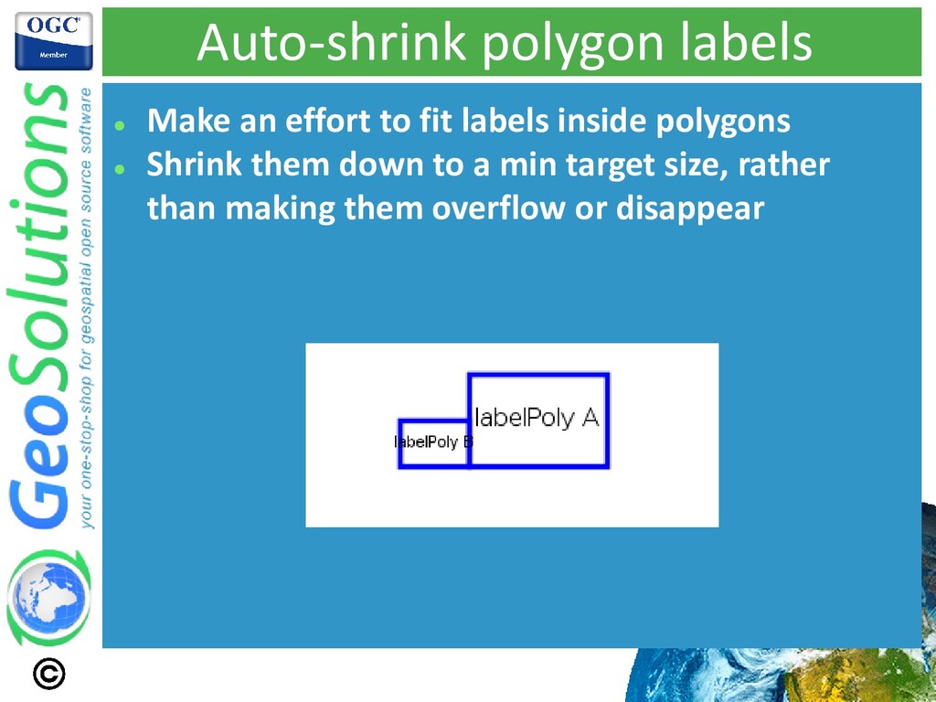
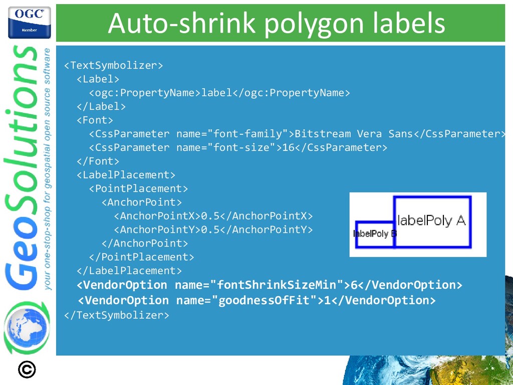
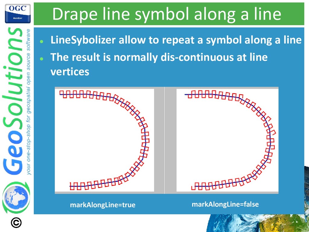
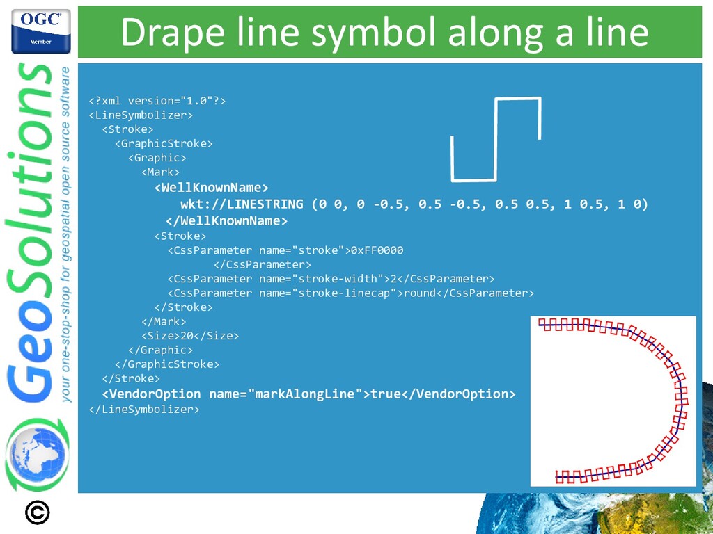
functionality, made available in all style languages. ⚫ Other functionalities added as well, independent of the Mapbox GL work ⚫ In particular: ⚫ Background fill ⚫ Associate symbol with label, make them show either together, or none ⚫ Automatic font shrinking to fit labels in polygons ⚫ Drape symbol along a line (vs just repeating it)
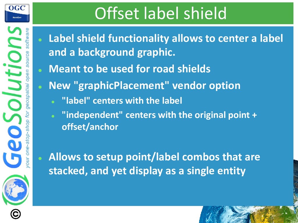
a label and a background graphic. ⚫ Meant to be used for road shields ⚫ New "graphicPlacement" vendor option ⚫ "label" centers with the label ⚫ "independent" centers with the original point + offset/anchor ⚫ Allows to setup point/label combos that are stacked, and yet display as a single entity
is a SQLite tile storage ⚫ One main table called "tiles" ⚫ One support table called "metadata" ⚫ Limited to the web Mercator tile matrix set ⚫ Tiles can be filled with images, but also with Mapbox Vector Tiles (MVT) ⚫ The metadata table provides, among others, a schema for them CREATE TABLE tiles (zoom_level integer, tile_column integer, tile_row integer, tile_data blob); CREATE TABLE metadata (name text, value text);
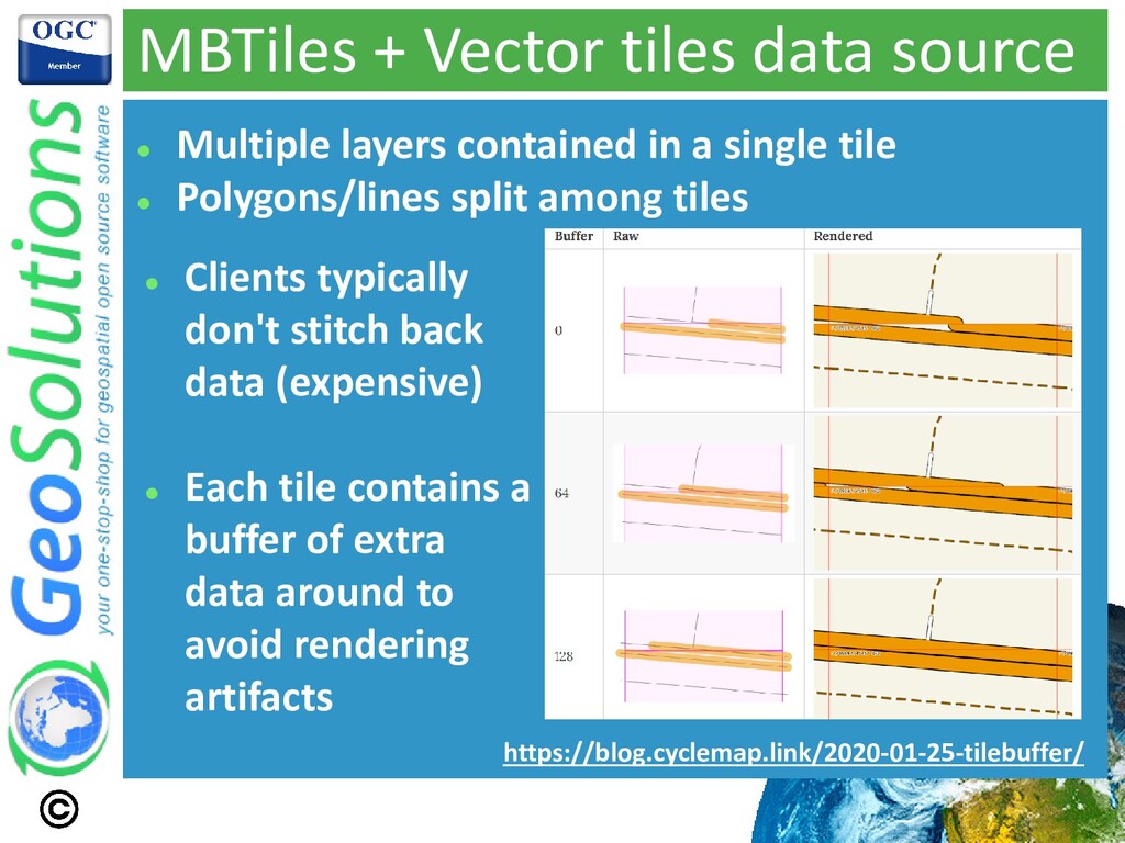
in a single tile ⚫ Polygons/lines split among tiles ⚫ Clients typically don't stitch back data (expensive) ⚫ Each tile contains a buffer of extra data around to avoid rendering artifacts https://blog.cyclemap.link/2020-01-25-tilebuffer/
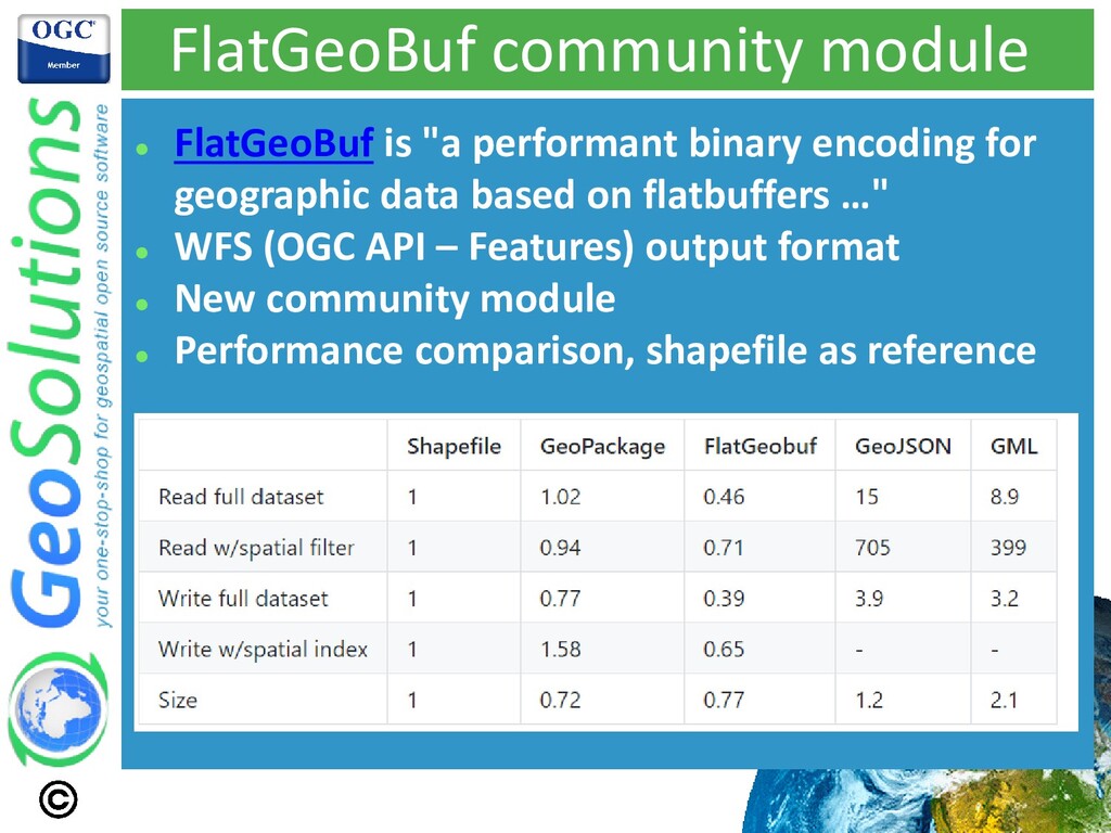
for geographic data based on flatbuffers …" ⚫ WFS (OGC API – Features) output format ⚫ New community module ⚫ Performance comparison, shapefile as reference
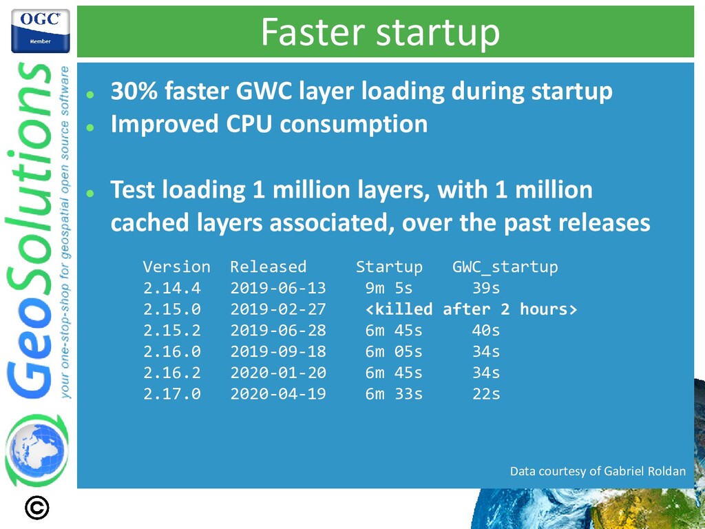
⚫ Improved CPU consumption ⚫ Test loading 1 million layers, with 1 million cached layers associated, over the past releases Version Released Startup GWC_startup 2.14.4 2019-06-13 9m 5s 39s 2.15.0 2019-02-27 <killed after 2 hours> 2.15.2 2019-06-28 6m 45s 40s 2.16.0 2019-09-18 6m 05s 34s 2.16.2 2020-01-20 6m 45s 34s 2.17.0 2020-04-19 6m 33s 22s Data courtesy of Gabriel Roldan
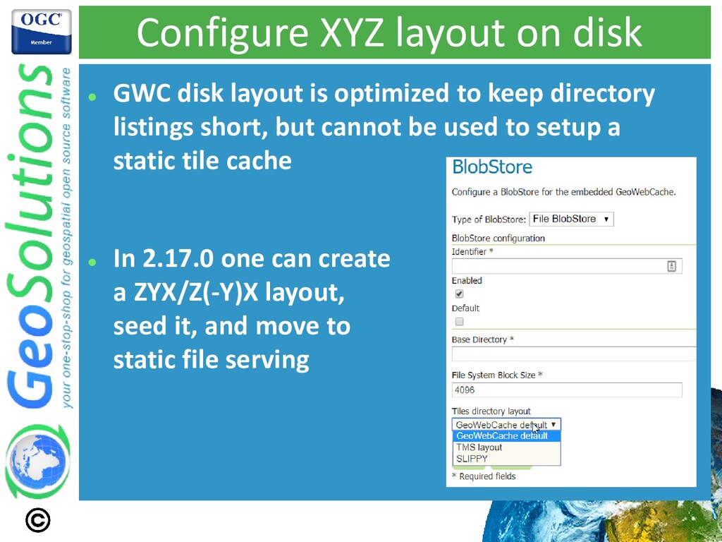
optimized to keep directory listings short, but cannot be used to setup a static tile cache ⚫ In 2.17.0 one can create a ZYX/Z(-Y)X layout, seed it, and move to static file serving