of archeological significance before doing restoration work ► Also interested in change through time Purpose ► Use historic maps of the San Jacinto Battleground to § identify sites of historical significance § Document change through time
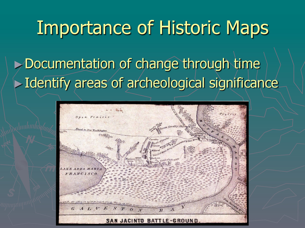
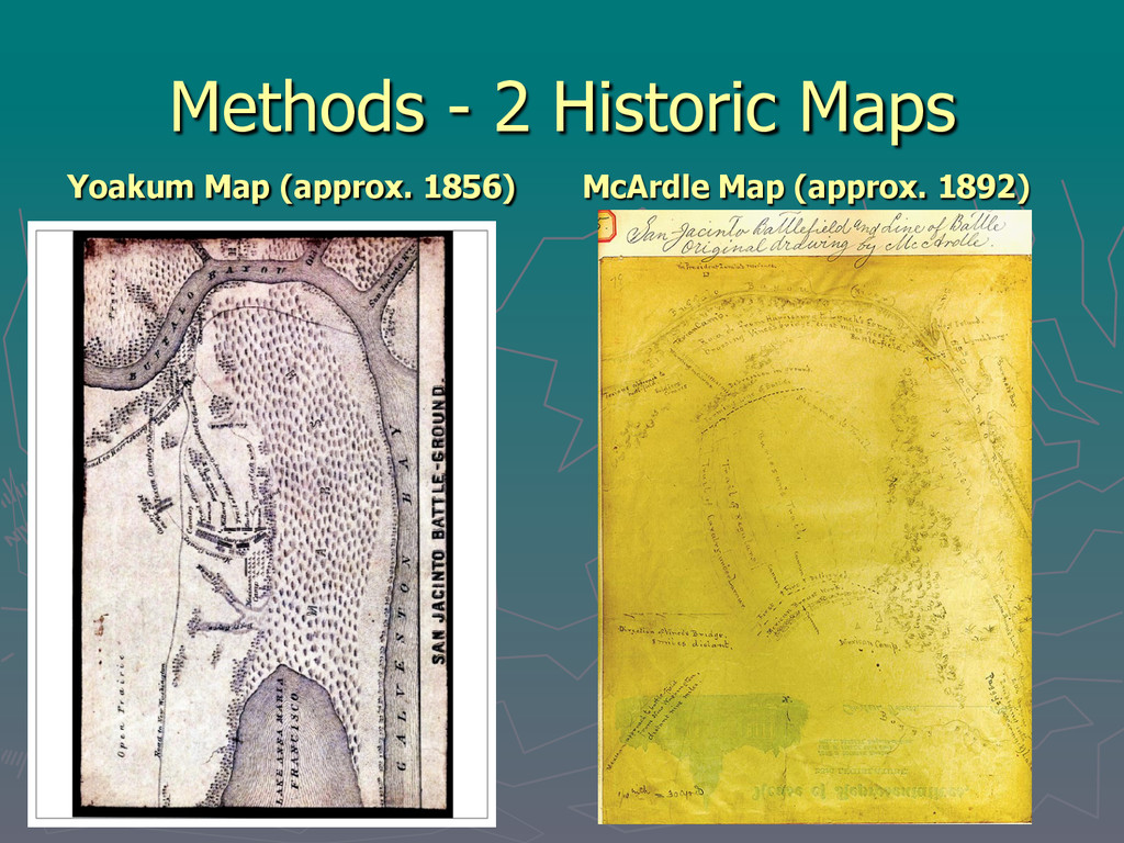
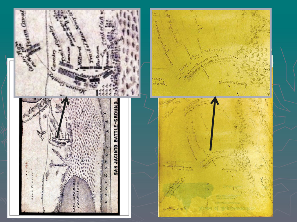
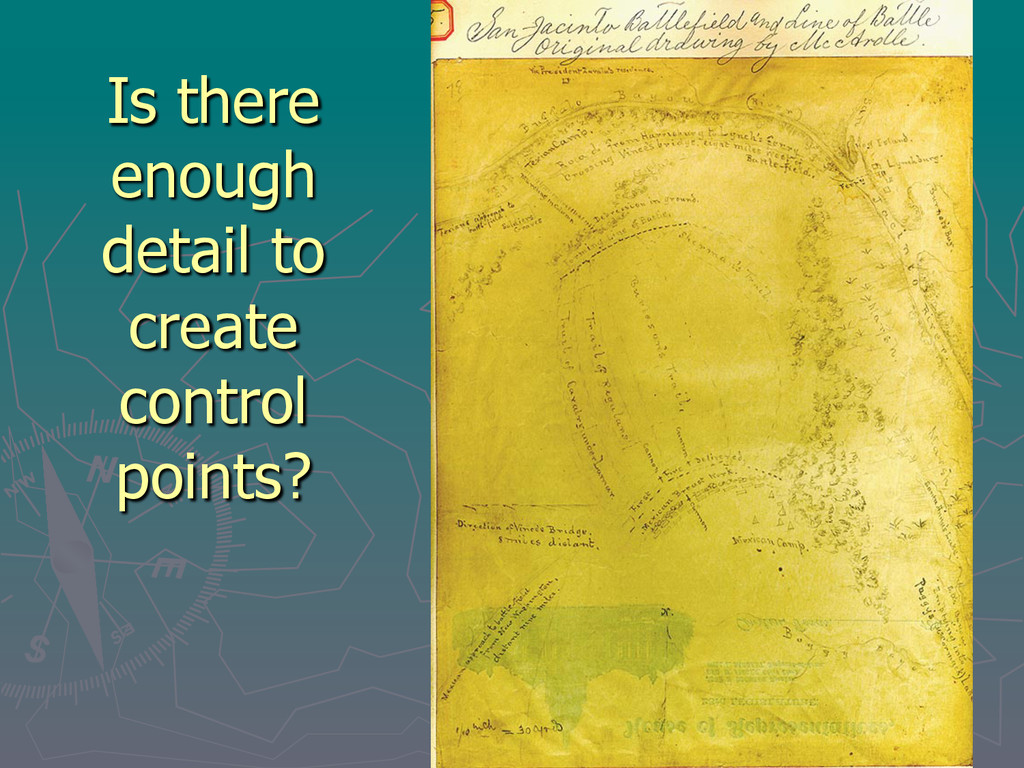
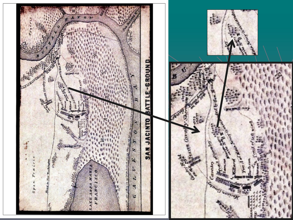
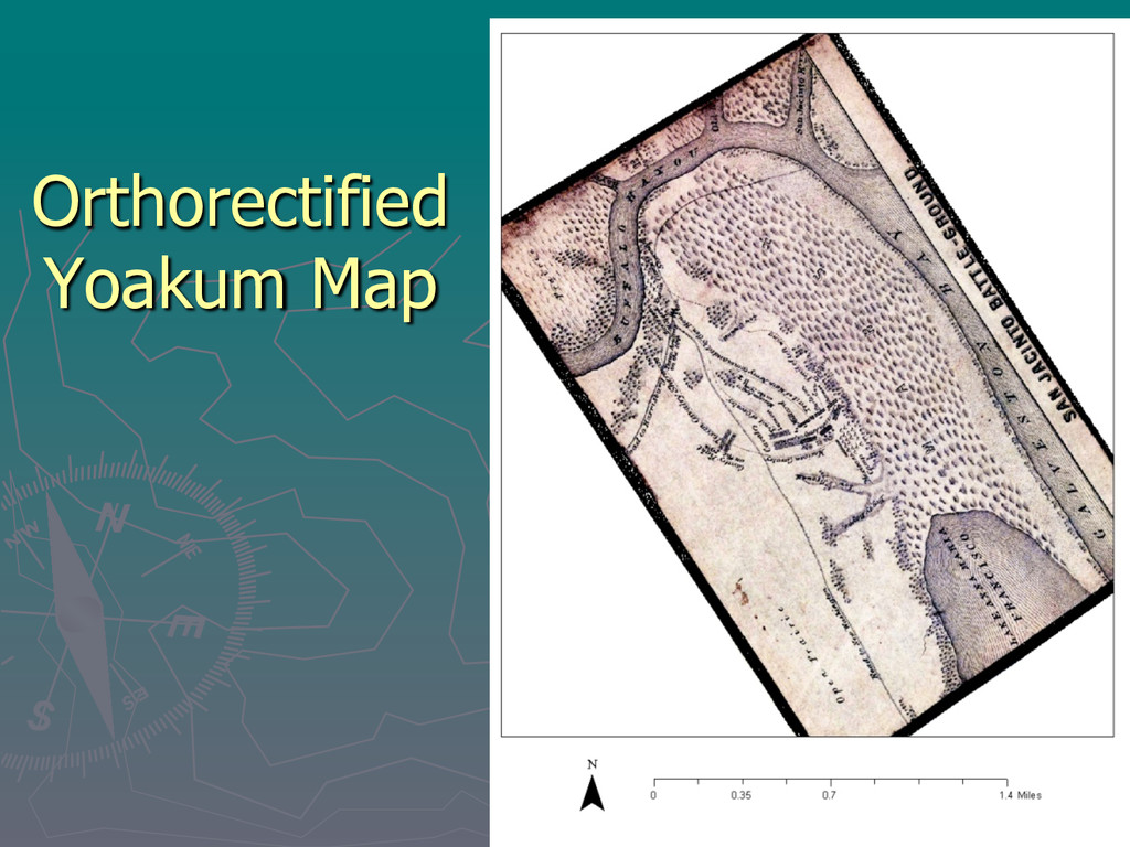
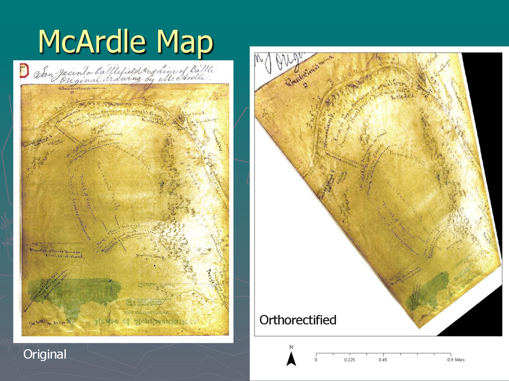
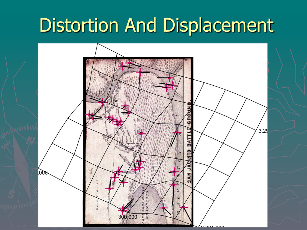
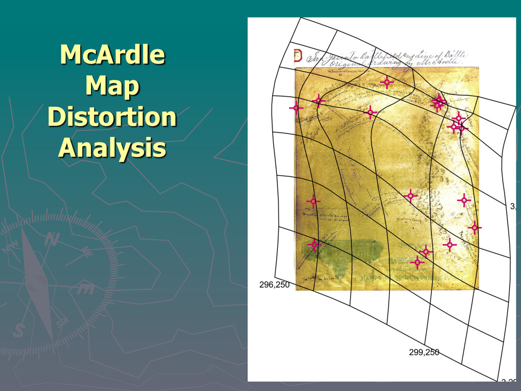
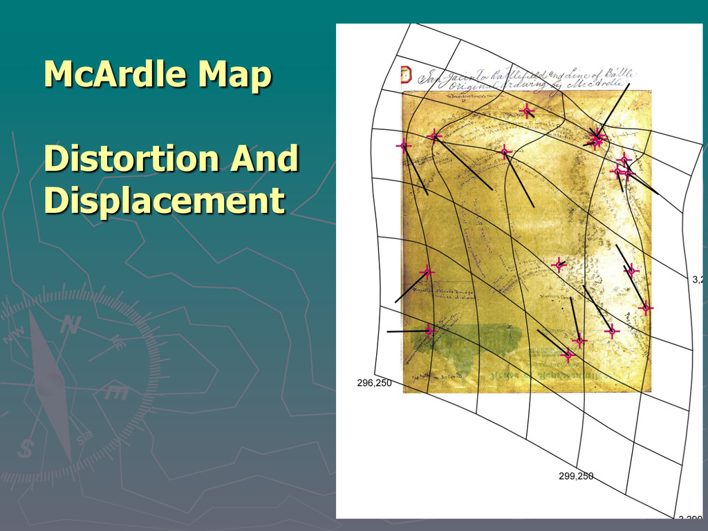
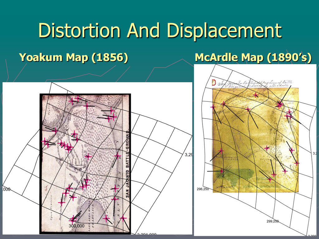
H. Yoakum was a TX Historian; 2 volume History of Texas § Consulted with Sam Houston about the battle details § No map scale included § No evidence that he was a surveyor or cartographer § Size: 11x19cm or 7.3”x4.6” § Source: University of North Texas website "Portal to Texas History" at http:// texashistory.unt.edu/ark:/ 67531/metapth2490/ McArdle Map (approx. 1892) § Artist; Painted the Battle of San Jacinto (1895) § Extensive battle research; interviewed battle survivors § Includes map scale § He served as a mapmaker during the civil war § Map drawn on back of TX State stationery § Source: Texas State Library and Archives Commission (TSLAC) at https:// www.tsl.texas.gov/mcardle/ sanjac/sanjac014.html
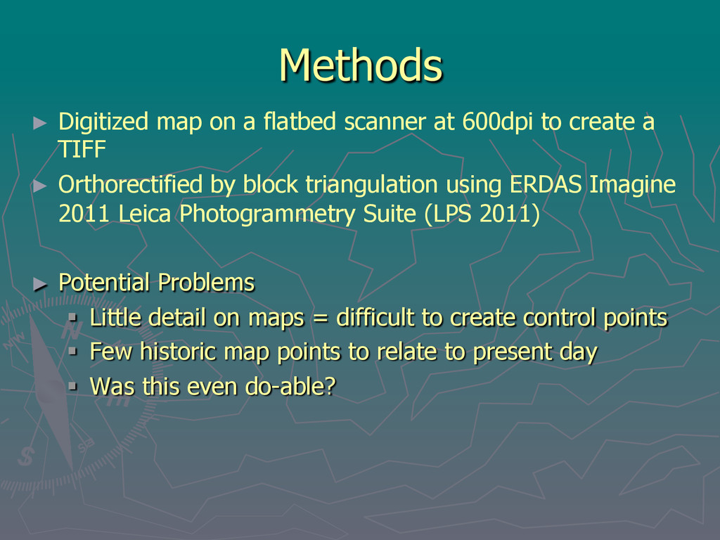
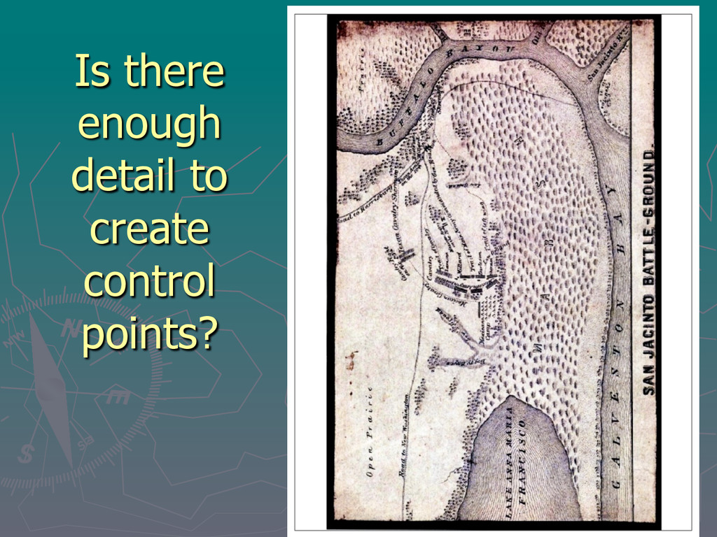
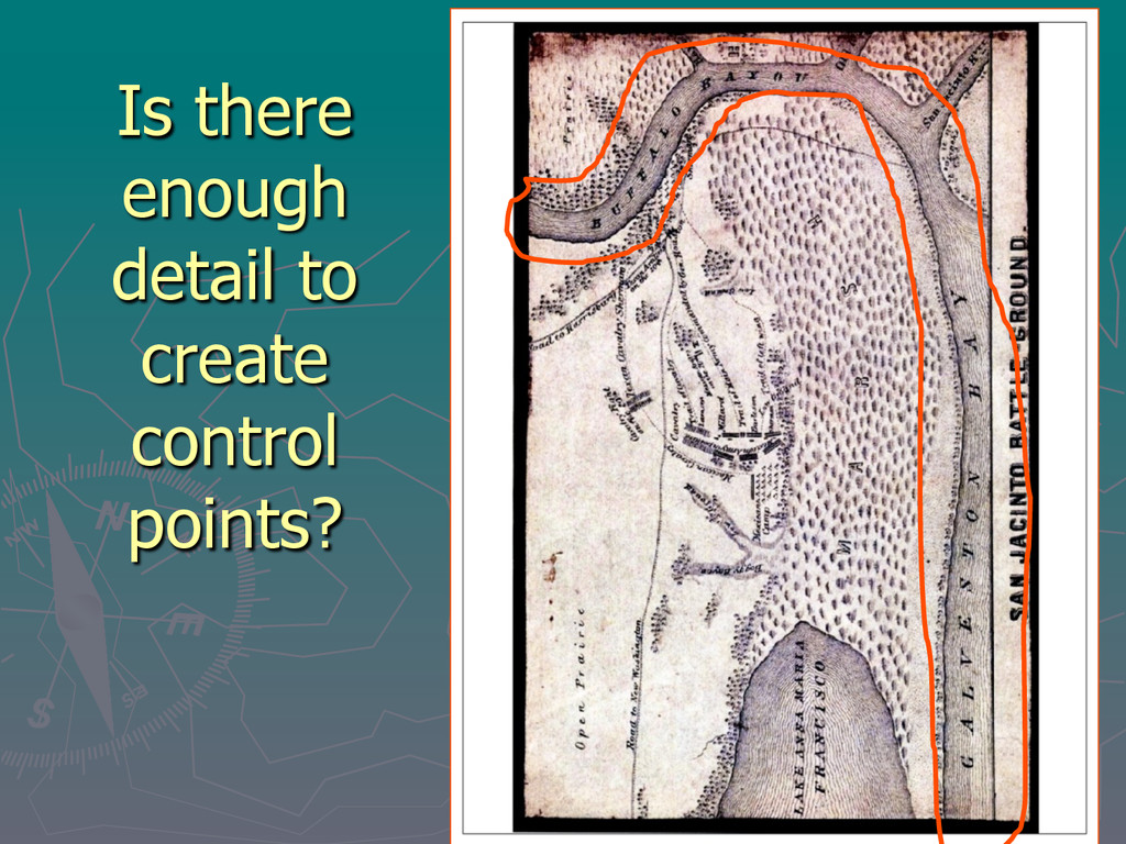
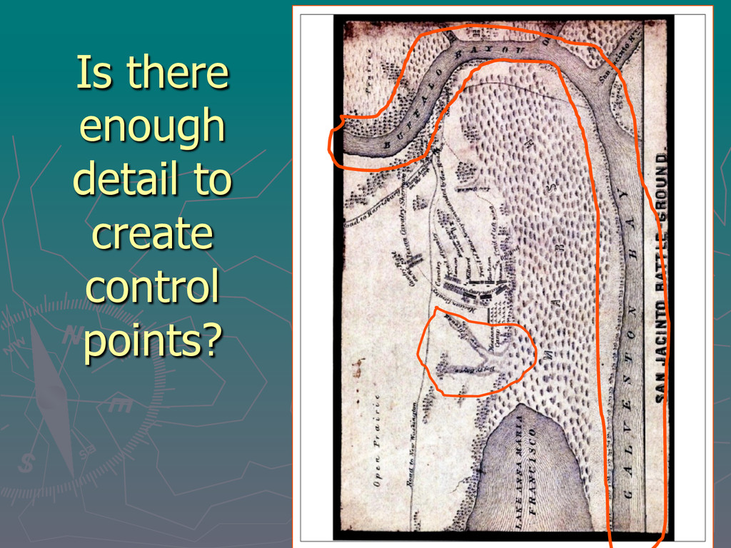
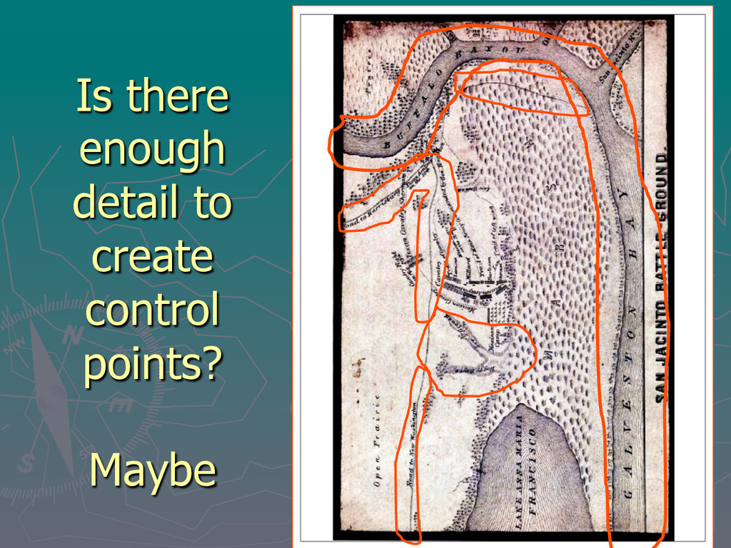
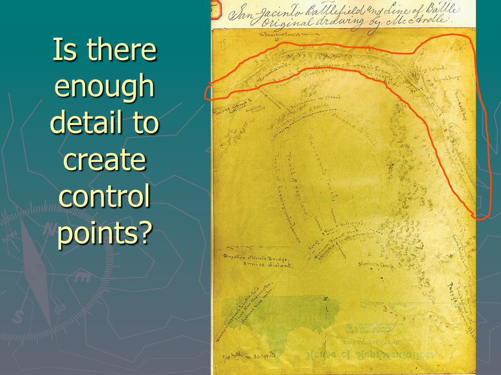
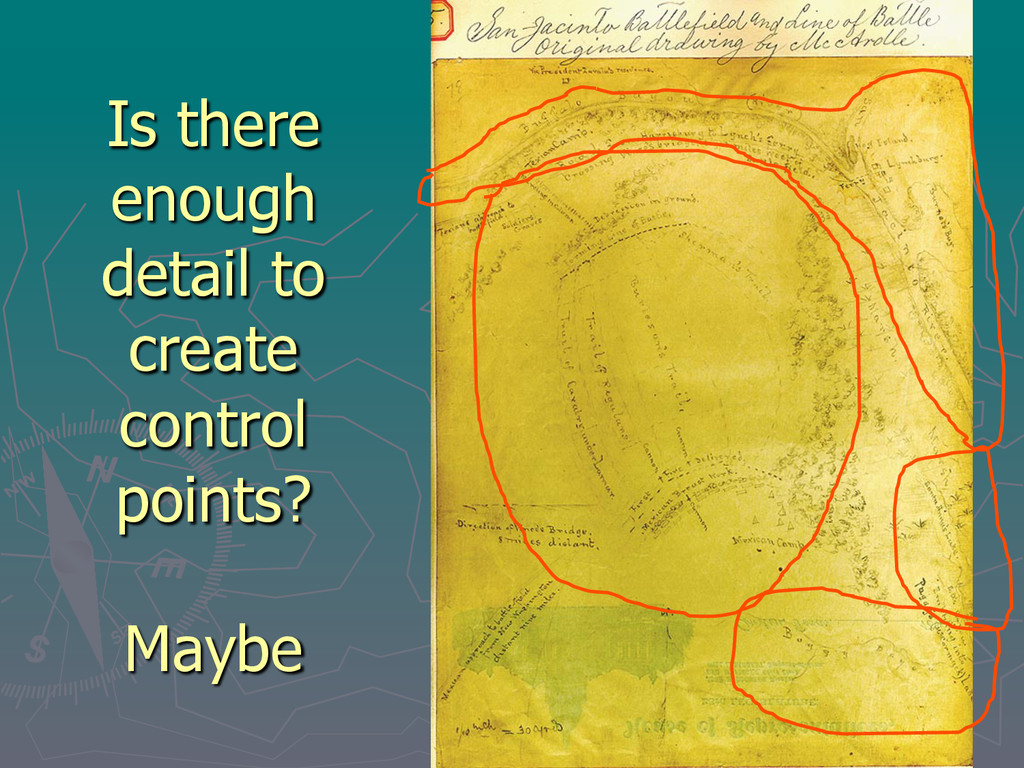
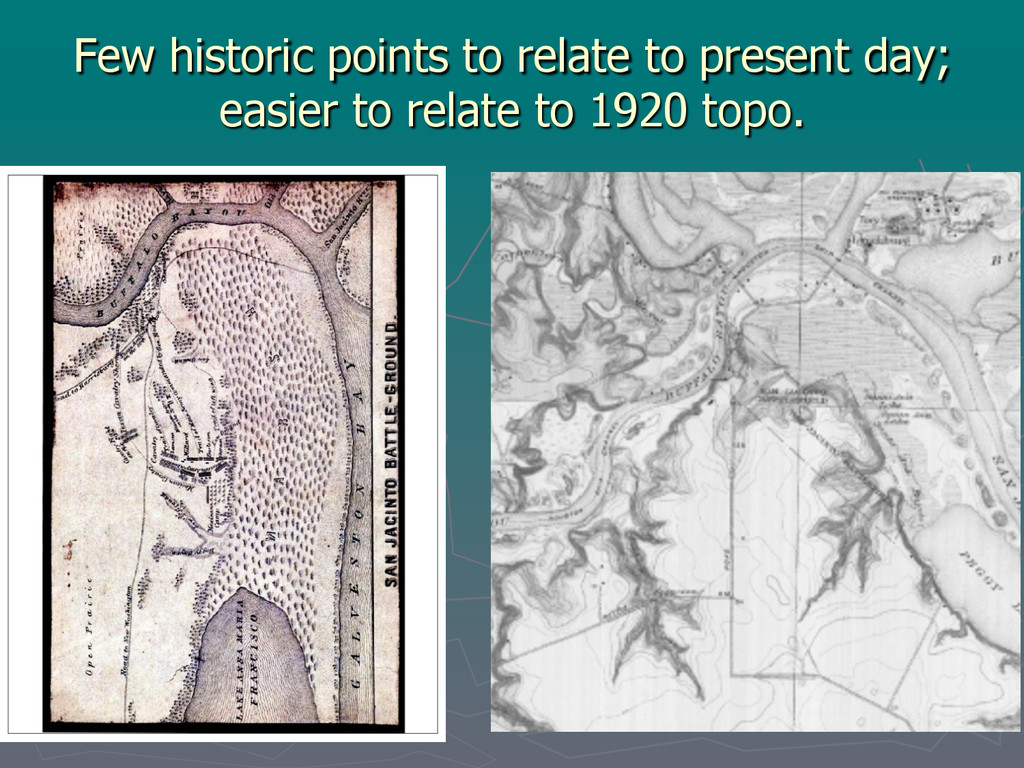
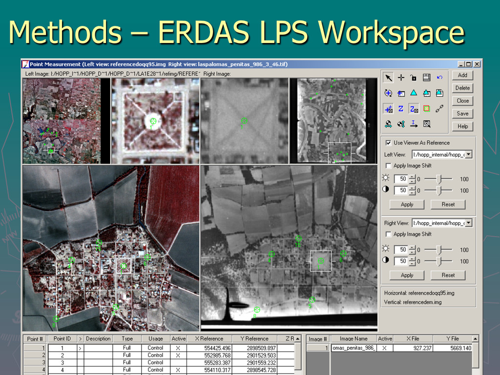
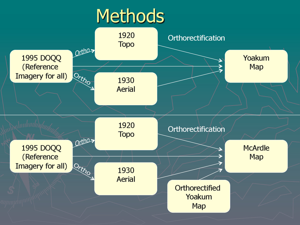
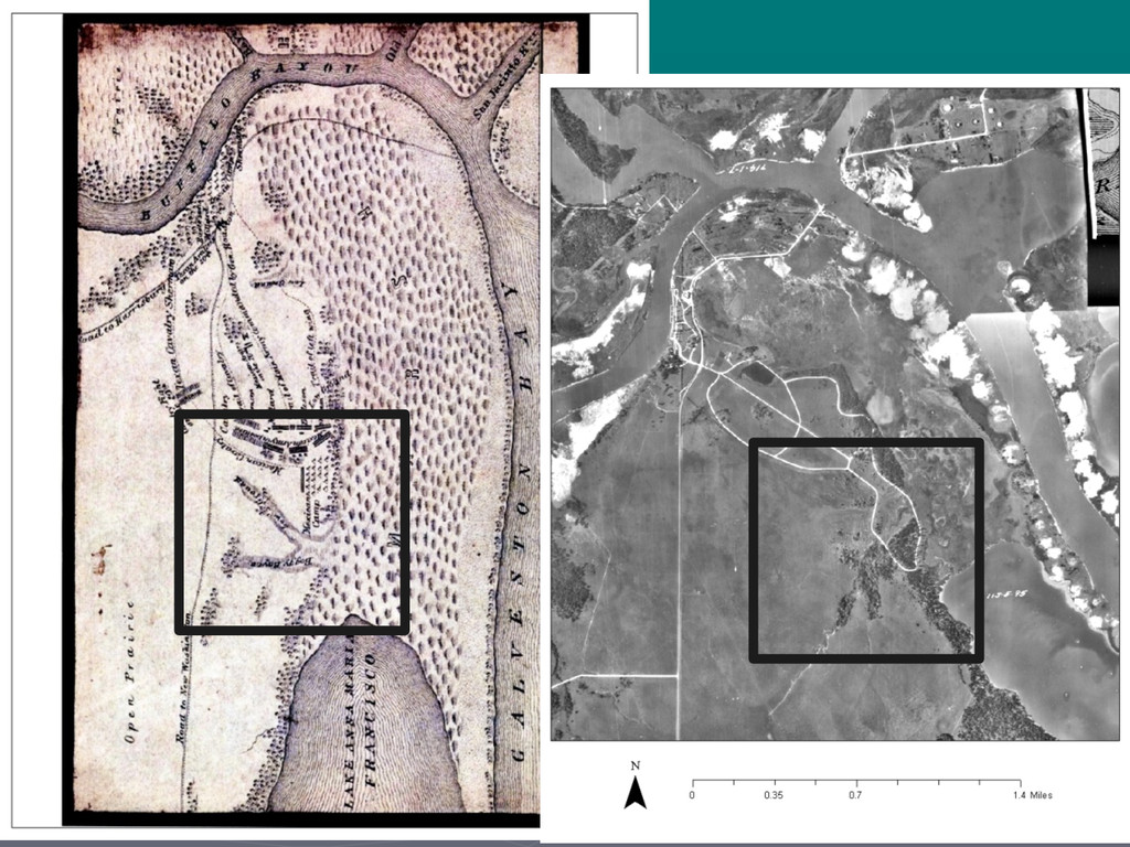
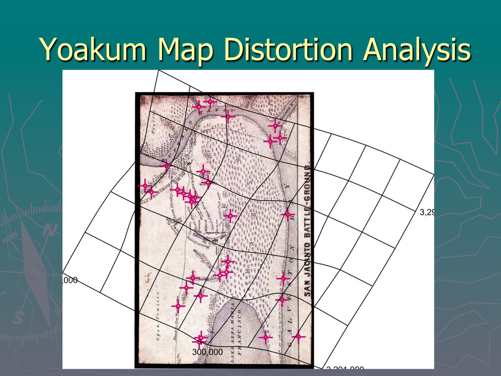
to create a TIFF ► Orthorectified by block triangulation using ERDAS Imagine 2011 Leica Photogrammetry Suite (LPS 2011) ► Potential Problems § Little detail on maps = difficult to create control points § Few historic map points to relate to present day § Was this even do-able?
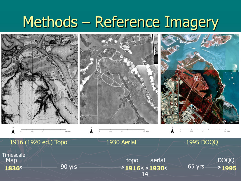
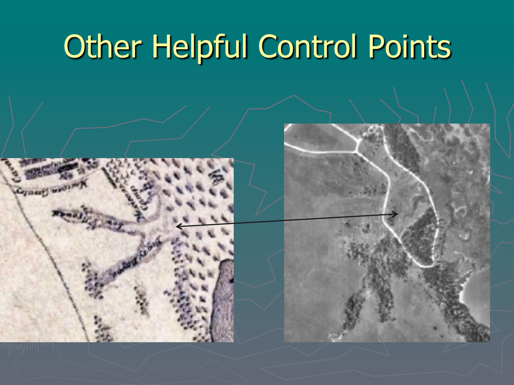
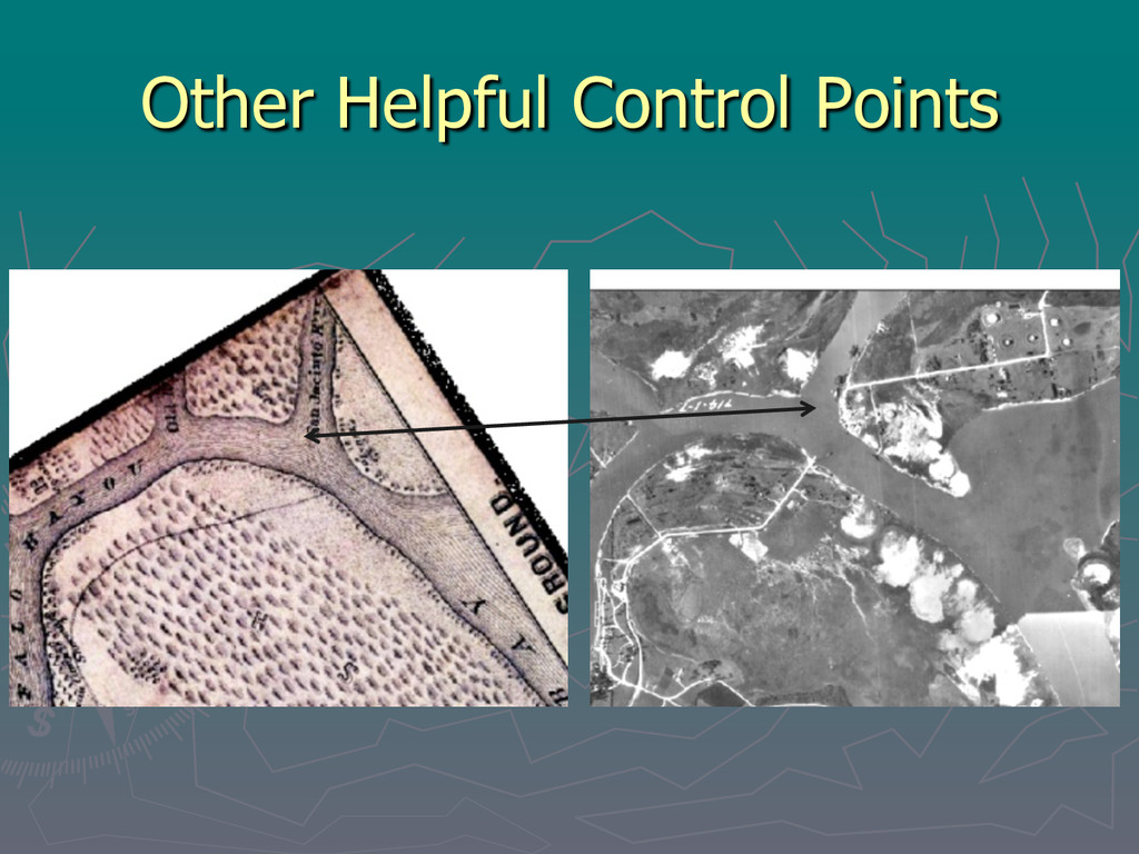
relate to present day § Was this even do-able? Answer: Maybe ► Used additional historic maps and imagery to generate control points § mosaicked 1995 DOQQ § 1920 ed. orthorectified USGS topographic maps § 1930 orthorectified aerial image (Tobin collection)
map better, but not to our group’s usual standards ► Consulted with an archeologist familiar with site § Provided insight § Resulted in much improved results
§ Where evidence is sometimes seen in certain seasons ► Knowledge of dredging and soil movement; when it became more frequent ► Where road to fairy was ► Where historic buildings probably were ► The Canon story
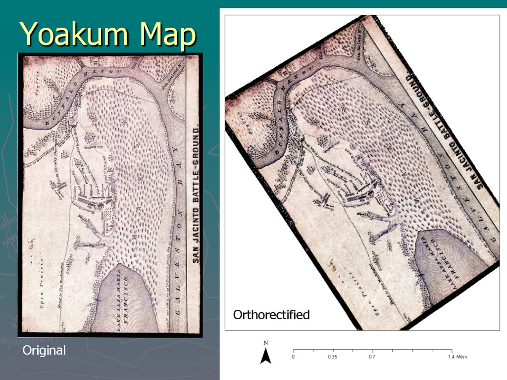
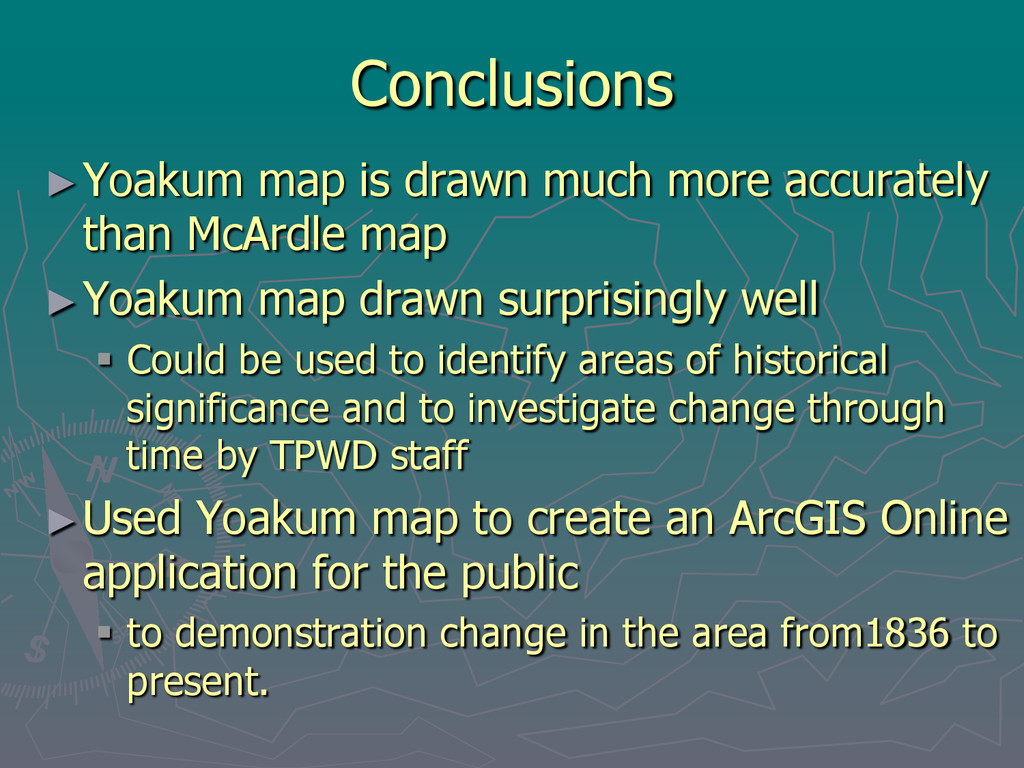
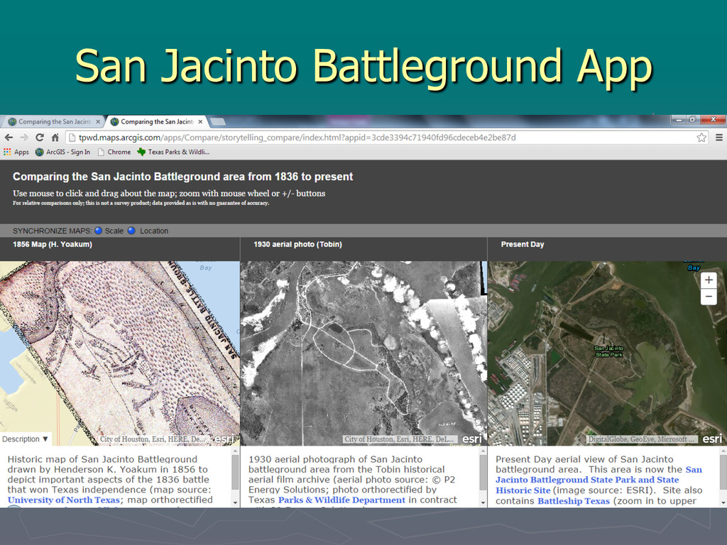
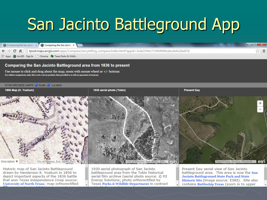
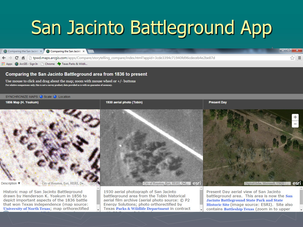
map ► Yoakum map drawn surprisingly well § Could be used to identify areas of historical significance and to investigate change through time by TPWD staff ► Used Yoakum map to create an ArcGIS Online application for the public § to demonstration change in the area from1836 to present.