Upgrade to Pro
— share decks privately, control downloads, hide ads and more …
Speaker Deck
Sign up for free
Menu
Search
Features
All features
Private URLs
Password Protection
Custom URLS
Scheduled publishing
Remove Branding
Restrict embedding
Deck Collections
Notes
Features
All features
Private URLs
Password Protection
Custom URLS
Scheduled publishing
Remove Branding
Restrict embedding
Deck Collections
Notes
Explore
Featured decks
Featured speakers
Programming
Technology
Storyboards
Explore
Featured decks
Featured speakers
Programming
Technology
Storyboards
Pricing
Search
Sign in
Sign up for free
SOC 4650/5650 - Lab-12 Replication
Search
Christopher Prener
April 08, 2019
Education
120
0
Share
Embed
Copy iframe code
Copy JS code
Copy link
Start on current slide
SOC 4650/5650 - Lab-12 Replication
Christopher Prener
April 08, 2019
More Decks by Christopher Prener
See All by Christopher Prener
washu-lec
chrisprener
0
210
slu_ahead.pdf
chrisprener
0
270
fundamental-causes-psych
chrisprener
0
160
fundamental-causes- slu-geriatric
chrisprener
0
250
fundamental-causes-ances
chrisprener
0
510
stitching-across-data-seams-stlc
chrisprener
0
130
fundamental-causes-slu-med
chrisprener
0
180
data-seams-paa
chrisprener
0
210
ami_hospitalizations
chrisprener
0
110
Other Decks in Education
See All in Education
Dronegeografía innovación didáctica y fotogrametría 3D para la enseñanza de la geografía local y la ciudadaniía activa
juanmartin2026
0
39k
私たちはなんでテストするんだっけ? Ver.東北IT物産展2026 in 会津若松
camel_404
3
220
SANG PENCIPTA BERBICARA (01ABSG-Q4-2026)
ssmedikasda
0
470
Design Guidelines and Models - Lecture 5 - Human-Computer Interaction (1023841ANR)
signer
PRO
0
1.7k
武藤の処世術を書いてみた
mutomasa
0
140
日本における応用言語学・言語教育学 これまでとこれから
terasawat
0
170
1002
cbtlibrary
0
350
Sekolah Sabat - Triwulan 4 2026 - Pelajaran 1
hiola
0
13k
観察、仮説、実行、検証、計画、提案を一年で3000回トレーニングする方法/3000 Thinking Loops in 365 Days
moriyuya
5
1.5k
1人 × AI、1か月でここまで作れる ー 数年前の外注換算3.8〜7.4億円・241〜379人月分の作業を、AI費用 約10万円・31日で
frievea
0
580
人間関係に取り組む、その時に / step away to make space
spring_aki
0
140
Modulo : abc
robintux
0
240
Featured
See All Featured
Max Prin - Stacking Signals: How International SEO Comes Together (And Falls Apart)
techseoconnect
PRO
0
490
Tell your own story through comics
letsgokoyo
1
1.1k
Skip the Path - Find Your Career Trail
mkilby
1
260
Navigating Algorithm Shifts & AI Overviews - #SMXNext
aleyda
1
1.7k
Save Time (by Creating Custom Rails Generators)
garrettdimon
PRO
33
5.2k
Self-Hosted WebAssembly Runtime for Runtime-Neutral Checkpoint/Restore in Edge–Cloud Continuum
chikuwait
0
890
The MySQL Ecosystem @ GitHub 2015
samlambert
251
13k
The World Runs on Bad Software
bkeepers
PRO
72
12k
Chasing Engaging Ingredients in Design
codingconduct
0
360
Applied NLP in the Age of Generative AI
inesmontani
PRO
4
2.5k
VelocityConf: Rendering Performance Case Studies
addyosmani
331
25k
SEO Brein meetup: CTRL+C is not how to scale international SEO
lindahogenes
2
2.9k
Transcript
Lab-12 Replication Coal Fields in Missouri and Illinois
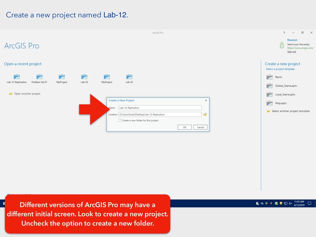
Create a new project named Lab-12. Different versions of ArcGIS
Pro may have a different initial screen. Look to create a new project. Uncheck the option to create a new folder.
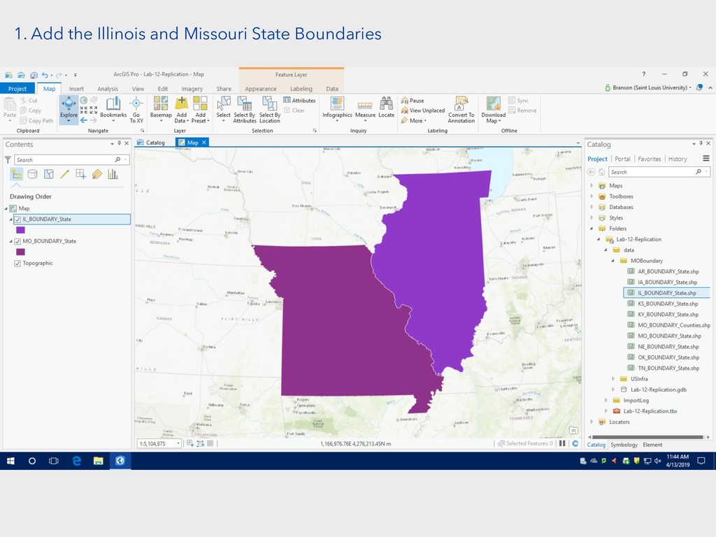
1. Add the Illinois and Missouri State Boundaries
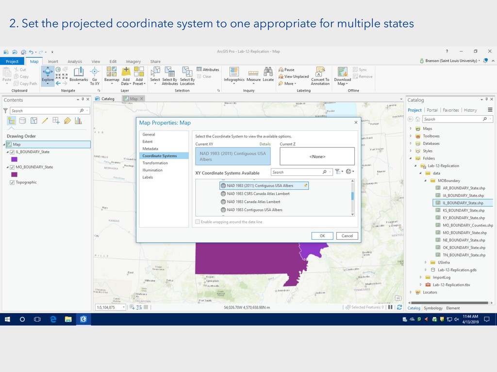
2. Set the projected coordinate system to one appropriate for
multiple states
3. Navigate to the merge tool in the Analysis tab
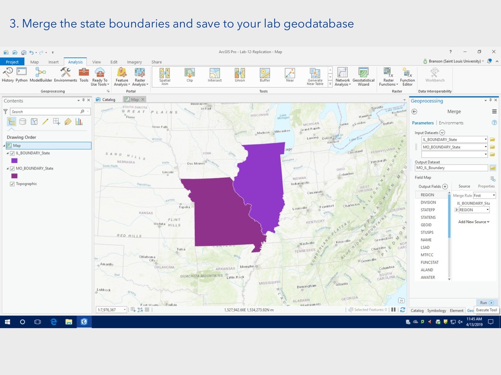
3. Merge the state boundaries and save to your lab
geodatabase
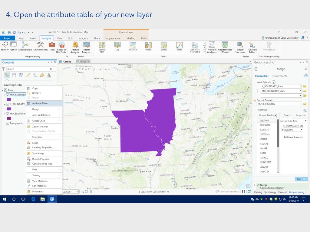
4. Open the attribute table of your new layer
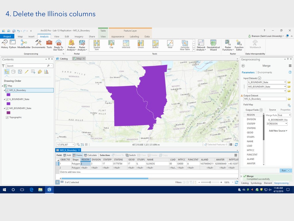
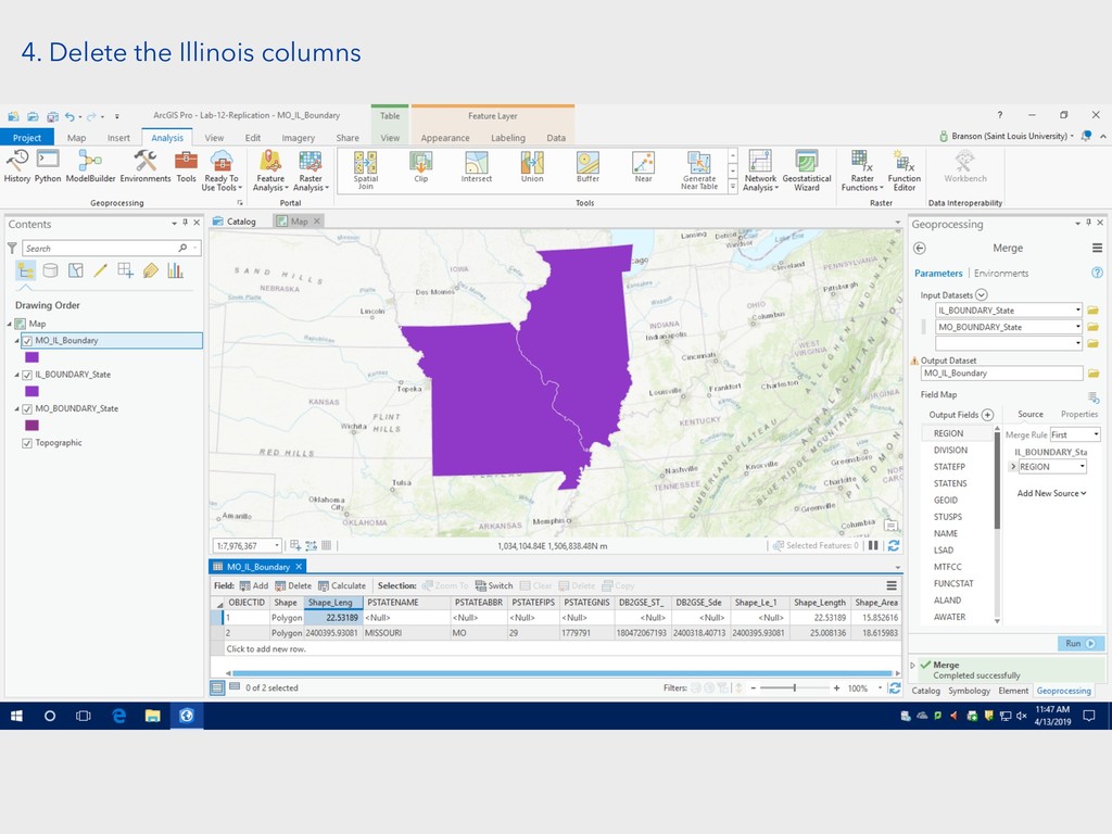
4. Delete the Illinois columns
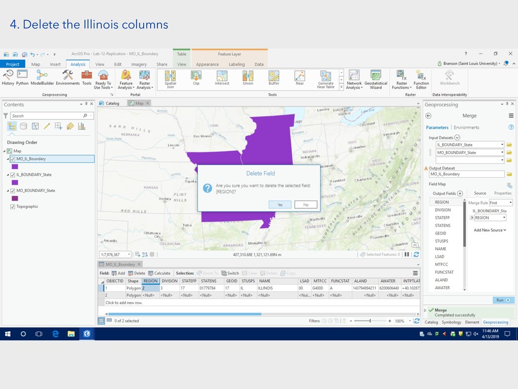
4. Delete the Illinois columns
4. Delete the Illinois columns
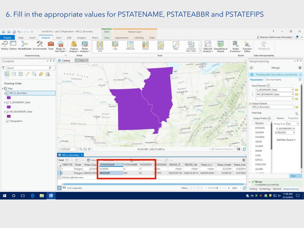
6. Fill in the appropriate values for PSTATENAME, PSTATEABBR and
PSTATEFIPS
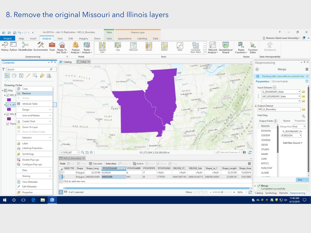
8. Remove the original Missouri and Illinois layers
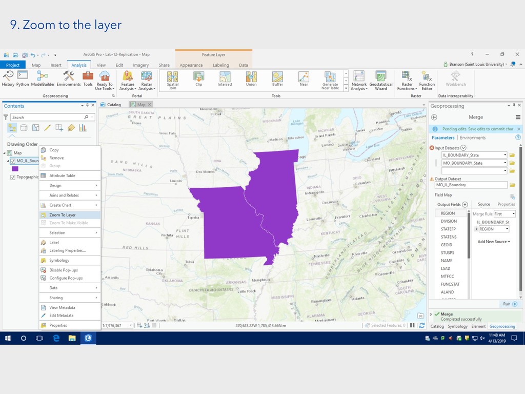
9. Zoom to the layer
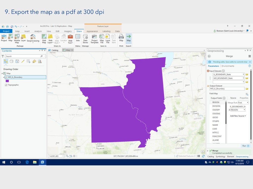
9. Export the map as a pdf at 300 dpi
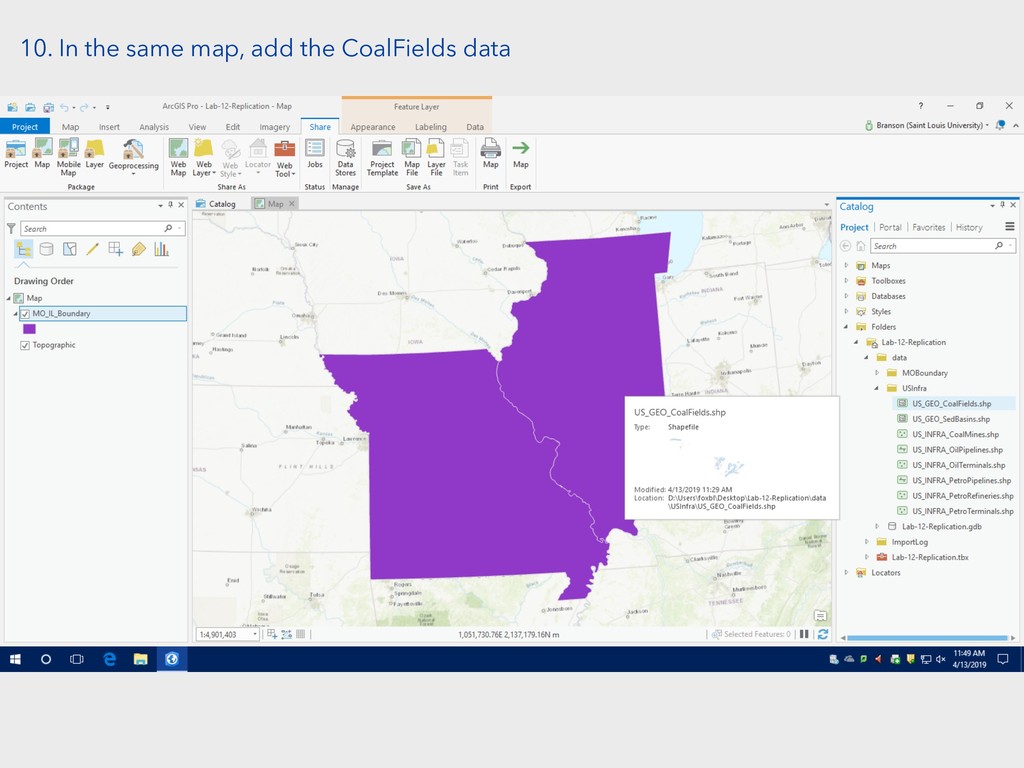
10. In the same map, add the CoalFields data
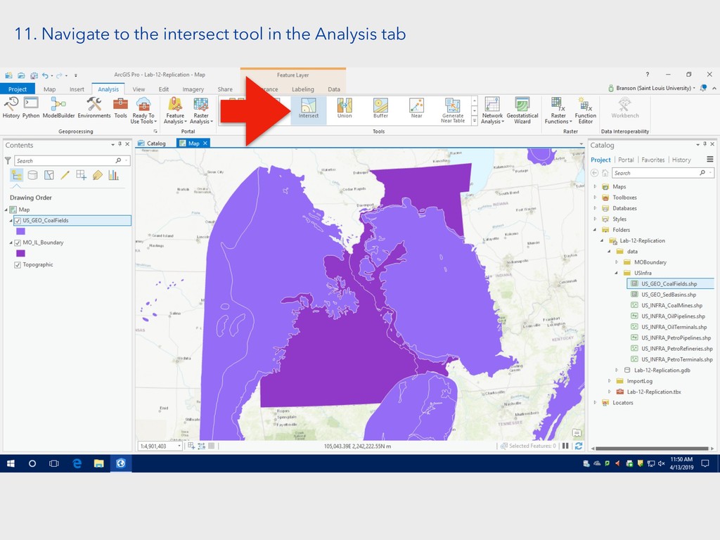
11. Navigate to the intersect tool in the Analysis tab
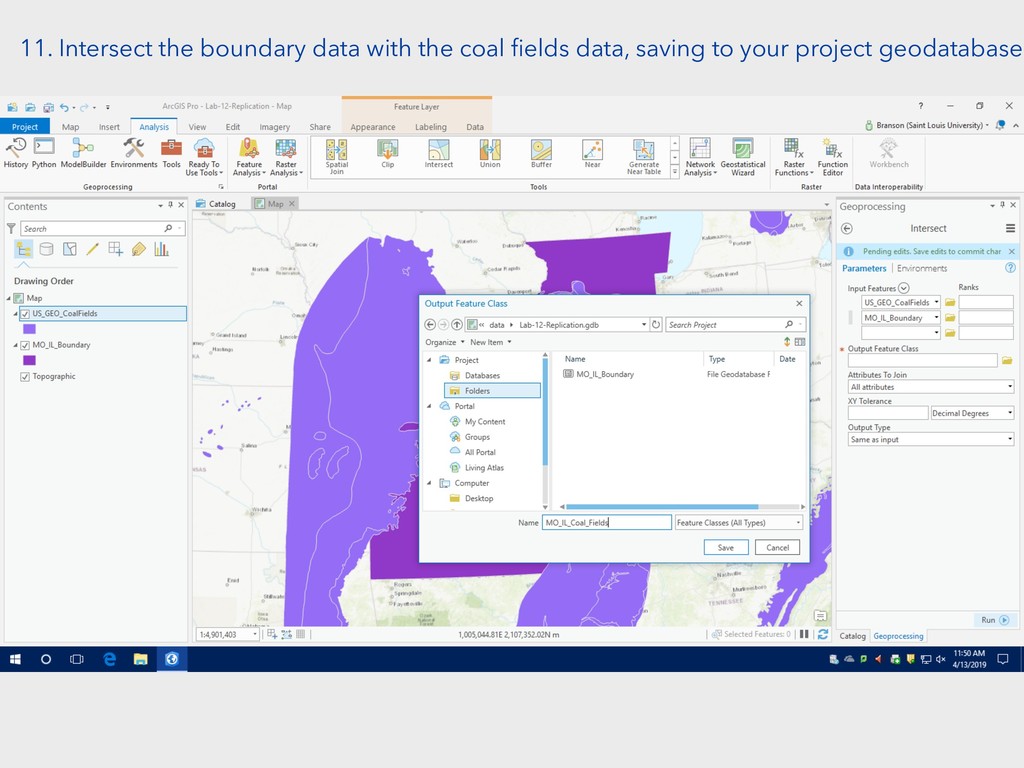
11. Intersect the boundary data with the coal fields data,
saving to your project geodatabase
12. Open the attribute table of the layer you just
created
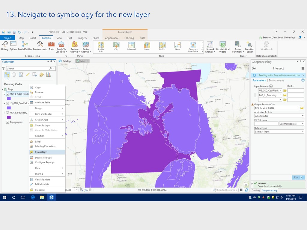
13. Navigate to symbology for the new layer
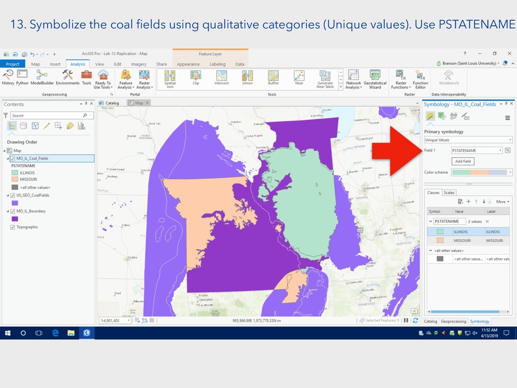
13. Symbolize the coal fields using qualitative categories (Unique values).
Use PSTATENAME
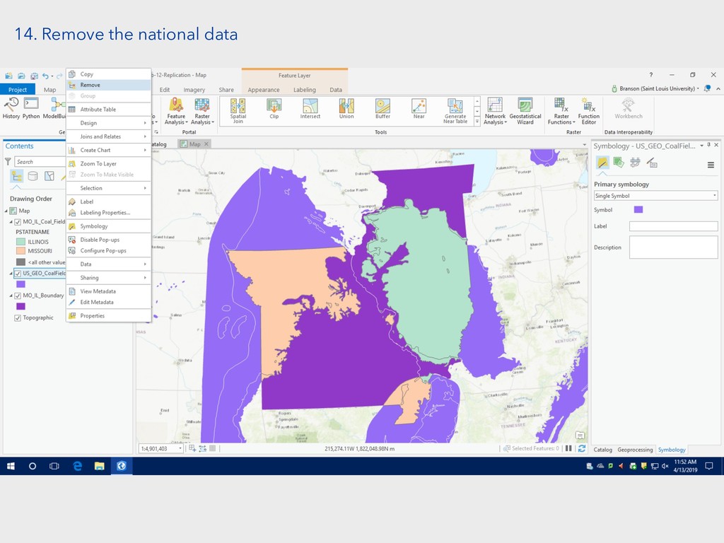
14. Remove the national data
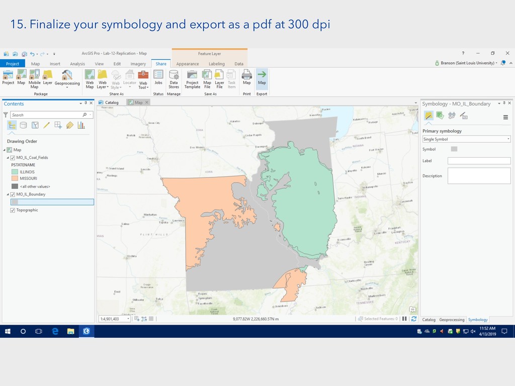
15. Finalize your symbology and export as a pdf at
300 dpi
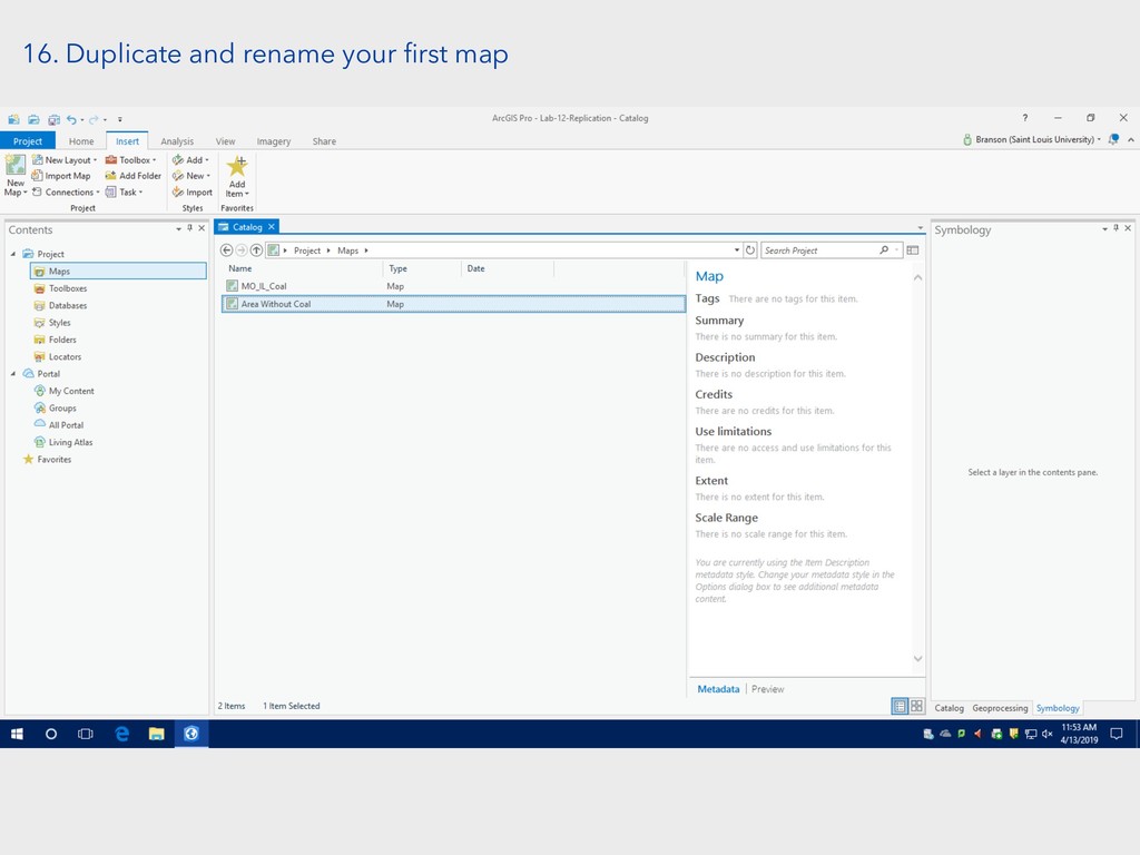
16. Duplicate and rename your first map
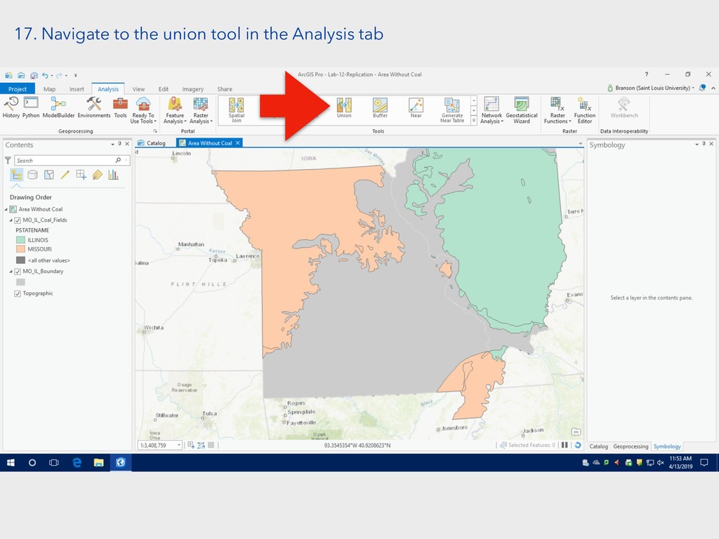
17. Navigate to the union tool in the Analysis tab
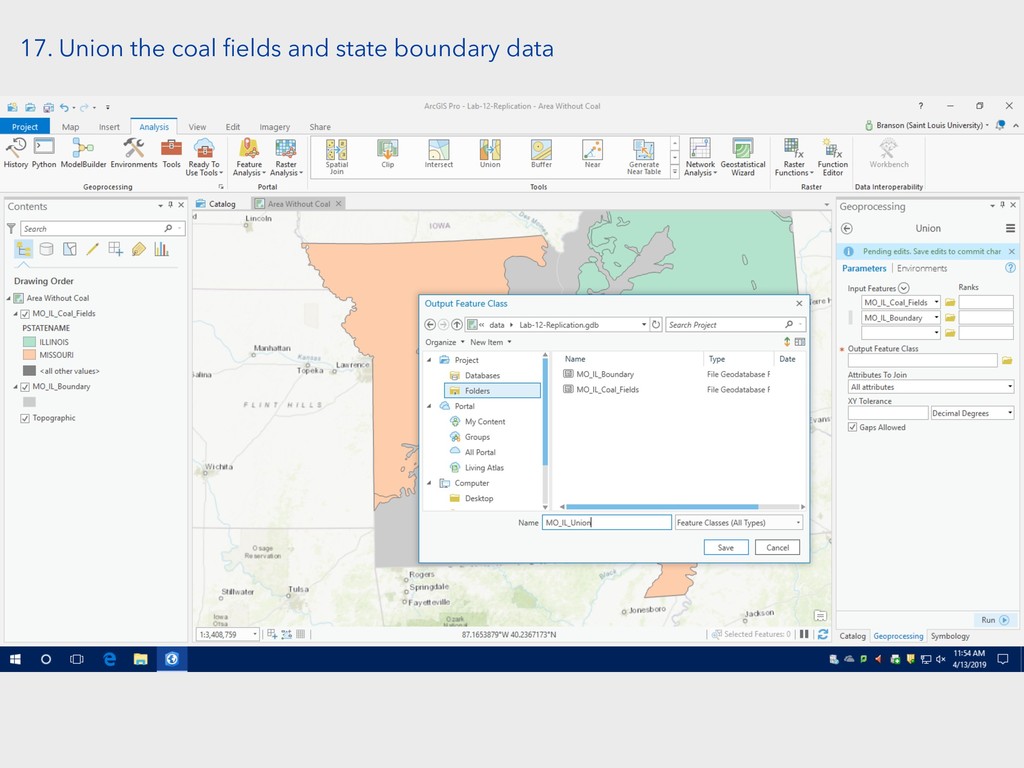
17. Union the coal fields and state boundary data
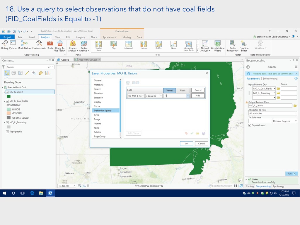
18. Use a query to select observations that do not
have coal fields (FID_CoalFields is Equal to -1)
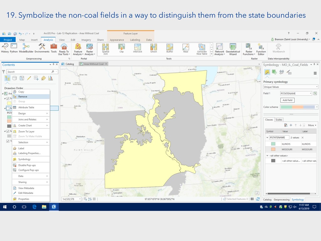
19. Symbolize the non-coal fields in a way to distinguish
them from the state boundaries
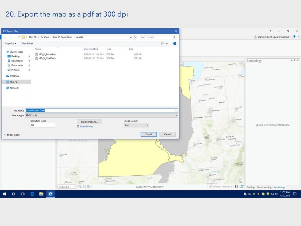
20. Export the map as a pdf at 300 dpi


 chrisprener
 juanmartin2026
 camel_404
 ssmedikasda
 signer
 mutomasa
 terasawat
 cbtlibrary
 hiola
hiola
 moriyuya
 frievea
 spring_aki
 robintux
 techseoconnect
 letsgokoyo
 mkilby
 aleyda
 garrettdimon
 chikuwait
 samlambert
 bkeepers
 codingconduct
 inesmontani
 addyosmani
 lindahogenes