Computational Science and Engineering. Applied Scientist Maritime Intelligence. Spend a lot of my time worrying about how to process remote sensing data efficiently.
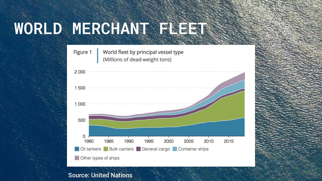
your back, gas in your car, and food on your plate” – Rose George, Ninety Percent of Everything. Without maritime shipping, half the world population would starve, the other half would freeze.
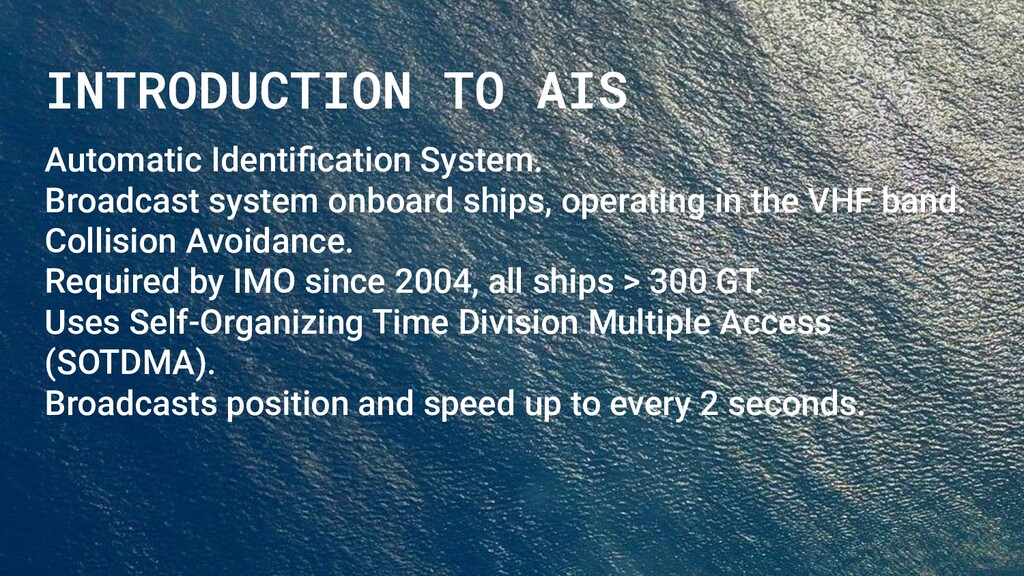
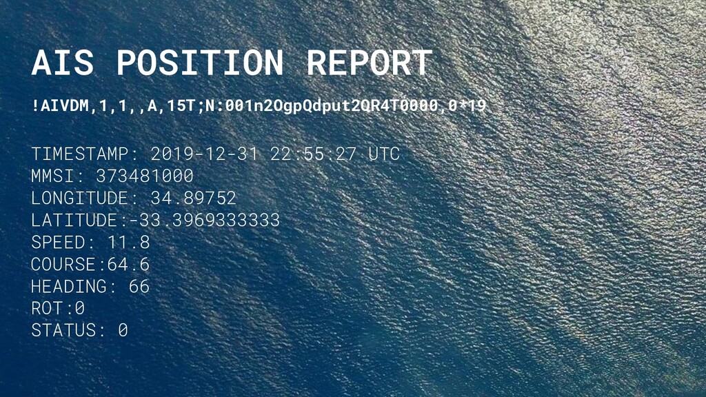
operating in the VHF band. Collision Avoidance. Required by IMO since 2004, all ships > 300 GT. Uses Self-Organizing Time Division Multiple Access (SOTDMA). Broadcasts position and speed up to every 2 seconds.
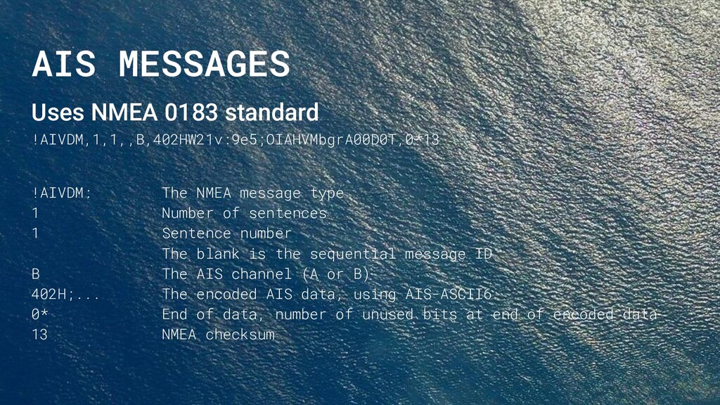
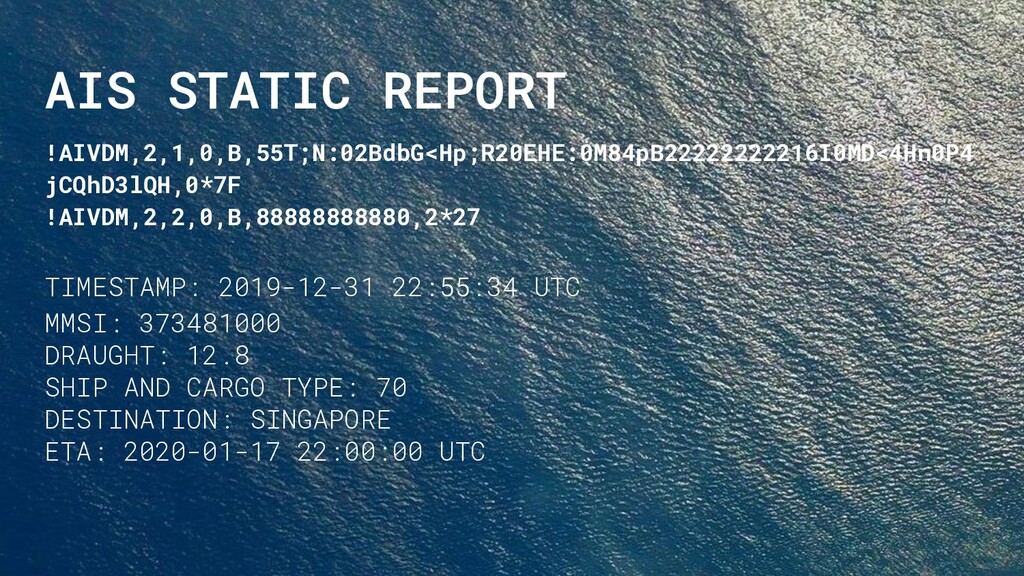
message type 1 Number of sentences 1 Sentence number The blank is the sequential message ID B The AIS channel (A or B) 402H;... The encoded AIS data, using AIS-ASCII6 0* End of data, number of unused bits at end of encoded data 13 NMEA checksum
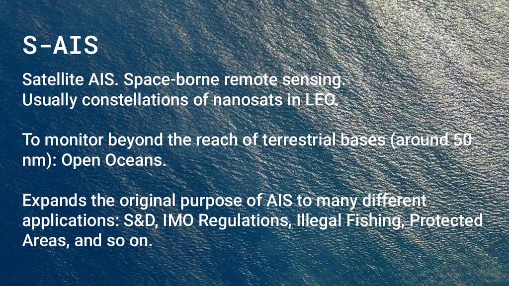
in LEO. To monitor beyond the reach of terrestrial bases (around 50 nm): Open Oceans. Expands the original purpose of AIS to many different applications: S&D, IMO Regulations, Illegal Fishing, Protected Areas, and so on.
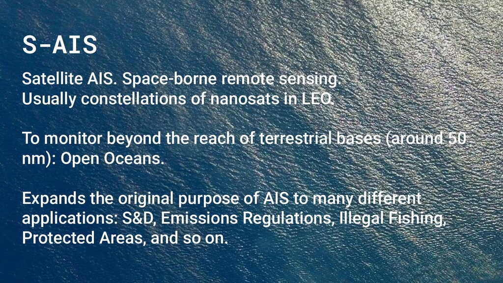
in LEO. To monitor beyond the reach of terrestrial bases (around 50 nm): Open Oceans. Expands the original purpose of AIS to many different applications: S&D, Emissions Regulations, Illegal Fishing, Protected Areas, and so on.
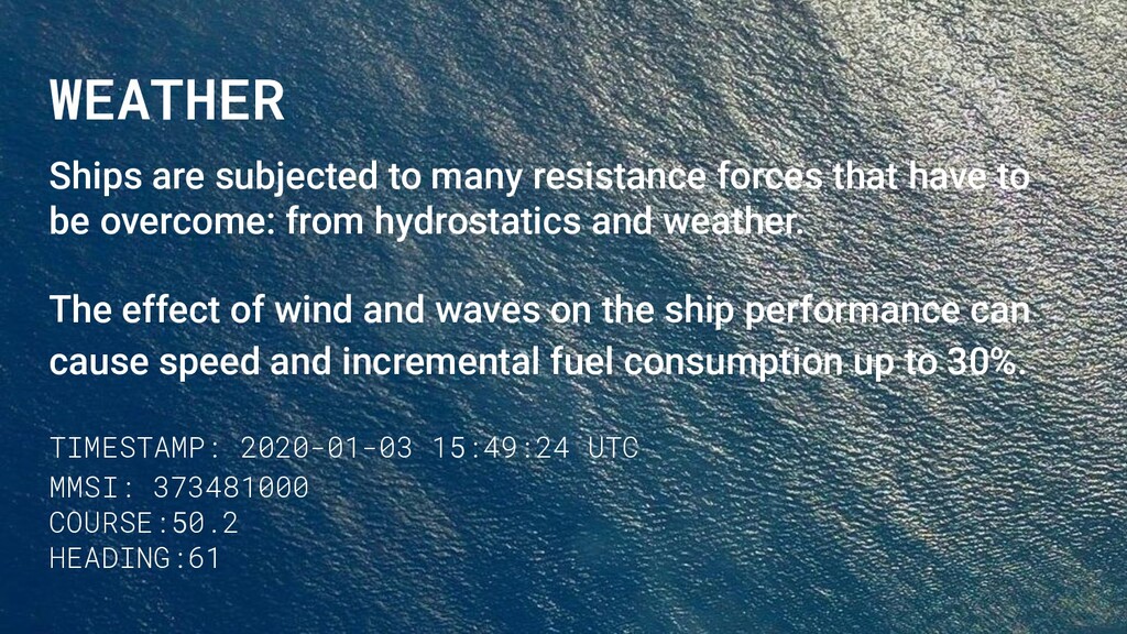
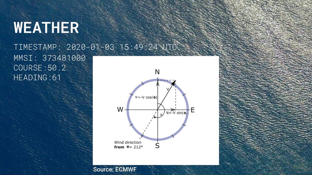
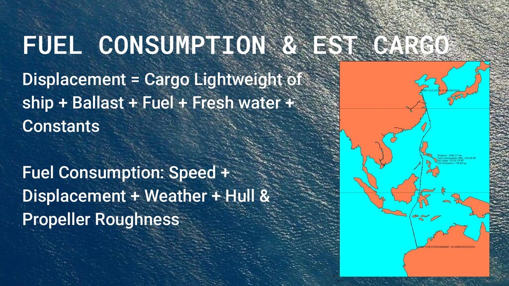
to be overcome: from hydrostatics and weather. The effect of wind and waves on the ship performance can cause speed and incremental fuel consumption up to 30%. TIMESTAMP: 2020-01-03 15:49:24 UTC MMSI: 373481000 COURSE:50.2 HEADING:61
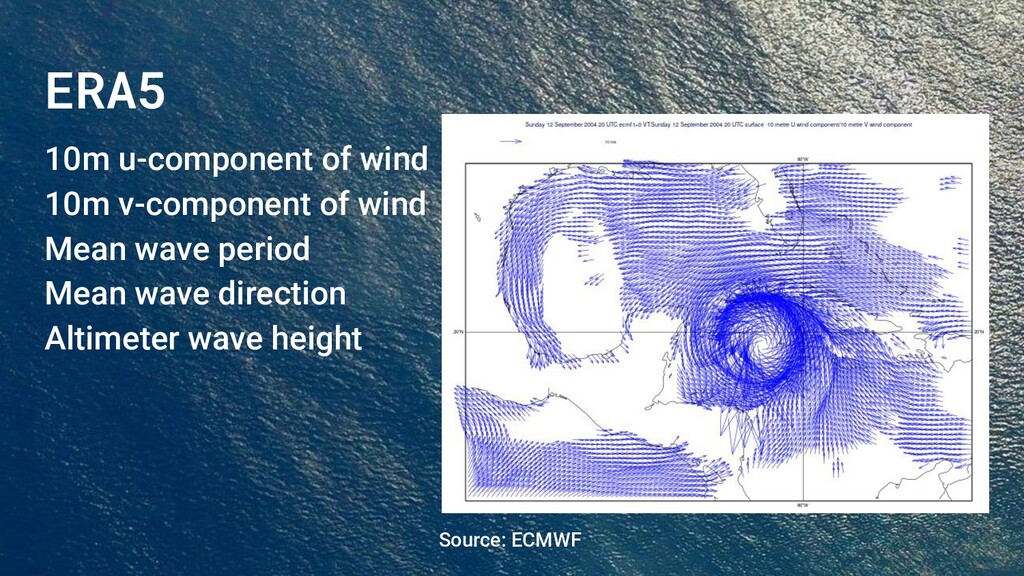
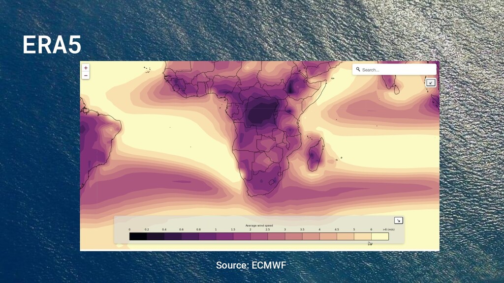
Weather Forecasts (ECMWF). Available for public use (1979 to within 5 days of real time). Hourly estimates of a large number of atmospheric, land, and oceanic climate variables. Covers the Earth on a 30 km grid, with uncertainties for all variables.
from a numerical model to produce an optimal estimate of the evolving state of the system. When Data Assimilation is used in past data: Reanalysis. ECMWF -> Data Assimilation -> Model -> Weather forecasts