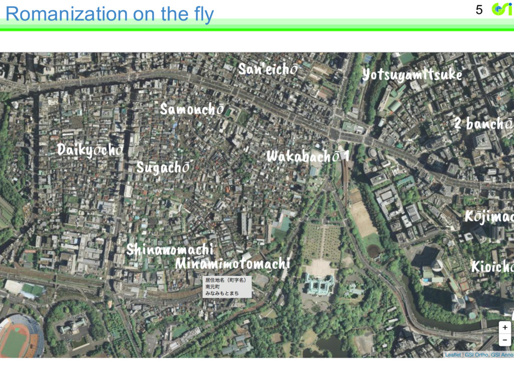
of Japan Browser-side rendering of address data as map annotations Hidenori FUJIMURA Geospatial Information Authority of Japan 1 ISO/TC 211 PT 19160 2015-12-08 Slides available at speakerdeck.com/hfu
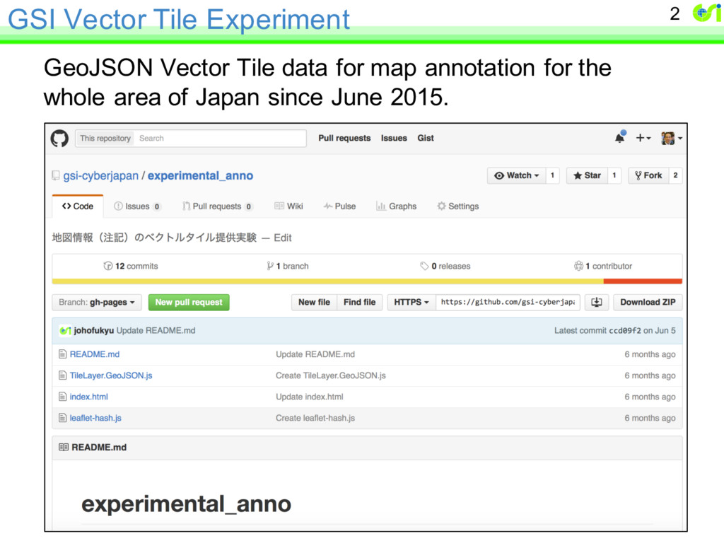
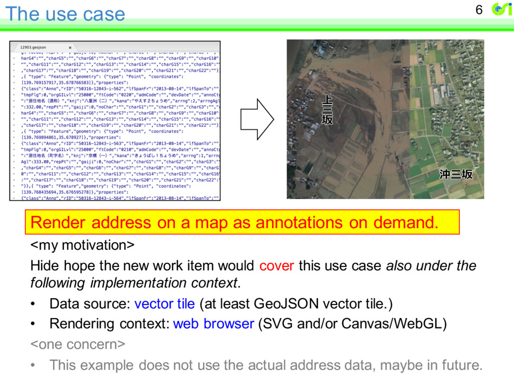
on demand. <my motivation> Hide hope the new work item would cover this use case also under the following implementation context. • Data source: vector tile (at least GeoJSON vector tile.) • Rendering context: web browser (SVG and/or Canvas/WebGL) <one concern> • This example does not use the actual address data, maybe in future. 6
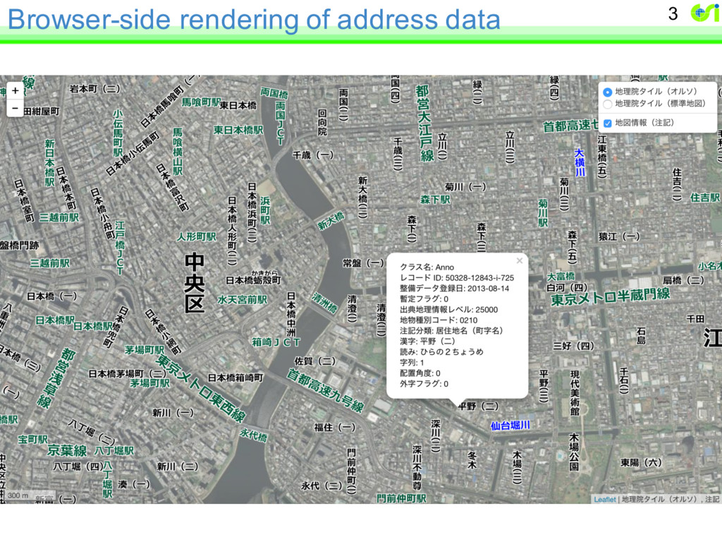
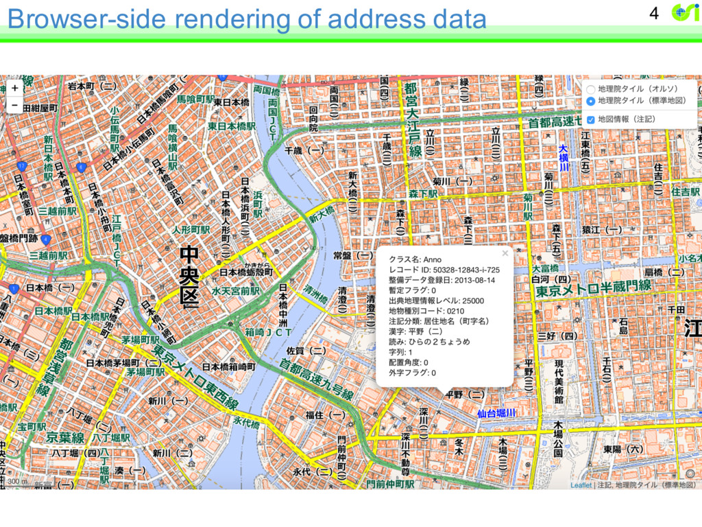
attribute of the annotation feature. – JavaScript program takes care of everything and instructs rendering environments, such as SVG or Canvas. – Better, more elegant way from 19160-5, or left for each implementation? • URLs – http://gsi-cyberjapan.github.io/experimental_anno/ – http://frogcat.github.io/gsi-anno/en/ – http://gsi-cyberjapan.github.io/cmp/joso.html 7