Experiments and Exercises Combining Efforts for Geospatial Data Sharing
Webinar
Strengthening regional cooperation in geospatial data sharing for mitigation of COVID-19 pandemics
2020-05-15T09:30/11:00+07:00@Teleconference hosted by ESCAP
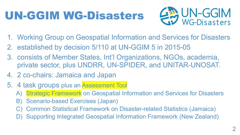
for Disasters 2. established by decision 5/110 at UN-GGIM 5 in 2015-05 3. consists of Member States, Int’l Organizations, NGOs, academia, private sector, plus UNDRR, UN-SPIDER, and UNITAR-UNOSAT. 4. 2 co-chairs: Jamaica and Japan 5. 4 task groups plus an Assessment Tool A) Strategic Framework on Geospatial Information and Services for Disasters B) Scenario-based Exercises (Japan) C) Common Statistical Framework on Disaster-related Statistics (Jamaica) D) Supporting Integrated Geospatial Information Framework (New Zealand) 2
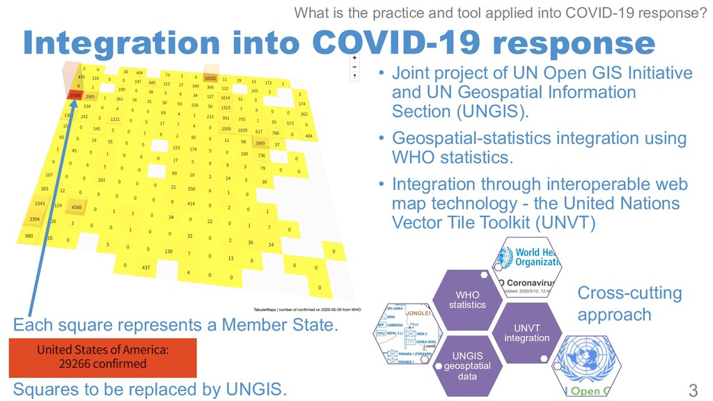
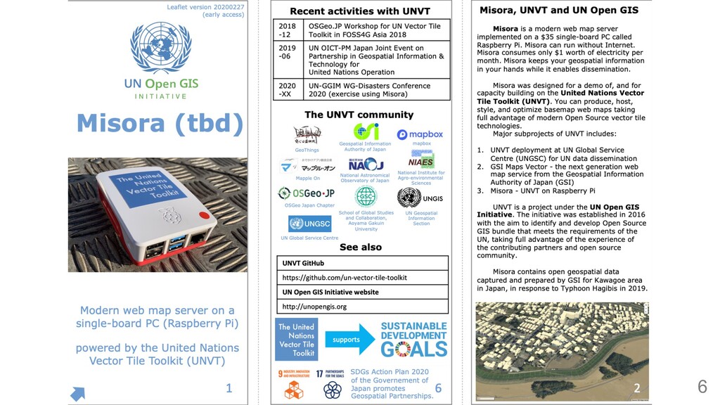
GIS Initiative and UN Geospatial Information Section (UNGIS). • Geospatial-statistics integration using WHO statistics. • Integration through interoperable web map technology - the United Nations Vector Tile Toolkit (UNVT) 3 Each square represents a Member State. Squares to be replaced by UNGIS. UNGIS geosptatial data UNVT integration WHO statistics Cross-cutting approach What is the practice and tool applied into COVID-19 response?
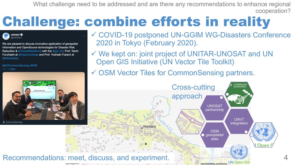
Conference 2020 in Tokyo (February 2020). ü We kept on: joint project of UNITAR-UNOSAT and UN Open GIS Initiative (UN Vector Tile Toolkit) ü OSM Vector Tiles for CommonSensing partners. 4 OSM geosptatial data UNVT integration UNOSAT partnership Cross-cutting approach What challenge need to be addressed and are there any recommendations to enhance regional cooperation? Recommendations: meet, discuss, and experiment.
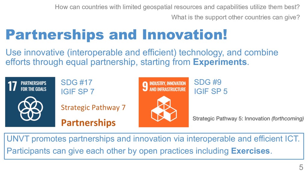
and capabilities utilize them best? What is the support other countries can give? 5 Use innovative (interoperable and efficient) technology, and combine efforts through equal partnership, starting from Experiments. SDG #17 IGIF SP 7 SDG #9 IGIF SP 5 UNVT promotes partnerships and innovation via interoperable and efficient ICT. Participants can give each other by open practices including Exercises.