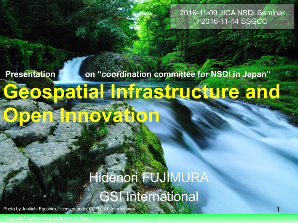
of Japan Presentation on “coordination committee for NSDI in Japan” Geospatial Infrastructure and Open Innovation Hidenori FUJIMURA GSI International 1 2016-11-09 JICA NSDI Seminar / 2016-11-14 SSGCC Photo by Junkichi Egashira, llicensed under CC BY 4.0 International
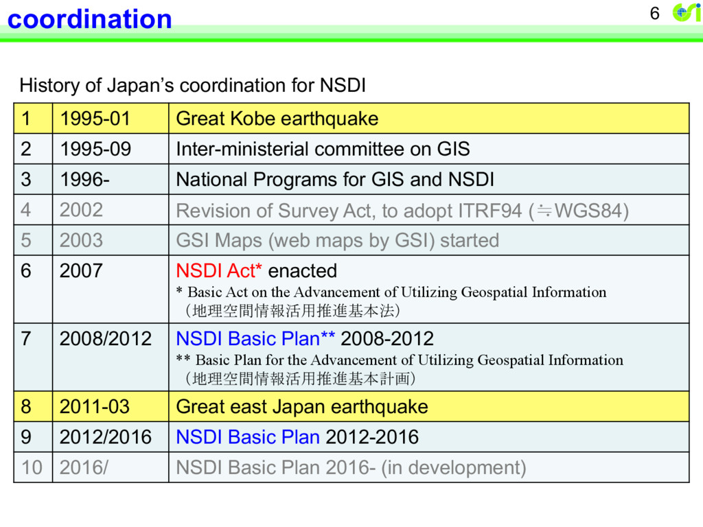
Great Kobe earthquake 2 1995-09 Inter-ministerial committee on GIS 3 1996- National Programs for GIS and NSDI 4 2002 Revision of Survey Act, to adopt ITRF94 (≒WGS84) 5 2003 GSI Maps (web maps by GSI) started 6 2007 NSDI Act* enacted * Basic Act on the Advancement of Utilizing Geospatial Information (地理空間情報活用推進基本法) 7 2008/2012 NSDI Basic Plan** 2008-2012 ** Basic Plan for the Advancement of Utilizing Geospatial Information (地理空間情報活用推進基本計画) 8 2011-03 Great east Japan earthquake 9 2012/2016 NSDI Basic Plan 2012-2016 10 2016/ NSDI Basic Plan 2016- (in development)
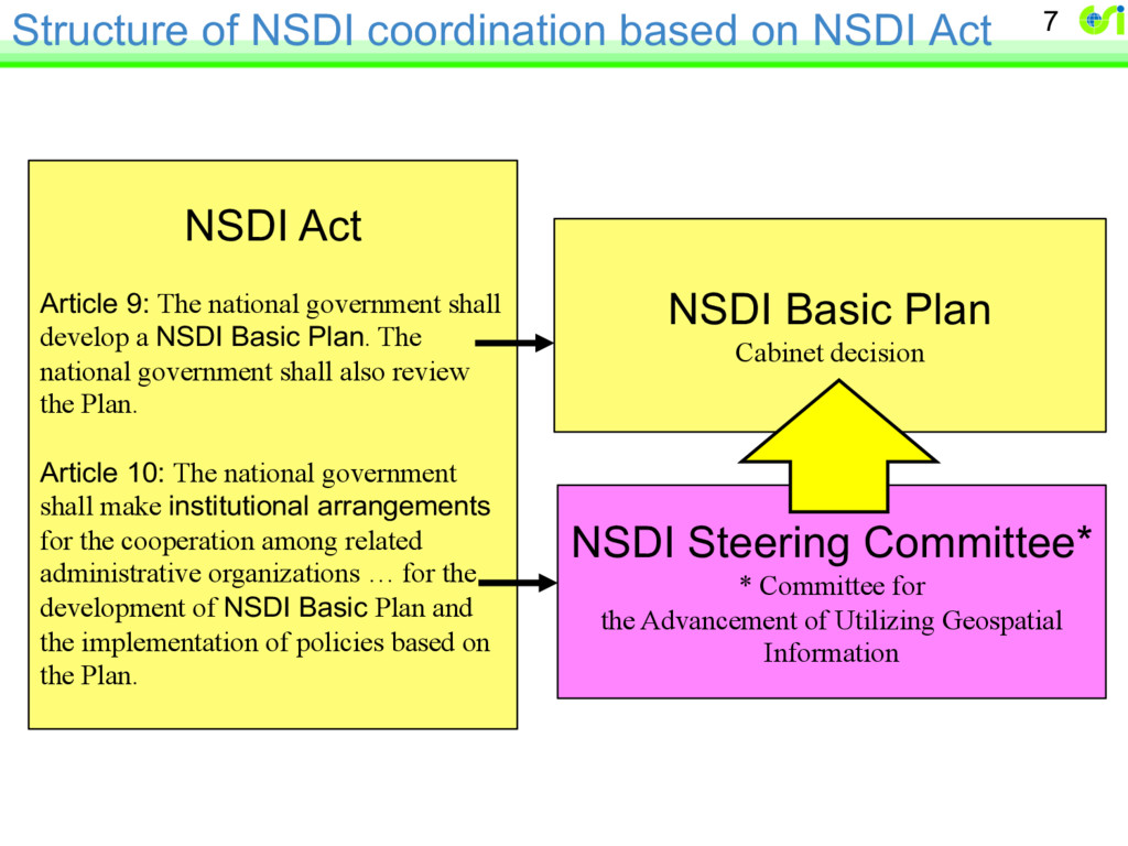
Act Article 9: The national government shall develop a NSDI Basic Plan. The national government shall also review the Plan. Article 10: The national government shall make institutional arrangements for the cooperation among related administrative organizations … for the development of NSDI Basic Plan and the implementation of policies based on the Plan. NSDI Basic Plan Cabinet decision NSDI Steering Committee* * Committee for the Advancement of Utilizing Geospatial Information
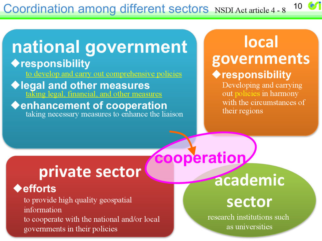
high quality geospatial information to cooperate with the national and/or local governments in their policies national government uresponsibility to develop and carry out comprehensive policies ulegal and other measures taking legal, financial, and other measures uenhancement of cooperation taking necessary measures to enhance the liaison academic sector research institutions such as universities local governments uresponsibility Developing and carrying out policies in harmony with the circumstances of their regions cooperation NSDI Act article 4 - 8
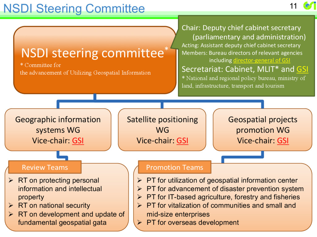
Satellite positioning WG Vice-chair: GSI Ø RT on protecting personal information and intellectual property Ø RT on national security Ø RT on development and update of fundamental geospatial gata NSDI steering committee* * Committee for the advancement of Utilizing Geospatial Information Chair: Deputy chief cabinet secretary (parliamentary and administration) Acting: Assistant deputy chief cabinet secretary Members: Bureau directors of relevant agencies including director-general of GSI Secretariat: Cabinet, MLIT* and GSI * National and regional policy bureau, ministry of land, infrastructure, transport and tourism Geospatial projects promotion WG Vice-chair: GSI Ø PT for utilization of geospatial information center Ø PT for advancement of disaster prevention system Ø PT for IT-based agriculture, forestry and fisheries Ø PT for vitalization of communities and small and mid-size enterprises Ø PT for overseas development Promotion Teams Review Teams
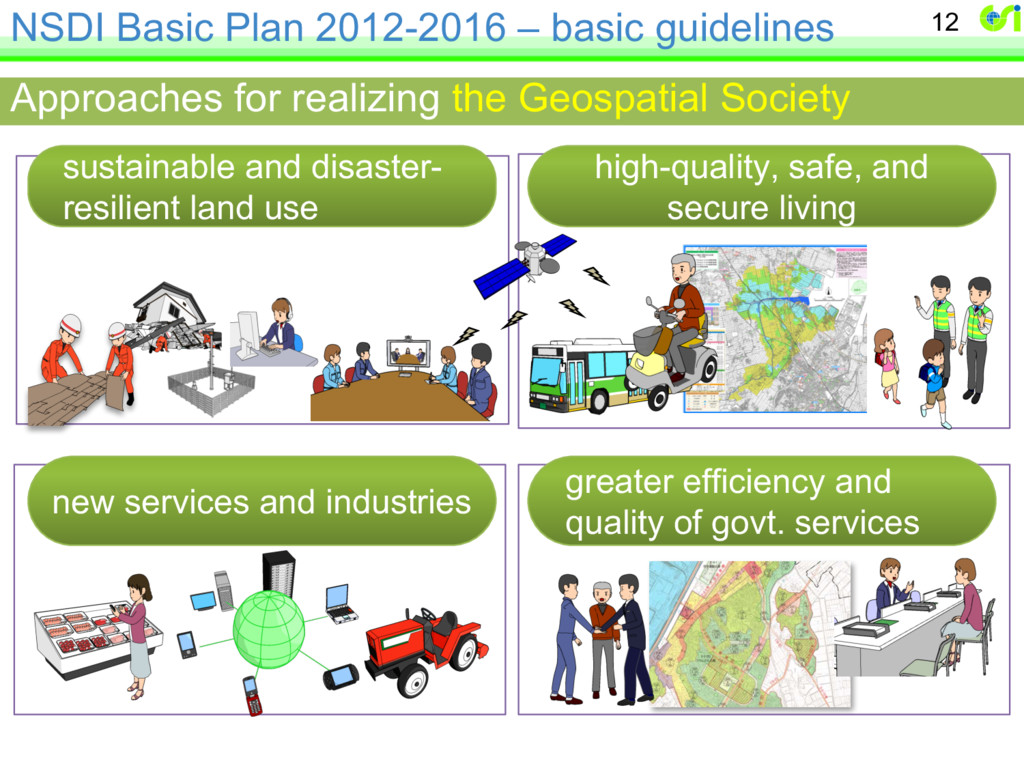
disaster- resilient land use high-quality, safe, and secure living new services and industries greater efficiency and quality of govt. services Approaches for realizing the Geospatial Society
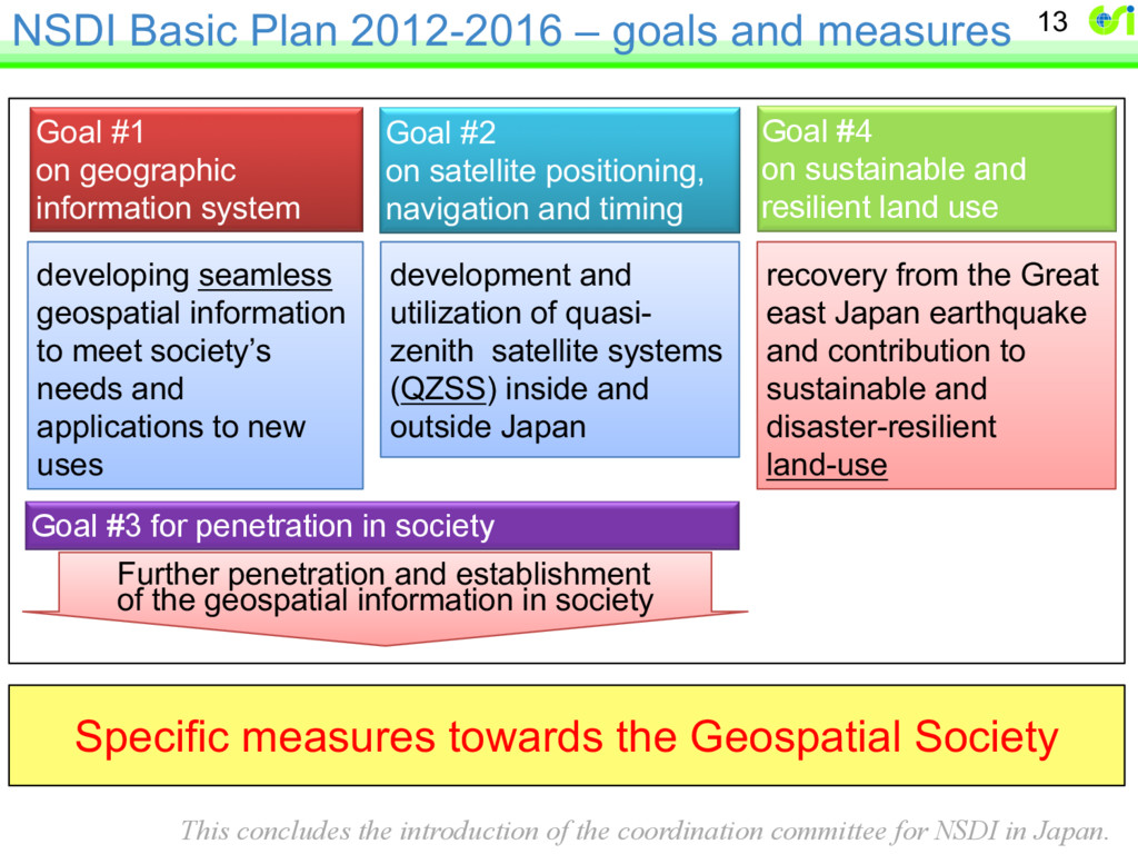
from the Great east Japan earthquake and contribution to sustainable and disaster-resilient land-use Further penetration and establishment of the geospatial information in society developing seamless geospatial information to meet society’s needs and applications to new uses development and utilization of quasi- zenith satellite systems (QZSS) inside and outside Japan Goal #1 on geographic information system Goal #2 on satellite positioning, navigation and timing Goal #4 on sustainable and resilient land use Goal #3 for penetration in society Specific measures towards the Geospatial Society This concludes the introduction of the coordination committee for NSDI in Japan.
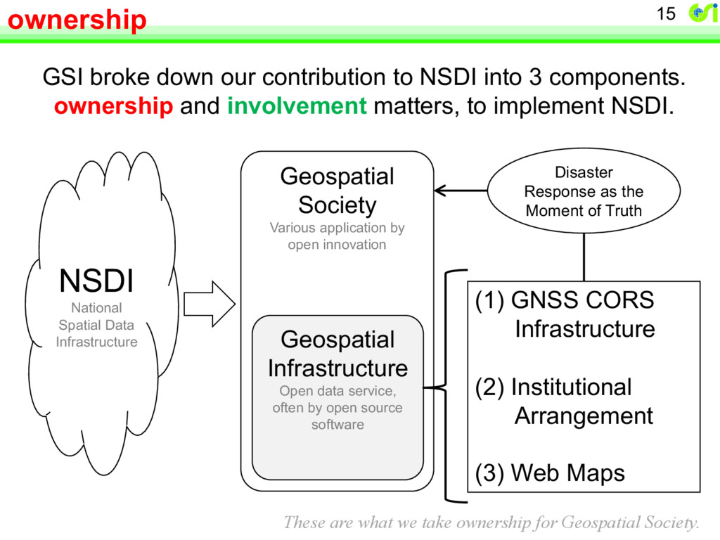
application by open innovation Geospatial Infrastructure Open data service, often by open source software (1) GNSS CORS Infrastructure (2) Institutional Arrangement (3) Web Maps Disaster Response as the Moment of Truth GSI broke down our contribution to NSDI into 3 components. ownership and involvement matters, to implement NSDI. These are what we take ownership for Geospatial Society.
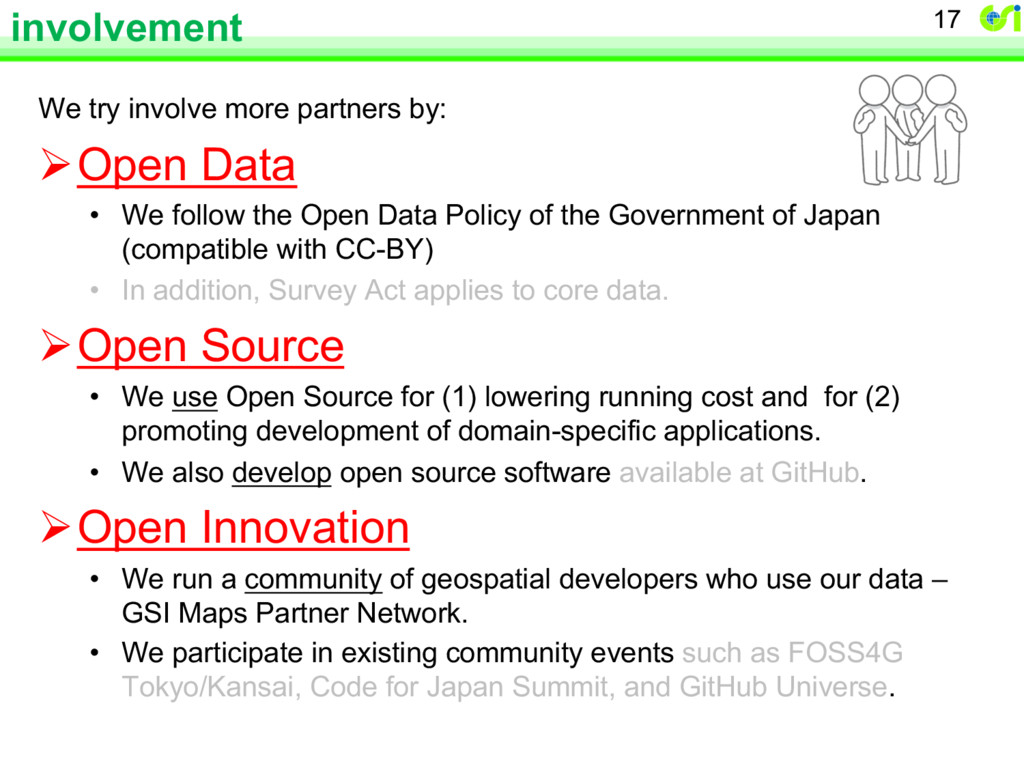
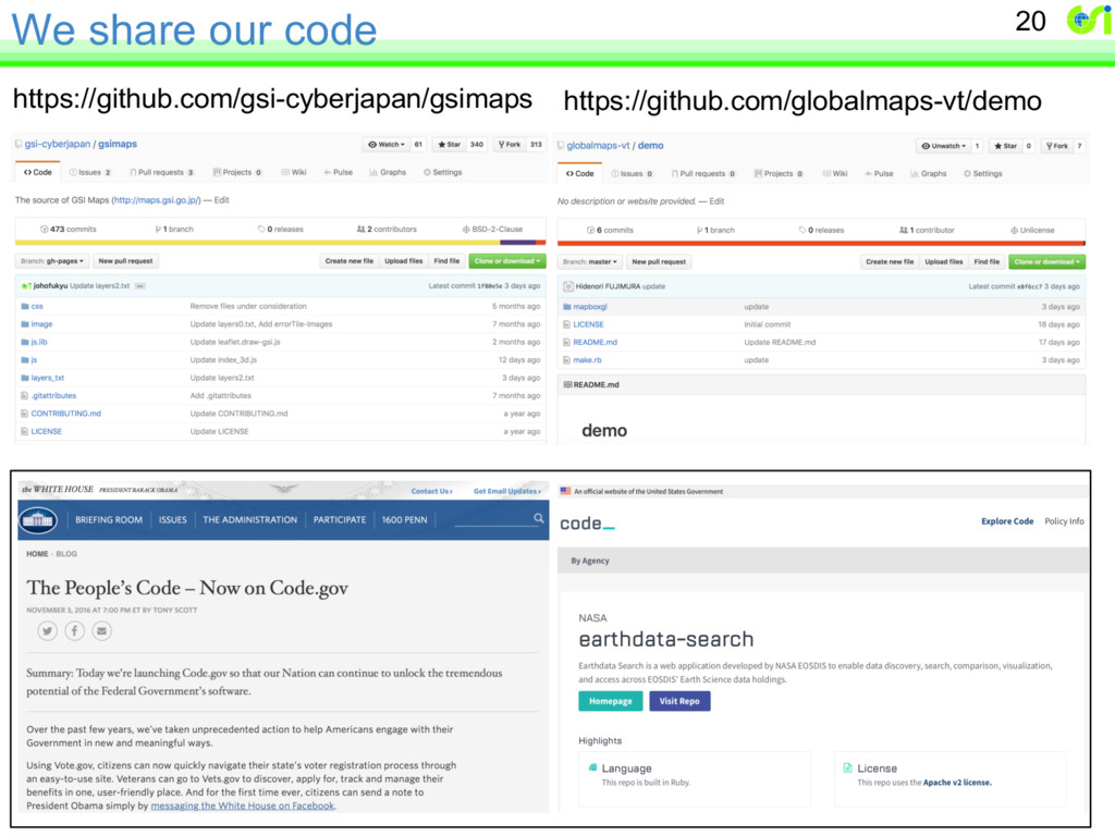
We follow the Open Data Policy of the Government of Japan (compatible with CC-BY) • In addition, Survey Act applies to core data. ØOpen Source • We use Open Source for (1) lowering running cost and for (2) promoting development of domain-specific applications. • We also develop open source software available at GitHub. ØOpen Innovation • We run a community of geospatial developers who use our data – GSI Maps Partner Network. • We participate in existing community events such as FOSS4G Tokyo/Kansai, Code for Japan Summit, and GitHub Universe. 17
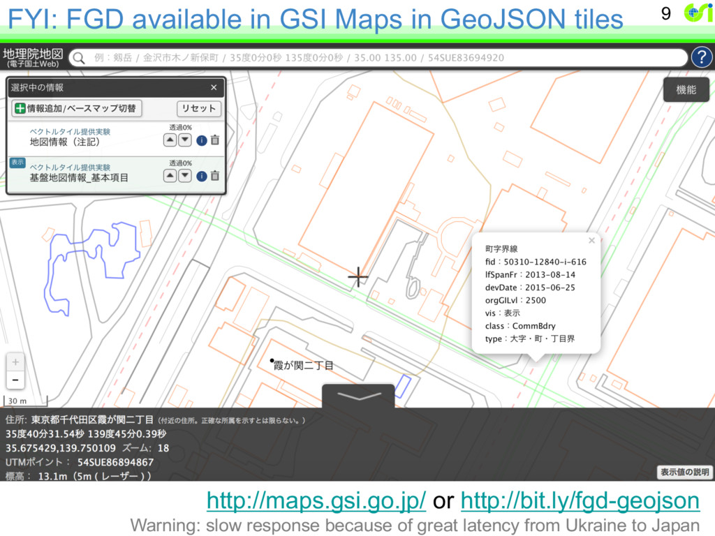
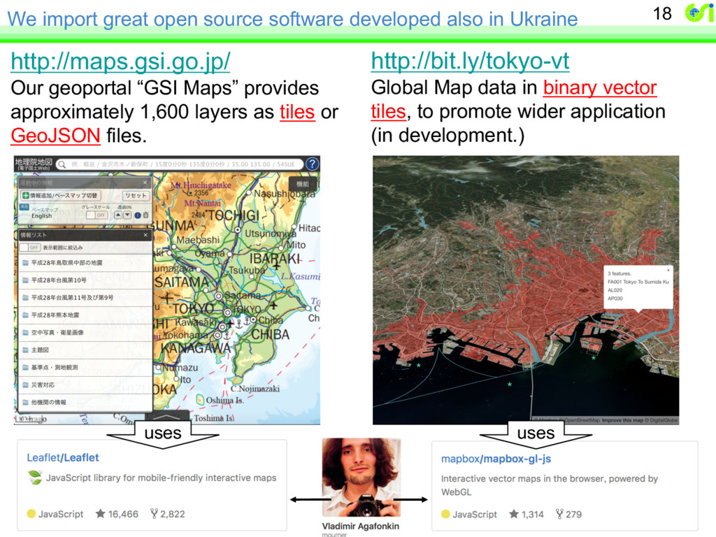
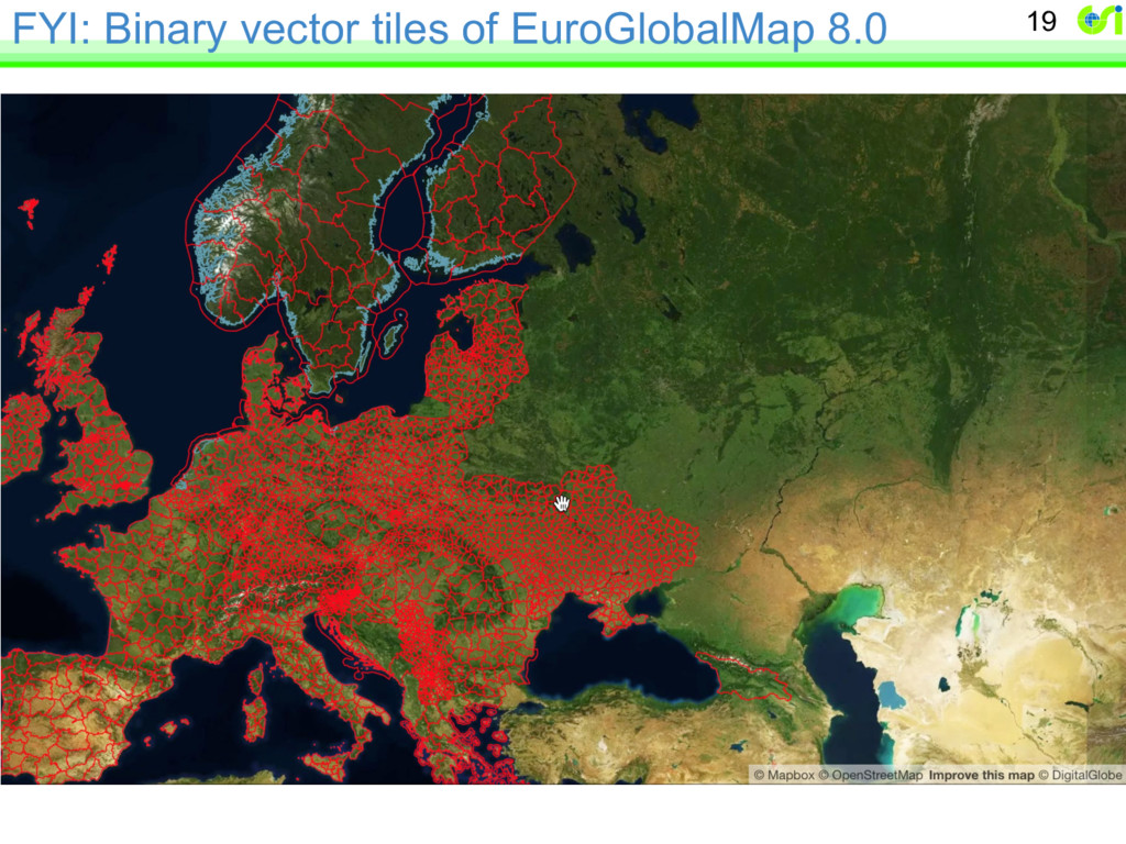
http://maps.gsi.go.jp/ Our geoportal “GSI Maps” provides approximately 1,600 layers as tiles or GeoJSON files. http://bit.ly/tokyo-vt Global Map data in binary vector tiles, to promote wider application (in development.) 18 uses uses