For SIDS – a joint experiment with UNITAR-UNOSAT 3. For SDGs – visualization of SDGs indicators with UNGIS 4. For COVID-19 response – visualization of WHO open data 5. For more inclusive web maps – vector tile experiments in GSI 6. For Member State capability – with ASIG and SOB UNVT: Monthly Report Recent progress in collaboration with various partners pursuing the vision and mission provided by UN Open GIS Initiatives and UN Geospatial Strategy. Common purpose of UNVT: to equip public organizations with the latest and efficient web map technology which the Internet platformers has been employing – vector tile technology. 1
UNGSC deployment project. • Members continue working from home. • Data conversion codes are tested in USGSC. (ongoing) • We started system requesting. • We established a channel at MS Teams
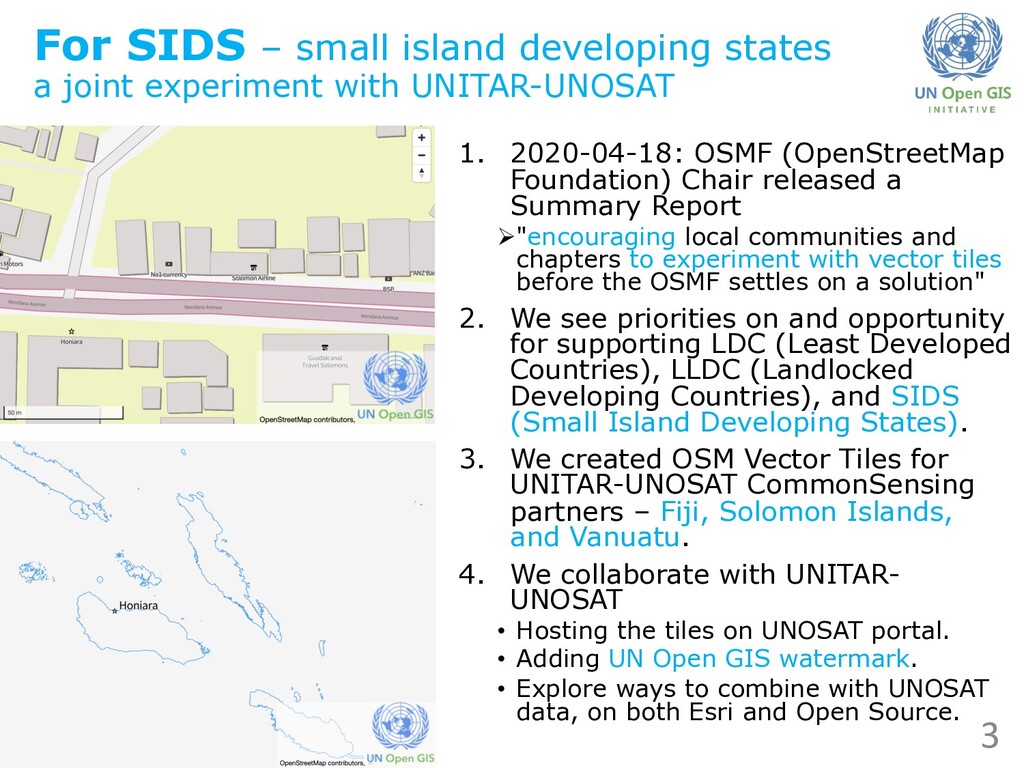
with UNITAR-UNOSAT 1. 2020-04-18: OSMF (OpenStreetMap Foundation) Chair released a Summary Report Ø"encouraging local communities and chapters to experiment with vector tiles before the OSMF settles on a solution" 2. We see priorities on and opportunity for supporting LDC (Least Developed Countries), LLDC (Landlocked Developing Countries), and SIDS (Small Island Developing States). 3. We created OSM Vector Tiles for UNITAR-UNOSAT CommonSensing partners – Fiji, Solomon Islands, and Vanuatu. 4. We collaborate with UNITAR- UNOSAT • Hosting the tiles on UNOSAT portal. • Adding UN Open GIS watermark. • Explore ways to combine with UNOSAT data, on both Esri and Open Source. 3
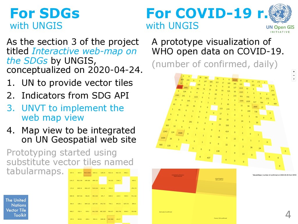
project titled Interactive web-map on the SDGs by UNGIS, conceptualized on 2020-04-24. 1. UN to provide vector tiles 2. Indicators from SDG API 3. UNVT to implement the web map view 4. Map view to be integrated on UN Geospatial web site Prototyping started using substitute vector tiles named tabularmaps. For COVID-19 r. with UNGIS A prototype visualization of WHO open data on COVID-19. (number of confirmed, daily) 4
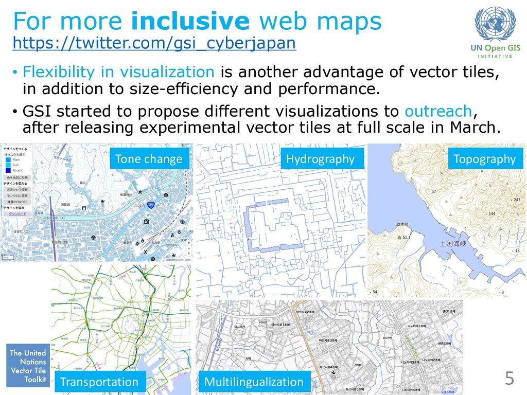
is another advantage of vector tiles, in addition to size-efficiency and performance. • GSI started to propose different visualizations to outreach, after releasing experimental vector tiles at full scale in March. 5 Tone change Hydrography Topography Transportation Multilingualization
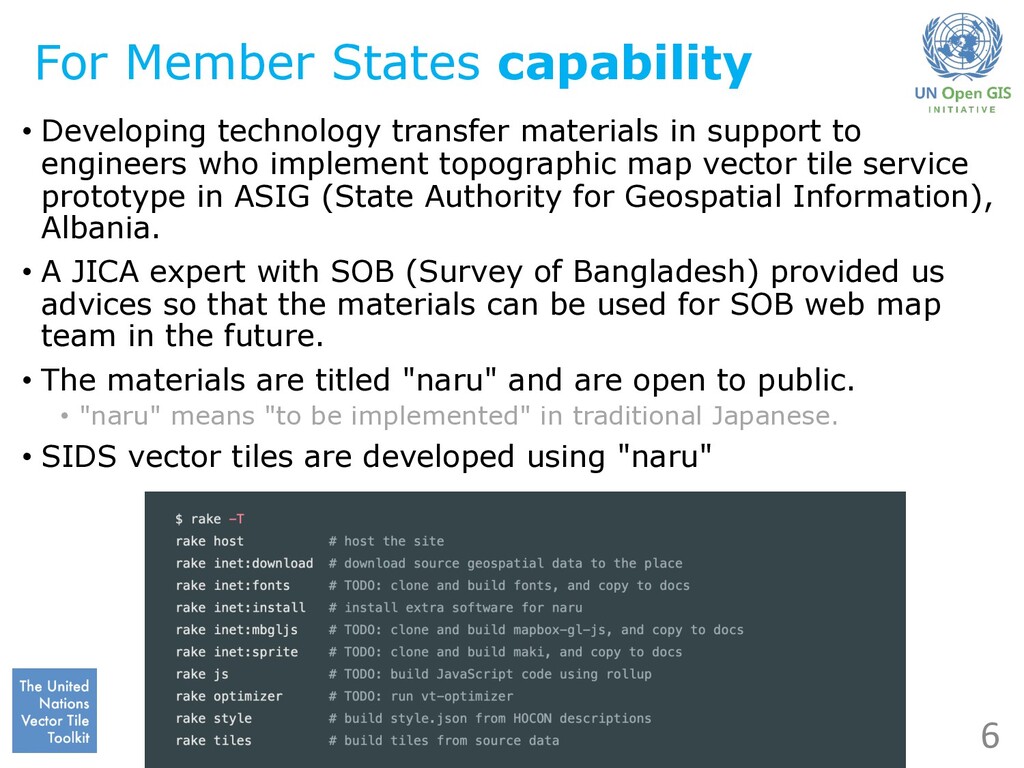
in support to engineers who implement topographic map vector tile service prototype in ASIG (State Authority for Geospatial Information), Albania. • A JICA expert with SOB (Survey of Bangladesh) provided us advices so that the materials can be used for SOB web map team in the future. • The materials are titled "naru" and are open to public. • "naru" means "to be implemented" in traditional Japanese. • SIDS vector tiles are developed using "naru"
For SIDS – a joint experiment with UNITAR-UNOSAT 3. For SDGs – visualization of SDGs indicators with UNGIS 4. For COVID-19 response – visualization of WHO open data 5. For more inclusive web maps – vector tile experiments in GSI 6. For Member State capability – with ASIG and SOB UNVT: Monthly Report Recent progress in collaboration with various partners pursuing the vision and mission provided by UN Open GIS Initiatives and UN Geospatial Strategy. Common purpose of UNVT: to equip public organizations with the latest and efficient web map technology which the Internet platformers has been employing – vector tile technology. 7