Upgrade to Pro — share decks privately, control downloads, hide ads and more …

Automatic map production with FME and Mapnik

Automatic map production with FME and Mapnik

Hans van der Maarel
Red Geographics

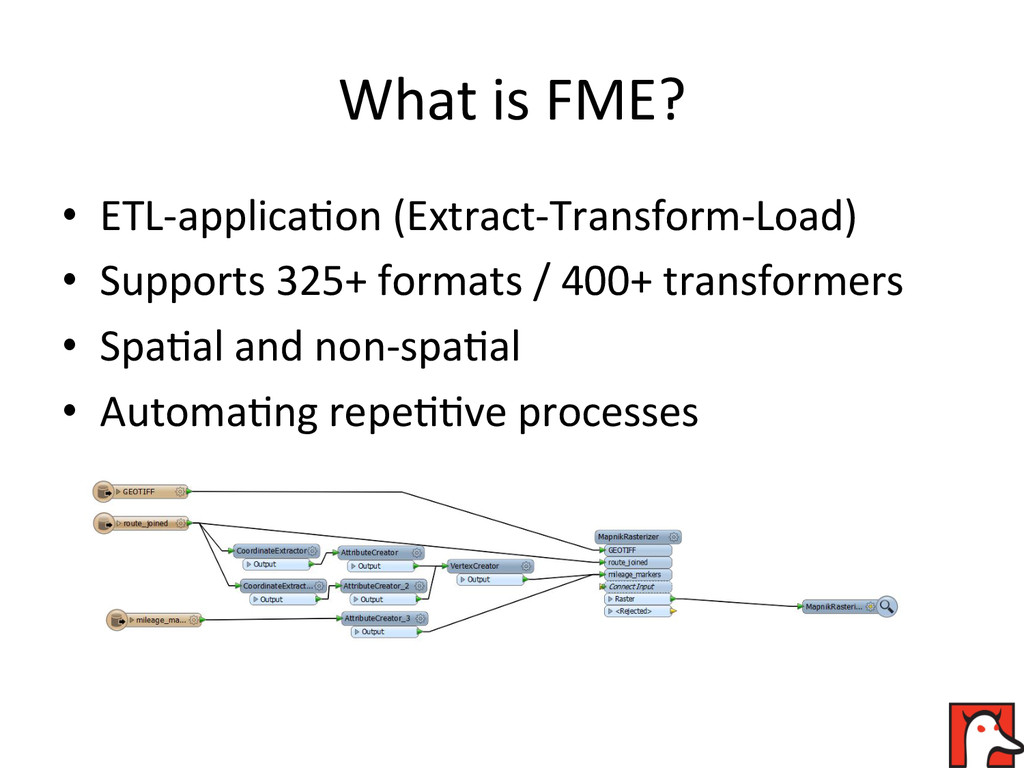
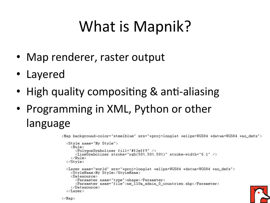
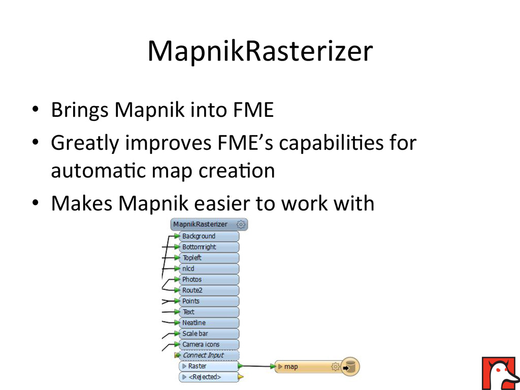
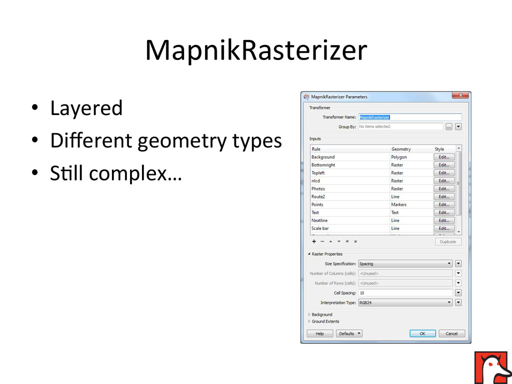
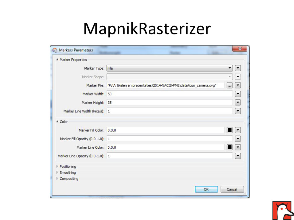
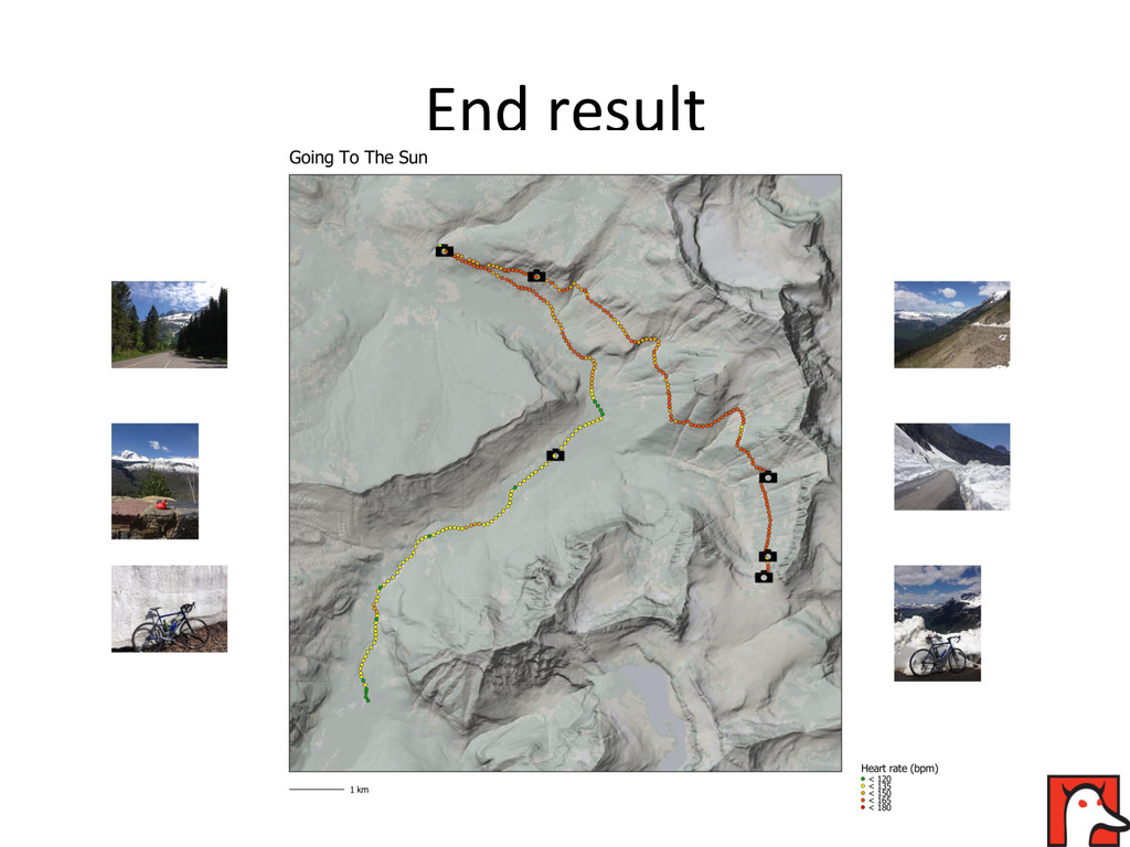
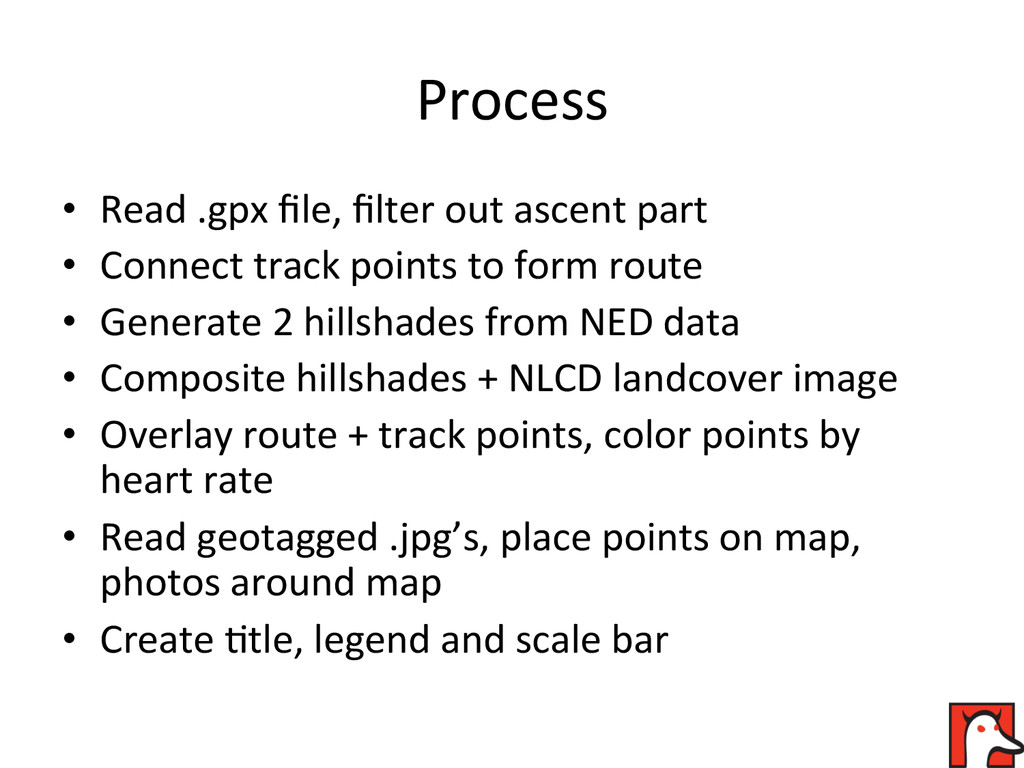
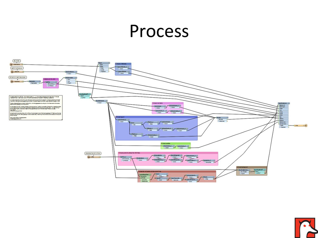
FME is an application for processing (geographic) data. Recently it introduced the MapnikRasterizer transformer, which uses Mapnik to render high quality rasters. This combination makes it a lot easier to use FME for automatic map production.

NACIS 2014

Nathaniel V. KELSO

October 08, 2014
Tweet

More Decks by Nathaniel V. KELSO

Other Decks in Design

Transcript

  1. Automa'c  map  produc'on  with   FME  and  Mapnik    

    Hans  van  der  Maarel  –  Red   Geographics  
  2. Structure  and  scope   •  Who  am  I?   • 

    What  is  FME?   •  What  is  Mapnik?   •  What  I  did  and  how  I  did  it    
  3. Who  am  I?   •  Cartography  /  GIS  background  

    •  Started  Red  Geographics  in  2004   •  Cartotalk  Editor  for  NACIS   •  Been  working  with  FME  for  15+  years  
  4. What  is  FME?   •  ETL-­‐applica'on  (Extract-­‐Transform-­‐Load)   •  Supports

     325+  formats  /  400+  transformers   •  Spa'al  and  non-­‐spa'al   •  Automa'ng  repe''ve  processes  
  5. What  is  Mapnik?   •  Map  renderer,  raster  output  

    •  Layered   •  High  quality  composi'ng  &  an'-­‐aliasing   •  Programming  in  XML,  Python  or  other   language    
  6. MapnikRasterizer   •  Brings  Mapnik  into  FME   •  Greatly

     improves  FME’s  capabili'es  for   automa'c  map  crea'on   •  Makes  Mapnik  easier  to  work  with  
  7. Process   •  Read  .gpx  file,  filter  out  ascent  part

      •  Connect  track  points  to  form  route   •  Generate  2  hillshades  from  NED  data   •  Composite  hillshades  +  NLCD  landcover  image   •  Overlay  route  +  track  points,  color  points  by   heart  rate   •  Read  geotagged  .jpg’s,  place  points  on  map,   photos  around  map   •  Create  'tle,  legend  and  scale  bar