Upgrade to Pro — share decks privately, control downloads, hide ads and more …

How the Dutch created The Netherlands

How the Dutch created The Netherlands

How
the
Dutch
created
The
Netherlands
A history lesson in maps

Hans van der Maarel
Red Geographics

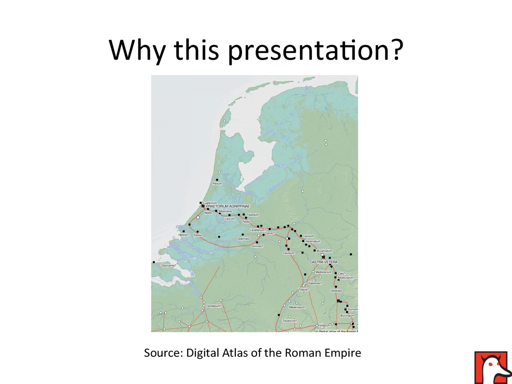
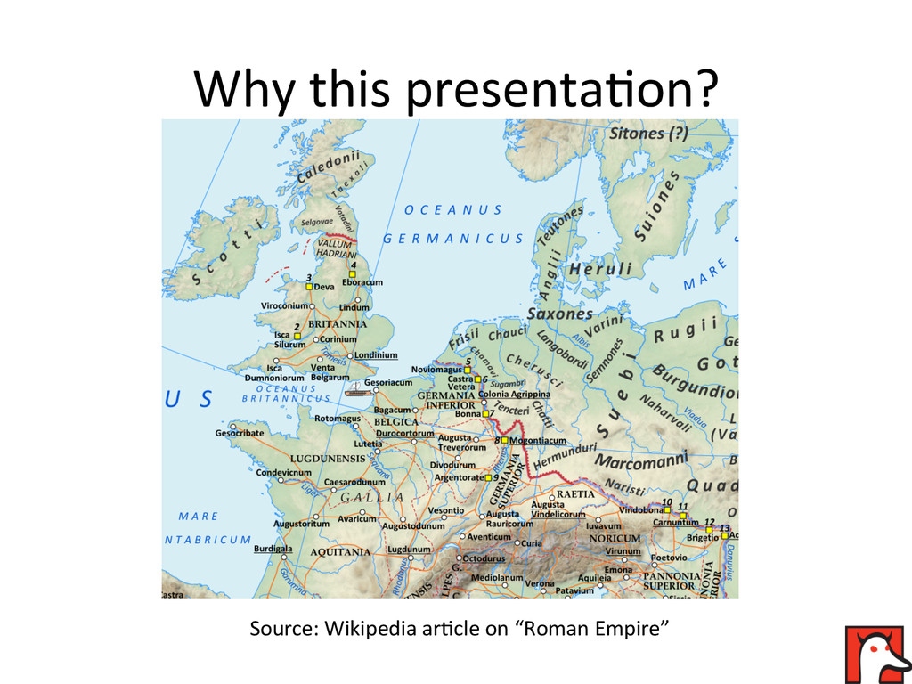
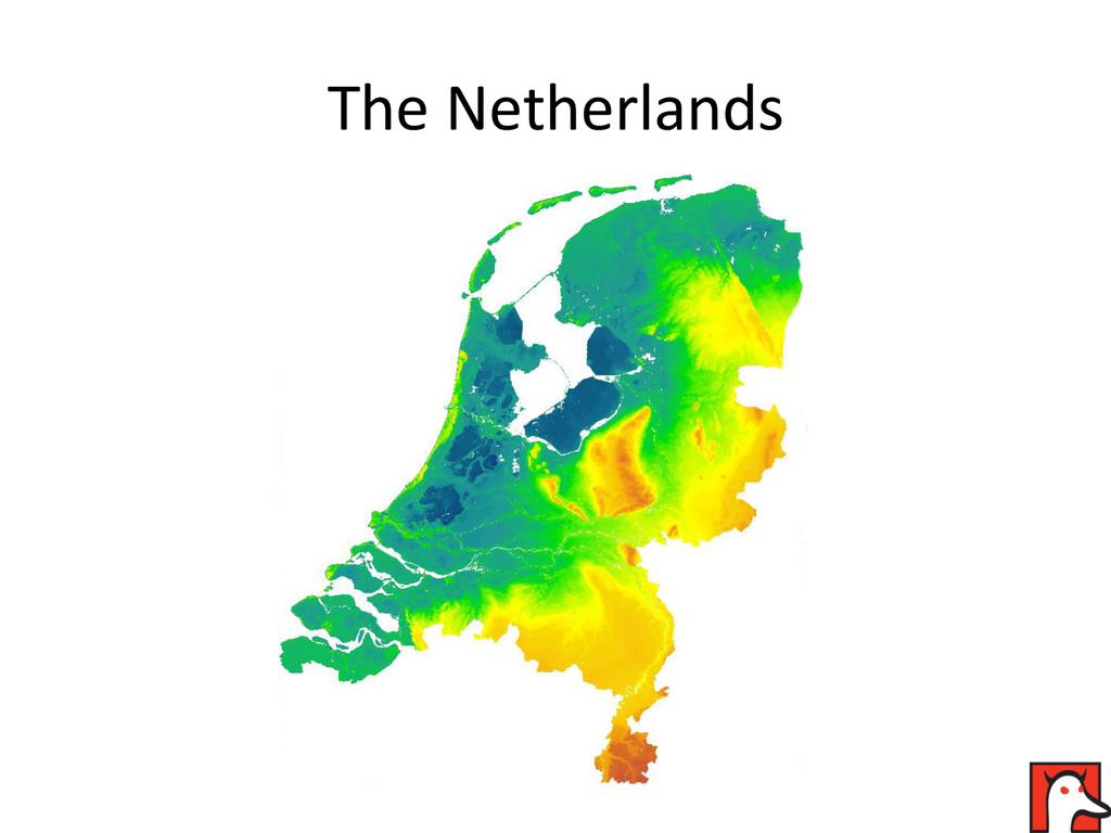
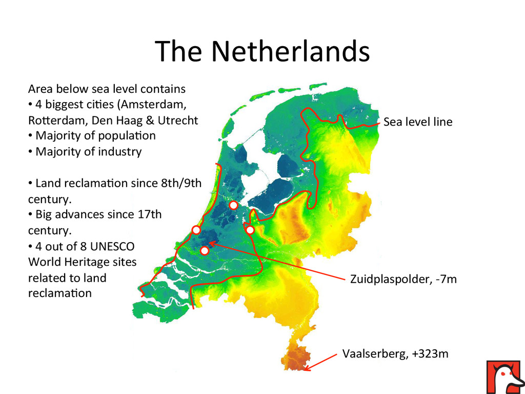
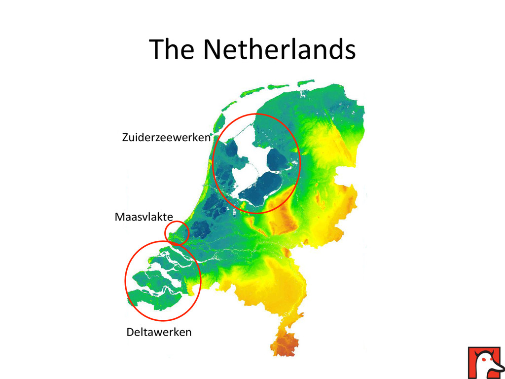
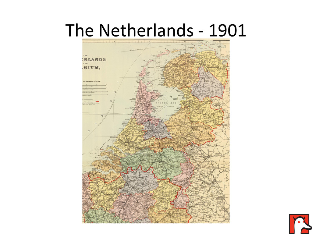
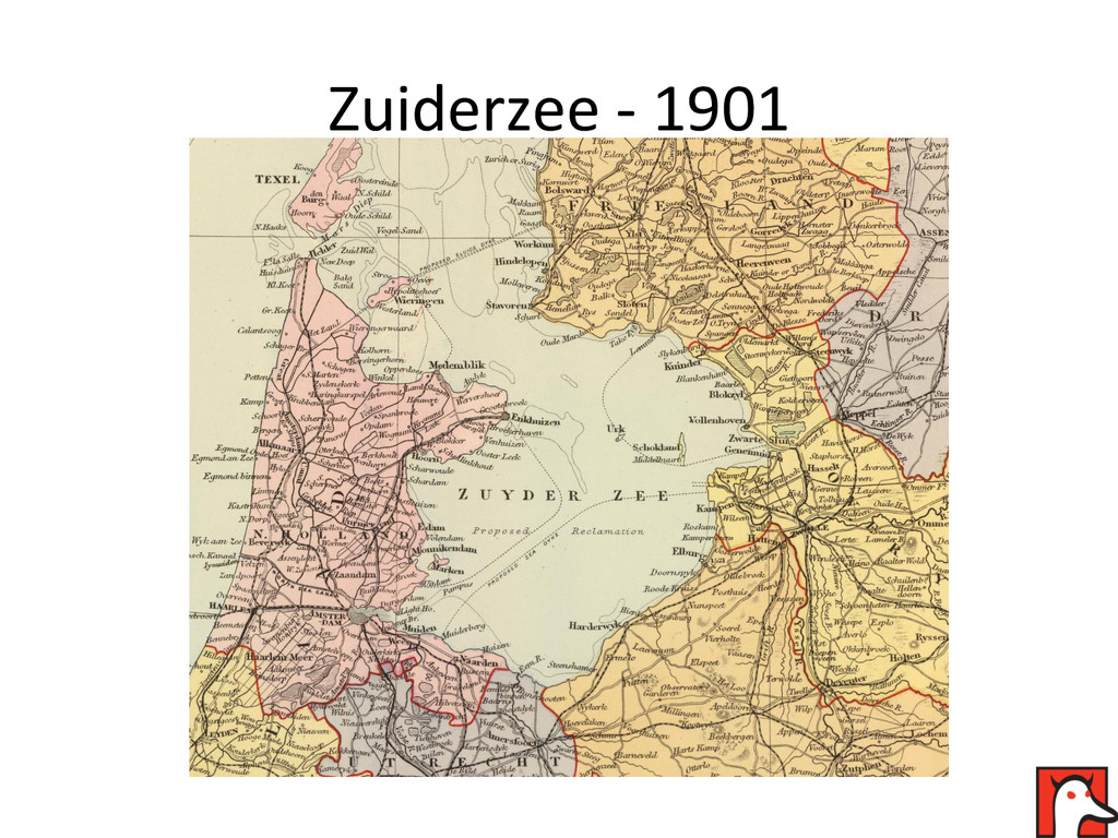
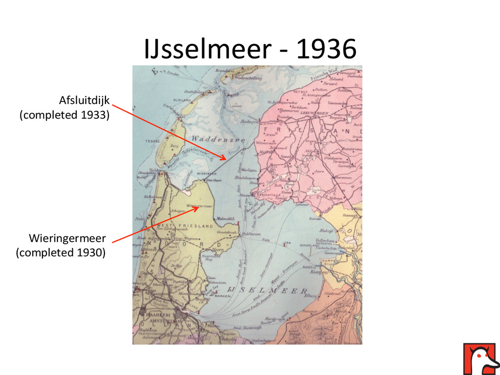
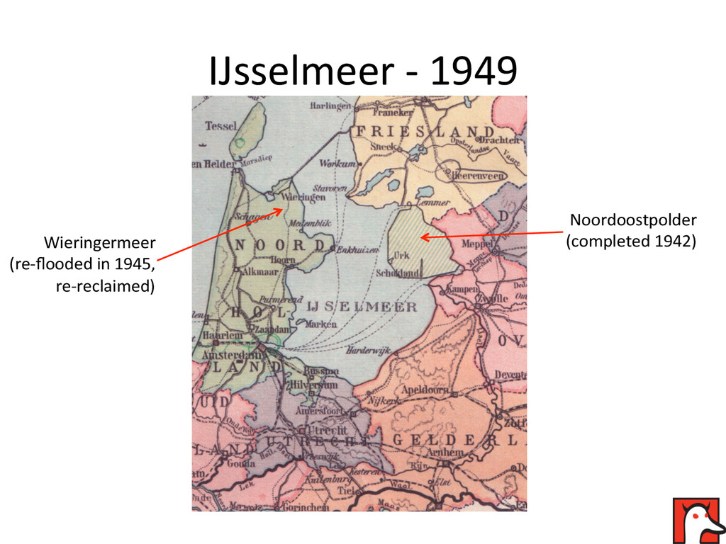
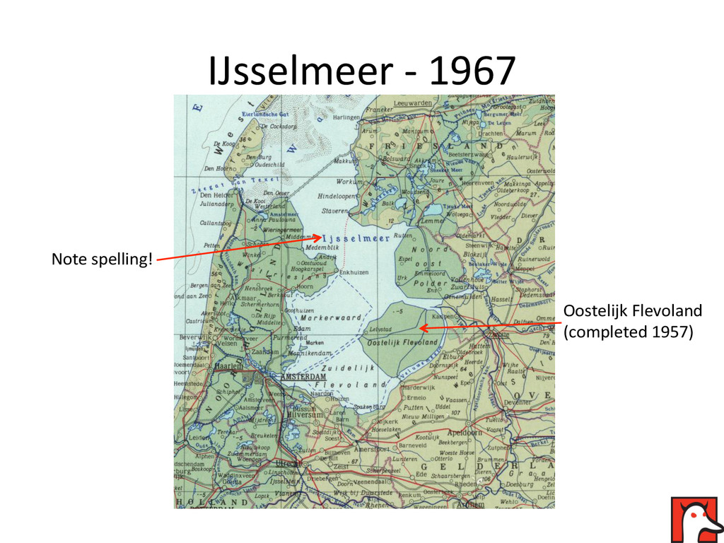
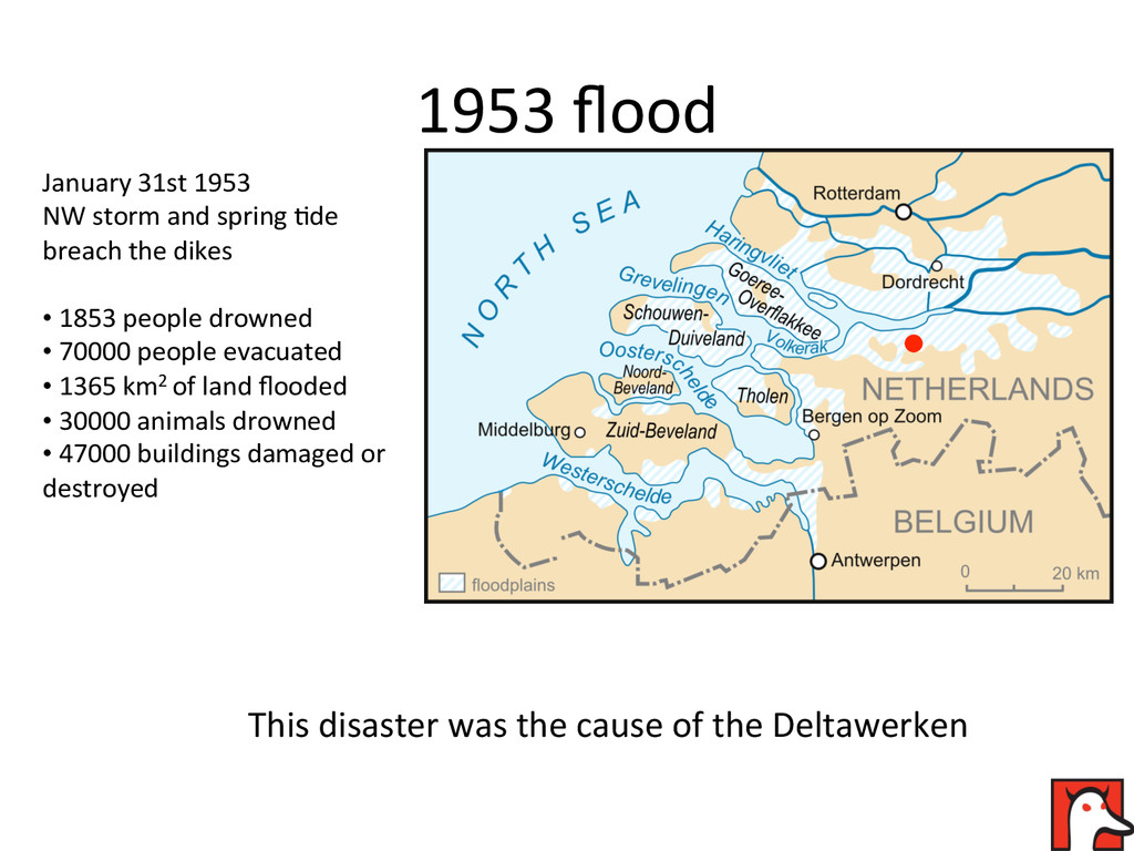
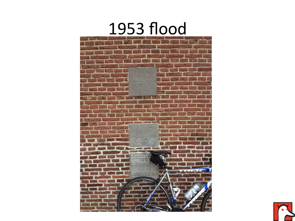
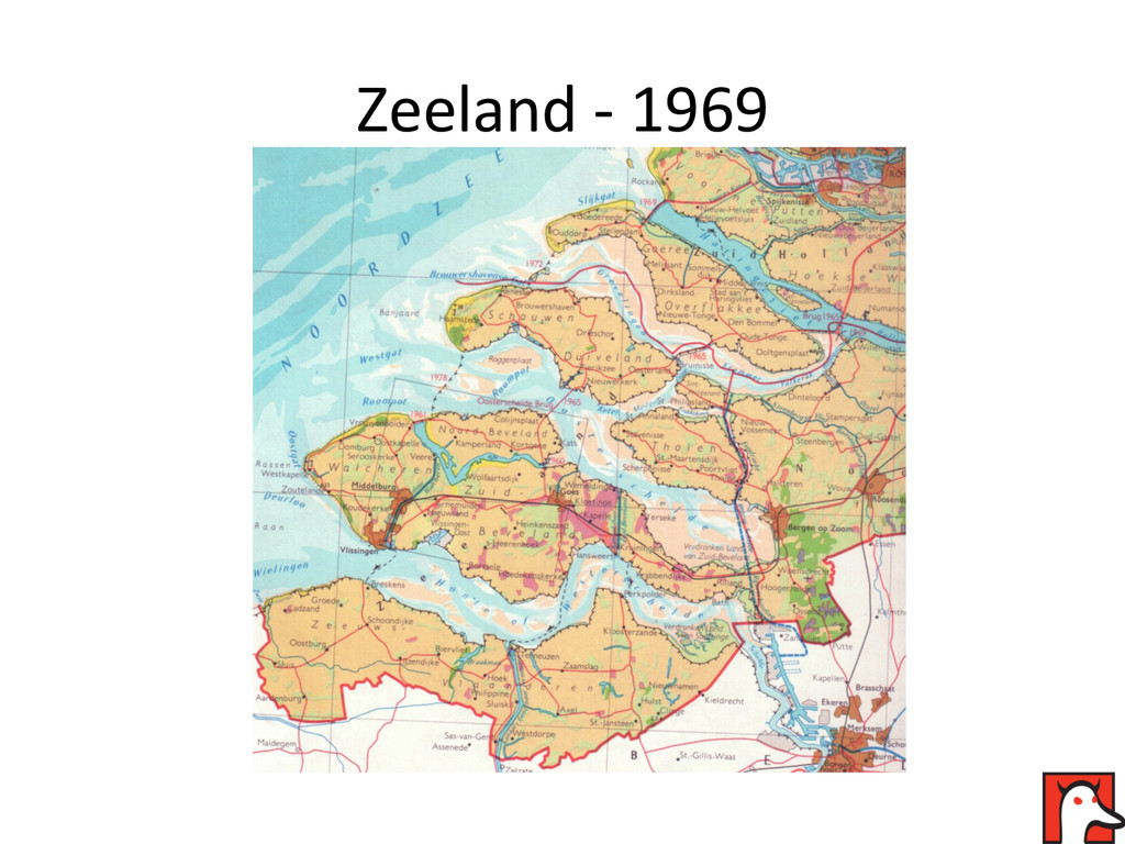
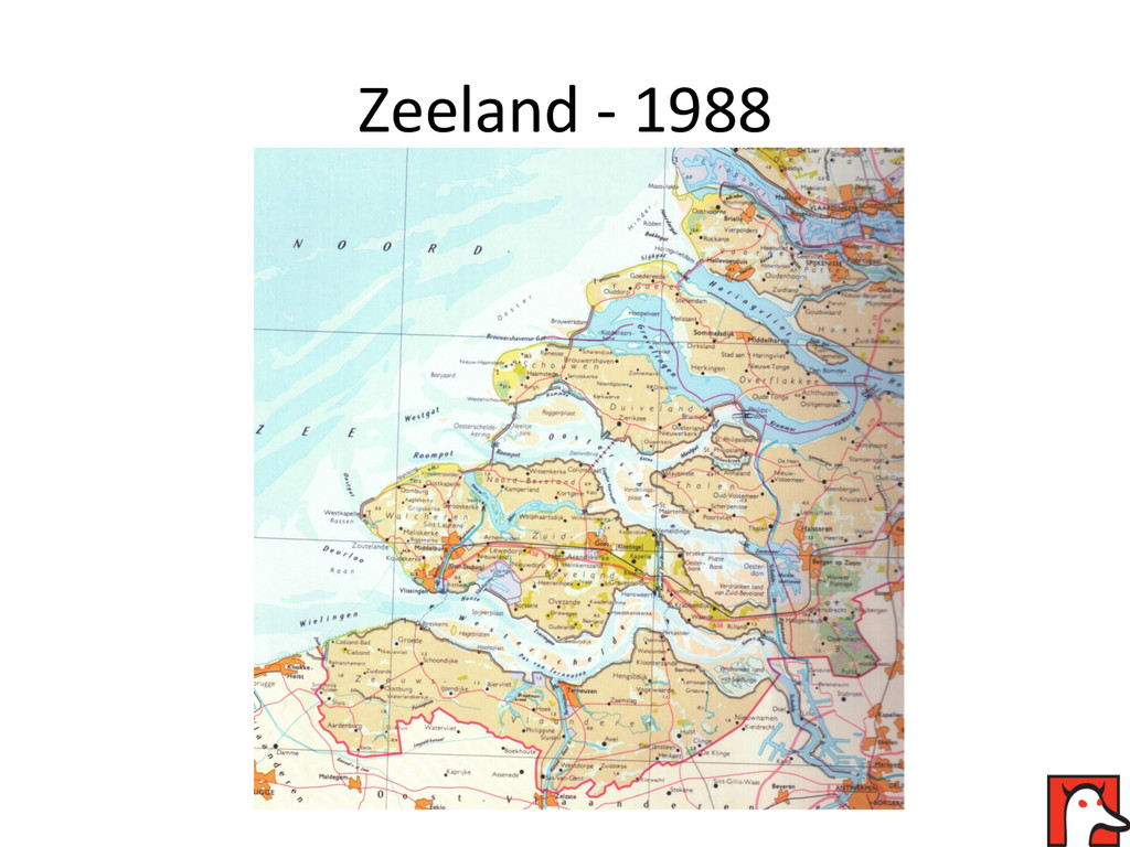
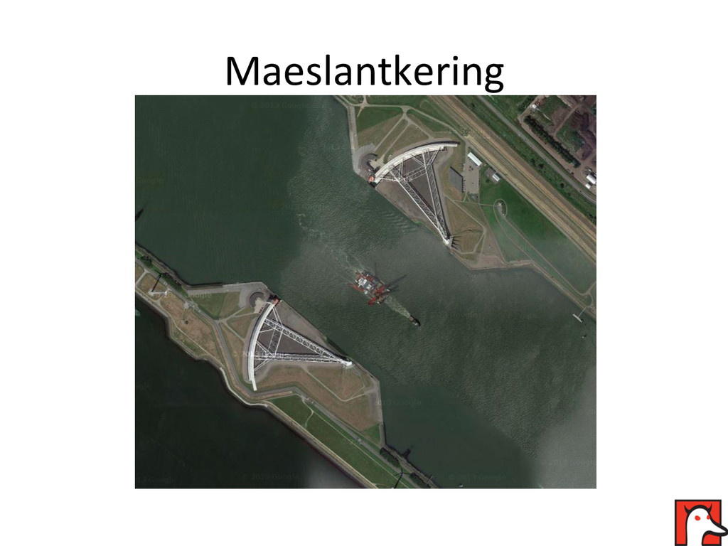
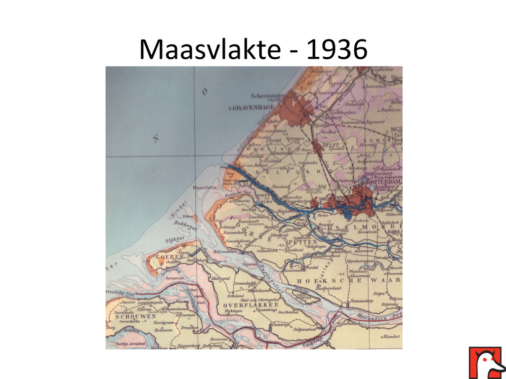
Seeing a modern Dutch coastline on a map that's supposed to portray something set in the past is something that annoys me immensely. In this talk I will highlight some of the big, man-made, changes in Dutch geography.

NACIS 2014

Nathaniel V. KELSO

October 09, 2014
Tweet

More Decks by Nathaniel V. KELSO

Other Decks in Design

Transcript

  1. How  the  Dutch  created  The   Netherlands   A  history

     lesson  in  maps     Hans  van  der  Maarel  –  Red  Geographics  
  2. Why  this  presenta?on?   •  Educate  cartographers   •  Show

     and  tell   •  Period  maps   •  Focus  on  20th/21st  century  
  3. The  Netherlands   Sea  level  line   Area  below  sea

     level  contains   •   4  biggest  ci?es  (Amsterdam,     RoRerdam,  Den  Haag  &  Utrecht   •   Majority  of  popula?on   •   Majority  of  industry   •   Land  reclama?on  since  8th/9th   century.     •   Big  advances  since  17th     century.   •   4  out  of  8  UNESCO     World  Heritage  sites   related  to  land   reclama?on     Vaalserberg,  +323m   Zuidplaspolder,  -­‐7m  
  4. IJsselmeer  -­‐  1949   Noordoostpolder   (completed  1942)   Wieringermeer

      (re-­‐flooded  in  1945,   re-­‐reclaimed)  
  5. IJsselmeer  -­‐  1969   Zuidelijk  Flevoland   (completed  1968)  

    Houtribdijk   (completed  1975)   Markerwaard   (plans  abandoned   in  the  1980s)  
  6. 1953  flood     January  31st  1953   NW  storm

     and  spring  ?de   breach  the  dikes     •   1853  people  drowned   •   70000  people  evacuated   •   1365  km2  of  land  flooded   •   30000  animals  drowned   •   47000  buildings  damaged  or   destroyed   This  disaster  was  the  cause  of  the  Deltawerken