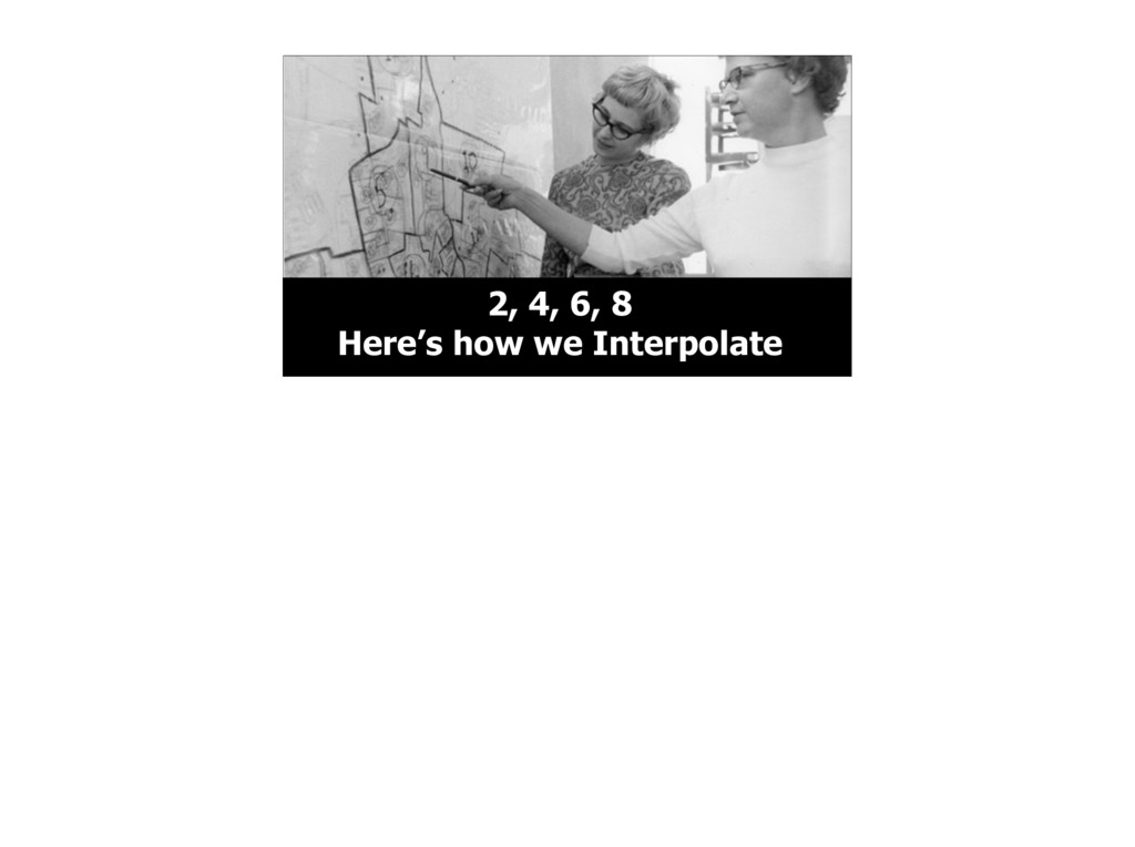
photo of two US Census employees presumably looking at something very important on a map. We’ll see how the census relates to what we’ll be talking about in a minute. Also lets take a moment to appreciate the 1970s styles going on here.
we’re going to talk about a particularly cool feature we added not quite a year ago. What’s a geocoder? Basically, its the software that makes the search box on a map work. You type in the name of a place and it helps you find it. It does a lot behind the scenes of course :)
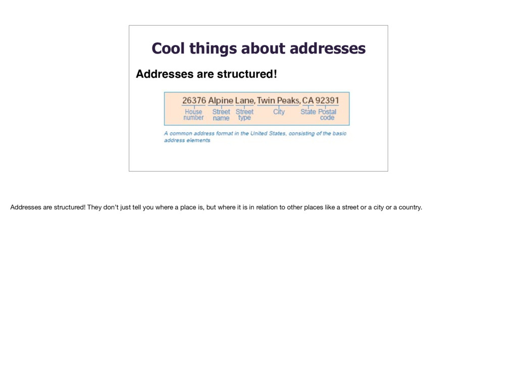
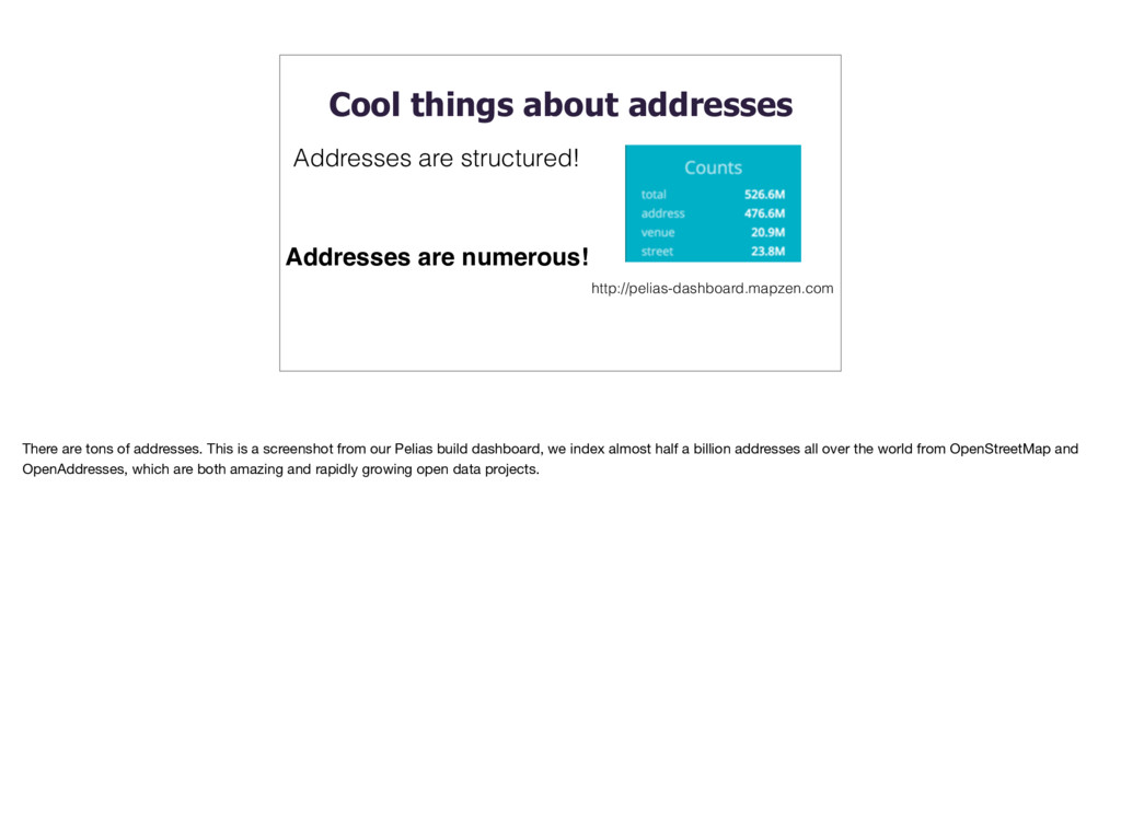
structured! There are tons of addresses. This is a screenshot from our Pelias build dashboard, we index almost half a billion addresses all over the world from OpenStreetMap and OpenAddresses, which are both amazing and rapidly growing open data projects.
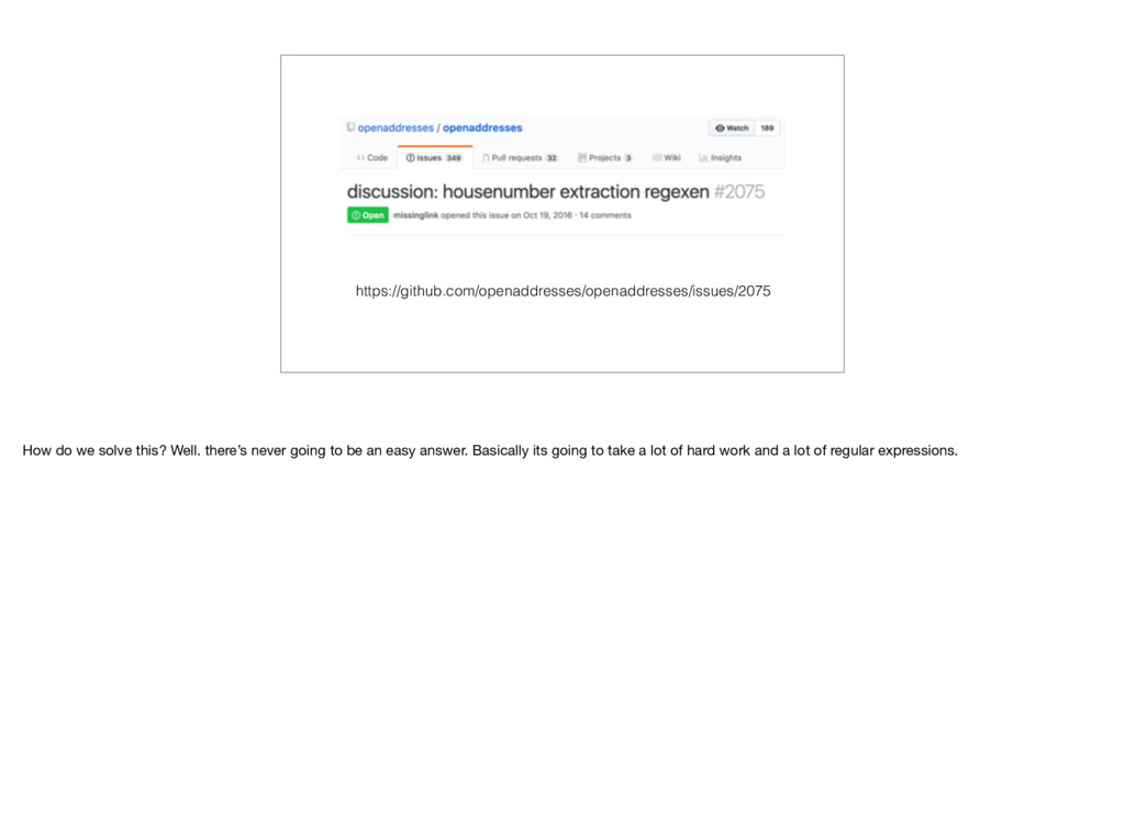
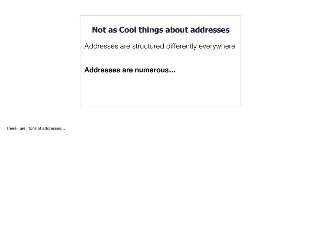
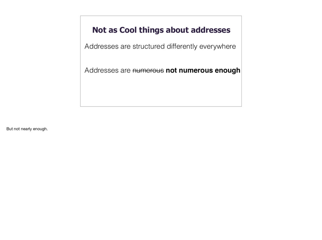
everywhere Addresses everywhere in the world are different. Some have house number first, some have street name first. Some streets don’t have name. Some places don’t have housenumbers. Almost every place does things a little bit differently.
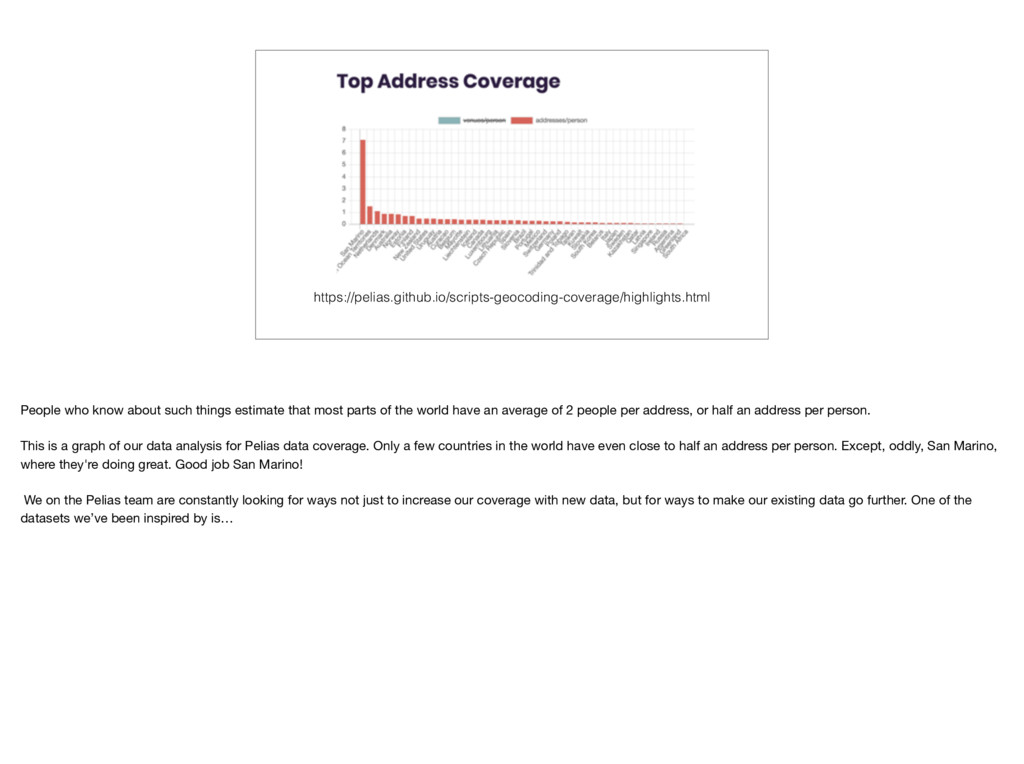
parts of the world have an average of 2 people per address, or half an address per person. This is a graph of our data analysis for Pelias data coverage. Only a few countries in the world have even close to half an address per person. Except, oddly, San Marino, where they're doing great. Good job San Marino! We on the Pelias team are constantly looking for ways not just to increase our coverage with new data, but for ways to make our existing data go further. One of the datasets we’ve been inspired by is…
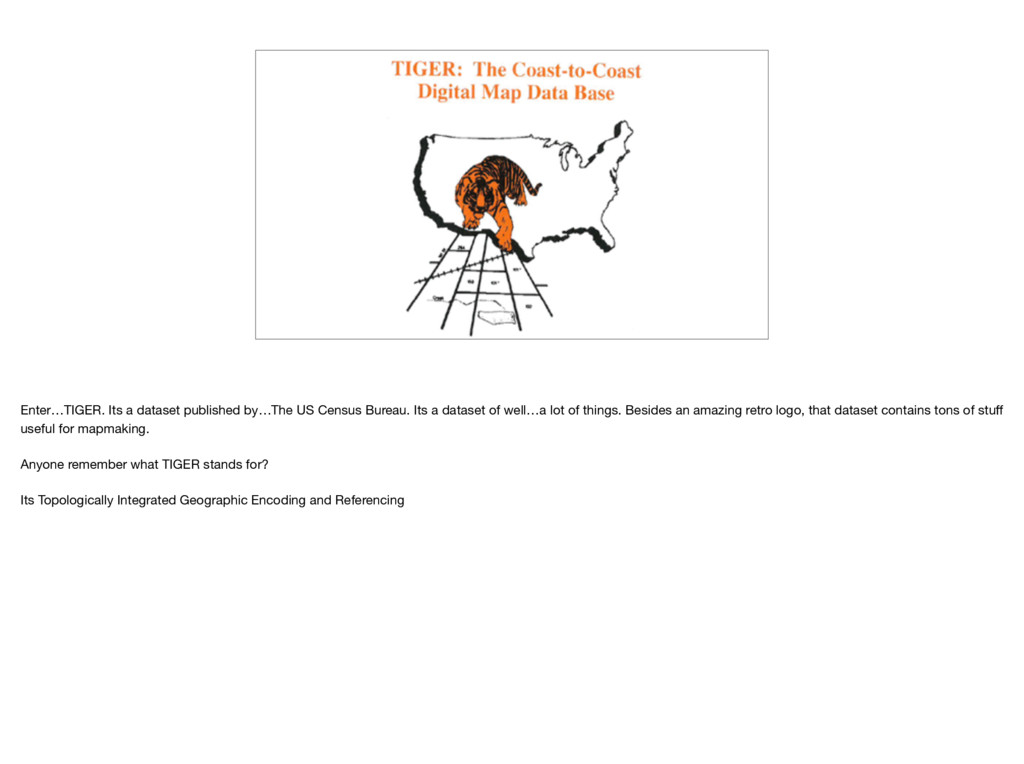
a dataset of well…a lot of things. Besides an amazing retro logo, that dataset contains tons of stuff useful for mapmaking. Anyone remember what TIGER stands for? Its Topologically Integrated Geographic Encoding and Referencing
in some form or another for decades. Back in the 70s it took 1300 people hand drawing maps to manage the dataset. Now they probably have someone with QGIS. This is a photo from their facility in Jeffersonville, Indiana
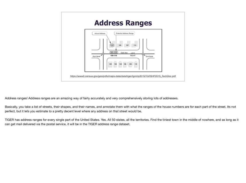
way of fairly accurately and very comprehensively storing lots of addresses. Basically, you take a list of streets, their shapes, and their names, and annotate them with what the ranges of the house numbers are for each part of the street. Its not perfect, but it lets you estimate to a pretty decent level where any address on that street would be. TIGER has address ranges for every single part of the United States. Yes. All 50 states, all the territories. Find the tiniest town in the middle of nowhere, and as long as it can get mail delivered via the postal service, it will be in the TIGER address range dataset.
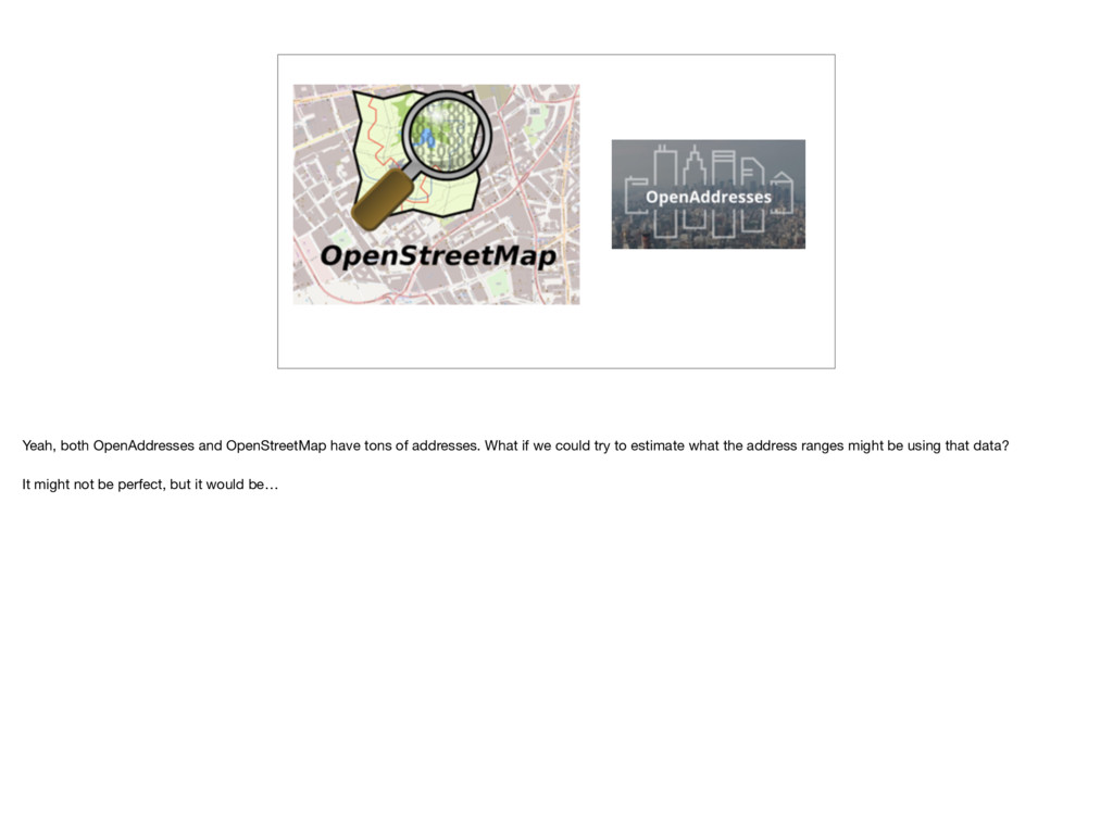
we wanted a geocoder thats useful all over the globe. A few other countries have detests comparable to TIGER, but most don’t. There must be something we can do with existing open data that can help us. Lets see…first we’ll need some street geometry
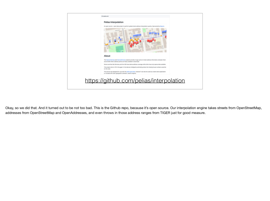
to be not too bad. This is the Github repo, because it’s open source. Our interpolation engine takes streets from OpenStreetMap, addresses from OpenStreetMap and OpenAddresses, and even throws in those address ranges from TIGER just for good measure.
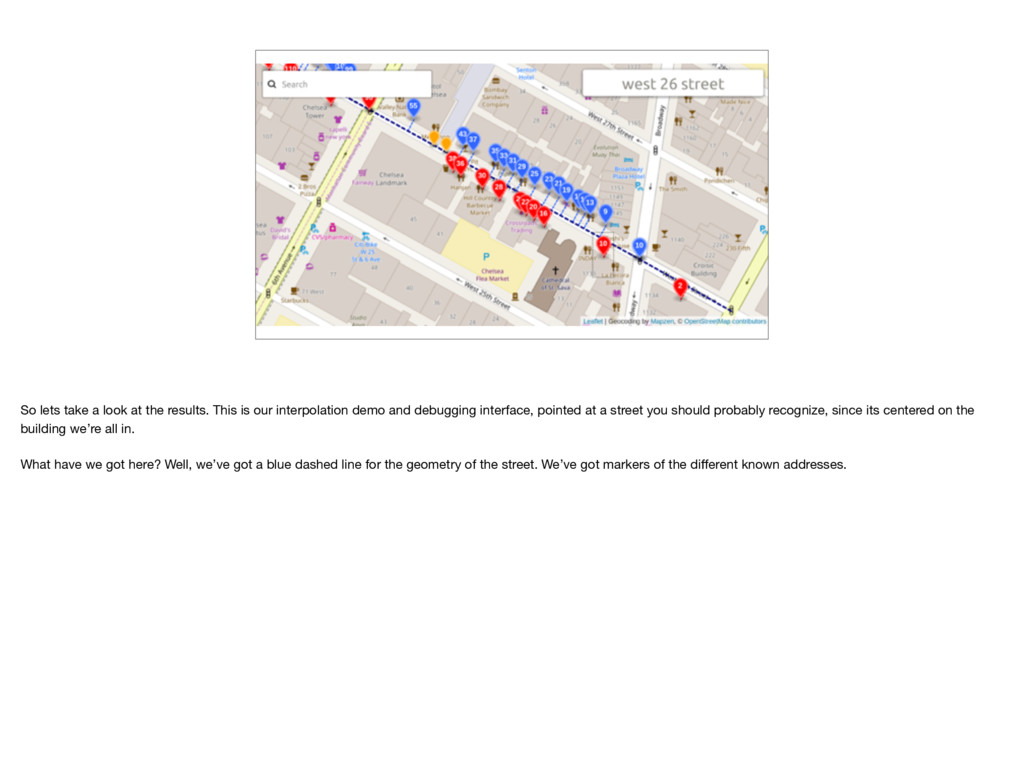
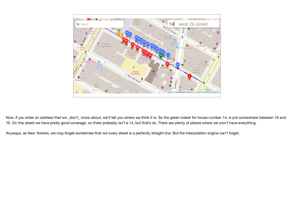
our interpolation demo and debugging interface, pointed at a street you should probably recognize, since its centered on the building we’re all in. What have we got here? Well, we’ve got a blue dashed line for the geometry of the street. We’ve got markers of the different known addresses.
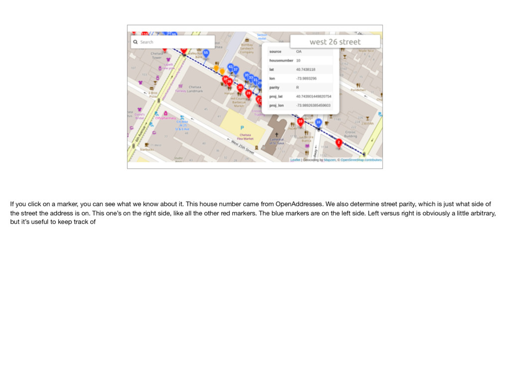
we know about it. This house number came from OpenAddresses. We also determine street parity, which is just what side of the street the address is on. This one’s on the right side, like all the other red markers. The blue markers are on the left side. Left versus right is obviously a little arbitrary, but it’s useful to keep track of
about, we’ll tell you where we think it is. So the green maker for house number 14, is put somewhere between 16 and 10. On this street we have pretty good coverage, so there probably isn’t a 14, but that’s ok. There are plenty of places where we won’t have everything. Anyways, as New Yorkers, we may forget sometimes that not every street is a perfectly straight line. But the interpolation engine can’t forget.
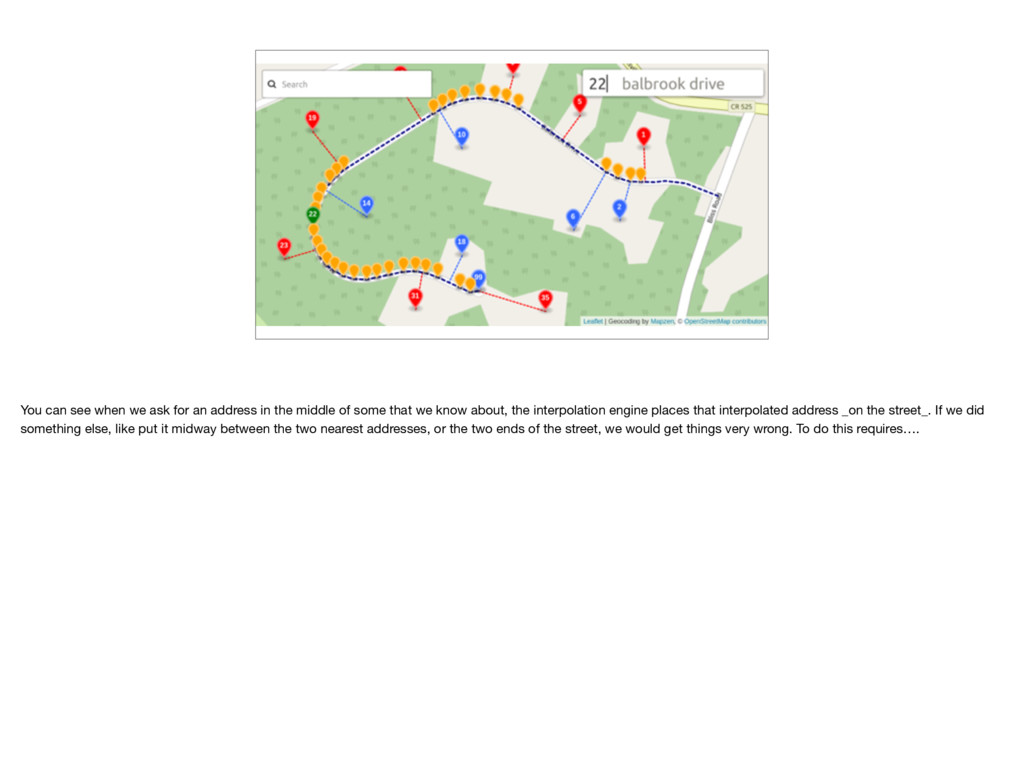
the middle of some that we know about, the interpolation engine places that interpolated address _on the street_. If we did something else, like put it midway between the two nearest addresses, or the two ends of the street, we would get things very wrong. To do this requires….
here because it’s wonderful. We do have code to deal with hypotenuses, unfortunately we don’t yet have any code concerning Hippocrates or Hippopotamuses.
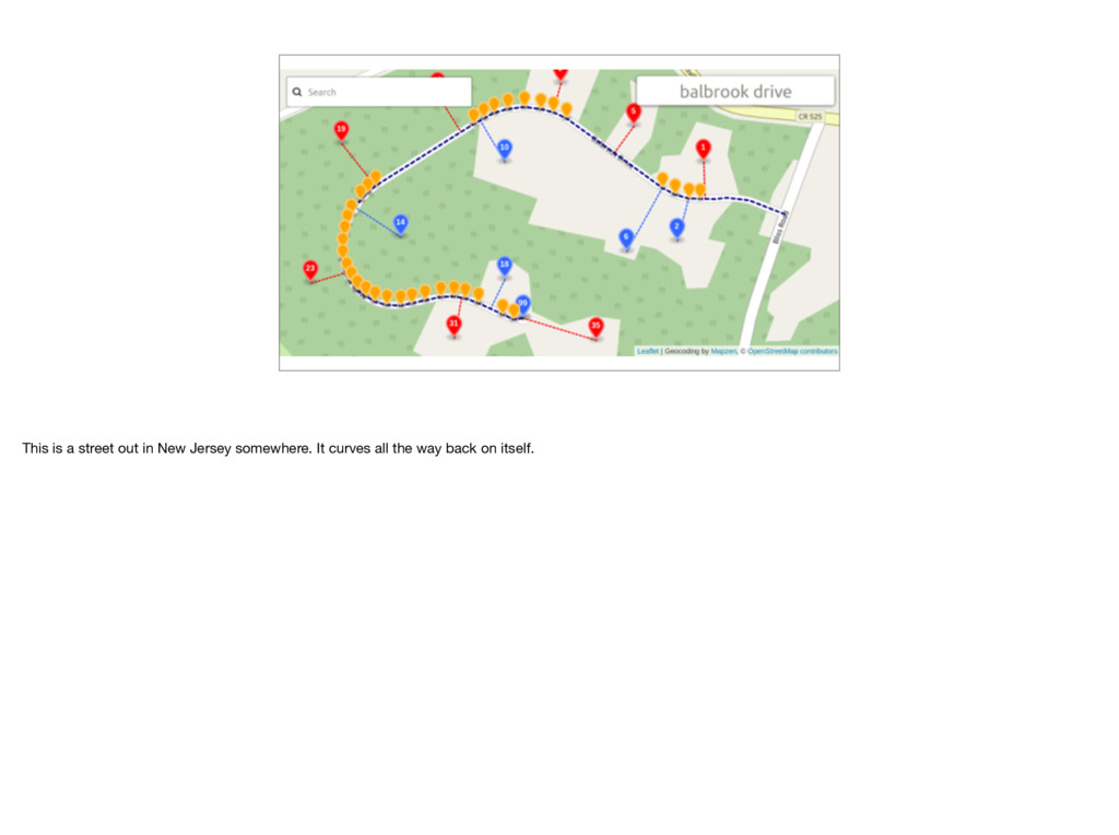
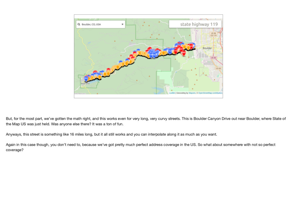
and this works even for very long, very curvy streets. This is Boulder Canyon Drive out near Boulder, where State of the Map US was just held. Was anyone else there? It was a ton of fun. Anyways, this street is something like 16 miles long, but it all still works and you can interpolate along it as much as you want. Again in this case though, you don’t need to, because we’ve got pretty much perfect address coverage in the US. So what about somewhere with not so perfect coverage?
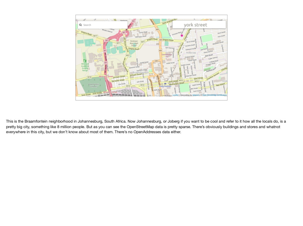
Johannesburg, or Joberg if you want to be cool and refer to it how all the locals do, is a pretty big city, something like 8 million people. But as you can see the OpenStreetMap data is pretty sparse. There’s obviously buildings and stores and whatnot everywhere in this city, but we don’t know about most of them. There’s no OpenAddresses data either.
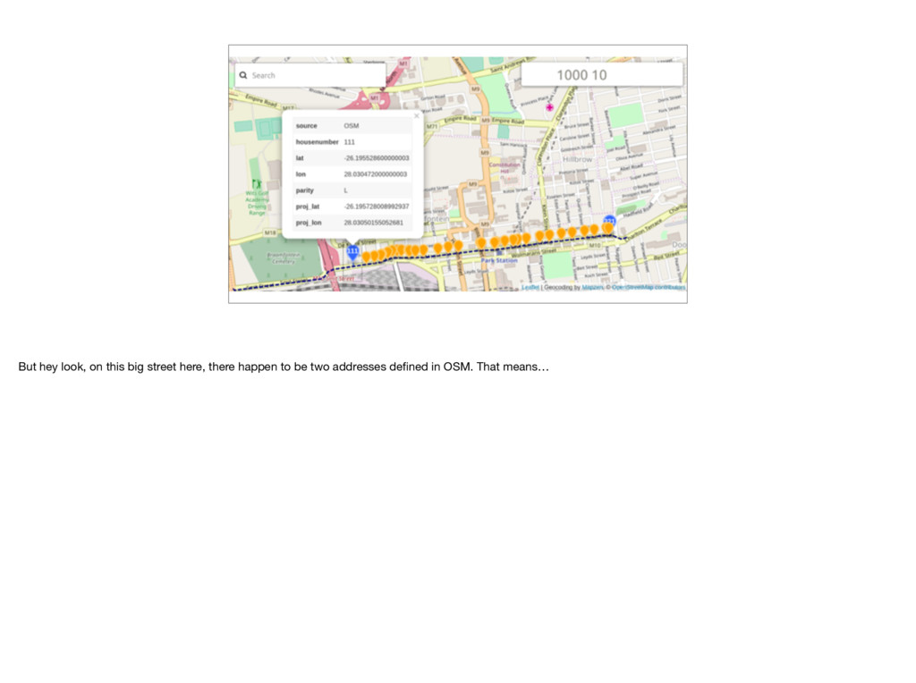
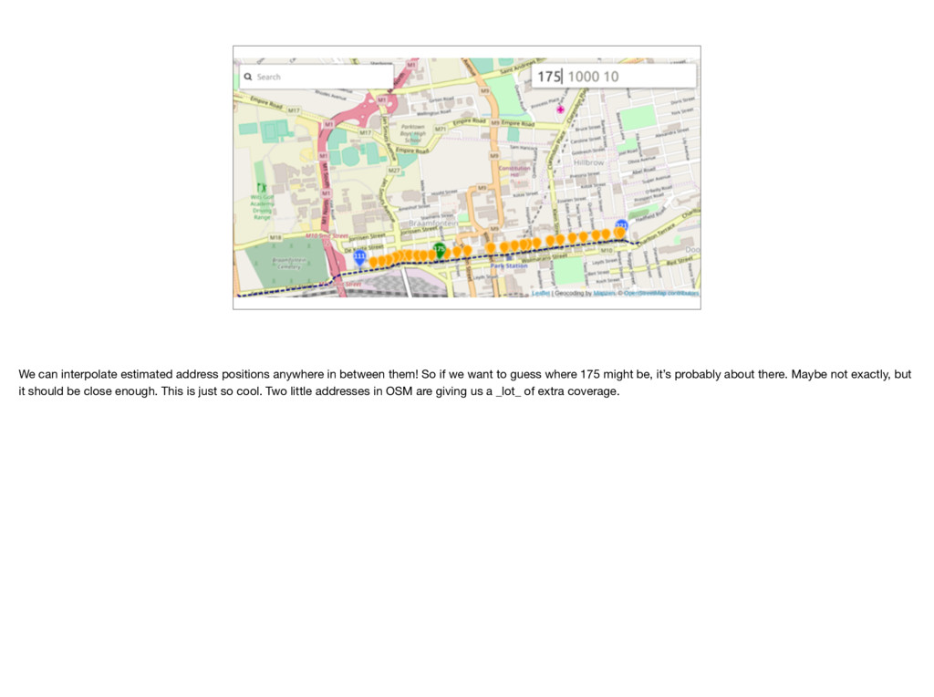
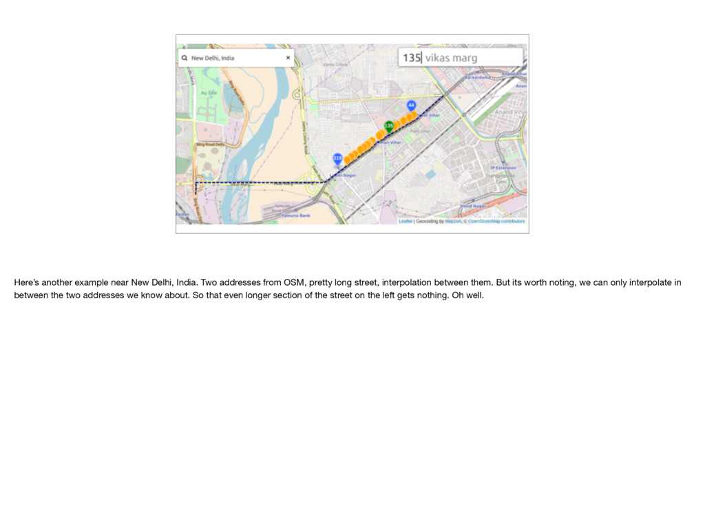
So if we want to guess where 175 might be, it’s probably about there. Maybe not exactly, but it should be close enough. This is just so cool. Two little addresses in OSM are giving us a _lot_ of extra coverage.
OSM, pretty long street, interpolation between them. But its worth noting, we can only interpolate in between the two addresses we know about. So that even longer section of the street on the left gets nothing. Oh well.
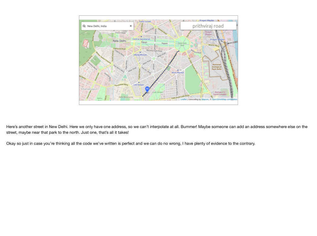
one address, so we can’t interpolate at all. Bummer! Maybe someone can add an address somewhere else on the street, maybe near that park to the north. Just one, that’s all it takes! Okay so just in case you’re thinking all the code we’ve written is perfect and we can do no wrong, I have plenty of evidence to the contrary.
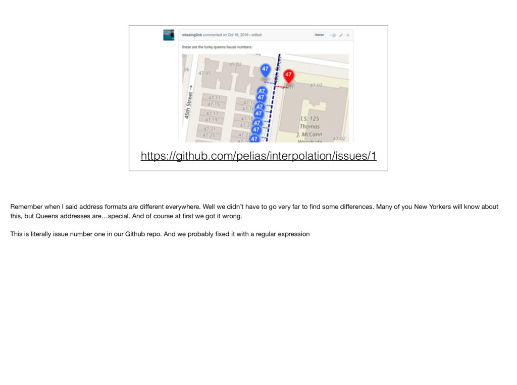
Well we didn’t have to go very far to find some differences. Many of you New Yorkers will know about this, but Queens addresses are…special. And of course at first we got it wrong. This is literally issue number one in our Github repo. And we probably fixed it with a regular expression
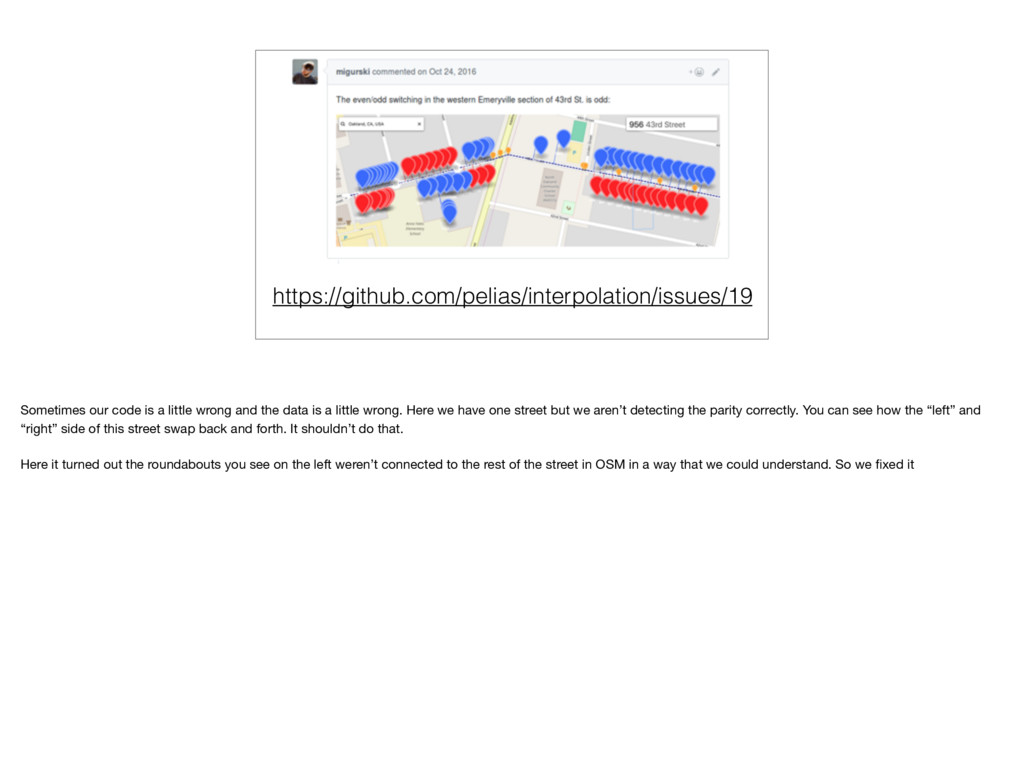
data is a little wrong. Here we have one street but we aren’t detecting the parity correctly. You can see how the “left” and “right” side of this street swap back and forth. It shouldn’t do that. Here it turned out the roundabouts you see on the left weren’t connected to the rest of the street in OSM in a way that we could understand. So we fixed it
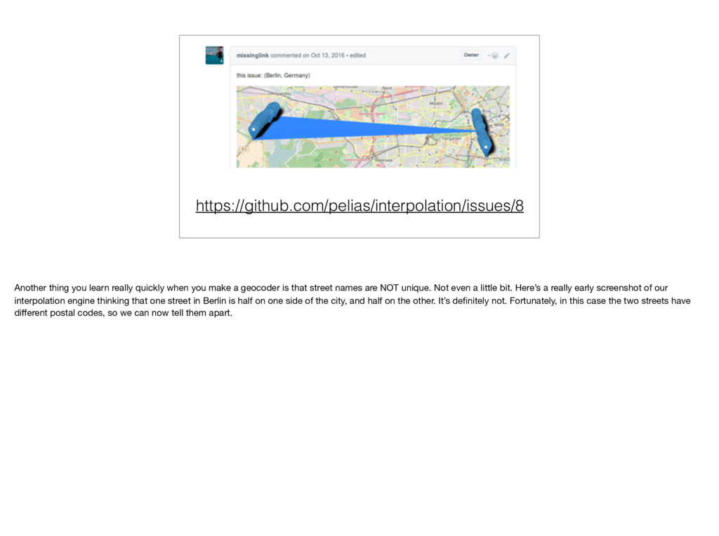
a geocoder is that street names are NOT unique. Not even a little bit. Here’s a really early screenshot of our interpolation engine thinking that one street in Berlin is half on one side of the city, and half on the other. It’s definitely not. Fortunately, in this case the two streets have different postal codes, so we can now tell them apart.
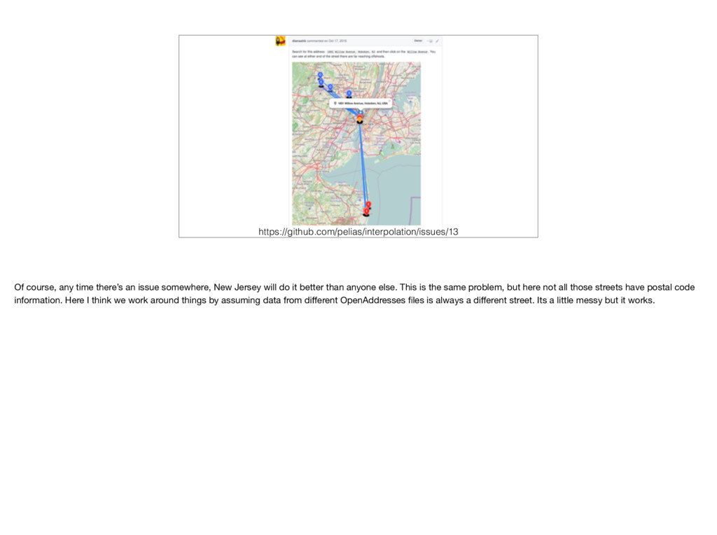
Jersey will do it better than anyone else. This is the same problem, but here not all those streets have postal code information. Here I think we work around things by assuming data from different OpenAddresses files is always a different street. Its a little messy but it works.
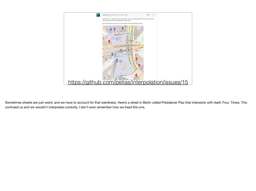
account for that weirdness. Here’s a street in Berlin called Potsdamer Plaz that intersects with itself. Four. Times. This confused us and we wouldn’t interpolate correctly. I don’t even remember how we fixed this one.
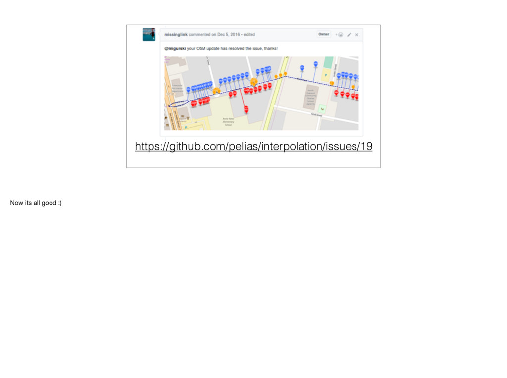
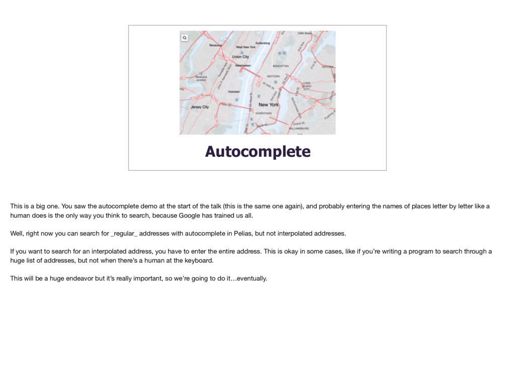
demo at the start of the talk (this is the same one again), and probably entering the names of places letter by letter like a human does is the only way you think to search, because Google has trained us all. Well, right now you can search for _regular_ addresses with autocomplete in Pelias, but not interpolated addresses. If you want to search for an interpolated address, you have to enter the entire address. This is okay in some cases, like if you’re writing a program to search through a huge list of addresses, but not when there’s a human at the keyboard. This will be a huge endeavor but it’s really important, so we’re going to do it…eventually.
:( Good software is fast. Right now our interpolation engine is pretty fast when searching, but it takes a long time to go through all the data initially. A long time…
computer. 16 days is a long time to wait, and if we don’t do anything it will only get longer, because there’s more data coming in all the time. But again, we’ll make it faster. By the way this is another census employee doing her awesome job. https://www.pinterest.com/pin/533535887087899041
9 • Add streets to OSM • Add street names to existing streets • Add addresses to existing OSM venues • Extra fancy: add address ranges to streets So that’s what we’ll be doing, but what can you do? Vote today, if you can and haven’t, you’ve still got time probably. Add more streets to OSM. There are already projects to help with this like Humanitarian OpenStreetMap Team. Also important is to make sure streets have NAMES. Without names we can’t combine them with address data to make address ranges. And like I already said, add addresses anywhere you can. Add them as new data, add them to existing data. As we saw just a few can go a long way. If you want to get really fancy OSM has tag formats for adding address ranges directly, and we support most of them. The OSM Wiki describes them.