Upgrade to Pro — share decks privately, control downloads, hide ads and more …

MSS - Software for planning research aircraft missions

Reimar Bauer
February 04, 2017

MSS - Software for planning research aircraft missions

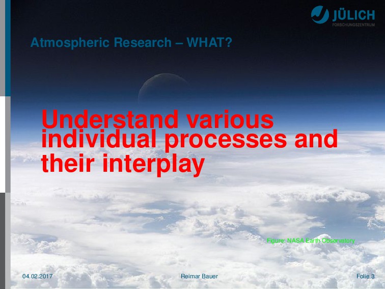
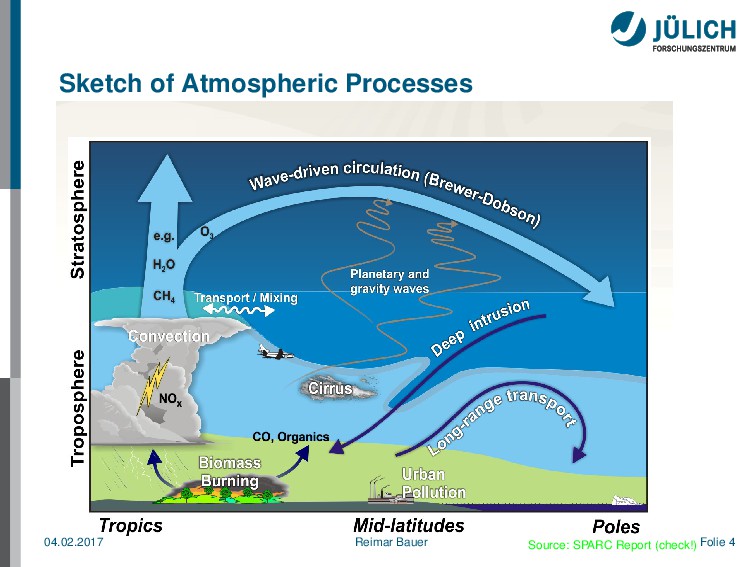
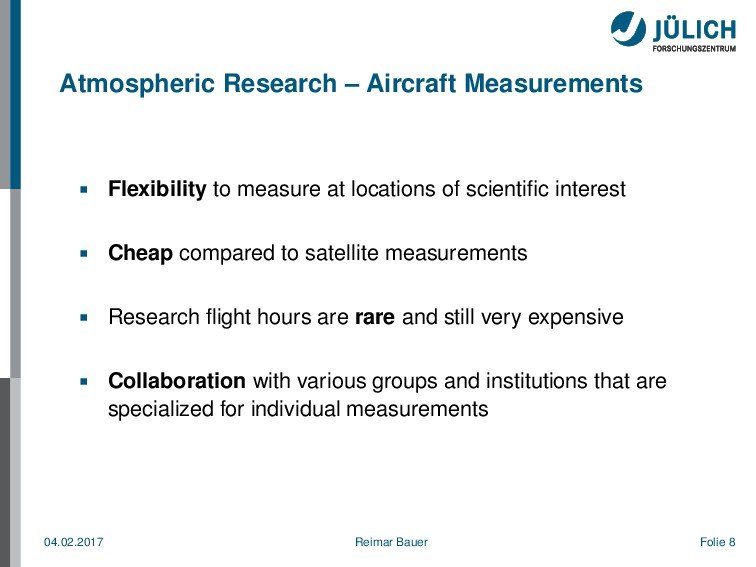
For understanding various individual processes and their interplay in the atmosphere we need an huge amount of measurements.
These measurements from aircrafts need a high level organisational process to keep costs low by collaboration.

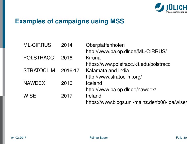
The Mission Support System MSS uses model simulations and optimizes the scientific outcome by finding the best flight path as well as consideration of various aircraft constrains, e.g. range, overflight permits.

Reimar Bauer

February 04, 2017
Tweet

More Decks by Reimar Bauer

Other Decks in Science

Transcript

  1. About me Forschungszentrum Jülich GmbH http://www.fz-juelich.de/ Reimar Bauer, IEK-7 @ReimarBauer

    Python Software Foundation Python Software Verband e.V. [email protected] Reimar.Bauer@python- verband.org [email protected] 04.02.2017 Reimar Bauer Folie 2
  2. Atmospheric Research – WHAT? Understand various individual processes and their

    interplay Figure: NASA Earth Observatory 04.02.2017 Reimar Bauer Folie 3
  3. Atmospheric Research – WHY? Provide predictions for the atmosphere regarding

    Climate Global warming Ozone hole . . . and many more 04.02.2017 Reimar Bauer Folie 5
  4. Atmospheric Research – HOW? Measurements of chemical trace gas composition

    and other parameters of interest that characterize these processes Laboratory Balloons Aircrafts Satellites Simulations of the atmosphere (composition, particles) by a variety of models 04.02.2017 Reimar Bauer Folie 6
  5. Atmospheric Research – AIM Improved understanding of the individual processes

    parametrize these processes in atmospheric models, e.g. Chemistry climate models (CCMs) and Earth system models (ESMs) Quality improvement of models and predictions for ozone hole, climate,. . . 04.02.2017 Reimar Bauer Folie 7
  6. Atmospheric Research – Aircraft Measurements Flexibility to measure at locations

    of scientific interest Cheap compared to satellite measurements Research flight hours are rare and still very expensive Collaboration with various groups and institutions that are specialized for individual measurements 04.02.2017 Reimar Bauer Folie 8
  7. Example: The Geophysica Aircraft Instrument Parameter P.I. Bay FOZAN O

    3 Ulanovsky, CAO FabrizioRavegnani, CNR Bay 5 FISH H 2 O (total) MartinaKraemer, JUELICH Bay 4 FLASH H 2 O (gas phase) AlexeyLykov, CAO Under Wing Pylon SIOUX NO NO y Particle NO y HansSchlager, DLR Under Wing Pod right HALOX t.b.d. ClO BrO FredStroh, JUELICH left Wing Pod HAGAR N 2 O, CFC12 CFC11 CH 4 , H 2 SF 6 Halon 1211 CO 2 MichaelVolk, BUW Bay 8 WAS Long lived trace gases and isotopo-logues ThomasRoeckmann, UTRECHT Fuselage Bay Many more instruments for measurements of different parameters 04.02.2017 Reimar Bauer Folie 11
  8. Example: The HALO Aircraft Top altitude: 15 km, range: 10000

    km HALO leaving the Arena Arctica. Picture by Peter Preuße, FZJ. 04.02.2017 Reimar Bauer Folie 12
  9. Planning of Research Flights Typically, scientific campaigns with more flights

    from a base airport address one or more scientific questions Model simulations provide related parameters of interest for the near future using meteorological forecast data Optimization of the scientific outcome by finding the best flight path (in 4 dimensions time, latitude, longitude, altitude) in the “model world” Consideration of various aircraft constraints (range, flight altitude, overflight permits. . . ) Discussion and iteration of the proposed flight plans with pilots and aircraft representatives 04.02.2017 Reimar Bauer Folie 13
  10. M ¯ ission S ¯ upport S ¯ ystem (MSS)

    Software to aid scientific flight planning: Marc Rautenhaus, formerly DLR, introduced MSS in 2012. It is since May 2016 a git FOSS project on bitbucket. Python 2.7.x Client / Server application OGC web map service based conda-forge - anaconda application License: Apache 2.0 Docs: mss.rtfd.io 04.02.2017 Reimar Bauer Folie 14
  11. Basic principle of the OGC Web Map Service standard A

    client (left) sends a GetMap request, encoded as an HTTP URL to the server (right). The server creates an image file and sends it to the client. Rautenhaus et al., GMD, 5, 55-71, 2012 04.02.2017 Reimar Bauer Folie 16
  12. Description MSS A data center can install the MSS server

    component and configure it to provide data. Already implemented methods for ECMWF, CLaMS, GWFC, EMAC, METEOSAT data. The client is a QT 4 GUI application which can access many MSS Servers. The client accesses the server and requests vertical, horizontal views and receives generated images. Scientists interactively design a flight route in direct relation to atmospheric prediction data. Way points of a proposed flight route are overlayed on any view of requested data. All the information could be exchanged and manipulated by others. 04.02.2017 Reimar Bauer Folie 17
  13. Architecture of MSS WMS Server Rautenhaus et al., GMD, 5,

    55-71, 2012 04.02.2017 Reimar Bauer Folie 18
  14. Architecture of MSS GUI Rautenhaus et al., GMD, 5, 55-71,

    2012 04.02.2017 Reimar Bauer Folie 19
  15. Installing MSS and running Server and Client $ conda config

    –add channels conda-forge $ conda create -n mssenv python=2 $ source activate mssenv $ conda install mss $ #demodata and standalone server $ demodata $ export PYTHONPATH=~/mss $ mswms $ #GUI $ mss 04.02.2017 Reimar Bauer Folie 20
  16. Top View A) map projection B) zoom/pan C) way points

    D) appearance E) open controls F) layer G) time setup H) new request 04.02.2017 Reimar Bauer Folie 21
  17. Features On Top View you could add different layers Satellite

    Tracks Remote Sensing KML Overlay On Table View we have the possibility to a add a hexagon flight pattern 04.02.2017 Reimar Bauer Folie 24
  18. Example: HALO flight from Kiruna to Oberpfaffenhofen Top view: Mixing

    ratios of N2O and O3: Source: POLSTRACC flight planning team 04.02.2017 Reimar Bauer Folie 25
  19. Example: HALO flight from Kiruna to Oberpfaffenhofen Side view: Mixing

    ratios of N2O and Ozone loss: Source: POLSTRACC flight planning team 04.02.2017 Reimar Bauer Folie 26
  20. Example: HALO flight from Kiruna to Oberpfaffenhofen Top view: Cloud

    cover and tropopause height: Source: POLSTRACC flight planning team 04.02.2017 Reimar Bauer Folie 27
  21. Example: HALO flight from Kiruna to Oberpfaffenhofen Side view: Clouds

    and Potential Vorticity: Source: POLSTRACC flight planning team 04.02.2017 Reimar Bauer Folie 28
  22. Examples of campaigns using MSS ML-CIRRUS 2014 Oberpfaffenhofen http://www.pa.op.dlr.de/ML-CIRRUS/ POLSTRACC

    2016 Kiruna https://www.polstracc.kit.edu/polstracc STRATOCLIM 2016-17 Kalamata and India http://www.stratoclim.org/ NAWDEX 2016 Iceland http://www.pa.op.dlr.de/nawdex/ WISE 2017 Ireland https://www.blogs.uni-mainz.de/fb08-ipa/wise/ 04.02.2017 Reimar Bauer Folie 30