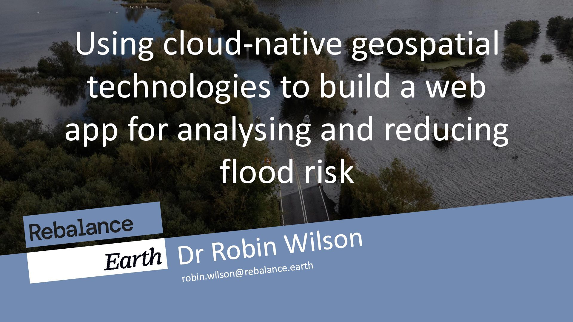
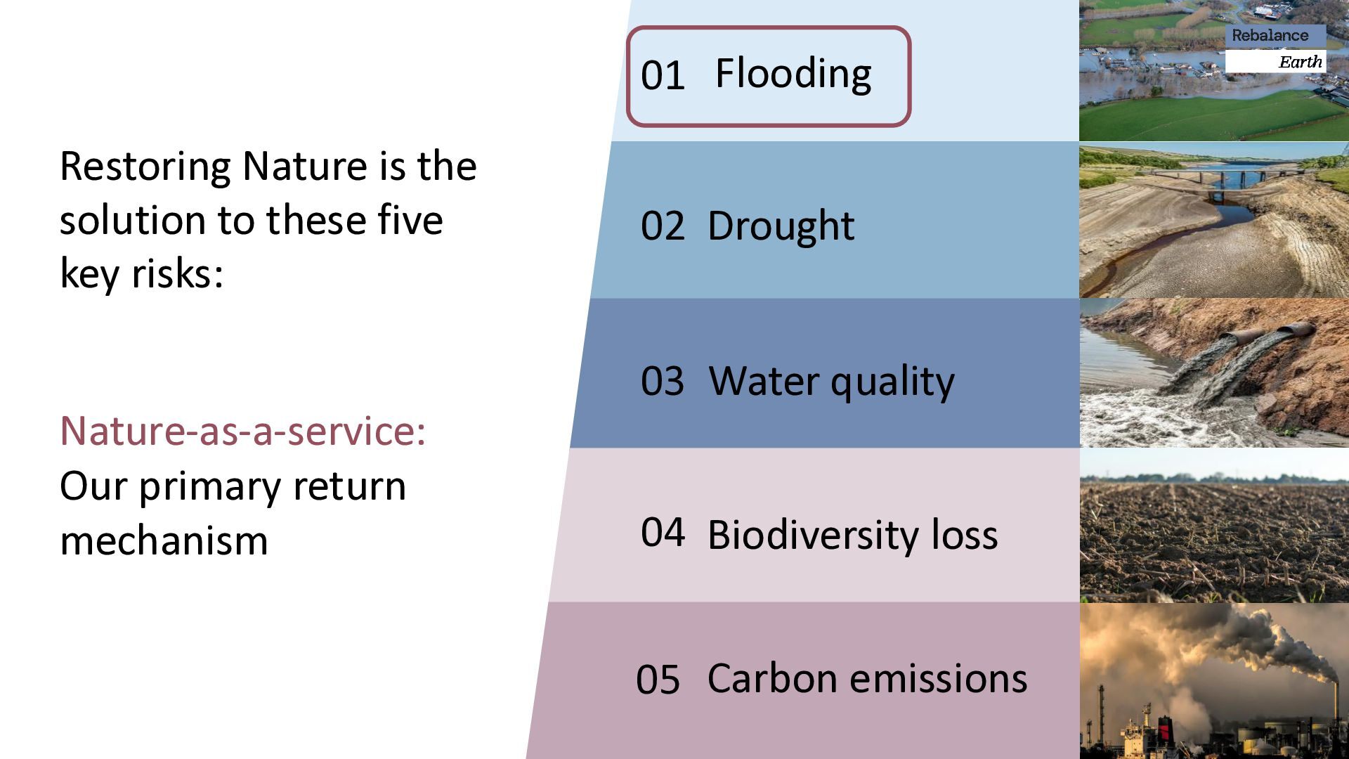
McVitie’s factory was flooded, leading to a £50 million insurance payout by RSA. This significant payout contributed to a decline in RSA's share price. The shell garage in Carlisle is now a stranded asset. The floods in 2005 and 2015 caused consistent business disruption and irreparable damage. The business case for Nature :
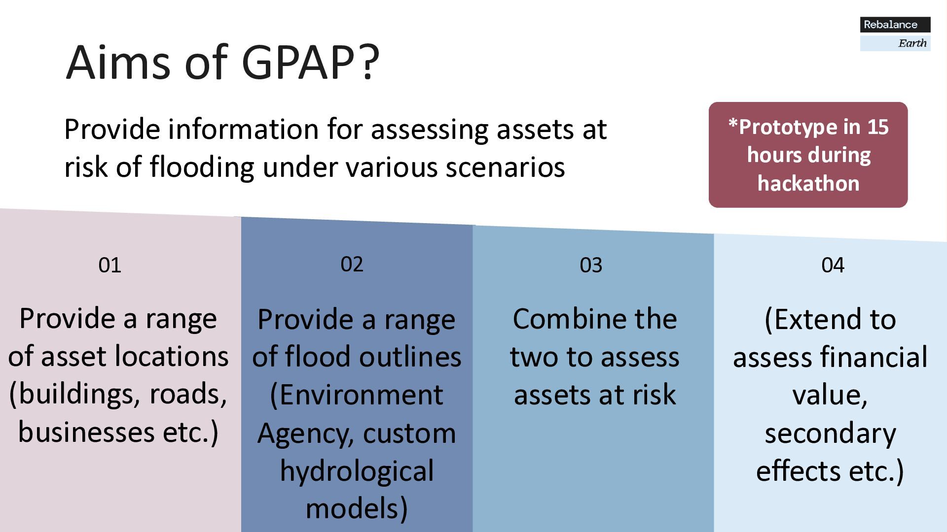
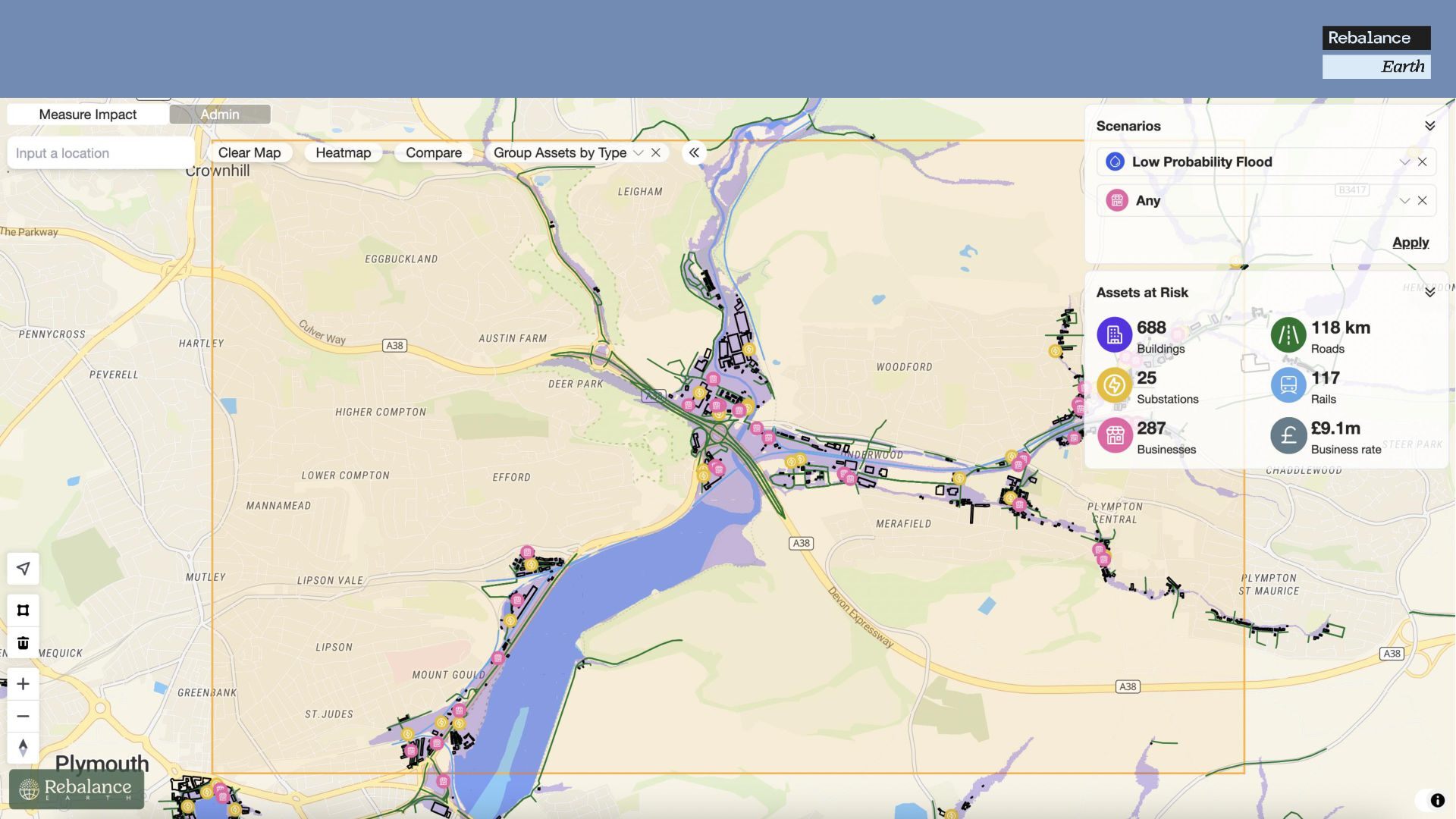
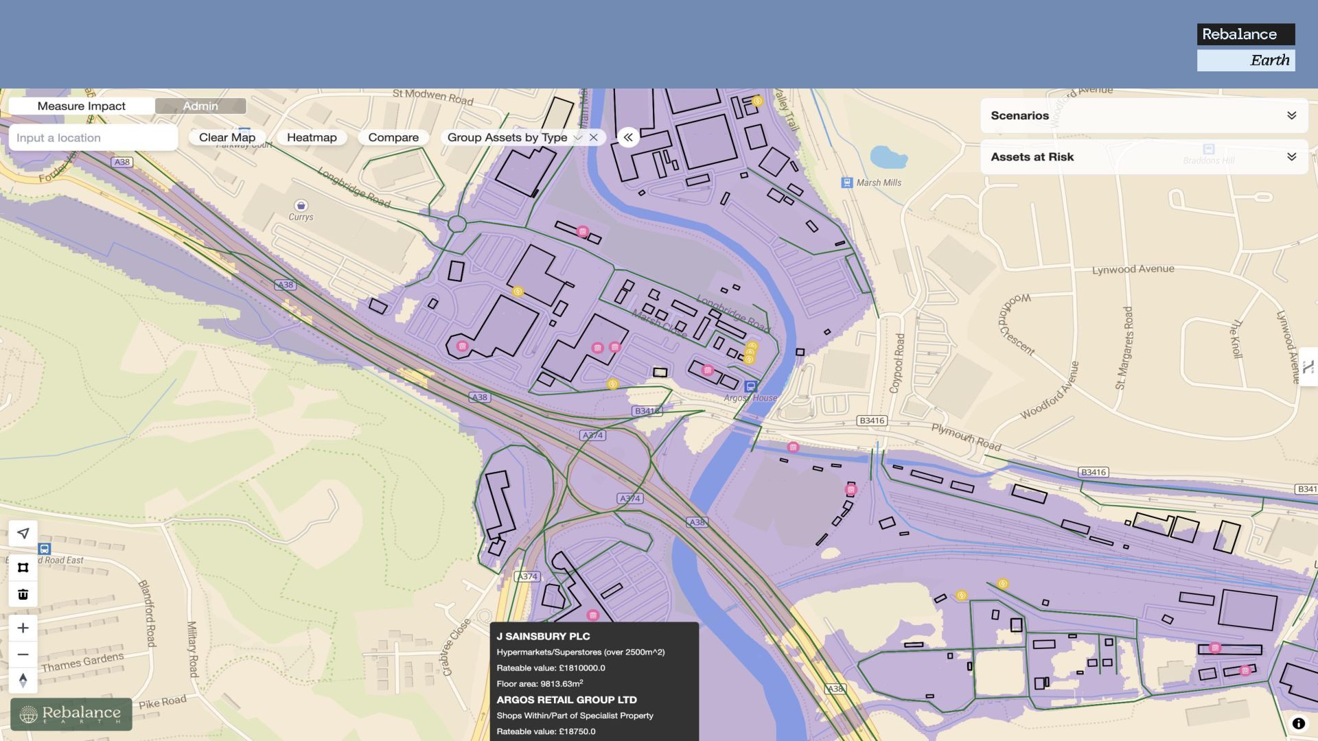
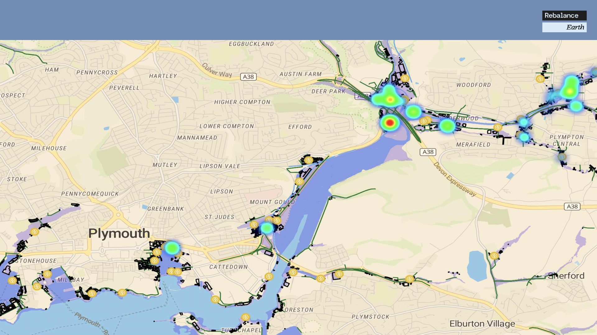
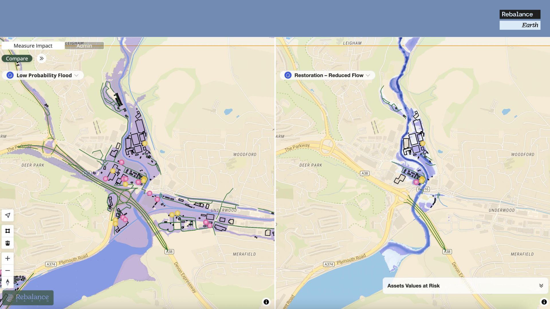
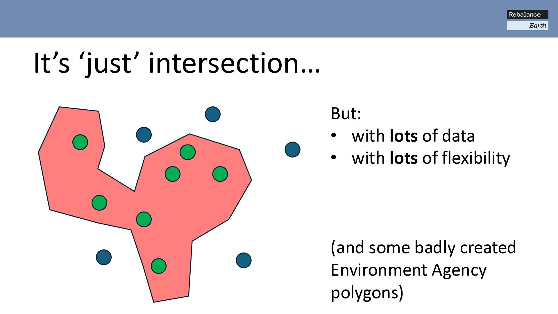
of flooding under various scenarios Provide a range of asset locations (buildings, roads, businesses etc.) Aims of GPAP? Provide a range of flood outlines (Environment Agency, custom hydrological models) Combine the two to assess assets at risk 04 (Extend to assess financial value, secondary effects etc.) *Prototype in 15 hours during hackathon
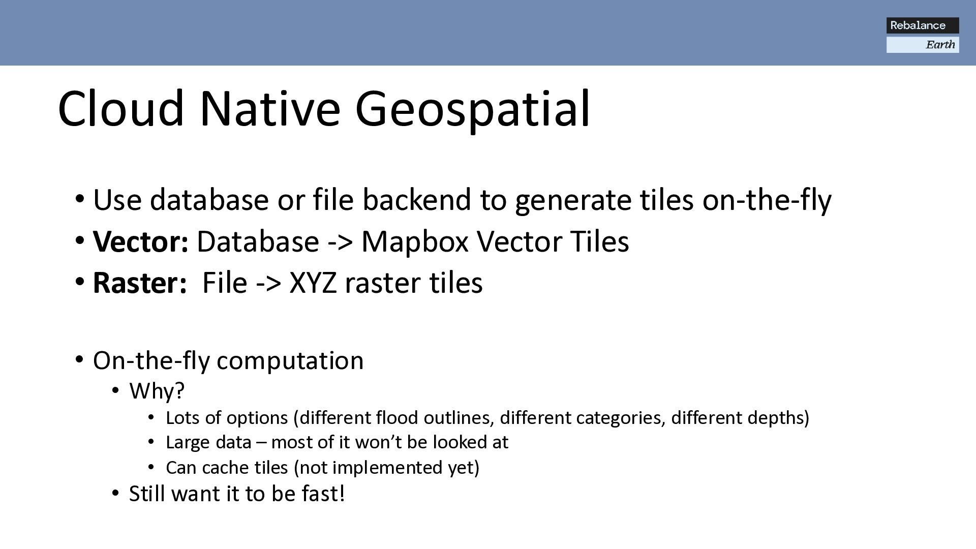
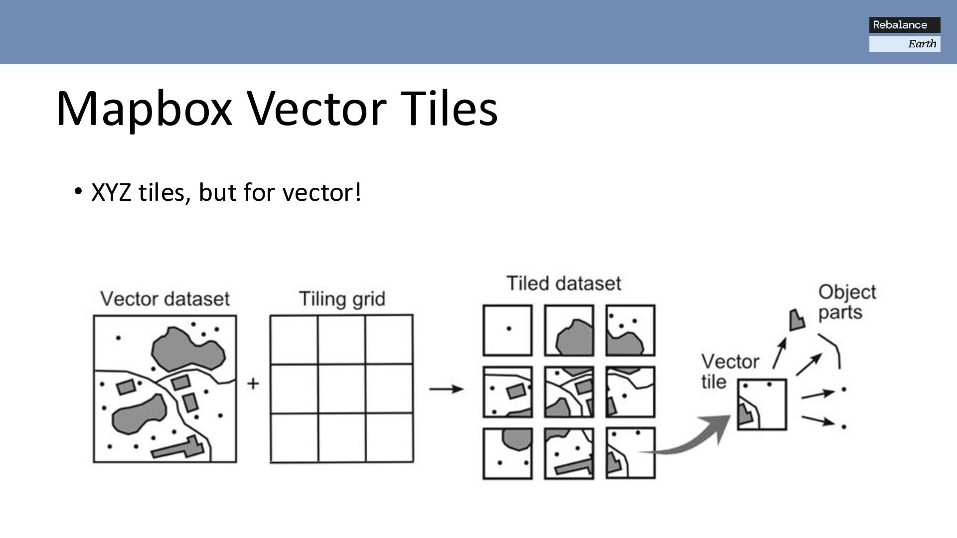
generate tiles on-the-fly • Vector: Database -> Mapbox Vector Tiles • Raster: File -> XYZ raster tiles • On-the-fly computation • Why? • Lots of options (different flood outlines, different categories, different depths) • Large data – most of it won’t be looked at • Can cache tiles (not implemented yet) • Still want it to be fast!
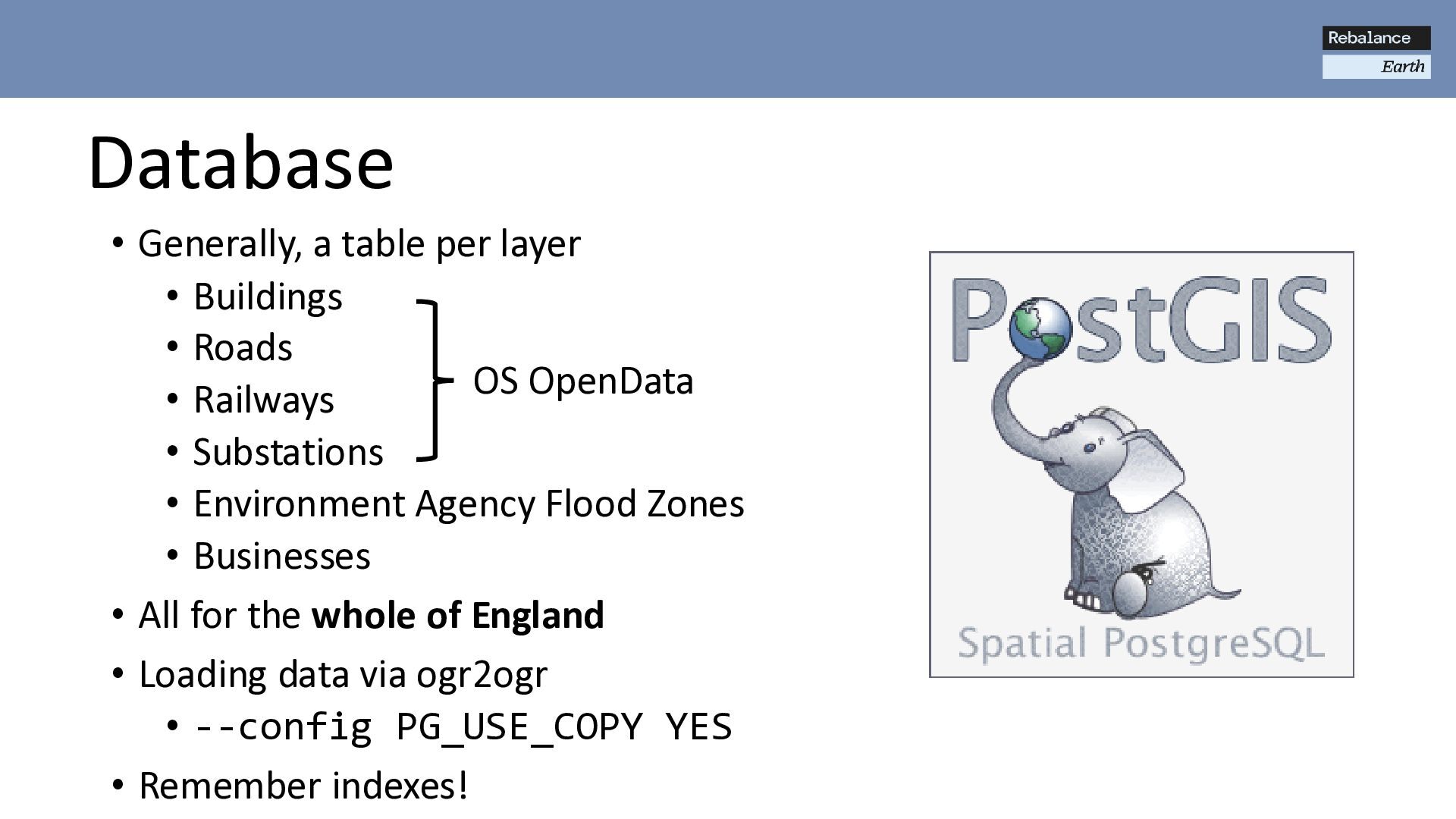
Roads • Railways • Substations • Environment Agency Flood Zones • Businesses • All for the whole of England • Loading data via ogr2ogr • --config PG_USE_COPY YES • Remember indexes! OS OpenData
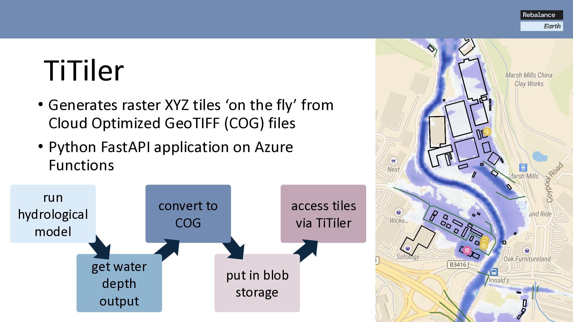
COG TiTiler • Generates raster XYZ tiles ‘on the fly’ from Cloud Optimized GeoTIFF (COG) files • Python FastAPI application on Azure Functions get water depth output run hydrological model
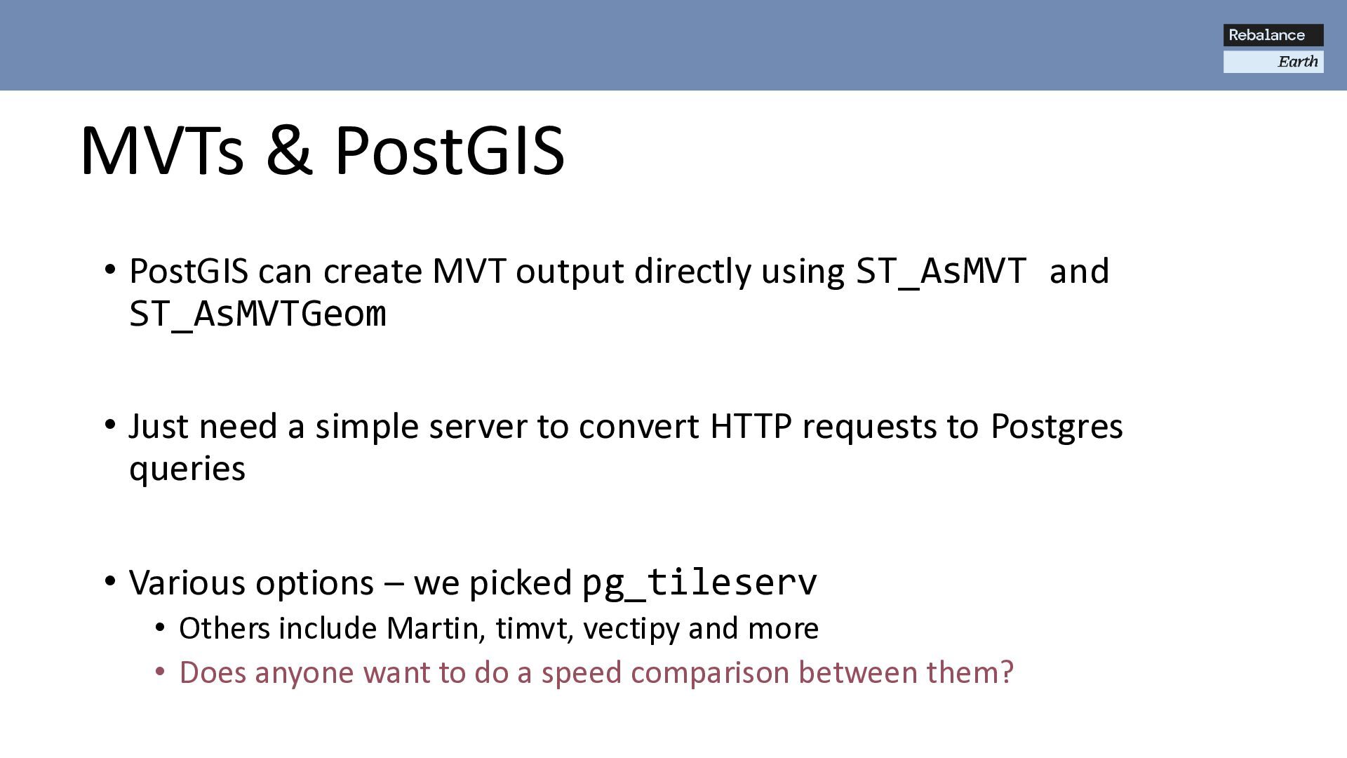
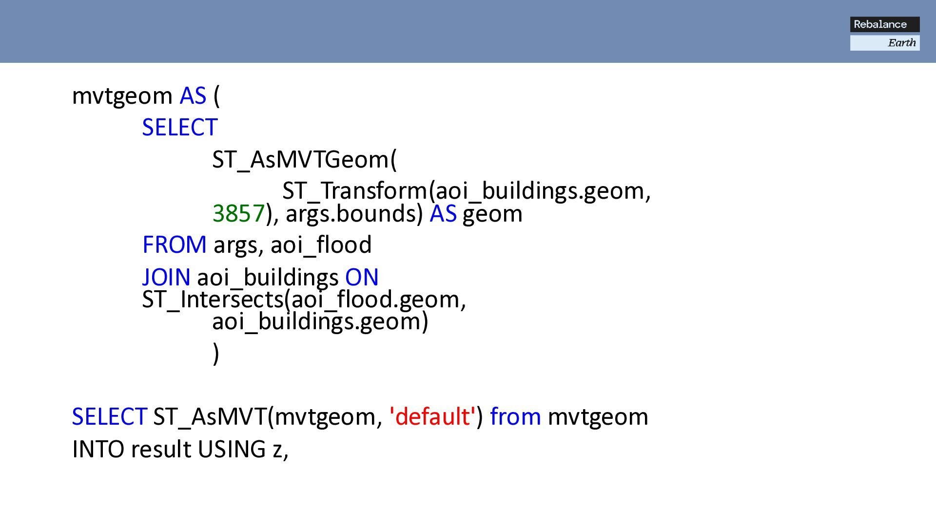
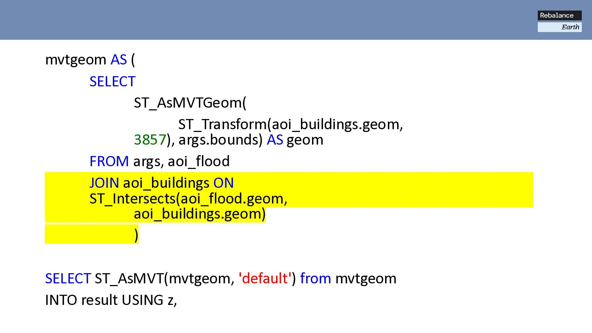
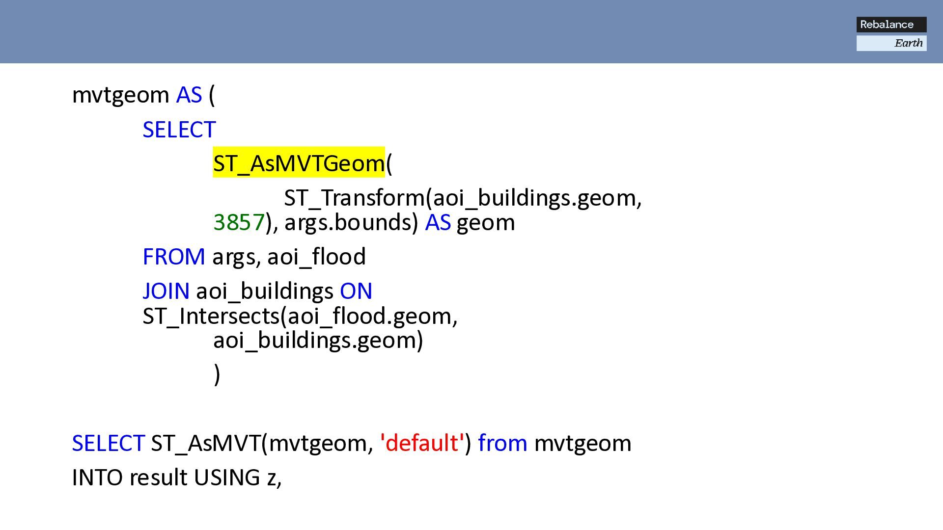
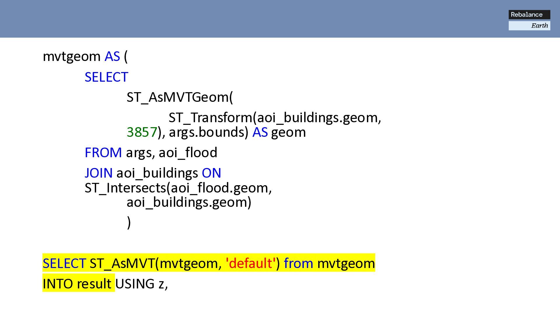
using ST_AsMVT and ST_AsMVTGeom • Just need a simple server to convert HTTP requests to Postgres queries • Various options – we picked pg_tileserv • Others include Martin, timvt, vectipy and more • Does anyone want to do a speed comparison between them?
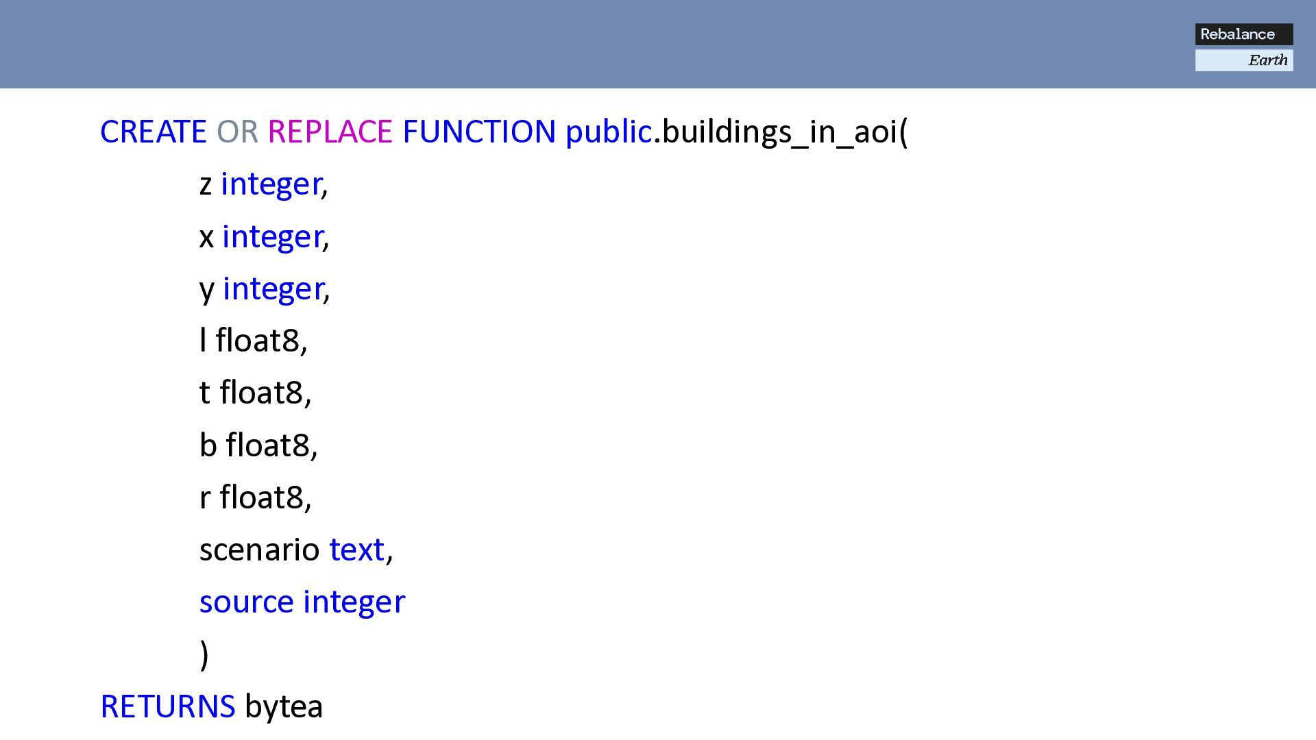
FROM args, aoi_flood JOIN aoi_buildings ON ST_Intersects(aoi_flood.geom, aoi_buildings.geom) ) SELECT ST_AsMVT(mvtgeom, 'default') from mvtgeom INTO result USING z,
FROM args, aoi_flood JOIN aoi_buildings ON ST_Intersects(aoi_flood.geom, aoi_buildings.geom) ) SELECT ST_AsMVT(mvtgeom, 'default') from mvtgeom INTO result USING z,
FROM args, aoi_flood JOIN aoi_buildings ON ST_Intersects(aoi_flood.geom, aoi_buildings.geom) ) SELECT ST_AsMVT(mvtgeom, 'default') from mvtgeom INTO result USING z,
FROM args, aoi_flood JOIN aoi_buildings ON ST_Intersects(aoi_flood.geom, aoi_buildings.geom) ) SELECT ST_AsMVT(mvtgeom, 'default') from mvtgeom INTO result USING z,
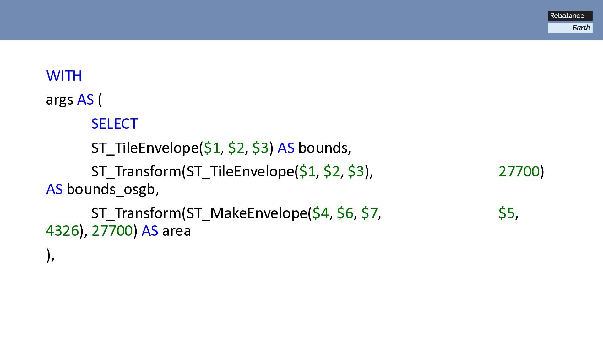
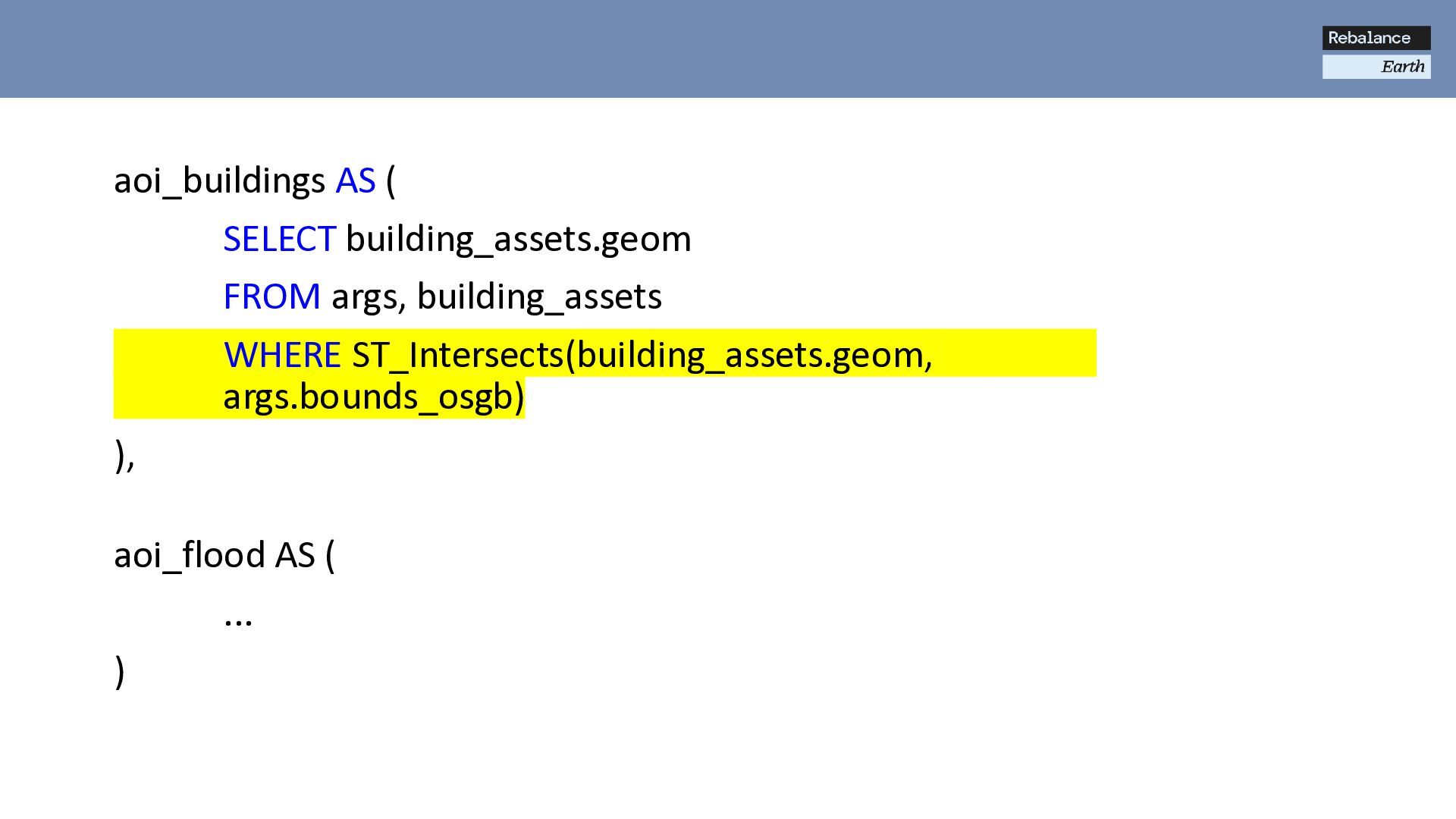
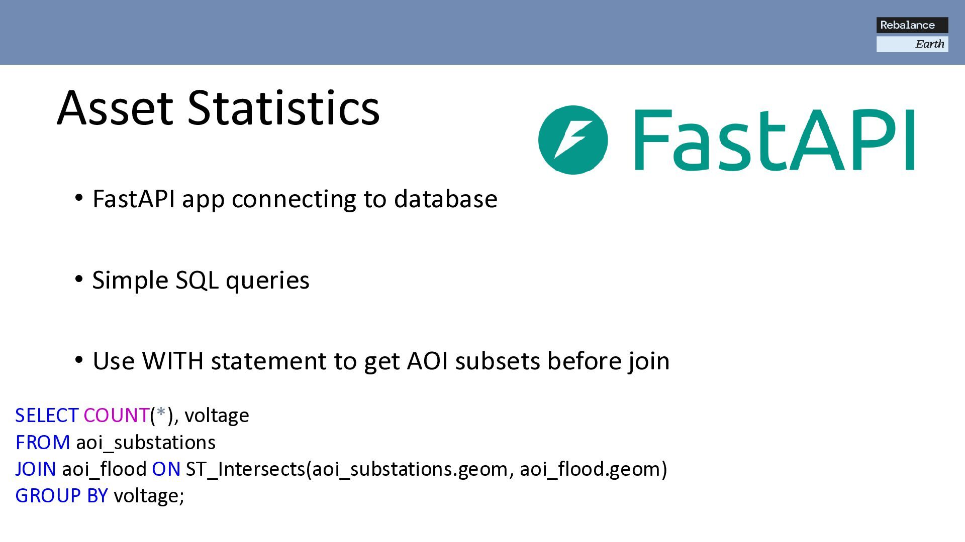
SQL queries • Use WITH statement to get AOI subsets before join SELECT COUNT(*), voltage FROM aoi_substations JOIN aoi_flood ON ST_Intersects(aoi_substations.geom, aoi_flood.geom) GROUP BY voltage;
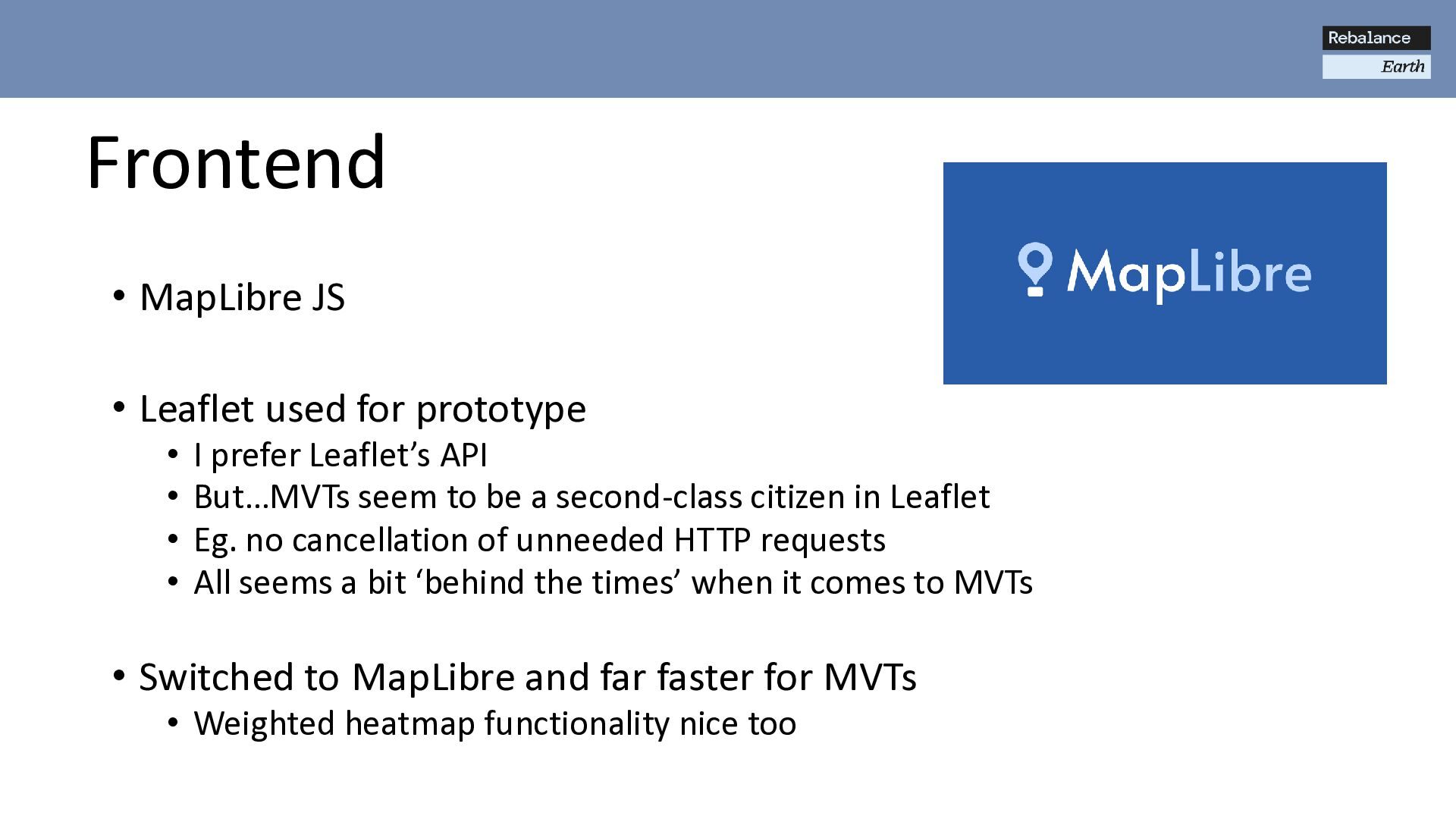
I prefer Leaflet’s API • But…MVTs seem to be a second-class citizen in Leaflet • Eg. no cancellation of unneeded HTTP requests • All seems a bit ‘behind the times’ when it comes to MVTs • Switched to MapLibre and far faster for MVTs • Weighted heatmap functionality nice too
Event Scan QR Code to learn more or visit: WWW.REBALANCE.EARTH/GEOTAM-CHALLENGE BRIEF: Develop an open-source proof of concept method to estimate business turnover at specific locations across the UK, with a retained focus on Manchester SUPPORT: Gain access to non-public datasets, expert mentorship, and a collaborative community via Discord PRIZES: Up to £2,000 in monetary awards, with the prospect to continue developing your work as part of a role at our fund GeoTAM Challenge
![...&rescale=-1.5,1.5 ...&colormap=[ [[-100,-1], [215,48,39,255]], [[-1,-0.5],[244,109,67,255]], [[-0.5,-0.2],[253,174,97,255]], [[-0.2,0.2],[254,224,144,255]], [[0.2,0.5],[171,217,233,255]], [[0.5,1.0],[116,173,209,255]], [[1.0,100],[69,117,180,255]]](https://files.speakerdeck.com/presentations/8824305c2166491bb153c9479b3b60ac/slide_13.jpg)