Upgrade to Pro — share decks privately, control downloads, hide ads and more …

Using Smartphones for Dynamic Mapping and Planning of Transit Systems in Africa

Using Smartphones for Dynamic Mapping and Planning of Transit Systems in Africa

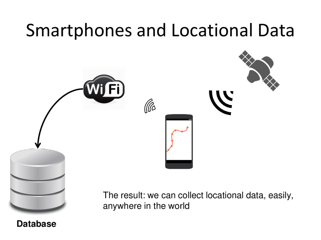
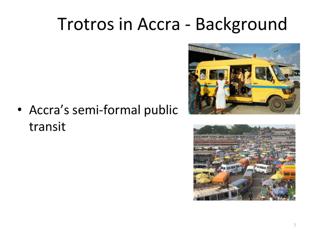
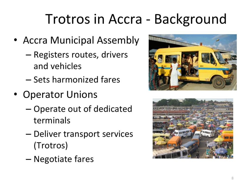
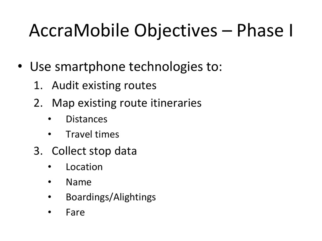
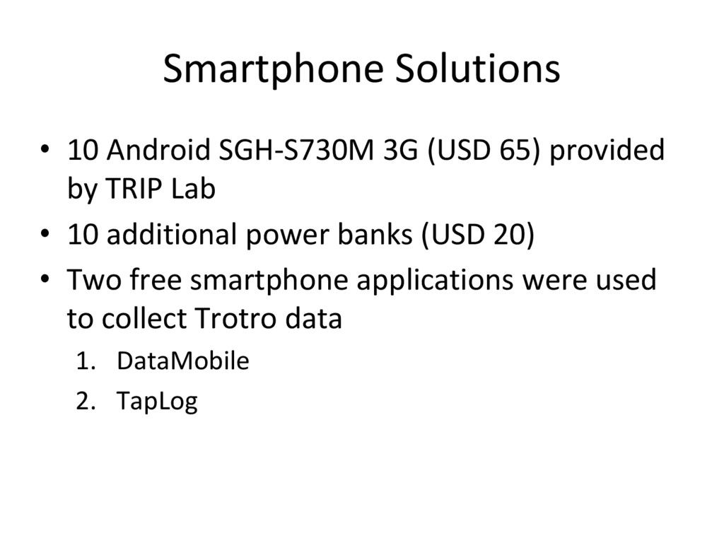
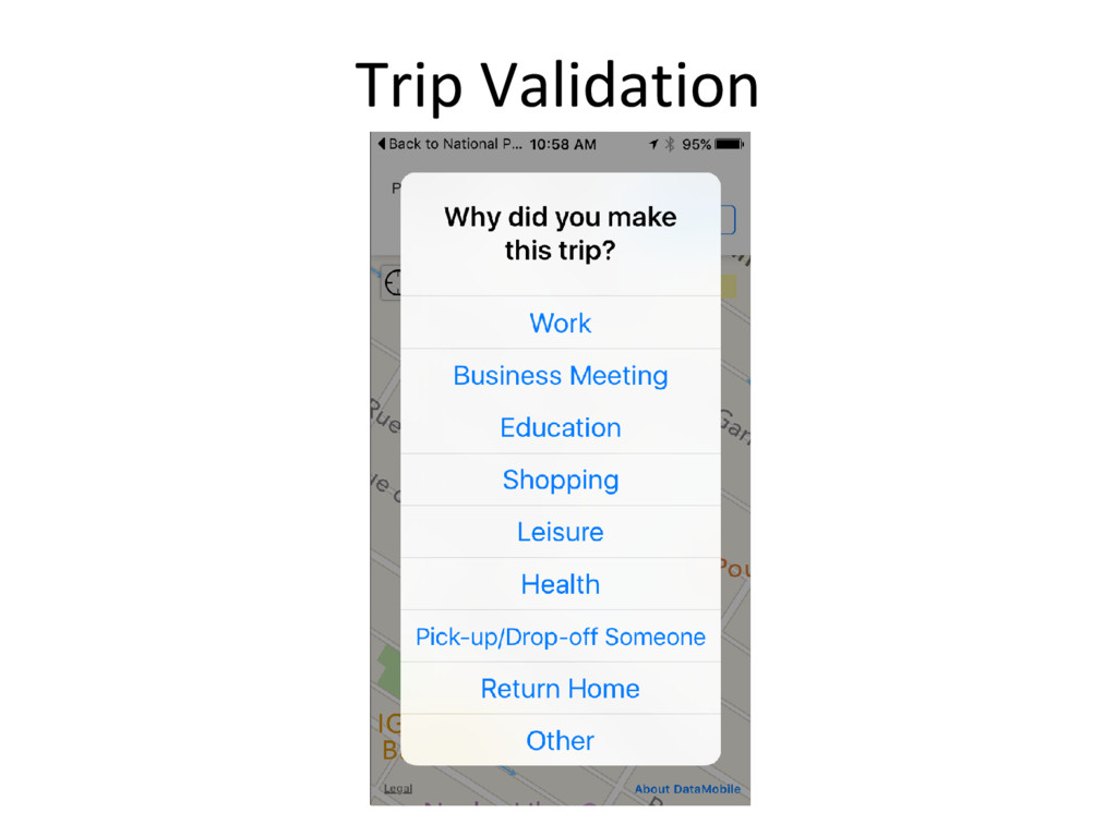
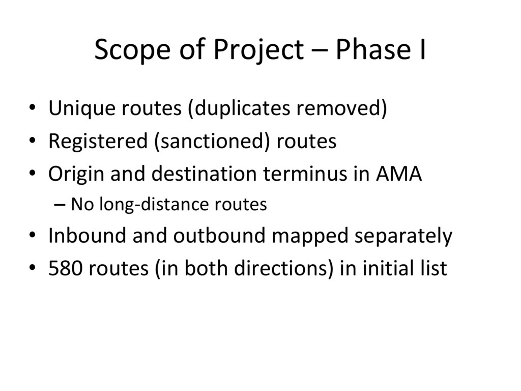
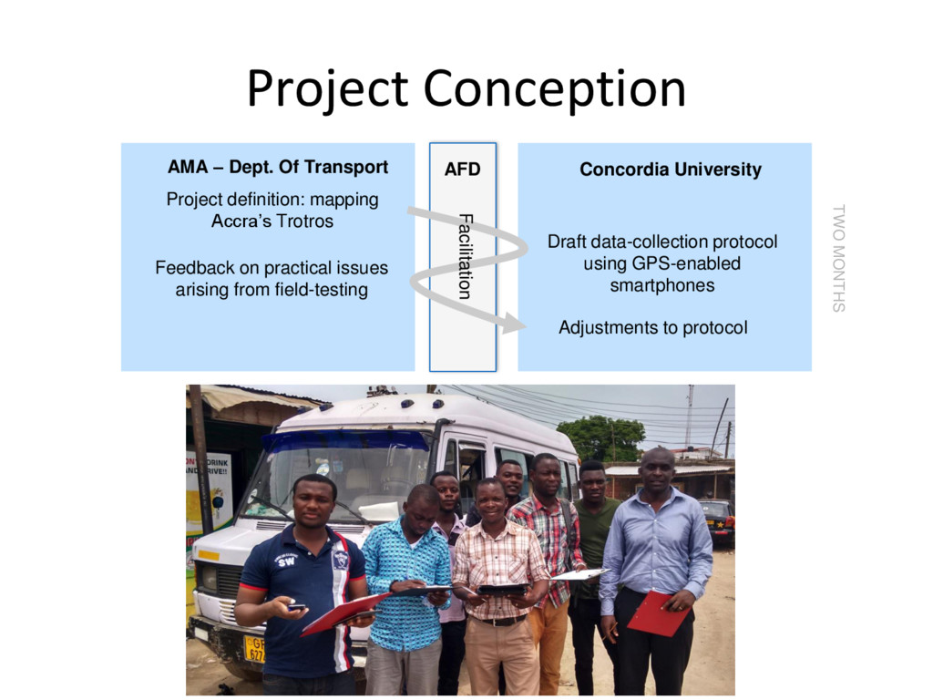
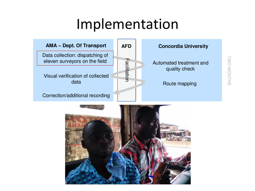
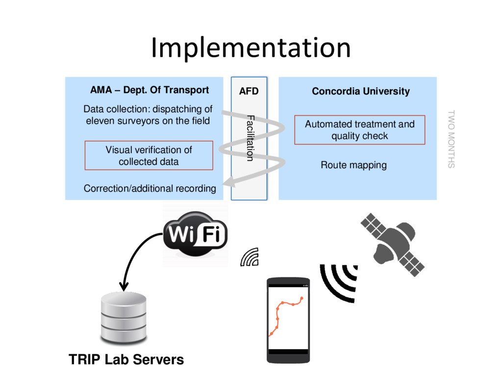
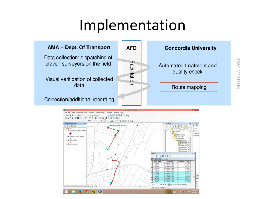
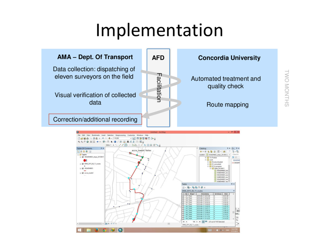
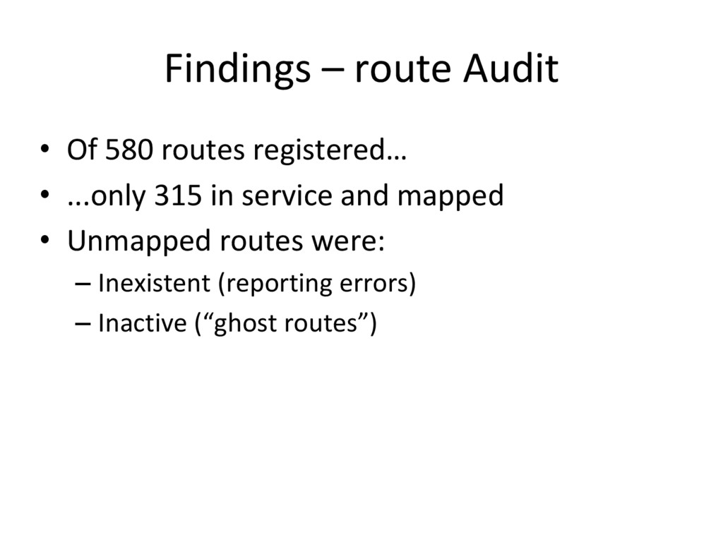
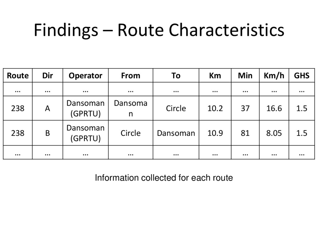
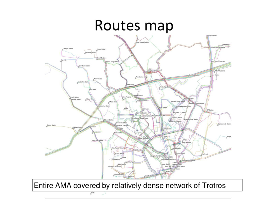
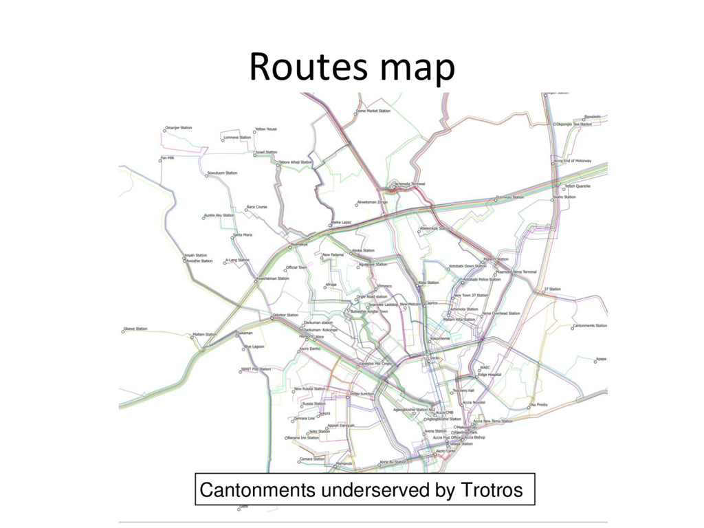
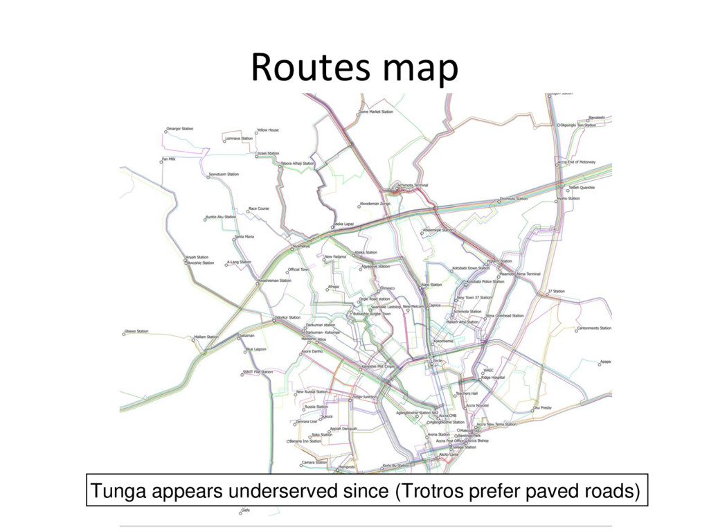
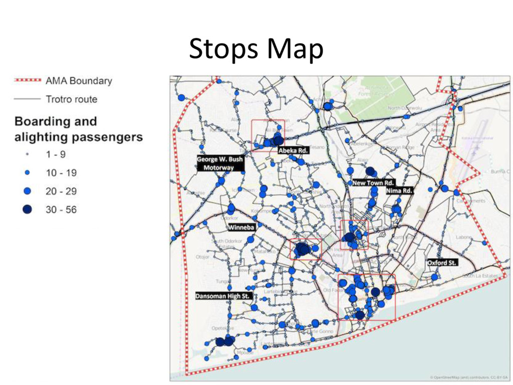
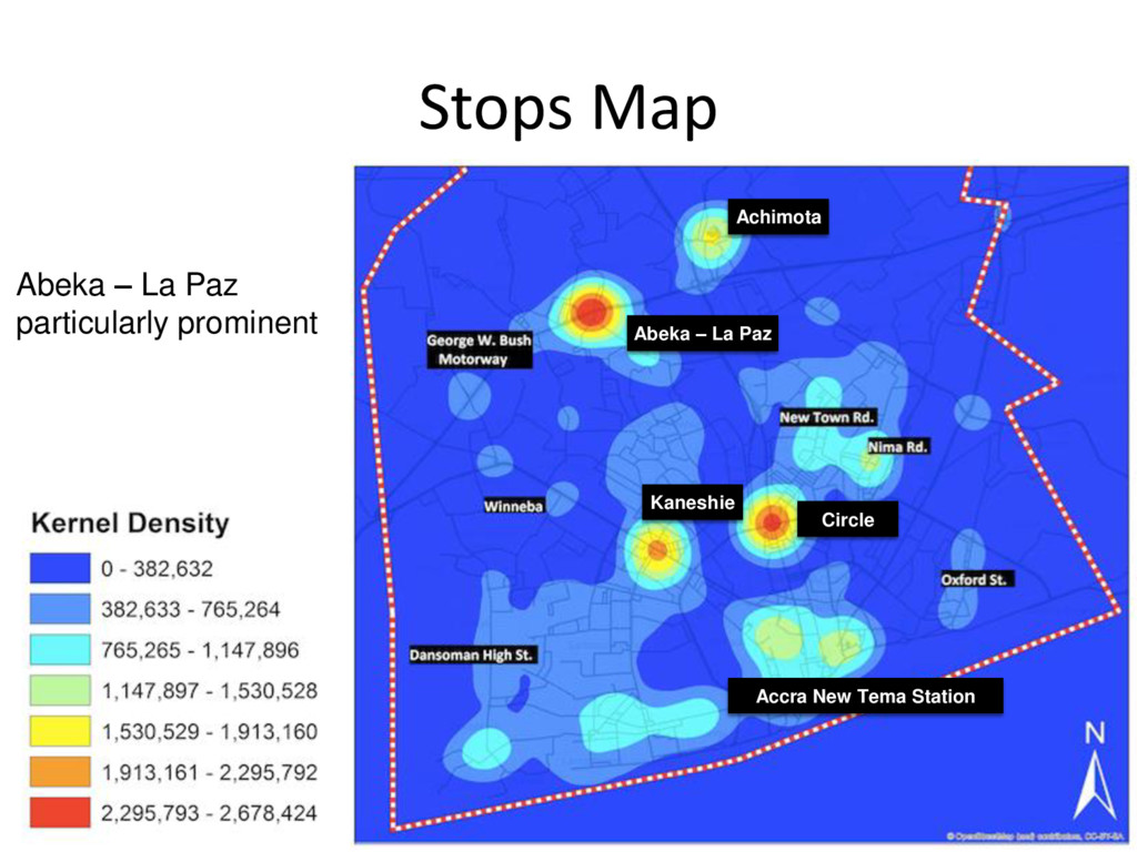
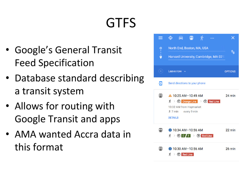
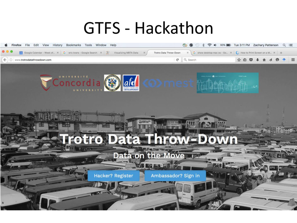
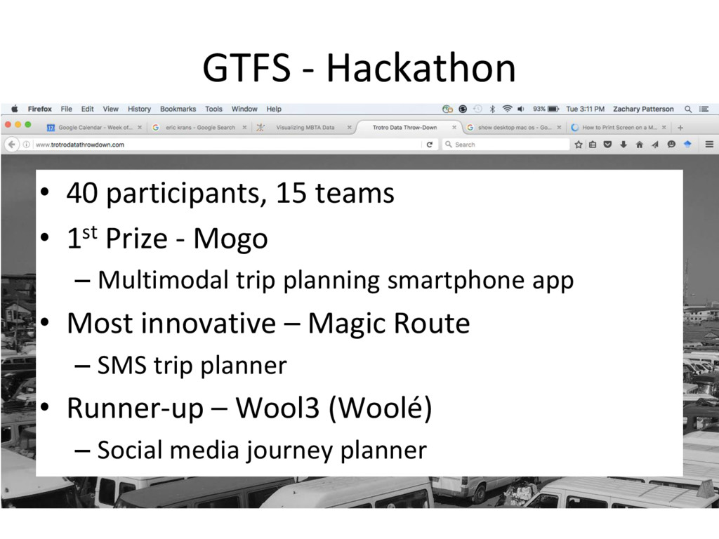
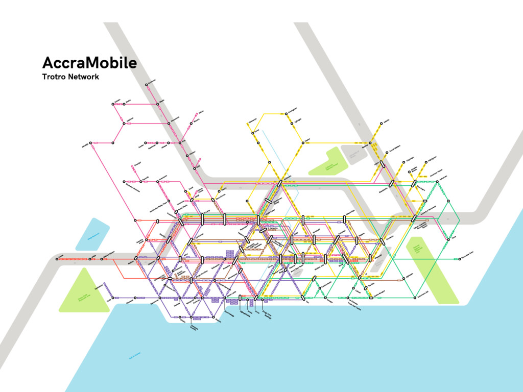
The presentation focuses on the two phases of the AccraMobile Project - a collaboration between the Accra Municipal Assembly (AMA), the Agence francaise de développement and Concordia University’s (Montreal, Canada) TRIP Lab. Impetus for the project originated from the AMA who sought to construct a documentary structure (route registry, protocols for data collection and mapping) for planning and passenger use of the Trotro bus network of Accra in Ghana. Phase 1 of the project involved: the adaptation of the TRIP Lab’s smartphone travel survey app, DataMobile; development of a data collection protocol; administration of Trotro route data collection; and the dynamic mapping of the routes. Data from Phase 1 has subsequently been trans- formed into Google’s General Transit Feed Specification (GTFS) format, and made accessible to the local community through a hackathon and map designed to be easily readable to Trotro users. While Phase 1 sought to gather information on the nature and breadth of the Trotro network for planning purposes, Phase 2 is directed primarily towards Trotro operators. It involves a great deal of engagement with operators with the aim of better understanding Trotro operations and developing business cases to finance a feet renewal program.

SecondaryCities

June 15, 2016
Tweet

More Decks by SecondaryCities

Other Decks in Technology

Transcript

  1. Dynamic Mapping of Secondary Cities Symposium Center for Geographic Analysis

    Harvard University 15 June 2016 Zachary Patterson, PhD Concordia University Using Smartphones for Dynamic Mapping and Planning of Transit Systems in Africa
  2. Research in the TRIP Lab 3 Three streams: • Statistical

    modeling and GIS • Discrete Choice Experiments in transport planning • Use of new technologies in data collection
  3. The Geographic Data Revolution • Five innovations have revolutionized how

    we collect locational data 1. GPS (satellites) 2. The Smartphone 3. Smartphone locational sensors (GSM, WIFI, GPS) 4. Smartphone ‘apps’ 5. The Internet
  4. Smartphones and Locational Data Database The result: we can collect

    locational data, easily, anywhere in the world
  5. Trotros in Accra - Background • Accra Municipal Assembly –

    Registers routes, drivers and vehicles – Sets harmonized fares • Operator Unions – Operate out of dedicated terminals – Deliver transport services (Trotros) – Negotiate fares 8
  6. AccraMobile Project - Background • Accra Municipal Assembly had: –

    List of routes – Origin and destination terminus – Regulated fare • …but lacked information on... – Routes in service – Actual route (itinerary) – Stops – Actual fares
  7. AccraMobile Objectives – Phase I • Use smartphone technologies to:

    1. Audit existing routes 2. Map existing route itineraries • Distances • Travel times 3. Collect stop data • Location • Name • Boardings/Alightings • Fare
  8. Smartphone Solutions • 10 Android SGH-S730M 3G (USD 65) provided

    by TRIP Lab • 10 additional power banks (USD 20) • Two free smartphone applications were used to collect Trotro data 1. DataMobile 2. TapLog
  9. Tap Log • A personal event logger • Logs events

    and associated information • …including locational data
  10. Tap Log Can record: • An event… • ...at a

    location... • ...with information about the event.
  11. Smartphone Apps Used 1. DataMobile used to collect • Route

    itineraries • Distances and travel times 2. TapLog used to collect • Stop location and name • Boardings and alightings • Fares
  12. Scope of Project – Phase I • Unique routes (duplicates

    removed) • Registered (sanctioned) routes • Origin and destination terminus in AMA – No long-distance routes • Inbound and outbound mapped separately • 580 routes (in both directions) in initial list
  13. Project Conception AMA – Dept. Of Transport Concordia University AFD

    Project definition: mapping Accra’s Trotros Draft data-collection protocol using GPS-enabled smartphones Feedback on practical issues arising from field-testing Adjustments to protocol TWO MONTHS Facilitation
  14. Implementation AMA – Dept. Of Transport Concordia University AFD TWO

    MONTHS Facilitation Data collection: dispatching of eleven surveyors on the field Visual verification of collected data Correction/additional recording Automated treatment and quality check Route mapping
  15. Implementation AMA – Dept. Of Transport Concordia University AFD TWO

    MONTHS Facilitation Data collection: dispatching of eleven surveyors on the field Visual verification of collected data Correction/additional recording Automated treatment and quality check Route mapping TRIP Lab Servers
  16. Implementation AMA – Dept. Of Transport Concordia University AFD TWO

    MONTHS Facilitation Data collection: dispatching of eleven surveyors on the field Visual verification of collected data Correction/additional recording Automated treatment and quality check Route mapping
  17. Implementation AMA – Dept. Of Transport Concordia University AFD TWO

    MONTHS Facilitation Data collection: dispatching of eleven surveyors on the field Visual verification of collected data Correction/additional recording Automated treatment and quality check Route mapping
  18. Findings – route Audit • Of 580 routes registered… •

    ...only 315 in service and mapped • Unmapped routes were: – Inexistent (reporting errors) – Inactive (“ghost routes”)
  19. Findings – Route Characteristics Route Dir Operator From To Km

    Min Km/h GHS … … … … … … … … … 238 A Dansoman (GPRTU) Dansoma n Circle 10.2 37 16.6 1.5 238 B Dansoman (GPRTU) Circle Dansoman 10.9 81 8.05 1.5 … … … … … … … … … Information collected for each route
  20. Findings – Route Characteristics N=629 Length Time Km In/Out Diff

    Minutes In/Out Diff Minimum 1.06 0.00 3 0 Maximum 38.71 11.22 128 59 Mean 10.03 1.21 38 12 Median 7.56 0.64 34 7
  21. Findings – Route Characteristics N=629 Speed Fare Km/h In/out Diff

    GHS In/out Diff Minimum 4.17 0.01 0.50 0.00 Maximum 59.24 41.74 8.00 4.50 Mean 16.07 4.72 1.67 0.14 Median 14.59 3.62 1.50 0.00
  22. Stops Map Warmer colours represent more frequented areas. Achimota Circle

    Kaneshie Abeka – La Paz Accra New Tema Station
  23. Stops Map Achimota Abeka – La Paz particularly prominent Circle

    Kaneshie Abeka – La Paz Accra New Tema Station
  24. AccraMobile Objectives – Phase II • Make Trotro route data

    more accessible – GTFS – User-friendly map • In-depth knowledge of routes and operations – Route itinerary variation – Estimates of total transit supply
  25. GTFS • Google’s General Transit Feed Specification • Database standard

    describing a transit system • Allows for routing with Google Transit and apps • AMA wanted Accra data in this format
  26. GTFS - Hackathon • 40 participants, 15 teams • 1st

    Prize - Mogo – Multimodal trip planning smartphone app • Most innovative – Magic Route – SMS trip planner • Runner-up – Wool3 (Woolé) – Social media journey planner
  27. GTFS -> User Map • Difficult for Trotro users to

    interpret • Useful to planners and authorities
  28. GTFS -> User Map • With GTFS data… • ...Postgres/PostGIS

    • …QGIS... • ...a Fine Arts student.. • and Illustrator...
  29. Route Variation • Phase I provided a snapshot of Trotro

    system • A critical question for users: – Do routes always take the same roads? – Do they always take the same amount of time? • One goal of Phase II was to understand just how much variation
  30. Route Variation While not all results are in, there is

    perhaps less variation than feared. Route 271 to downtown
  31. Total Transit Supply • Trotro map indicates extent of the

    system • Route variation provides estimate of reliability • Total transit supply is unknown • Phase II will allow estimates of total supply
  32. Total Transit Supply • The system is organized around terminals

    • Terminals are divided into substations
  33. Total Transit Supply • A substation houses: – ~6 routes

    – ~50 Trotros • Trotros allocated to routes on boards • Record of boards provides all activity • This info + maps can lead to supply estimates Example of route assignment board
  34. Conclusions • AccraMobile project demonstrated: – Successful use of collaborative

    technologies for teams working far apart on dynamic mapping – Technological leapfrogging of planning techniques in Africa – Interest of using mobile technologies for transit planning in Accra • All with a very reasonable budget < GHS 27,500