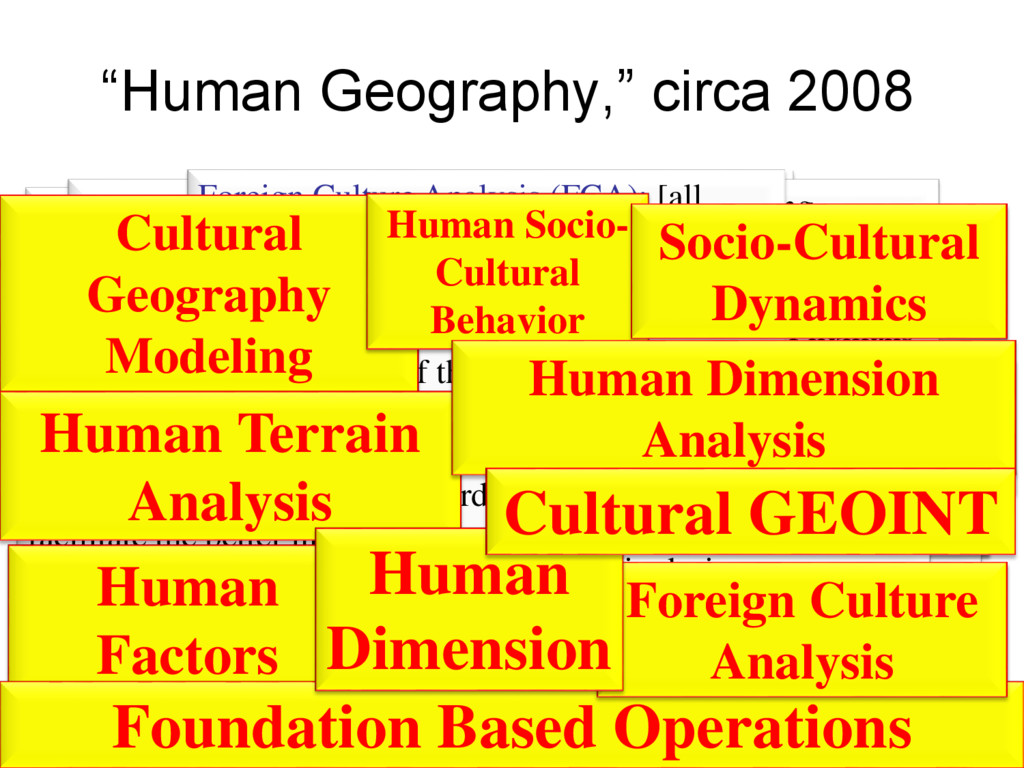
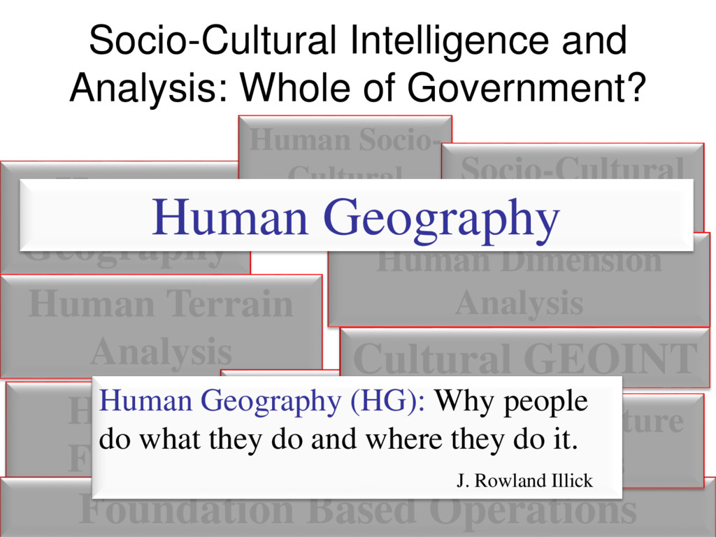
Socio- Cultural Behavior Cultural GEOINT Socio-Cultural Dynamics Human Dimension Analysis Human Dimension Foreign Culture Analysis Foundation Based Operations Human Dimension Human Dimension Analysis Human Factors Foreign Culture Analysis Human Terrain Analysis: a multi- disciplinary scientific approach to describe and predict geospatial and temporal patterns of human behavior by analyzing the attributes, actions, reactions, and interactions of groups or individuals in the context of their environment Human Terrain Analysis Socio-Cultural Dynamics Foundation Based Operations (FBO): incorporates demographics, ethnicity and tribes, religion, languages, economics, politics, and other data themes into the newly created HG Domain - Term used by NGA Foundation Based Operations Cultural GEOINT: this is the term used by Marine Corps Intelligence Activity (MCIA) to describe their efforts at geospatially describing and analyzing human terrain/factors/geography/etc. Cultural GEOINT Human Socio-Culture Behavior (HSCB): a modeling program used to enable DOD and USG to understand and effectively operate in the human terrain during non- conventional warfare and other missions Human Socio- Cultural Behavior Human Factors: the psychological, cultural, behavioral, and other human attributes that influence decision-making, information flow, and information interpretation by individuals or groups at any level in any state or organization Cultural Geography Modeling: Understanding and influencing the civilian population at the tactical level in support of current operations - Used by TRADOC Cultural Geography Modeling Cultural Geography Modeling Human Dimension: the presence, activities (including transactions – both physical and virtual), culture, social structure/organization, networks and relationships, motivation, intent, vulnerabilities, and capabilities of humans (single or groups) across all domains of the operational environment (space, air, maritime, ground, and cyber) Foreign Culture Analysis (FCA): [all source analysis of] shared demographics, norms, values, institutions and artifacts which assists in anticipating the actions of population within the operating environment Human Dimension Analysis: the effective understanding of anything associated with the Human Dimension, across all five domains, that could impact the security, safety, economy, or environment Socio-cultural Dynamics (SCD): information about the social, cultural, and behavioral factors characterizing the relationships and activities of the population of a specific region or operational environment. -Initially employed by DIA in order to facilitate the better intelligence analysis of foreign populations in relation to DOD missions and threats Cultural Geography Modeling Human Factors Human Terrain Analysis Human Socio- Cultural Behavior Socio-Cultural Dynamics Foundation Based Operations Human Dimension Analysis Foreign Culture Analysis Human Dimension Cultural GEOINT