Upgrade to Pro — share decks privately, control downloads, hide ads and more …

The Quito Comparative Communities Project

The Quito Comparative Communities Project

Drones provide ready mapping inputs, computer analysis adds detailed data.

SecondaryCities

June 15, 2016
Tweet

More Decks by SecondaryCities

Other Decks in Technology

Transcript

  1. © 2016 Gabriel Munoz Moreno THE QUITO COMPARATIVE COMMUNITIES PROJECT

    DRONES PROVIDE READY MAPPING INPUTS COMPUTER ANALYSIS ADDS DETAILED DATA
  2. Two communities in Quito were compared both started in 1980,

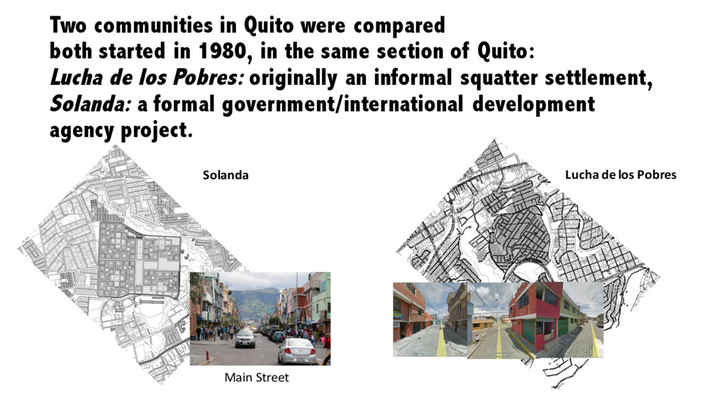
    in the same section of Quito: Lucha de los Pobres: originally an informal squatter settlement, Solanda: a formal government/international development agency project. scale 1:--- 0 15 30 50 200 m 100 N Solanda Lucha de los Pobres Main Street
  3. © 2016 Gabriel Munoz Moreno DRONES IN COMMUNITY MAPPING Drone:

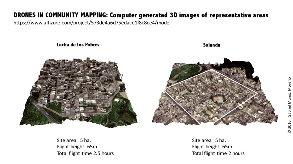
    Phantom Professional Camera: Stabilized camera GoPro Hero 4 Software: Agisoft PhotoScan 1.2.5 Mapping of the two communities was done with multiple drone passes to increase the resolution for the 3D image generated. (Battery life is critical because of short effective flight times)
  4. © 2016 Gabriel Munoz Moreno Site area 5 ha. Flight

    height 65m Total flight time 2.5 hours Site area 5 ha. Flight height 65m Total flight time 2 hours Lucha de los Pobres Solanda DRONES IN COMMUNITY MAPPING: Computer generated 3D images of representative areas https://www.altizure.com/project/573de4a6d75edace1f8c8ce4/model
  5. © 2016 Gabriel Munoz Moreno DRONES IN COMMUNITY MAPPING Building

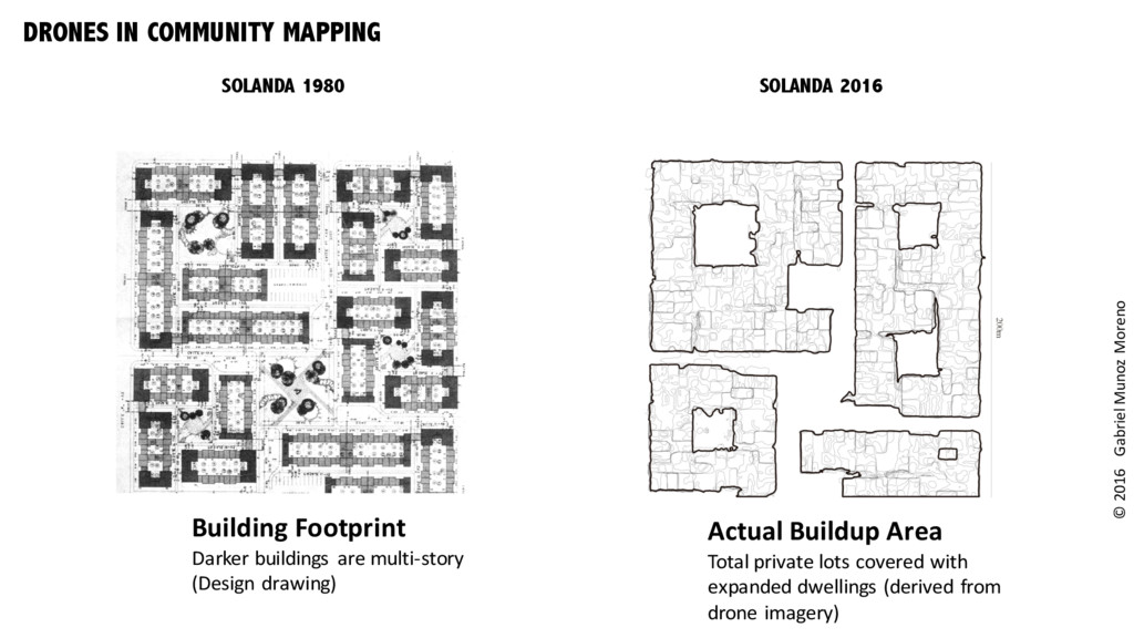
    Footprint Darker buildings are multi-story (Design drawing) Actual Buildup Area Total private lots covered with expanded dwellings (derived from drone imagery) SOLANDA 1980 SOLANDA 2016
  6. © 2016 Gabriel Munoz Moreno Various Analysis Routines May be

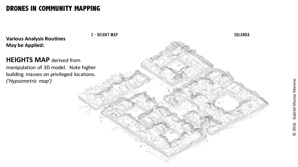
    Applied: HEIGHTS MAP derived from manipulation of 3D model. Note higher building masses on privileged locations. (‘Hypsometric map’) DRONES IN COMMUNITY MAPPING
  7. © 2016 Gabriel Munoz Moreno DRONES IN COMMUNITY MAPPING Various

    Analysis Routines May be Applied: SUN AND VENTILATION ANALYSIS X/Y - SECTIONS
  8. © 2016 Gabriel Munoz Moreno DRONES IN COMMUNITY MAPPING Various

    Analysis Routines May be Applied: STRUCTURAL ANALYSIS BASED ON THE GRID GENERATED BY FINDING VERTEX AND EDGES ON THE MODEL
  9. © 2016 Gabriel Munoz Moreno DRONES IN COMMUNITY MAPPING Various

    Analysis Routines May be Applied: BY CALCULATING THE INCREASE IN SURFACE, IT IS POSSIBLE TO CALCULATE THE MATERIAL INPUT NEEDED FOR THAT INCREASE.