Upgrade to Pro — share decks privately, control downloads, hide ads and more …

Building the Next Generation Water Data Viewer - Water Data Interactive (WDI)

Building the Next Generation Water Data Viewer - Water Data Interactive (WDI)

Ginny Vragel and Richard Winkelbauer - Texas Water Development Board

More Decks by Texas Natural Resources Information System

Other Decks in Technology

Transcript

  1. Building  the  Next  Genera1on     Water  Data  Viewer  

    Water  Data  Interac1ve  (WDI)   Ginny  Vragel,  Texas  Water  Development  Board   Richard  Winkelbauer   1  
  2. Architecture   4   •  ArcGIS  Server  10.3  in  the

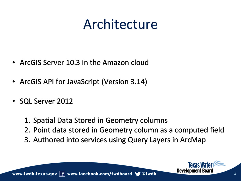
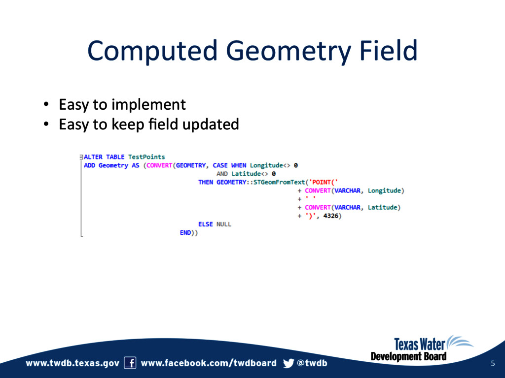
     Amazon  cloud   •  ArcGIS  API  for  JavaScript  (Version  3.14)   •  SQL  Server  2012     1.  Spa3al  Data  Stored  in  Geometry  columns   2.  Point  data  stored  in  Geometry  column  as  a  computed  field   3.  Authored  into  services  using  Query  Layers  in  ArcMap  
  3. Computed  Geometry  Field   5   •  Easy  to  implement

      •  Easy  to  keep  field  updated  
  4. What  worked  well  for  us   6   •  ArcGIS

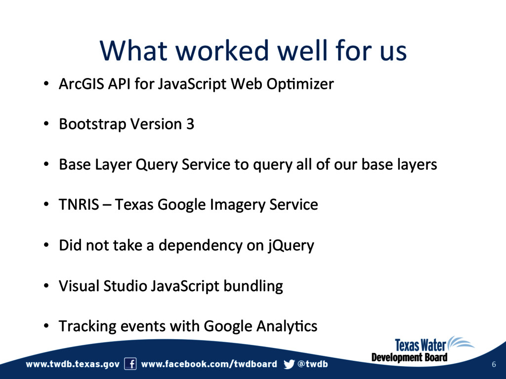
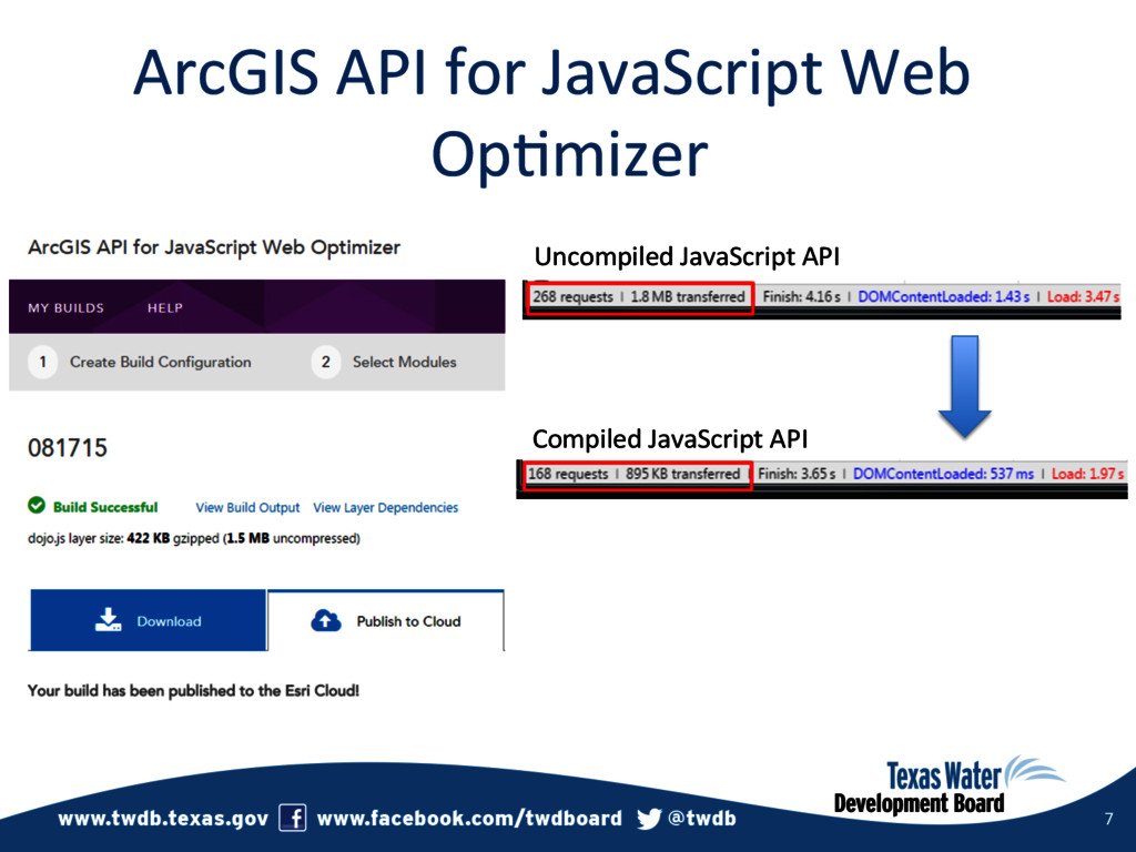
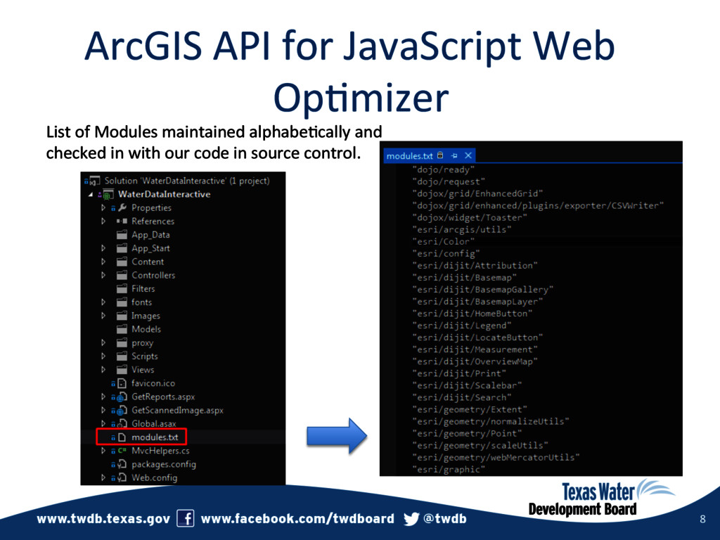
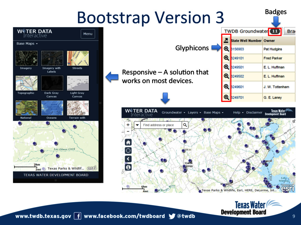
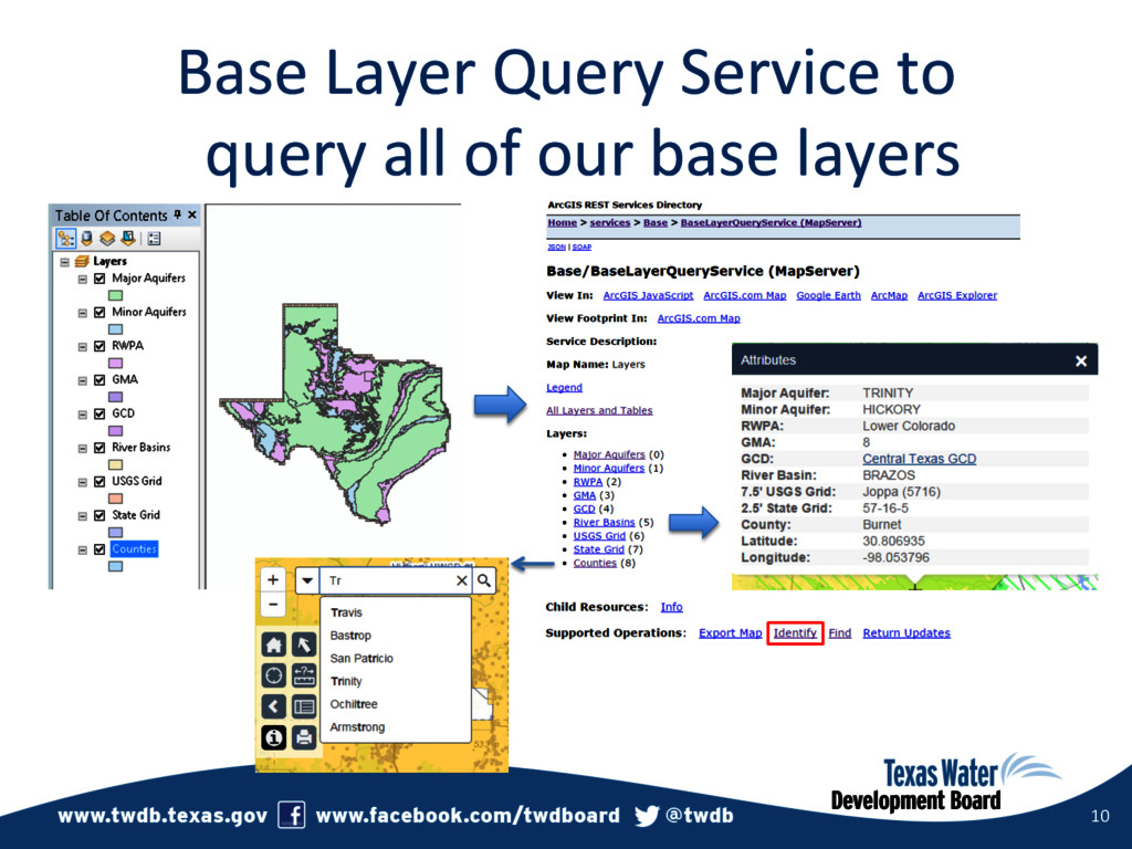
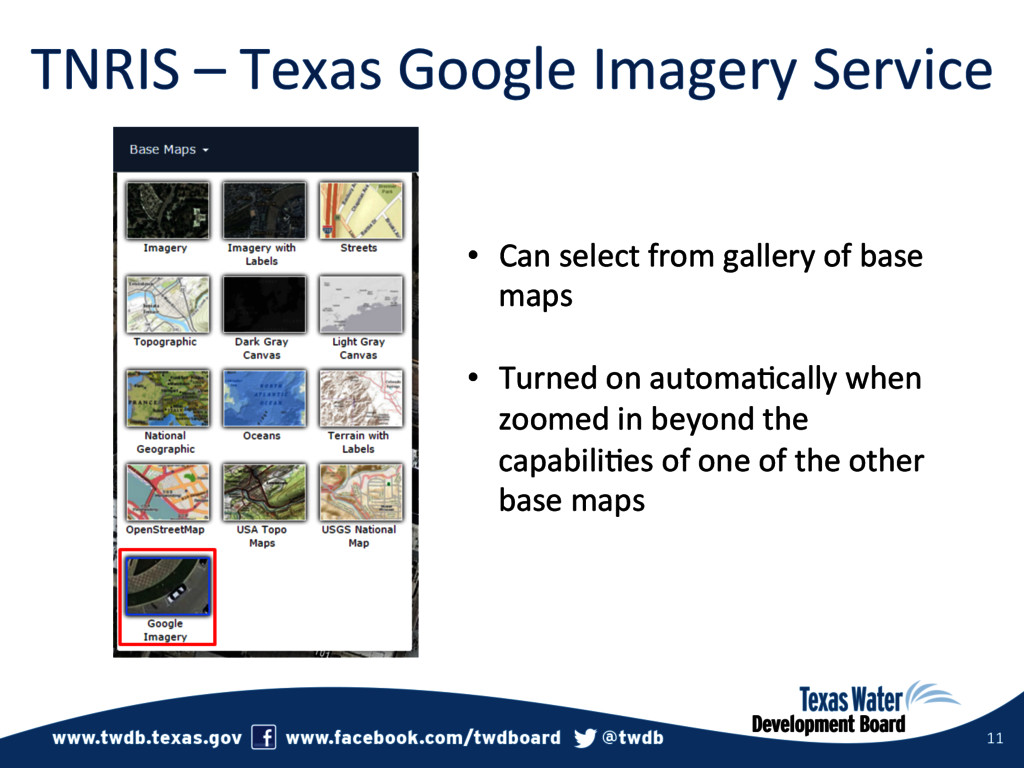
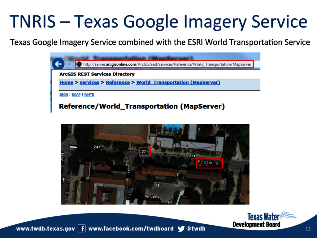
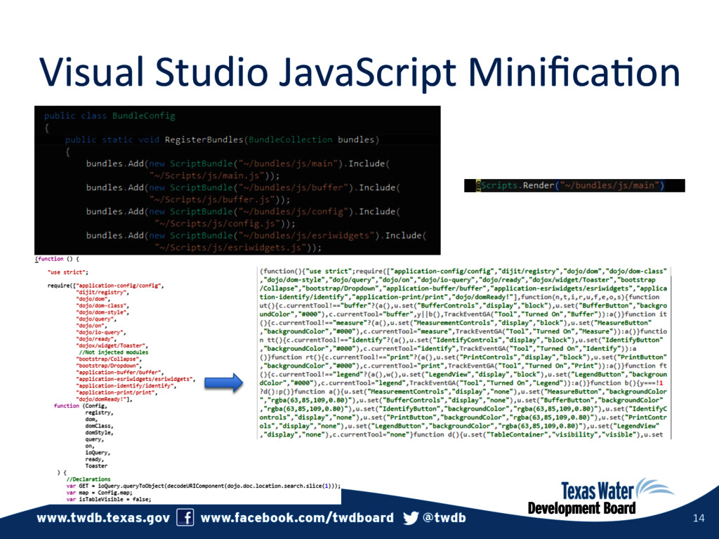
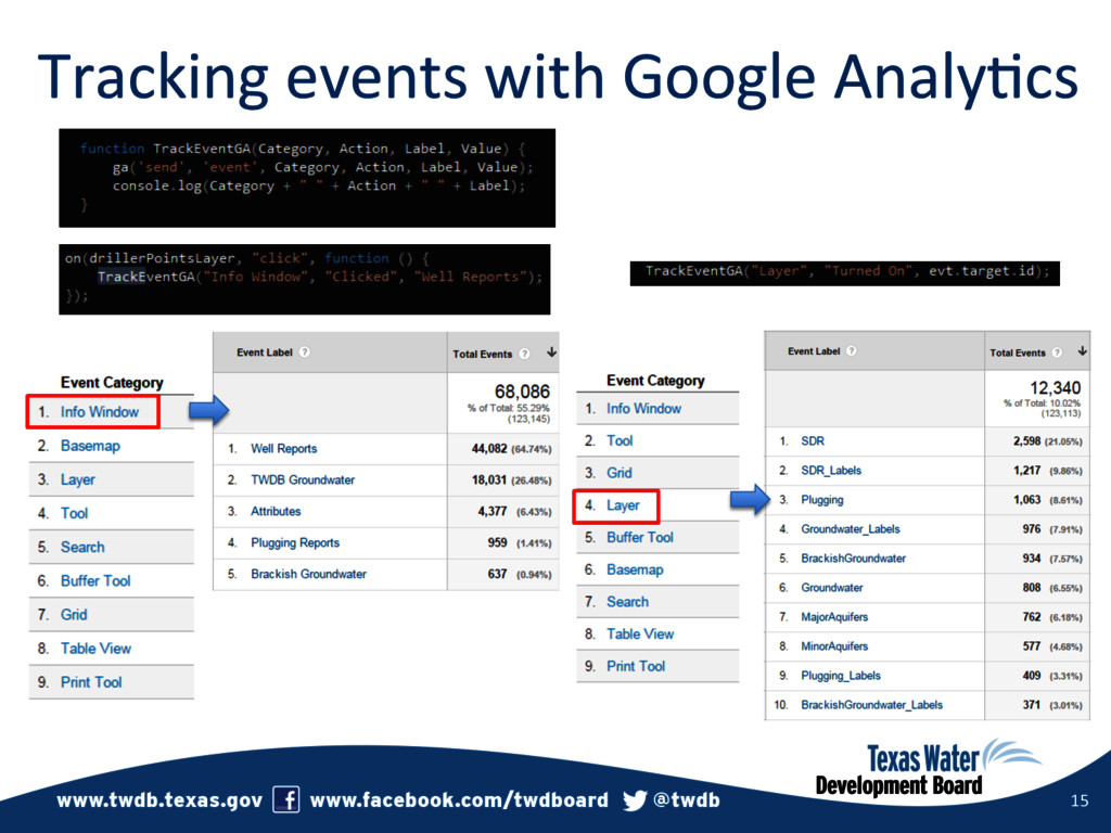
     API  for  JavaScript  Web  Op3mizer   •  Bootstrap  Version  3   •  Base  Layer  Query  Service  to  query  all  of  our  base  layers   •  TNRIS  –  Texas  Google  Imagery  Service   •  Did  not  take  a  dependency  on  jQuery   •  Visual  Studio  JavaScript  bundling   •  Tracking  events  with  Google  Analy3cs  
  5. ArcGIS  API  for  JavaScript  Web   Op3mizer   7  

    Uncompiled  JavaScript  API   Compiled  JavaScript  API  
  6. ArcGIS  API  for  JavaScript  Web   Op3mizer   8  

    List  of  Modules  maintained  alphabe3cally  and   checked  in  with  our  code  in  source  control.  
  7. Bootstrap  Version  3   9   Responsive  –  A  solu3on

     that   works  on  most  devices.   Glyphicons   Badges  
  8. TNRIS  –  Texas  Google  Imagery  Service   11   • 

    Can  select  from  gallery  of  base   maps   •  Turned  on  automa3cally  when   zoomed  in  beyond  the   capabili3es  of  one  of  the  other   base  maps  
  9. TNRIS  –  Texas  Google  Imagery  Service   12   Texas

     Google  Imagery  Service  combined  with  the  ESRI  World  Transporta3on  Service  
  10. Did  not  take  a  dependency  on  jQuery   13  

    Dojo  handles  the  DOM  manipula3on  as  well