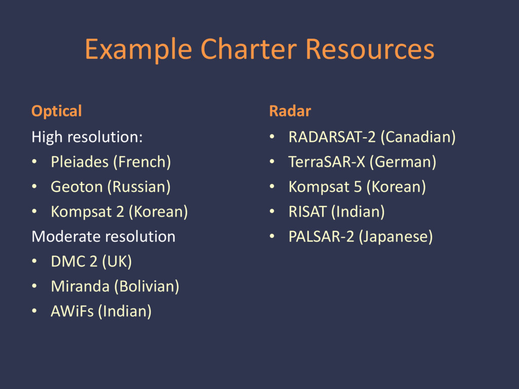
wet for major fires this year • Major floods of 2016: • March (TX & LA) • April (TX) • May/June (TX) • August (LA) • Airplanes: Texas Civil Air Patrol • Satellites: International Charter & US assets
CDT Texas Task Force 1 Texas Division of Emergency Management Texas Commission on Environmental Quality Texas Railroad Commission Texas Department of Transportation Texas Military Department Texas Department of Public Safety Texas A&M Forest Service Texas Public Utility Commission Texas General Land Office Texas Department of Criminal Justice Texas Parks & Wildlife Department Federal Emergency Management Agency NOAA - National Weather Service U.S. Geological Survey U.S. Army Corps of Engineers U.S. Department of Agriculture American Red Cross
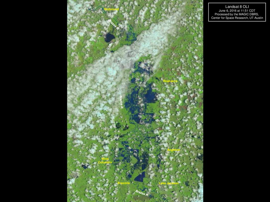
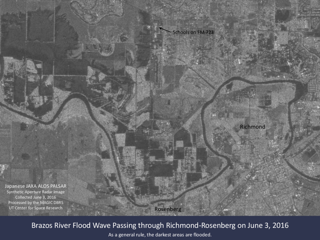
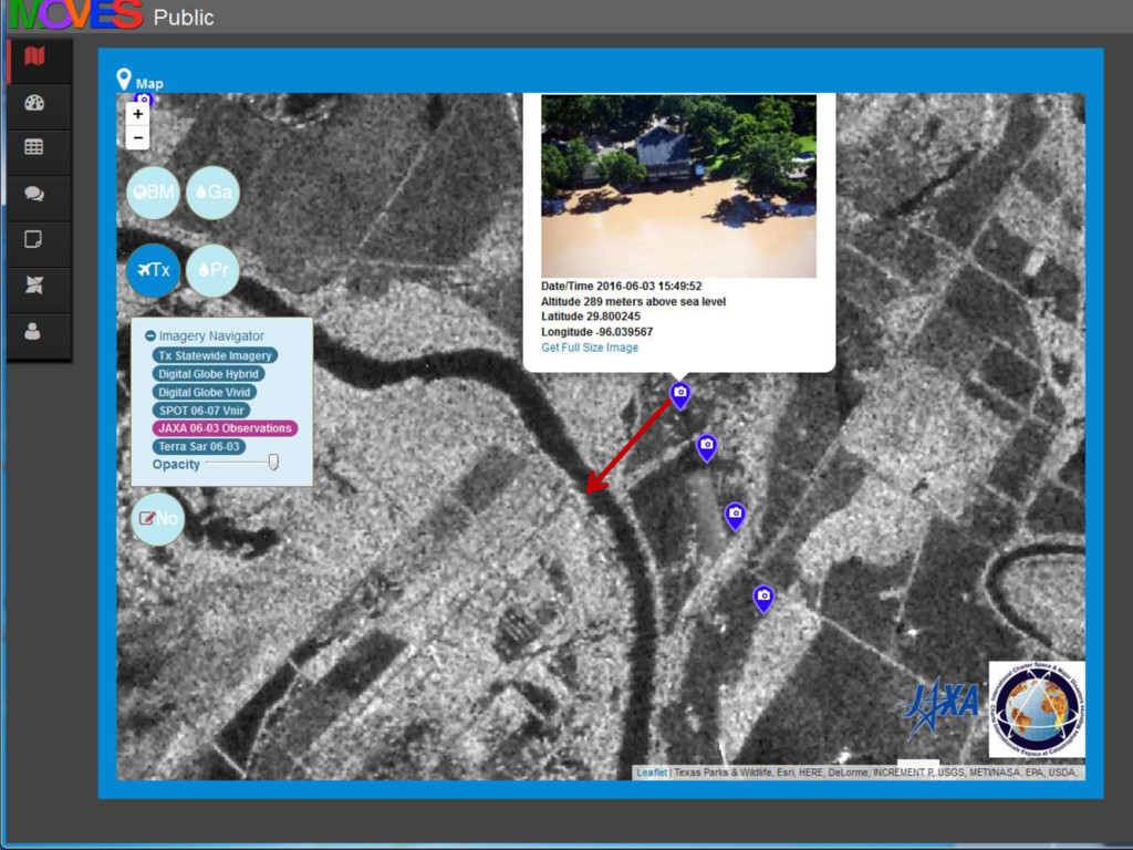
Passing through Richmond-Rosenberg on June 3, 2016 As a general rule, the darkest areas are flooded. Japanese JAXA ALOS PALSAR Synthetic Aperture Radar Image Collected June 3, 2016 Processed by the MAGIC DBRS UT Center for Space Research
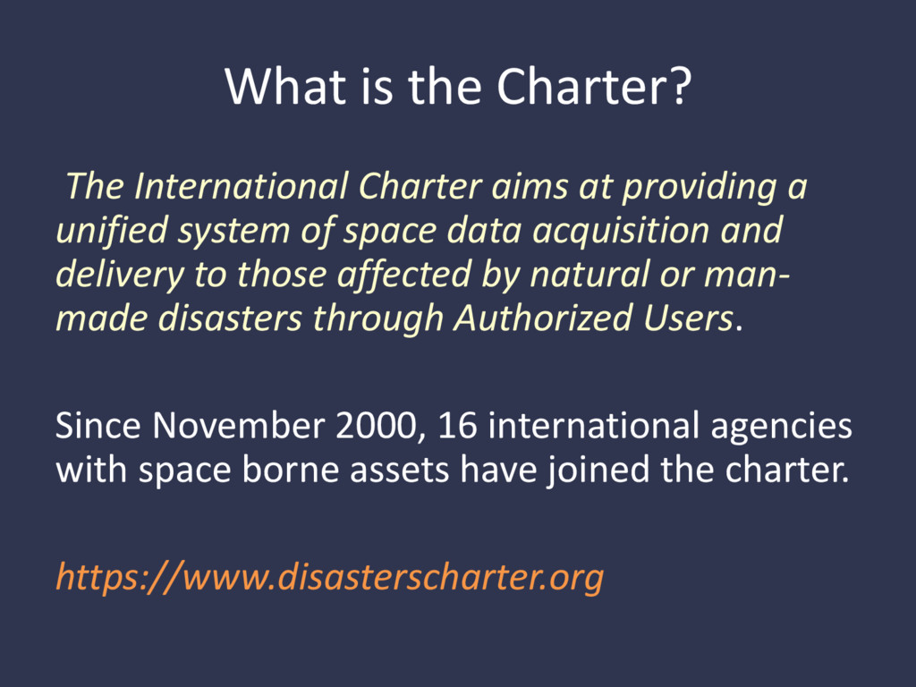
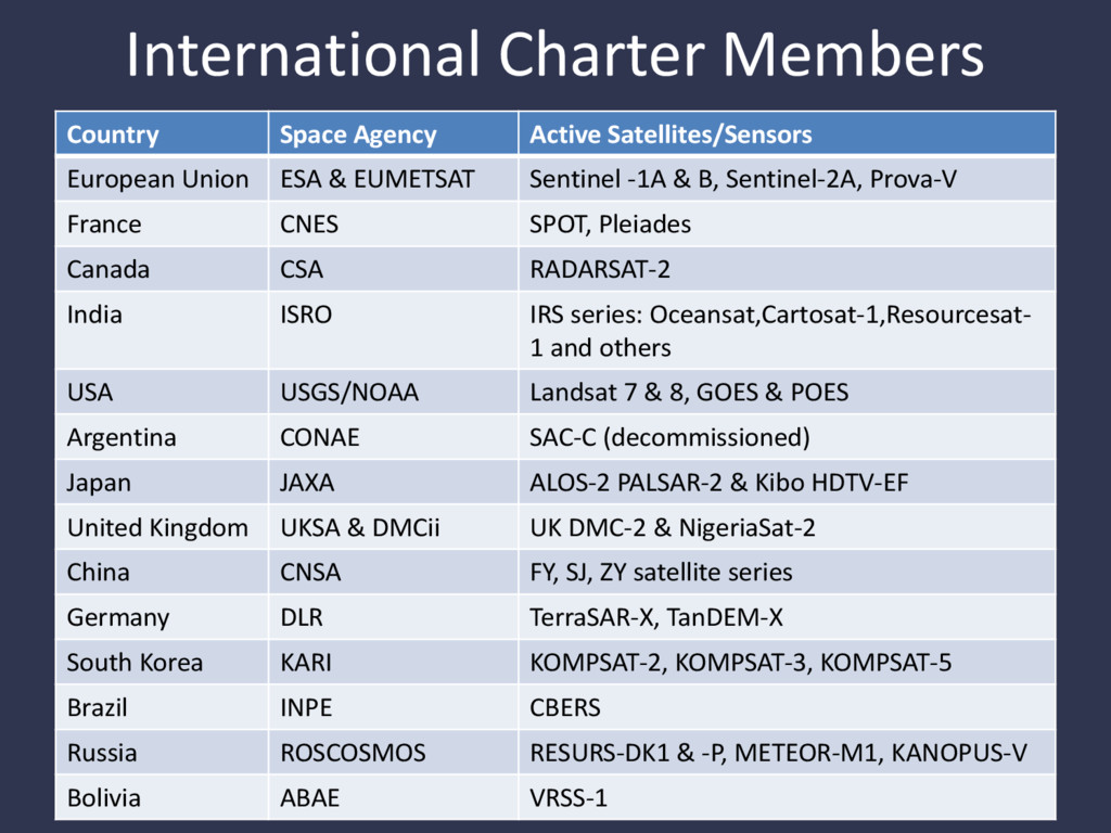
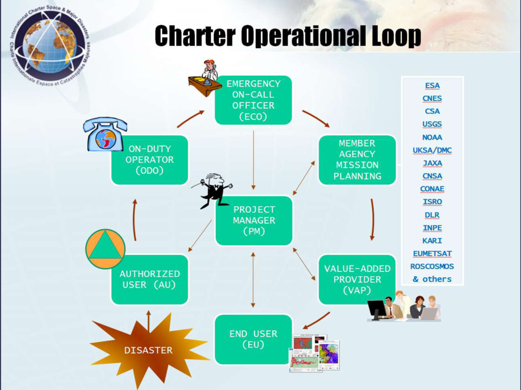
a unified system of space data acquisition and delivery to those affected by natural or man- made disasters through Authorized Users. Since November 2000, 16 international agencies with space borne assets have joined the charter. https://www.disasterscharter.org
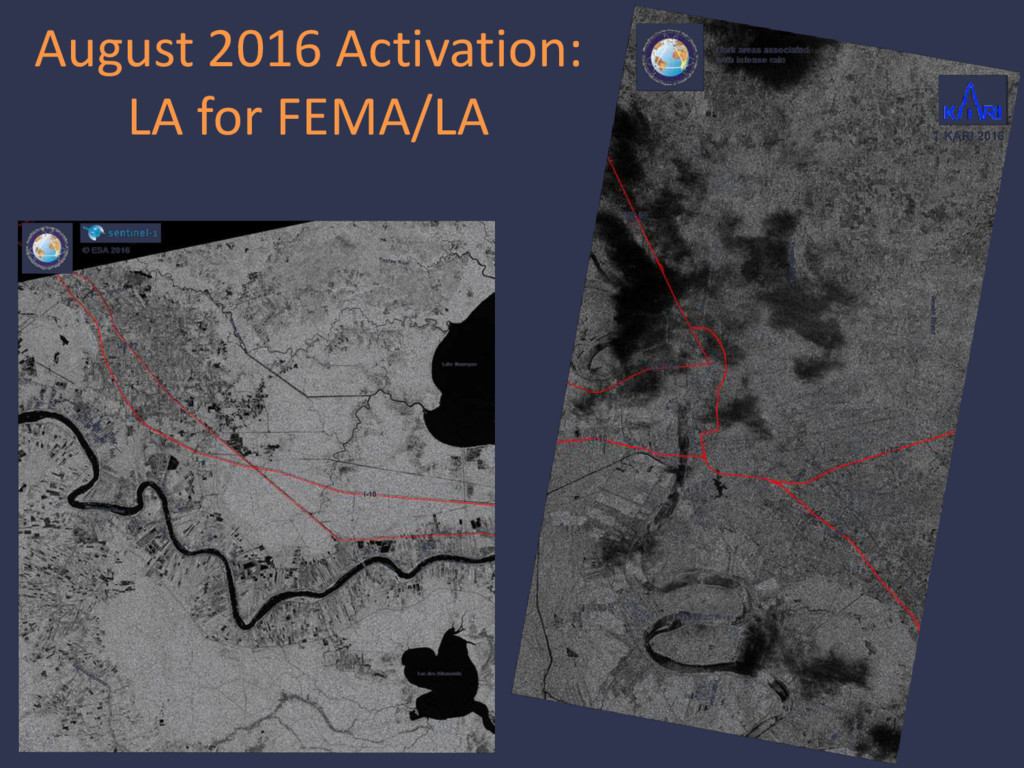
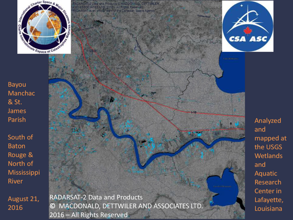
2016 – All Rights Reserved Bayou Manchac & St. James Parish South of Baton Rouge & North of Mississippi River August 21, 2016 Analyzed and mapped at the USGS Wetlands and Aquatic Research Center in Lafayette, Louisiana
![Questions? Contact us: Gordon Wells: [email protected] Teresa Howard: [email protected] Center](https://files.speakerdeck.com/presentations/4a2c37e28b7f4275b1122dd226fb6e9b/slide_44.jpg)