area organization of female geospatial professionals dedicated to awareness, education, and participation in Geography and Geographic Information Systems (GIS). SWIGGIS Austin is proud to organize and participate in local: • Charity Events & Scholarships • Professional Development Panels & Workshops • Social Hours & Networking • Youth & Peer Mentoring • Community Outreach for all things Geospatial Upcoming SWIGGIS Events are: • Wed Jan 23: New Year Social Hour @ Cover 3 on Anderson Ln @ 6pm • Wed Feb 6: 1st Planning MeeFng of the Year, Open to all with interest in SWIGGIS, online via Google Hangout @ 7:30 pm • Thurs Feb 28: Resume Review @ 7-8:30 pm LocaFon TBD • March (End of Month): Quarterly MeeFng with Tech presentaFon
Professionals from a variety of disciplines and backgrounds with the aim of fostering an environment conducive to sharing of ideas, continuing education, and networking. On June 23, 2012, URISA Texas was officially recognized as an organizing chapter of Urban and Regional Information Systems Association (URISA). URISA is a nonprofit association of professionals using Geographic Information Systems (GIS) and other information technologies to solve challenges in state/provincial, regional and local government agencies and departments. URISA is the premier organization for the use and integration of geospatial technology to improve the quality of life in urban and regional environments. As the Texas State Chapter our goal is to provide a platform for great ideas and people and to inspire leadership and achievement. We strive to provide exceptional educational experiences, a vibrant and connected community, and the essential resources you need to be successful in your career as a GIS professional. We welcome everyone interested in all aspects of GIS to get involved.
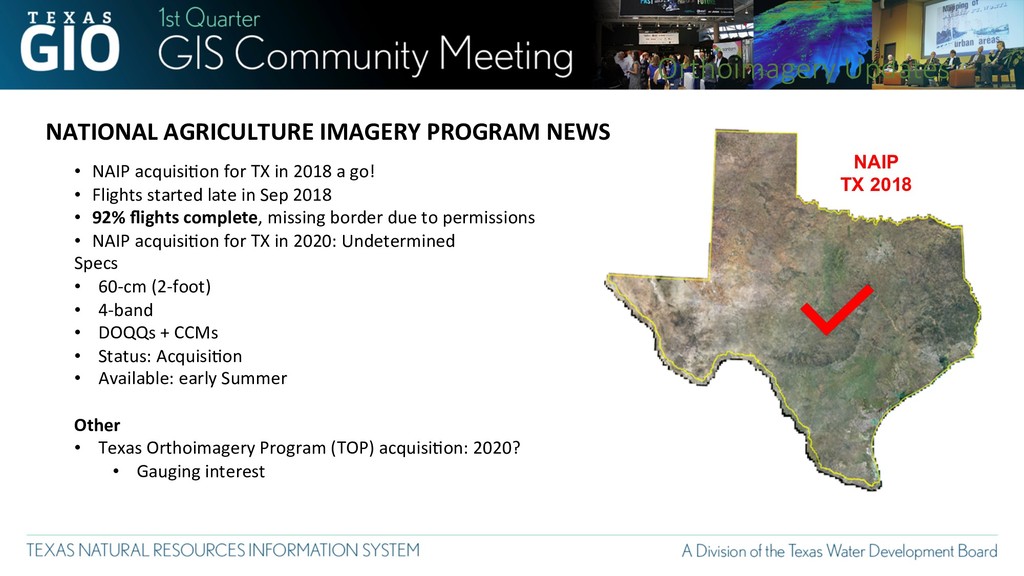
acquisiFon for TX in 2018 a go! • Flights started late in Sep 2018 • 92% flights complete, missing border due to permissions • NAIP acquisiFon for TX in 2020: Undetermined Specs • 60-cm (2-foot) • 4-band • DOQQs + CCMs • Status: AcquisiFon • Available: early Summer Other • Texas Orthoimagery Program (TOP) acquisiFon: 2020? • Gauging interest Orthoimagery Updates
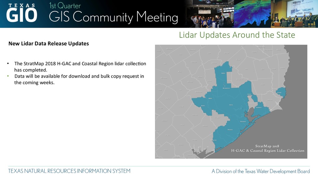
• The StratMap 2018 H-GAC and Coastal Region lidar collecFon has completed. • Data will be available for download and bulk copy request in the coming weeks.
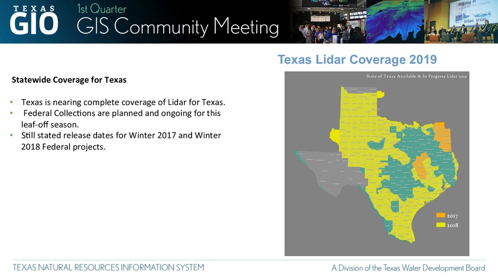
is nearing complete coverage of Lidar for Texas. • Federal CollecFons are planned and ongoing for this leaf-off season. • SFll stated release dates for Winter 2017 and Winter 2018 Federal projects.
Open Data Portal (ODP) Customers to New Socrata Platform. Planned Phase II activities. • Initiated Planning 2019 TX Government Data Forum • June 27, 2019 • Initiated Planning for 2019 Data Management Training • Analytics Accelerator • How to Lead with Data
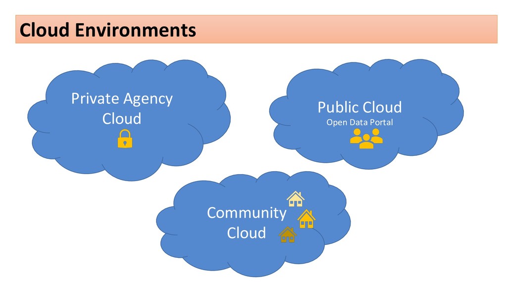
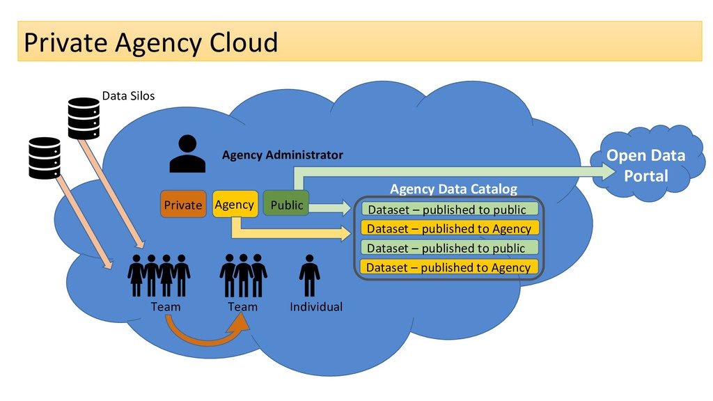
Team Agency Data Catalog Dataset – published to public Dataset – published to Agency Dataset – published to public Dataset – published to Agency Data Silos Open Data Portal
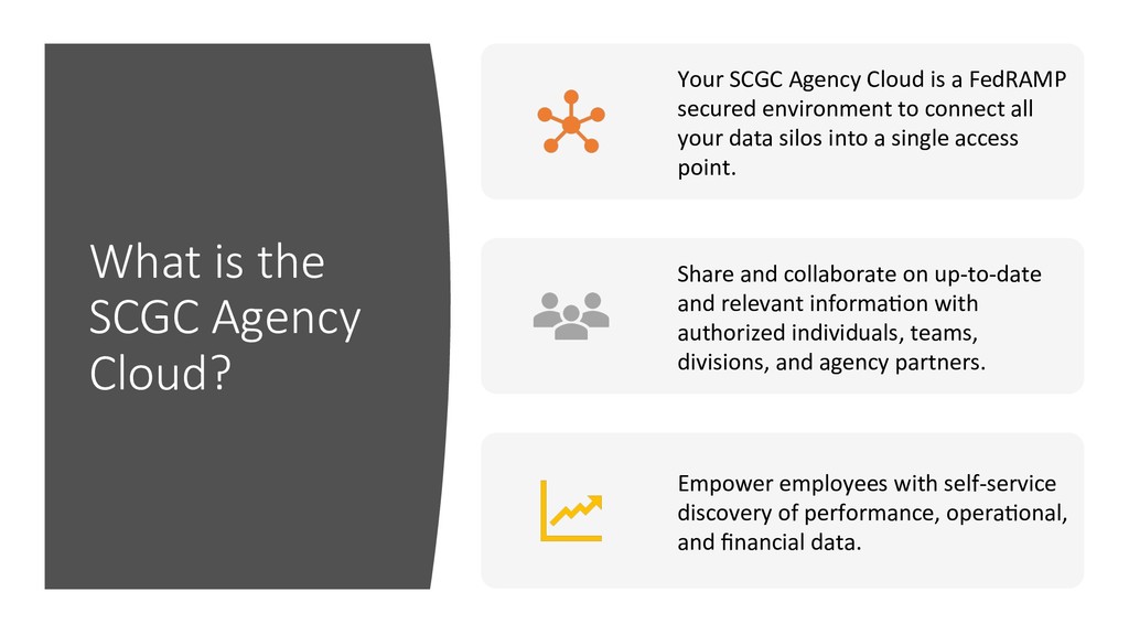
is a FedRAMP secured environment to connect all your data silos into a single access point. Share and collaborate on up-to-date and relevant informaFon with authorized individuals, teams, divisions, and agency partners. Empower employees with self-service discovery of performance, operaFonal, and financial data.
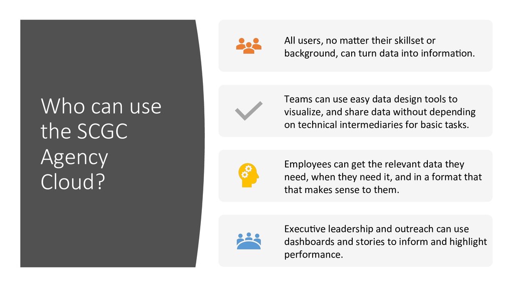
maler their skillset or background, can turn data into informaFon. Teams can use easy data design tools to visualize, and share data without depending on technical intermediaries for basic tasks. Employees can get the relevant data they need, when they need it, and in a format that that makes sense to them. ExecuFve leadership and outreach can use dashboards and stories to inform and highlight performance.
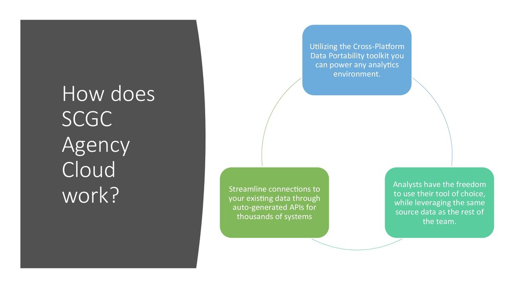
Portability toolkit you can power any analyFcs environment. Analysts have the freedom to use their tool of choice, while leveraging the same source data as the rest of the team. Streamline connecFons to your exisFng data through auto-generated APIs for thousands of systems
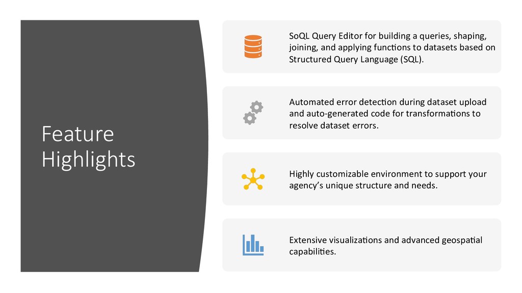
joining, and applying funcFons to datasets based on Structured Query Language (SQL). Automated error detecFon during dataset upload and auto-generated code for transformaFons to resolve dataset errors. Highly customizable environment to support your agency’s unique structure and needs. Extensive visualizaFons and advanced geospaFal capabiliFes.
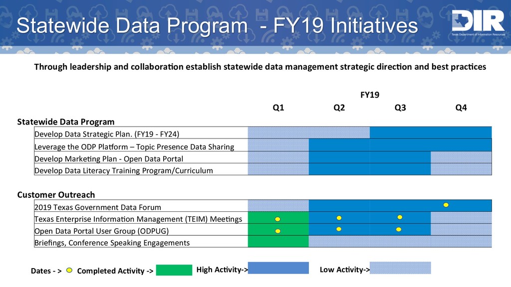
establish statewide data management strategic direc?on and best prac?ces FY19 Q1 Q2 Q3 Q4 Statewide Data Program Develop Data Strategic Plan. (FY19 - FY24) Leverage the ODP Plamorm – Topic Presence Data Sharing Develop MarkeFng Plan - Open Data Portal Develop Data Literacy Training Program/Curriculum Customer Outreach 2019 Texas Government Data Forum Texas Enterprise InformaFon Management (TEIM) MeeFngs Open Data Portal User Group (ODPUG) Briefings, Conference Speaking Engagements High Ac?vity-> Low Ac?vity-> Dates - > Completed Ac?vity ->
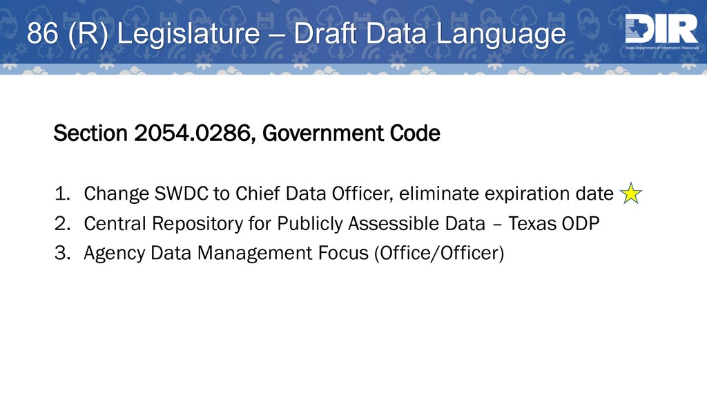
Code 1. Change SWDC to Chief Data Officer, eliminate expiration date 2. Central Repository for Publicly Assessible Data – Texas ODP 3. Agency Data Management Focus (Office/Officer)