Page • New Lidar 2016-2017 Project Page • Google Pilot – renewed for 18 months • Infogroup Enterprise License • SCAUG Conference – next week • Community Knowledge Base Texas GIS Community Meeting – 2nd Quarter
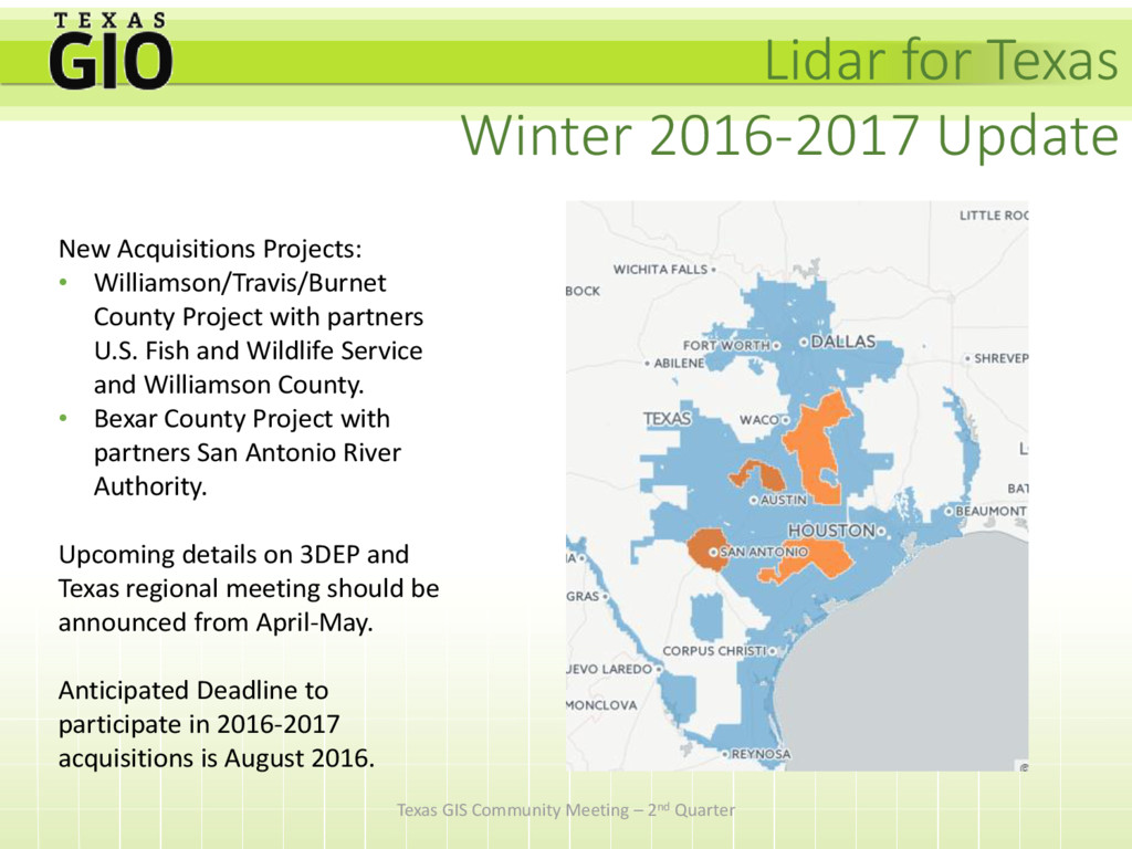
– 2nd Quarter New Acquisitions Projects: • Williamson/Travis/Burnet County Project with partners U.S. Fish and Wildlife Service and Williamson County. • Bexar County Project with partners San Antonio River Authority. Upcoming details on 3DEP and Texas regional meeting should be announced from April-May. Anticipated Deadline to participate in 2016-2017 acquisitions is August 2016.
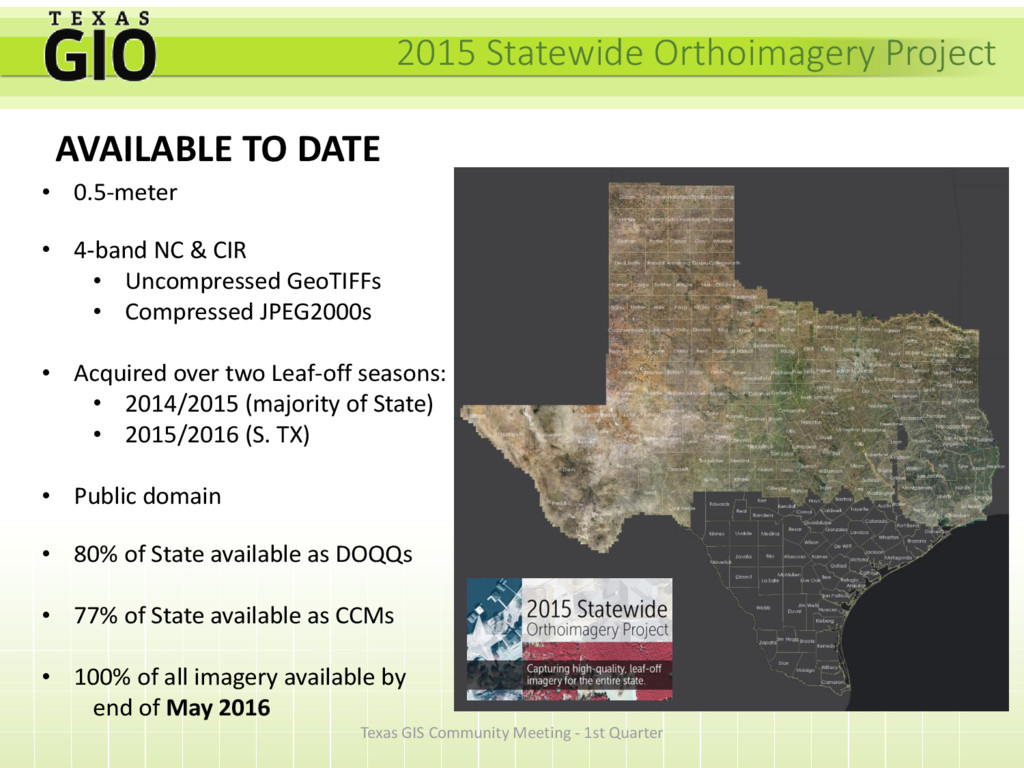
Quarter AVAILABLE TO DATE • 0.5-meter • 4-band NC & CIR • Uncompressed GeoTIFFs • Compressed JPEG2000s • Acquired over two Leaf-off seasons: • 2014/2015 (majority of State) • 2015/2016 (S. TX) • Public domain • 80% of State available as DOQQs • 77% of State available as CCMs • 100% of all imagery available by end of May 2016
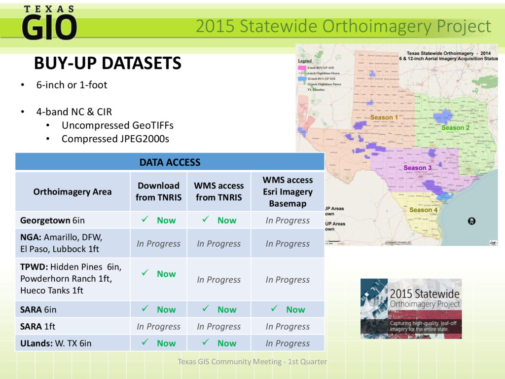
Quarter BUY-UP DATASETS • 6-inch or 1-foot • 4-band NC & CIR • Uncompressed GeoTIFFs • Compressed JPEG2000s DATA ACCESS Orthoimagery Area Download from TNRIS WMS access from TNRIS WMS access Esri Imagery Basemap Georgetown 6in Now Now In Progress NGA: Amarillo, DFW, El Paso, Lubbock 1ft In Progress In Progress In Progress TPWD: Hidden Pines 6in, Powderhorn Ranch 1ft, Hueco Tanks 1ft Now In Progress In Progress SARA 6in Now Now Now SARA 1ft In Progress In Progress In Progress ULands: W. TX 6in Now Now In Progress
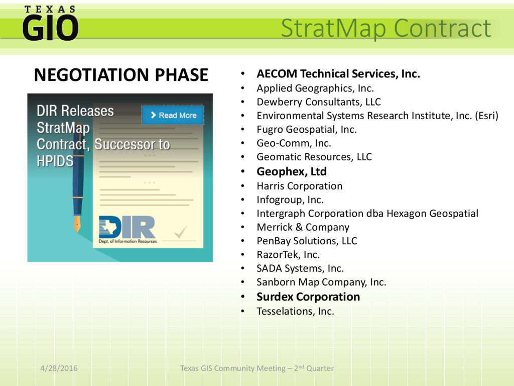
NEGOTIATION PHASE • AECOM Technical Services, Inc. • Applied Geographics, Inc. • Dewberry Consultants, LLC • Environmental Systems Research Institute, Inc. (Esri) • Fugro Geospatial, Inc. • Geo-Comm, Inc. • Geomatic Resources, LLC • Geophex, Ltd • Harris Corporation • Infogroup, Inc. • Intergraph Corporation dba Hexagon Geospatial • Merrick & Company • PenBay Solutions, LLC • RazorTek, Inc. • SADA Systems, Inc. • Sanborn Map Company, Inc. • Surdex Corporation • Tesselations, Inc.